We got up earlier today than we had in a long time. It was cold but dry, so we didn’t have to take the time to dry out our bags. After a quick breakfast we sorted through our snacks for the day and then packed up camp. We left lost of our gear in the meadow and hiked out with light packs.
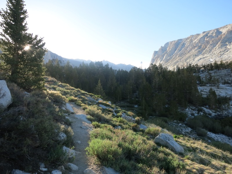
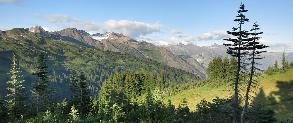
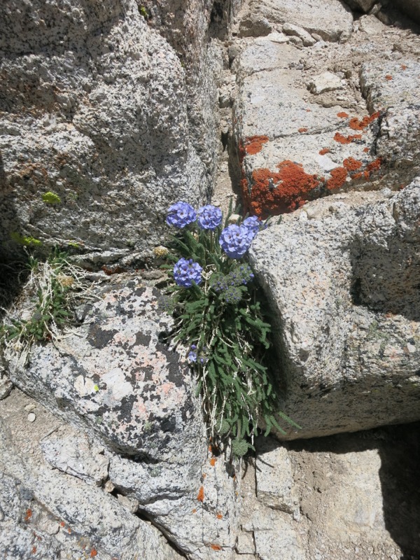
After a successful dry crossing of Whitney Creek we joined the John Muir Trail and headed east to the mountain. Right away the views were stunning. As the sun came up it painted a line of light on the pale ridges to the south and lit up the tops of the trees. We walked along the creek for a few miles through open pine forest. As we’ve seen since we entered the Sierra, many of the trees were twisted and gnarled, their barkless wood burnished to shades of rich gold and brown. Contrasted with the deep blue sky and the white of the granite all around us, it makes for some incredible scenery. Little pockets of miniature alpine flowers grew along the trail and in cracks in the rocks. The colors out here are just amazing.
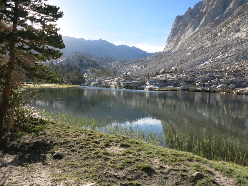
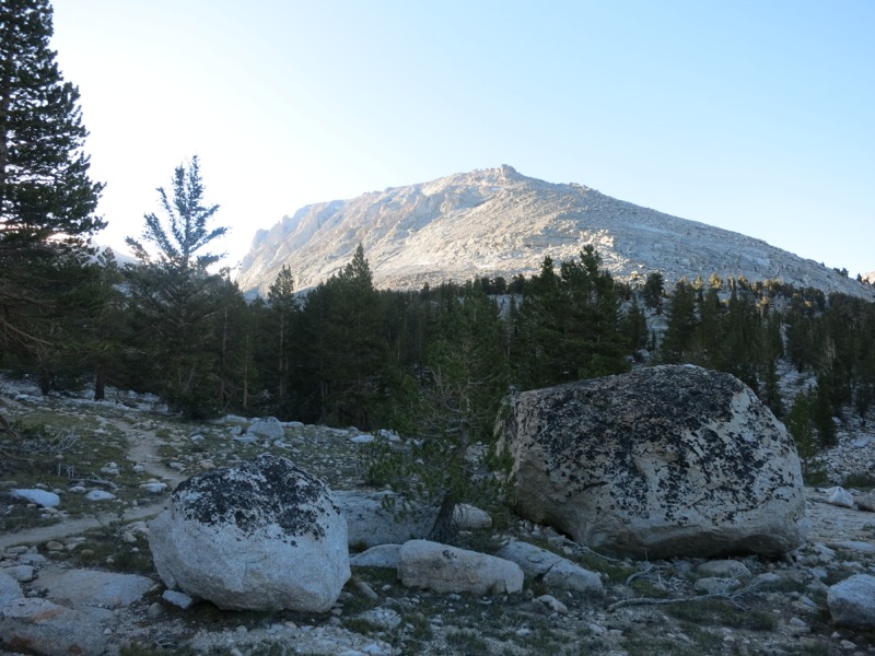
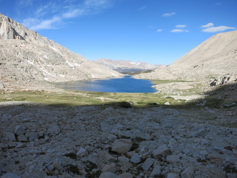
Eventually we came to Timberline Lake, which was still as glass except for the ripples from the trout as they caught bugs. It was a gorgeous, picturesque spot and it was easy to see why they don’t allow camping here – it would get trashed so quickly. True to its name, we soon passed the tree line and headed into open alpine meadow. After crossing over a ridge we were treated to a vista over Guitar Lake with the sheer wall of Whitney behind it. It seemed impossible that we would ever be able to climb it.

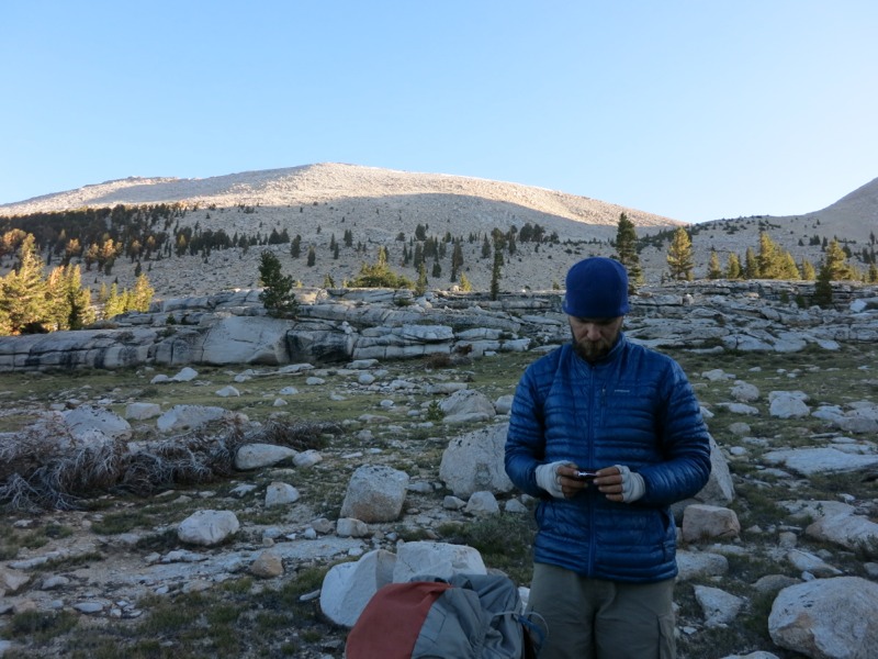
Guitar Lake is a popular spot for hikers to stay the night before summitting. Logically enough, it’s named for the shape of the lake – wide at either end, narrow in the middle, with a narrow neck sticking out the west side. This would have been a lovely place to camp. I can’t believe how green it was. In pictures taken during regular snow years it’s a barren, rocky, snow-filled basin – nothing like the paradise we saw today.
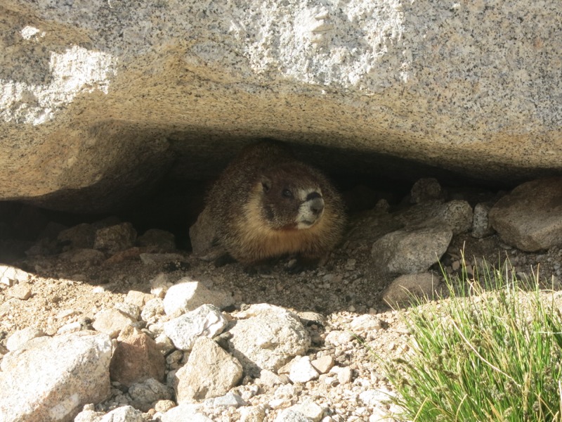
There were lots of fat marmots grazing around the meadow and they weren’t very shy about people. I’ve heard that hikers who leave their packs here risk having the shoulder straps chewed up since the varmints will go after all the salt accumulated there from sweat.
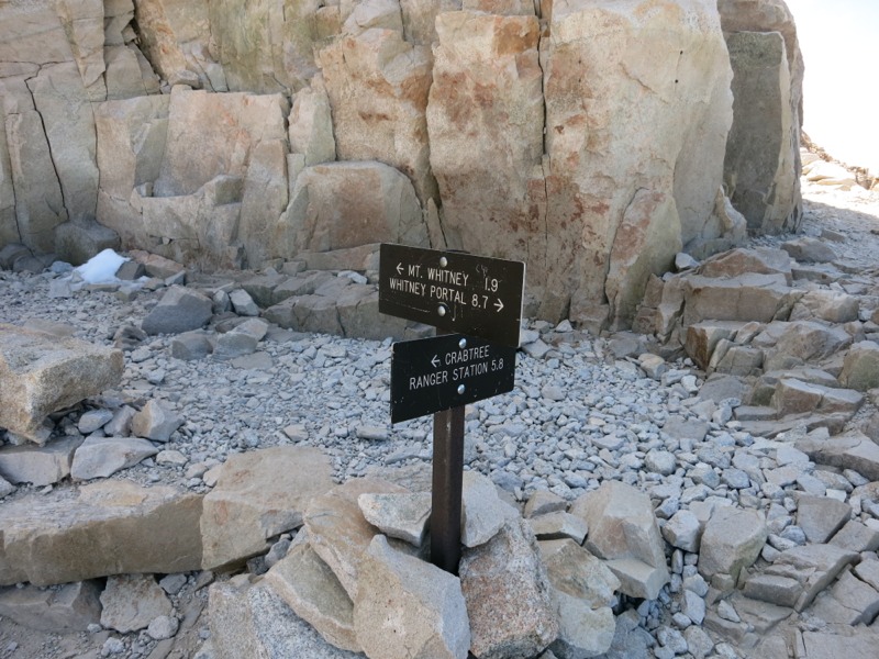
After another slight ridge we passed some small glacial pools and then started our climb in earnest. Switchback after rocky switchback, we crawled up the mountain. We were feeling every one of the 11,000 feet and we still had 3,500 feet more to gain. One slow step at a time we climbed the first section. After a few miles of this we reached the Whitney portal junction, where the trail up the east side of the mountain joins the west side trail we were on. Suddenly there was a population explosion. The east side is the main access to the mountain and lots of dayhikers come up that way since there’s a trailhead at the bottom. The east side is a steeper trail since it starts from a lower elevation, and it’s very impressive that people hike up it with little prior training or acclimation. We had 6 weeks of 20-mile days under our belts and were still struggling! It was a little gratifying to see that we moved faster than most of them, though.

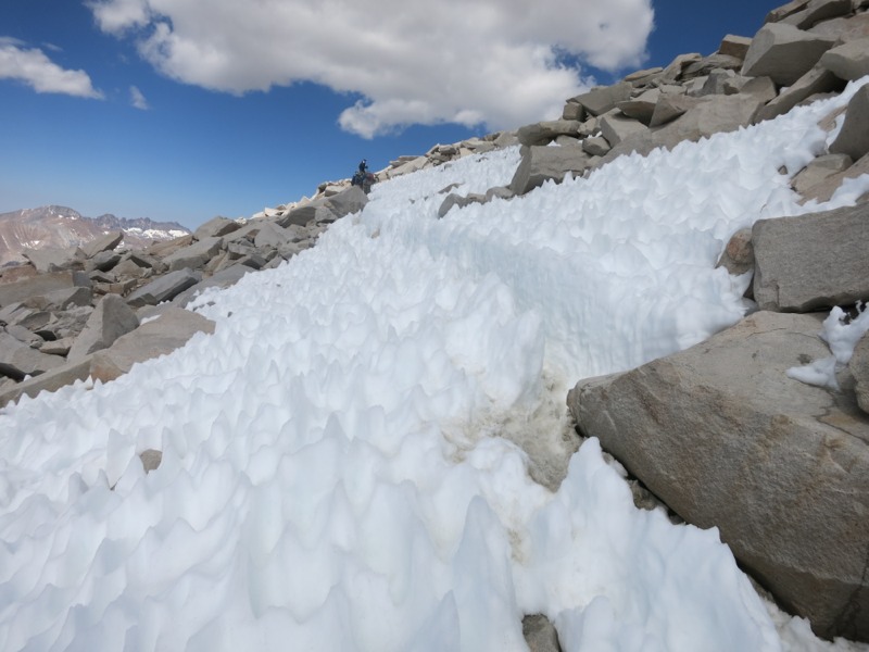
After the portal junction the trail turned north and ran along the back face of the mountain. Somewhat discouragingly, we still had 2 miles and 1000 feet of uphill to do. Some sections turned into a bit of a rock scramble and we actually passed over a 30-foot traverse of snow all melted into spikes from the sun.
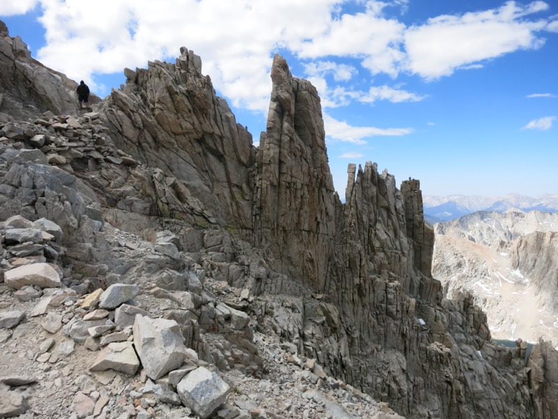
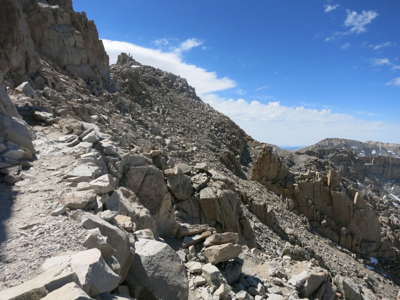
We passed a few slots in the mountain face that allowed us to catch glimpses of the east side and the little frozen lakes thousands of feet below us. Finally the trail hooked right and started up the last stretch. Even this was surprisingly tough – we knew it was the end, but couldn’t actually see the summit or the but there until we were nearly at the top. All we could go by were the other hikers far above us, showing us how far we still had to go.
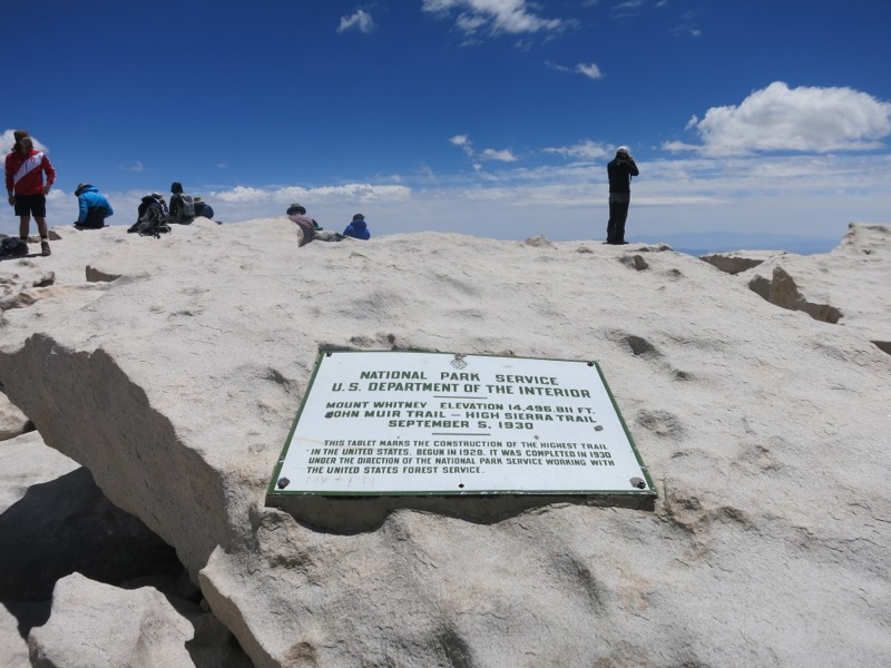
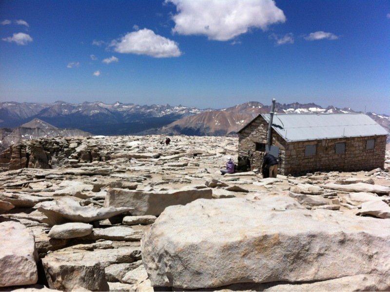
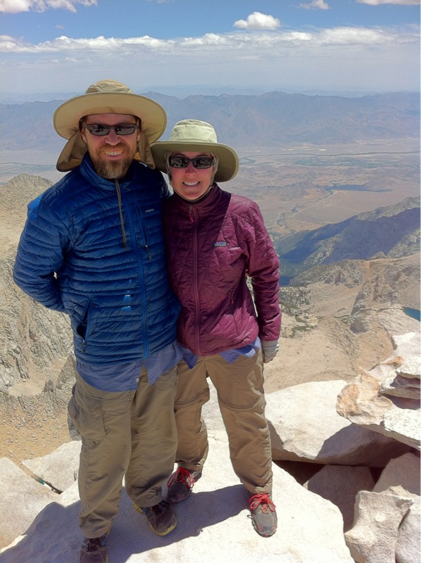
Finally, though, we were at the top – 14,505 feet and higher than we’d ever been outside of an airplane. I’ve been waiting a long time to get here and it was a pretty emotional moment. I felt so grateful to be there with Keith, with both of us in good enough health and acclimated enough to reach the top. We signed the register and checked out the little Smithsonian hut before finding a place to sit on the eastern face.
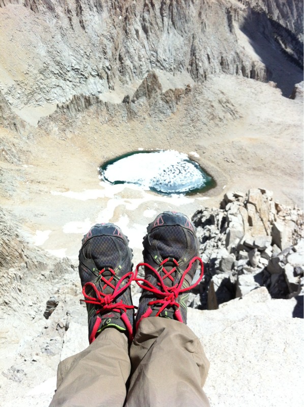
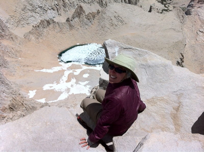
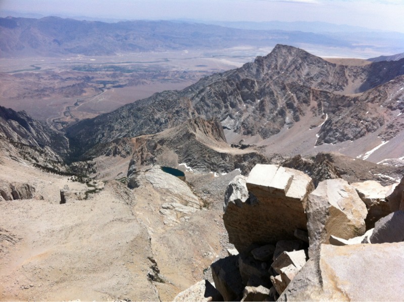
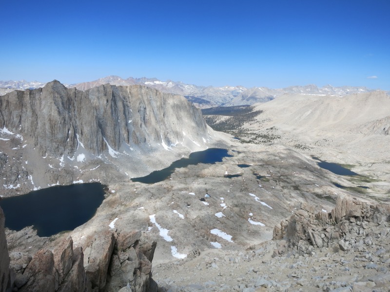
The views were absolutely breathtaking. The cliffs dropped straight down for thousands of feet to a partially frozen lake – which was itself thousands of feet above the Onion Valley below. Far away we could see the town of Lone Pine, a popular resupply stop for hikers. It felt like we could see every peak in the entire range. We could even spy Mts. Owens and Jenkins in the hazy distance, all the way back at Walker Pass. It was an incredible reminder of how far we’ve come in over 100 miles and a week’s worth of hiking. We bundled up in our bags to escape the wind and just sat for a while, taking it all in.

We couldn’t stay all day, though, and after a long rest we packed up and started down. This took much less effort than the climb up but navigating the rocks was harder with gravity on our side. We did the whole thing in reverse and about half the time it took us to climb. It was cool to be able to look back over the valley we left that morning. The lakes looked tiny and the trail next to them was only barely visible. In seemingly no time at all we were back on the valley floor and heading west, back to Crabtree Meadow. We started passing hikers who were heading to Guitar Lake to summit the following day. One of them was Packman, who we hadn’t seen since before Chicken Spring Lake. It was really good to talk to him again since this might be the last time we see him.
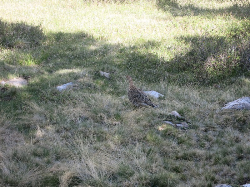
We passed all the wonderful sights in reverse, gaining a second perspective on some beautiful country as we hiked the easy trail back to our campsite. At one point we passed a grouse with a bunch of little chicks. Even though we were only a few feet away she didn’t seem concerned about us. We were so close that we could hear her chirping to her babies. After a few more miles we reached the turnoff for the meadow and found our camp safe and sound. We were considering doing a few more miles today to set us up to cross Forester Pass tomorrow but as soon as we laid down we knew we would stay here again tonight. We’ll turn in early and get up early again tomorrow to hit the pass – the highest point on the official PCT at 13,200. It’ll be another day of climbing but not as steep as today was. The day after tomorrow we’ll head into town for a resupply through Kearsage Pass, which is supposed to be spectacular. We are very much looking forward to having a few days off and a real bed and the amazing scenery along the way is the icing on the cake.
– Posted from the PCT
Location:Pct mile 766