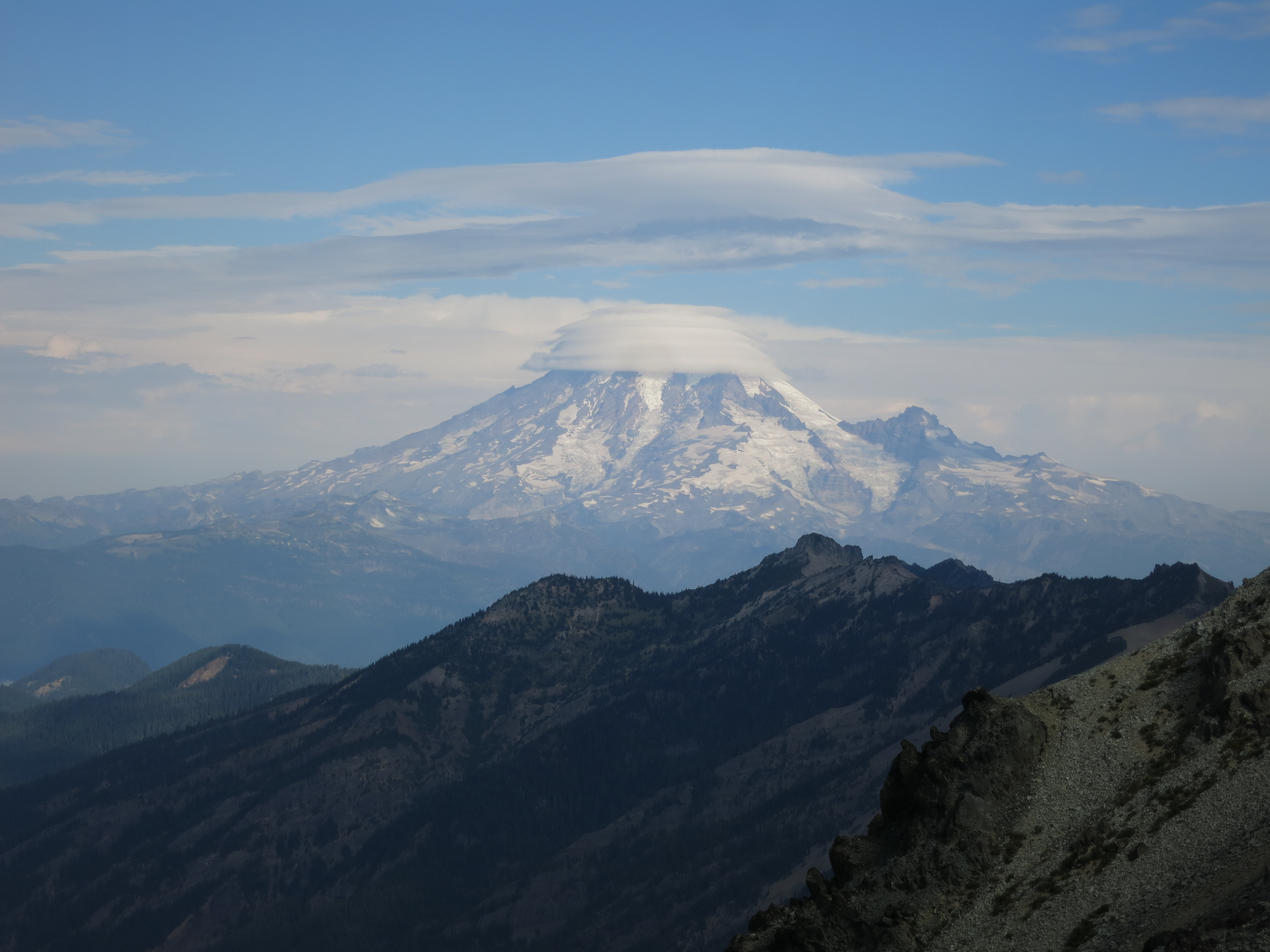
 We were up earlier than normal this morning. We knew our hike into town would take longer than normal, both because of some challenging terrain and because we would take a lot of time sightseeing. After nearly a week of gorgeous, clear, hot weather the pattern was shifting. In the morning dusk we could see lightning filling the clouds that had settled around Mt. Adams overnight.
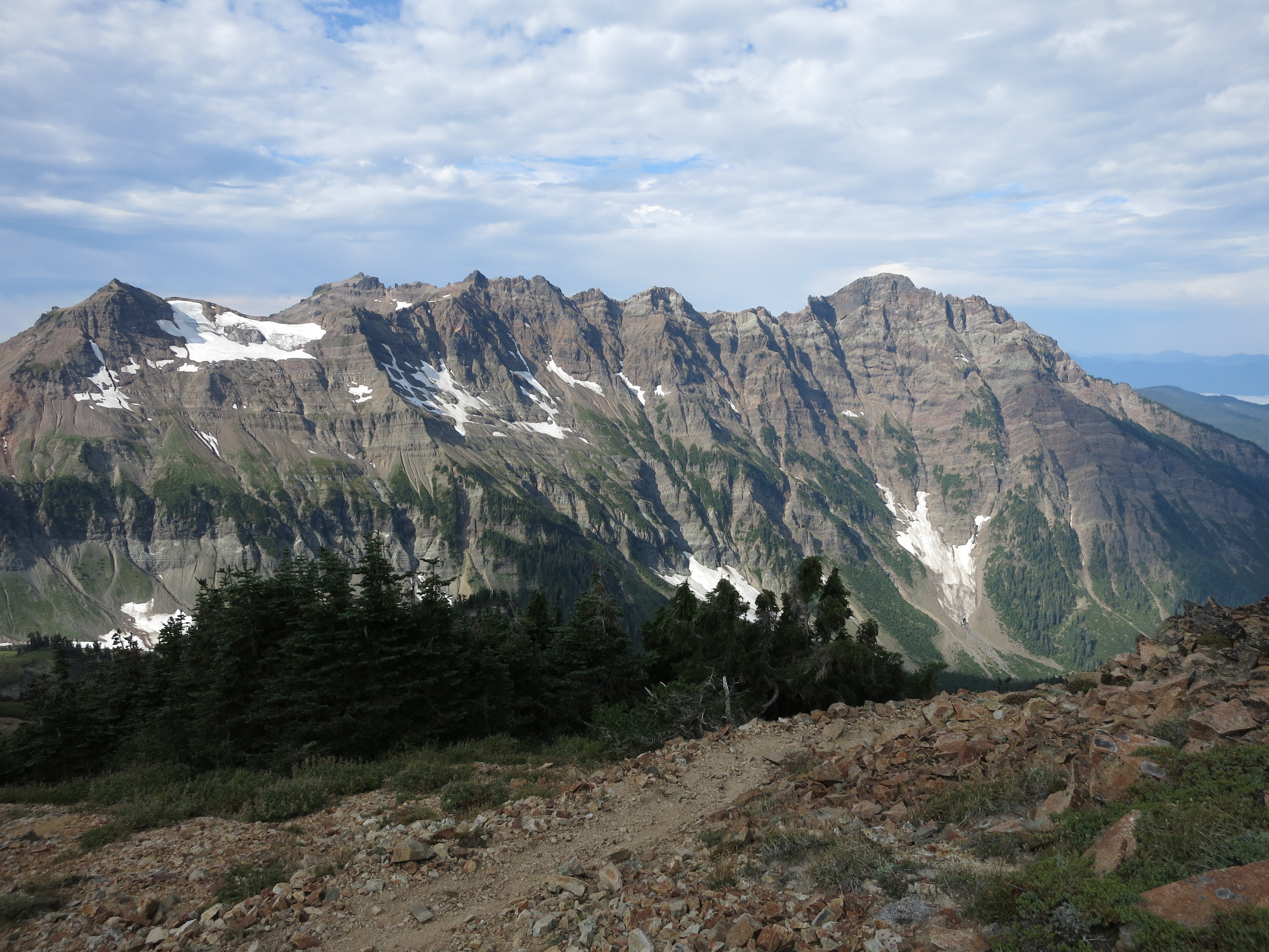
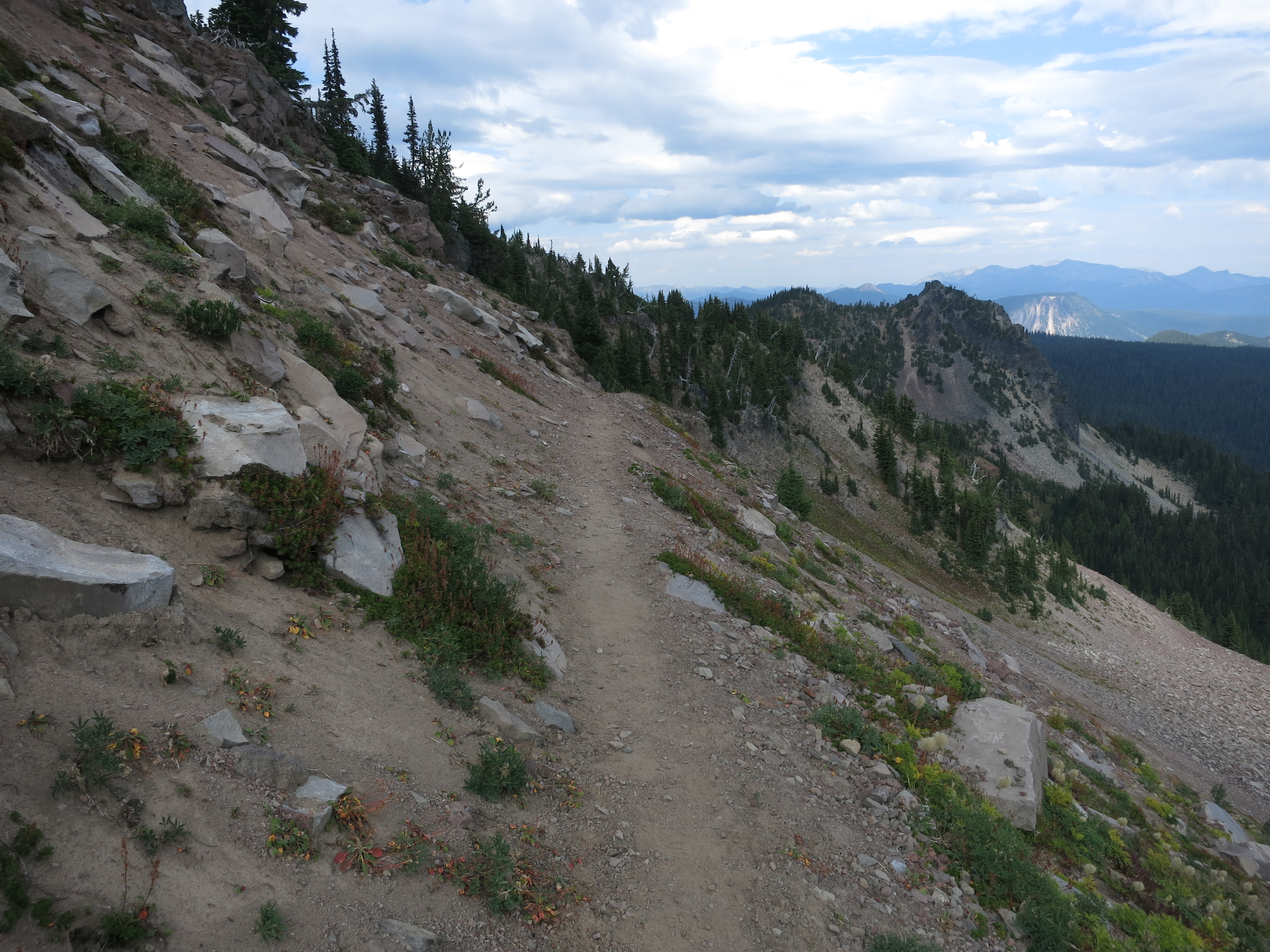
 We started off across the rocky landscape, quickly passing the last few trees as we hiked above the treeline. Our first obstacle today was one of the most scenic and photographed stretches of the entire PCT – the Knife’s Edge, a narrow and rugged ridgetop that took us above the Packwood Glacier.
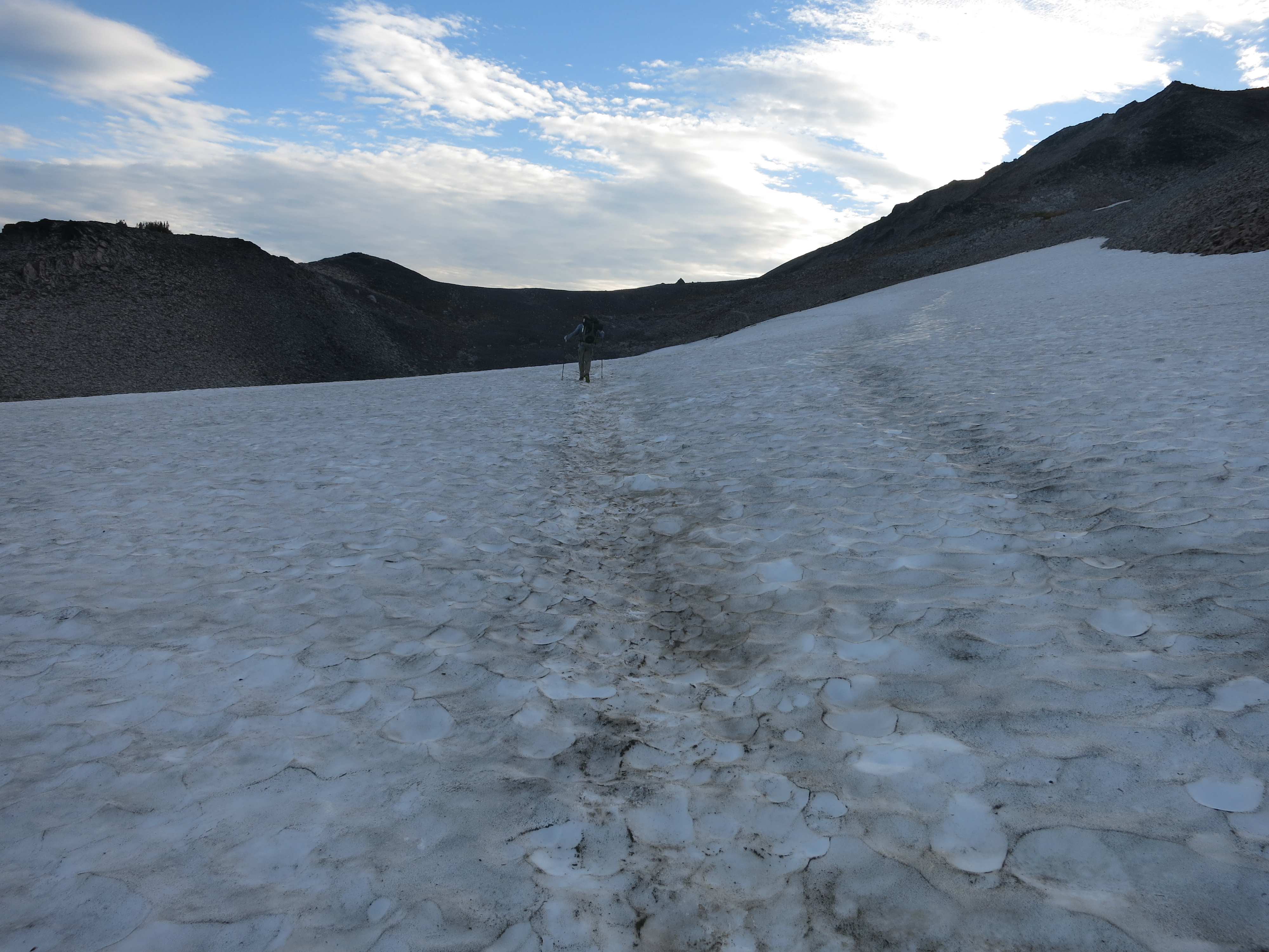 We climbed steeply towards Old Snowy Mountain, traversing a large snowfield and filling our shoes with mud as we mucked through the surprisingly soft till at its edges.

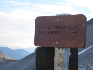 After a little more rock scrambling we reached a trail junction where an equestrian bypass took a slightly less scenic but much less exposed route. We pushed on, eager to feast our eyes on a stretch of trail I’ve looked forward to hiking ever since I first heard about the PCT.

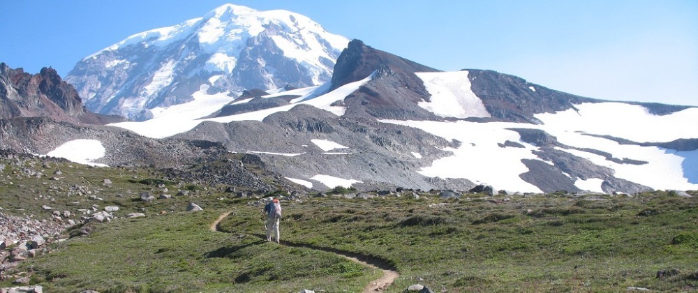
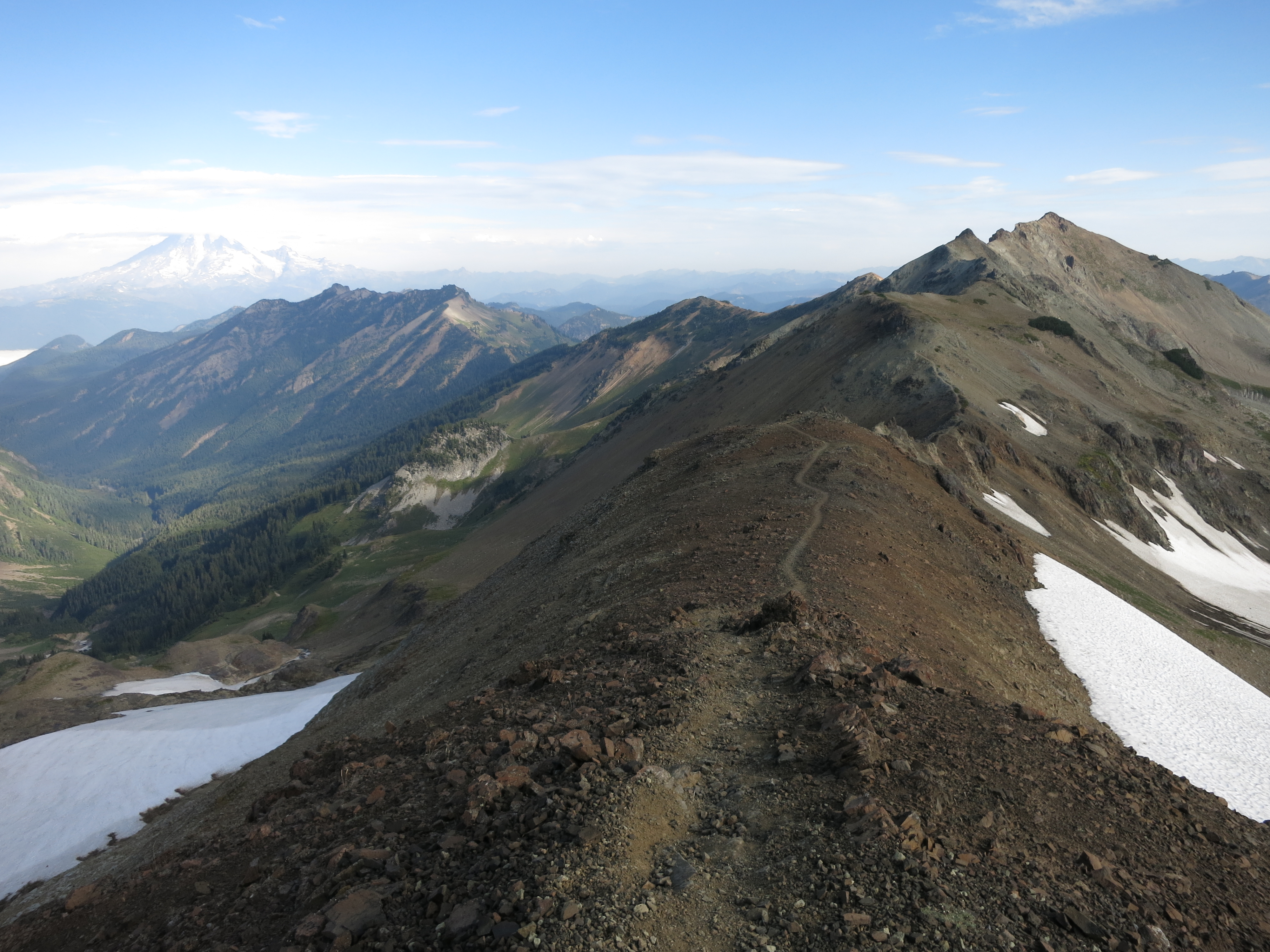
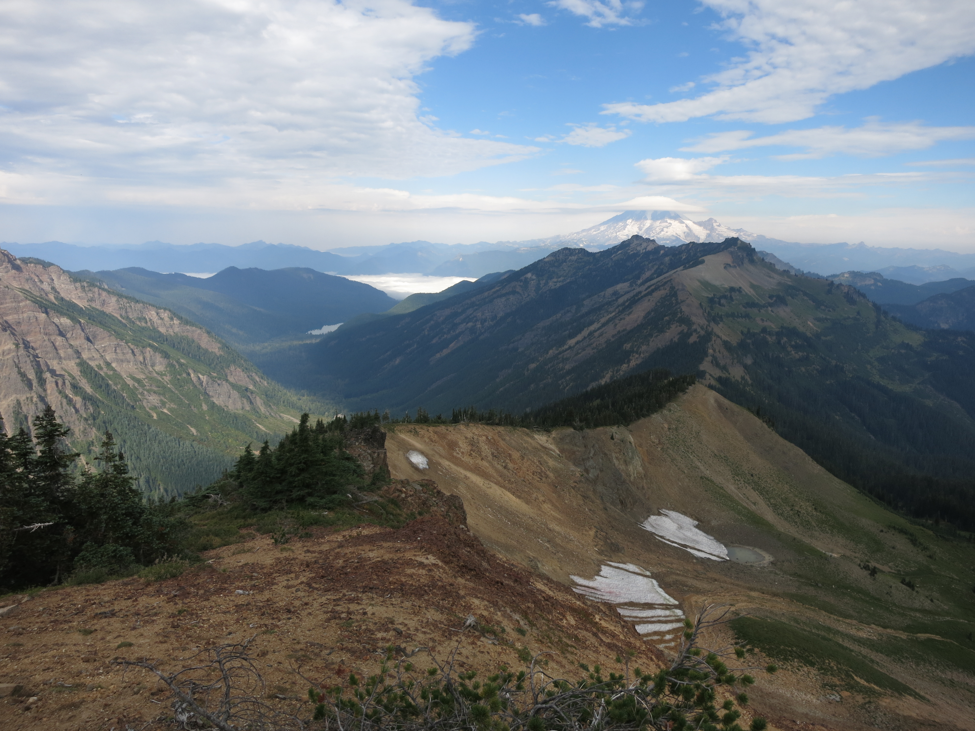
 Soon we were there at the top, the 2-mile ridgewalk laid out before us, with the mountain spine reaching all the way to Mt. Rainier in the distance. It was the most beautiful and rugged stretches I’ve ever hiked.
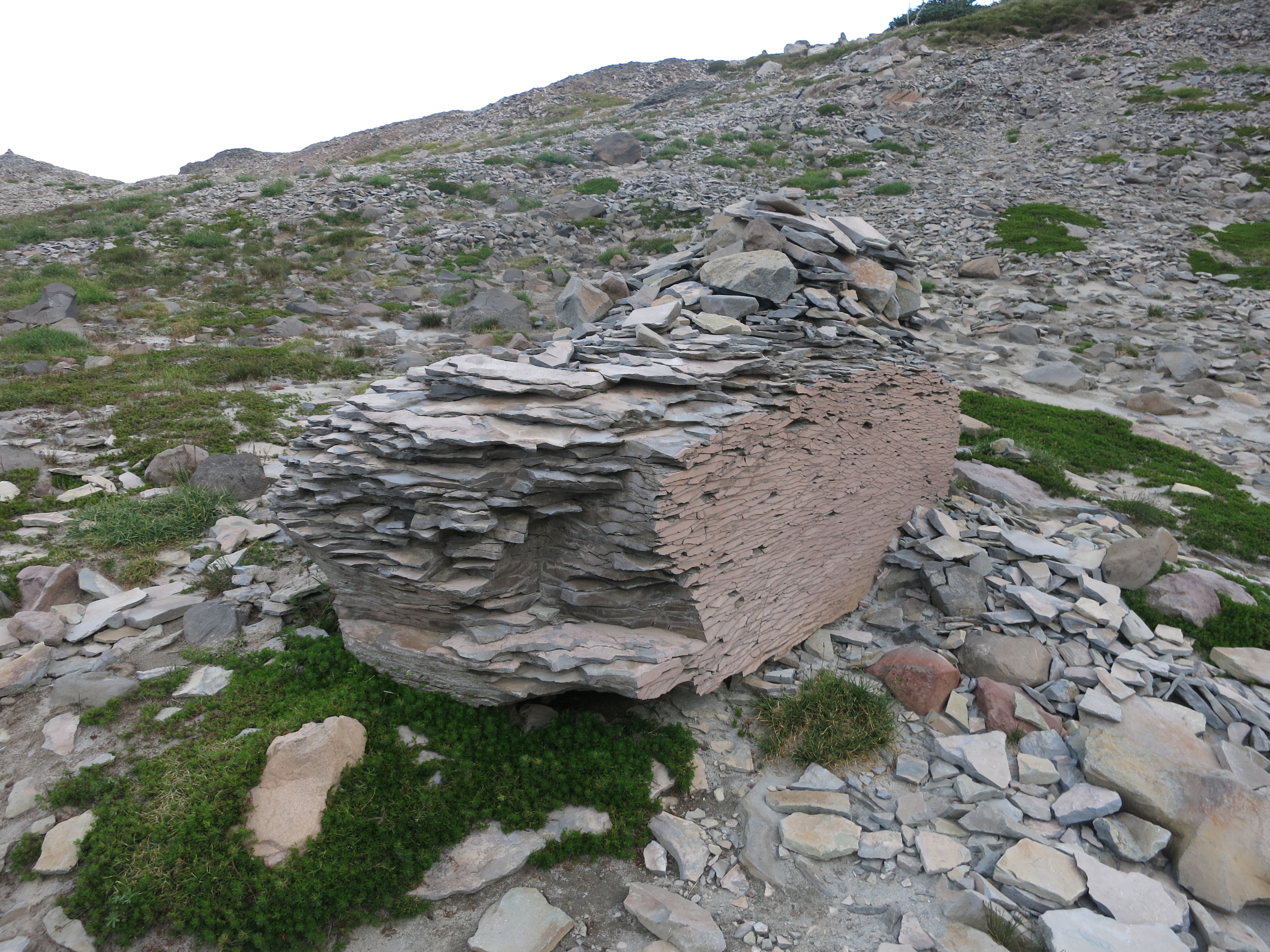
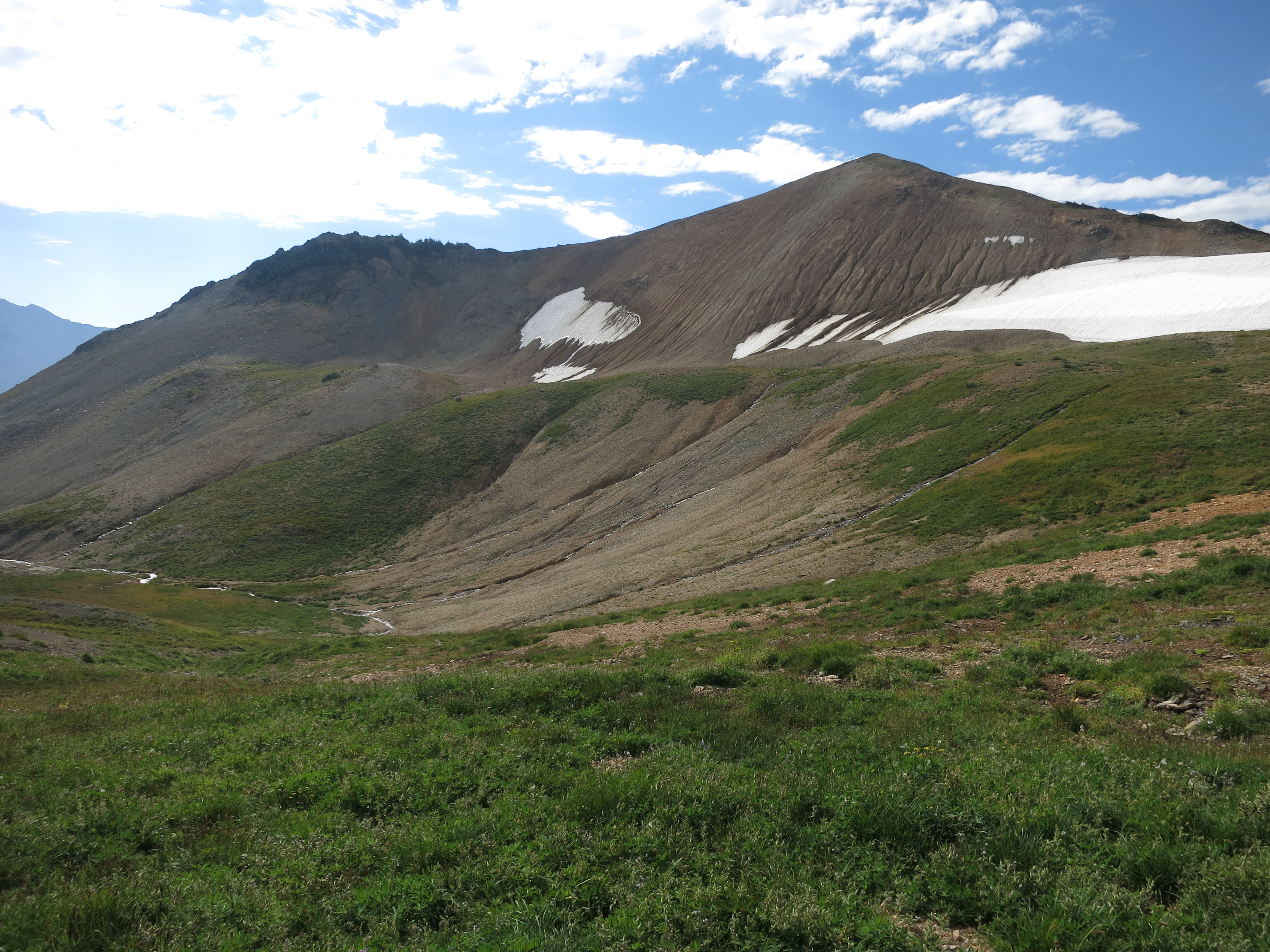
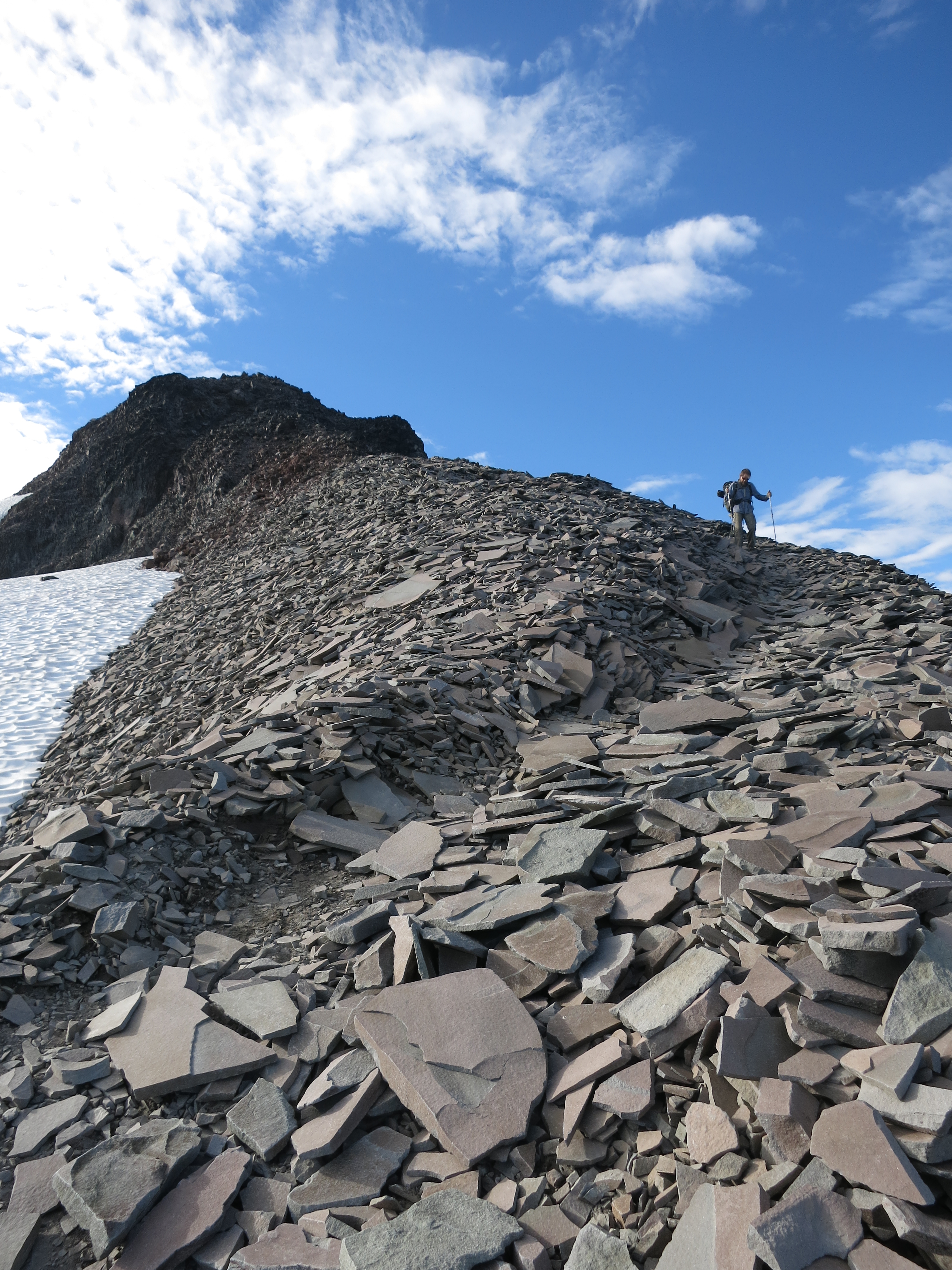 The hills were steep – both up and down – and our first descent was built entirely on piled shale: thin, flat slabs of rock that shifted, tilted, and clinked musically under our feet.
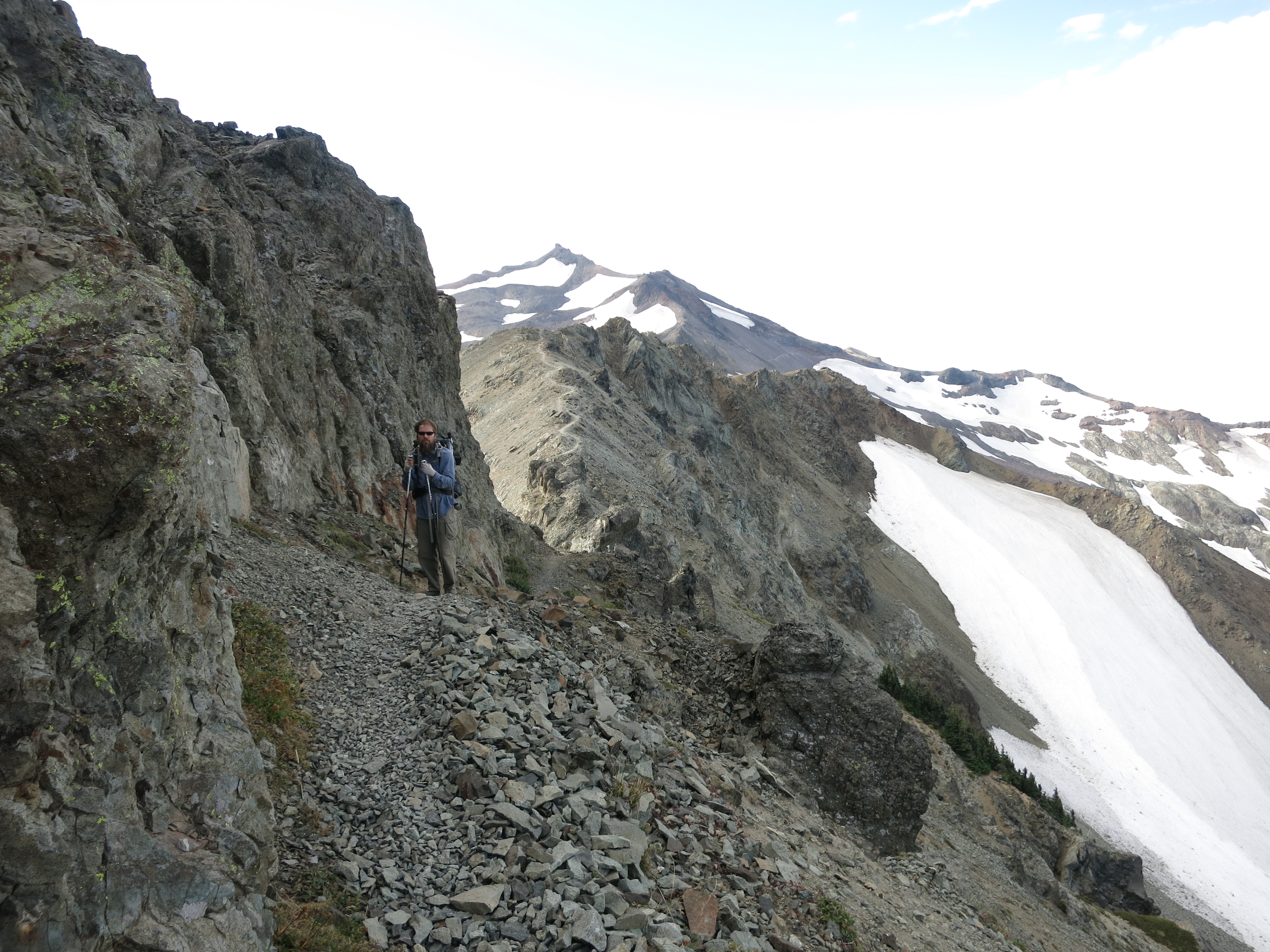
 As we had expected, we were slowed both by the terrain and by the constant compulsion to just stop and stare, overwhelmed, at the landscape around us.
 When the trail finally left the ridge it dropped into rocky green alpine park, rolling over the open valley until we gradually descended back into the forest. We were feeling the call of town and the pressure of impending weather after having spent so much time on the ridge and we put on the afterburners. We skipped lunch in favor of snacks and sped through the trees up a long climb.
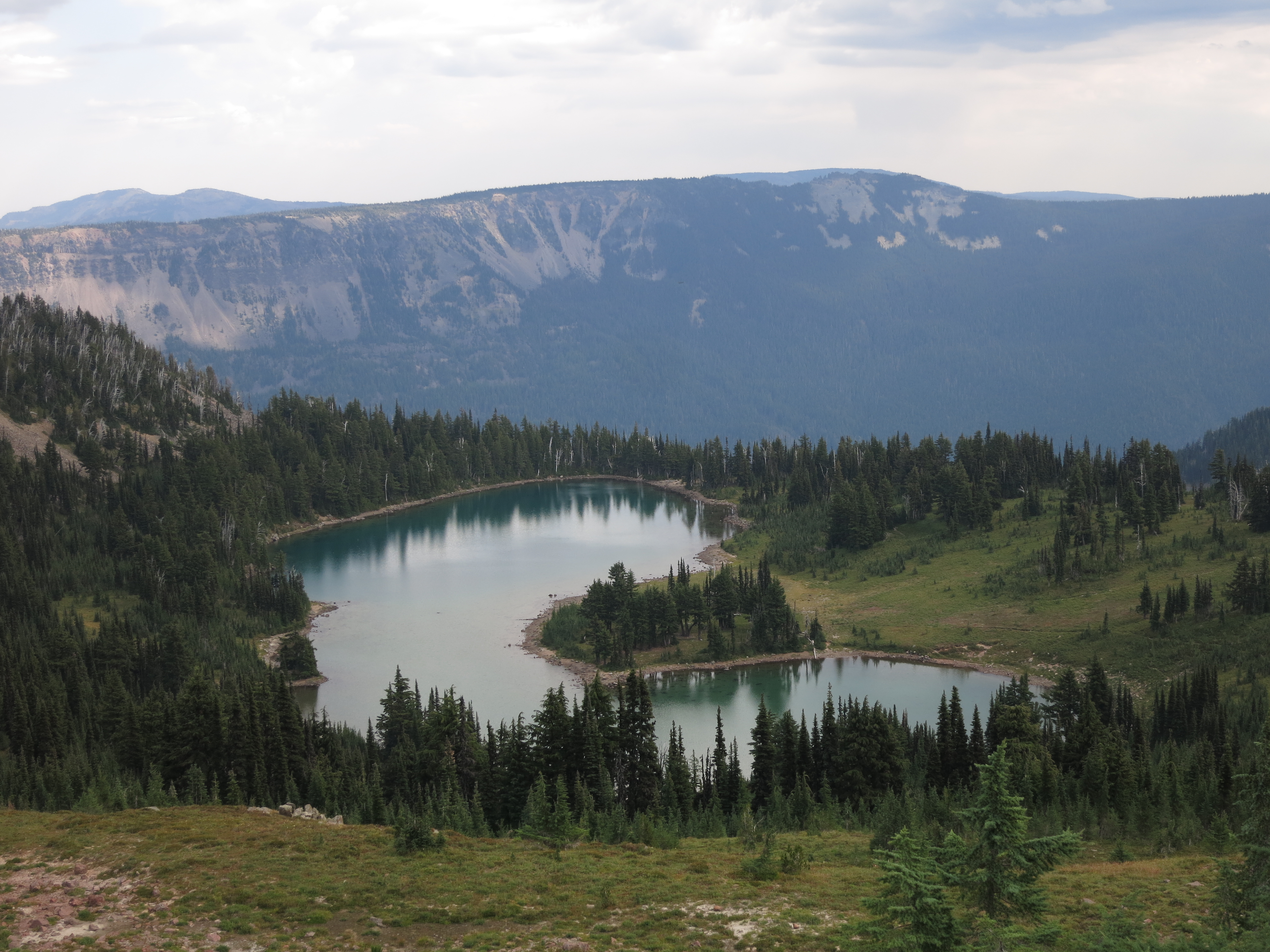 Near the top we emerged into another open area overlooking Shoe Lake. Now it became obvious that we were racing the first rain since Mt. Hood. Ahead of us the land dropped away to a low valley where our destination sat at the bottom of a ski hill. We could see clouds boiling over the ridge on the other side of the highway and we began to think we’d be caught in the rain.
 The trail turned east to follow the spine we were currently on. We hiked for a few more miles before taking a side trail shortcut down through the ski hills, following maintenance roads until we could see civilization below us. White Pass is a tiny resort with the few amenities we needed the most – nice little condo-kitchenette rooms for rent and a convenience store next door stocked with lots of Costco’s oven-ready lasagna. A few minutes after we returned to our room, fully laden with resupply boxes and town food, the rain began. The clouds were so low that we could only see a hundred feet up the ski slopes – the clear skies and long views we’d had on the Knife’s Edge a few hours earlier were gone. What amazing timing! The rain is supposed to continue tomorrow and we will likely take the day off to pile on some calories.