Day 25 – Cleghorn picnic area to ridge above Cajon Pass – 22 miles


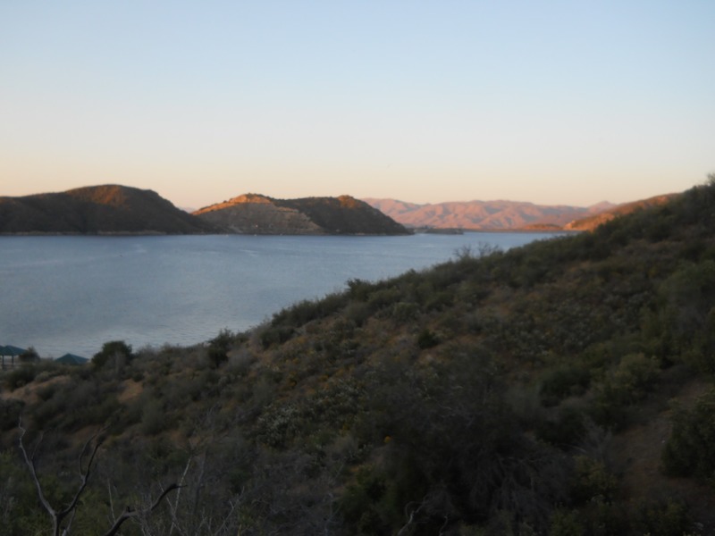
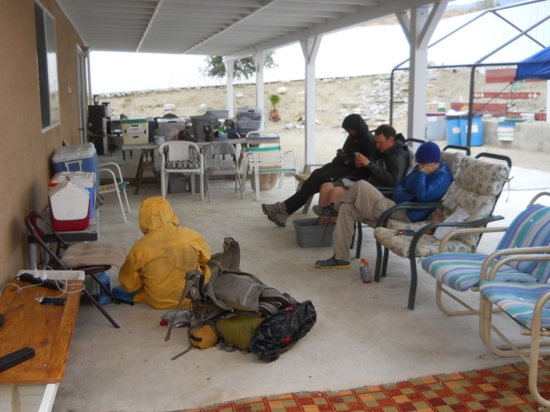
The alarm went off at 5 this morning, since we knew we were in for a hot morning and we were a little worried about getting hustled out of our spot by a ranger. We had the luxury of running water to do our laundry and flush toilets…all the conveniences of home.


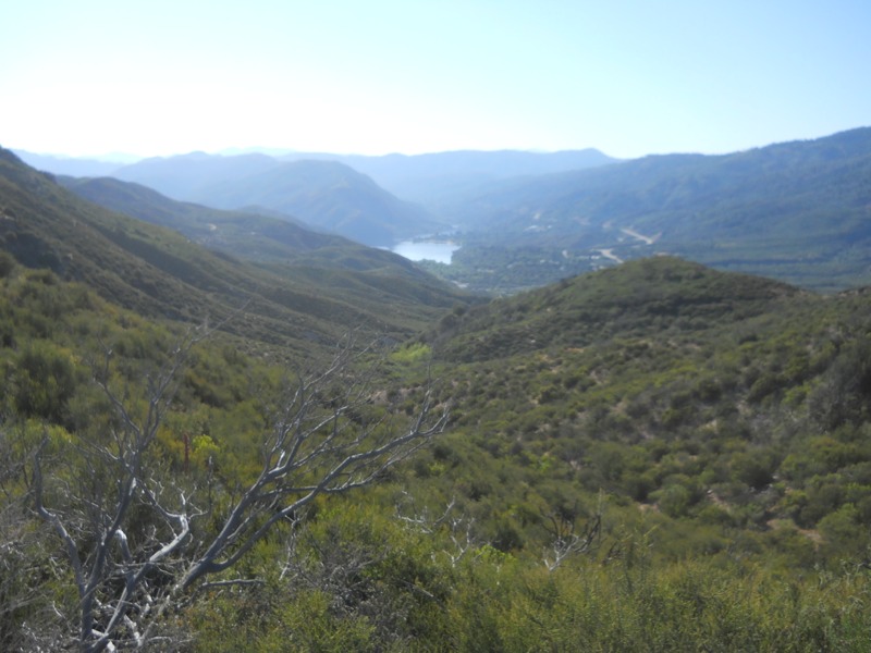
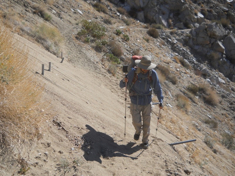
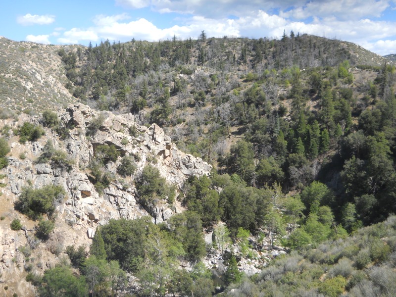
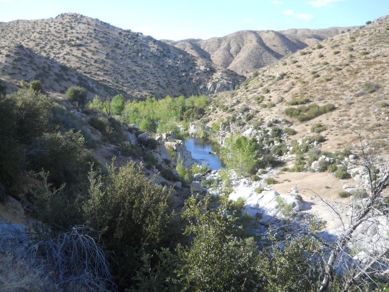
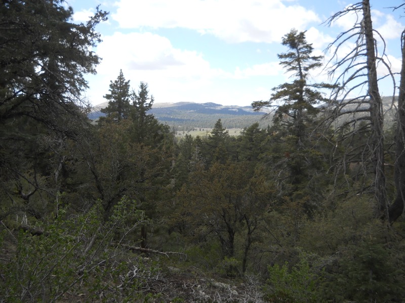
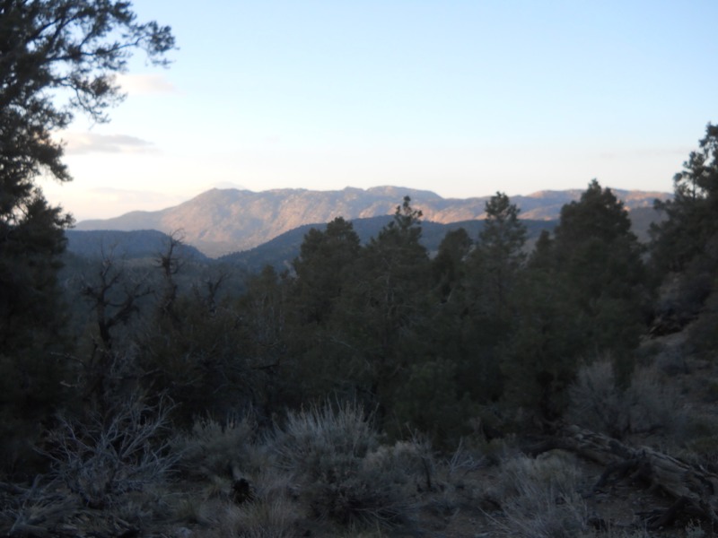
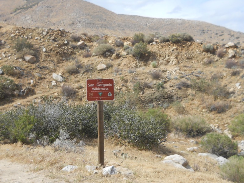
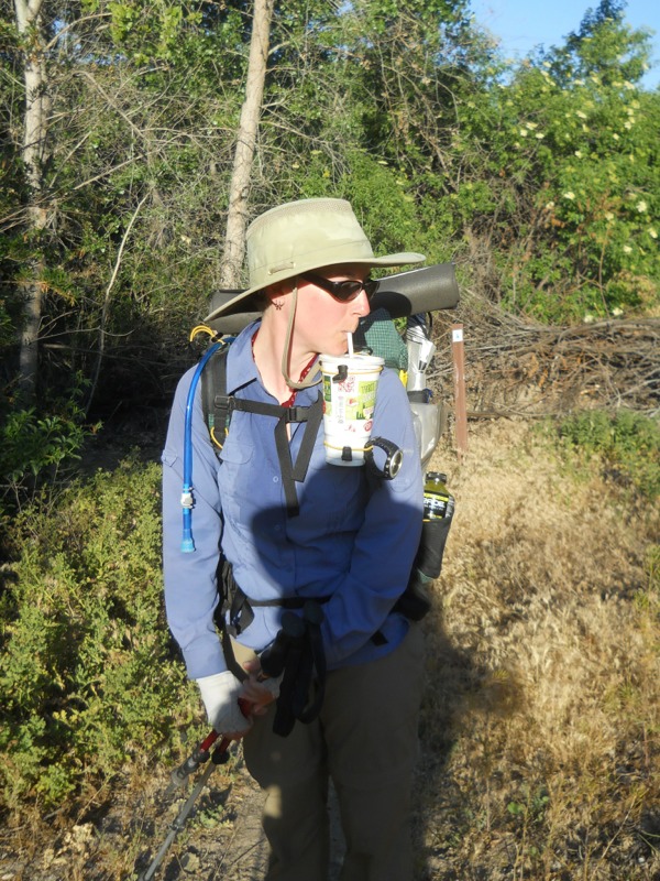
The trail started right off with a climb out of the reservoir basin. It was already hot and we were sweating buckets. As soon as we got to the top of the dividing ridge and started down the other side, we could feel the humidity drop. It was the opposite of yesterday when we climbed the ridge to the lake originally. As we started dropping down into Horsethief Canyon and losing altitude it got even hotter. A stream a mile later gave us the chance to wet down our clothes but it didn’t take them long to dry in the heat.


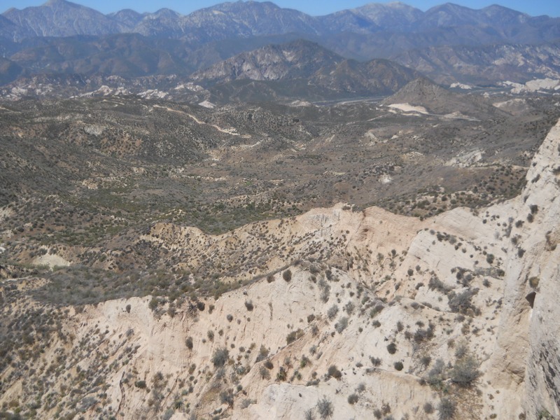
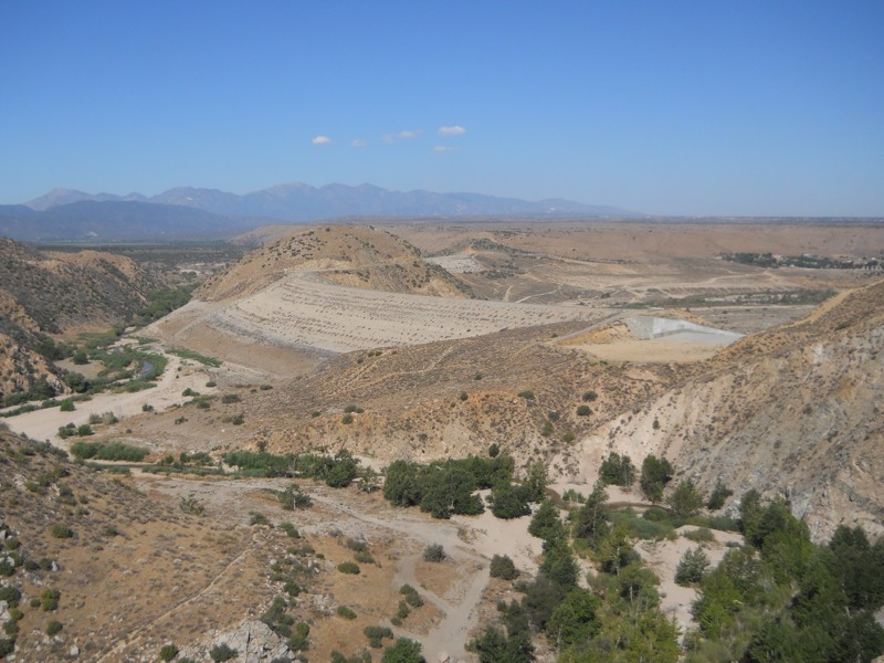
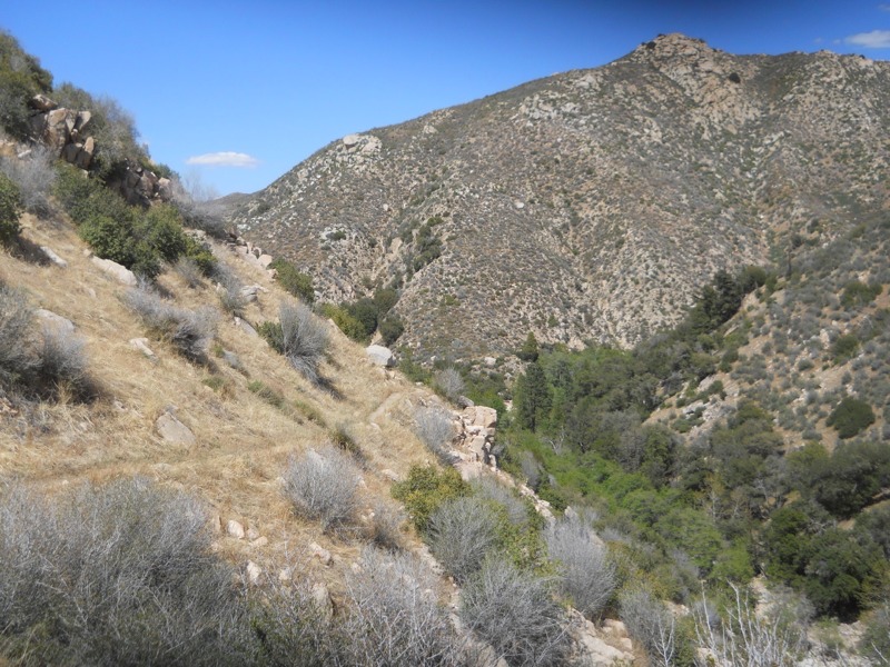
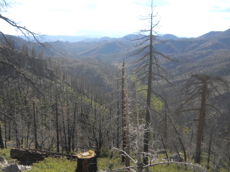
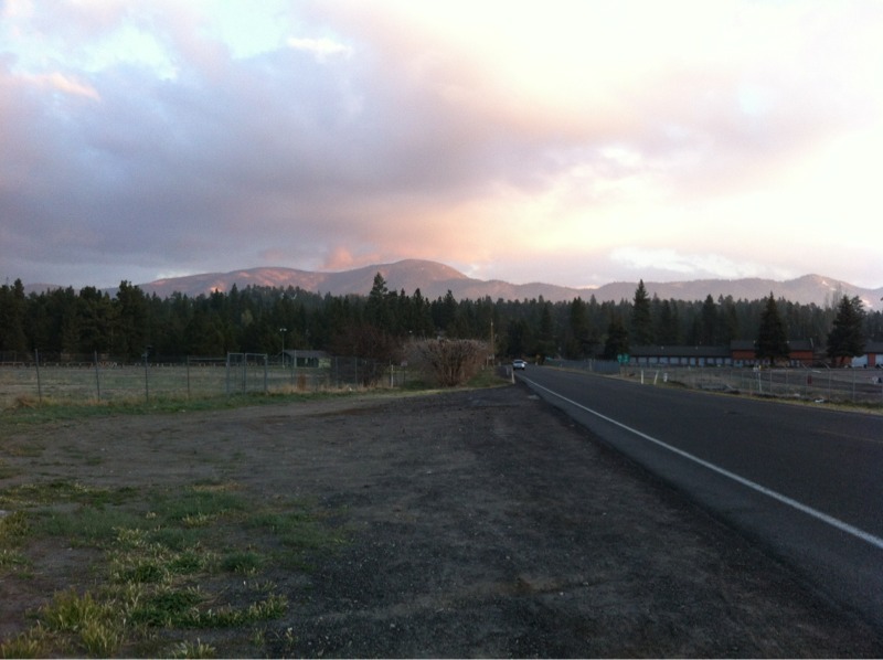
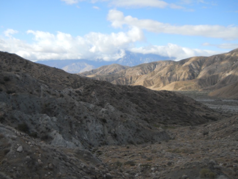
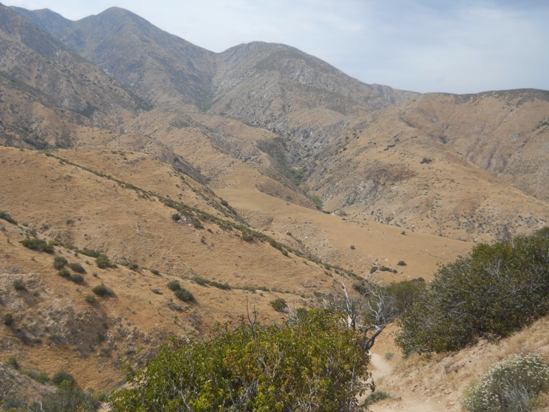
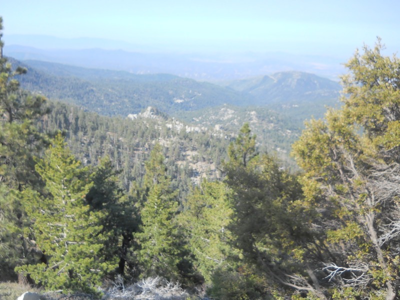
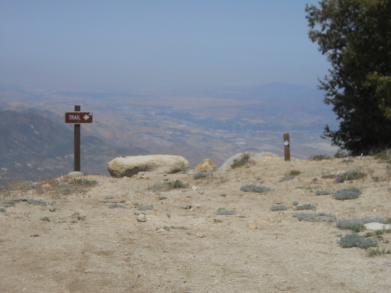
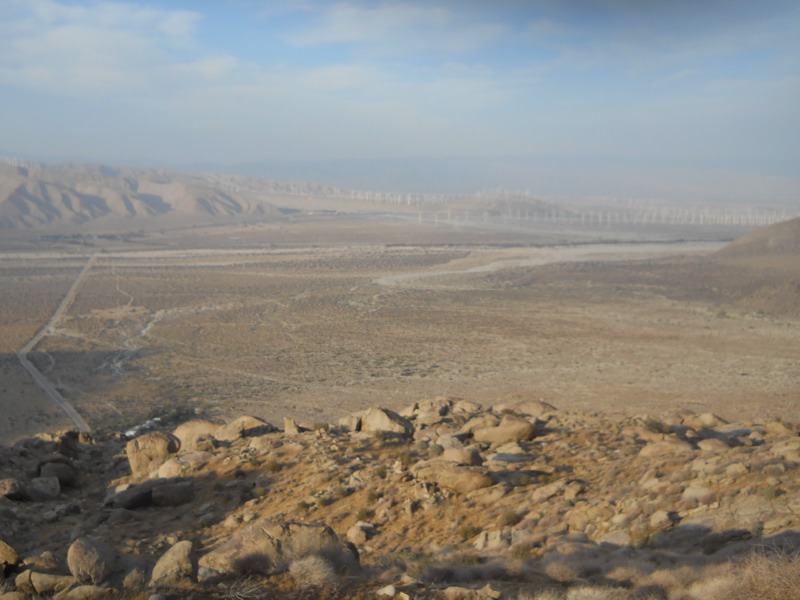
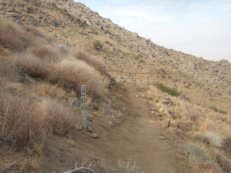
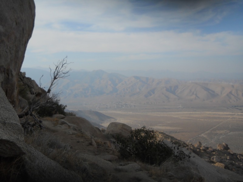
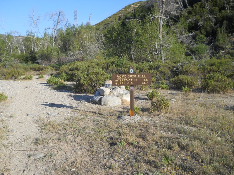
It was a slog…we started off making good time but as the temps went up our speed went down. We had over 13 miles to go to the McDonalds and the thought of cold drinks was the only thing that kept us going. After climbing out of the canyon we were treated to a sudden view of the desert floor, Cajon Pass, I-15, and the San Gabriel mountains we would be heading into. We had beautiful, badlands-like scenery as we wound our way down the skinny ridgetops.


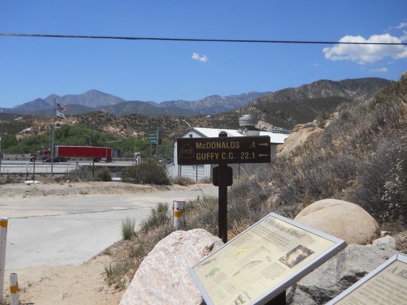
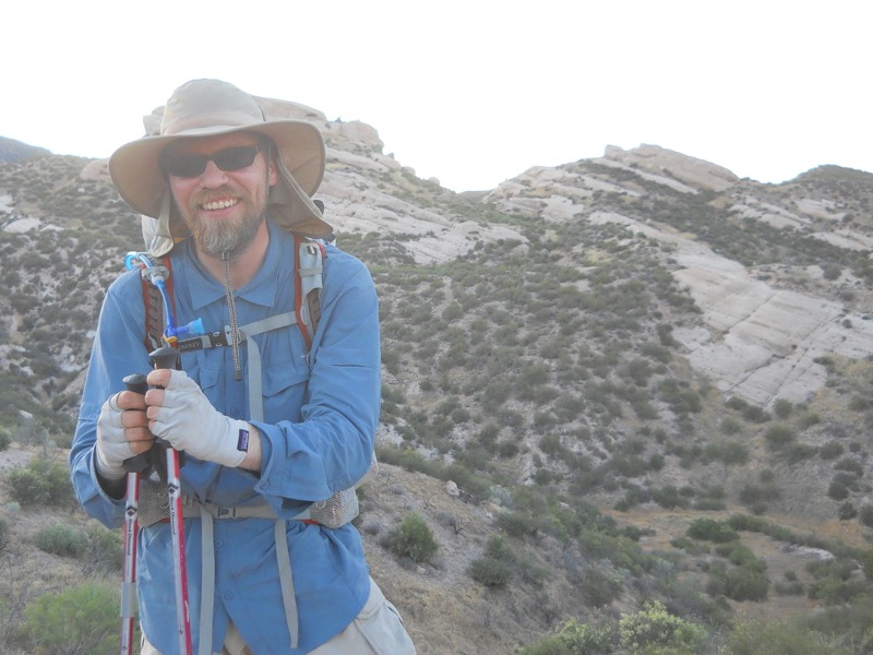
I finally reached the highway a while ahead of Keith, who moves a bit slower in the heat. I actually had cell service and was able to entertain myself and catch up on emails while I waited in the shade of my umbrella. After a while he came down the trail and we headed for the food, faster than we had moved all morning.


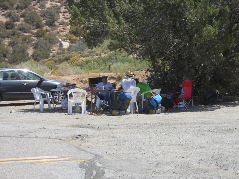
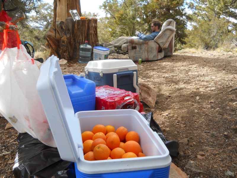
Many calories and cups of liquid later, we lounged around in the relative cool of the restaurant. Or plan was to kill a few hours and hike out in early evening. This was originally going to be around 5 but it was still stifling out. We moved to the hiker-packed spot of shaded grass between the restaurant and the convenience store, bought some drinks to carry back on the trail, and waited. Someone said the temperatures yesterday and today had been record-setting. Today it had reached 100 degrees. We had 22 miles to go until the next sure water source.


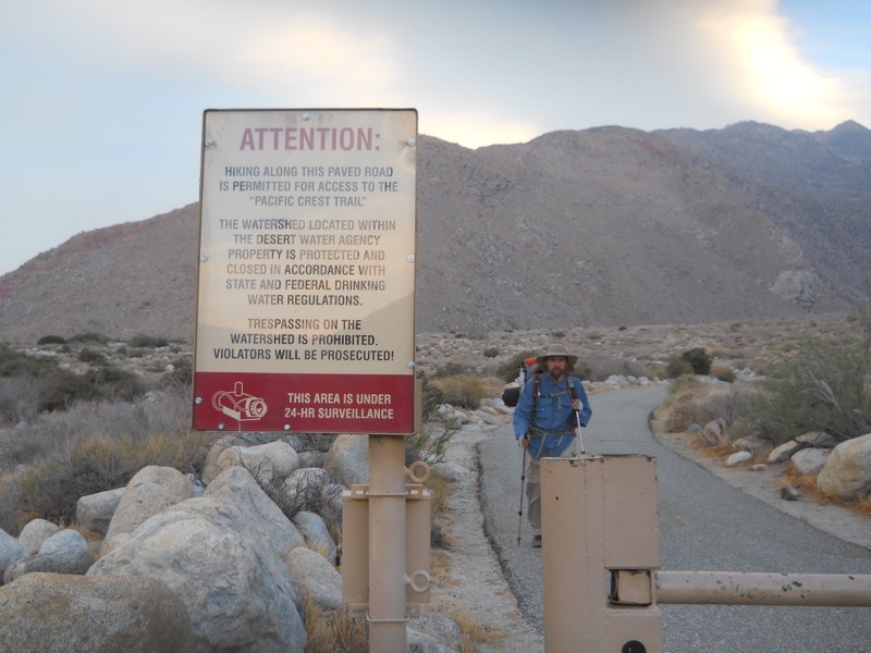
Finally, an hour later than planned, we headed down the “historic stretch of Route 66” (as our maps informed us) back to the trail. Instead of looking historic, it looked more like the dead-end major-freeway frontage road that it was. Trash was everywhere and as we walked we passed through a cloud of sulfury sewer smell. We couldn’t wait to get back out onto the trail – it’s not garbage-free, unfortunately, but it’s worlds better than this.


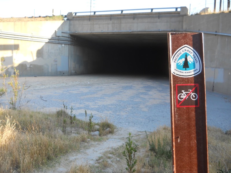
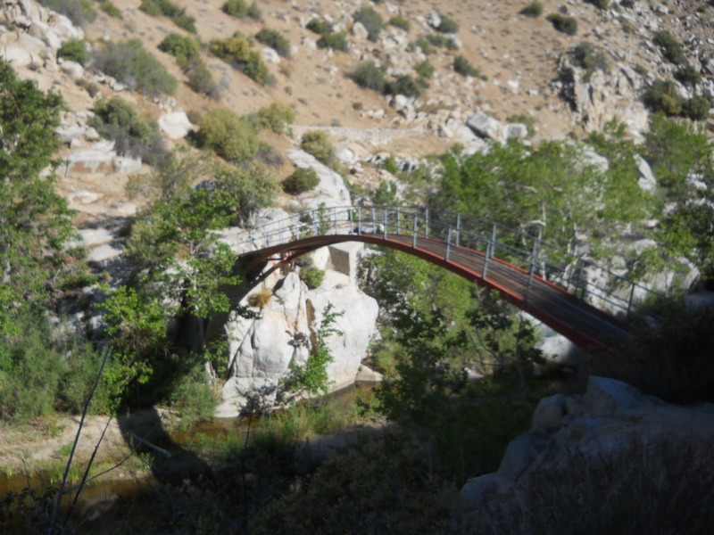
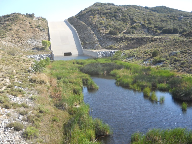
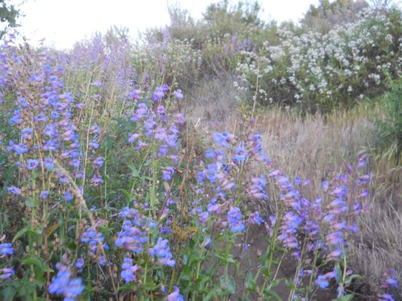
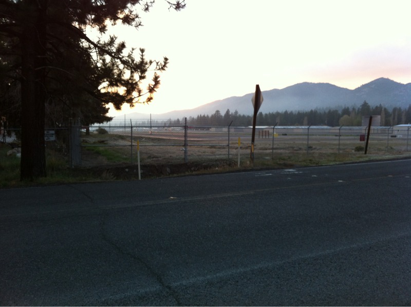
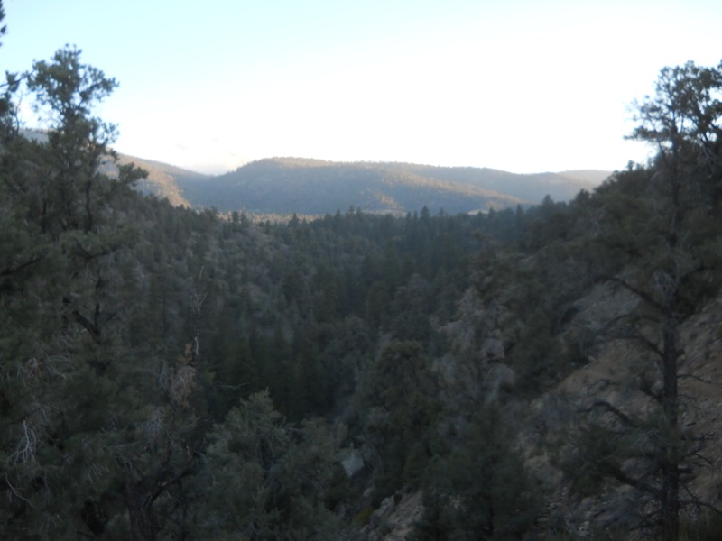
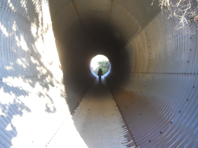
After passing through the creepy culvert that ran under the highway, we came out into a canopy of green. The area was marshy and a thicket of short, bright green trees had grown in. It was surprisingly pretty after the depressing road walk. Finding our way was a little tough but eventually we reached the ridges west of the highway. It was neat to look back and see how much smaller the freeway looked, and to know that we had walked under it a couple hours earlier.


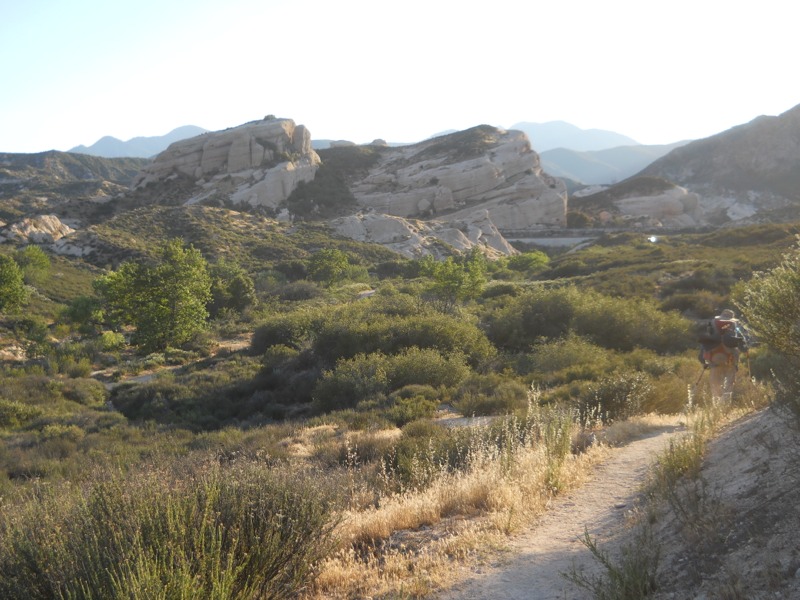
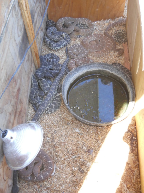
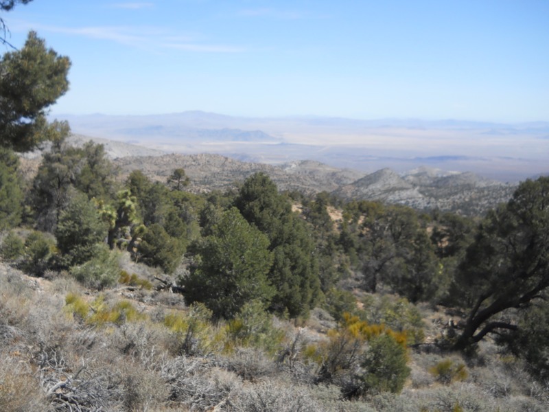
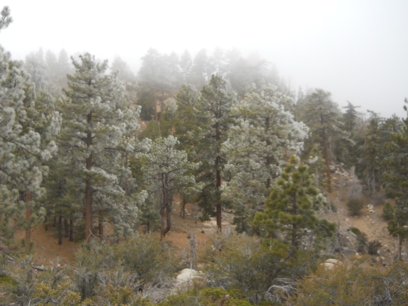
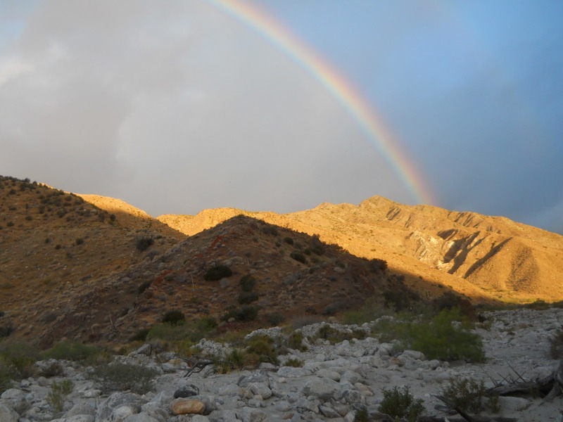
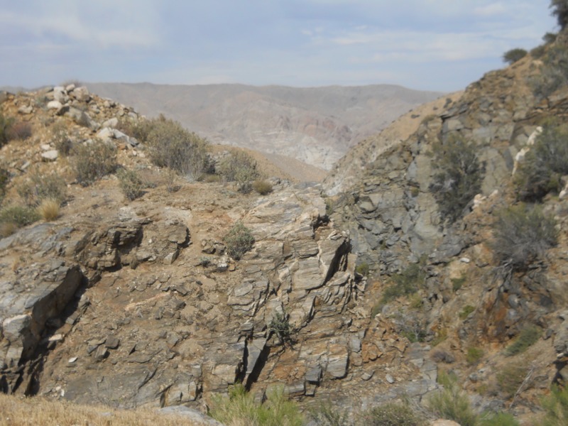
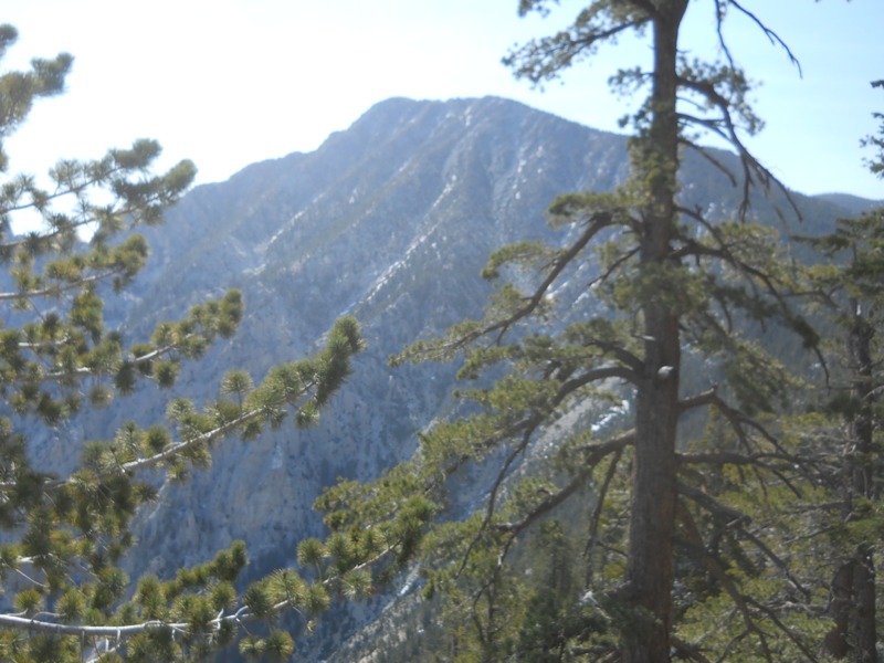
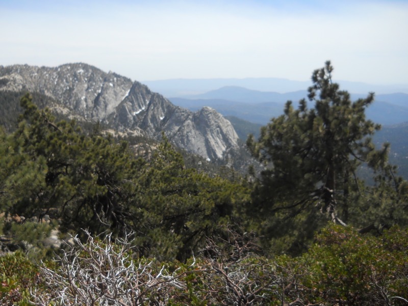
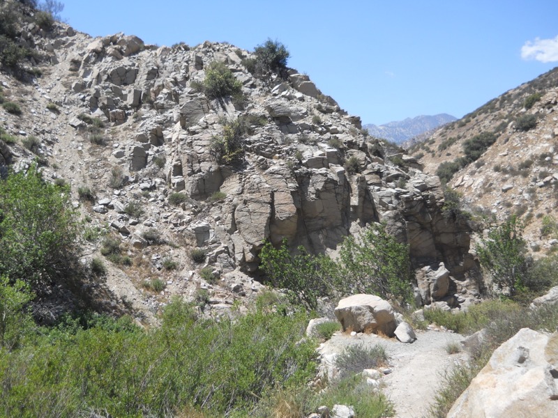
Giant upthrusts of rock jutted up from the ground at crazy angles. They sort of looked like the ones at Vasquez Rocks, a county park to the west of us that comes just before our next town stop. We would cross the San Andreas fault later that night so it made sense that the local geology was interesting.


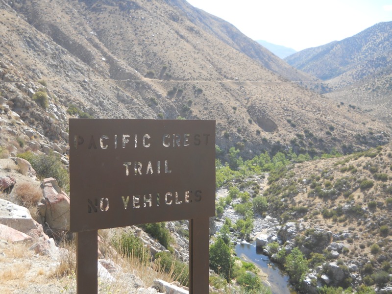
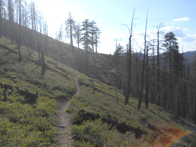
It was a relief to walk in the cool of the evening and we made good time. As it got dark we hiked past the Swarthout Canyon water cache and a bunch of hikers settling in for the night. We didn’t need any water since we had carried 5 liters each out of the pass…a satisfying feeling. We hiked on, aiming to reach higher elevations so we could avoid the heat of the morning. Since the moon was new it was pretty dark and we slowed down to avoid tripping over rocks. Hiking next to steep drop offs doesn’t bother me in the daylight, but doing it at night was unnerving. We got a lot of climbing done without using a lot of water – one of the advantages of night hiking. One of the disadvantages is that the big flying bugs come out and fly into your face in an effort to get to know your headlamp better.


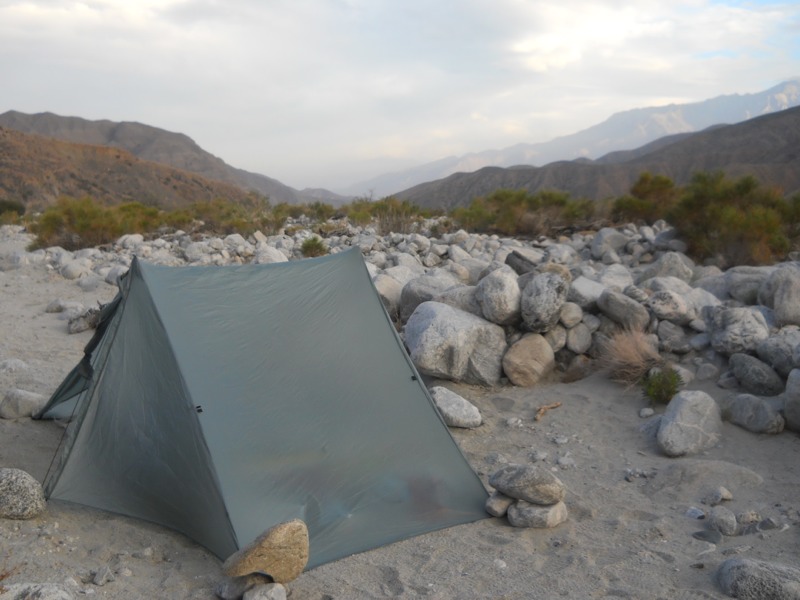
Around 10:30 we found a bare spot just off the trail and set up camp. Not a moment too soon either, since a big group of hikers passed us a few minutes after we stopped. We’re on a bit of a slant so we’ll be sliding downhill all night, but it’s better than climbing another 500 feet. We can see the big curve where I-15 snakes east, lit up by headlamps on one side and break lights on the other. We must be under a major flight path because a plane comes over every minute or so. It’s strange to be in the wilderness and still so close to civilization.

– Posted from the PCT

Location:Pct mile 351

Day 24 – Deep Creek Hot Springs to Cleghorn picnic area – 21 miles


Despite all the people at the hot springs, we had a pretty quiet night in the hills away from the beach. It was a warm night, too, the warmest we’ve had in a while. It was nice not to have to be completely bound up in our bags.


We packed up and had breakfast down at the beach. Keith talked to a few groups of hikers about his missing umbrella and we were feeling optimistic that it would find its way back to him. In a way, it’s convenient that he lost it here with so many hikers in one place. Anyone who comes through trying to find its owner ought to get the message.


We successfully resisted the urge to stay another day at the springs and headed up the canyon. It was already getting hot at 8 am but we continued to get shade now and then as we snaked in and out of the smaller canyons. This has been a fun and pretty stretch to hike with the creek winding down below. As we neared the end, we passed a woman heading southbound. She had gotten caught in an ice storm on Mt. Baden-Powell, which we’ll tackle after Wrightwood. More motivating was the news she shared about the Mother’s Day cache of cold sodas at the highway a few miles up. That really got our feet moving…


We exited the canyon at the Mojave Forks dam, which is not like dams I’m used to seeing. There wasn’t any water going over the spillway. In fact, there didn’t seem to be any water moving anywhere. The guidebook said that it was used for flood control, but that it was mostly unnecessary since Deep Creek never got enough snowmelt to flood. We followed the trail behind the dam, fording the small stream bed after taking off our shoes – a new experience, since up until now we had been able to rock hop across creeks. Then it was up and down over some beat-up trail to the trailhead at Highway 173. When we reached the lot, we found an awesome surprise – trail magic! Shepherd was grilling up hot dogs and serving heaven in a cup – root beer floats! Nothing like a float at 10 am when you’ve hiked 7 hot miles already. She had oranges, too, which are quickly becoming one of our favorite trail treats. We’re still amazed and humbled that people do this just for the sake of helping us out!


While we were relaxing, the owner of the property next to the trailhead drove up on his ATV. Somehow Shepard knew that he trained dogs in rattlesnake avoidance, just like our friend Kelly who gave us a ride from Warner Springs. He offered to show us his snakes, which I was totally game for but Keith wasn’t as much. He had about 15 rattlers of different kinds in a cage in his backyard. It was super cool to see them all coiling up in defense and rattling their tails. I guess now I can’t complain about not having seen any.


After returning to the trailhead, two other hikers – Gator and Walking Home – joined our group and Gator had Keith’s umbrella! Just in time for a scorching desert slog! He was overjoyed to get it back. Now fully armed, we reluctantly pulled ourselves out of the hospitable vortex and headed out to make some miles…after visiting the previously mentioned soda cache.


We got a reprieve heading down towards Cabazon a week ago, but we were now definitely back in the full force of the desert heat. Even with our umbrellas it was oppressive. We ambled along slowly, eyes half closed, concentrating on moving as few muscles as necessary to get down the trail. Luckily it was pretty easy going with only small rises. We were definitely moving slower than usual, but we were doing better than we had been during our first week in the desert.


We were on hillsides once again, heading in and out of side canyons, hoping to see a change in the trail as we rounded each bend. The landscape to the north became enviously green and lush and cattle appeared. Finally we reached highway 173 again, and more magic in the form of cold sodas was waiting just across it. What a much-needed morale booster! We continued on past the Cedar Springs dam, along the highway for a while, and then into a shady wooded stretch. We couldn’t believe our luck when we came across yet another cooler. This one was full of fresh fruit! I hadn’t had a fresh peach in so long and I ate one so fast I nearly swallowed the pit. We also took an orange and a banana for breakfast. Fresh fruit tastes amazing when you don’t have the chance to eat it every day. All this unexpected magic has turned a tough, hot day into a bearable one.


After this last bounty, the trail started climbing steeply, much to our dismay. The reward was worth it when we stood on the ridge overlooking Silverwood Lake. Even the air felt different – after a full day of dry oven heat, we could tell the air coming off the lake was full of moisture. And cooler, too. It was still plenty hot as we skirted the lake high above the shore. We enviously watched people cruising around in their boats down below. It reminded me of MN. After another mile or two we reached a steep side trail to a boat-in picnic area with outhouses and trash cans. Without a second thought we started down. We were planning on taking a dip, but given how late it was getting and how cold the water was we just waded around, washed out our sweaty shirts, and gave ourselves bandanna baths. I called my mom to wish her a happy Mother’s Day as Keith had earlier. It was a lucky day to have cell service!


After our refreshing break we headed back up the slope to get in a few more miles. It had finally cooled off and we made great time, hiking through swarms of shrieking gnats and on into the dark to reach our next water source at the lake’s main picnic area/parking lot. We didn’t get as far was we would have liked for the day, but for how hot it was we did pretty well. Tomorrow we go under I-15 and another interstate crossing means more hot weather. There is a bonus, though – the hiker heaven of a McDonalds at Cajon Pass. All the soda I can drink and French fries to boot – that’s enough to get me 13 miles through the heat.

– Posted from the PCT

Location:Pct mile 328

Day 23 – Holcomb Creek to Deep Creek Hot Springs – 22 miles


We were up and on the trail early this morning since we knew it was likely to be hot. We followed Holcomb Creek up its canyon for nearly 8 miles before parting ways. Holcomb is a good water source during hiking season and it was nice to not have to worry about whether it would be flowing. I heard red-winged blackbirds calling from the brush in the middle of the creek bed.


The climb away from Holcomb and into the Deep Creek drainage wasn’t too strenuous but the morning was heating up and we were sweating quite a bit. After coming over the ridge and down to the creek we crossed a bridge and headed to the Splinter trailhead for lunch. The Forest Service was there holding a fisheries volunteer event. We hoped they might offer us some of their vast amounts of food, but it wasn’t to be.


After lunch we set off down the creek drainage. It was hotter than we’ve felt in a while, but being on the south side of the canyon we had occasional shade. I can see why this section of trail was closed for so long – it was built into sandy cliff sides high above the creek. Even now some sections wanted to crumble away under our feet. I had done something to the front of one of my ankles and it was really bothering me on the shifting gravel. I can’t figure out what I did – I sort of jabbed it before lunch but that didn’t seem bad enough to cause this. It might be the beginning of a shin splint. I’ll wrap it tonight and hope it feels better tomorrow.


We had planned to grab some water at the hot springs and move another few miles down the trail. We’ve heard it can be busy on weekends and since it’s clothing-optional, the view isn’t always that great. The guidebook totally downplayed it. When we finally limped in, though, we saw Matt and Jamie with their dogs, plus a few other hikers we knew out of a big crowd. They had been here for two days already and were planning to move on tomorrow. It took very little convincing for us to join them, and we were off to soak our sore bodies in a surprisingly non-stinky hot pool. My ankle feels better already, which is good because we have another long day tomorrow…


Keith’s umbrella has gone missing and he’s pretty bummed about it given that we’re back in the desert. We think it was pulled off his pack as we were squeezing though some brush on the way up the canyon. Hopefully someone will find it and bring it up the trail, as we did with the GPS unit before Idyllwild.

– Posted from the PCT

Location:Pct mile 308

Day 22 – Big Bear City to Holcomb Creek – 20 miles


Today we headed back to the trail, and we were mostly successful in fighting the sluggishness that seems to come with the last day in town. We were helpfully woken up early by the dog in the room next to us, which got us going on packing and eating breakfast. During our trip to the grocery store yesterday we had picked up a few things for breakfast to save the time over going out. We were out the door in a surprisingly short amount of time.


We headed up the road towards the trailhead, hoping to catch a hitch. We hadn’t gone more than ten minutes before someone pulled over and offered us a ride. Gabriel was running some errands on his day off. He told us he was redoing his bathroom, so he was currently missing some important modern plumbing – something we can identify with! He saved us five miles and a few hours of roadwalking! Thanks for picking up two scruffy-looking schlubs like us!


Once back on the trail, we made great time even with full packs. We have some easy terrain coming up over the next few days until we start back up into the mountains after I-15. We hiked straight west, a new direction for us, and wound through the piney hills above Big Bear. The views of the desert to our right were amazing, and later in the day we were treated to glimpses of Big Bear Lake (the town) from across the lake of the same name. The mountains towering over the town all had streaks of fresh snow. Last night was a good one to spend in a hotel room!


After lunch we entered a burn area still recovering from a fire in 1999. The fire was so large that we’ll be walking through the damage tomorrow too as we head up the Deep Creek canyon. The area had a semi-permanent detour in place ever since and this is the first year that this section of actual PCT is officially open again. Lots of hikers, especially in the last few years, have ignored the detour but it’s good to know that the trail is back up to PCT standards.


We followed the ridges through the burn and gradually dropped down to Holcomb Creek. We passed our second trail camp of the day. They both had these cool solar pit toilets that were open-air behind a tall wooden enclosure. What a good idea to keep the stink down! Very nice backcountry facilities. A mile or so later, enough to put us out of earshot of the camp, we found a nice open spot near a small trickle of creek. It feels much warmer tonight than our last few nights out – one more sign that we’re heading into the desert again. It will probably be very hot over the next few days but at least we won’t be cold at night.

– Posted from the PCT

Location:Pct mile 286

Days 20 and 21 – Big Bear City – 7 miles


We got up a little later today than we meant to – the cold weather is going strange things to my watch and it apparently reset itself last night. Hopefully a new battery from town will fix the problem. It was cold again last night without a tent but it was nice to be back out under the stars.

Motivated to get into town, we didn’t loose too much time getting on the trail. It was nice hiking in the cool, sunny morning weather. We wound around low rises through scrub that was surprisingly desert-like given that we had been in a forest of pines and cedars yesterday. We saw more cacti, yucca and even Joshua trees. The miles flew by and in just a few hours we reached the highway. Keith called Papa Smurf, who cheerfully drove out to haul us and two other hikers down to Nature’s Inn where we had rooms reserved. Mud and Dingo work in Alaska north of the Arctic Circle and have been doing crazy long days. This will be their first zero day. We’re not quite so tough! On the way into town we heard that the search teams found the missing hikers we learned about yesterday. They seem to be in good condition too. What a relief!


Our room at the hotel has a whirlpool tub, which is a wonderful thing. We’re a quick mile’s walk from Thelma’s, a great restaurant, which is near the laundromat and donut shop. Efficient layout for hungry, dirty hikers…

After breakfast the next day we took the bus down to the grocery store to resupply. We’re surprisingly good at ignoring the extra distractions and getting only what’s on our list. We’re also getting better at knowing what will hold up to the abuse of getting stuffed in a pack, and what will be especially satisfying to eat. After getting back to our room we worked through our other chores – sorting and packing food, washing out our water bladders and filter, journaling, and such – and turned in early for an early morning back to the trail.

– Posted from the PCT

Location:Pct mile 266

Day 19 – Mission Creek Trail Camp to past Arrastre Trail Camp – 19 miles


Some days the miles take forever and some days they fly by so quickly we can hardly believe it. Yesterday and today are perfect examples of these opposites. We had some of the easiest trail yet today, with only a little gain in the morning and flat or downhill for the rest of the day. We walked mostly on compacted dirt and duff. All of this proves, of course, that we can make great time – as long as we’re hiking in cool weather on trail graded like a sidewalk.


The cold from the previous night continued into the afternoon. We were glad we had set up the tent – even with it and our 20-degree bags we were a little cold. When we finally forced ourselves out to get packed up, we found that we had camped near Matt and Jamie, the couple hiking with their two huskies. We are really surprised that we caught up with them since they hike quickly. Jamie shared some of their extra filtered water with us. We chatted about the trail for a bit and found out that it had been over 100 degrees the day they came down into the desert near Cabazon. I figured we had gotten lucky that day – even though it was a monotonous stretch at least it had been cool! We were fortunate yesterday too – the guidebook says that Mission Creek can be another hot stretch.

Jamie also shared the news that search and rescue teams were looking for three missing dayhikers. That explained the helicopter yesterday. These guys have been missing since Saturday and it sounds like they left without much warm clothing or water. Given how cold we were last night it sounds a little grim. As we were packing up the sheriff came by and made sure that we knew to keep an eye out. We heard helicopters all day.


As we hiked up to great views of the peaks all around us, we could see that the pines at higher altitudes were silvered over with frost. When we took a morning break we were rained on as the sun melted it from the needles. Later on we would get caught in some frozen rain – much better than actual rain since it bounced off our jackets without getting us wet.


We climbed up to the Coon Creek group camp, which had the unexpected luxury of a pit toilet and a trash can (along with a heavily-graffitied cabin). After a little more gain we started down an old jeep road. We passed a 250-mile marker someone had built out of pinecones. Just before lunch we passed “Predators in Action,” a company that trains large predators for movies and TV. It was a little sad to see bears, tigers, and cougars pacing in their cages.


The sun finally came out strongly at lunch, and we took our time in order to dry out our bags. When we sleep in a cold tent they can get a little damp from the moisture in our breath. If we were in for another cold night, we wanted to make sure they were as dry and as insulating as possible. After lunch we hit the trail hard to try and crank out another 10 miles. In no time at all we had done 3 without breaking a sweat. Then we got distracted…


First it was by a cache full of soda put out by local trail angels Papa Smurf and Mountain Mama. We each took one to have with dinner tonight. What a treat! Then, not a mile later, we an across a second cache maintained by the Big Bear Hostel. This was the hiker motherlode! Sweet tangerines, cookies, sodas, water, and a hiker first aid kit that even had tissues in it. To top it all off, we could enjoy our bounty while sitting in a recliner. There was even a mirror so we could clean ourselves up. It was hard to leave this one behind, but tomorrow’s town day was calling…


A few miles down the trail we reached Arrastre trail camp and the first water since our camp this morning. Luckily we hadn’t needed to carry much since it was so cold out. We took a few liters from the nearby trickle to filter after we set up camp tonight. Then we pushed on – too late to make all 20 miles we had hoped for, but close enough to make for a quick day tomorrow. We camped up on a ridge after climbing out of the Arrastre Creek drainage. It was a little exposed but we thought it would be warmer than sleeping down near the creek where all the cold air pooled. We had a beautiful view of the sunset on the nearby mountains. It turned all the clouds pink.


We have less than 8 miles until we reach our exit point tomorrow and they should be pretty level. After the last few days we’re looking forward to sleeping in a heated room. Big Bear is supposed to be a fun town for hikers. After a layover day and a zero, we’ll start our next segment towards Wrightwood. This marks the point where we swing west for a few hundred miles to skirt north of the LA basin. We’ve now completed 10% of the trail! It seems strange – on one hand, it feels like we haven’t been out here long enough to make it this far. On the other hand, we can remember almost every one of those miles. And 10% done means 90% left… We’ll keep focussing on the next stretch ahead of us, just like we have been. I’ll be dreaming about breakfast platters tonight.

– Posted from the PCT

Location:Pct mile 259-ish

Day 18 – Whitewater Creek to Mission Creek trail camp – 20 miles


It’s hard to put into words exactly how beautiful the scenery was this morning, so just refer to the picture above. The rainbow was a perfect, bright arc through the sky. The ends were actually in the canyon with us. Further out, we could see a very faint second arc. Unfortunately, this meant rain although we hadn’t had any the previous night. It sprinkled very lightly on and off while we packed up and had breakfast. Just as we were finishing it got quite a bit heavier, as though it was driving us to get going. We got to use our homemade ponchos for a while as we crossed the creek canyon and climbed over another saddle.


The trail took us ridge walking for a while, doubling back so we could see the canyon, Mt. San Jacinto, and the desert east of the mountains. It was absolutely beautiful and different from anything we’ve seen yet. The far mountains we were heading into were shrouded in fog and mist – the reason behind our rainbow and our sprinkles this morning. We continued to get drizzled on intermittently and it became sort of a game – stop and put your raingear on, and the rain would stop. Stop to pack it away, and it would start up again.


We dropped down into Mission Creek canyon, which was another new environment for us so far on this hike. For the first time, good on-trail water was plentiful as we crossed and re-crossed the creek. The plants were an unusual mix of trees, grasses, and desert flora. I even saw a cattail. We followed the creek far up the canyon for most of the day before really heading into the mountains. At times the trail was more indistinct than we had ever seen so far. With seasonal flooding this section must be incredibly hard to maintain and we appreciate the all the hours that crews have put into it. When we weren’t sure where to go next we would look for the tall wooden posts that marked the next stretch of tread. Late in the afternoon we got buzzed by a helicopter flying up the canyon. I wondered if they were search and rescue out looking for someone. If so, it must have been obvious that we weren’t them because they didn’t hang around long.


The day ended with some rough climbing as we transitioned to a different landscape. We had our first encounter with poodle dog bush, a nasty skunky-smelling plant that can cause bad rashes if touched. We’ll see this plant again soon – it’s one of the first to repopulate burn areas.


As we climbed over the last few miles we began to see pines, huge cedar trees, and other alpine plants. It was beautiful but we were running out of gas after a long day. We were glad to get to camp and the first water since we left the creek canyon. We even had a picnic table to unload our gear! At this point it doesn’t take much to make us happy. The last stretch of trail was cold as we reached 8000 feet again, but at least it was calm. This will be a great night for bundling up in our bags and our tent will give us a little bit of extra warmth. No wonder this felt like a tough day – we climbed over 6500 feet!


– Posted from the PCT

Location:PCT mile 240

Day 17 – Ziggy and the Bear’s to Whitewater Creek – 10 miles


We woke up this morning a little earlier than expected due to the early morning rush of hikers packing up. It was a bummer since we had been so careful to be quiet when we came in the previous night and to put ourselves off in an isolated corner, but there’s no real way to broach the subject without people thinking you’re a grump. I threw in the towel pretty quickly and got up but Keith tried to get back to sleep.


Breakfast from the trail angels was wonderful! Oatmeal, cereal, and best of all, coffee and fresh fruit! I sat around and chatted with other hikers as we all ate. After breakfast I showered and stretched out my leg. It felt much better than yesterday. Given our late night we took a leisurely morning, finishing up a few other chores, reading, and relaxing in the wonderful hospitality. Ziggy and the Bear are two of the nicest, kindest people you will ever meet. It still blows my mind that people are willing to open their lives and hearts to many stinky weirdos every year. We do tend to be good-natured and appreciative of the most minor luxuries (like brand-name tissues!) but it’s such a huge undertaking. They have already hosted over 260 hikers this season – Keith and I were 250 and 251. It’s a busy year out here!


Eventually, though, we felt the urge to be moving on and we packed up and hit the trail. The first stretch was through flat desert scrub towards a nearby wind farm. This was a good place for it, seeing as we had been blown around all last night and today as we hiked. After making our way up to a saddle in a narrow canyon, we crossed over into the San Gorgonio wilderness.


Here the wind was even stronger. We are the hiker equivalent of high-profile vehicles, and sometimes a gust would catch us mid-step and nearly throw us down a cliff. Once or twice we had to just stop, brace ourselves, and wait for it to end. It was funny to see ants get blown end over end up the trail (probably not so funny for them though).


As we entered the wilderness the entire landscape changed. Suddenly we were walking through rolling hills, with long beautiful views across the wide canyon to rocks that were striped and colored like the badlands. We eventually dropped down to the canyon floor, which was an enormous rock and sand bed for Whitewater Creek.


This was our stop for the day and we decided to camp out on one of the sandy stretches. We planned to set up the tent since we had been hearing about rain tonight ever since Idyllwild. We thought it would be a picturesque campsite with lovely background noise from the creek, just like in an REI catalog! Well, we discovered there are two problems with this idea: one, without sand stakes and with strong winds, your tent won’t stay up. We solved this issue somewhat by putting big rocks over each stake. The other problem is that when the wind gusts as it did, sand comes in under the edges of your tent and gets in everything. Every last nook and cranny. We took all this pretty much in stride because it was easier than relocating over the creek and all the rocks. I didn’t get much sleep, though, listening to the tent and wondering if it would blow over. One thing was true – it did turn out to be a picturesque site!


– Posted from the PCT

Location:PCT mile 220

Day 16 – San Jacinto River to Ziggy and the Bear’s – 25 miles


It was nice to camp near a water source for a change, but it made for a cold morning. It was hard to get out of our warm cocoons so we had breakfast in bed. Between cold mornings and camping around other people we’ve gotten good at changing clothes in our bags.


With 4 liters of water each (another dry day), we hit the trail towards Fuller Ridge. We wound through pine trees and boulders with great views to the west. The trail was much gentler than I had expected, with only a few steep switchbacks up to the ridge. As expected, the ridge itself didn’t give us any problems. We didn’t even realize we had crossed it until we started losing elevation on the other side. The only snow we encountered was on the switchbacks heading down. Still, in a year with normal snowfall we could easily see how it would be a dangerous obstacle to get past.


A few easy miles later at the trailhead we met a family with young kids out camping. They had the whole lot to themselves and it looked like they were having a great time. It made me a little nostalgic for the days of our family vacations. With no water or toilets at the trailhead, these people were pretty hardcore!


The rest of the day consisted of long, gentle switchbacks all the way down into the desert. As we started dropping down out of the mountains we were only 4 miles from the next water source as the crow flies, but the trail took 16 miles to get there. We lost about 5000 feet of hard-earned elevation. As we began down we ran into Carrie from Seattle, whom we saw briefly in town. We played tag all day. Now that her feet are healing she can really fly down the trail!


All day we had wonderful views if the desert floor, the town of Cabazon, and the wind farm east of town. I think Cabazon was the place where they filmed the part of the movie “Pee-Wee’s Big Adventure” with the giant dinosaur statues. As we progressed the pines and other trees disappeared, replaced by the now-familiar yucca, cactus, manzanita and scratchy shrubs. It was a little monotonous and a little frustrating to know that we were taking such a roundabout path…but I can’t complain too much about gentle elevation changes. We were lucky, too, that it was relatively cool with gusting winds. I got the impression that this section could have been much hotter. In previous years some hikers have needed rescuing from this stretch since they didn’t carry enough water out of the mountains.


As we headed towards our shady lunch spot the trail got progressively more overgrown. It was very sandy, too, and prone to eroding along the edge. This continued for a while after lunch. Between the trail and the wind, I managed to roll both ankles within a minute of each other and plant myself on my face both times. Luckily it was a pretty empty stretch so there was no one around to see. Eventually the shrubs cleared a little and we only had rocks to contend with under our feet. I saw my first rattlesnake today! I only got a glimpse of him though, since by the time I connected the buzzing sound with the snake he had retreated under a bush and all I could see was his black tongue. There will be other chances, I’m sure – we still have lots of desert to cross. Some time after that we passed the 200-mile marker. It’s hard for me to grasp that we’ve done 200 in nearly two weeks of hiking.


Finally, after one last gentle set of switchbacks, we reached the Snow Creek faucet. I was pretty sure I was done for the day, having broken the 20-mile barrier for the first time since Lake Morena, but there were trail angels 5 miles further along and it was hard to resist the idea of a shower. Carrie decided to go for it and after Keith arrived we talked it over and decided to try too.


It was a tough hike – flat over the desert floor, but very windy and hard to find our way in the dark. My right calf had been feeling tight since we reached the faucet and it was not happy walking through so much sand. Luckily we have GPS apps on our phones, or we would have had trouble finding where to cross under I-10. The last mile was the worst – I was at a real low and every stone I caught my right foot on sent pain up my leg. I was really gimping along.

As often seems to happen, we reached the trail magic just as we felt that we couldn’t go any further. Ziggy and the Bear’s house is another hiker oasis in Southern California. They used to live near Anza about 70 miles back (another tough and hot stretch) but have relocated here. They have a whole outfit for hikers – a canopied yard to sleep in, a shower, a sink to wash laundry in, port-a-potties, and FOOD. Even though we rolled in at 9:30 there was still someone there to greet us and show us the ropes. After a little laundry and a soda, we zonked out on our pads for some much-needed rest. Given how sore we are, I’m not sure we’re ready for consistent 20-mile days yet but I’m sure things will feel better in the morning. The weather is supposed to be cool for a few days with possible rain tomorrow. This will be nice since it means we don’t have to get going early tomorrow to beat the heat. After today, we could definitely use a lower-mileage day.

– Posted from the PCT

Location:PCT mile 211

Day 15 – Idyllwild to tributary of the San Jacinto River – 8.5 miles


We wrapped up our visit to Idyllwild this morning with a visit to the post office to mail off my broken camera. I’m really bummed that I won’t have it for the foreseeable future but at least we have Keith’s as a backup. If the repair goes well there’s a chance I could have it sent to Agua Dulce 250 miles up the trail.


Dave, yet another local trail angel, hauled us up the road to the Humber Park trailhead where we arrived a few days ago. He warned us about how hot and dry the next section is and gave us each a roll of life savers to avoid dry mouth. What a deal! Thanks Dave!


To get back to the PCT we hiked 2.5 miles and 1600 feet back up the Devil’s Slide trail. It was hot but well-graded and before we knew it we were back at the top. Along the way we met Mr. Green on his way into town. Turns out he is also from Minneapolis! He read that we were from the burbs in a trail register and has been eager to meet us ever since. We were happy to pass on some phone numbers he could call to try and get a ride.


Once back on the PCT, we headed north again over easy terrain. We were making for the trail junction two miles ahead, where we would take the alternate route to the top of Mt. San Jacinto. The trail started picking up grade and we could feel it with our full packs. Still, even though we moved slowly, our pace was steady as we climbed up to 10,800 feet – our highest point yet! I know we wouldn’t have been able to keep this pace up two weeks ago. We keep getting stronger…


We met lots of dayhikers out from Palm Springs along the way who came up via the tram car. It was a beautiful climb to a rocky summit. When we got to the junction with the last bit of trail we dropped our packs and pushed on. We both lost the trail near the top and did a little bit of rock hopping to get to the top. The view was amazing, looking straight down into he desert. We could see windmills, Palm Springs, Joshua Tree NP, and (I think) I-10, still nearly 30 trail miles away.


The trip down was actually a little rougher than the trip up. The west side of the alternate loop wasn’t maintained as well as the east, and we had to get over a few fallen trees. There were lots of tiny rocks on the tread – the kind that turn into ball bearings when you’re going downhill. The brush was pretty overgrown. Still, we made it back to the PCT in good time and found a campsite near good water. Tomorrow we go over Fuller Ridge, which seems to be referred to as “the infamous Fuller Ridge” in lots of journals. Not this year, though – it’s nearly snow free. Looking forward to more spectacular views tomorrow!

– Posted from the PCT