Days 135-141 – Finishing Oregon

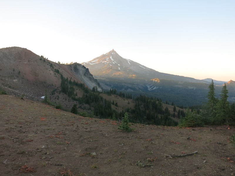
Day 135 – MacKenzie Pass to Old Santiam Road – 14 miles – pct mile 2003


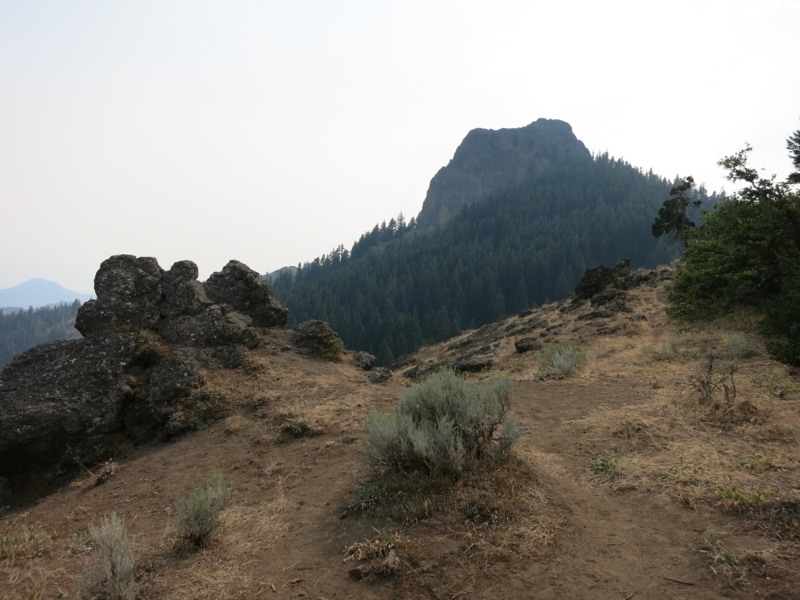
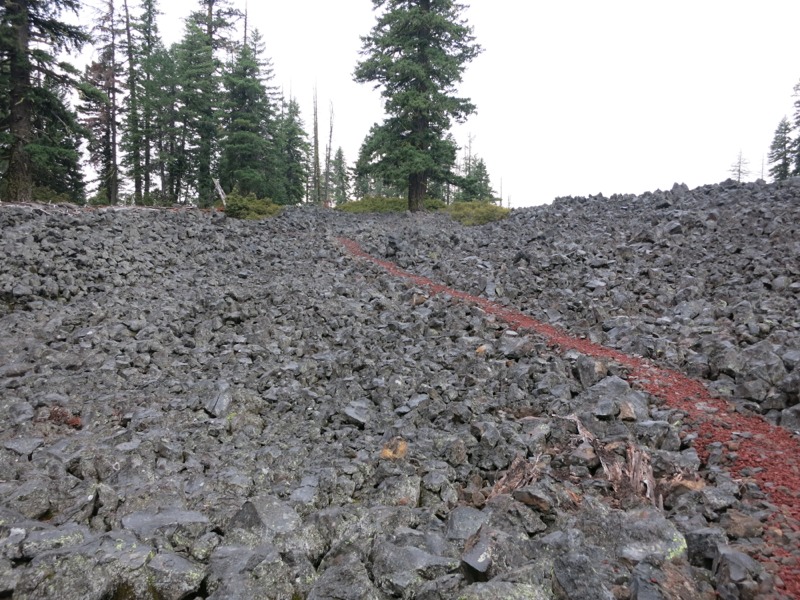
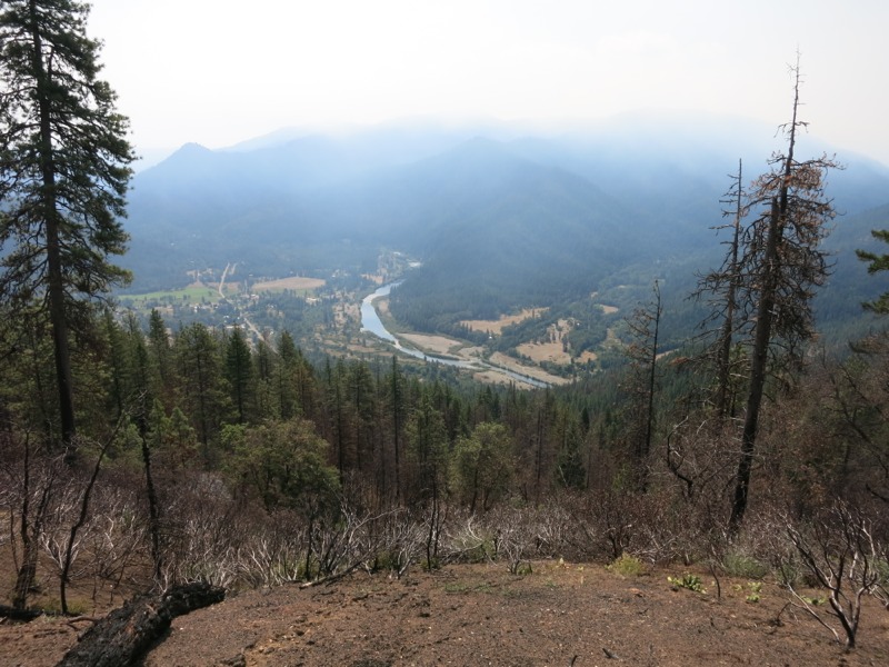
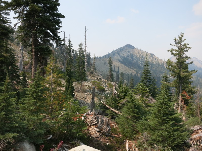
Back to the trail today to start the final leg in Oregon! We were worried about getting a hitch back since Bend is 30 miles from the trail. As it turned out, we didn’t need to worry. A lady saw us walking up the main drag and gave us a ride to Sisters, where the highway splits off for McKenzie Pass. Not more than 5 minutes after she dropped us off a nice guy named Gary picked us up and we were on our way. The trail crossed the highway in the middle of a huge, desolate lava field filled with rough black chunks of volcanic rock. We started off climbing through this field towards Little Belknap Peak. It was tough going – the temperatures were high despite a slight breeze and we had to be extremely careful with foot placement so as not to twist an ankle or knee. Thankfully the lava field didn’t extend for more than a few miles. Before long we were back on dusty volcanic soil, rounding the slopes of Mt. Washington – the first of the “presidential” peaks we’ll encounter. We crossed through dense forest and open, burned out areas as we gently dropped down to the spur trail for Big Lake Youth Camp and our next resupply shipment. The camp is very hiker friendly and allows us to use their shower and laundry facilities in addition to holding our shipments. Luckily, since we were just in town we didn’t need to spend time on these chores and instead worked to sort through our food for the next 6 days. Another long-ish leg. Even this didn’t take too long and in about an hour we were packed and ready to hit the trail again. We walked up the entrance road to avoid having to backtrack to the trail and soon picked up our path again. With dusk turning to dark and our packs heavy with water, we just went far enough to get out of earshot of campers on the road and set up for the night.

Day 136 – Old Santiam road to Shale Lake – 27 miles – pct mile 2030


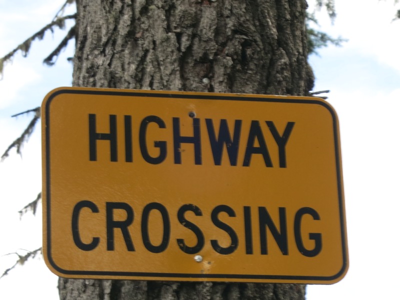
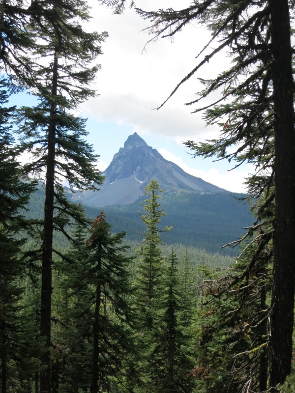
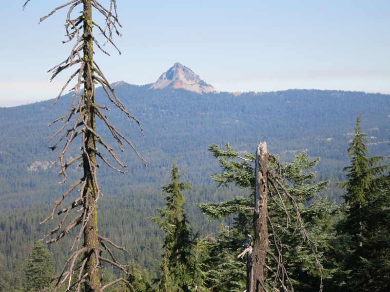
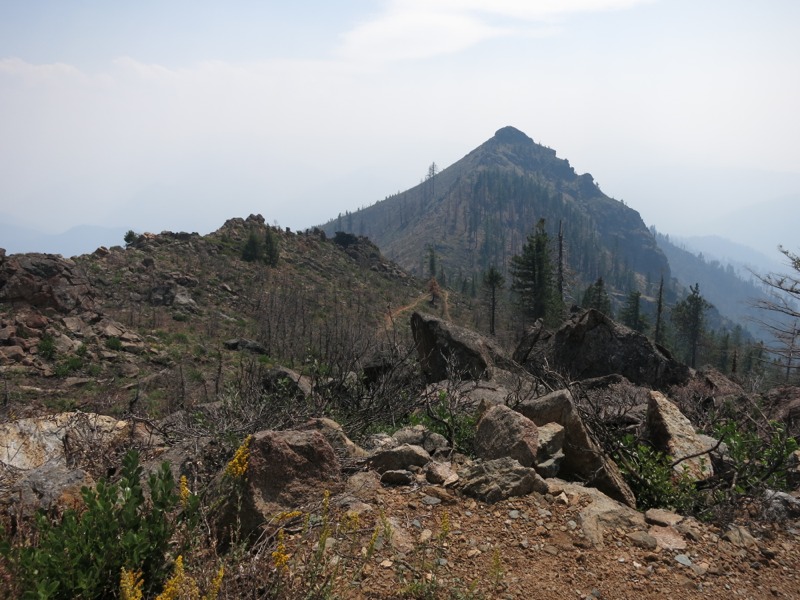
This morning was warmer than we’ve had recently, so it was a little easier to get up and going. We started off with a few easy miles through a burned area towards Santiam Pass, another highway crossing. Visibility was good through the burned trees – all bleached white and completely lacking in vegetation – and we could see the craggy summit of Three-Fingered Jack, the next peak we would skirt. Sounds like it was named for a pirate captain rather than a president. After the road we stopped to chat with Lon, a local section hiker, about bike touring. He’s ridden down the west coast and across the states – something we’d like to try some day, although maybe on a smaller scale. We climbed over a few miles as we came around the peak, getting a good look at it up close. Way up near the top we could see tiny dots as people headed towards the summit. We followed a ridge around to the back side and were rewarded with the sight of broad bands of red and black streaking through the rock – the back face looked completely different from the front. Soon we reached Koko Lake for lunch. It was more of a pond than a lake but it was deep and the water tasted fine. We took advantage of the beating sun and lack of shade to dry out our sleeping bags, which had been damp with dew this morning. After eating we started north again and into an afternoon of climbing. As we switchbacked up ridges, cooled by a nice breeze, we caught glimpses of Mt. Jefferson’s sharp, snow-streaked summit. This was by far the most impressive of the peaks we’ve encountered over the last two days. The climb was uneven and sometimes rocky and we didn’t quite make the speed we were hoping. As we transitioned back into forest and out of the burned area at last the shadows grew longer and the light turned orange as the sun set. We continued hiking after it was full dark, thanks to my new headlamp, and reached Shale Lake after another hour or so. We had expected it to be crowded and we could hear other people, but we had no trouble finding a spot up on a rise under some trees. Hopefully this will keep the dew to a minimum tomorrow morning.

Day 137 – Shale Lake to past Ollalie Lake – 24 miles – pct mile 2054


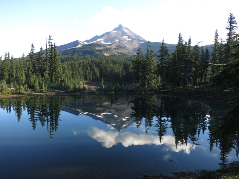
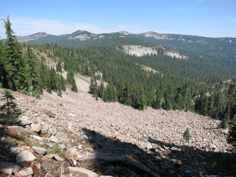
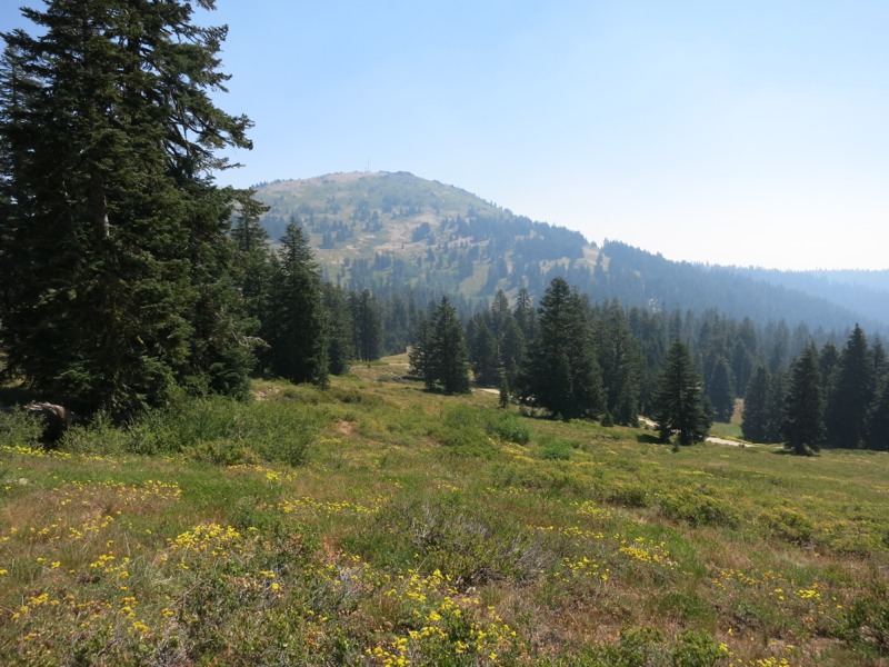
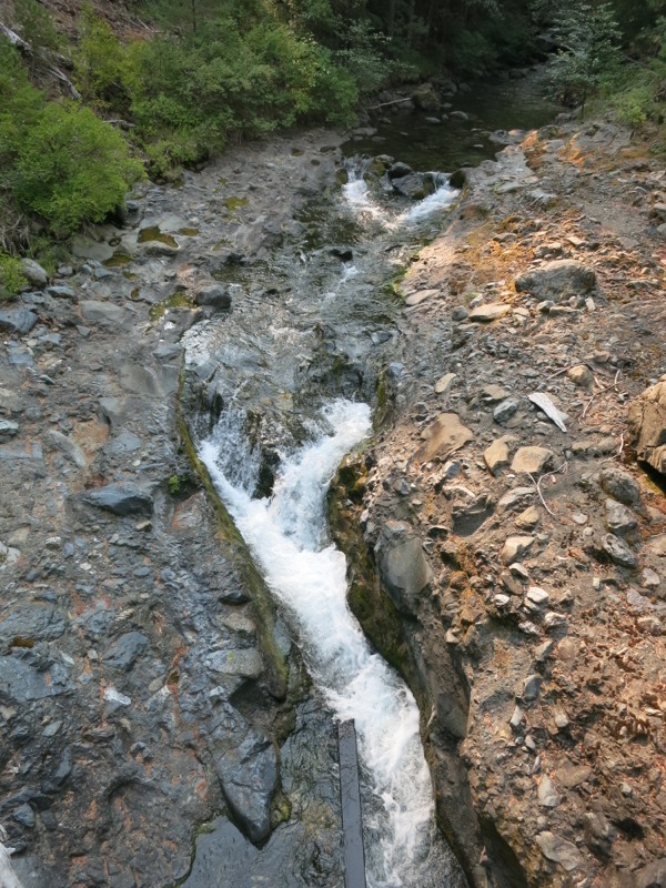
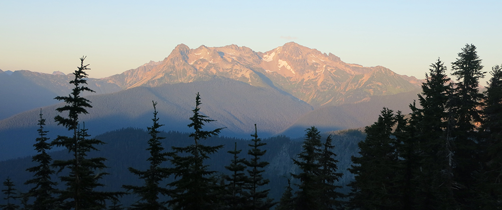
We woke up this morning to see Mt. Jefferson reflected in the still-as-glass Shale Lake. Despite the closeness of the lake the dew was minimal so we didn’t have to dry our bags out at lunch. We started off on a decline through shady pine forest as we swung around Jefferson’s western flank. After a few miles we reached Milk Creek, our first glacial creek. True to its name it was cloudy with rock flour from the glaciers high up on the mountain. A steep, rocky climb through overgrown trail followed before we reached Russell Creek. This was also glacial, and much cloudier and faster-running than Milk Creek. It was a tricky crossing and Keith didn’t escape without soaking his leg and nearly losing his hiking poles. Another gentle climb followed before we leveled out. We started to pass lots of people out for the weekend, including a pack train that was hauling out trail crew supplies. We stopped short for lunch at a pleasant, non-milky stream. We hadn’t come very far yet since we’d been fighting the stream crossing and overgrown brush, but we were both hungry for a meal. The going was slow after lunch, too, when we faced the steepest climb we’d had in quite a while. First we strolled through Jefferson Park, a broad alpine meadow northwest of the peak that reminded us a lot of Spray and Seattle Parks near Mt. Rainier. The views were beautiful but we knew we’d be struggling up one of the surrounding ridges before long. Soon we were – working slowly up slopes that were alternately forested and open. The trail was nothing but fist-sized rocks that rolled under our feet like ball bearings as we tried to push ourselves uphill. When we reached the top we were rewarded with a bird’s eye view of all the valleys and ridges around us. Jefferson towered nearby and we could get a good look at its glaciers, but the top half was socked in with thick gray clouds that had shown up during lunch and would build for the rest of the day. After soaking in the views while we took a rest we headed up the spine of a ridge lined with a row of scraggly, wind-twisted dwarf trees. Starting down the other side was slow as we tried not to beat up our ankles any worse than we already had on the rocks. Being above tree level meant that we spent some time crossing a rock field and even skirted a patch of snow. Soon enough we reached the trees and continued descending through sparse alpine forest to thicker growth down off the ridge. Miles of undulating trail took us past numerous lakes, over more rocks and finally to the turnoff for the Ollalie Lake Resort. We stopped by to fill up our water for the night and scored a few sodas from the store when the friendly cashier re-opened it just for us. We plodded back to the trail in the dark, loaded down with the dead weight of our water bladders, and went far enough up it to find a nice spot off-path a little to set up camp. Today was a tough day. We worked hard from the moment we set out, and our feet and knees are very sore from all the rocks, but we still fell a few miles short of our goal. Tomorrow’s terrain should be easier.

Day 138 – Past Ollalie Lake to Joe Graham Horse Camp – 29 miles – pct mile 2083


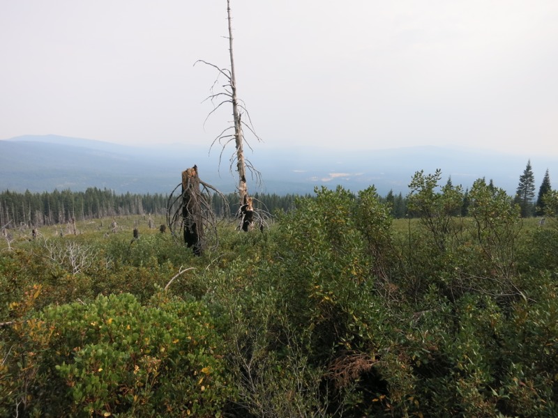
Today was a pretty unremarkable day aside from the fast pace we set. Although we hiked for nearly the same amount of time as yesterday we got in 4 miles more. This was thanks to the gentle terrain – no steep climbs and good, clear dirt trail. The trade off was that the day was mostly viewless through dense forest draped in hanging moss. We kept hoping to catch a glimpse of Mt. Hood, fewer than 25 miles away by the end of the day, but that will have to wait until tomorrow. We hiked 17 miles to a spring for lunch. Our guidebook promised that it always had good water but we were disappointed to find only still pools. It tasted fine, though, and when we filter every source we drink from it’s hard to get too worried about it. The remaining 12 miles went as quickly as the morning had – not always the case – and we even had the cell service to reserve a hotel room in Cascade Locks this weekend. We hiked the last mile or so in darkness, as has been the case lately. What was new was the enormous toads that seemed to take over the trail after it got dark. We saw at least 5 and heard more in the brush. Some of them were nearly as wide as my hand with the fingers spread. Good thing we’re not cowboy camping tonight. We camped at a horse camp near the trail, grateful for luxuries like a spigot, a picnic table and trash cans.

Day 139 – Horse Camp to Timberline Lodge – 24 miles – pct mile 2107


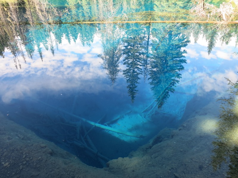
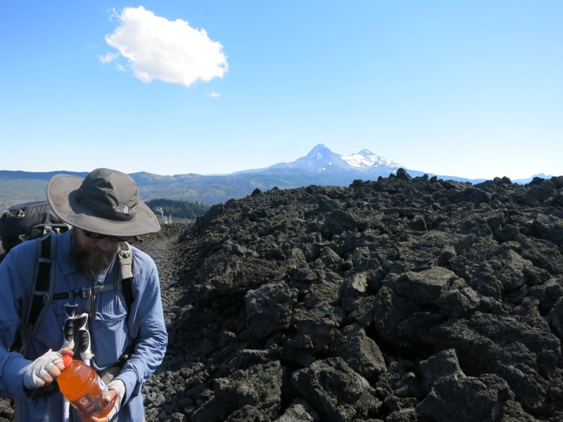
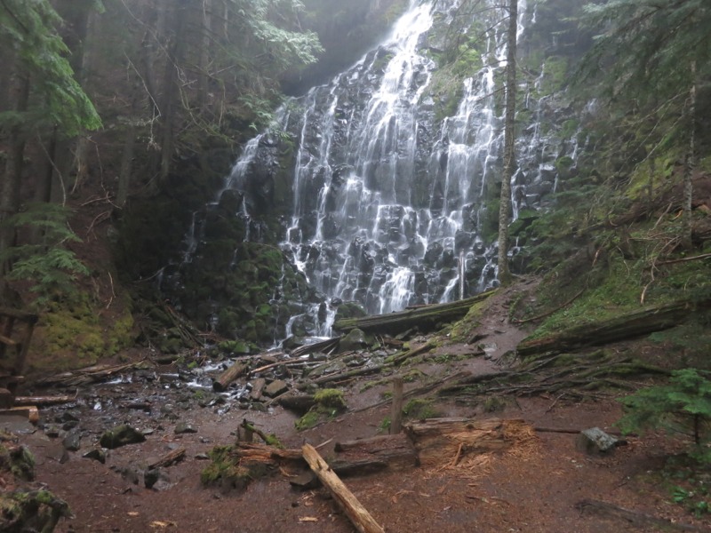
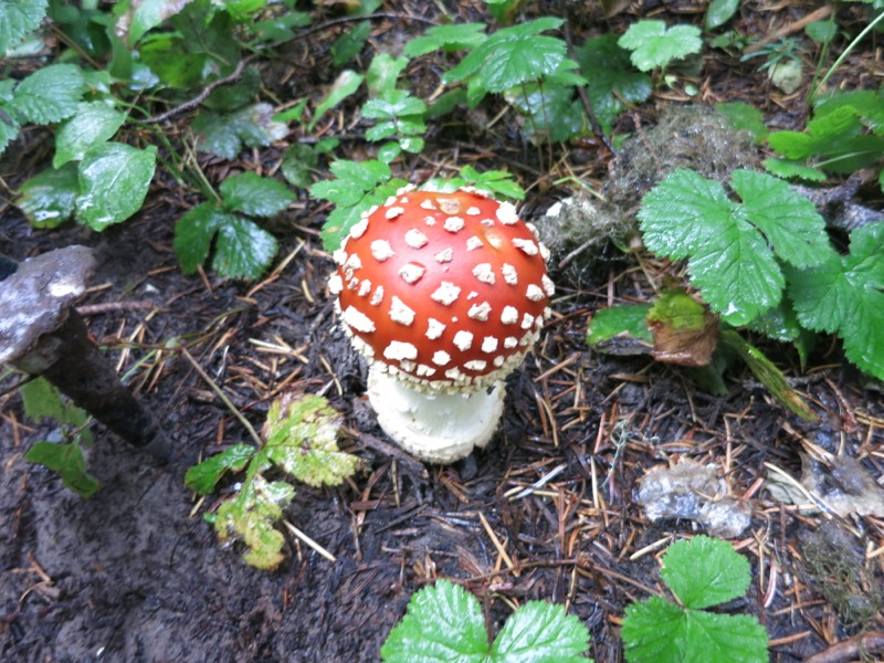
The meadow near our campsite was completely fogged over this morning. Luckily this didn’t translate into damp gear. We started north along the shore of Timothy Lake for a few miles before coming to our first distraction of the day. Little Crater Lake is an artesian spring that gradually eroded out a small, steep-sided pool 45 feet deep. The water was so clear that it was a deep ultra blue. It looked like the lake was filled with windex. It also looked much shallower than we knew it to be. After contemplating the pool for a while and watching a big fish make its way across the bottom, we hiked the short leg back to the trail and turned north. What a cool little side trip! We continued to hike through mostly viewless forest until a few miles after lunch, when the trail turned east and we got our first views of Mt. Hood to the north. They would also be our last views, although we didn’t know it at the time. We’d apparently stepped into mushroom heaven. All of a sudden shrooms of all different colors and sizes cropped up along the trail. We crossed a highway and hiked 5 miles to another, stopping twice to chat with hikers we hadn’t seen since Crater Lake. After the second highway we turned north again and started climbing up the slopes of Mt. Hood itself – gently at first, then steeply. The sunny day had turned thickly overcast, hiding views of the mountain and making nightfall earlier than usual. The trail turned into sand as the forest thinned out around us. It made for really tough climbing. We could see the lights of Timberline Lodge, our goal for the night, but were separated from them by a yawning chasm of darkness that our headlamps couldn’t pierce. Somewhere down there a river was churning. We took a sharp turn and started heading up the canyon. It was a little spooky hiking on such soft slopes with nothing but blackness on one side. Eventually we reached the glacial river that had been making all the noise – much smaller where we crossed it, but still tricky in the dark. We reached the side trail to the lodge soon after, where we’d reserved a room for the night. By the time we showered and ate it was late and we were exhausted. We went to sleep looking forward to tomorrow’s breakfast buffet.

Day 140 – Timberline Lodge to Lolo Pass – 18 miles – pct mile 2125


It was a struggle to leave a real bed, but the lure of the best breakfast on the trail helped. We stuffed ourselves with eggs, meat, potatoes, Belgian waffles and excellent fresh fruit. After lingering for a while to graze, we headed back to our room to pack up and get going. The low-hanging clouds from last night had stayed and the mountain slopes seemed to disappear into a sea of puffy white. We hung around long enough to take a few pictures of the outside of the lodge – also seen in the movie The Shining – before heading out. Almost right away we dropped into the clouds we’d seen earlier. Visibility was tough and we couldn’t see much more than the trail in front of us, which had turned into a true rainforest. Ferns and mushrooms sprouted everywhere and huge cedars draped with moss hung over us. We wound along the side of the mountain, hearing but not seeing the glacial rivers that carved apart the ridges we were hiking on. We climbed and dropped and it seemed like Oregon’s gentle terrain had come to an end. Eventually we reached the rocky glacial valley carved by the Sandy River. It reminded us a lot of the rivers on the Wonderland trail, with one important difference – no bridge! We had to go a half mile or so upstream to find a place where we felt comfortable crossing the swift current and cloudy water. We finally inched across on a couple of skinny logs and made it over safely. Then came the hike back down to the trail crossing and the inevitable climb out of the valley. We took a short alternate route past the beautiful Ramona Falls. As we sat down to have a snack while we took in the sights it started to rain instead of just threatening like it had been all day. We decided to move on instead of taking a break and getting chilled. After meeting back up with the PCT we had another tricky crossing over a fast-flowing creek. We then started up again, climbing all the way up to Bald Mountain and along its ridge before descending to Lolo Pass. By the time we started down it was dark and the going was tough over slippery rocks and roots. At least the rain had stopped for a little while. We and a few other hikers made camp at the bottom of the pass near a paved road. We’re in for more storms tonight. We’ve got a very long way and a big drop into Cascade Locks tomorrow – it would be tough to do it all in the rain…

Day 141 – Lolo Pass to Cascade Locks – pct mile 2155


It rained hard all last night. We slept badly and woke up to realize that we were camped in about an inch of water. Apparently what looked like a good flat spot in the dark was actually the low point of this campsite. Everything we were carrying was soaked – packs, food bags, electronics, and worst of all, clothes and sleeping bags. And it was still raining. Oregon was giving us quite the sendoff! After trying to salvage something dry to wear – which pretty much meant our sleeping clothes – we put on our ponchos and conferred with the other hikers we’d camped with. It was a tough situation. We were a little more than a day out of town, especially since it would take us a while to pack up, and spending another night out with wet clothes and sleeping bags was not an option. We were all worried about taking the trail down into the Columbia gorge after this much rain. In a stroke of good fortune, the parents of one of the hikers we’d camped with lived nearby. Luna had called them that morning and her dad was going to drive out and get her and her husband Werewolf so they could get into Portland that weekend. Tired, cold and wet, with gear that was heavy from the soaking it had gotten, it didn’t take much to convince us to get a ride with them. We threw our stuff into our bags and packed up our sopping wet tarp and footprint. Then the 8 of us headed up Lolo Pass Road into the rain to meet our rescuers. After 5 miles of roadwalking we reached the spot where he’d parked and piled into his camper for the ride down to their place. Luna’s parents were incredibly hospitable and helpful. They were also recent transplants from St. Paul, having moved out here less than a year earlier. Pizza and a warm place out of the rain helped put us all in better spirits before they hauled us down to Cascade Locks. We picked up our resupply from the post office – including, ironically, our umbrellas – and headed to our hotel room to empty our packs. Soon every flat surface was covered in drying gear and we’d cranked the heat up to help things along. We already plan to take an extra day here to make sure our bags are completely dry. Tomorrow we hope to find a way to get back out to the trail in order to hike some of the section we missed, but it’s a very roundabout drive and will be difficult to get a ride.

– Posted from the PCT

Location:Pct mile 2155

Days 132-134 – Bend

Day 132 – Diamond View Lake to Willamette Pass – 7 miles – pct mile 1914


This morning we packed up and hiked 5 miles in to Shelter Cove Resort on the shores of Odell Lake. It was easy trail through more forest and took us along the lovely Trapper Creek at the end. Well-flowing water has been a rarity over this last lake-filled section. Odell Lake was massive, stretching out into the distance behind a curve of the mountains. To the north we could see the runs at the Willamette Pass Ski Area twisting down the mountain. Heading north from the resort meant climbing up to the highway. This led us past a neat overlook of the lake. We were pleased to see how far north we’d come around its perimeter. The trail was in good condition and before long we reached the junction where the Skyline alternate rejoined the PCT. From there we had another mile or two of rolling hills that brought us up to the highway at last. We’ve decided to hitch into Bend for a few days. The shin splint I picked up after Crater Lake hasn’t gone away and we need to visit an REI to trade in some gear. There are other reasons too – one of them certainly being that we’re still struggling with morale a little – but those are the two that are most urgent. Through a series of hitches from some kind people, we made it into town that night and went to sleep clean in real beds.

Days 133 and 134 – Bend


Zero days in Bend. Clean clothes, new socks and headlamp, and a full grocery store. What could be better? This is the biggest town we’ve been in since we went into LA at the Saufley’s. It’s a little disorienting – we’re not quite ready to head back to civilization yet…We will jump back on trail at MacKenzie Pass, about 75 miles north of where we left. This means we’ll miss the Three Sisters – three enormous volcanic cones – but our eyes are on the border now and winter is coming. We’ll add this stretch to the already-long list of places to revisit when we come back out here.

– Posted from the PCT

Days 129-131 – Crater Lake and North

Day 129 – Crater Lake to Diamond Lake – 19 miles – pct mile 1852


We were up and packed in record time under the light of our headlamps. Even with heavy packs it didn’t take us long to return to where we were dropped off last night. We hiked north a little to get a better view of the island and took a seat to watch the sky fill with color. The clouds were pretty heavy – it had rained a little overnight – and they lit up bright pink. We couldn’t see more than slivers of the sun itself as it rose over the eastern rim peaks, but it was still an incredible experience and we were happy that we got up early for it. As the sun got higher the wind came up and we quickly went from comfortable to cold. With the show mostly over we headed up the road to the lodge, looking forward to a hot breakfast and fresh coffee. After stuffing ourselves we went back to the main hall to finish charging our electronics. I sat down in a comfy chair next to the roaring fireplace and tried to read but ended up napping instead. Finally we roused ourselves to leave – just as it started to rain. We put on our ponchos and headed out into it. We stopped by a cafe to grab sandwiches for the afternoon and by the time we really started on our way the rain had mostly stopped. It got nicer as we started north on the 8-mile rim walk, with the sun shining and the fog over the lake lifting. We marveled at how the view changed every time the trail came to an overlook. We got a close up on the rocky western edge of Wizard Island and the “shallows” (still 90 feet deep) between it and the rim. In the small bays where the island’s rocks met the lake the water’s extreme clarity made it look green. As we rounded the Watchtower (the highest point we’ll reach in Oregon or Washington) we could hear thunder and see the low clouds rolling toward us over the forest. The next wave of weather hit with a slap – suddenly we were in a downpour, getting hailed on while a cold wind gusted. The sandy trail we were on turned into a river before our eyes and started to erode. We struggled on past tourists parked at the lookout points, snug and dry in their warm cars. The complete lack of trail signage made it even harder to follow in the rain and we got lost for a little before Keith pulled up the GPS. Finally we picked it back up and started heading north, away from the rim. As we descended into forest the wind died and the rain eased. It was easier going but still unpleasant as we splashed through enormous puddles of cold water. We put our heads down and hiked. We’d come through it mostly dry and completely sold on the ponchos, but it was still cold and the exercise helped warm us up. A few hours later we stopped to eat our sandwiches and realized that the rain had stopped. Not only that, but the little horizon we could see through the trees seemed to be getting lighter. By the time we finished eating and moved on the afternoon sun was shining intermittently through the trees and we could actually take our rain gear off. We reached the highway eventually and hung out our thumbs, hoping for a ride to nearby Diamond Lake. Our guidebook said there was a free hiker/biker camp there with water – a nice alternative to the nearly 30-mile waterless stretch coming out of Crater Lake. It took us a while to get a ride but eventually a woman who knew about the PCT and us hikers stopped. In no time at all we were 5 miles away in the wonderful tiny campground reserved just for hikers. We picked one of the 5 sites, spread our stuff out on the provided picnic table and set up. Incredibly, the nearby pizza place/store was still open at 6:30 on a Sunday and we picked up a large pizza and sodas. A relaxing early night and a delicious dinner were just what we needed after burning all those calories to stay warm.

Day 130 – Diamond Lake to saddle – 22 miles – pct mile 1875


The first part of our day was taken up by the challenge of getting back to the PCT. We headed up a trail that paralleled the lake all the way to its northern tip, where we arrived at the chilly, windy Diamond Lake Resort. After a quick stop at their store for sodas (for later) and ice cream (for now) we continued north to the Howland Mountain trailhead. There we picked up a 7-mile trail of the same name that would supposedly lead us back to the PCT. Not all trails are as well-maintained as the one we’ve been following for four months, so side trips like this are a little bit of an adventure. Our guidebook described this trail as well-used and in fact it was in very good condition with fewer downed trees than we’ve encountered lately on the PCT. We worked our way back up to the Cascade crest, catching glimpses of craggy Howland Mountain and needle-pointed Mt. Thielsen at the very end of our climb just before we got back on trail. With the fun, relaxing side trip complete we started north again. We stopped to talk with a couple of southbounders at the semi-incorrect sign marking the high point of the trail through OR and WA. Semi-incorrect because if one took the equestrian trail through Crater Lake – which stays off the rim – this would be the high point. After an hour or so of chatting we moved on, bound for the water at Maidu Lake. This beautiful lake was a mile off-trail but was a better alternative than the next source, which was also off-trail but much further down the slopes. We filtered water and ate a leisurely late lunch/early dinner. We nearly stayed at the lake for the night but wanted to get the return climb out of the way before tomorrow. Our maps showed a loop trail that connected back to the PCT without any backtracking, but our guidebook described it as “defunct.” It was, but 90% of it was navigable by looking for the pathway through the trees. Downed trees were easy to step over except for a few large snarls. Once we got near the top where it rejoined the PCT the trail petered out, but from there it was a simple straight shot to regain our trail. Another mile of hiking brought us to a saddle where we’d planned to stay the night. Just as we thought, there were a few obvious campsites there already and we wasted no time setting up for the night.

Day 131 – saddle to Diamond View Lake – 24 miles


We took another alternate today – the old Oregon Skyline trail, which winds by many lakes while the PCT stays high and dry up on the crest. We started out with a 9-mile mostly downhill leg to a forest road and trailhead. A few minutes of road walking brought us to the start of the alternate. It stretched through the forest, mostly level but with a deep rut in the middle from the recent rains that made for tired feet. We stopped for lunch at Oldenberg Lake, closer in than the 4.5 miles indicated by the sign at the start of the trail. A curious chipmunk made it necessary for us to watch our food bags closely, but he didn’t bother the sleeping bags we’d put out to dry after the recent damp weather. After lunch we continued on through open forest. The lodgepole pines were sparse and undergrowth scarce, limited to low-growing manzanita shrubs. There was a surprising amount of dead wood scattered over the forest floor. Too bad we don’t ever make campfires. The trail eventually dumped us out at another road. According to our maps we had missed a turnoff somewhere. We hiked along the road for a bit and tried to rejoin the trail where the two came close to meeting, but even with a gps in the open woods we couldn’t find it. We returned to the road and hiked another short stretch until we came to a trailhead with a path that led back to it, clear as day. Either our maps are just wrong or the trail had been rerouted. We were glad to be back on and making progress forward. The rest of the day – 7 miles to Diamond View Lake – was surprisingly tough. It was hot and humid and we climbed over trail that was at times rocky and eroding. The mosquitos made a reappearance in force and were actually biting. We were glad to finally reach the lake and crawl into our bags as the chill of the night set in.

– Posted from the PCT

Days 124-128 – Welcome to Oregon!

Day 124 – Callahan’s Resort to Hyatt Meadows – 21 miles – pct mile 1748


We forced ourselves back to the trail today after a good lunch and a few last cold drinks. It was very hot and humid and we went through our water much faster than normal, so it’s a good thing we brought more than usual. We roadwalked for a mile down the highway before regaining the trail and climbing back into the Siskyou Mountains. Water was sparse. We had to hike into the dark to get to our source for the night – a spigot that turned out to be dry. Just as it was getting too dark to hike without a light I tripped and faceplanted and banged my knee. For just a second I thought I’d ruined the rest of my hike but luckily I hadn’t twisted anything. I’d probably have a bad bruise but it was fine to hike on. We thought we’d have to push on another few miles to the next water, which would take a long time in the dark, but not long after the spigot we came over a rise and heard water – lots of it. A little further down was a big open area perfect for camping. Things went from bad to perfect in that second and the day ended on a good note.

Day 125 – Hyatt Meadows to near Brown Mountain – 25 miles – pct mile 1773


It was hot again today. Lots of downed trees on the trail this morning. Some of them forced us off trail in order to get around them. We lost time at lunch looking for a spring off the trail. When we finally found it the water was flowing well – cold and delicious and worth the effort. We cruised over flat trail through partially logged forest. Welcome to Oregon! We stopped at the Brown Mountain Shelter to get water from the hand pump there. It would have been a really nice place to spend the night but we wanted to make a few more miles. We were finally encouraged to stop by rumbles of thunder. The rain held off just long enough for us to find a flat spot, set up the tent and get our gear inside. It didn’t go on for very long so it might not do much for the humidity tomorrow.

Day 126 – near Brown Mountain to past Christi’s Spring – 20 miles – pct mile 1773


It rained again this morning, just as we were getting ready to leave the tent. We dawdled for a bit until it let up, then jumped out and packed everything up. It started up again just as we were leaving but, like last night, didn’t last very long. Within two hours it was sunny again. We hiked through fields and fields of black lava rock boulders, thankful to whatever master trail crew had built this section. We walked on a layer of crushed red pumice – much nicer than the black rock around us. We reached a highway and tried to catch a hitch to the west, where the cafe at hiker-friendly Fish Lake Resort called to us for lunch. No one stopped for us and after awhile we but the bullet and walked there on the road. Happily, it turned out to about half as far away as our map indicated. We chowed down on burgers and fries and bought a sodas for that night. As we were packing up to leave the thunder started up again with rain right behind it. We had no choice but to head out into it. The road walk wasn’t bad but the trail had become a river. Our feet and lower legs were soaked almost instantly. It was really unpleasant hiking, but at least our climb up the slopes of Mt. Mc Loughlin was gentle. After a few hours the rain and near-constant thunder stopped, giving us a few more hours to dry out as we hiked. I got my second sting of the trip when I brushed past a shrub and apparently irritated a wasp. At first I thought the plant I’d touched had been a nettle, but once I saw the bug he didn’t last long. When we stopped at Christi’s Spring to get water for the night we were surprised to see hail on the ground. If we hadn’t stopped for lunch we’d have been hiking in it. It had gotten very cold. Our wet feet especially were feeling it and our breath was steaming. Two other hikers had built a nice fire at a nearby site and we shared the warmth for a bit before hiking on. We didn’t make it very far before deciding that, damp and cold as we were, setting up before dark would be a good idea. Slipping into dry clothes and a down bag was heaven. It took me a lot longer than I expected to warm up.

Day 127 – past Christi’s Spring to burn area – 26 miles – pct mile 1818


This morning was cold – in the low 40’s – and still very damp. It took us a while to get going. When we finally did the forest was foggy with steam from scattered rotting wood. We hiked through piles of hail from yesterday’s storm. In some places it looked like a coating of snow. We’ve been so lucky with weather timing over the last few days! A few southbounders said they’d been hailed on for 30 minutes and rained on until dark. At least we had time to dry out and didn’t have to set up in the rain. Towards lunch we walked a ridgeline in the Sky Lakes Wilderness and saw our first really impressive views since entering the state. The last mile or so until the creek where we planned to eat was an exercise in avoiding the tiny frogs that were everywhere. Brought out by the rain, maybe? The rest of the day was uneventful, mostly easy hiking through forest and a large burnt out area. At least this made it easy to find a spot to camp. Tomorrow we reach Crater Lake, our third-to-last national park and a sight I’ve wanted to see for a long time.

Day 128 – burn area to Crater Lake – 15 miles – pct mile 1833


We did ten easy miles to Mazama Village at Crater Lake NP his morning over forested, mostly viewless ridges. The rim – the part everyone comes to see – is another 4 miles up the trail, but most of the facilities are down at the base of the volcanic cone in Mazama. We fought with the coin-op showers, did our laundry without a hitch, and commiserated with other hikers about the storm two days ago. Most importantly, we feasted at the restaurant. $10 AYCE salad bar? Yes please! It was an awesome way to load up on the vitamins we probably don’t get enough of in our dehydrated meals and energy bars. The texture of fresh lettuce was so satisfying. We visited the store for sodas, ice cream and our resupply boxes. This leg – 6 days and change – will be our longest since leaving the Sierra Nevada and our packs are heavy with food. We intended to hike out that night but were dreading carrying the weight up to the rim. Just as we forced ourselves to saddle up and head north, a nice couple we had been talking to offered us a ride up. We gratefully accepted and 7 miles later – the road is longer than the trail – we were looking out over the lake. It was incredible. Such a huge, silent expanse of water, empty of anything to lend a sense of perspective. It was hard to tell exactly how large it was. To our north we looked down on Wizard Island jutting 800 feet out of the water. It was less than half as tall as the rim itself. Along the edge of the crater the Watchman and Hillman Peak towered another 500 feet over us. Thankfully, the trail goes around them instead of over them. After a few long minutes of staring, we turned away to hike down the PCT for a short distance. The park doesn’t allow camping directly on the rim and we’ve heard stories about how strictly enforced this rule is. We went down far enough to find the first flat spot well away from the road and made camp. Tomorrow we’ll get up early and hike back up to the rim to see the sunrise.

– Posted from the PCT

Location:Pct mile 1833

Days 122 and 123 – ridge in Oregon to Callahan’s Resort – 19 miles


We had 19 easy miles to hike into Callahan’s Resort today over gently rolling Oregon ridges. The air was more humid than we were used to. Even though the morning was cool we were sweating on the uphills. Just as we reached the high point of the day’s hike we came across a cooler full of sodas. This was our first trail magic in a while – a definite sign that we’re coming back into civilization. We passed through a tunnel of flowers and green growth as we rounded the slopes of Mt. Ashland. The biggest bumblebee I’ve ever seen was perched on a stalk of blooms that overhung the trail right at eye level. It droned off with a little coaxing even though it looked too big to keep itself airborne. We stopped for lunch at the table and spigot provided by the Mt. Ashland Inn. The local dogs visited us and curled up under the picnic table, panting in the heat. We moved on towards the resort. The trail followed a road for a while and it was strange to hear so much traffic through the trees. Eventually it led us down to a creepy trainyard where we took a short, steep side trail down to the road. We passed under I-5 for the last time and turned into the resort. A few minutes later we were unpacking in a cozy room, resupply boxes (and new shoes!) in hand.


The next morning we had planned to hit the trail again, but the ultra-comfortable bed and the last of Keith’s cold convinced us to stay another day. We ate breakfast up on their deck and watched hummingbirds argue over the feeders hung all around us. It was nice to have a full day off and a fun way to celebrate reaching Oregon. It also marked 4 months since we started at the southern border!

– Posted from the PCT

Location:Pct mile 1727

Day 121 – Bear Dog Spring to Oregon at last – 25 miles

We slept through our alarm this morning but still managed to make our goal for the day. The terrain is getting easier…

More ridge walking through the Siskiyou Mountains today. The morning was hot and a little humid and even the easy climb we faced left us dripping with sweat. We crossed networks of forest roads and saw more vehicle traffic than we’re used to. Maybe this is hunting season up here? We passed by one camp where the people looked like they were getting ready to go bowhunting. We heard cowbells as we hiked the last few miles to our lunch spot and saw evidence of them everywhere. The water source we ate at was trampled and mucky. This was too bad, because the reason we stopped here was that the next few sources were listed on our maps as cow-contaminated. I don’t understand why ranchers aren’t required to take steps to protect water sources from their livestock. This is a big part of why we filter every source we drink from.


After lunch we continued on through a few torn up areas that looked as though they had been logged. It was a shock to come from shady forest into the exposed, debris-filled expanses. We’ll see more of this as we head north – especially in Washington. We started our big climb for the day, but good shade and full bellies made it easy going. We hiked up and around, turned a corner…and saw the sign welcoming us to Oregon! We celebrated with sodas (cold, even, after soaking them in the stream at lunch) and snacks. After taking the requisite victory pictures and signing the trail register, we left California and nearly two-thirds of the trail behind as we hiked into Oregon.


Our first impression of the state was of windy, lonely, wide-open spaces as we finished up our climb. We left tree cover behind us as we hiked up an increasingly exposed ridge. To our west were open, rolling hills. We could see the bare slash of a forest road as it stretched across them. To our east was a sea of trees across a wide valley. We stopped for water at Sheep Camp Spring, 5 miles short of our intended campsite but the next few sources were small seasonal creeks and we couldn’t count on them flowing. This spring had a better flow than we’ve seen from any source in the last few days.


The last 5 miles were partially uphill – tough with the dead weight of the water and the fatigue of a long day. We took it slowly and reached the top of the ridge as the sun was setting. A few miles more brought us to a flat, open expanse where we were able to pick a level spot to camp. It was a nice change from last night. Tomorrow will be a little shorter. We have fewer than 20 miles to reach our next resupply spot – Callahan’s resort, outside of Ashland. They serve hikers an AYCE spaghetti dinner that has been occupying a lot of our thoughts today. That, showers, laundry, and breakfast the following day will all be incentive to move quickly tomorrow.


– Posted from the PCT

Location:Pct mile 1708

Day 120 – Seiad Valley to Bear Dog Spring – 21 miles

We packed up quickly this morning with thoughts of breakfast on our minds. The cafe opened at 7 but we were delayed a little by the local cat Tick, who was sweet and handsome and wanted to be petted. We’ve seen lots of dogs on our journey but no cats since Agua Dulce and we were happy to oblige him for almost fifteen minutes. It made us miss our kitties back at home. When a day starts with a cat-loving session you know it’s going to be good.


Breakfast was wonderful, although we skipped the infamous pancake challenge – five plate-sized pancakes, each weighing a half pound. If you eat it in two hours it’s free. On average one hiker (champion eaters, of course) per season successfully completes it. Stuffing yourself with that much dense batter sounds like no fun at all. After cramming ourselves full of non-pancake breakfast we filled our water bottles and started off up the highway. This was an unexpectedly enjoyable town stop and we’re very glad we stayed the night.

After walking the narrow shoulders of the highway for nearly a mile we were glad to get on the trail. Glad for a split second, that is – until it started going up. We were facing 4500 feet of gain over 8 miles. We climbed and climbed over well-maintained but unusually steep trail. The area we were climbing through was burned last summer, but although we didn’t have much shade it was still early enough that the sun wasn’t so fierce. We took it slowly. It reminded me a lot of the climb out of Belden except it was steeper and had fewer water sources along the way. After a mile or two we passed Fern Spring, dripping from a pipe into a nice concrete trough, and we wet down our bandanas and shirts. I felt better than I had since getting sick and Keith held up well with a runny nose but no real cough.


This and a breeze kept us pretty comfortable as we climbed ridge after ridge. At the end of one switchback we met a rattlesnake – the fifth we’ve seen on trail and the first since Walker Pass over a thousand miles ago. Maybe this is how California says goodbye: with a cute cat and a deadly snake. We reached Lookout Spring near the top of our climb with the worst of it behind us and took a snack break before attacking the rest of it. Our views were hazy with more smoke but they got more and more impressive as we climbed. Finally we topped out on the main spine and followed its gently rolling crest for the next few miles to a marshy meadow.


We took another break here and filtered water before moving on. On days where we can get a big breakfast we save time by not stopping for lunch – usually we stuff ourselves well enough to just snack for the rest of the day. We still took our time here to recover a bit from the morning before moving on. The next few miles were level or downhill, but after crossing a forest road we started another climb. This one seemed steeper and longer than had been indicated in the elevation profile…or maybe we were just sick of uphills.

It took us to the spine of another partly forested ridge. As the sun set the mountains to the east of the ridge faded to a deep purple. The spine on the western side was starkly outlined against the brilliant red-orange-pink sky. We hurried on, anxious to get to the upcoming spring and set up camp before it dusk turned into dark. Turns out the spring was only a trickle, and the nearby campsite was shoehorned into a tiny grove, but it would be just fine for the night.


So many milestones! Today we left the last outpost of civilization in California. This morning our remaining miles to Canada dropped into triple digits…and it seems like we passed the halfway marker not that long ago. Tomorrow we will cross the border into Oregon, leaving behind the state that took us four months to hike through. Oregon and Washington are about 450 and 500 miles long, respectively. I have a feeling that our remaining time out here in paradise is going to slip through our fingers like so much fine volcanic dust. Before we know it we’ll be facing real-life problems again.

– Posted from the PCT

Location:Pct mile 1683

Day 119 – spring-fed stream to Seiad Valley – 18 miles


It was very hard to get up early this morning – made even harder by my bad coughing fits. The cafe was calling, though, and we forced ourselves up and on the trail. Almost right away we met a southbounder named Vogue. He shocked us by sharing the info that we were only the 319th and 320th northbounds that he had met. Given how many people started this year (estimates range anywhere from 700 to 1200) and how far back we are in the pack, this must mean that a lot of hikers have gotten off the trail for whatever reason.

The terrain wasn’t very challenging all morning – which was good because I was still moving very slowly. We dropped down past a spring and a few logging roads to reach Grider Creek. We would follow it all the way to the forest service campground near where it fed into the Klamath River. The trail rolled gently up and down, losing elevation gradually along 12 miles of brushy path. We dropped back down into poison oak territory and had to watch our feet again.


Finally we reached the campground and started the second leg of the day’s hike – a 6+ mile roadwalk into town. The road was gravel for a few miles but became paved as we approached the river. It was all tough on our feet – paved or not – especially because we were hurrying to reach the cafe before it closed. The river was shallow enough for ducks and geese to stand in and it was frustrating to know that we’d have to go all the way up to the highway and then double back to Seiad Valley instead of just crossing the water now.

We reached the highway with little time to spare and hung out our thumbs for a hitch. The second truck to pass us stopped and we hopped in the back. Because of these kind folks we made it for lunch with only 15 minutes to spare. The ladies working there were extremely nice and didn’t mind us sitting around for a while. Two burgers, a pile of fries and cup after cup of soda later we stumbled next door to the lawn of the hiker-friendly RV park and fell asleep under a tree. The original plan had been to hang around until early evening and then to tackle the steep, hot climb into the mountains. This went out the window soon after we woke up. The most we’d hoped to hike tonight was 6 miles. If we stayed the night in town this still wouldn’t change the day we reached our next resupply. Given our colds (Keith had inevitably caught it, too) and the 18 miles we’d already hiked it was an easy decision to stay.


We had a wonderfully relaxing afternoon reading and napping and rehydrating with cold drinks from the store next door. As the day wore on other hikers trickled in and we all sat around chatting in the nice hiker area the RV park had set up. We bought showers – coin operated! – and went to bed feeling clean and relaxed. Hopefully this will do a lot to beat back our colds.

– Posted from the PCT

Location:Pct mile 1662

Day 118 – stream to spring-fed stream – 22 miles

Tough day today. I still couldn’t reach our normal speed, especially on the uphills, and we fell well short of our goal for the day. Our morning started right off with a steep climb. Later on we missed an important junction and added 1 1/2 non-PCT miles to our day, plus a lot of unnecessary elevation gain. At least it was a scenic detour – nearly to the rim of the Marble Mountains.


Just before lunch we met another southbound hiker named Forest (or maybe Forrest?) and spent a pleasant but valuable chunk of time talking with him. After lunch and two more slow climbs the trail leveled off and skirted some open ridges. We had nice views for the first time in a few days when the ever-present smoke let up. Apparently we’d gotten far enough north of the Butler fire for it to all collect into a higher-altitude brown cloud, making it look like the worst smog cover we’d ever seen. Nice to think that we’ve been breathing that crud for the last five days! No wonder I’ve been doing so badly.

We had our second bear encounter today, but it was much less exciting than our first back in Lassen. We came around a corner startled him away from the rotten log he was tearing at. He took off right away, crashing down the slope into the woods, and if we’d been a little farther away it would have been hard to tell whether it was a bear or just a clumsy deer.


The end of the day looked grim. We had a lot of miles to cover before the next water source and it seemed as though we would be hiking until well after dark. Our best chance to avoid this was a stream on our maps that closely paralleled the trail, but it was down a steep drop. It was impossible to tell whether it would be reachable or blocked off by dense scrub or even running at all. We kept our ears open as we approached it and heard running water – a good start. A little further down we could see some open ground down a steep but short slope. We got down without too much trouble and found ourselves in a prime campsite, with the stream nearby down another slope. This was a welcome change from the rest of the day and we didn’t waste any time setting up camp.

Tomorrow will be an early morning. We’re close to Seiad Valley, the last town the trail touches in California, and they have a cafe there that’s almost a mandatory stop for hikers. The problem is that it’s only open until 2, so we’ll have to make good time to get there. Thankfully the entire stretch remaining is one long downhill, so I ought to be able to handle it.

– Posted from the PCT

Location:Pct mile 1644

Day 117 – Etna to stream – 15 miles

Back to the trail today. My cold isn’t gone yet but I’m feeling much better than yesterday. Each additional day off is becoming more and more precious, but we made the right call this time. After a big breakfast and a slice of banana cream pie (which I’ve been craving ever since Big Bear nearly 1400 miles ago) we hit the post office to mail some things home and then started up Main Street towards the trail. We were worried it would be a tough hitch but before long someone stopped. Larry was on his way up to Etna Summit to pick up his brother and a few other hikers arriving this afternoon.


We set off on more ridgewalks, a pattern we’d follow all afternoon. The uphills weren’t too steep but I was still working harder than I should have – not quite as bad as the day we came into town but not up to my normal speed. The heat made things tougher and in a matter of moments our cleanliness was just a fond memory as we sweated up the hills. It was still very smoky. At one point we couldn’t have been more than 5 miles away from a column of smoke that was the target of many firefighting helicopters. We were glad we had a deep valley and a tall ridge between us and it. All day it smelled like campfire but thankfully my cough didn’t seem to get too much worse.


We made a solid 15 miles to a creek for the night – not too bad for the slow rate we were going. The last few miles were the toughest, filled with steep climbs, lots of rocks (painful for sore ankles) and overgrown brush. We fought through it all to reach some nice campsites. We’re overlooking a deep valley from a cliff, enjoying a chilly breeze and glad once again to be out on our own.

– Posted from the PCT

Location:Pct mile 1622