Day 105 – Hat Creek Rim to Burney Falls – 22 miles


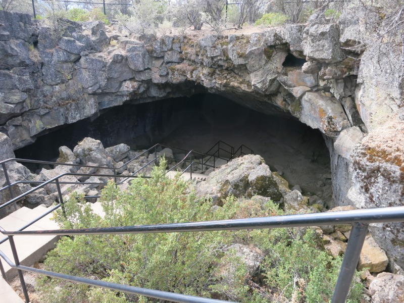
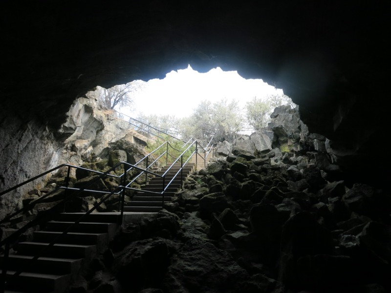
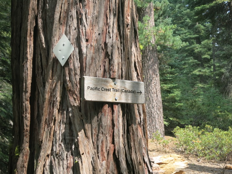
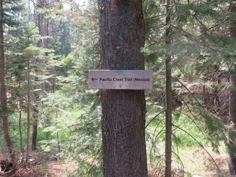
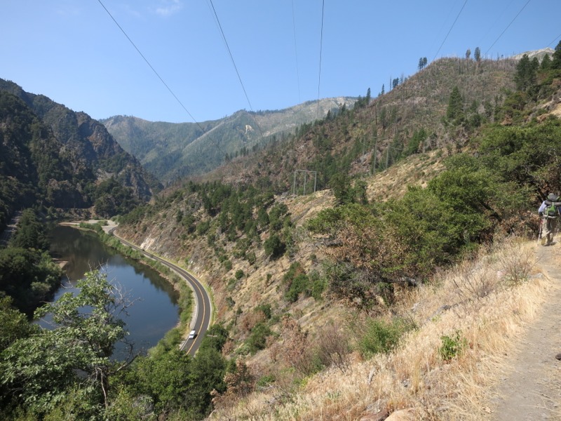
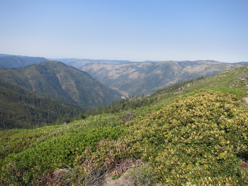
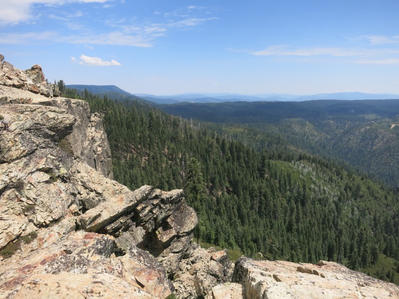
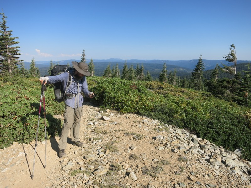
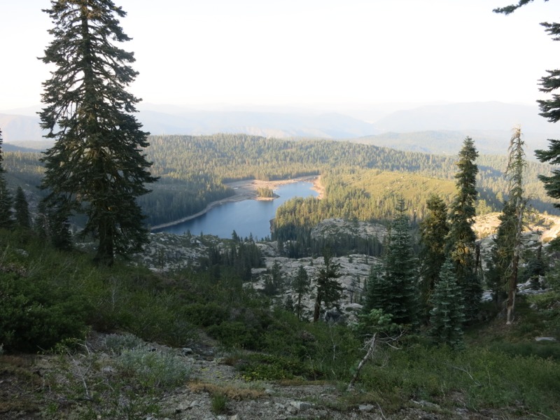
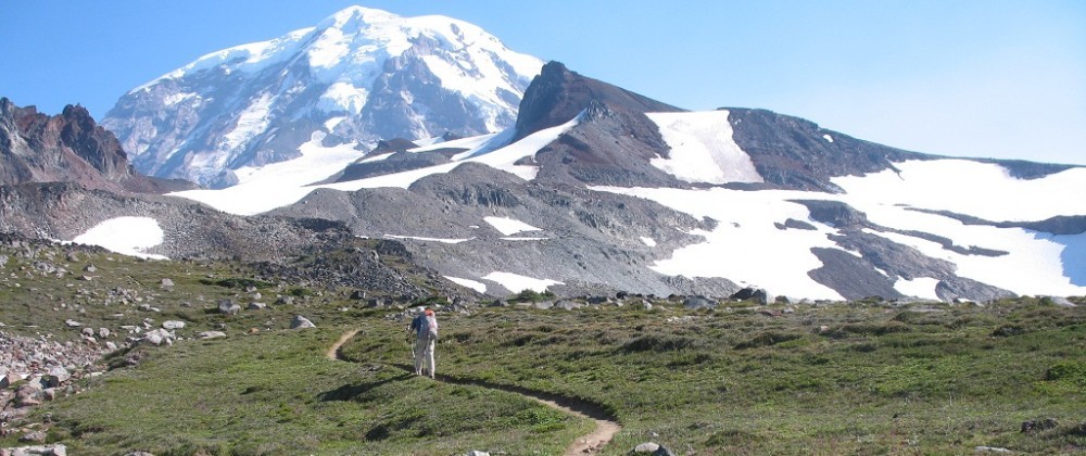
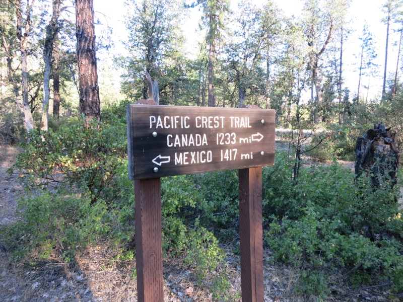
Up and on the trail a little earlier than normal since we were hoping to get off the rim before the day heated up. We didn’t have far to go before we reached a few switchbacks and descended to the land below, which sat on top of a massive lava flow. We hiked through scrub and small trees, sometimes shaded and sometimes not. It was heating up quickly and we were glad to be off the exposed fault. Our switchbacks marked the start of another western swing. We’ll follow the trail west along the top of California until we reach I-5, when we’ll turn north again and make for Oregon.


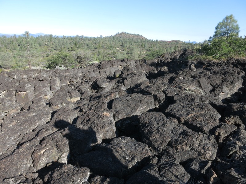
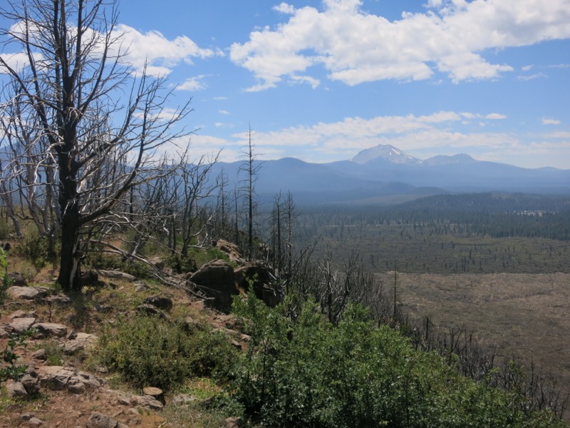
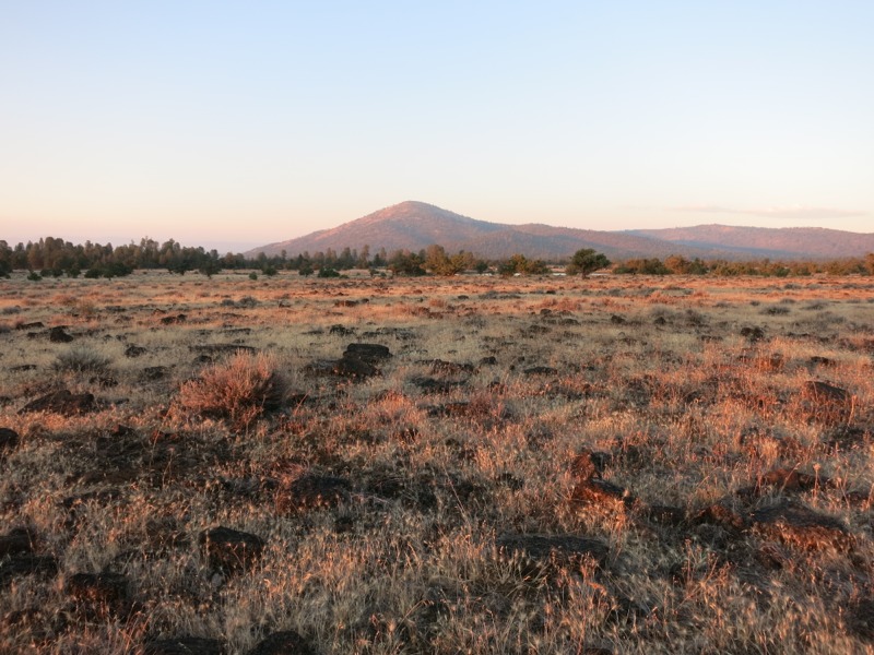
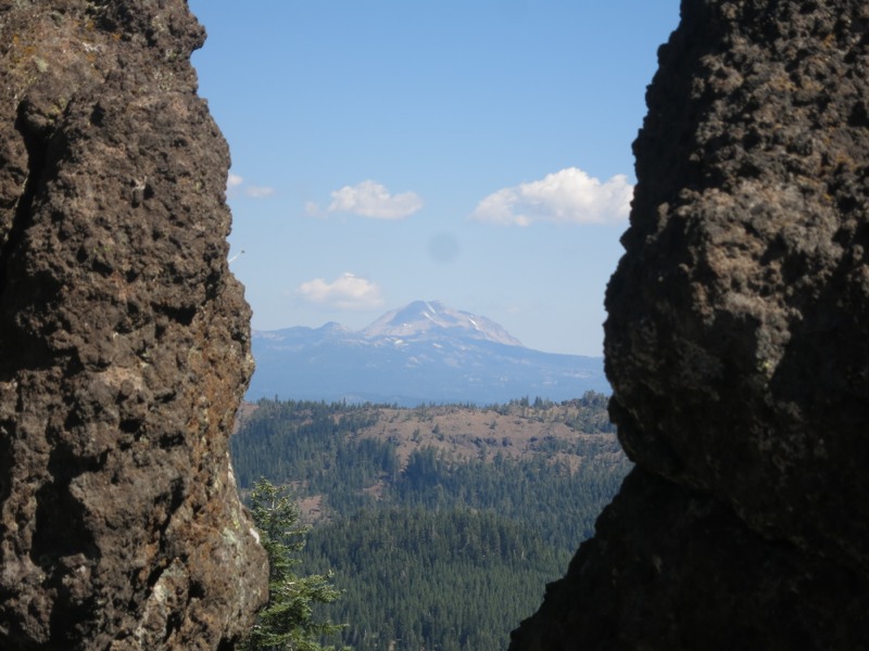
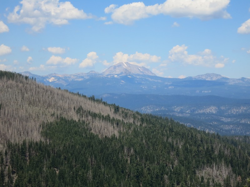
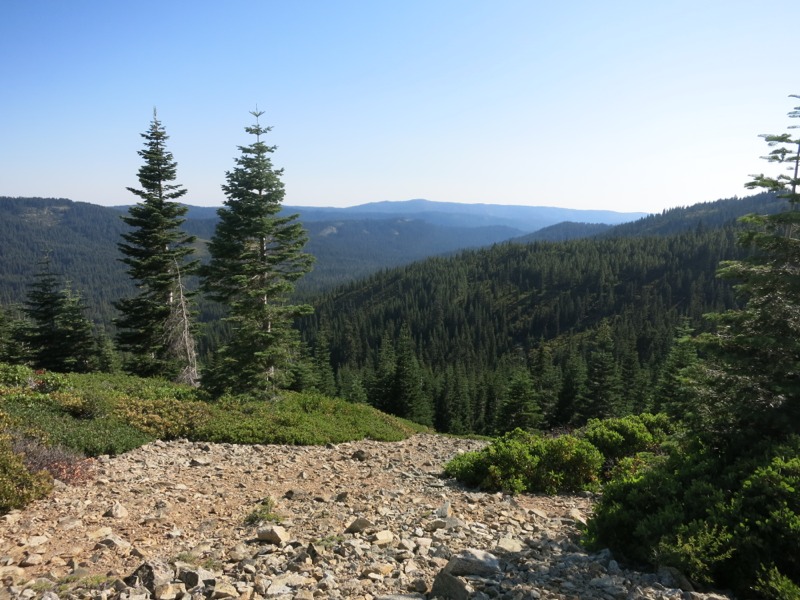
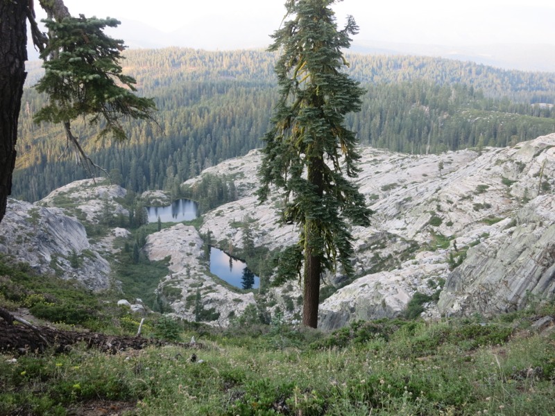
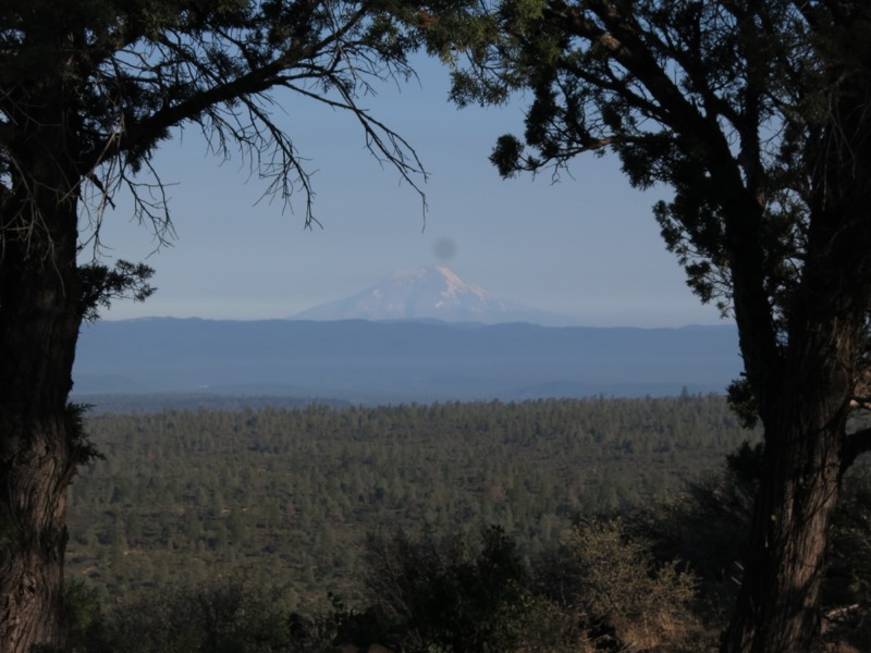
After crossing a forest road we started through a stretch of open grassland. We could finally see Mt. Shasta towering on the horizon. It held much more snow than Lassen, which had only had streaks. The open grassy stretch signaled that we were coming to the end of the lava flow. Although we could still see chunks of porous volcanic rock there was a forest on the near horizon and we hiked towards it as fast as we could go. We were eager to get out of the sun and off the small rough rocks.


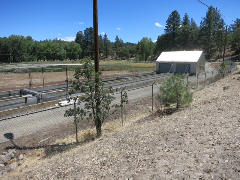
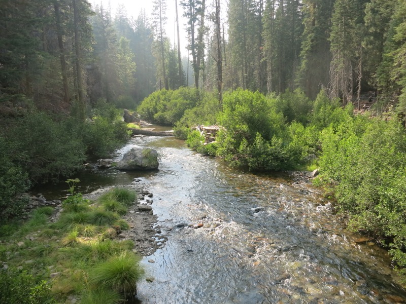
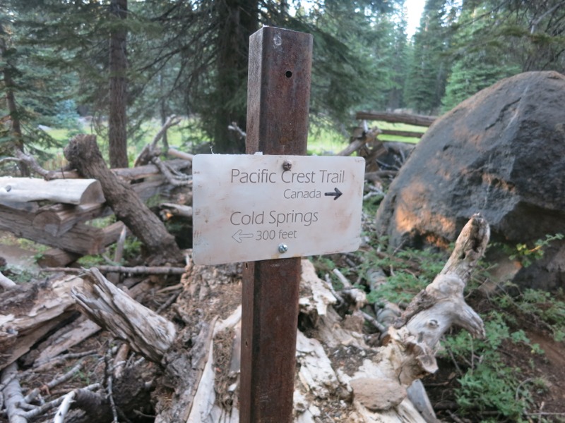
After weaving through the trees for a few miles we came to the Crystal Lake fish hatchery and a creek with our first natural water in 30 miles. We stopped here for lunch even though it was early. Since the next 12 miles to Burney Falls state park are waterless too we decided to eat here rather than carry extra water for cooking. The park would likely have snacks in case we wanted something other than what we had in our bags.


After lunch we hiked past the hatchery and the beautiful lakes in the area. What we could see of the facility looked cool – long concrete troughs of water, just like in the old Disney cartoon with Humphrey the bear. Except I’m pretty sure raising fish is more difficult than the ranger in the cartoon made it look, with his packet of rainbow trout seeds. We eventually left the lakes behind and climbed up a slight ridge, heading west for the state park.


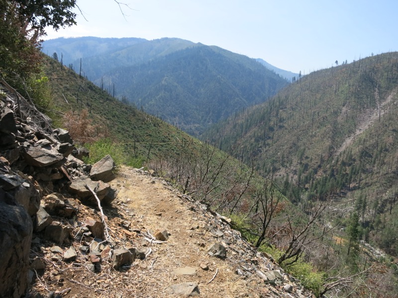
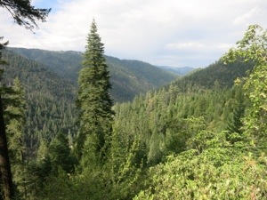
It was very hot – hotter than yesterday, although this was supposed to be the cooler day. We were mostly in the sun with only intermittent shade as we hiked through open forest, crossing forest roads every mile or so. After a few miles we met a southbound thru-hiker and exchanged water information – especially important for him since he was bound for the dry rim. He mentioned that we were about a mile out from a cache, which moved us along a little quicker. If there were chairs there it would make for a nice break spot.

There were chairs, as it turned out – and a cooler full of sodas and ice and tootsie rolls and mini candy bars, and a plastic bin full of ramen and boxes of cracker jacks, and trash barrels, and a big cooler jug full of cold water. It was the best-stocked cache in 1400 miles of hiking and we couldn’t resist taking a long break. A soda full of ice tasted wonderful after the dusty heat we’d been hiking through. While we were there Manchurian hiked in. We’d seen him at lunch for the first time since Chester.

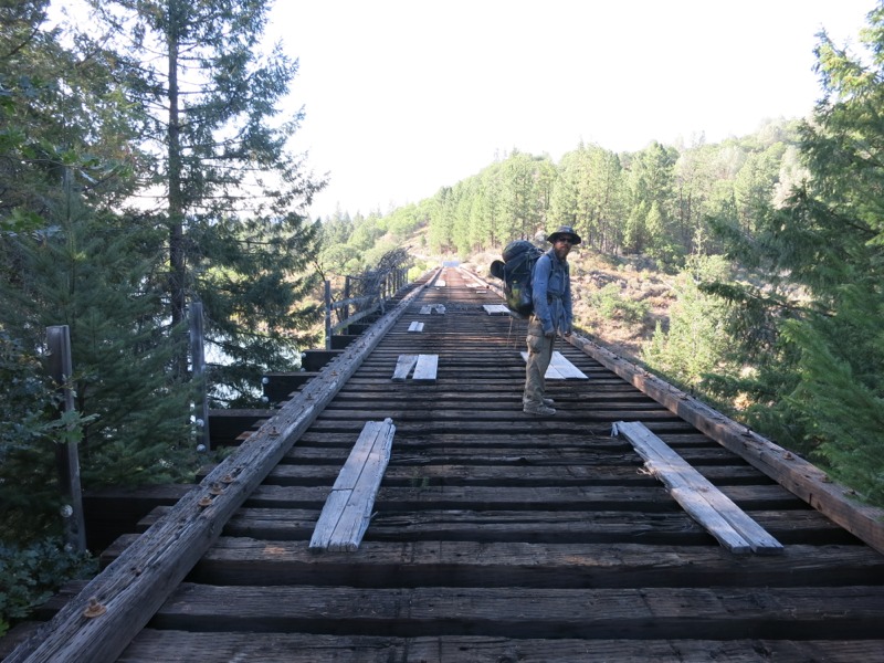
He shared an interesting bit of trivia: the railroad bridge from the movie Stand By Me was located just a mile or so off trail, spanning Lake Briton south of the highway. He was going to get to the railway by way of a jeep road on our maps, then follow it out to the bridge. We thought this sounded like an awesome idea – especially since the line was decommissioned, so we didn’t have to worry about getting run down by a train ourselves. We left about 15 minutes after him and followed his footprints up the trail.

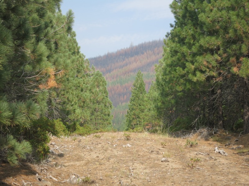
The heat of the afternoon hadn’t passed yet but a breeze helped keep things somewhat comfortable. We hiked through a burn area again and were glad for any moving air at all. We passed road after dirt road before reaching the one we’d picked out on our maps. It led us steeply down towards the long, narrow lake reservoir but was in good enough shape to hike with ease. At the bottom it joined a road of crushed red rock that we had crossed a mile back. This was supposed to be the rail tracks as marked on our maps, but it was obvious that the railroad company had reclaimed the material. Would the bridge still be there or would it be gone too? The suspense was building.


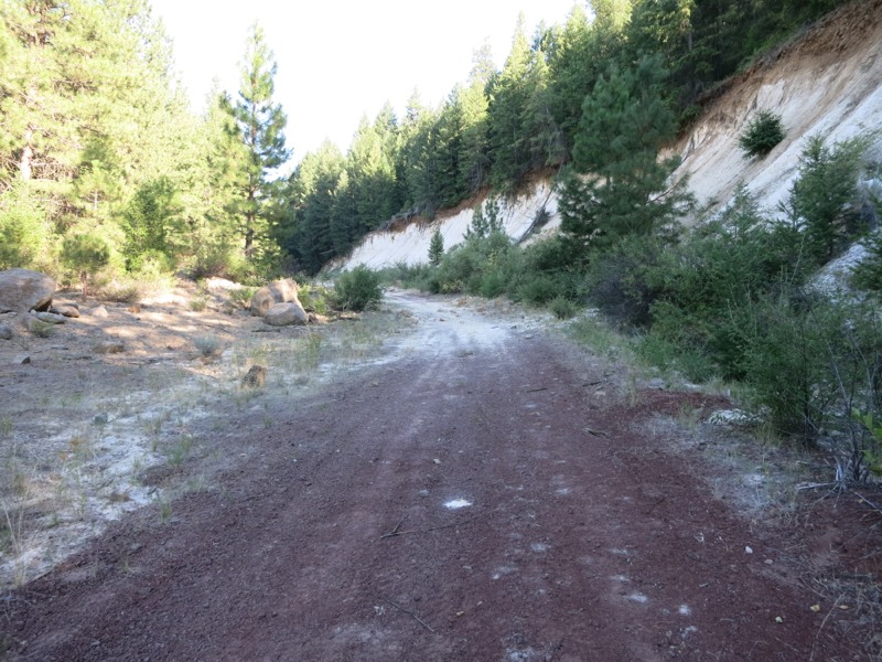
At least we knew we were on the right track, as it were, because we were suddenly following Manchurian’s tracks again. He must have taken the road at the first crossing. We walked up the tread past tall, chalky cliffs that were eroding drifts of loose white dust. Suddenly, instead of being coated with red volcanic dust, our shoes and gaiters were powdered with white. We turned a corner past the second chalk cliff and there it was: an old railroad trestle blocked off with concrete bulkheads and barbed wire. It was easy enough to get around the wire, but there was no way I was going very far from the fence. Being able to see down between the cross-ties gave me vertigo. Keith went out far enough for me to take a picture, then we both went back to the road. Manchurian must have crossed to the other side – a crazy idea given how rotten some of the wood looked.


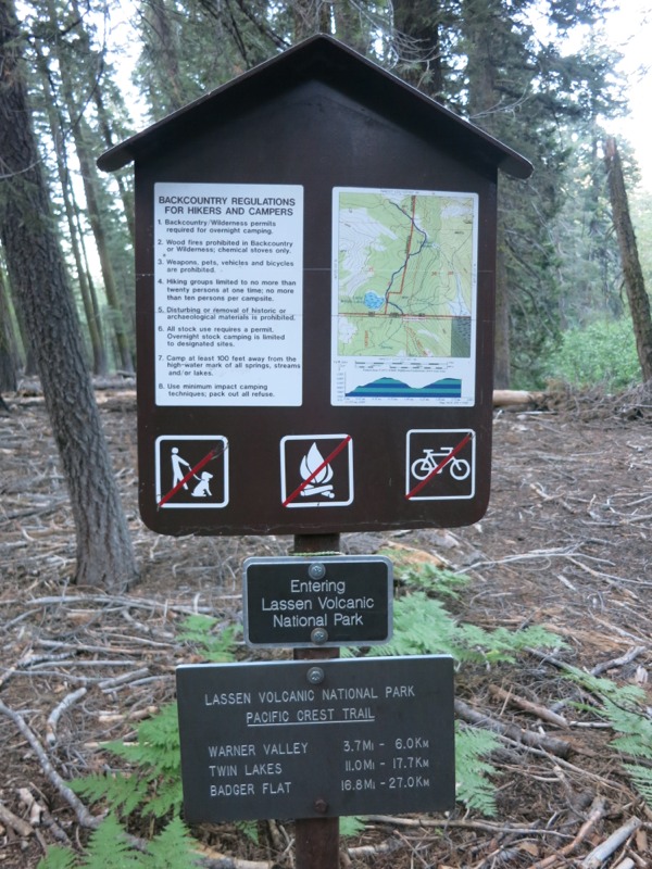
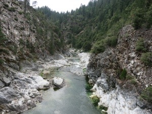
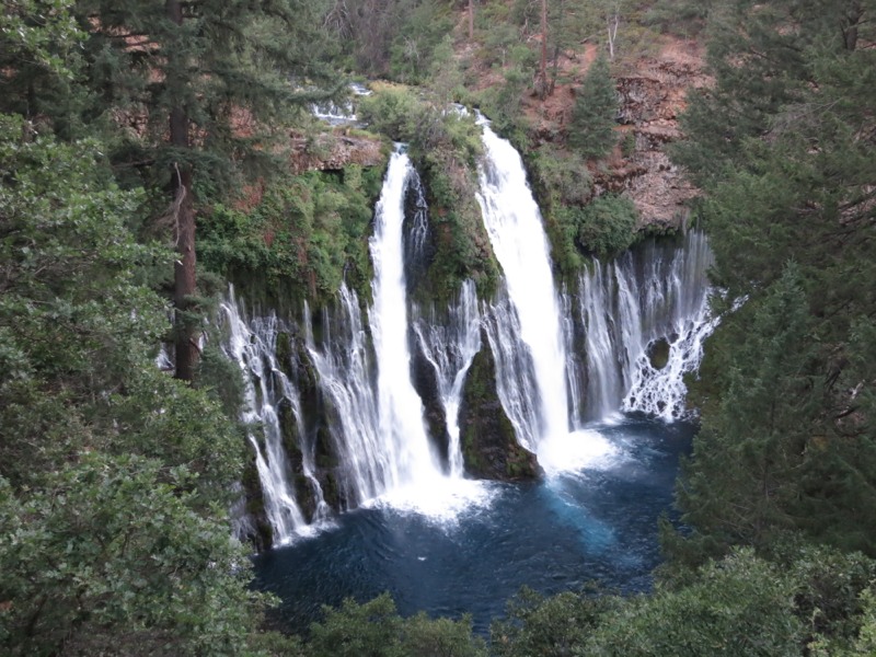
We retraced our steps to the PCT and started towards the park again. We made good time over easy terrain. After entering the park we took an alternate route to the store and water spigots. This took us along a dry creekbed that became the raging Burney Falls in less than a mile, fed by underground springs. It was as if the water appeared from nowhere. The falls itself was amazing too – a few main streams from the creek above, and a hundred little streams coming out of the rock face. It all drained into a deep blue pool. Incredibly picturesque…


After dropping by the store for some ice cream and drinks, we filled up our water bottles and hit the trail to find a campsite. Tomorrow the terrain starts climbing again. We’ve been spoiled for the last few days since it’s been so flat. Each day brings us closer to our next town stop…

– Posted from the PCT

Location:Pct mile 1424

Day 104 – Old Station to Hat Creek Rim – 24 miles


We let ourselves sleep in a little this morning since the post office didn’t open until 8:30 and we had to retrieve our resupply package. We sorted through our new food while we ate breakfast from the little deli in the store of the RV park. We already had a lot on hand from shopping in Chester, so we had to whittle our supply down a bit – neither of us wanted to carry much extra today, when we would be carrying so much water weight.


We set off down the trail to the Subway Cave and the last sure water for nearly 30 miles. The cave was a lava tube with stairs accessing it at either end and it was blissfully cool inside in contrast to the building heat of the day. It was dark, too, especially before our eyes had a chance to adjust. We had brought our headlamps but still had to move slowly over the rough floor. It was completely disorienting. At one spot I thought we had reached the end and turned around, when we were actually moving through the cave to the exit staircase. As we climbed out we could feel the temperature rising. We were loathe to go back out but the longer we waited the worse it would get.


Outside we filled our water bottles and bags. This morning we’d learned good things about a water cache up on the rim, so we took a slight risk by only carrying 3 liters each. It would only get into the mid 80s, which helped. We’d heard that temperatures last week reached into the 100s – which was right around the time that we were roasting in Belden. Even as it was we were sweating freely when we left the spigots at the cave. We hiked through desert scrub and then sparse trees as we approached and climbed the rim. On top was more scrub and fewer trees. This area was burned in a fire a few years ago and was almost completely exposed.


We hiked north, at times right along the rim’s edge, looking down at the highway below. The trail was full of fine gray volcanic dust that puffed up with every step. It was alternately clear and lined with sharp volcanic rocks, so we had to spend a lot of time watching our feet. We were so loaded down with water that a stumble could easily turn into a bad fall. The western horizon was dotted with mountains – Lassen to the south, Sugarloaf directly to our left, and a few smaller peaks to the north. We were supposed to be able to see Shasta from here but the haze from distant fires prevented us from catching a glimpse.


We swung east to skirt the deep canyon Lost Creek cut into the rim. We could hear water but there was no way to get down to it. After what seemed like miles we rounded a corner and headed northwest to return to the rim north of the intrusion. Soon after we stopped in a rare patch of shade to rest, drink, and snack. Our strategy was to break the rim walk into sections. Now we had three miles to go to the relay station (the site of a fire tower before the area burned), then another three to the cache, then as many as we could do before dark.


The relay station marked the end of our very slight elevation gain. The next few miles to the cache was a similarly slight downhill but rocky in parts and we had to move slowly over the rough patches. It didn’t slow us down too badly and we reached the cache in good time. We refilled our supply for tonight and tomorrow morning, then relaxed in the provided chairs and had another snack.


After leaving the cache we seemed to cross into cow country. Cow prints and cow pies were everywhere. At one point we passed the first surface water we’d seen all day – an incredibly mucky wallow. I pity the backpacker so low on water that he has to consider drinking that sludge. Apparently someone else pitied him too, because he or she had left a few jugs of clean well water on the other side of the trail.


The trail had wandered away from the rim when we entered the pasture area but now it headed back. We passed a stretch that looked like a quail superhighway – their tracks were everywhere in the fine dust. Animals use the trail as a walkway too, like the bears we saw yesterday. It was starting to get rockier as we headed towards a stretch of lava flow, and we kept our eyes peeled for a clear, flat campsite – hard to do with the gorgeous sunset framing the western skyline. Just as t was beginning to be tough to see we found the perfect spot. We’re camped 20 feet from the rim’s edge with crickets singing all around us. One advantage of the dry terrain is that we can probably get away with cowboy camping tonight for the first time in a few weeks. Tomorrow we only have 10 miles to hike until water…

– Posted from the PCT

Location:Pct mile 1402

Day 103 – Lassen ridge to Old Station – 26 miles


Today was a day full of firsts! The first such first happened when I stepped out to conduct some morning business. I had picked my spot and just started to dig a business hole when a bee landed on my knee and stung me. This was the first bee sting I’ve ever received and it had the intended effect – I bolted back to the tent, worried that she would follow with all her buddies, but apparently fleeing the scene was enough to pacify them. I’m still not sure if I came too close to a hive or what. The upshot is that I know I’m not allergic to bee stings! It stung for a few hours but didn’t swell up. All in all, I’d take a bee sting over another red ant stinging me in the armpit like at the Andersons’.


After that slight delay, we got on with our morning – packing up and hiking the short distance to Drakesbad Ranch for breakfast. Along the way we took a little time to see Boiling Springs Lake, another nearly on-trail volcanic oddity. We could smell the lake for a half mile before we reached it – a sulfurous reek, like a thousand eggs boiling all at once. The lake was surrounded by red sand and was a cloudy blue-green with clusters of foam floating on its surface. If it was boiling like its name suggested we couldn’t tell, but the south side was throwing off a lot of steam. Trusting that a well-worn path of footprints wouldn’t dump us through a thin crust of earth into a boiling pool, we followed them out to a slight rise and found ourselves staring down into a boiling mudpot. After a while we decided not to push our luck before breakfast and walked back along the warm sand to continue on. Having these volcanic features so close to the trail is a huge treat! Being able to see them up close has been an incredible experience.


Breakfast was wonderful and filling. The bees thought so too, attracted by our omelettes, and I was a little gunshy after this morning. We fended them off long enough to eat and then set off to fill up our water bottles at the pool house. Drakesbad has a hot spring-fed pool – one of the big attractions here, I’d imagine. We each took more water than normal since our afternoon would be very dry and we’d be hiking through a burn. As we were packing away our water we chatted with a couple of guys who were hiking south to Belden. Better down that stretch than up it, as we hiked it.


The second “first” happened about a mile up the trail from Drakesbad. We were climbing a ridge and as we popped up over the edge we locked eyes with a bear standing about 40 feet down the trail. We stopped where we were and all stared at each other, and then we saw a cub behind her as it stood up for a better look at us. It was amazing to finally see a bear up close after so long. Her coat was a rich golden brown and long and shaggy. She wasn’t agitated – no chuffing or stomping or any of that – and we all just sat and watched each other for a bit. Finally I suggested that she shoo, and she turned around and headed off the trail to our right. Her cub followed after one last long look at us. When they were well off the path into the scrub and tearing up some rotting logs, we passed them – talking at her the entire time so she knew where we were.


The rest of the day couldn’t quite rival this excitement. Instead we settled into one of the longest, flattest sections we’ve had so far as we wound between peaks through burned out forest. Thankfully it was relatively cool and the skies were hazy, keeping the sun from beating down too strongly. Eventually we passed out of Lassen National Park and started down the Hat Creek canyon. The creek provided the first water in about ten miles – good practice for tomorrow, when we’ll tackle the shadeless Hat Creek Rim and a 30-mile waterless stretch.


With the flat ground we made excellent time to Old Station, our next resupply point. This is home to the Hat Creek RV park (everything seems to be Hat Creek around here), the store and deli of which were still open when we arrived. AND it was taco Tuesday. We got cold drinks and hot showers, then retired back to the PCT to set up camp and enjoy our dinner. Tomorrow we’ll be there when the post office opens so we can claim our package and start the rim before it gets too hot. That’s the plan, anyway…


– Posted from the PCT

Location:Pct mile 1378

Day 102 – Chester to Lassen ridge – 17 miles


We slept in this morning, making for a wonderful and uninterrupted 11 hours of sleep – the most we’ve had in a very long time. We really needed it. After packing up and checking out we went over to a diner in a gas station for lunch. Despite the dubious location, the online reviews steered us right and our sandwiches and fries were delicious. After one more milkshake from the Pine Shack Frosty we got in touch with a local trail angel and secured a ride back to the trail. This was great because we had been expecting a very difficult hitch from town. Piper’s Mom is another one of those kind people who host hikers and haul them around like she did for us. Her daughter hiked the trail a few years ago and wrote a book about it. They are both regular posters on the PCT-L mailing list and it was wonderful to meet Meredith in person.


A cool breeze was blowing as we started north again and we were glad that yesterday – much hotter than today – had been our day off. We hiked through dense forest and open, manzanita-filled meadows. Narrow dirt forest roads criss-crossed our path. It’s strange to think that we didn’t cross any in the Sierra, then a few near Tahoe, and now (in logging country) we never seem to be very far from one.


We came to a ridge that looked out west over a sea of pines towards Lassen, which slouched low on the horizon. Our view was obscured by a heavy haze. We hoped it was due to the weather and not a nearby fire. Eventually we reached the north fork of the Feather River, the same river that ran past Belden. It was much smaller now but still had a respectable enough flow to earn a wooden bridge. While taking a break on the other side, we watched a quail and her chicks make their way over the deadfall and through the tall grasses along the riverbank. Later, while passing a meadow, we startled two large birds that looked like turkeys but sounded more like honking swans.


Near the end of the day we crossed into Lassen National Park, our 4th of the 7 national parks we’ll hit on this trip. Lassen is volcanic and this has already shown itself in the red, porous rocks and very fine dust we’ve been encountering the last few days. It was also evident in the highlight of today’s hike – a short side trip to the Terminal Geyser. A quarter mile down a spur trail, we rounded a corner and came out of the forest to see clouds of steam billowing out of a small canyon. The air was filled with rotten egg sulfur stink.


As we got closer we could see pools of boiling water, but we still couldn’t tell exactly where the steam was pouring out of the ground – there was too much of it. With all the warning signs and blinding, stinky smoke we were reluctant to get too close. The entire thing roared like a jet engine. A small creek trickling out and down the hill was cloudy and lined with orange mineral deposits. It wasn’t too hot to touch, but it would have been too hot to bathe in. Neither of us had ever seen a geyser before and it was incredible to be able to get right up close.


After this short but amazing side trip we set off for another mile or so of hiking to get some uphill out of the way for tomorrow. We’ll be getting breakfast at the Drakesbad Ranch tomorrow and wanted to get within a mile or two for a short hike in. We are camped on the edge of a forested ridge, overlooking another sea of trees and the distant ridges to our north. We can see Lassen if we crane our necks to the left. Soon it will be in our rearview mirrors and we’ll be watching Shasta get bigger and bigger.


– Posted from the PCT

Location:Pct mile 1352

Day 101 – Chester


Up early this morning and out of camp in a half hour, since we didn’t take the time to eat breakfast. We were hoping for a quick hitch and the chance to eat in town. Sunday morning is apparently a tough time to hitch, though, and we waited for about an hour while cars whizzed past us. The wait was eased by the wonderful trail magic provided at the crossing by a local trail angel. A cold soda really hit the spot and helped to stave off the morning “blahs” from not eating.

Our luck changed for the better when a CHP officer pulled up in his SUV. We though we were going to get a talking to for trying to hitch, but he just wanted to offer us a ride into town. Just like they teach us in elementary school, police officers are just sometimes there to help! It was a little intimidating riding in the back seat behind his giant rifle, and when we got to town Keith had to open my door for me, but we were very grateful for the ride. We were happy to find that he had a pretty good opinion of PCT hikers – it’s always nice to hear that we’re seen as a respectful and low-key crowd, because not everyone feels that way.

After an incredible breakfast we went over to the hotel. Since it was so early our room wasn’t ready yet but the manager gave us a place to put our bags. We headed next door to the grocery store to resupply for the two days to Old Station. After that was laundry and checking in with home. By this point our room was ready and we got to the best part of a day off ( latter eating, of course) – showers and relaxing in front of the TV. We were both so tired that we couldn’t keep our eyes open very late and we turned in even earlier than we usually do on the trail.

– Posted from the PCT

Location:Pct mile 1335

Day 100 – Halfway done! – 25 miles


Halfway done, distance-wise! It better take us fewer than 100 days to do the second half or we’ll be hiking in an awful lot of snow.


We brought celebratory “halfway” sodas alllllll the way up from Belden, but some rude people drank them last night. I guess the 5 beers already soaking in the cold spring weren’t enough for them. Now I know how vegetarians feel when the meat-eaters take all the veggie dishes at a buffet. This is why we like to be on our own, away from other people. So, we had no bubbly of any sort to celebrate with when we reached the midway marker but even that couldn’t dampen our spirits too much.


The marker claims 1325 miles each to Mexico and Canada, but because of changes to the trail this is inaccurate. The marker itself is nearly at mile 1327 and the actual trail midpoint is around 1330. Neither point stopped us from celebrating. It feels strange to be half done – like it’s taken us forever to get here, but we can’t believe we’re already here. It’s frightening to think that we only have half the trail left before we have to return to the real world with all its stresses and crowds. How am I ever going to go back to driving a car – steering tons of metal at 60 mph around a bunch of other hunks of metal?


The first few steps in our journey feel like they happened last year. I’m amazed at all we got done before we left, especially in the last week: a blur of last-minute dehydrating, weighing, and packing of meals and snacks; packing up our belongings so our house sitters could move in; and a hundred minor things you need to do before skipping town for 6 months.


Our first few weeks on the trail feel like they happened much longer than 3 months ago, but I can still remember our campsite for every single night of the trip. Part of this is because of lack of input – I have fewer things to keep track of so it’s easier to remember the details. But when they’re laid out next to each other in a sequence it’s easy to see that we just haven’t been out here that long in “real world” terms. Even fairly recent events, like arriving in Tahoe two weeks ago, seem like they happened much further back than thy actually did. When you’ve got nothing to do but hike and think all day, time slows down.

Not necessarily in a bad way. We’ve gotten good at zoning out, in a way – just letting our thoughts drift as our eyes scan the trail in front of us and feed the information to our bodies. We hike without really thinking about it, like reading a string of words and visualizing the concept it represents. Our bodies are used to the motions and the pull of the packs now, the subtle shift they cause in center of gravity. This all makes it easy for our minds to just drift, taking in the sights, sounds, and smells around us. We’re beginning to think more and more about what it will mean for us to be done and going back to reality. How long will it take for this trip to feel like just a wonderful dream?

We’re camped about a mile from the highway to make for a short trip into Chester tomorrow. It’ll be another long layover instead of a full day off but if we get in early enough it should give us enough time to rest up.

– Posted from the PCT

Location:Pct mile 1334

Day 99 – Belden to Cold Spring – 18 miles


It was so hot last night that it was hard to get to sleep. We were grateful to be sleeping in a real bed, though. We woke up to an actual rooster crowing and caught an early ride back to the trailhead. From there we walked back to the restaurant at the resort to get a hearty breakfast. The food was really well-cooked and the portions were huge, so we had some leftovers to carry with us for lunch. As we got ready to leave it was already getting hot and we soaked ourselves with water in preparation for the climb ahead of us.


For every big downhill there’s usually a big uphill as you climb out of the canyon you dropped into. Belden was no exception and we faced almost 5000 feet of gain over 14 miles. It would be a test of our endurance. We started out in partial shade but were still sweating in the building heat of the day. We climbed parallel to the highway for a few miles before turning north and heading up the Chips Creek canyon. We hiked through a gauntlet of poison oak lining both sides of the trail. Before long our meager shade vanished completely as we entered the scorched area from the Chips burn last summer, caused by a hiker’s improperly put-out fire.


This section would have been much tougher if not for the creeks and springs that crossed the trail every mile or so. We were able to stop almost whenever we needed and cool down with wet bandannas. We took our time and drank so much water that we had to stop and filter more. With this relaxed pace we reached the end of the burn still feeling strong. How much easier would Southern California have been if we’d had ice-cold water available every few miles?


This brought us out of Plumas and into Lassen National Forests. We kept climbing, pushing through undergrowth that was blocking the trail. Chips Creek continued to rush through the canyon below us, a constant back note to our huffing and puffing. Finally we crossed it twice in quick succession and stopped for lunch at the second crossing. Leftover breakfast potatoes and the remainder of an enormous piece of ham (originally as big as my face) hit the spot in a very satisfying way. The wasps thought so too, and as soon as the food appeared we had visitors checking us out. Defending our food didn’t make for a very relaxing lunch but it did make us move faster than we would have otherwise.


After eating it was back to the climb for another few miles. A little more hiking brought us out of the trees and into a meadow, then over soft dirt trail to the open top of the ridge at last. Here we met Busted, a hiker new to us, and we chatted as we cruised the last 5 mostly-downhill miles to Cold Springs and the end of our day. When we arrived we found the place crowded – everyone from the Braaten’s the previous night was there along with Fireball, a hiker we’d been leapfrogging ever since we left Sierra City. We had no trouble finding a spot off on our own and mostly out of earshot. The spring water was cold as promised and was piped into a metal trough, making it easy to fill our water bottles. The air was finally cooling off and we looked forward to a comfortable night.


Tomorrow we will reach the halfway point of the trail after over three months of hiking. It feels strange to think about – long overdue and too soon at the same time. We’ve been out here working hard every day but it still feels kind of sudden. It makes me think back to the very beginning, when 100 miles seemed impossibly long and we counted off every tiny fraction of distance as we passed the milestones – one tenth, one fifth, a quarter. Some hikers are starting to get homesick. We think about home and family a lot and are looking forward to seeing everyone, but I’m happy to find that we’re in no hurry whatsoever to finish and go back earlier than we have to. It’ll all be there when we get back and we’ll be back soon enough, with this incredible 6 months in the past.

– Posted from the PCT

Location:Pct mile 1309

Day 98 – Clear Creek Spring to Belden – 13 miles


The first part of our hike this morning took us through the forest and to the bald ridge tops outside the town of Belden. We caught our first glimpse of Mt. Lassen in a few days – it’s not a very tall peak and previously it seemed that there were always trees or other ridges in the way. It disappeared quickly as we started our decent into Belden – a long 5000 foot drop over innumerable switchbacks. We had to be on the lookout for poison oak, as we will for much of the rest of California.


The descent was easy but a bit monotonous. Gnats liked to swarm around our faces but luckily they didn’t seem to bite. Near the bottom we passed a trail crew on their way up. We made sure to thank them for their efforts! At the bottom we hiked right into the Belden Town Resort, apparently the site of weekly raves that we’ve heard a lot about. Our guidebook describes this place as creepy, but I didn’t really get that vibe. Eclectic, maybe, but not creepy.


We were planning to stay with the Braatens, local trail angels that lived just up the highway. They came to pick us up since they hate to have hikers walk the narrow, dangerous road. They have an entire mini-unit for the hikers to use including two bedrooms, a bathroom and kitchen. It was very hot in the river valley and our cool showers felt wonderful after the last few sweaty days. Afterwards we walked up to the little country store/RV park nearby to do our laundry, buy snacks and get milkshakes. It was a nice, relaxing afternoon. Towards evening a few other hikers arrived and we chatted with them for a while before turning in. We’ll head out tomorrow morning for Chester two days away, but we were very grateful for our mini-day off.


– Posted from the PCT

Location:Pct mile 1278

Day 97 – ridge camp to Clear Creek Spring – 22 miles


Sometime very early this morning we woke up to sprinkles. We hopped out of the net tent to put the rain tarp over everything and cinched it down. The rain stopped a few minutes later and the moon came out…but we’ll take that over having to pack up wet gear. It took a long time to get back to sleep.


The next morning we started right off with the rest of the long climb. Mile after mile, winding around the ridges, we worked our way up. It was hot already and we were sweating freely. I had a goatee of droplets running off my chin. After a few miles we arrived at a little trickle of a spring, where we wiped ourselves off in preparation for adding a new layer of salt during the rest of the climb.


Finally we reached the exposed ridge that marked the end of the steepest part. From there we meandered up and down, stopping for a break and a snack in a patch of shade. Some rock ledges gave us a semi-panoramic view of the surrounding terrain – rolling ridges as far as the eye could see, carpeted in lush coniferous forest. We headed north, thinking about cold drinks and burger lunches. We passed a sign from some local trail angels inviting hikers to their cabin – a very tempting prospect, but we had a goal in mind already.


After 5 miles of easy terrain we reached the road leading to Bucks Lake and the resorts there. It was a long, hot walk but there was very little traffic on the road so we didn’t have to worry too much about walking on the sometimes-narrow shoulder. As we turned a corner on the last leg, a man stopped in his car and told us to come up to the campground and share his site if we happened to stay the night here. We knew we would be tempted when we were full of food in the heat of the afternoon, but the town of Belden is reachable by lunch tomorrow if we put in a few more miles.


Soon after that we reached the store and picked up some cold drinks to have on the way to the resort another mile up the road. The woman at the counter guessed (somehow) that we were hiking the PCT and this got the attention of a family who had dropped by to pick up some snacks. They were impressed to hear that we had come all the way from Mexico. After a little more chatting, they offered us a ride to the restaurant – which we gratefully accepted! Fred and Erin and their girls were camping at one of the nearby campgrounds. We jumped in the back of their truck and were there before we knew it, sitting on the patio under a big shady umbrella and looking out over the lake as we sipped our sodas. It was absolute heaven after all the sweating we’d done over the past few days.


They had lunch at the table next to us and when we finished we discovered that they had picked up our tab for us – how generous is that, to pay for a couple of stinky hikers’ lunches! More than that, they offered us a spot down at their campsite with the promise of “tons of food.” A hiker’s worst dilemma – food or town (and the promise of showers and laundry)? In the end, with Belden so close, we had to decline but we were extremely close to ditching the rest of the day in favor of more calories and conversation. Then came the icing on the cake – they offered us a ride back to the trail, saving us a few more miles of scorching road walk on full bellies. Guys, if you’re reading this, I hope you know that you made our day absolutely wonderful! It was awesome to meet you all and thank you again for all your generosity!


At the Bucks Lake trailhead we reluctantly said our goodbyes and started up the hill, because of course it started with a climb. It was nothing compared to this morning but soon the inevitable sweat-drenching began all the same. We stopped at a creek a mile up to filter some water, then continued on our way. As the grade eased we found ourselves in a meadow filled with scarlet paintbrush. Hummingbirds were zooming around everywhere, fighting over patches of flowers and scolding and chasing each other. It took us a while on this hike to stop being startled by the sound of them flying nearby because they sound like the world’s biggest, ugliest bug. They’ve been around consistently since Southern California and through the Sierra.


We sweated up the ridge to the summit of Mount Pleasant. To our east were Silver and Gold Lakes, down off the cliff nestled into a sheet of granite. They were beautiful but looked much lower than normal with wide patches of dry lakebed showing. After crossing a few more minor ridges in the forest we passed Clear Creek Springs, our water source for the night, and an occupied stretch of flat ground. We went one more ridge over and found a flat spot down off the trail to spend the night. Tomorrow we have 11 miles to hike to Belden. It’s mostly downhill – we’ll lose nearly 4500 feet as we switchback down into the canyon for the north fork of the Feather River. Our reward for getting past all the poison oak will be showers, clean laundry, and milkshakes up at the store. We can’t wait to wash off all the sweat from the last four days.

– Posted from the PCT

Location:Pct mile 1278

Day 96 – Whiskey Spring to ridge camp – 24 miles

We were awakened by some early morning visitors today – deer crashing around near our tent before the sun came up. When we shined our lights on them they just stood there and looked at us dumbly. Maybe they couldn’t tell what was going on with the net tent, but it took some scolding to get them to leave so we could go back to sleep.

Other than that it was a pretty uneventful morning. Our tent was in the shade but we could still feel the heat and humidity as we packed up. We started out on a slight climb through open forest and hilltop meadow, then spent the rest of the morning on gentle hills in the woods. We crossed a lot of roads – a few real ones, even, with pavement and lines and everything. There’s logging activity in this area and we saw a few trucks loaded with timber. On one lookout I think we caught our first glimpse of Mt. Lassen, still a few days away.
20130807-160203.jpg

We stopped at a creek for lunch, hoping that it would still be running since it was a steep hike down. It was and the icy water helped revive us. After lunch we started a long, switchback-filled descent down to a fork of the Feather River. We’d been looking forward to this all day – there was supposed to be great spots for swimming down in the canyon. As we dropped down, avoiding the poison oak, the skies clouded over and a breeze came up. By the time we reached the steel arch bridge high over the river, it had cooled off significantly and looked as though it might rain.

We dropped our packs at a well-used campsite and walked out to the river, where we sat and soaked for a little while. It felt great to clean the dirt and sweat off our legs and faces. The water was warm enough to swim in, but neither of us wanted to take the time since we had a long climb out of the canyon waiting for us. Instead we just sat and watched the dipper birds hopping around on the rocks next to the churning water. They stuck their heads into the bubbling pools to look for bugs and other tidbits. This river will definitely go on our list of places to revisit someday when hiking isn’t our main goal.
20130807-160133.jpg

After our relaxing soak, we began the climb out of the canyon – the flip side of the long downhill into it. It was steep but we made surprisingly good time. This is the payoff for spending weeks above 8000 feet. When we drop down to 3000 feet the air is so much richer that we were barely breathing hard. We certainly were sweating, though. The nice breeze that had cooled us off at the river was gone and it was incredibly muggy. We had three water sources coming up. We planned to get water at the third before hiking up another mile or so to a spot on the map that looked like it might be flat enough to camp on. This was a bit of a gamble since there was no campsite marked on our map. It if wasn’t suitable we’d probably have to push on another few miles until we reached the top of the climb.

We passed the first two water sources in quick succession and crossed our fingers that the third (a small creek) was still flowing. It was, with great force, and we stood in front of its cascade and caught the cold damp air rolling off it. It was like having our own air conditioning. We loaded up with water, carefully crossed the mossy, slippery rocks, and hiked on. By now it was starting to get dark and we were anxious to find out if our gamble would pay off. We trudged up and up and rounded a corner, and there it was – a flat campsite big enough for three tents, complete with a fire ring. This was better than we had dared to hope for. The bugs started in on us right away so we got the tent up in record time and dived in. Tomorrow we face the last 5 miles of this steep climb, but we’ll reach a restaurant by lunch and be able to get some real food. The day after that we should reach the town of Belden for another short break. We’ve been making great time on this section so far.

– Posted from the PCT

Location:Pct mile 1256