Day 29 – Little Jimmy camp to Sulfur Spring camp – 20 miles


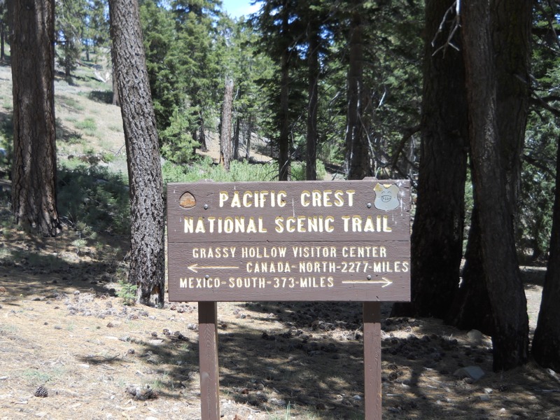
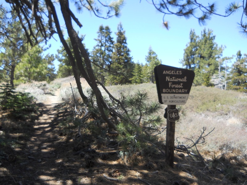
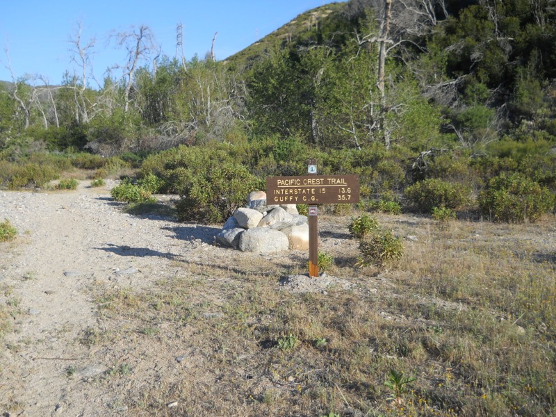
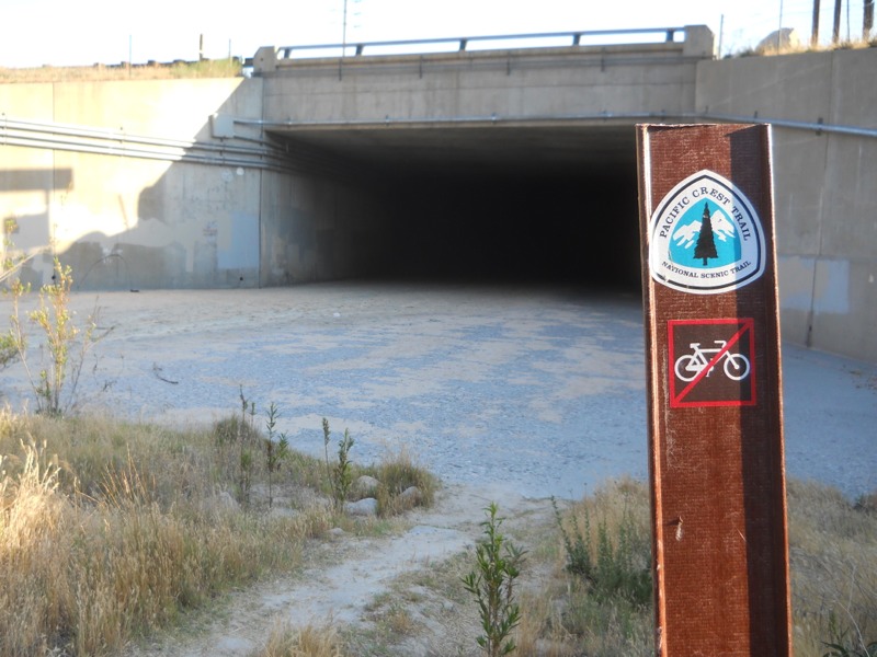
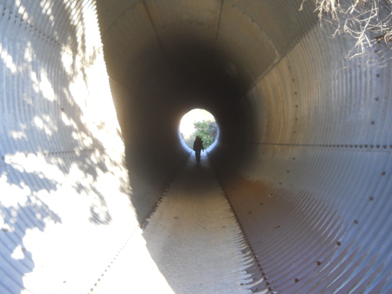
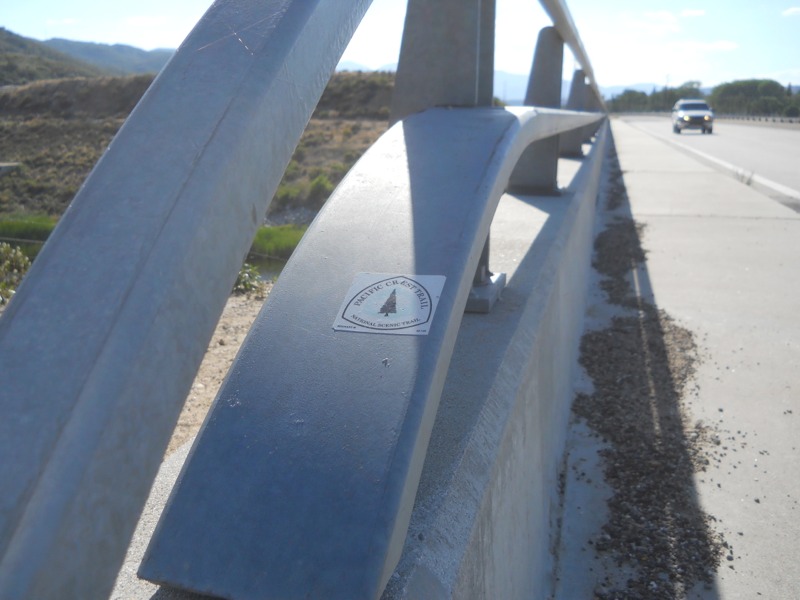
We started off a chilly morning by heading down to our third crossing of Hwy 2. This began the official endangered species detour, which runs over 20 miles on rough trail to bypass 4 closed miles of the PCT. This wasn’t too appealing, so we decided to take the old detour – continuing on the trail to the closed section, then road walking around it and an additional short stretch to where the trail met the highway.


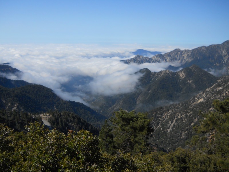
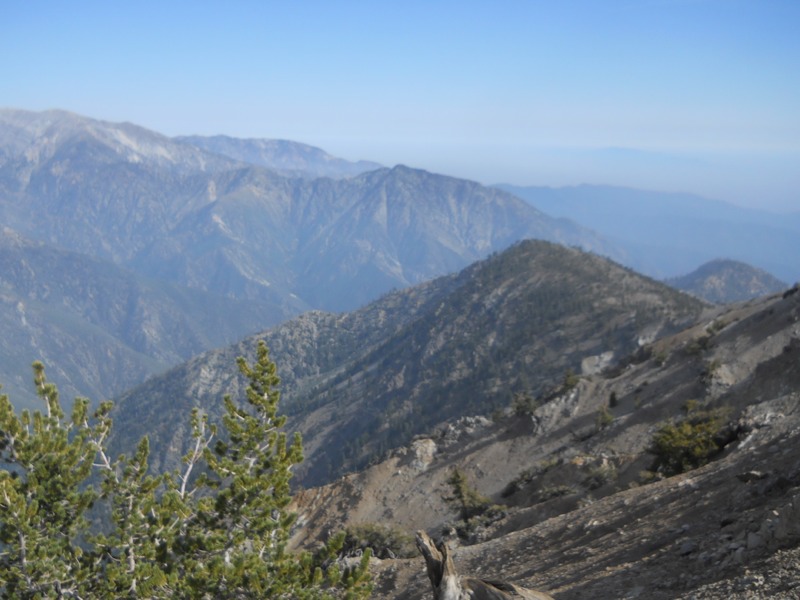
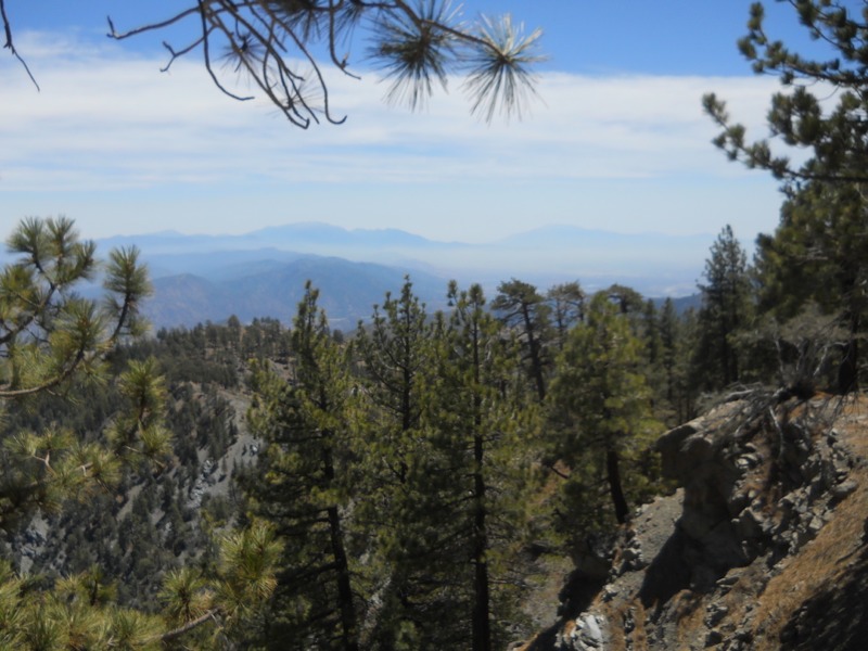
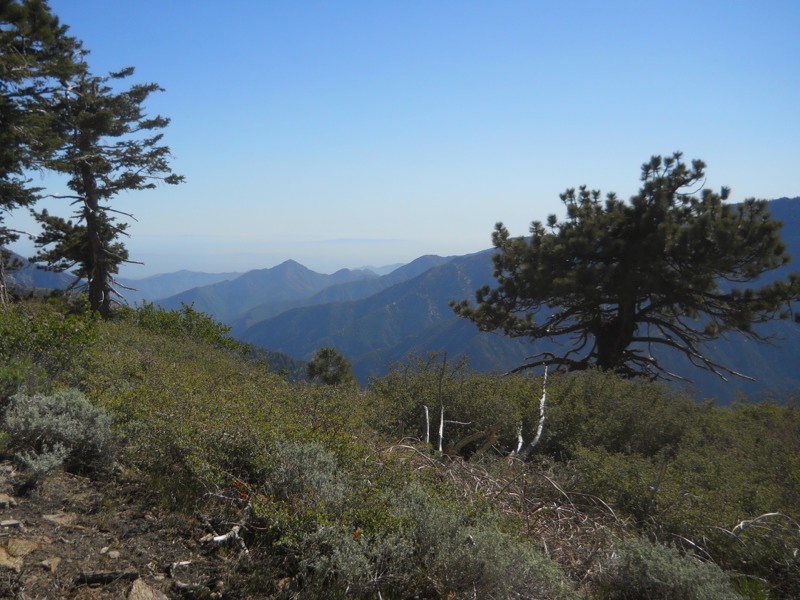
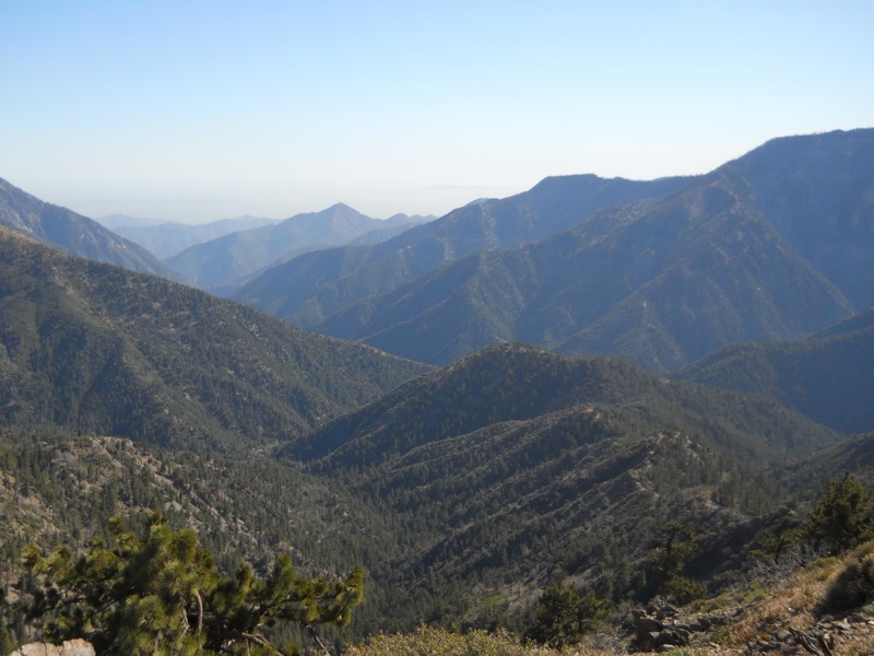
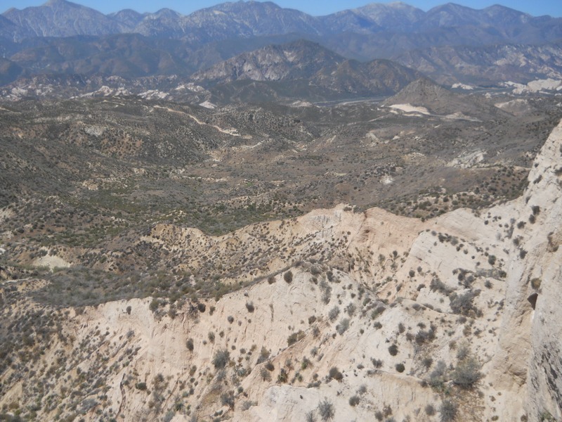
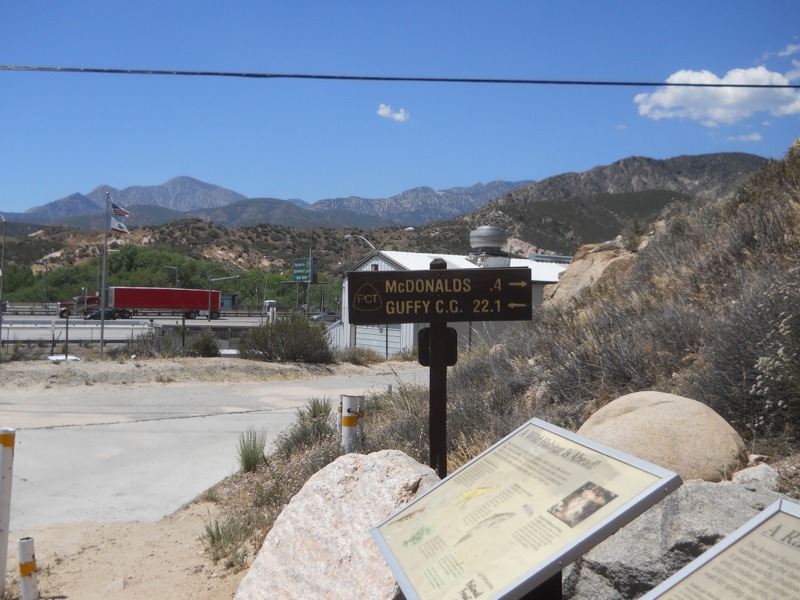
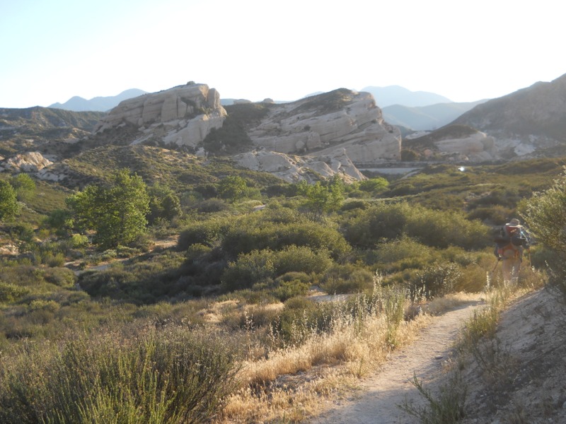
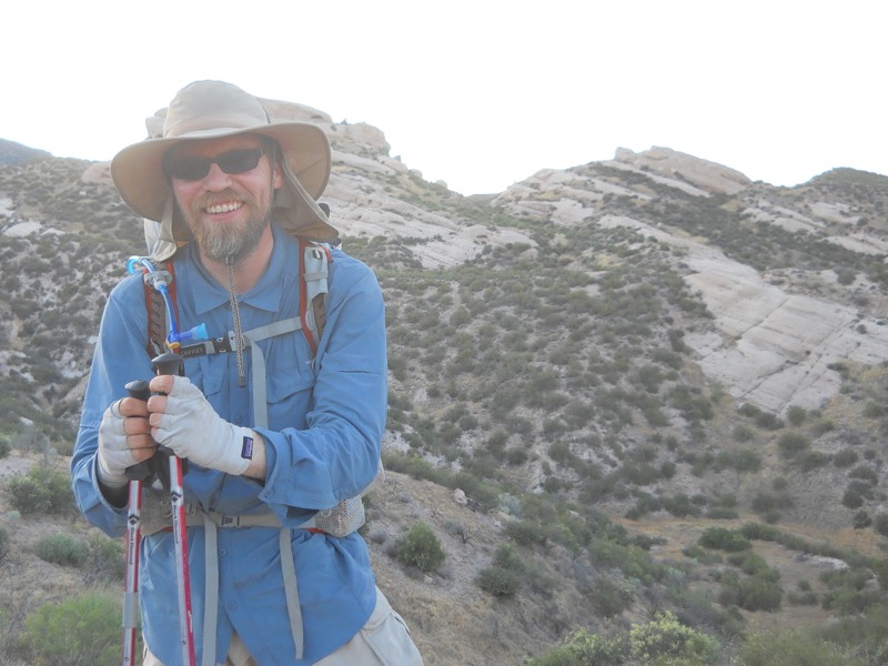
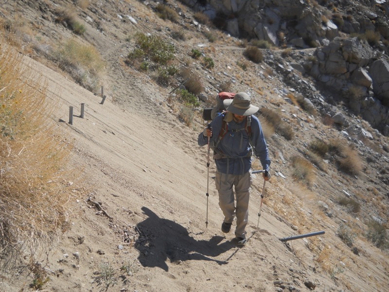
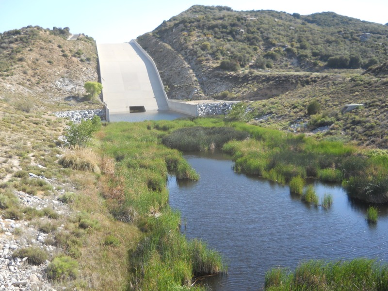
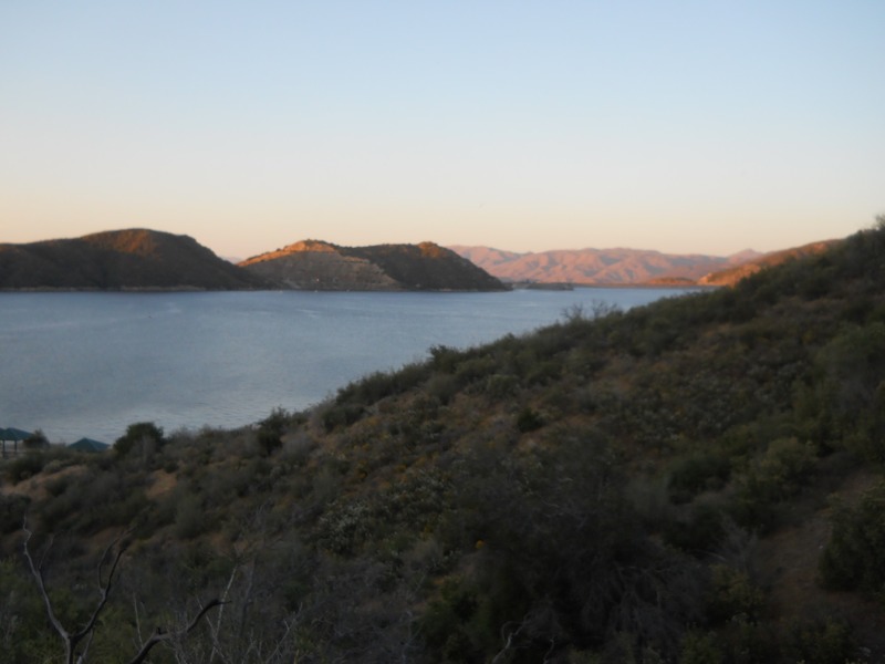
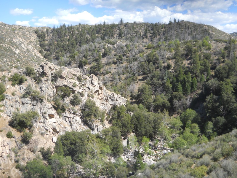
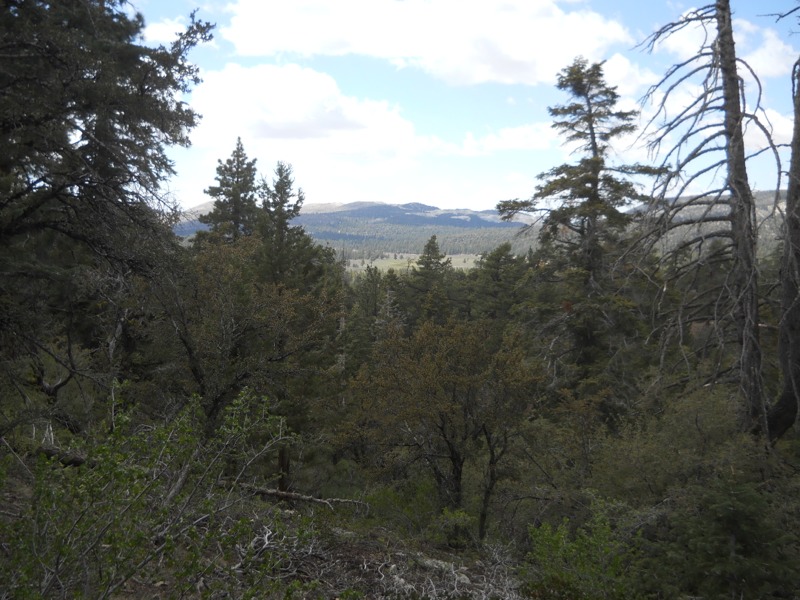
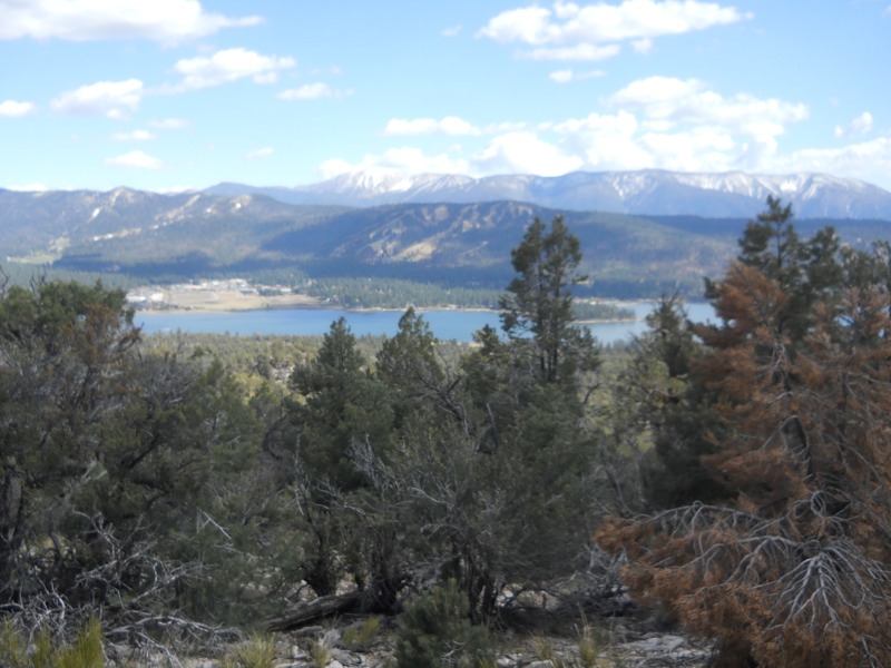
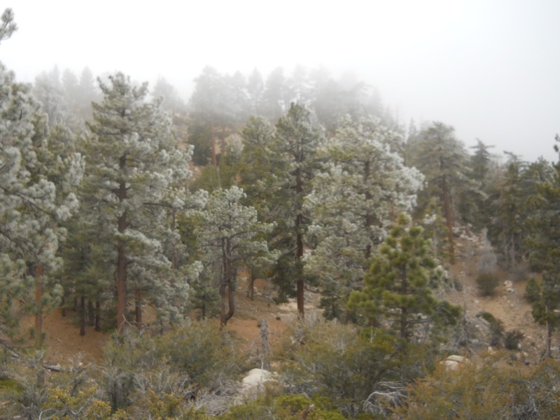
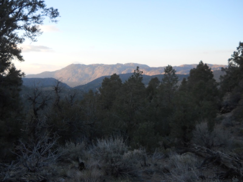
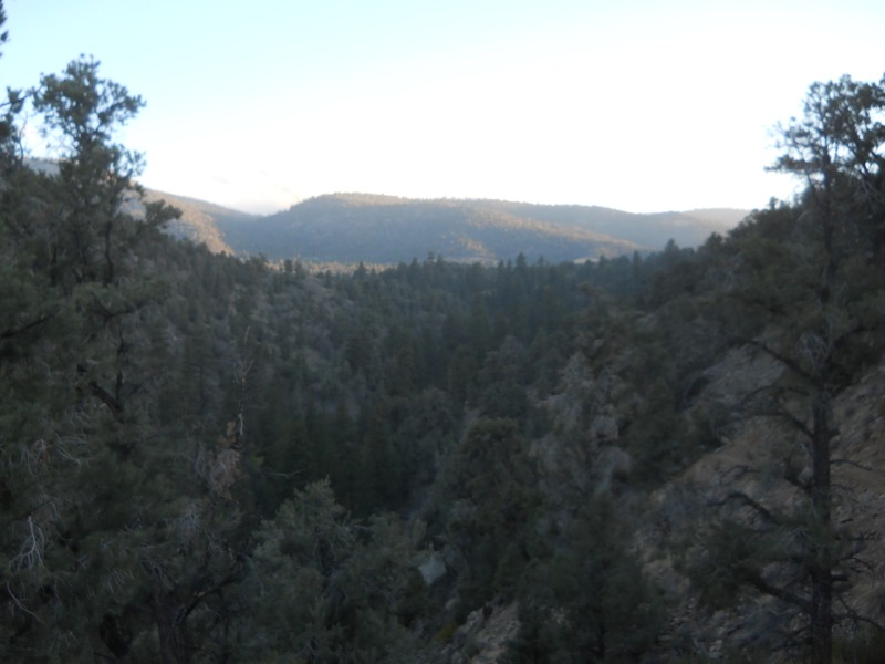
We set off from Islip Saddle and climbed up, and up, and up to a ridge. Our efforts were rewarded with great views. Lower-lying clouds had moved in overnight and the mountains rose out of them like islands. All too soon, we were headed down again to another crossing of the highway, and then back up and back down. Finally we reached Eagle’s Roost picnic area and the start of our road walk.


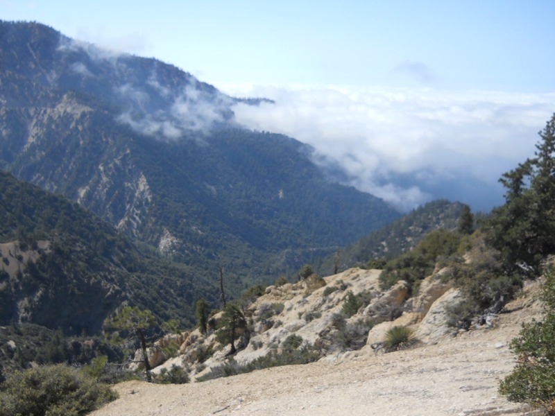
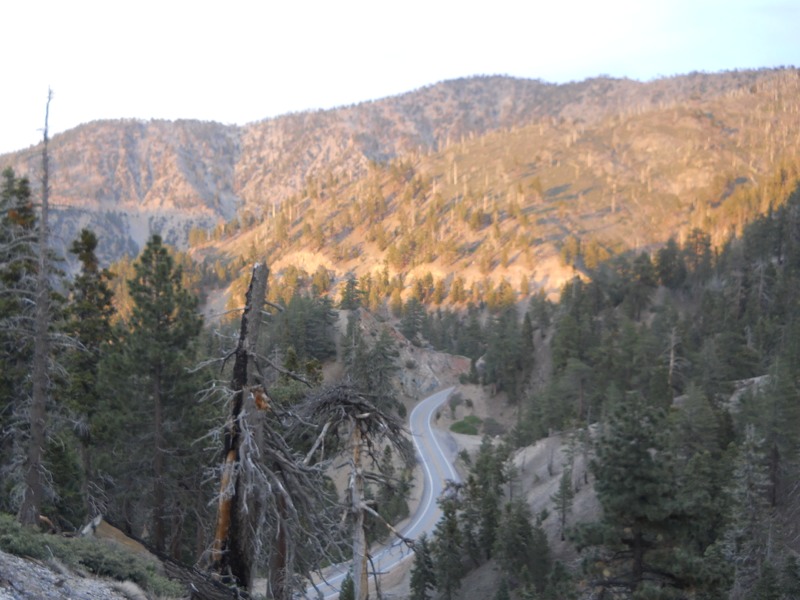
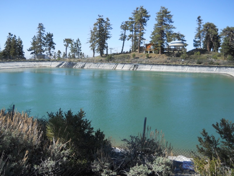
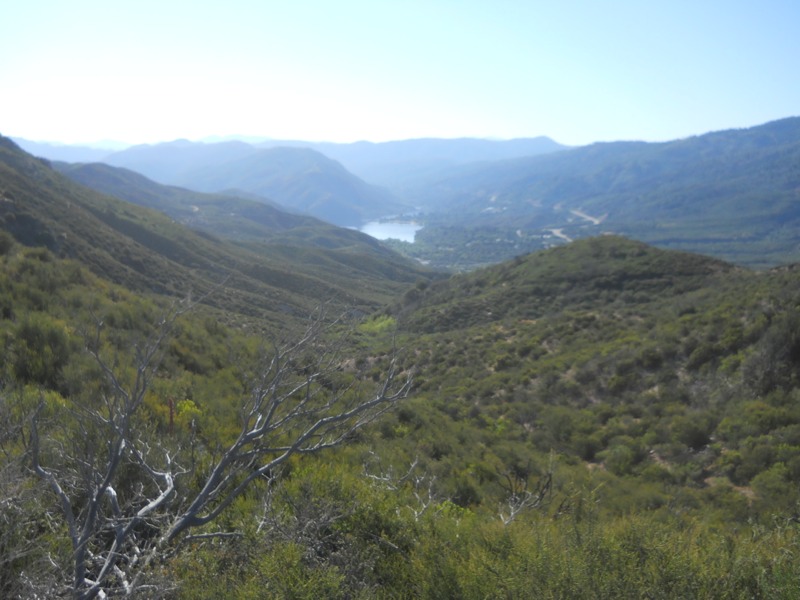
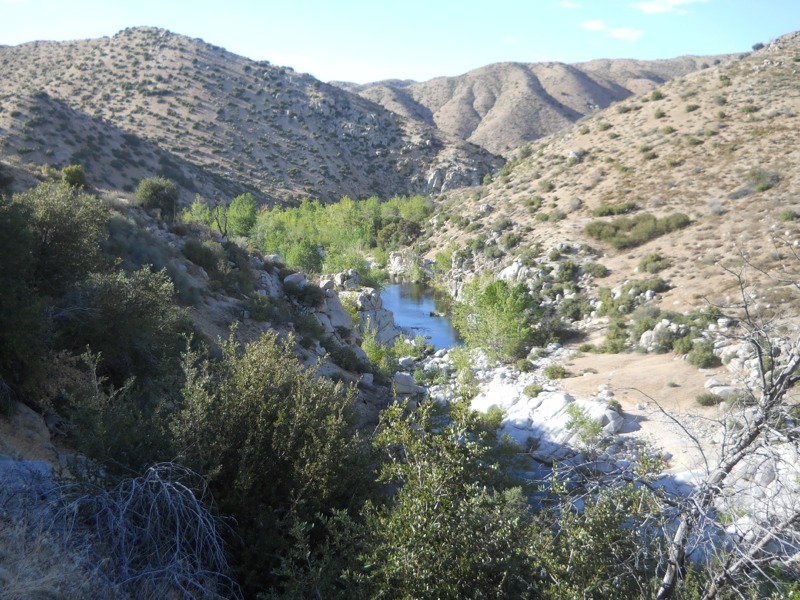
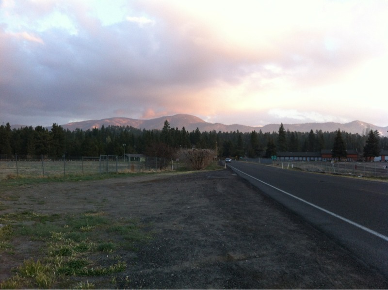
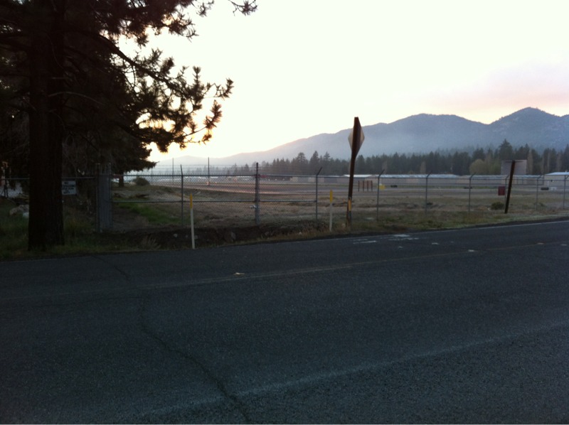
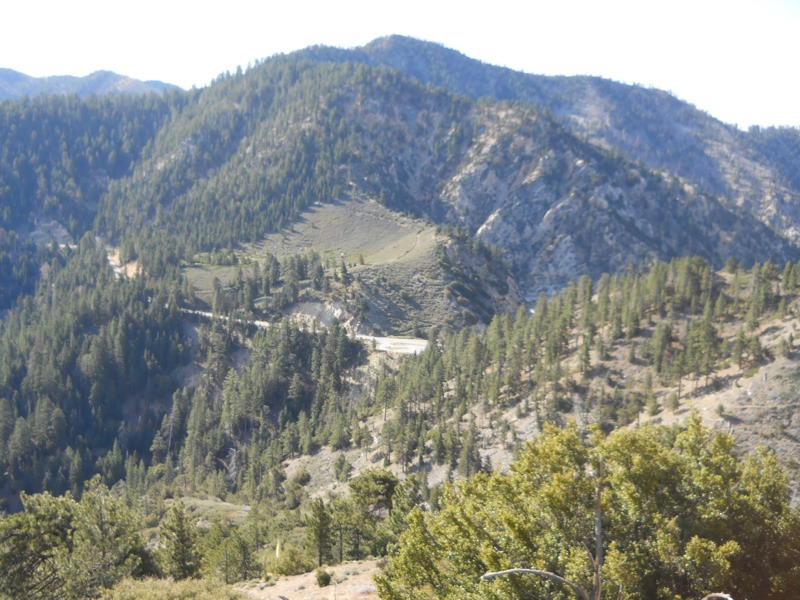
For being on a winding highway with narrow shoulders, the walk was surprisingly uneventful. There was very little traffic and we could hear it coming from a long way off. Cars were moving pretty slowly to get around the curves. As we walked the clouds drifted in with foggy fingers, just enough to feel eerie as we passed a few closed and rundown ski areas. Sooner than we expected, we reached the Buckhorn campground and our next water.


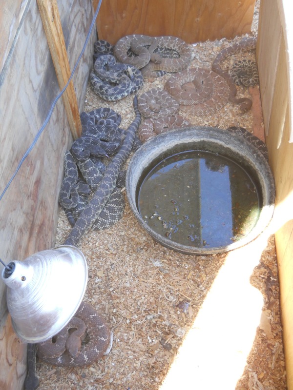
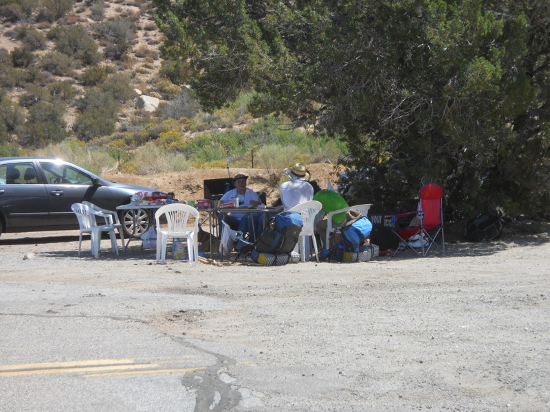
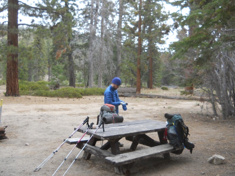
This campground was much more populated than the small forest camps we’ve been passing lately. Even on a Monday there were lots of people out. We got rid of some garbage and did some laundry, then headed back out. On the way back to the entrance a small dog came running out of a campsite behind us (off leash, of course) and bit me twice on the backs of my legs. Thankfully the fact that I was wearing pants helped to deflect it a little and they didn’t break the skin too badly. I would have some nice bruises later on though. The owner was apologetic but the damage was done. I was so furious that I wouldn’t even speak to her, afraid of what I might say or do, and we got out of there as fast as we could. At least it had been me and not one of the small children camping further up the loop. This isn’t the first issue we’ve had with off-leashed dogs while backpacking. What kind of idiot brings a dog that aggressive out in public and “forgets” to leash it? If only there had been a ranger nearby.


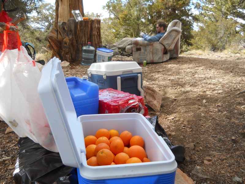
After that unpleasantness, we had a few more miles on the road before rejoining the trail. It wound down away from the highway for a mile or so before reaching Camp Glenwood, a Boy Scout camp. We joined Matt, Jamie, Rabbit, Lightning Rod and a few others here and had lunch. Everyone was feeling a sort of general malaise and debating whether to stay for the night. We knew we had to get a few more in, so we set off eventually.


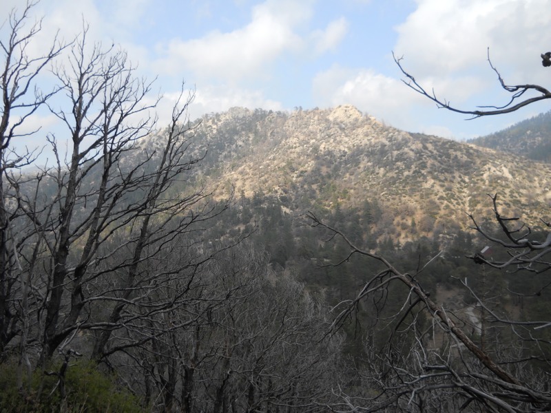
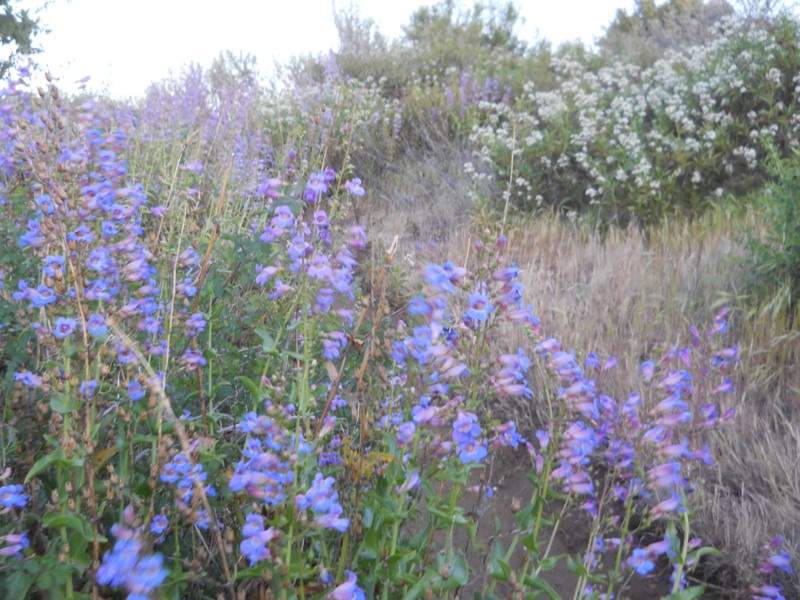
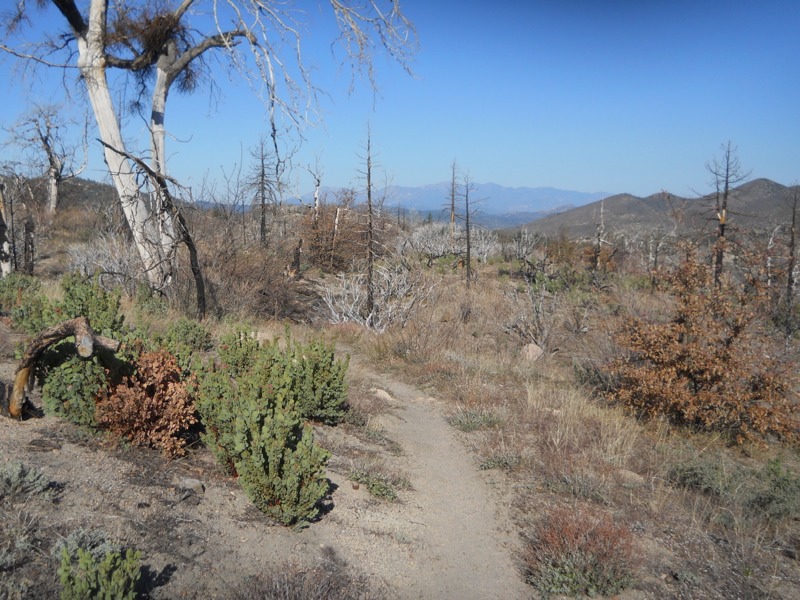
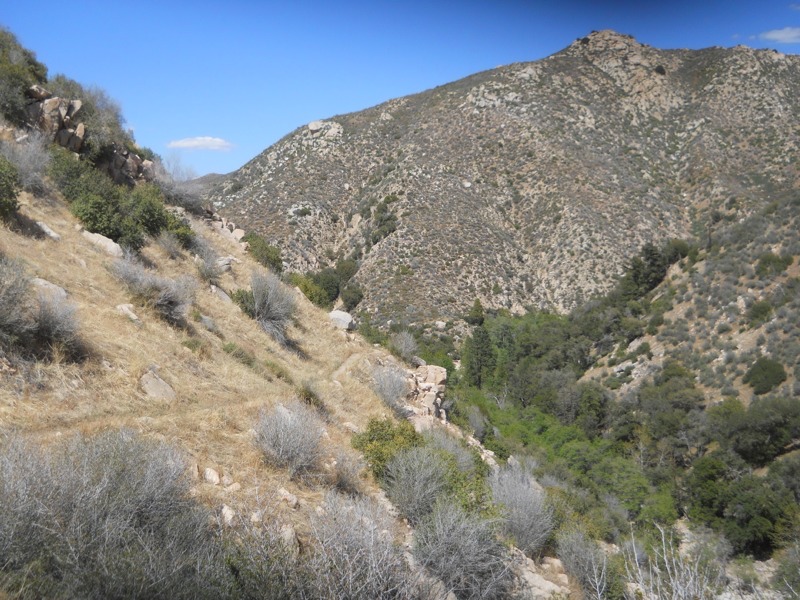
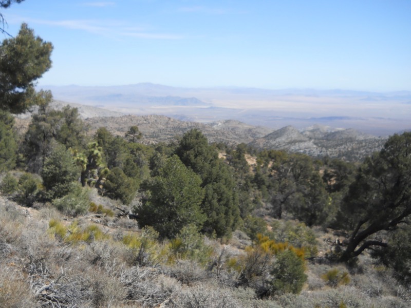
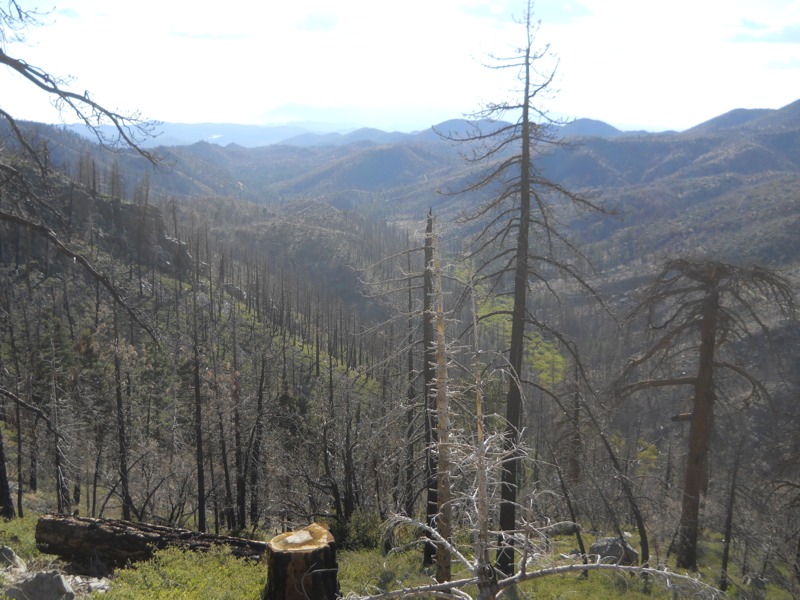
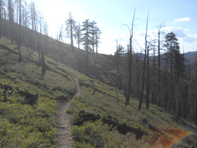
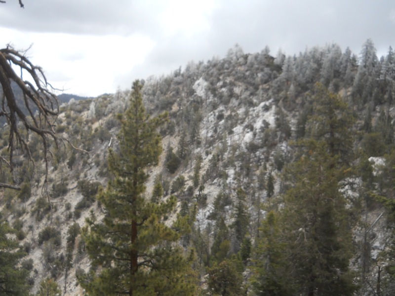
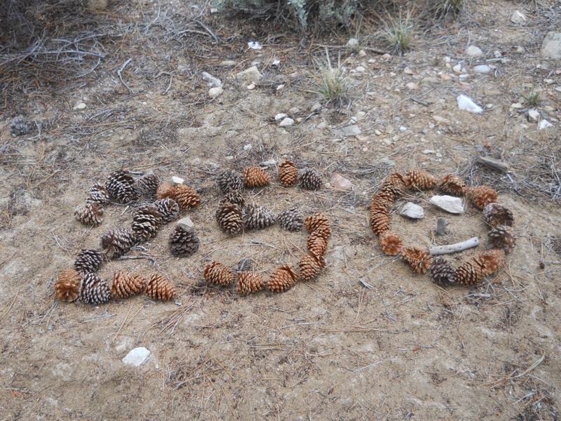
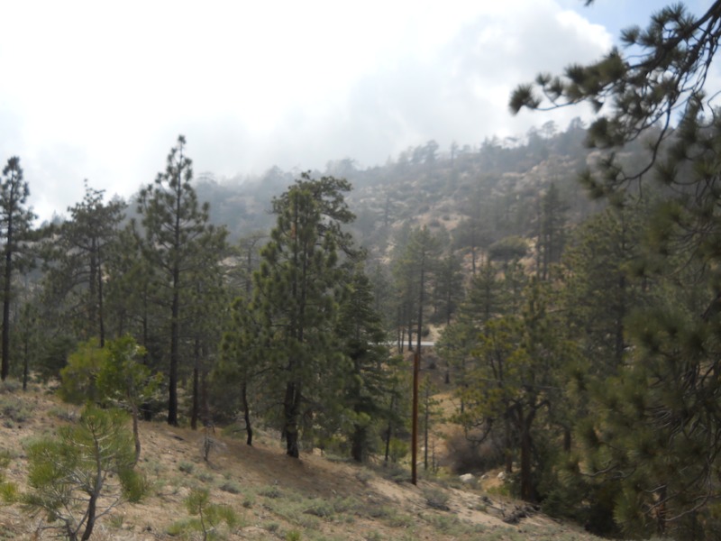
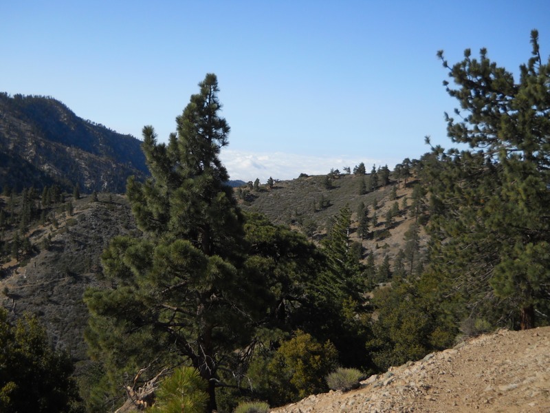
The fact that it was easy trail made it less difficult to leave. We followed old jeep roads off and on, and the sections that were actual trail were pretty flat. As we hiked we entered the Station Fire burn site and the trees around us became blackened and leafless. Poodle dog bush made a reappearance. It was easy to maneuver around now but we have a stretch coming up that will be more challenging. A few miles out from camp we came across a fruit cache and took a few pieces for breakfast. Always a nice surprise! During the last mile into camp we started seeing more desert plants again, a reminder that the next few days will be hot and water-constrained again. At least it’s still cool now – as we ate dinner at camp (at a picnic table!) it was still cold enough for us to shiver. Looks like it will be another cold morning.

– Posted from the PCT

Location:Pct mile 407

Day 28 – Hwy 2 to Little Jimmy camp – 15 miles


Leaving town is always tough, and today was no exception. There seemed to be a million little things left to do and we’re never inclined to get up at the crack of dawn when we’re sleeping inside. Nonetheless, we got going eventually and headed up the road towards the trailhead with our thumbs out. We hadn’t been walking for more than a few minutes when someone saw us, pulled a u-turn, and offered us a ride. Heather was just finishing her volunteer shift at the school and decided to help us out with a lift. She told us that the people in town love to see us start showing up in the spring. All of the towns we’ve visited so far are very hiker-friendly, but Wrightwood seemed especially so.


Up at the trailhead we bumped into Mr. Green, the Minnesotan we last saw outside of Idyllwild. He was heading into town and tried to get us to stay an extra day. It was really tempting to talk MN restaurants with him (he tends bar at Rudolph’s in Uptown) but the trail was calling. We might catch up with him again in Agua Dulce since many hikers take multiple days off there.


We had an easy 5 miles to start off with – gentle ups and downs over good pine duff. A sign helpfully reminded us just how far we have left to go to Canada. This was all a prelude to the day’s big climb up Mt. Baden-Powell, named for the founder of the Boy Scouts. The trail switchbacked up 2500 feet over 4 miles but was very well-graded and lovingly maintained by the scouts. What would have been a hard climb a month ago was (almost) a nice stroll, even with full packs. We took the short spur trail to the summit, signed the register, and enjoyed the views. The air was hazy, maybe from fires, so we couldn’t see as far as we had hoped.


After summitting we headed for the Little Jimmy camp, our destination for the night. Along the way we were passed by Lightning Rod (whom we had met on the summit) and Thirsty Boots, who had hiked the three long scenic trails multiple times along with a whole bunch of shorter ones. The two of them hike a very similar pace to ours, so even though we were about 100 yards behind them we didn’t catch them until the spring before camp. The last 6 miles was rougher than our first few but thankfully there was no sign of the wind that nearly blew us off the mountain before town.


Once at camp, we ran into Matt and Jamie and their dogs, as well as Stefan and Angela whom they have been hiking with (and who we refer to as “ze Germans”). We were all in town together but kept pretty much to ourselves. Tomorrow we will come across the all-but-permanent endangered species detour put in place to protect the Arroyo Toad. Even though it only skips a few miles of trail, the official detour is 20 miles of hiking on rough trail. We and the other folks here will take the old detour, which is much shorter but had a dicey 3-mile road walk. We were glad to hear that we wouldn’t be the only ones risking traffic!


– Posted from the PCT

Location:Pct mile 384

Day 26 – ridge to Wrightwood via Hwy 2 – 18 miles


We woke up this morning with the sun in our eyes and Wrightwood on our brains. We had slept in a little after our late night and as we packed up the hikers from Swarthout Canyon passed us on their way west. Before long we were on our way and heading up. We would climb for several miles towards the junction with the trail to the top of Mt. Baldy (aka Mt. San Antonio).


After a few miles of steady uphill grade we entered a burned stretch with lots of poodle dog bush, last seen in Mission Creek. It was passable without getting up close and personal to the plant, but it did require some shimmying and careful stepping. In another week or so this might not be the case. Luckily the stretch ended at a jeep road and we were happy hikers again. Just past the road was a new and nearly-empty water cache. Good thing we didn’t need any…


We kept climbing up into the higher reaches of the San Gabriels. We passed from desert scrub back into pines once again, and the views around us stretched to bald-topped mountains further up the range. On the north side of the spine we could see the Mojave desert laid out into the distance. Almost before we knew it we had passed the Mt. Baldy trail at 8300 feet, about 3500 feet above where we’d camped that morning. The climb wasn’t effortless but it was easy enough that my mind wandered on autopilot for much of it. This is the first time I can remember this happening. All day long I kept stopping to look at the vistas around us, feeling incredibly grateful to be out here doing what I’ve dreamed about for a long time.


It was windy again to a degree that we haven’t seen since Whitewater Creek. As we got higher it started tossing us around. Luckily, it was mostly upslope instead of towards the cliff. After the junction we had a few level miles to the Guffy Campground and our first reliable water. We stopped here to cool lunch but had to find a spot on the lee side of the ridge to avoid the gusts.


It really got bad after we left the campground. The trail took us over an exposed, treeless ridge and we fought the wind nonstop for a quarter mile or so. Sometimes all we could do was lean on our poles and try not to get blown over. Dropping behind the ridge top made for much easier walking, but the last few miles to our exit point wouldn’t all be so easy.


We crossed through a ski area past snow-making water reservoirs, intermittently out in the open. Trying to pick our way down a rutted trail full of large loose rocks is tough enough without the wind, but the unexpected gusts ruined our balance. This, combined with short ups and downs steeper than we had seen all day, made for a few of the most frustrating and nerve-wracking miles we’ve had.


Once we reached the highway things looked grim for a while. Our guidebook said this was an easy hitch into town, but we saw no cars for about 10 minutes. We were considering roadwalking, but the shoulders on the winding road were very narrow. We were sard from having to make a tough decision when a car came around the curve. I threw out my thumb, and incredibly, they stopped! We had a ride! The guy who helped us out was actually lost a little hit after trying to take the scenic route home, but he still helped us out. In minutes we were 6 miles down the road in town and headed for a shower and a pizza. We’ll take a zero tomorrow, rest up and do our town chores before heading for Agua Dulce.


– Posted from the PCT

Location:Pct mile 369

Day 25 – Cleghorn picnic area to ridge above Cajon Pass – 22 miles


The alarm went off at 5 this morning, since we knew we were in for a hot morning and we were a little worried about getting hustled out of our spot by a ranger. We had the luxury of running water to do our laundry and flush toilets…all the conveniences of home.


The trail started right off with a climb out of the reservoir basin. It was already hot and we were sweating buckets. As soon as we got to the top of the dividing ridge and started down the other side, we could feel the humidity drop. It was the opposite of yesterday when we climbed the ridge to the lake originally. As we started dropping down into Horsethief Canyon and losing altitude it got even hotter. A stream a mile later gave us the chance to wet down our clothes but it didn’t take them long to dry in the heat.


It was a slog…we started off making good time but as the temps went up our speed went down. We had over 13 miles to go to the McDonalds and the thought of cold drinks was the only thing that kept us going. After climbing out of the canyon we were treated to a sudden view of the desert floor, Cajon Pass, I-15, and the San Gabriel mountains we would be heading into. We had beautiful, badlands-like scenery as we wound our way down the skinny ridgetops.


I finally reached the highway a while ahead of Keith, who moves a bit slower in the heat. I actually had cell service and was able to entertain myself and catch up on emails while I waited in the shade of my umbrella. After a while he came down the trail and we headed for the food, faster than we had moved all morning.


Many calories and cups of liquid later, we lounged around in the relative cool of the restaurant. Or plan was to kill a few hours and hike out in early evening. This was originally going to be around 5 but it was still stifling out. We moved to the hiker-packed spot of shaded grass between the restaurant and the convenience store, bought some drinks to carry back on the trail, and waited. Someone said the temperatures yesterday and today had been record-setting. Today it had reached 100 degrees. We had 22 miles to go until the next sure water source.


Finally, an hour later than planned, we headed down the “historic stretch of Route 66” (as our maps informed us) back to the trail. Instead of looking historic, it looked more like the dead-end major-freeway frontage road that it was. Trash was everywhere and as we walked we passed through a cloud of sulfury sewer smell. We couldn’t wait to get back out onto the trail – it’s not garbage-free, unfortunately, but it’s worlds better than this.


After passing through the creepy culvert that ran under the highway, we came out into a canopy of green. The area was marshy and a thicket of short, bright green trees had grown in. It was surprisingly pretty after the depressing road walk. Finding our way was a little tough but eventually we reached the ridges west of the highway. It was neat to look back and see how much smaller the freeway looked, and to know that we had walked under it a couple hours earlier.


Giant upthrusts of rock jutted up from the ground at crazy angles. They sort of looked like the ones at Vasquez Rocks, a county park to the west of us that comes just before our next town stop. We would cross the San Andreas fault later that night so it made sense that the local geology was interesting.


It was a relief to walk in the cool of the evening and we made good time. As it got dark we hiked past the Swarthout Canyon water cache and a bunch of hikers settling in for the night. We didn’t need any water since we had carried 5 liters each out of the pass…a satisfying feeling. We hiked on, aiming to reach higher elevations so we could avoid the heat of the morning. Since the moon was new it was pretty dark and we slowed down to avoid tripping over rocks. Hiking next to steep drop offs doesn’t bother me in the daylight, but doing it at night was unnerving. We got a lot of climbing done without using a lot of water – one of the advantages of night hiking. One of the disadvantages is that the big flying bugs come out and fly into your face in an effort to get to know your headlamp better.


Around 10:30 we found a bare spot just off the trail and set up camp. Not a moment too soon either, since a big group of hikers passed us a few minutes after we stopped. We’re on a bit of a slant so we’ll be sliding downhill all night, but it’s better than climbing another 500 feet. We can see the big curve where I-15 snakes east, lit up by headlamps on one side and break lights on the other. We must be under a major flight path because a plane comes over every minute or so. It’s strange to be in the wilderness and still so close to civilization.

– Posted from the PCT

Location:Pct mile 351

Day 24 – Deep Creek Hot Springs to Cleghorn picnic area – 21 miles


Despite all the people at the hot springs, we had a pretty quiet night in the hills away from the beach. It was a warm night, too, the warmest we’ve had in a while. It was nice not to have to be completely bound up in our bags.


We packed up and had breakfast down at the beach. Keith talked to a few groups of hikers about his missing umbrella and we were feeling optimistic that it would find its way back to him. In a way, it’s convenient that he lost it here with so many hikers in one place. Anyone who comes through trying to find its owner ought to get the message.


We successfully resisted the urge to stay another day at the springs and headed up the canyon. It was already getting hot at 8 am but we continued to get shade now and then as we snaked in and out of the smaller canyons. This has been a fun and pretty stretch to hike with the creek winding down below. As we neared the end, we passed a woman heading southbound. She had gotten caught in an ice storm on Mt. Baden-Powell, which we’ll tackle after Wrightwood. More motivating was the news she shared about the Mother’s Day cache of cold sodas at the highway a few miles up. That really got our feet moving…


We exited the canyon at the Mojave Forks dam, which is not like dams I’m used to seeing. There wasn’t any water going over the spillway. In fact, there didn’t seem to be any water moving anywhere. The guidebook said that it was used for flood control, but that it was mostly unnecessary since Deep Creek never got enough snowmelt to flood. We followed the trail behind the dam, fording the small stream bed after taking off our shoes – a new experience, since up until now we had been able to rock hop across creeks. Then it was up and down over some beat-up trail to the trailhead at Highway 173. When we reached the lot, we found an awesome surprise – trail magic! Shepherd was grilling up hot dogs and serving heaven in a cup – root beer floats! Nothing like a float at 10 am when you’ve hiked 7 hot miles already. She had oranges, too, which are quickly becoming one of our favorite trail treats. We’re still amazed and humbled that people do this just for the sake of helping us out!


While we were relaxing, the owner of the property next to the trailhead drove up on his ATV. Somehow Shepard knew that he trained dogs in rattlesnake avoidance, just like our friend Kelly who gave us a ride from Warner Springs. He offered to show us his snakes, which I was totally game for but Keith wasn’t as much. He had about 15 rattlers of different kinds in a cage in his backyard. It was super cool to see them all coiling up in defense and rattling their tails. I guess now I can’t complain about not having seen any.


After returning to the trailhead, two other hikers – Gator and Walking Home – joined our group and Gator had Keith’s umbrella! Just in time for a scorching desert slog! He was overjoyed to get it back. Now fully armed, we reluctantly pulled ourselves out of the hospitable vortex and headed out to make some miles…after visiting the previously mentioned soda cache.


We got a reprieve heading down towards Cabazon a week ago, but we were now definitely back in the full force of the desert heat. Even with our umbrellas it was oppressive. We ambled along slowly, eyes half closed, concentrating on moving as few muscles as necessary to get down the trail. Luckily it was pretty easy going with only small rises. We were definitely moving slower than usual, but we were doing better than we had been during our first week in the desert.


We were on hillsides once again, heading in and out of side canyons, hoping to see a change in the trail as we rounded each bend. The landscape to the north became enviously green and lush and cattle appeared. Finally we reached highway 173 again, and more magic in the form of cold sodas was waiting just across it. What a much-needed morale booster! We continued on past the Cedar Springs dam, along the highway for a while, and then into a shady wooded stretch. We couldn’t believe our luck when we came across yet another cooler. This one was full of fresh fruit! I hadn’t had a fresh peach in so long and I ate one so fast I nearly swallowed the pit. We also took an orange and a banana for breakfast. Fresh fruit tastes amazing when you don’t have the chance to eat it every day. All this unexpected magic has turned a tough, hot day into a bearable one.


After this last bounty, the trail started climbing steeply, much to our dismay. The reward was worth it when we stood on the ridge overlooking Silverwood Lake. Even the air felt different – after a full day of dry oven heat, we could tell the air coming off the lake was full of moisture. And cooler, too. It was still plenty hot as we skirted the lake high above the shore. We enviously watched people cruising around in their boats down below. It reminded me of MN. After another mile or two we reached a steep side trail to a boat-in picnic area with outhouses and trash cans. Without a second thought we started down. We were planning on taking a dip, but given how late it was getting and how cold the water was we just waded around, washed out our sweaty shirts, and gave ourselves bandanna baths. I called my mom to wish her a happy Mother’s Day as Keith had earlier. It was a lucky day to have cell service!


After our refreshing break we headed back up the slope to get in a few more miles. It had finally cooled off and we made great time, hiking through swarms of shrieking gnats and on into the dark to reach our next water source at the lake’s main picnic area/parking lot. We didn’t get as far was we would have liked for the day, but for how hot it was we did pretty well. Tomorrow we go under I-15 and another interstate crossing means more hot weather. There is a bonus, though – the hiker heaven of a McDonalds at Cajon Pass. All the soda I can drink and French fries to boot – that’s enough to get me 13 miles through the heat.

– Posted from the PCT

Location:Pct mile 328

Day 23 – Holcomb Creek to Deep Creek Hot Springs – 22 miles


We were up and on the trail early this morning since we knew it was likely to be hot. We followed Holcomb Creek up its canyon for nearly 8 miles before parting ways. Holcomb is a good water source during hiking season and it was nice to not have to worry about whether it would be flowing. I heard red-winged blackbirds calling from the brush in the middle of the creek bed.


The climb away from Holcomb and into the Deep Creek drainage wasn’t too strenuous but the morning was heating up and we were sweating quite a bit. After coming over the ridge and down to the creek we crossed a bridge and headed to the Splinter trailhead for lunch. The Forest Service was there holding a fisheries volunteer event. We hoped they might offer us some of their vast amounts of food, but it wasn’t to be.


After lunch we set off down the creek drainage. It was hotter than we’ve felt in a while, but being on the south side of the canyon we had occasional shade. I can see why this section of trail was closed for so long – it was built into sandy cliff sides high above the creek. Even now some sections wanted to crumble away under our feet. I had done something to the front of one of my ankles and it was really bothering me on the shifting gravel. I can’t figure out what I did – I sort of jabbed it before lunch but that didn’t seem bad enough to cause this. It might be the beginning of a shin splint. I’ll wrap it tonight and hope it feels better tomorrow.


We had planned to grab some water at the hot springs and move another few miles down the trail. We’ve heard it can be busy on weekends and since it’s clothing-optional, the view isn’t always that great. The guidebook totally downplayed it. When we finally limped in, though, we saw Matt and Jamie with their dogs, plus a few other hikers we knew out of a big crowd. They had been here for two days already and were planning to move on tomorrow. It took very little convincing for us to join them, and we were off to soak our sore bodies in a surprisingly non-stinky hot pool. My ankle feels better already, which is good because we have another long day tomorrow…


Keith’s umbrella has gone missing and he’s pretty bummed about it given that we’re back in the desert. We think it was pulled off his pack as we were squeezing though some brush on the way up the canyon. Hopefully someone will find it and bring it up the trail, as we did with the GPS unit before Idyllwild.

– Posted from the PCT

Location:Pct mile 308

Day 22 – Big Bear City to Holcomb Creek – 20 miles


Today we headed back to the trail, and we were mostly successful in fighting the sluggishness that seems to come with the last day in town. We were helpfully woken up early by the dog in the room next to us, which got us going on packing and eating breakfast. During our trip to the grocery store yesterday we had picked up a few things for breakfast to save the time over going out. We were out the door in a surprisingly short amount of time.


We headed up the road towards the trailhead, hoping to catch a hitch. We hadn’t gone more than ten minutes before someone pulled over and offered us a ride. Gabriel was running some errands on his day off. He told us he was redoing his bathroom, so he was currently missing some important modern plumbing – something we can identify with! He saved us five miles and a few hours of roadwalking! Thanks for picking up two scruffy-looking schlubs like us!


Once back on the trail, we made great time even with full packs. We have some easy terrain coming up over the next few days until we start back up into the mountains after I-15. We hiked straight west, a new direction for us, and wound through the piney hills above Big Bear. The views of the desert to our right were amazing, and later in the day we were treated to glimpses of Big Bear Lake (the town) from across the lake of the same name. The mountains towering over the town all had streaks of fresh snow. Last night was a good one to spend in a hotel room!


After lunch we entered a burn area still recovering from a fire in 1999. The fire was so large that we’ll be walking through the damage tomorrow too as we head up the Deep Creek canyon. The area had a semi-permanent detour in place ever since and this is the first year that this section of actual PCT is officially open again. Lots of hikers, especially in the last few years, have ignored the detour but it’s good to know that the trail is back up to PCT standards.


We followed the ridges through the burn and gradually dropped down to Holcomb Creek. We passed our second trail camp of the day. They both had these cool solar pit toilets that were open-air behind a tall wooden enclosure. What a good idea to keep the stink down! Very nice backcountry facilities. A mile or so later, enough to put us out of earshot of the camp, we found a nice open spot near a small trickle of creek. It feels much warmer tonight than our last few nights out – one more sign that we’re heading into the desert again. It will probably be very hot over the next few days but at least we won’t be cold at night.

– Posted from the PCT

Location:Pct mile 286

Days 20 and 21 – Big Bear City – 7 miles


We got up a little later today than we meant to – the cold weather is going strange things to my watch and it apparently reset itself last night. Hopefully a new battery from town will fix the problem. It was cold again last night without a tent but it was nice to be back out under the stars.

Motivated to get into town, we didn’t loose too much time getting on the trail. It was nice hiking in the cool, sunny morning weather. We wound around low rises through scrub that was surprisingly desert-like given that we had been in a forest of pines and cedars yesterday. We saw more cacti, yucca and even Joshua trees. The miles flew by and in just a few hours we reached the highway. Keith called Papa Smurf, who cheerfully drove out to haul us and two other hikers down to Nature’s Inn where we had rooms reserved. Mud and Dingo work in Alaska north of the Arctic Circle and have been doing crazy long days. This will be their first zero day. We’re not quite so tough! On the way into town we heard that the search teams found the missing hikers we learned about yesterday. They seem to be in good condition too. What a relief!


Our room at the hotel has a whirlpool tub, which is a wonderful thing. We’re a quick mile’s walk from Thelma’s, a great restaurant, which is near the laundromat and donut shop. Efficient layout for hungry, dirty hikers…

After breakfast the next day we took the bus down to the grocery store to resupply. We’re surprisingly good at ignoring the extra distractions and getting only what’s on our list. We’re also getting better at knowing what will hold up to the abuse of getting stuffed in a pack, and what will be especially satisfying to eat. After getting back to our room we worked through our other chores – sorting and packing food, washing out our water bladders and filter, journaling, and such – and turned in early for an early morning back to the trail.

– Posted from the PCT

Location:Pct mile 266

Day 19 – Mission Creek Trail Camp to past Arrastre Trail Camp – 19 miles


Some days the miles take forever and some days they fly by so quickly we can hardly believe it. Yesterday and today are perfect examples of these opposites. We had some of the easiest trail yet today, with only a little gain in the morning and flat or downhill for the rest of the day. We walked mostly on compacted dirt and duff. All of this proves, of course, that we can make great time – as long as we’re hiking in cool weather on trail graded like a sidewalk.


The cold from the previous night continued into the afternoon. We were glad we had set up the tent – even with it and our 20-degree bags we were a little cold. When we finally forced ourselves out to get packed up, we found that we had camped near Matt and Jamie, the couple hiking with their two huskies. We are really surprised that we caught up with them since they hike quickly. Jamie shared some of their extra filtered water with us. We chatted about the trail for a bit and found out that it had been over 100 degrees the day they came down into the desert near Cabazon. I figured we had gotten lucky that day – even though it was a monotonous stretch at least it had been cool! We were fortunate yesterday too – the guidebook says that Mission Creek can be another hot stretch.

Jamie also shared the news that search and rescue teams were looking for three missing dayhikers. That explained the helicopter yesterday. These guys have been missing since Saturday and it sounds like they left without much warm clothing or water. Given how cold we were last night it sounds a little grim. As we were packing up the sheriff came by and made sure that we knew to keep an eye out. We heard helicopters all day.


As we hiked up to great views of the peaks all around us, we could see that the pines at higher altitudes were silvered over with frost. When we took a morning break we were rained on as the sun melted it from the needles. Later on we would get caught in some frozen rain – much better than actual rain since it bounced off our jackets without getting us wet.


We climbed up to the Coon Creek group camp, which had the unexpected luxury of a pit toilet and a trash can (along with a heavily-graffitied cabin). After a little more gain we started down an old jeep road. We passed a 250-mile marker someone had built out of pinecones. Just before lunch we passed “Predators in Action,” a company that trains large predators for movies and TV. It was a little sad to see bears, tigers, and cougars pacing in their cages.


The sun finally came out strongly at lunch, and we took our time in order to dry out our bags. When we sleep in a cold tent they can get a little damp from the moisture in our breath. If we were in for another cold night, we wanted to make sure they were as dry and as insulating as possible. After lunch we hit the trail hard to try and crank out another 10 miles. In no time at all we had done 3 without breaking a sweat. Then we got distracted…


First it was by a cache full of soda put out by local trail angels Papa Smurf and Mountain Mama. We each took one to have with dinner tonight. What a treat! Then, not a mile later, we an across a second cache maintained by the Big Bear Hostel. This was the hiker motherlode! Sweet tangerines, cookies, sodas, water, and a hiker first aid kit that even had tissues in it. To top it all off, we could enjoy our bounty while sitting in a recliner. There was even a mirror so we could clean ourselves up. It was hard to leave this one behind, but tomorrow’s town day was calling…


A few miles down the trail we reached Arrastre trail camp and the first water since our camp this morning. Luckily we hadn’t needed to carry much since it was so cold out. We took a few liters from the nearby trickle to filter after we set up camp tonight. Then we pushed on – too late to make all 20 miles we had hoped for, but close enough to make for a quick day tomorrow. We camped up on a ridge after climbing out of the Arrastre Creek drainage. It was a little exposed but we thought it would be warmer than sleeping down near the creek where all the cold air pooled. We had a beautiful view of the sunset on the nearby mountains. It turned all the clouds pink.


We have less than 8 miles until we reach our exit point tomorrow and they should be pretty level. After the last few days we’re looking forward to sleeping in a heated room. Big Bear is supposed to be a fun town for hikers. After a layover day and a zero, we’ll start our next segment towards Wrightwood. This marks the point where we swing west for a few hundred miles to skirt north of the LA basin. We’ve now completed 10% of the trail! It seems strange – on one hand, it feels like we haven’t been out here long enough to make it this far. On the other hand, we can remember almost every one of those miles. And 10% done means 90% left… We’ll keep focussing on the next stretch ahead of us, just like we have been. I’ll be dreaming about breakfast platters tonight.

– Posted from the PCT

Location:Pct mile 259-ish