Day 18 – Whitewater Creek to Mission Creek trail camp – 20 miles


It’s hard to put into words exactly how beautiful the scenery was this morning, so just refer to the picture above. The rainbow was a perfect, bright arc through the sky. The ends were actually in the canyon with us. Further out, we could see a very faint second arc. Unfortunately, this meant rain although we hadn’t had any the previous night. It sprinkled very lightly on and off while we packed up and had breakfast. Just as we were finishing it got quite a bit heavier, as though it was driving us to get going. We got to use our homemade ponchos for a while as we crossed the creek canyon and climbed over another saddle.


The trail took us ridge walking for a while, doubling back so we could see the canyon, Mt. San Jacinto, and the desert east of the mountains. It was absolutely beautiful and different from anything we’ve seen yet. The far mountains we were heading into were shrouded in fog and mist – the reason behind our rainbow and our sprinkles this morning. We continued to get drizzled on intermittently and it became sort of a game – stop and put your raingear on, and the rain would stop. Stop to pack it away, and it would start up again.


We dropped down into Mission Creek canyon, which was another new environment for us so far on this hike. For the first time, good on-trail water was plentiful as we crossed and re-crossed the creek. The plants were an unusual mix of trees, grasses, and desert flora. I even saw a cattail. We followed the creek far up the canyon for most of the day before really heading into the mountains. At times the trail was more indistinct than we had ever seen so far. With seasonal flooding this section must be incredibly hard to maintain and we appreciate the all the hours that crews have put into it. When we weren’t sure where to go next we would look for the tall wooden posts that marked the next stretch of tread. Late in the afternoon we got buzzed by a helicopter flying up the canyon. I wondered if they were search and rescue out looking for someone. If so, it must have been obvious that we weren’t them because they didn’t hang around long.


The day ended with some rough climbing as we transitioned to a different landscape. We had our first encounter with poodle dog bush, a nasty skunky-smelling plant that can cause bad rashes if touched. We’ll see this plant again soon – it’s one of the first to repopulate burn areas.


As we climbed over the last few miles we began to see pines, huge cedar trees, and other alpine plants. It was beautiful but we were running out of gas after a long day. We were glad to get to camp and the first water since we left the creek canyon. We even had a picnic table to unload our gear! At this point it doesn’t take much to make us happy. The last stretch of trail was cold as we reached 8000 feet again, but at least it was calm. This will be a great night for bundling up in our bags and our tent will give us a little bit of extra warmth. No wonder this felt like a tough day – we climbed over 6500 feet!


– Posted from the PCT

Location:PCT mile 240

Day 17 – Ziggy and the Bear’s to Whitewater Creek – 10 miles


We woke up this morning a little earlier than expected due to the early morning rush of hikers packing up. It was a bummer since we had been so careful to be quiet when we came in the previous night and to put ourselves off in an isolated corner, but there’s no real way to broach the subject without people thinking you’re a grump. I threw in the towel pretty quickly and got up but Keith tried to get back to sleep.


Breakfast from the trail angels was wonderful! Oatmeal, cereal, and best of all, coffee and fresh fruit! I sat around and chatted with other hikers as we all ate. After breakfast I showered and stretched out my leg. It felt much better than yesterday. Given our late night we took a leisurely morning, finishing up a few other chores, reading, and relaxing in the wonderful hospitality. Ziggy and the Bear are two of the nicest, kindest people you will ever meet. It still blows my mind that people are willing to open their lives and hearts to many stinky weirdos every year. We do tend to be good-natured and appreciative of the most minor luxuries (like brand-name tissues!) but it’s such a huge undertaking. They have already hosted over 260 hikers this season – Keith and I were 250 and 251. It’s a busy year out here!


Eventually, though, we felt the urge to be moving on and we packed up and hit the trail. The first stretch was through flat desert scrub towards a nearby wind farm. This was a good place for it, seeing as we had been blown around all last night and today as we hiked. After making our way up to a saddle in a narrow canyon, we crossed over into the San Gorgonio wilderness.


Here the wind was even stronger. We are the hiker equivalent of high-profile vehicles, and sometimes a gust would catch us mid-step and nearly throw us down a cliff. Once or twice we had to just stop, brace ourselves, and wait for it to end. It was funny to see ants get blown end over end up the trail (probably not so funny for them though).


As we entered the wilderness the entire landscape changed. Suddenly we were walking through rolling hills, with long beautiful views across the wide canyon to rocks that were striped and colored like the badlands. We eventually dropped down to the canyon floor, which was an enormous rock and sand bed for Whitewater Creek.


This was our stop for the day and we decided to camp out on one of the sandy stretches. We planned to set up the tent since we had been hearing about rain tonight ever since Idyllwild. We thought it would be a picturesque campsite with lovely background noise from the creek, just like in an REI catalog! Well, we discovered there are two problems with this idea: one, without sand stakes and with strong winds, your tent won’t stay up. We solved this issue somewhat by putting big rocks over each stake. The other problem is that when the wind gusts as it did, sand comes in under the edges of your tent and gets in everything. Every last nook and cranny. We took all this pretty much in stride because it was easier than relocating over the creek and all the rocks. I didn’t get much sleep, though, listening to the tent and wondering if it would blow over. One thing was true – it did turn out to be a picturesque site!


– Posted from the PCT

Location:PCT mile 220

Day 16 – San Jacinto River to Ziggy and the Bear’s – 25 miles


It was nice to camp near a water source for a change, but it made for a cold morning. It was hard to get out of our warm cocoons so we had breakfast in bed. Between cold mornings and camping around other people we’ve gotten good at changing clothes in our bags.


With 4 liters of water each (another dry day), we hit the trail towards Fuller Ridge. We wound through pine trees and boulders with great views to the west. The trail was much gentler than I had expected, with only a few steep switchbacks up to the ridge. As expected, the ridge itself didn’t give us any problems. We didn’t even realize we had crossed it until we started losing elevation on the other side. The only snow we encountered was on the switchbacks heading down. Still, in a year with normal snowfall we could easily see how it would be a dangerous obstacle to get past.


A few easy miles later at the trailhead we met a family with young kids out camping. They had the whole lot to themselves and it looked like they were having a great time. It made me a little nostalgic for the days of our family vacations. With no water or toilets at the trailhead, these people were pretty hardcore!


The rest of the day consisted of long, gentle switchbacks all the way down into the desert. As we started dropping down out of the mountains we were only 4 miles from the next water source as the crow flies, but the trail took 16 miles to get there. We lost about 5000 feet of hard-earned elevation. As we began down we ran into Carrie from Seattle, whom we saw briefly in town. We played tag all day. Now that her feet are healing she can really fly down the trail!


All day we had wonderful views if the desert floor, the town of Cabazon, and the wind farm east of town. I think Cabazon was the place where they filmed the part of the movie “Pee-Wee’s Big Adventure” with the giant dinosaur statues. As we progressed the pines and other trees disappeared, replaced by the now-familiar yucca, cactus, manzanita and scratchy shrubs. It was a little monotonous and a little frustrating to know that we were taking such a roundabout path…but I can’t complain too much about gentle elevation changes. We were lucky, too, that it was relatively cool with gusting winds. I got the impression that this section could have been much hotter. In previous years some hikers have needed rescuing from this stretch since they didn’t carry enough water out of the mountains.


As we headed towards our shady lunch spot the trail got progressively more overgrown. It was very sandy, too, and prone to eroding along the edge. This continued for a while after lunch. Between the trail and the wind, I managed to roll both ankles within a minute of each other and plant myself on my face both times. Luckily it was a pretty empty stretch so there was no one around to see. Eventually the shrubs cleared a little and we only had rocks to contend with under our feet. I saw my first rattlesnake today! I only got a glimpse of him though, since by the time I connected the buzzing sound with the snake he had retreated under a bush and all I could see was his black tongue. There will be other chances, I’m sure – we still have lots of desert to cross. Some time after that we passed the 200-mile marker. It’s hard for me to grasp that we’ve done 200 in nearly two weeks of hiking.


Finally, after one last gentle set of switchbacks, we reached the Snow Creek faucet. I was pretty sure I was done for the day, having broken the 20-mile barrier for the first time since Lake Morena, but there were trail angels 5 miles further along and it was hard to resist the idea of a shower. Carrie decided to go for it and after Keith arrived we talked it over and decided to try too.


It was a tough hike – flat over the desert floor, but very windy and hard to find our way in the dark. My right calf had been feeling tight since we reached the faucet and it was not happy walking through so much sand. Luckily we have GPS apps on our phones, or we would have had trouble finding where to cross under I-10. The last mile was the worst – I was at a real low and every stone I caught my right foot on sent pain up my leg. I was really gimping along.

As often seems to happen, we reached the trail magic just as we felt that we couldn’t go any further. Ziggy and the Bear’s house is another hiker oasis in Southern California. They used to live near Anza about 70 miles back (another tough and hot stretch) but have relocated here. They have a whole outfit for hikers – a canopied yard to sleep in, a shower, a sink to wash laundry in, port-a-potties, and FOOD. Even though we rolled in at 9:30 there was still someone there to greet us and show us the ropes. After a little laundry and a soda, we zonked out on our pads for some much-needed rest. Given how sore we are, I’m not sure we’re ready for consistent 20-mile days yet but I’m sure things will feel better in the morning. The weather is supposed to be cool for a few days with possible rain tomorrow. This will be nice since it means we don’t have to get going early tomorrow to beat the heat. After today, we could definitely use a lower-mileage day.

– Posted from the PCT

Location:PCT mile 211

Day 15 – Idyllwild to tributary of the San Jacinto River – 8.5 miles


We wrapped up our visit to Idyllwild this morning with a visit to the post office to mail off my broken camera. I’m really bummed that I won’t have it for the foreseeable future but at least we have Keith’s as a backup. If the repair goes well there’s a chance I could have it sent to Agua Dulce 250 miles up the trail.


Dave, yet another local trail angel, hauled us up the road to the Humber Park trailhead where we arrived a few days ago. He warned us about how hot and dry the next section is and gave us each a roll of life savers to avoid dry mouth. What a deal! Thanks Dave!


To get back to the PCT we hiked 2.5 miles and 1600 feet back up the Devil’s Slide trail. It was hot but well-graded and before we knew it we were back at the top. Along the way we met Mr. Green on his way into town. Turns out he is also from Minneapolis! He read that we were from the burbs in a trail register and has been eager to meet us ever since. We were happy to pass on some phone numbers he could call to try and get a ride.


Once back on the PCT, we headed north again over easy terrain. We were making for the trail junction two miles ahead, where we would take the alternate route to the top of Mt. San Jacinto. The trail started picking up grade and we could feel it with our full packs. Still, even though we moved slowly, our pace was steady as we climbed up to 10,800 feet – our highest point yet! I know we wouldn’t have been able to keep this pace up two weeks ago. We keep getting stronger…


We met lots of dayhikers out from Palm Springs along the way who came up via the tram car. It was a beautiful climb to a rocky summit. When we got to the junction with the last bit of trail we dropped our packs and pushed on. We both lost the trail near the top and did a little bit of rock hopping to get to the top. The view was amazing, looking straight down into he desert. We could see windmills, Palm Springs, Joshua Tree NP, and (I think) I-10, still nearly 30 trail miles away.


The trip down was actually a little rougher than the trip up. The west side of the alternate loop wasn’t maintained as well as the east, and we had to get over a few fallen trees. There were lots of tiny rocks on the tread – the kind that turn into ball bearings when you’re going downhill. The brush was pretty overgrown. Still, we made it back to the PCT in good time and found a campsite near good water. Tomorrow we go over Fuller Ridge, which seems to be referred to as “the infamous Fuller Ridge” in lots of journals. Not this year, though – it’s nearly snow free. Looking forward to more spectacular views tomorrow!

– Posted from the PCT

Days 13 and 14 – San Jacinto wilderness and zero in Idyllwild – 4 miles


Our first real town stop! On Wednesday we made our sore muscles carry us 4 miles up the trail to Saddle Junction, where we took the Devil’s Slide trail 2.5 miles and 1600 feet down into Idyllwild. Thankfully the PCT stretch was more forgiving than the day before – even in small uphills we were going slowly. Not much gas left in our tanks. We saw our first patches of snow so far.


At the trailhead we got a ride from JJ, the trail angel we met earlier in the week. He not only drove us to our hotel but also ran us by the post office and gave us a quick tour of the town. I felt a little better about our struggles the previous day after he told me that it was known as a particularly tough stretch. He says that the locals here see thruhikers as one of the signs of spring. The lilacs are blooming in town. I wonder if this is earlier than normal.


We stayed at the super-friendly Apple Blossom Inn. They let us use their laundry so we could do our clothes while we showered instead of having to sit at the laundromat. We also got our first taste of news in a while. It’s so dry and much hotter than normal for southern California and already several fires have broken out west of here. It’s probably only a matter of time before we will have to deal with a fire detour and closed sections of trail.


The rest of our layover day and our zero the following day were filled with town chores (mailing, shopping, and cleaning our gear), relaxing (actually having some time to read) and eating. It was nice to be able to get fresh vegetables and juice. The only damper on our fun was my new camera, which seems to have broken within a month of buying it. I’m sure it will be fun to try and wrangle repairs from the trail. Considering how careful I’ve been with it, I’m pretty frustrated. At least we still have Keith’s camera.


Tomorrow we head back up to the mountains. We will probably take the alternate route to the top of Mt. San Jacinto. The next day we go over Fuller Ridge, which can be dangerous in a normal snow year but won’t be an issue for us. Then it’s all the way back down into the desert on our way to Big Bear. We had a great time in town but are ready to get hiking again!

– Posted from the PCT

Day 12 – Live Oak Spring trail to campsite in Jacinto wilderness – 17 miles


Not much to write about today, other than that it was beautiful, tough and full of elevation change. We did over 3300 feet of gain and 5700 feet of loss as we went up and around the mountain ridges of the Desert Divide. That’s not even counting the 600 feet each way and extra 2 miles to hike off trail to a scummy water source. I shouldn’t complain too much because it stopped us from having to visit Apache Spring, which is 1/2 mile off trail but an incredible 700 feet down the mountain. Water was on our minds all day.


The wind was relentless last night and all today. Every time we crossed a saddle or came around a ridge it threatened to knock us over. I slept badly last night because of it, but not as badly as I would have slept if we were in a tent that was flapping all night. Tonight we managed to find a spot that was a little more sheltered.


The best thing about today were the views – we looked down on Palm Springs and the desert all day and now that it’s dark we can see the town from our campsite all lit up. Rolling peaks and rocky ridges as far as the eye can see…it was beautiful to look at but rough to hike. The ascent of Spitler and Apache peaks were especially steep, and as we hiked the last few miles to the campsite it seemed that the grade would never get gentler.


The good news is that we’re close to the next on-trail water and we only have four miles to our turnoff for town. On days like this we’ll take what we can get.


– Posted from the PCT

Day 11 – near Nance Creek to Live Oak Spring trail – 17 miles


Today was a day of extremes – extreme exertion and extreme rewards. We set our alarm for 5 in order to get to the Paradise Valley cafe with enough time to lounge before it closed at 3. When the alarm went off with no birdsong and no light on the horizon, we found it tough to get up and snoozed for a while. Finally the call of burgers and sodas lured us out and got us on the trail. It took us a while to warm up our muscles as we went up and down the rocky slopes. After a few miles we hit the Hiker’s Oasis water cache, where we caught up with U-turn. He was also looking forward to the food, which had made up about 50% of our group conversations yesterday. We didn’t need any water so we just signed the logbook and left a message about the GPS unit we found yesterday. Trail gossip spreads pretty quickly and we knew this would help us find the owner.


After the cache we set off into the rolling hills west of the town of Anza, which was visible for a log time. Inexplicably, we found ourselves back in Anza-Borrego state park for about the third time this trip. I don’t understand how we can be back inside its borders when we were hiking in it a week ago. This must be one large park. As the sun got higher in the sky the shade on the western side of the hills got smaller and smaller. Five miles out from the highway we thought we were in for some easier terrain based on our elevation profile. We could be there in two hours if the trail was good! Unfortunately, this was not to be the case. We seemed to wind up, down, and around every mountain that stood between us and the road. We would drop down sharply only to encounter the steepest, least shaded switchbacks we had yet seen. The thought of burgers went from imminent to taunting. It got hotter still. Finally it became clear that we were headed to the road, and none too soon – Keith had run out of water and the half liter I had left was warm as bathwater. Even with the rough trail we had made pretty good time with the proper motivation.


Reaching the Pines-to-Palms highway was a shock after so much wilderness. Cars seemed to be moving 100 miles an hour just feet from us. We walked in the ditch, as far from the road as we could get, and after a mile we entered heaven. The Paradise Cafe is super hiker-friendly. The waitress on the patio greeted me with a cheerful “Welcome to paradise!” as I stumbled up to the front. Truer words had never been spoken. After dropping my pack I wetted down my hair and washed the dirt off my hands at the hiker hose right out front. As I went to go sit down next to U-turn at the wonderfully shaded patio table I passed a man leaving the cafe who introduced himself as JJ, a trail angel in Idyllwild. He gave me his number and told me that he gives hikers rides to and from the trailhead and a place to stay if they want. I must have looked a little overwhelmed, because he assured me that the waitstaff would confirm that he was legit and not just some weird guy. So now we had a ride into town in a few days and I didn’t even have to open my mouth to ask anyone.


The next miracles were the ice waters waiting at the table, the cold diet coke that arrived astonishingly fast, and the menu itself. Most hikers dream about the Jose burger – with Swiss, guacamole, jalapeños, and bacon. Keith and I both arrived at the Gus burger instead – a bacon cheeseburger with two kinds of cheese on thick, crispy garlic bread. I can’t remember the last time I ordered a bacon cheeseburger and this seemed like a good time to start. While we waited for our food we signed the PCT hiker logbook the restaurant keeps. Redpod, another hiker we’ve been around the last few days, dropped by our table. He had arrived here earlier at the magic hour – that special time of day when you can order breakfast and then turn around and get lunch. As it turned out, Redpod was the owner of the lost GPS unit. We’re glad we don’t have to carry the extra ounces up the mountain to Idyllwild! Redpod is from Joplin, MO of all places and was there when the big tornado hit a few years ago.


The food arrived and it was delicious beyond all description. All the different flavors and textures and fat that we don’t get with our backpacking meals set our brains racing. We ate slowly, conscious of the fact that it was a lot of rich food at one time, and it was wonderful. I nearly finished the entire thing – all 1/2 pound burger – and only left a little on my plate because we still wanted to make some miles that afternoon. As we sat around digesting Alan walked in, followed soon after by Hope and Bunk. We also met Brooke, who had hiked with them before but backtracked up trail to the kickoff. Even though we only met this group yesterday, it already feels like we’ve known them a long time. We’re really looking forward to taking a rest day with them in town.

We had planned to stay through the heat of the afternoon and it gave us plenty of time to talk, laugh, and do some minor chores like laundry and refilling water. I even got the chance to recharge my phone. Keith called a place in Idyllwild and reserved us a room later this week. We’ve already gotten a lot of restaurant recommendations, if you can believe it.


Finally, there was nothing more to be done but wet down our hats and hit the trail. A nice woman named Rachel stopped on the side of the road as we walked along and gave us a ride the rest of the way – our first hitch! Her work sometimes does training hikes along this section of the trail, but “never the whole thing” as though it wasn’t a totally crazy thing to be doing. She said we had shown up during the hottest week so far, which I could believe after yesterday’s desert. I’d heard rumors that it was 100 degrees in Palm Springs. We’re glad to be heading into higher elevations!


It was really pleasant to hike in the relative cool of the late afternoon. The landscape had changed abruptly to become less desert-like and more forested and rocky, with lots of enormous boulders around every turn. We hiked along the gentle trail, lost in our own thoughts and listening to the wind hiss through the pines. Our target destination was only 6 miles out. This will make for a lower-mileage day tomorrow and a short jaunt into town the following day. The last three miles were pretty steep (as most of tomorrow and the following day will be) as we started the real climb. Even so, we were surprised about the speed of our pace, especially given that we were carrying 3 liters of water each. Before we knew it we were within a mile of our target. I guess the good food and copious drinks really gave us back our energy after the slog this morning. Its also a gratifying sign of how much stronger we’ve gotten. We reached the turnoff for the spring and decided to camp there since the trail down was a mile long with lots of elevation loss. We’re glad we filled up at the cafe. As we arrived the wind really picked up but we managed to find a pretty sheltered spot. One of the advantages of cowboy camping is not having to wrestle with a tent in this kind of weather.

Tomorrow is almost all uphill. We’ll probably need to do some off-trail miles to get water, so it’s good that we don’t have too many miles to make. We’re starting to feel the call of a day in town and have lots of gorgeous country to see between here and there.

– Posted from the PCT

Day 10 – boulderfield to just above Nance Creek – 17 miles


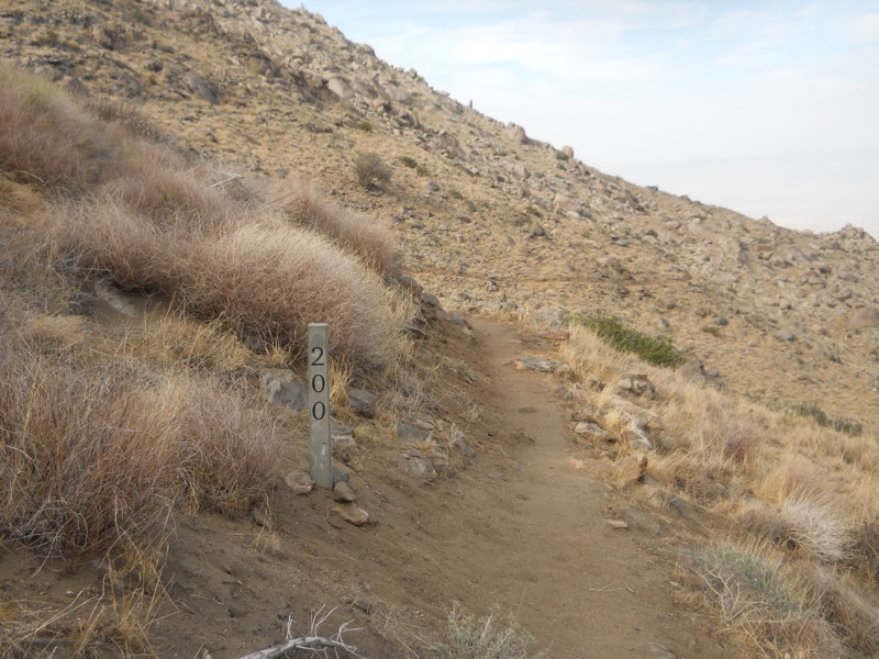
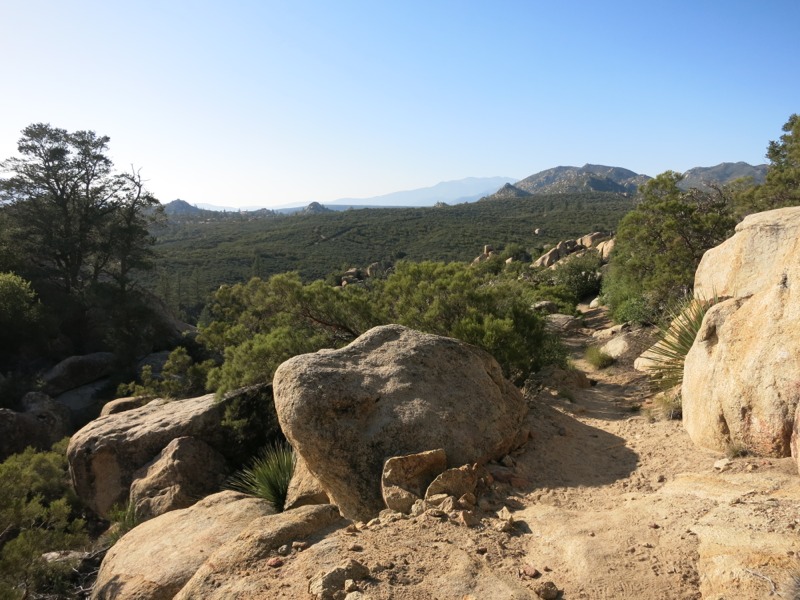
After packing up this morning we hit the trail for 3 miles to the first water. We were running lower than usual and I had drained my main water bag coming into camp last night, so we were eager to refill. It had been a warm night even at our elevation and by the time we set off at 7 the sun was already intense. Looked like it would be a hot day…


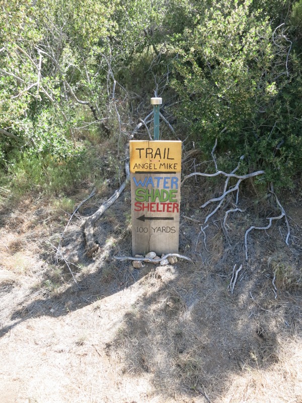
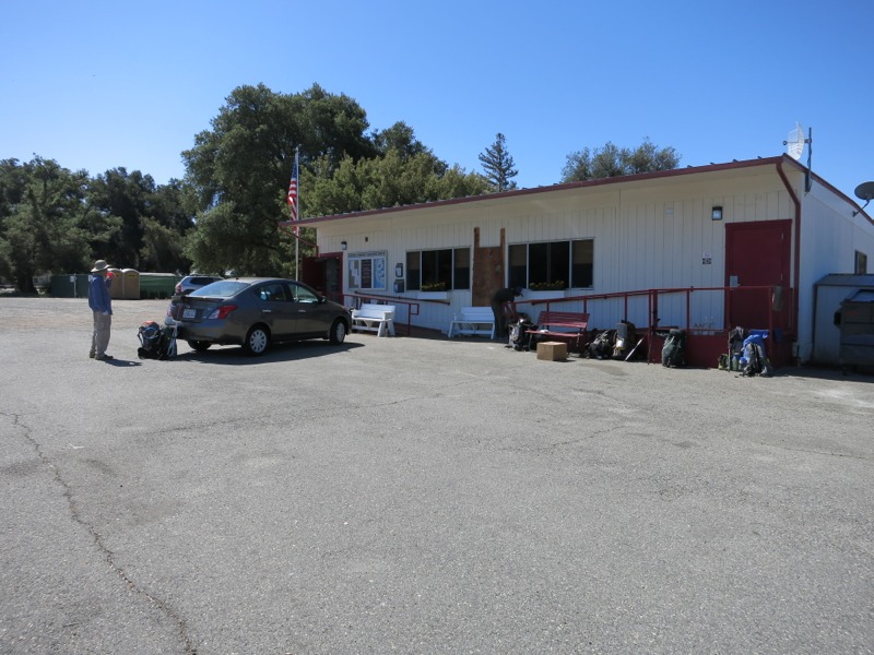
Luckily the trail was pretty gentle as we headed towards our stop. It was nice to be able to hike in the shade when we skirted the western side of the ridges. In no time at all we arrived at the side trail for trail angel Mike’s house. It was well signed, complete with a little solar light for hikers arriving after dark. We headed up the steep spur to his driveway, past the massive hiker-use water tank, and down into paradise.


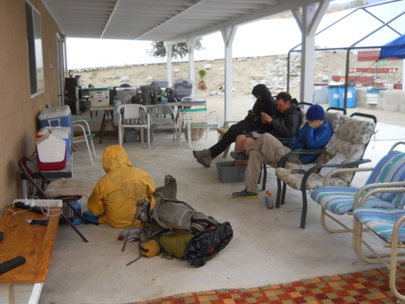
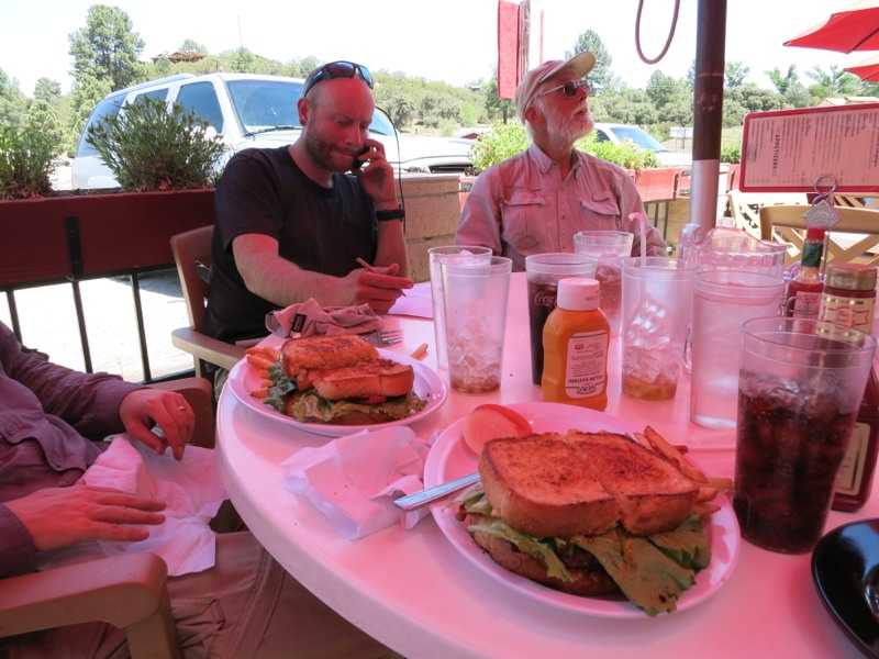
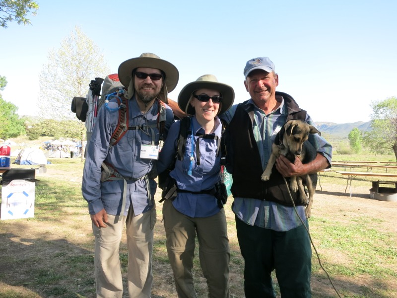
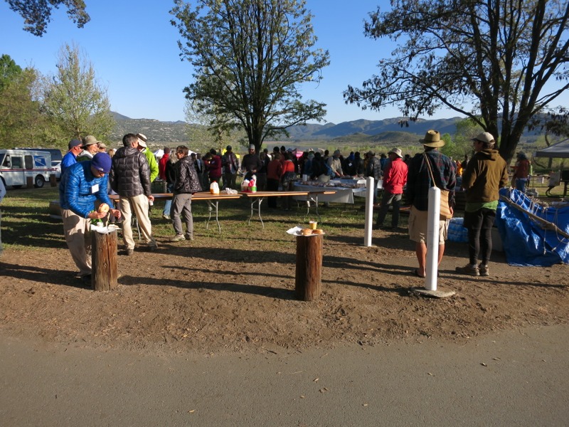
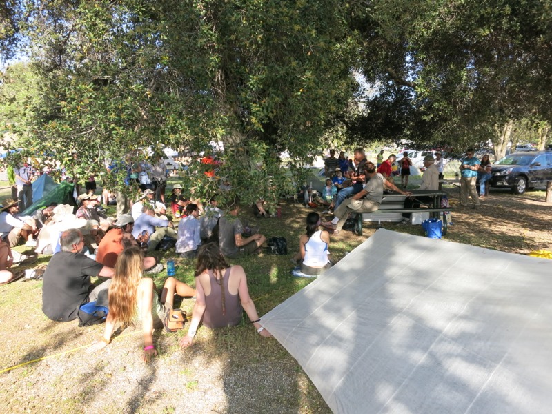
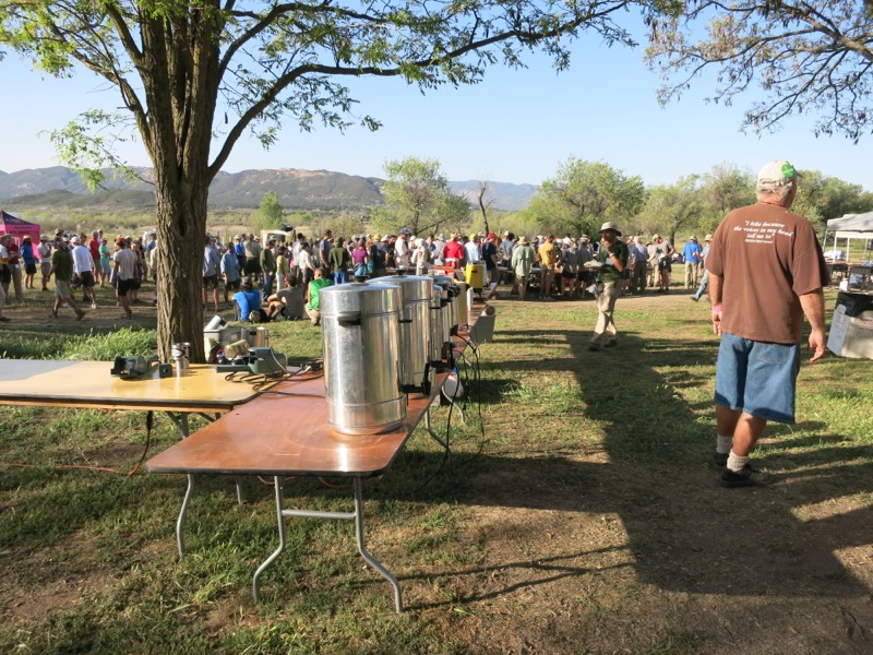
As we came into the yard we were greeted by a bunch of other hikers, Mike and Nina, and their dog. We instantly felt at home as we introduced ourselves to Matt, Hope, Bunk, Yardsale, and U-turn. Yardsale kept insisting that we had just earned our trail nicknames – Perfect Timing – because we had arrived moments before breakfast was ready. Like good hobbits, this was second breakfast for us and it blew our morning granola out of the water. On his enormous outdoor griddle Mike had prepared the best fry-up we’d ever had – meat, eggs, potato, onion, griddled tortillas, and pancakes with butter, syrup and STRAWBERRIES. That, plus coffee, cold pink lemonade, and great conversation made our morning more wonderful than it already had been. It instantly reminded me of Big Lar’s cabin in Wisconsin – sit around and eat lots of great food, have your smoke, and shoot the breeze with a bunch of friendly people. Thanks so much to Mike for all he does for us dirty hikers!


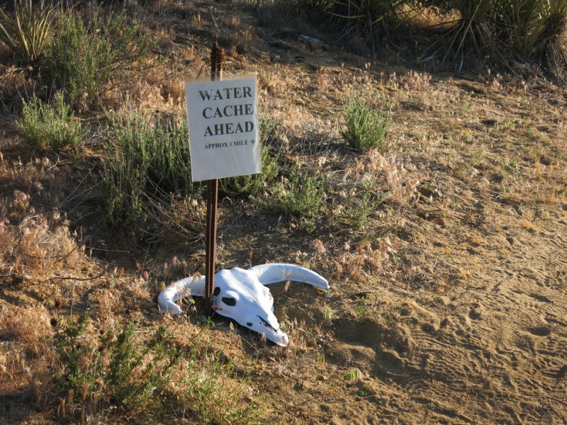
After eating we refilled our water, paid the love forward with a donation to the food jar, and reluctantly headed back to the trail. Our only regret was that we couldn’t take a zero there. That would have meant incredible BBQ chicken and a luxurious night in the RV Mike keeps for hikers. Unfortunately, we had to make miles in order to reach another well-loved trail destination tomorrow – the Paradise Cafe. Besides amazing burgers, the place is an important water stop in a dry stretch. They normally have a spigot outside for hikers to use but we have heard that it froze in a recent storm. Since they are only open until 3 tomorrow and closed on Tuesday, we have to get within striking distance today. Sometimes on the trail it doesn’t feel like we’re hiking the crest so much as hiking from one wonderful food stop to the next.


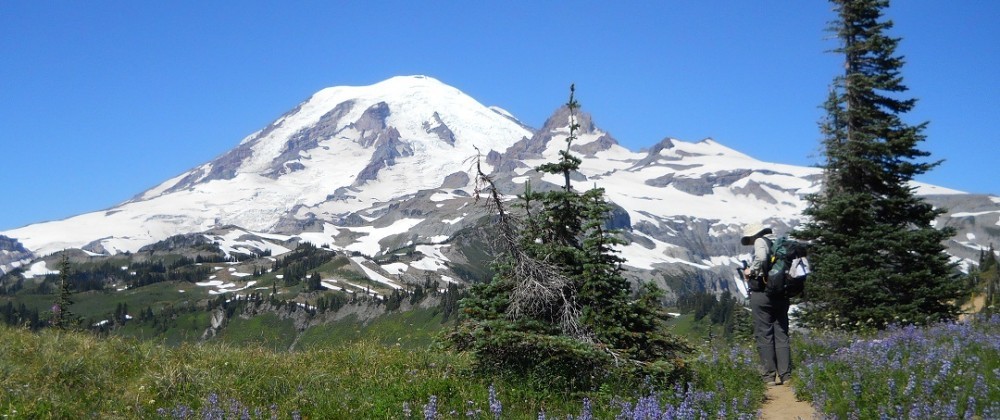
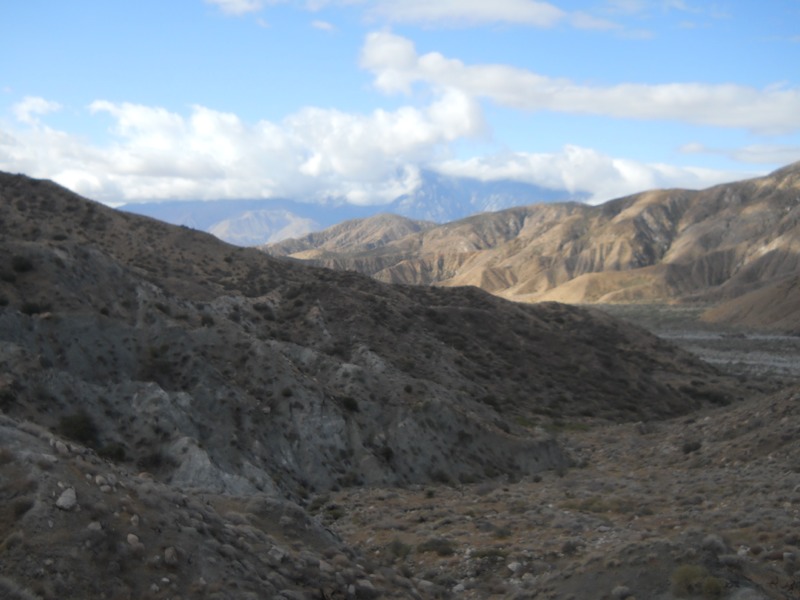
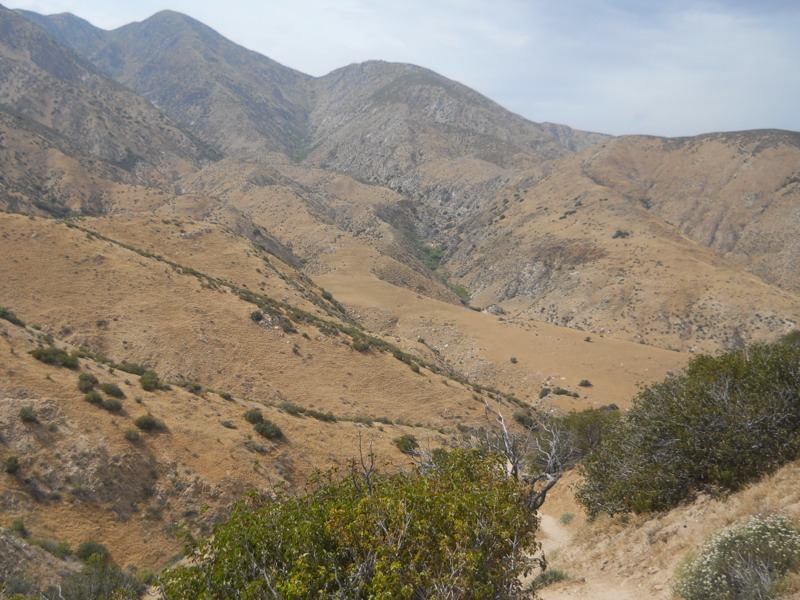
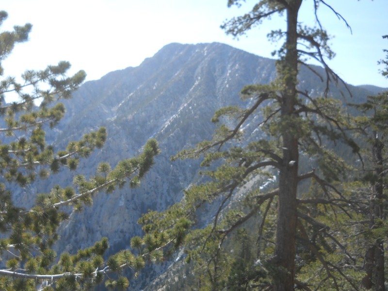
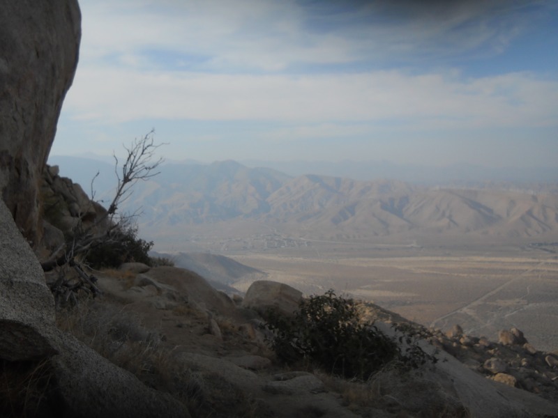
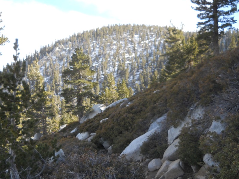
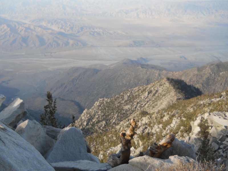
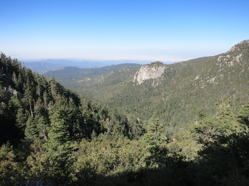
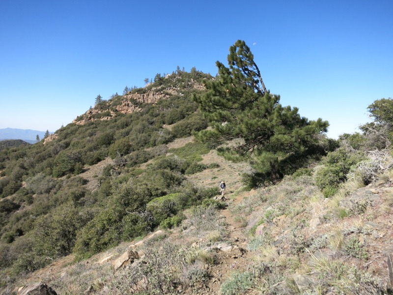
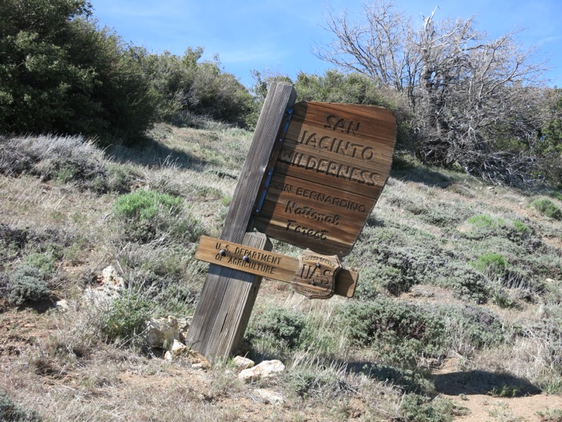
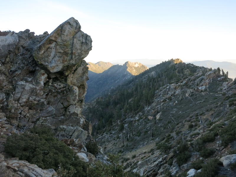
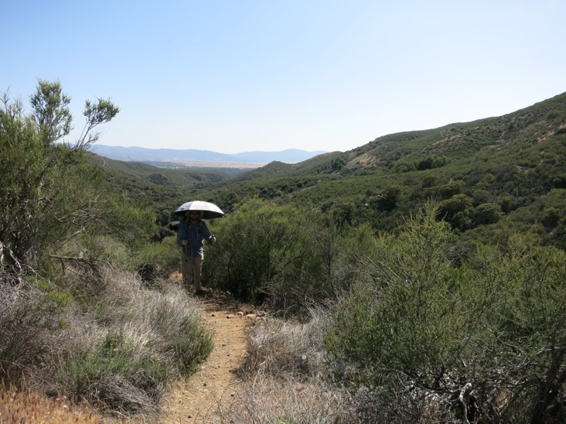
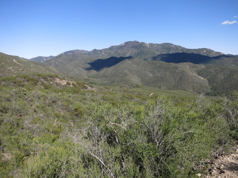
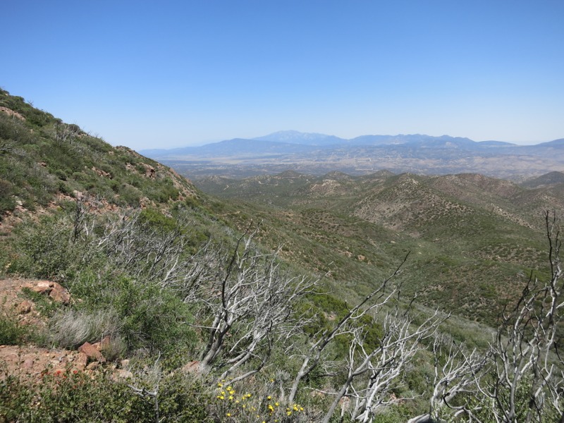
We hit the trail with Hope, Bunk and U-turn on our heels and started right up a fairly steep climb. Nothing like a hearty second breakfast to give us hiking power. Before we knew it we had reached the top and were treated to a wonderful view of the Anza Valley and a taste of things to come. In the far distance we could see Mt. San Gorgonio. Closer in was Mt. San Jacinto, which we will skirt after our stop in Idyllwild. There is an alternate trail route that goes right to the top – maybe we’ll take it. As we descended steeply, losing all the elevation we just gained (not an uncommon phenomenon out here) I thought I could see the Salton Sea through a gap to the east.


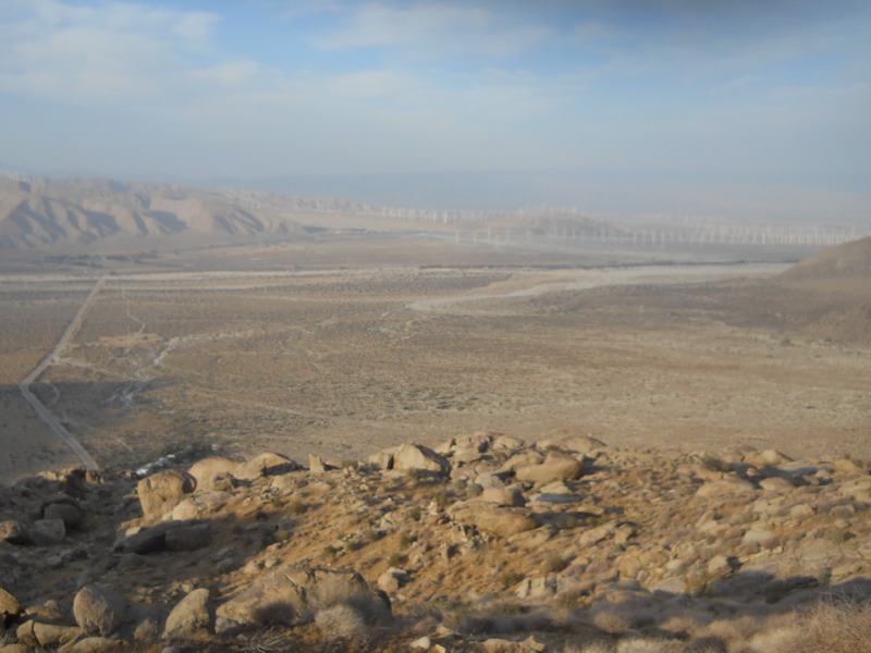
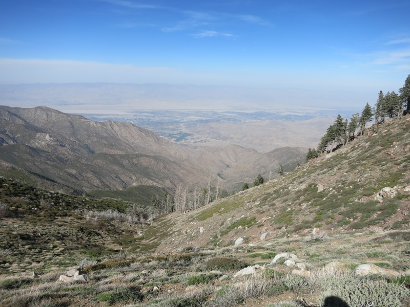
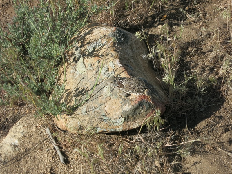
We descended more and more and it got hotter with every step. By the time we leveled out it was oppressive. Thank goodness for our umbrellas and our new gloves. The gloves especially have been great – I wore them all day yesterday and even fell asleep with them on. We slogged across another desert floor toward a tiny creek, hoping to wet down our hats and gloves before finishing the trek to the next reliable water. Unfortunately, the creek was nothing more than damp dirt and we had to go on dry. The thermometer on my watch read 90 degrees under the shade of my umbrella. I’m glad we’re hiking this now and not a week later like everyone who started at kickoff…

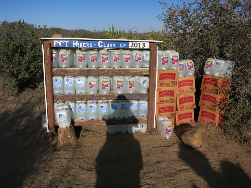
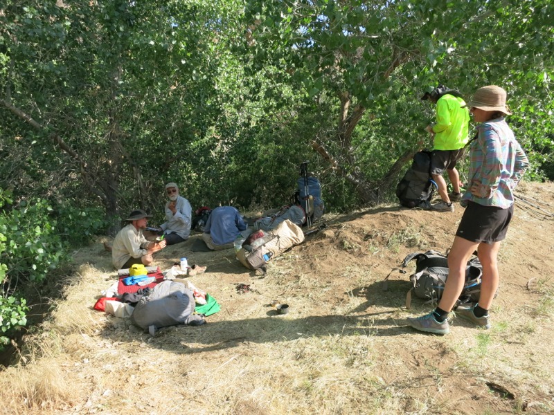
Finally we reached the turnoff for the Tule Spring spigot. After a steep quarter mile down we reached our second oasis of the day after Mike’s – shade, a hose spitting out cold water, and all the folks we had met that morning. We instantly headed for the water. I soaked my shirt, head, gloves and hat. It felt amazing and it was so hot out that I dried in minutes. As we sat around and bonded over the challenge of this last section we cooked a lunch of chili and noodles and waited out the rest of the afternoon heat. After a while Alan from CO showed up. We had hiked around the same schedule as him the first week and had seen him at kickoff. He had already done his 20 miles for the day so he was there for the night as the rest of us packed up and moved on.


Rejuvenated by the rest and the food and hiking in the cool of early evening, we set out to make a quick few miles before dark. As we hiked up the fairly way trail we came across a fallen GPS messenger unit similar to the SPOT device we carry. We suspect it belongs to Yardsale and will carry it until we can find its owner. A little explanation is called for here – Yardsale got his trail nickname from he fact that every time he stops to dig something out of his pack, things go flying everywhere. Yesterday, back before we ever met this group, we came across a nice titanium spork lying on the ground. Since we were on private property we left it there but found out this morning that it belonged to Yardsale, who was apparently being true to his name. I felt bad for not bringing it up the trail with us. Hopefully this GPS unit is his and I can make amends by returning a piece of safety gear that costs quite a bit more than an eating utensil.

We passed Hope, Bunk and U-turn at Nance Creek and pushed on for a little longer to set ourselves up to hit the cafe early tomorrow afternoon. We’ll get up a bit earlier than usual to make sure we can do the remaining 11 miles before it gets too hot. Gorging ourselves with our new group should be a pleasant way to wait out the afternoon heat. After that, we will make a few more miles towards town in hopes of reaching it on Wednesday or Thursday. It was another great day and we are thrilled to have met so many cool people. Still having a great time and getting stronger every day…

– Posted from the PCT

Day 9 – Warner Springs to boulderfield in the San Jacintos – 15 miles


Kind of an uneventful day today…after grabbing a bagel breakfast at the kickoff we packed up our gear and headed back to the trail. The party goes on for another day but we are anxious to be hiking and away from all the people. Many of the presentations are repeats of yesterday.

Thanks to the handy ride board, Helicopter (a thruhiker from last year) offered to pay the trail spirit forward by driving us back. We had a great conversation along the way about the logistics of hiking in a low snow year, since this year’s coverage is similar to last. She knows a lot of the people whose trail journals I followed last year.


Once back at our jump-off point, we wetted down our hats and hair in anticipation of a hot afternoon and set off north. The trail wound over wide plains just as it had on the way into town. We passed a small airport where they were flying gliders. Along the way we met a trail maintenance crew leaving from their worksite. We appreciate the hard work they did on a hot day!

The trail entered tree cover and scrub as we crossed back and forth over Agua Caliente creek. At the last crossing we stopped and had a lunch of sweet potato and ham. The only hikers we encountered all day weren’t thruhikers – they must all still be at the kickoff.


After our last creek crossing we started up, a trend that continued for the rest of the day. We were entering the San Jacinto mountains. The trail wound up and around ridges that got taller and taller. We had a great view of the plains and basin we had climbed out of earlier. The manzanita shrubs were blooming and they were beautiful. They remind me of lilacs – some bushes have dark pink flowers and some are a lighter pinkish-white. They buzz like beehives as we pass from all the pollinating insects.


Our camp is in a big boulderfield tonight. As it gets dark it’s strange to see large chunks of the night sky blotted out around us. Tomorrow we’ll start by making 3 miles to the first water since the creek. Even though it’s not classic desert terrain up here, it is still very dry and we have to remember to keep an eye on how much water we carry. If we make big miles tomorrow we’ll set ourselves up for great burgers on Monday at the Paradise Cafe.

– Posted from the PCT

Day 8 – Lake Morena, ADZPCTKO

Today was our first zero day! No miles to hike – our only real chores were to eat, rehydrate, and rest. We are back at Lake Morena for the extensively abbreviated ADZPCTKO. In only slightly longer terms, this is the annual day zero PCT kick-off. It’s an annual gathering of this year’s thruhikers like us (the class of 2013), PCT section hikers (people less crazy than us) and past hikers who come back as sort of a class reunion. Plus all the wonderful folks who help put on this event, which grows larger every year. This year is no exception as registration filled up in record time.

Last night we got a ride back to the Lake Morena campground from Kelly, who was offering rides on the well-coordinated ADZ website’s ride board. We met him at the Warner Springs post office. He was a little later than planned, mostly because he had to pull an accident victim from a roll-over wreck that was leaking fuel everywhere. Then he got a flat tire. You know, no big deal. We are unbelievably grateful that he still took time out of his crazy day to drive us back! He’s not only dedicated, but also super knowledgeable about the landscape we were driving through – way better than any trail guide. Thank you, Kelly, for helping us when the universe seemed to be putting every possible obstacle in your way!


We got in late but thankfully didn’t disturb anyone as there was a lot of celebrating going on. We headed to bed in preparation for a full day of calorie grazing. Today we woke up and checked into our spot, receiving our class of 2013 bandanas and official thruhiker wristbands. It was a surreal experience to walk through the campground. I must have seen nearly every piece of gear that I’ve ever heard about. After the extensive search we did for a new tent last winter, it was especially cool to see all the models I had to decide among. Te campground was a sea of puffy, lightweight down jackets.

We visited the vendor tents first with a specific goal in mind – finding pairs of sun gloves. These were the one thing I’d thought about getting but never did and really regretted it. No matter how many times I put sunscreen on my hands and wrists it always seems to wear off too quickly – either through the sweating or the rubbing from the straps of my hiking poles or the supercharged sun. I had seen a few pairs of gloves on the trail that I coveted and was hoping to find some here… and we weren’t disappointed! We were able to pick up a new spork for Keith, too, who broke his at Barrel Spring. I’m not sure if it was his mighty man strength or my huge hearty meals.


With that done, we sat in on a few presentations given by folks running the KO. One was an interesting talk on avoiding overuse injuries. We also heard one on general trail conditions and the state of some long-standing detours. Then there was the traditional SoCal water report discussion. Through crowdsourcing they maintain a record of the status of water sources all along the trail – whether this seasonal creek has dried up or is low-flow, if a particular water cache is stocked, and such. This is really important info for us, especially during this dry year! The man who currently coordinates this info and issues reports is Halfmile, who also happens to be the mastermind behind the incredibly detailed maps that escort us north. He got a lot of much-deserved applause. Before hiking the trail ever seemed like a real possibility for us, I would get by on reading hiker journals and following along on his free maps. The volunteers behind this trail are just amazing.

We broke up all the lectures with a trip to the nearby store for lunch and ice cream. We also met a lot of new people. As someone who is shy I can’t remember the last time I was around so many people where it felt natural to just walk up and introduce myself and start chatting. We’re sharing a site with Jordan and Brock, who welcomed us in last night and offered us food. Matt and Jamie from Washington are here too, thruhiking with their huskies – two of the calmest, most polite dogs I’ve ever met. It’s really great to meet people who take such great care of their pets. We hung around with everyone in the afternoon while we repacked the food we received in our mail drop yesterday.


Before dinner we went to a talk on general snow and mountain safety. With the record low snow we shouldn’t have to worry about this as much as in past years, but it was still good info to have. Many of the snow travel techniques he was taking about were familiar to us after so many years of MN snow but we have never used ice axes before. I’m interested to see if we have an easier time in the Sierra snowpack than folks from less arctic places. Maybe it won’t make a difference!


Dinner was burritos served en masse, with chips and delicious salsa. Feeding this horde of people is an enormous task and it still amazes me that we aren’t asked to pay a cent for it as the thruhiker guests of honor. After dinner we grabbed a hot drink from one of the many carafes lined up on the tables. Mom and Dad would certainly have approved of the immediate availability of coffee. With a hot cup to ward off the chilly dusk, we sat around in front of the big movie screen for the official welcome and short film festival. It made me laugh that the screen was a rigged up piece of Tyvek – the white wrap they put underneath the siding on houses, which many hikers use as a lightweight and durable groundsheet. The films were great and really whetted our appetite for the rest of the trail. Afterwards, it was hard to only think of our next 4 days to Idyllwild and not let ourselves get ahead to the Sierra and points north.

Tomorrow we’ll get up early and grab breakfast, then pursue a lead on getting a ride back to Warner Springs. The next section looks like it might be trick water-wise again, but then so will most of Southern California. We’ll be heading up into the San Jacinto mountains and are looking forward to some amazing scenery!

– Posted from the PCT