Day 73 – Trinity Lakes to near Donohue Pass – 15 miles


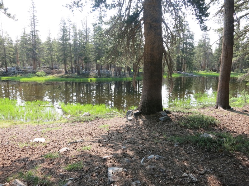
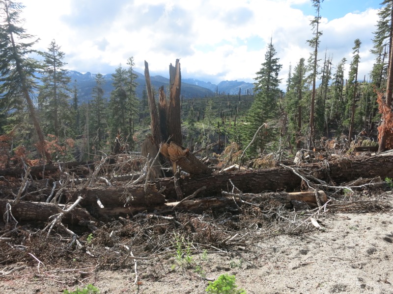
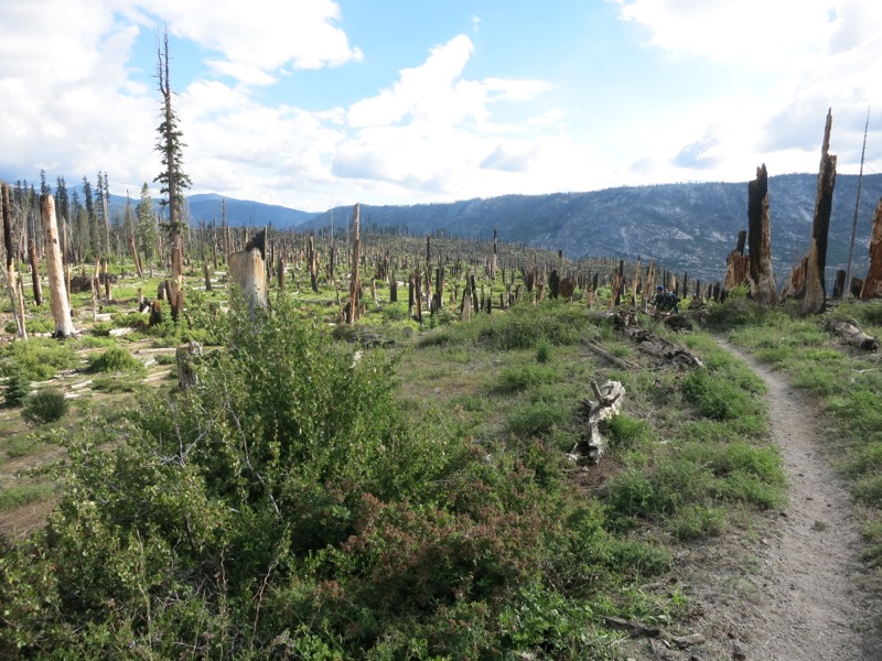
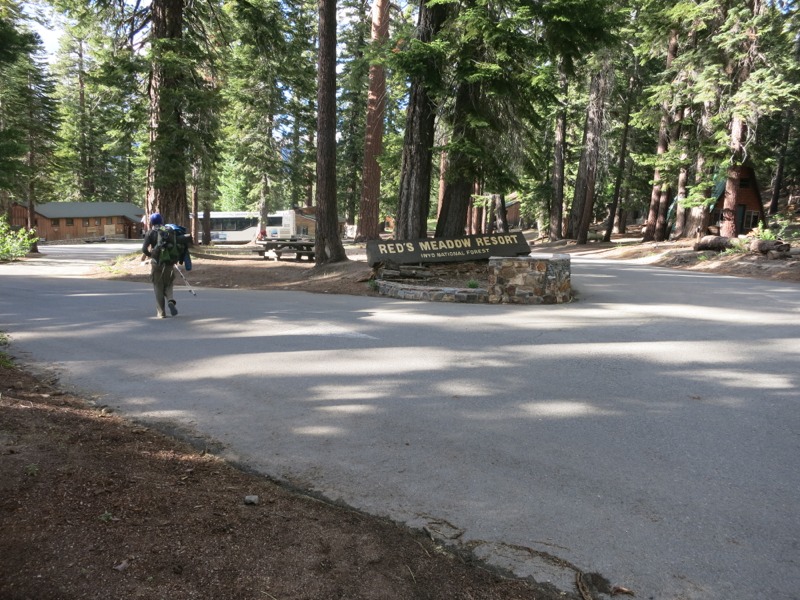
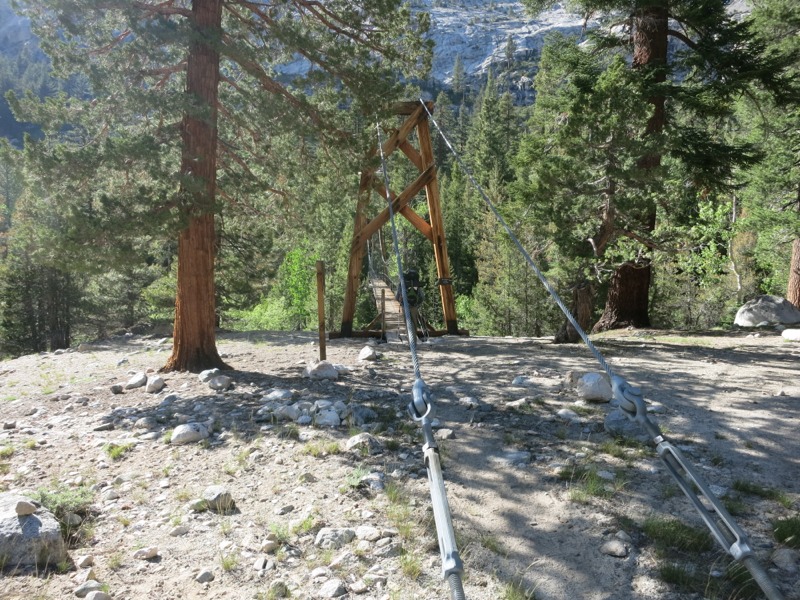
Between the heat, the constant whine of mosquitos and a sloped campsite, neither of us slept well last night. The bugs were still around in force in the morning but as we took our time eating breakfast and packing they dissipated a little. We still brought out our bottle of bug spray for the first time on the trip. It’ll be a constant companion until Tahoe at least. It’s strange to think back to our last night of cowboy camping, before Muir Pass. Things changed so quickly!


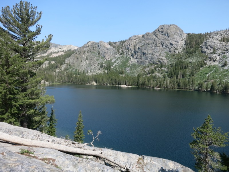
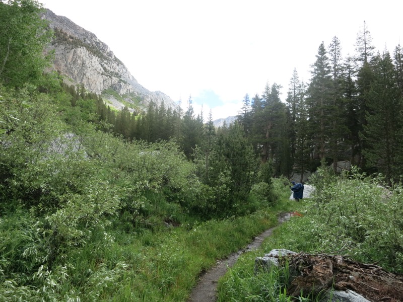
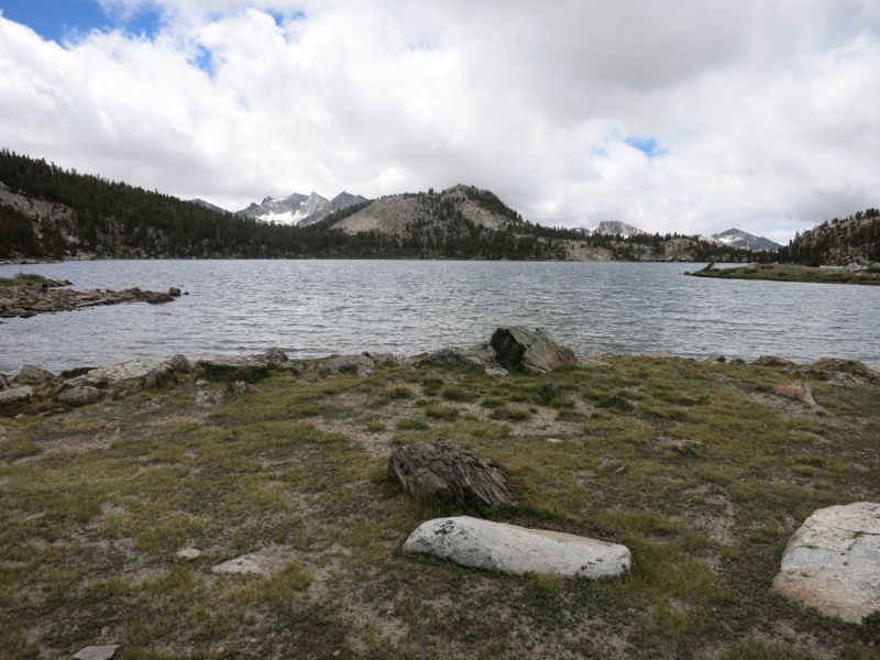
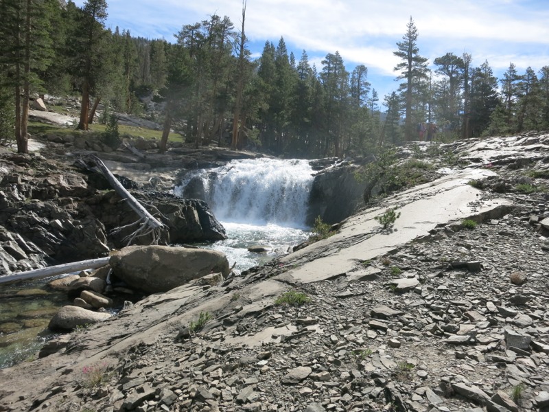
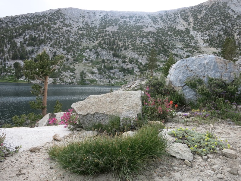
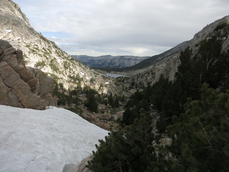
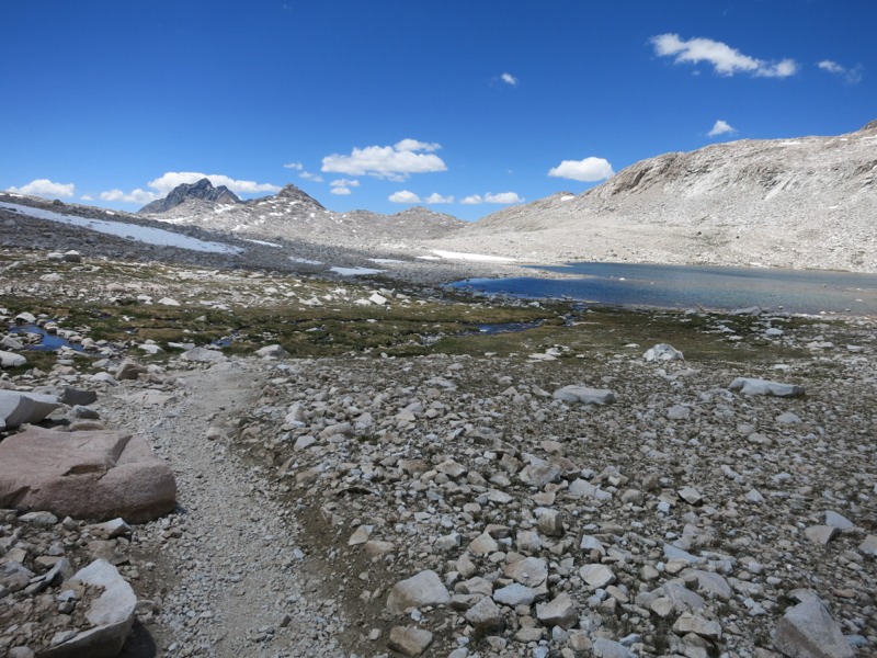
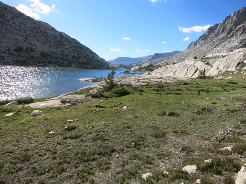
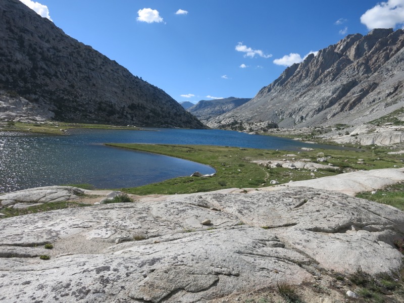
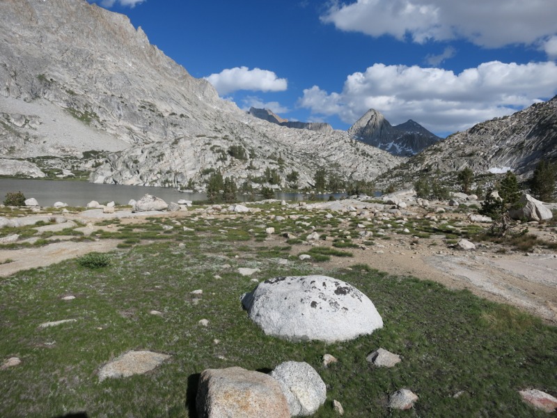
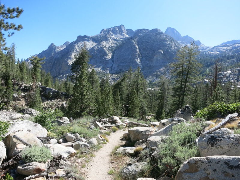
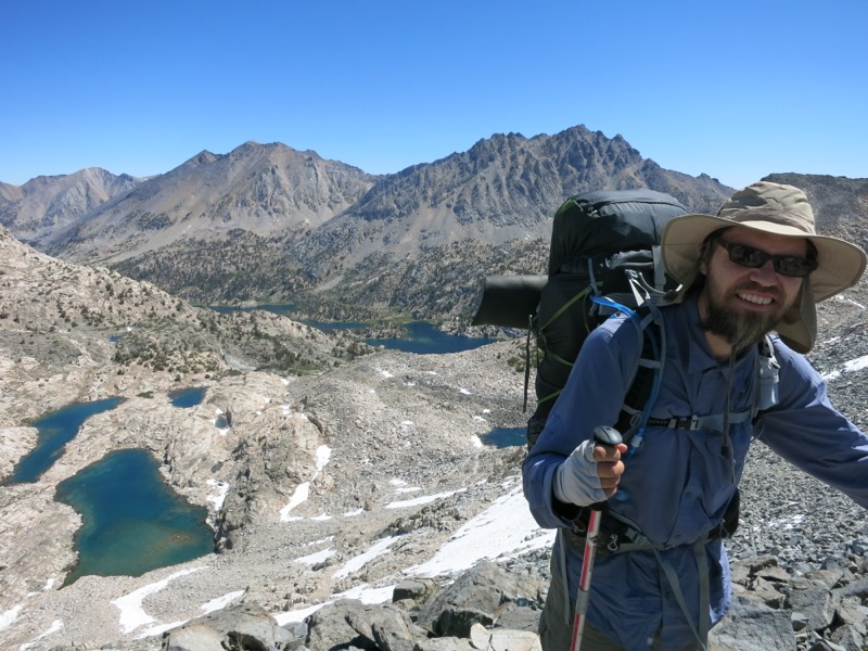
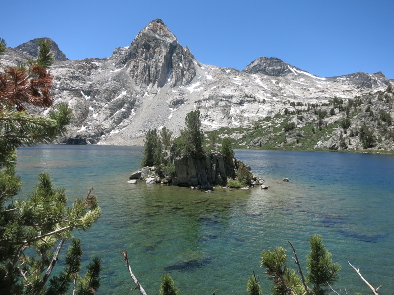
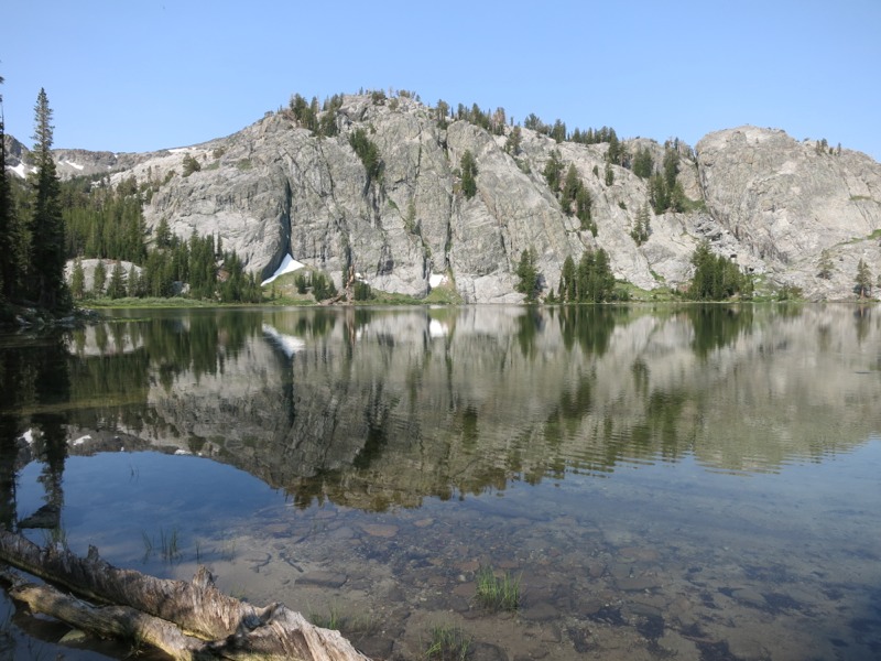
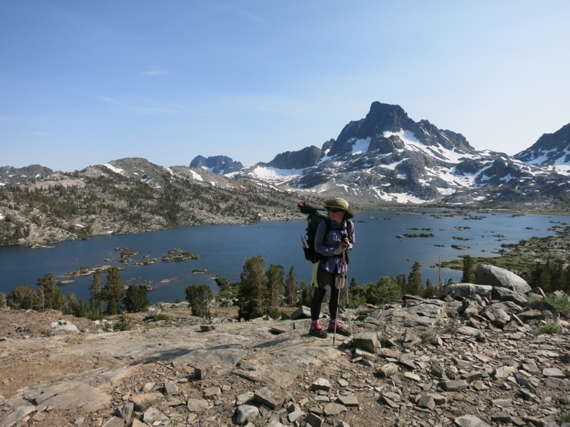
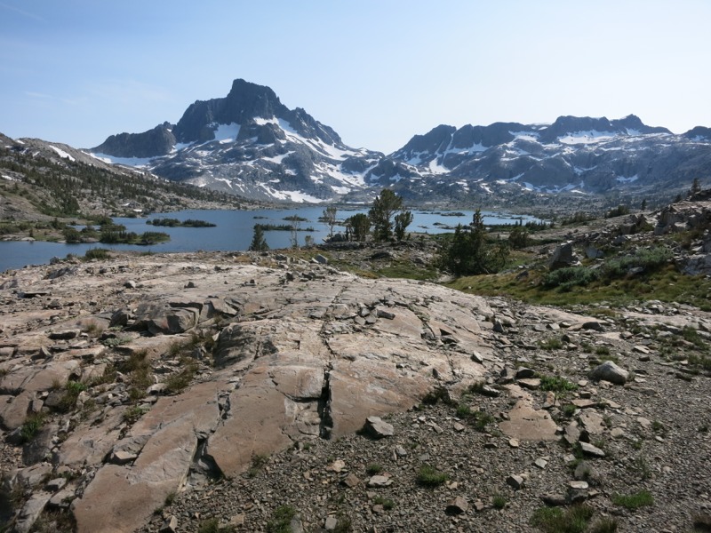
Back on the trail we continued up the JMT alternate past lake after alpine lake – Gladys, Rosalie, Shadow, Garnet, Ruby, and the crown jewel (as it were) Thousand Island Lake. This last one marked the re-merging of the PCT and JMT. Each lake was set in its own little bowl and was a scenic reward to see after climbing the ridge separating it from the previous one. Thousand Island Lake was the largest and most scenic, named for the many tiny granite islands dotting its surface. It was not named, as I joked, for the fact that every single restaurant out here – starting in Southern California and persisting through Mammoth – puts thousand island dressing on their burgers. This is one regional twist that Keith doesn’t approve of.


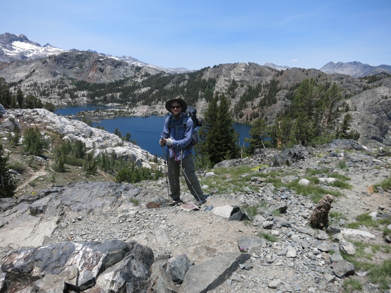
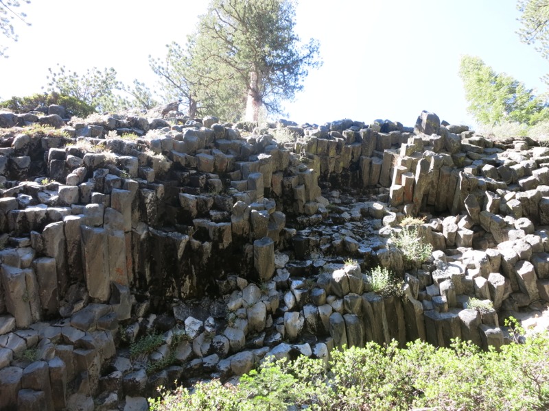
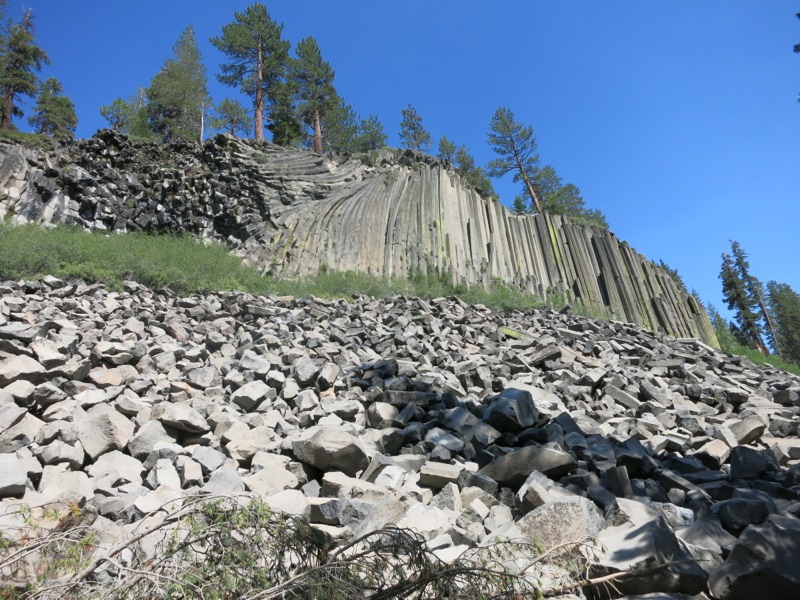
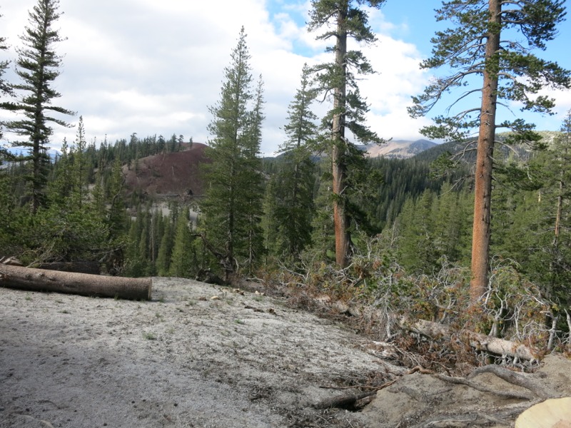
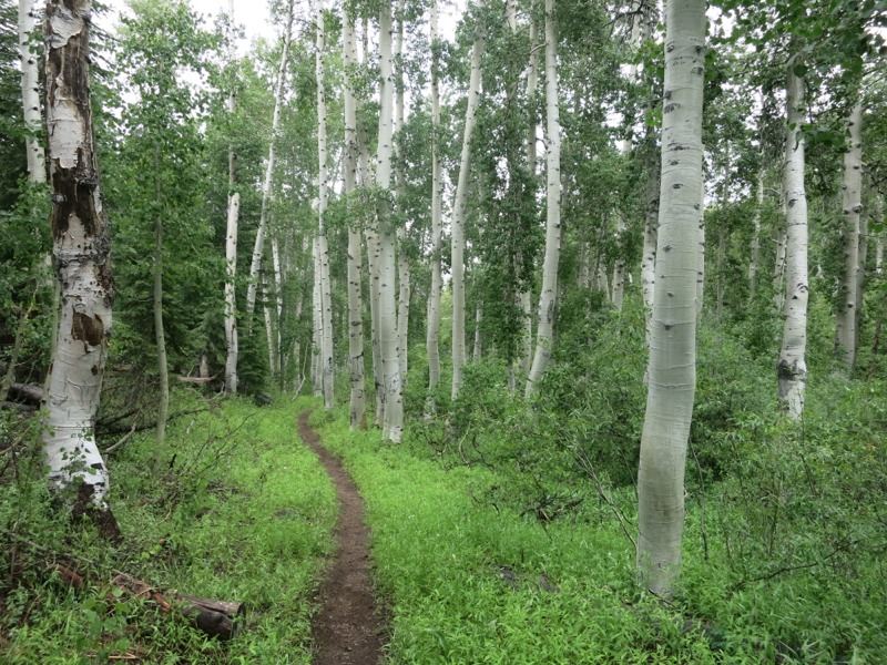
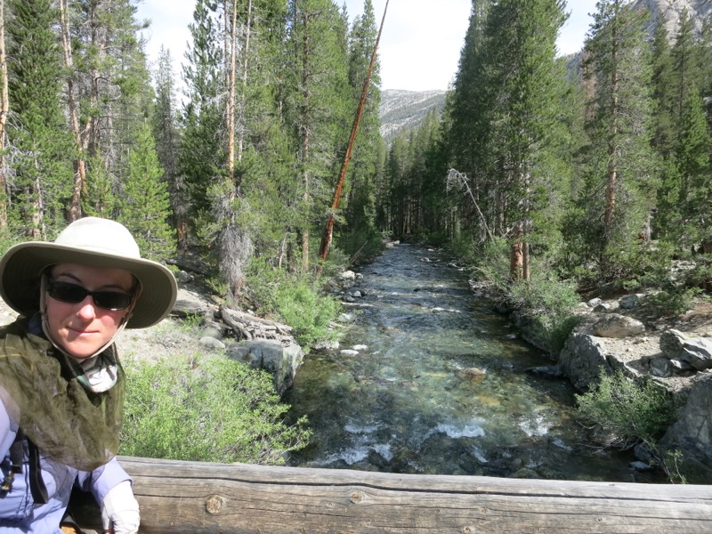
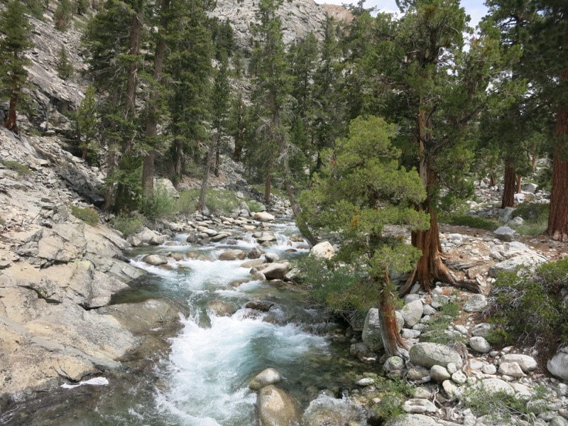
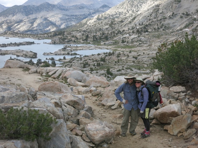
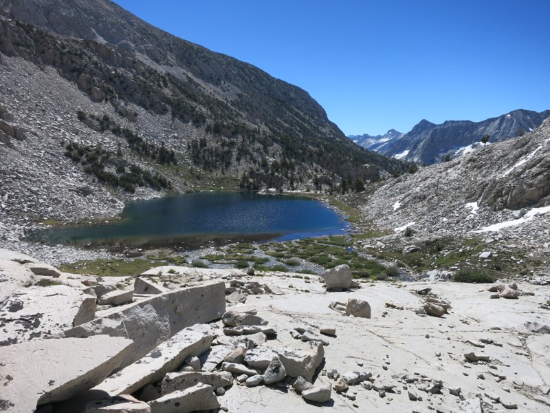
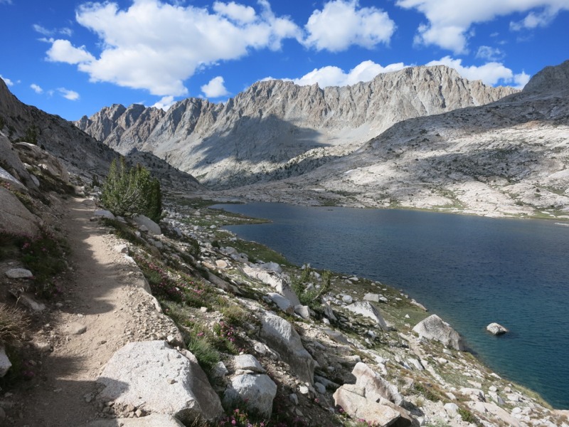
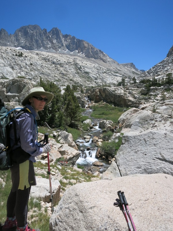
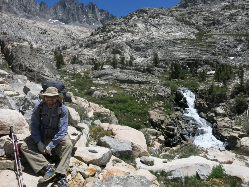
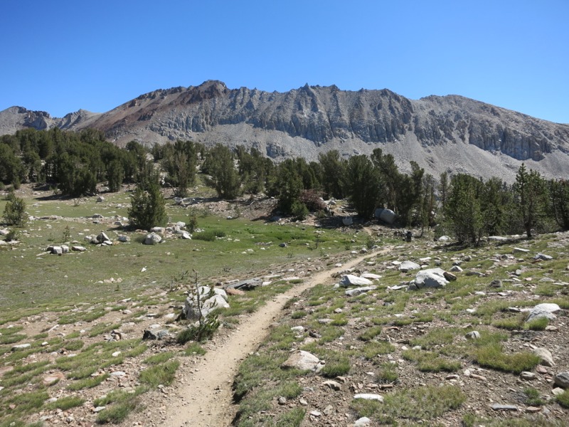
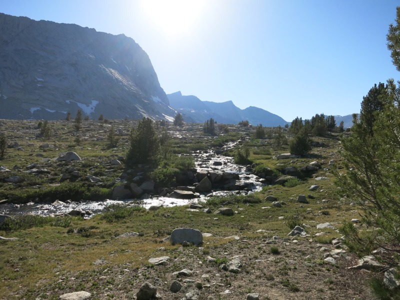
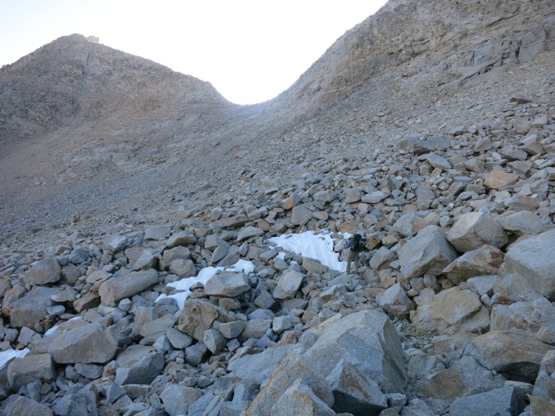
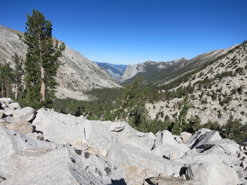
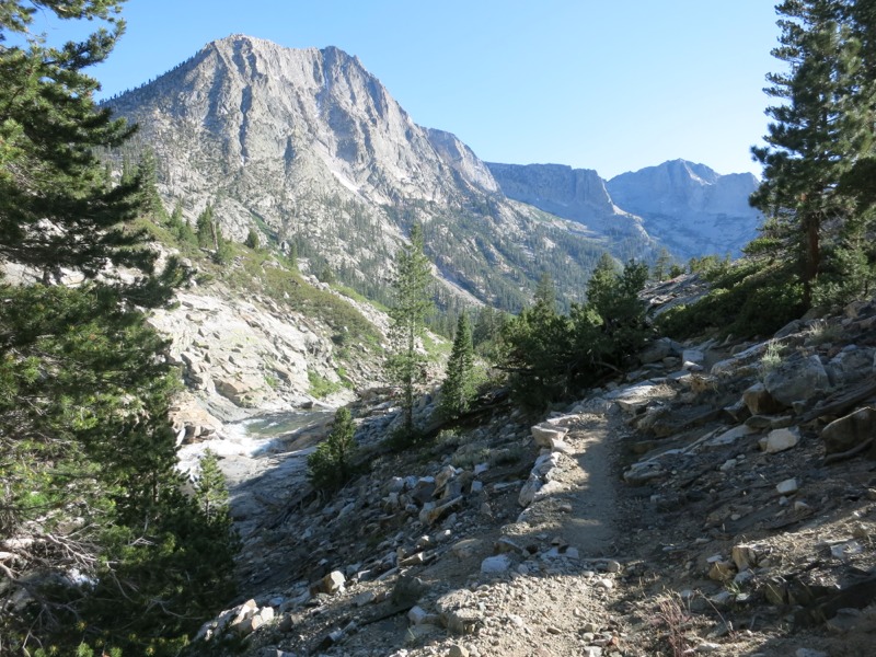
We ate lunch at the trail junction and soaked our feet in the big lake. In true Lang tradition I managed to get a mild sunburn on my legs during the half hour I had my socks off. After lunch we started up the PCT towards Donohue Pass, the last “intimidating” pass we cross. For some reason it’s not usually lumped in with the big seven we’ve already done – that’s Forester, Glen, Pinchot, Mather, Muir, Selden and Silver, if you’re still keeping track. Maybe it’s an easier approach. We’ll find out tomorrow. Along the way we crossed over Island Pass, which was really more of a glorified saddle. We started through a stretch of rocky trail, sparse pine, and trickling streams.


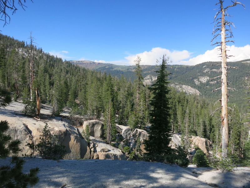
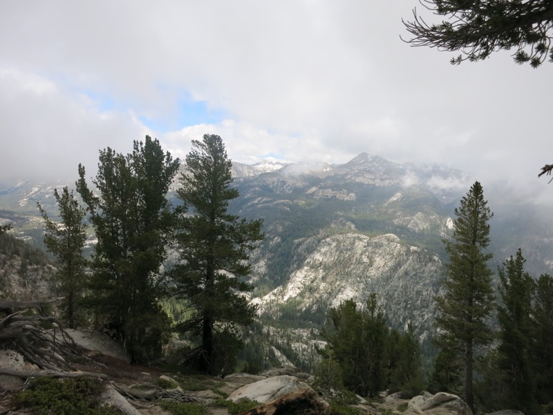
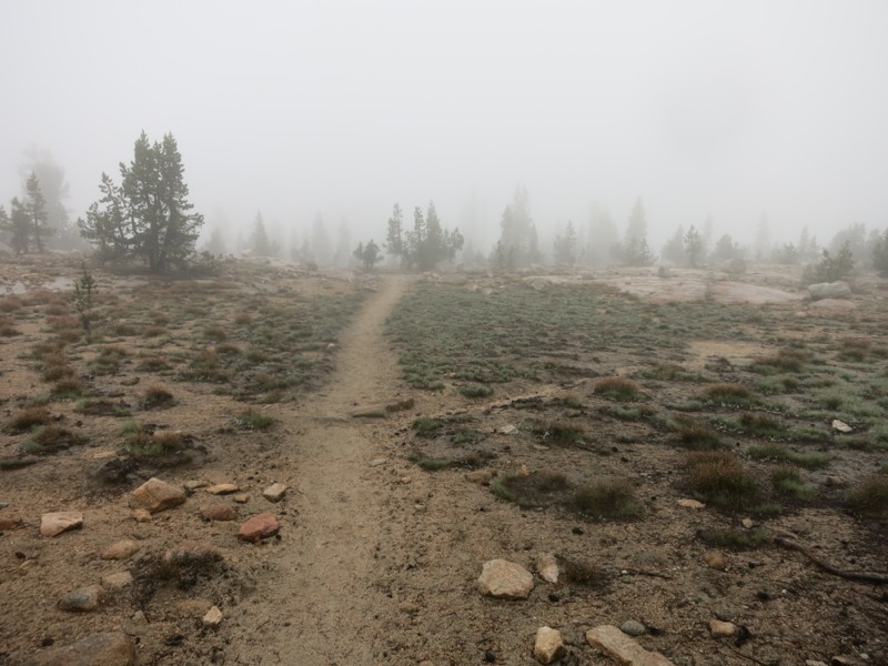
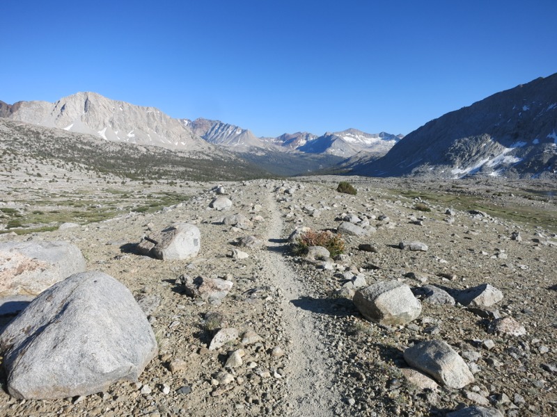
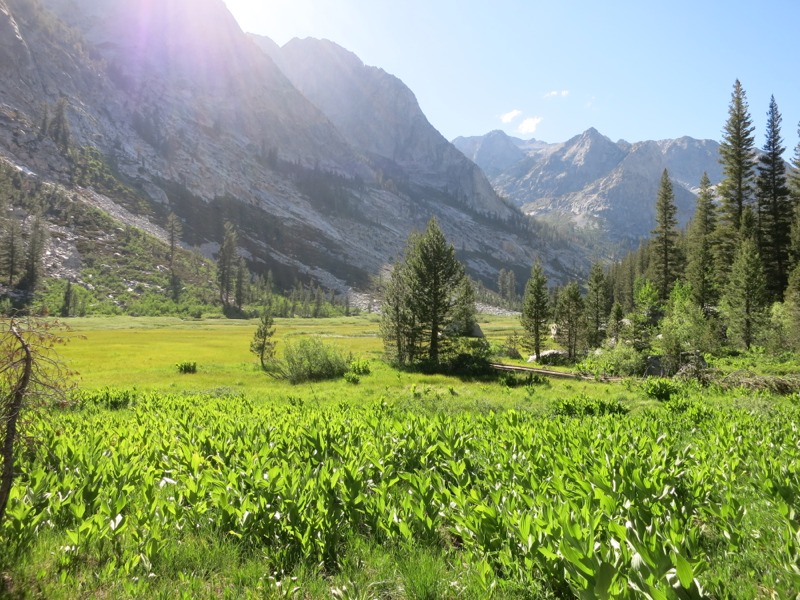
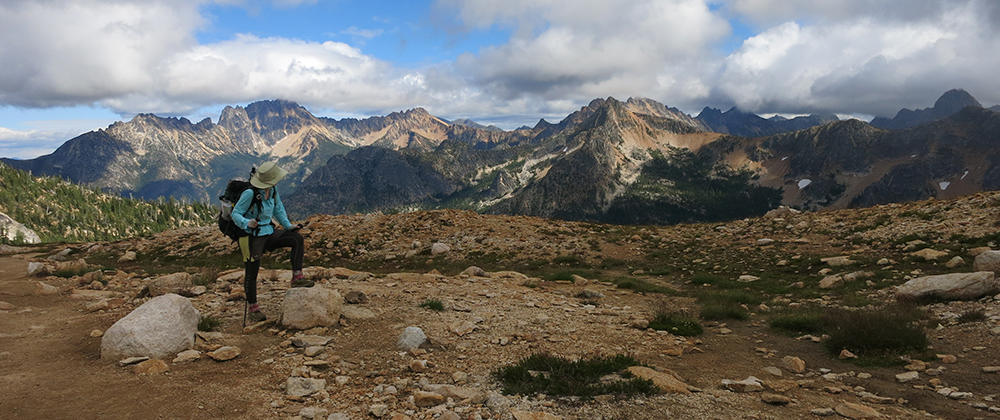
As we gained altitude we started passing short stretches of meadow until we hit an open, green expanse 2 miles short of the pass that was impossible to resist. We’ve got a backdrop of peaks behind us and a long view to the east in front of us so we should catch the sun early tomorrow. It’s much cooler up here tonight than it was last night, although the bugs are still around.


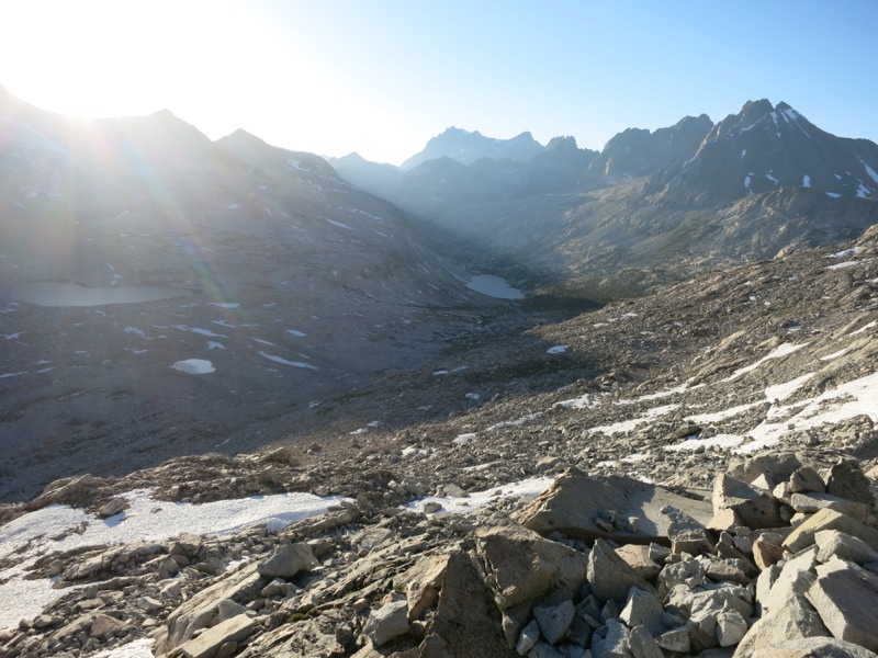
Once we get over the pass tomorrow we have easy trail all the way to Tuolumne Meadows. We hope to grab lunch there and then follow the JMT as it splits from the PCT again and heads to its northern end in Yosemite Valley. That’s the plan, at least, assuming permitting isn’t a problem. If we’re really lucky we might score a permit to hike up the massive granite Half Dome. We’ll have to see…

– Posted from the PCT

Location:Pct mile 927

Day 72 – Reds Meadow to Trinity Lakes – 6 miles


Back to the trail again, at last. We left our hotel and began the process of getting back to the trailhead at Reds Meadow. A town trolley to the mountain bike shuttle brought us to Mammoth Mountain and from there the Eastern Sierra public transit bus returned us to the meadow – what service! The bus drivers up here are positively awesome. Without us even mentioning that we were thruhikers, our driver asked the full bus to be extra nice to us be wise we were “hiking all the way from Mexico to Canada.” We actually got applauded just for being on a 6 month dream vacation.


It was much hotter than we were used to up here – consequence of a heat wave – and we were sluggish to get going. We stopped for lunch in the little cafe and then dragged ourselves out of the town vortex and started up the trail. First stop was a short detour to Devil’s Postpile National Monument, a natural formation of hexagonal rock columns nearby. We had seen something similar last summer on the Wonderland Trail. Also attributed to the devil (though I’m not sure what it is about hexagonal stones that screams evil), the Devil’s Pipe Organ had been a little more impressive in scale since it covered an entire massive cliff face. This formation had a trail to the top, so we could see the tops of the columns all fitted together like a huge, half-buried turtle shell.


Afterwards we started north again and soon came to a junction where the PCT and the John Muir trail diverged. From Mt. Whitney (the south end of the JMT) the two had shared the same track, but here they diverge for about 15 miles and run up opposite sides of a valley. We had decided to take the JMT arm – said to be more scenic by some people, and we thought it would be fun to say we hiked the length of the entire JMT on our trip since we plan to follow it to its northern end in Yosemite Valley soon.


We started uphill through pine forest and over big stone man-steps. This route changes elevation more than the PCT alternate, but we were all rested up and well fed from town and we powered our way up. The bugs got bad very quickly – much worse than we’d seen in the middle of the day. They were even bad while moving, while before we could avoid getting bitten by hiking at even a slow pace. The bugs and the heat encouraged us to stop and camp earlier than we might have otherwise. We dropped packs at the first lake we came across – a mosquito haven, but how much worse could it get? In record time we had the net tent up and were safely inside, performing the now-standard ritual of squishing all the lucky ones that made it in with us. They have been a constant hum around us all evening. I think I have to swallow my pride and admit that they’re swarming worse than I’ve ever seen them in MN – although they’re not as aggressive as they were in the BWCA, where DEET was only a placebo. Thank goodness.


The lake behind us is beautifully still and reflecting the pink sunset clouds off its surface. I hope it cools down tonight. Tomorrow we’ll hike the rest of this alternate leg, then rejoin the PCT and head for Tuolumne a few days away. Even further out is Tahoe, and Tahoe is just across the state line from the casinos in Nevada, and in the casinos are all-you-can-eat buffets…but we’ve got to take it one day at a time.

– Posted from the PCT

Location:JMT alternate mile 4

Days 69, 70 and 71 – Mammoth Lakes

Didn’t expect to take three days but we needed to rest my ankle and a few other nagging injuries. The next section to Tahoe will be challenging and we’ll need to be in good shape.

In the meantime we’re eating all the fresh food we can, trying to satisfy every craving we’ve had over the last few days.

– Posted from the PCT

Location:Pct mile 907

Day 68 – below Silver Pass to Mammoth Lakes – 19 miles


The morning started out damp and still overcast. We knew the weather had improved because the mosquitos were starting to work their way in under the edges of our tent. We packed up and hiked for most of the morning in our (dry) sleep clothes since we planned to reach town this evening. We had two climbs to overcome early in the day, then flat or downhill trail the rest of the way into Reds Meadow.


We were up and on our way quickly. After a short descent to Fish Creek and a bridge crossing, we attacked the side of a ridge on a long switchbacking climb up to Lake Virginia. The skies started to clear and we saw patches of blue for the first time in nearly two days. By the time we reached Purple Lake and the beginning of our next climb, it was warm enough to change into our damp clothes. We rushed up the next climb and then started our long, gradual drop. We could see the ridge across the valley floating in and out of view behind the fog. Eventually we stopped for a cold lunch, scrounging some remaining food out of our bear cans, and rushed on our way.


We were in a hurry to reach Reds Meadow, a campground and resort in the mountains, in time to catch the bus that was the first step in getting down to town. We had another 10 miles to go at lunch and a little over four hours to do them. We could make it but it didn’t leave a lot of time for dawdling. We set off through the sparse pine forest on good trail, making good time for a few miles until I managed to trip over nothing and roll my ankle in a tough fall. It wouldn’t bother me much until a botched stream crossing on slippery rocks a few miles later, but after that it did really start to slow me down. By that point we were close enough to the trailhead to be confident in making the bus. As we neared the meadow we started to see more and more downed trees. Lots of the debris had obviously been cleared off the trail itself and was piled off to the side. This area experienced a record-breaking wind storm in the spring of 2012 and the forests were devastated. Last year’s crop of thruhikers had a lot of trouble getting through this section since it was necessary to climb over all the blowdowns and dead lumber piled over the trail. We felt very thankful for all the volunteers that had cleaned up this stretch – we certainly wouldn’t have made the shuttle in time if not for their efforts.


As we came nearer to the spur trail to the meadow the damage got worse. Whole hillsides were cleared of trees, populated only with five-foot-tall trunks of snapped wood. It was as though they had been scraped off by a massive hand. The trees seemed to start again right where the spur trail peeled off the PCT, and in a few minutes we were back under towering pines at the Reds Meadow store. I sat down to rest my increasingly painful ankle and Keith went to go get us some drinks and snacks. While I waited I wrote up a note about my glasses to post back on the sign for the turnoff. I had some hope that the group carrying them might catch up while we were in town, but there are so many exit points from the trail in this area that it would be easy to miss each other.


Suddenly it was time to catch the last bus of the day down from the resort. This bus is an arm of the same transportation system that shuttled us between Bishop and Independence a week ago and it is amazing. It runs among a number of popular national forest facilities in the mountains before bringing passengers down to the Mammoth Mountain ski area. From there we were supposed to be able to catch a bike shuttle to the town of Mammoth Lakes. The bike shuttle wasn’t running by now but we didn’t need to worry – since the driver from Reds Meadow was heading back to the garage anyway, she dropped us right in town after gliding the huge vehicle effortlessly over the curvy mountain roads. Along the way she gave us a bunch of good info on different restaurants and hotels around town and even offered to let us stay at her house. Not bad for a couple of stinky, scruffy hikers! We politely declined, since we were planning to take a few days off here, but it was incredibly nice of her. She was a heck of a driver, too.


Before long we were holed up in a hotel room, pizza in hand and a bag of ice on my ankle. I’m sure it’ll feel better with a day or two of rest. Tomorrow we’ll resupply for a short hike to Tuolumne Meadows in Yosemite NP. Once we get there we’ll have some choices to make about what we want to do. We’ll have the chance to hike down into the Yosemite Valley itself and finish the John Muir Trail if we want, but we need to understand the logistics of getting around a little better before we can decide.

– Posted from the PCT

Location:Pct mile 907

Day 67 – Bear Creek to below Silver Pass – 17 miles


We woke up this morning to sprinkles of rain and moved quickly to pack up our sleeping bags so they wouldn’t get wet. The haze from yesterday was fully overcast and the air was damp. Rain is a bummer when you carry all your supplies in a bag on your back, but at least it got us moving more quickly than normal. We felt lucky that the rain had held off until morning instead of starting when it was still dark.


The bugs weren’t deterred at first and we fought them off while filtering our water and eating our breakfast. We hurried to get on the trail and moving, when they don’t seem as bad. The rain picked up a little as we started our first climb of the day and we were happy for our rain gear. Before long we were heading down switchbacks into the Vermillion Valley, named for the distant reddish cliffs that kept slipping into the fog and low hanging clouds. It was tough mentally to lose so much elevation when we knew we would be climbing another pass in a few hours. The foliage around us was lush and bright green, contrasting sharply with the white bark of aspens as we headed towards Mono Creek. We stopped to cook lunch and managed to get out of the drizzle under a tall pine tree. We’d need the energy for the upcoming climb up Silver Pass.

As we headed back up the trail the rain picked up, setting the tone for our hike back up to 11,000 feet. We knew it would be a tough, steep few miles. As we gained altitude everything got wetter. Between wet undergrowth and swollen streams, our feet (which had been some degree of damp all day) were soon soaked. Soon we were above the low cloud ceiling and everything was socked in with fog. It was eerie and beautiful. It got colder too, and the wind at the top of the pass was cutting and full of small frozen drops of rain. Our views were obscured by mist and rain and we kept expecting to see the top of the pass, but ridge after ridge appeared in front of us. The air was heavy with moisture. Under our rain gear we were sweating with the exertion of the climb. We wanted to stop for a break but didn’t dare. Our ponchos and our exertion were the only things keeping us warm. It was getting late, too, and we wanted to get as far down off the pass as we could to avoid a damp camp.


Finally we cleared the top, slipped down some snow on the other side, and started splashing down the trail on the other side. We went quickly after our slow climb and before long we started to see groups of tents from other hikers that had come over before us. We kept going until the light faded under the cloud cover, then we pulled over at a flat spot just off the trail and put up the tent. All the clothes we were wearing were wet to some degree and we expected to have a very damp night. Thankfully, though, our sleep clothes and bags were dry and once we had curled up we were actually very cozy. It’ll be unpleasant to put wet clothes and shoes on tomorrow, but the incentive to reach Reds Meadow and our next town stop is a strong motivator. It would be nice to be able to dry everything out in a hotel room. We are hoping for sunny weather tomorrow.

– Posted from the PCT

Location:Pct mile 888

Day 66 – Evolution Creek to Bear Creek – 20 miles


The bugs were still hanging around this morning, but thanks to our net tent we were able to eat and pack up in comfort. We bundled up in our bug gear to take down the tent and ground cloth and were on our way without getting bitten up too badly. Right away we met a group of hikers crossing the stream and one of them had the news that someone had found my glasses. I’m not sure how the rumor made its way up the trail since the hiker that has them is still a day or two behind us, but it made my morning. Now I don’t have to spend lots of money on a new pair in Mammoth.


We had a nice long downhill stretch for about half the day, sticking close to Evolution Creek and then crossing branches of the San Joaquin River – on real bridges, thankfully. Aspen trees worked their way into the piney foliage as we paralleled the river on a rocky path. The water had a beautiful blueish tinge to it as it raged over granite slabs between its banks. We passed a side trail to Florence Lake and Muir Trail Ranch but skipped a visit since they don’t have anything for resupplying or snacking. Everything they use is brought in by pack trains.


After the junction the trail started gaining elevation steeply. We wanted to stop for lunch but needed water to cook. The next creek was 2 miles away and way above us. Resigned to hard work on an empty stomach, we started up the switchbacks but hadn’t gone very far before we heard water and saw a side trail down into a gully. This unexpected boon wasn’t on our maps but we took full advantage of it. It was a very steep spur down and required some boulder-hopping to get to the stream but it turned out to be a very nice lunch spot. The bugs weren’t even that bad.


After a good lunch the rest of the climb seemed easy. We hiked up to the creek – the same one that we’d taken from below – and did our daily laundry. A group of hikers taking a break there told us that they had heard it was supposed to snow tomorrow at higher elevation. It wasn’t a complete surprise – the weather had gone from hot to hazy to overcast for the first time we could remember on this stretch. We’ll be down off Selden Pass by then but we were hoping to cross Silver Pass tomorrow. We’ll have to play it by ear and see how things look.


We continued on our ascent towards the pass. This was much less strenuous than the others had been – Selden was only 11,000 feet up instead of 12k and 13k like the passes before it. We had already done a good chunk of this on the hike to the creek and only had about 1000 feet left over a few miles. The hike up was beautiful – green grass and plants, little alpine flowers of all colors and trickling streams flowing into rocky lakes. We never reached treeline as we had on the other passes. At the top stunted pines framed our view of the sprawling, island-dotted Marie Lake. It was picturesque alpine scenery at its best. A cold wind encouraged us not to linger and we started down after a quick snack. The descent was over trail that was alternately rocky and good smooth tread, and with the end of the day less than 4 miles away we made great time.


As with yesterday we ended with a creek ford. Bear Creek was deeper than Evolution had been. We scouted upstream a little, hoping for a rock crossing to save us the unpleasantness of wet shoes tomorrow, but in the end there was nothing to be done except plunge in. The rocks were very slippery and the knee-deep current made it a little difficult to pick our way across. With our hands firmly locked on our hiking poles the waiting mosquitos were able to feast and we got pretty bitten up. Safely on the other side, we headed across the meadow in hopes of getting away from the bugs. No such luck, though, and we quickly went about setting up the net tent again. We were much more practiced at it this time and they didn’t have much of a chance to feed before we were safely inside and eliminating all trespassers.

– Posted from the PCT

Location:Pct mile 871

Day 65 – Middle Fork Kings River to Evolution Creek – 16 miles


We started the day off with another warm morning as we packed up and began the last 4 miles up to the pass. We passed lake after alpine lake. Around every corner was a new beautiful sight and as we climbed each ridge we saw each lake from a new and seemingly more spectacular viewpoint. Once we got above them the lakes seemed filled with water of brilliant blues and greens. The trail took us over creeks and rock fields and eventually a few snowbanks. At times it was a fun exercise in finding our own route to the next cairn of rocks.


As we got above treeline we started to feel hopeful that we were nearly there, but we were fooled by Muir’s many false summits. Often we would top a ridge to find a lake instead of the stone hut that marks the top. This was very different from the other passes, where the final ascent was obvious from the steep switchbacks – most of the climb was still steep but stretched over miles of trail up the canyon. I can’t imagine what this climb is like during a normal snow year and how people find their way. Finally we headed up one last set of switchbacks to see a stone roof and chimney and we knew we were there at last.


We spent a long time at the top with other hikers. We investigated the hut, built out of stone bricks cleverly fit together. The inside was lined with benches and a stone fireplace. I’m not sure what anyone would burn up here since it’s surrounded for miles by stone and snow. Still, if someone happened to get caught on the pass in bad weather, the hut would be a very cozy refuge.


We had the pleasure of meeting up with Mr. Green again, a fellow Minneapolis local. He had been slightly ahead of us but spent yesterday laid up with a bug from something he ate. We finally got the chance to have a good long chat with him – until now we’ve only seen him in passing. We talked about all the restaurants back home that we were craving. Then we started talking about our next town stop, Mammoth Lakes, in a few days. A southbound JMT hiker nearby was from Mammoth, so we got recommendations on where to eat. All of this conversation happened as we were snacking out of our bear canisters. By the midpoint of every section hikers are pretty fixated on food.


Finally we started down the rocky trail on the other side of the pass. Like the approach, this was spread out over much more terrain than the other passes. We crossed snowbanks and splashed through trickles of water as the trail collected the melt runoff. We passed by Wanda Lake, named for Muir’s daughter (as was Helen Lake on the other side of the pass) and stopped at the headwaters of Evolution Creek. We would stay within earshot of the creek for most of the rest of the day. We stopped here for lunch and took our time, not wanting to rush through such beautiful scenery.


When we hit the trail again we dropped into the Evolution Basin and wound around the shores of a gorgeous chain of lakes. They were incredibly blue and framed by the bright white granite cliffs around us. Along the way we met Storytime, a hiker we hadn’t seen since the Anderson’s nearly 400 miles ago. He is doing this section southbound with a group of other guys. It was a totally unexpected and happy moment. We dropped out of the basin into pine forest, switchbacking down to McClure Meadow – a lush, open expanse of green grass on either side of the creek. We alternated between peeks into the meadow and dense pine forest as we headed west.


As the evening got later we stopped to figure out how much farther to hike. Right away the mosquitos were all over us…not a good sign of things to come. We decided to make for the major crossing of Evolution Creek. We’d heard that it was an actual ford – not just a rock-hop as all creek crossings had been until now. If we had to get our shoes wet we would rather do it tonight instead of first thing tomorrow morning. We cruised down the trail ahead of the bugs and were soon staring out over the wide creek. True to what we’d heard, there was no way to get across dry. The crossing at the trail seemed about knee height, but just a short way upstream we crossed a rock bed half as deep. This creek has a reputation for being dangerous. Like many obstacles during this dry year, it wasn’t as risky for us.


We set up camp below some pines on the other side. As soon as we dropped our packs we were fighting swarms of mosquitos – more than I’d ever seen in one place. We threw on our jackets and headnets and set up our net tent as quickly as we could. As long as we kept moving it was surprisingly bearable. Thank goodness for bug netting! It was a miracle to crawl into our tent and be out of their reach. We know they’ll be bad for much of the rest of the Sierra, but hopefully not this bad.

– Posted from the PCT

Location:Pct mile 851

Day 64 – Mather Pass to Middle Fork Kings River – 17 miles


We were still recovering from yesterday’s hike, so we let ourselves sleep in late. We decided we’d wait until the sun came up over the ridge to rouse ourselves. This made for a very pleasant morning. We could dry our bags from last night’s frost, sit on our mattresses and have breakfast while getting warmed by the sun. In general, and even last night, it was warmer than we expected it to be at 11,000 feet. This was the first day in a long time where I didn’t need to start hiking with my jacket and warm hat on.


We started off by descending the rest of the way down Mather towards the lakes and pines below. Along the way we met a hiker named Dance Party, who was thrilled to find out who we were. In case it hasn’t been obvious, PCT hikers all get nicknames. Mine is Sweet Tooth – partially because of my baking skills but mostly because I eat more candy than any three small children combined. Keith’s is Pants-Off Dance-Off, because the pair of pants he started the hike with were way too big in the waist. He doesn’t wear a belt under the hip belt of his backpack so they would fall down at inopportune times. The reason our names are relevant now is because Dance Party had been hiking with another Sweet Tooth – a guy we’ve been hearing about since Wrightwood who’s described as a “GQ mountain man.” How anyone can stay GQ during a 6 month hike I’m not sure since we all get so filthy and bedraggled. Anyhow, they kept seeing our names in the registers just a day or so ahead of them and they wanted to meet us since our teams sounded so similar. We felt like celebrities when she realized who we were. We have a reputation without even knowing it!


After chatting up Dance Party for a while we continued down to Palisade Lakes through a stunningly scenic canyon. There were little alpine flowers of all different colors everywhere, growing along the trail and out of crevices in the rocks. We rounded the lakes and started dropping down a gorge alongside Palisade Creek. The trail was steep and rocky at times, skirting little switchbacks here and there, and we were both very glad to be going down it instead of climbing up it. This went on for a while and we lost around 1500 feet in elevation. We were never very far from the roaring of the creek and occasionally we were treated to a beautiful waterfall.


Once the terrain flattened out a bit we stopped for a quick lunch on the edge of a pine forest. After this we headed off again for a relatively easy afternoon filled with tons of deer sightings. Some of them were terribly spooked by us passing by and some hardly cared at all. The trail was nearly level and led us over nice pine duff so we could watch the scenery around us instead of rocks under our feet. Soon we came to the middle fork of the Kings River. It was tempting to take a swim because the sun was so hot and we were walking through an exposed burned area, but we had miles to make and it was getting late.


Eventually we started on a very gradual uphill, with the river always nearby and occasionally passing through lush green meadows. The tough decision of the day came right at the end when we had to figure out whether we were going to camp at a certain site or push on another mile – and 1000 feet up. We were pretty tired but decided to go on, reasoning that the miles would be easier tonight than they would be tomorrow morning. This would also take a big chunk out of the remaining climb to Muir Pass. In the end we gritted our teeth and did it and it turned out not to be so bad. There were very few of what I call “man-steps” – rock steps higher than my knees that were obviously put there by someone 6 feet tall. Those are tough for someone short like me. We took the trail slow and steady and before long we were at the top, glad to not have to face it tomorrow. We ought to catch the sun earlier up here than we would have further down the valley, too.


As it is we’re nearly 4 miles from the pass and expecting more snow than we’ve seen so far. We’re in a very good position to go up and over before it all softens up tomorrow. It was a good day – not as strenuous as some of them have been, especially yesterday. It’s a nice change to end the day without being completely wiped out.

– Posted from the PCT

Location:Pct mile 835

Day 63 – near Woods Creek to Mather Pass – 15 miles


Two passes in one day and we are exhausted. We went over Pinchot and Mather today since they’re only 10 miles apart. This will let us spend tomorrow setting up for Muir 20 miles up the trail. Muir usually has the most snow of any pass and crossing it later in the day can be a recipe for frustration. Stopping short tomorrow will let us hit it early the following day.


Mather was tough because we were already tired. We reached the top right around 7 and both took tumbles as we slipped over the soft snow on the descent. We’re camped around 11,000 feet a mile or so below the pass, on the first flat open spot we could find off the trail. The moon is so bright tonight that it’s lighting up the granite rockfields around us and casting huge black shadows off the ridges.


I managed to lose my glasses today. Luckily my sunglasses are prescription so I’m not blind but navigation will be tough after dark. I think they might be somewhere back on Pinchot pass. I realized they were gone around lunch so we spent the afternoon asking southbound hikers to keep an eye out for them. I’m not holding out a lot of hope. Maybe I can get a new pair in Mammoth in another few days.


– Posted from the PCT

Location:Pct mile 818

Day 62 – Kearsarge Pass trail to near Woods Creek – 14 miles


We had a very scenic campsite, but it was cold until the sun came up over the pass. We slept in a little – a nice change from our last few days on the trail. When we got going, we rejoined the PCT before long and started up the slopes to Glen Pass. It was a slow and scenic few miles. We were definitely feeling the weight of our packs today. Thankfully our tough climbing on the last section – Whitney and Forester – were done near the end of the leg. No such luck this time since we’re doing about a pass per day.


The climb up to the pass was shorter and less intimidating than at Forester. We stopped for a break at the top to take in the view and watch the traffic jam up ahead. Pascal is a hiker that has his own team of mules and one of them was balking at the descent through the snow. Other hikers were trying to help him encourage the animal along and eventually they got going but it took a while. Once Pascal reaches Washington he’ll cut over to the Continental Divide Trail and then head all the way down to South America. Quite a trip!


The decent off the pass was dicey at times – steep, rocky, and through intermittent snow – but before long we reached the basin and all the blue-green lakes below. We skirted their shores, watching the trout leap for bugs. On the way down we met a group of backpackers. One of them was wearing a Twins hat and it turned out that he and another guy were from Bloomington and Brooklyn Park! Small world. We all agreed that this was a good summer to miss the baseball season since the Twins were being their usual selves. At Rae Lake near the ranger station we took a quick break before heading on. We were going very slowly and were starting to feel the pinch of time. We had a certain site in mind to stay at tonight in order to hit Pinchot Pass early tomorrow. Along the way we were passed by a NPS mule train – a string of mules hauling supplies, led by two NPS employees on horses. It was neat to see but we ended up dodging manure for the next few hours. Leave no trace, indeed.


As we headed towards Woods Creek, which marked the start of the climb towards the next pass, we took another break and snacked instead of cooking lunch. Neither of us was very hungry. Maybe it was the altitude. We took a short nap in the sun, too – today was one of those days where we have trouble keeping our eyes open as soon as we sit down.


Finally we roused ourselves for the last 5 miles of the day. We descended to Woods Creek, where we chatted with a very nice couple from Australia who are traveling up the west coast. We crossed a suspension bridge over the creek – an actual bridge! It was similar to the two on the Wonderland trail but much shakier, with a few missing planks. We crossed without incident and started uphill towards our campsite and the pass. We followed the creek up its drainage and past all the cascades it made over the rocks. The climb wasn’t bad but we were dragging with no lunch in our bellies. It seemed to take forever to reach the small forest of trees that marked our campsite. We set up right on the edge with the hope that the mosquitos wouldn’t be as bad but I think we didn’t gain much. They have suddenly made an appearance over the last few days now that we’re around a lot more water. They seem to swarm a lot but don’t bite very much – plenty of time for that to change! We are glad to be back in our bags and are anticipating a tough day tomorrow.


– Posted from the PCT

Location:Pct mile 803