Day 83 – past Pennsylvania Creek to Carson Pass – 21 miles


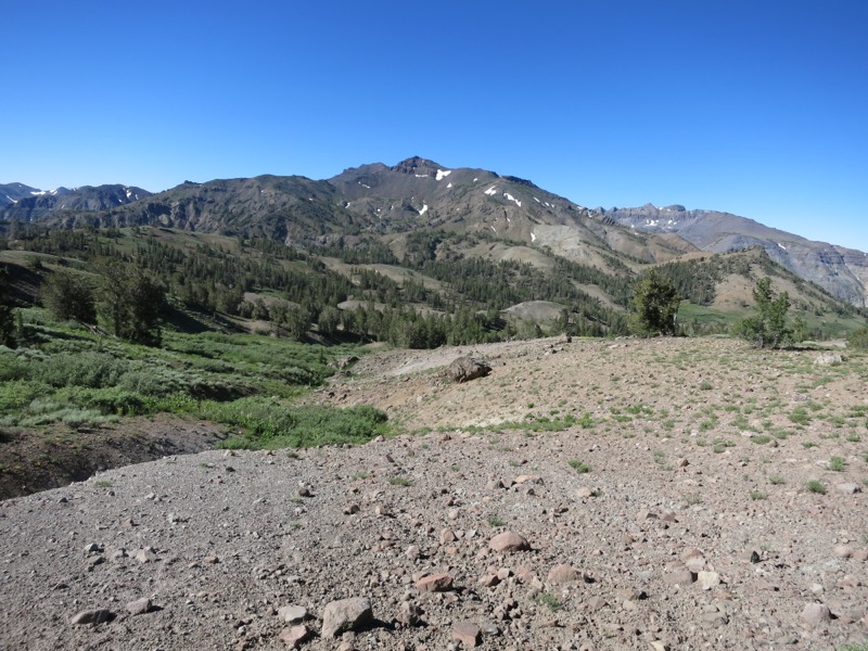
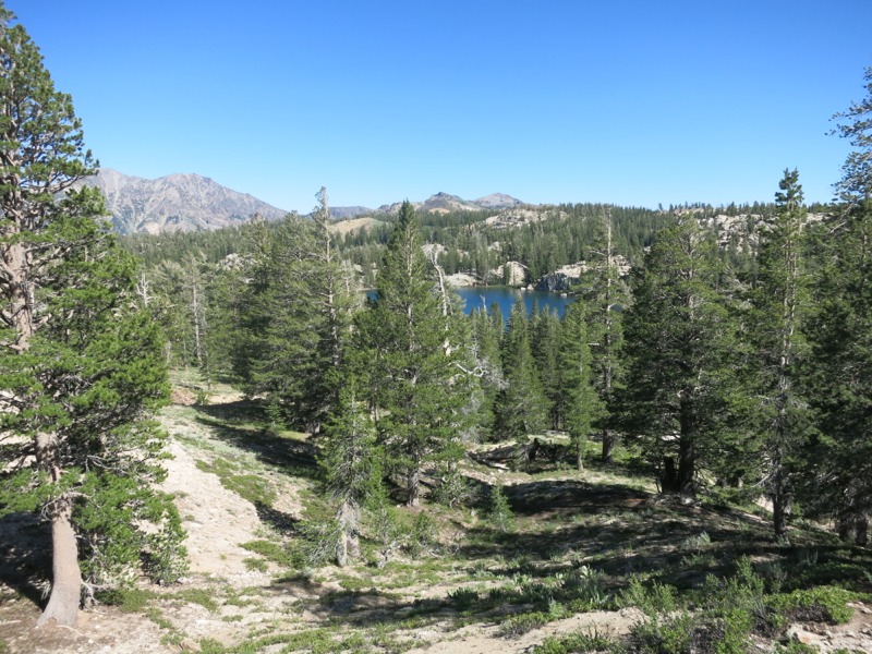
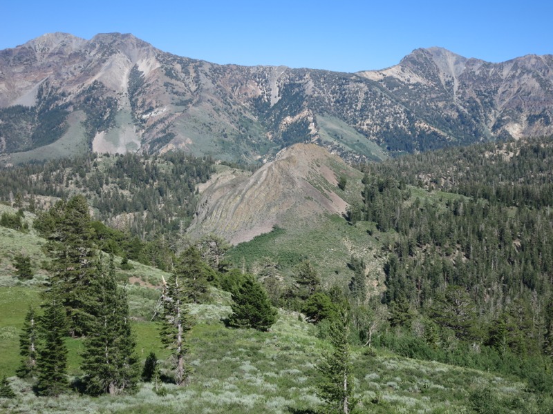
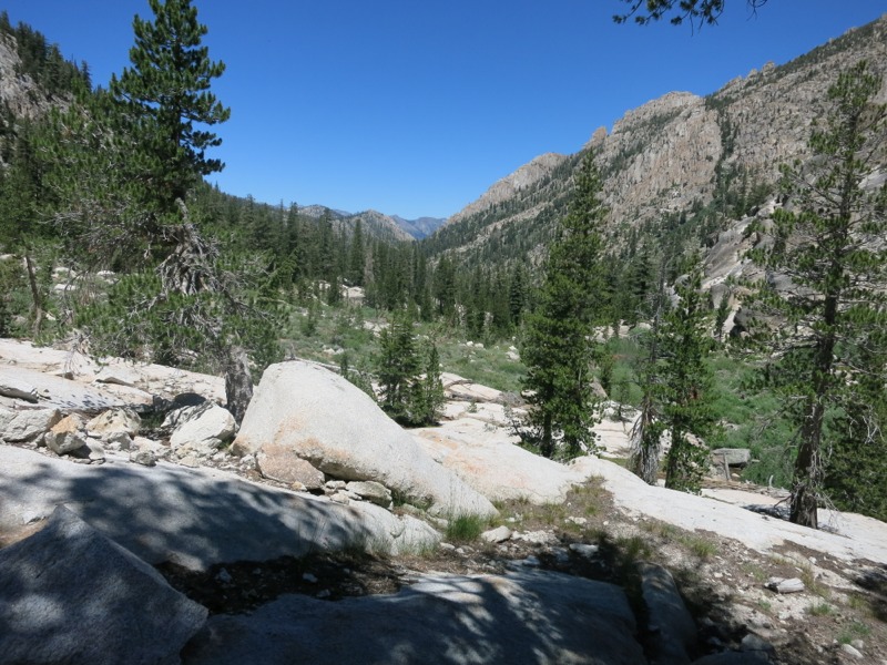
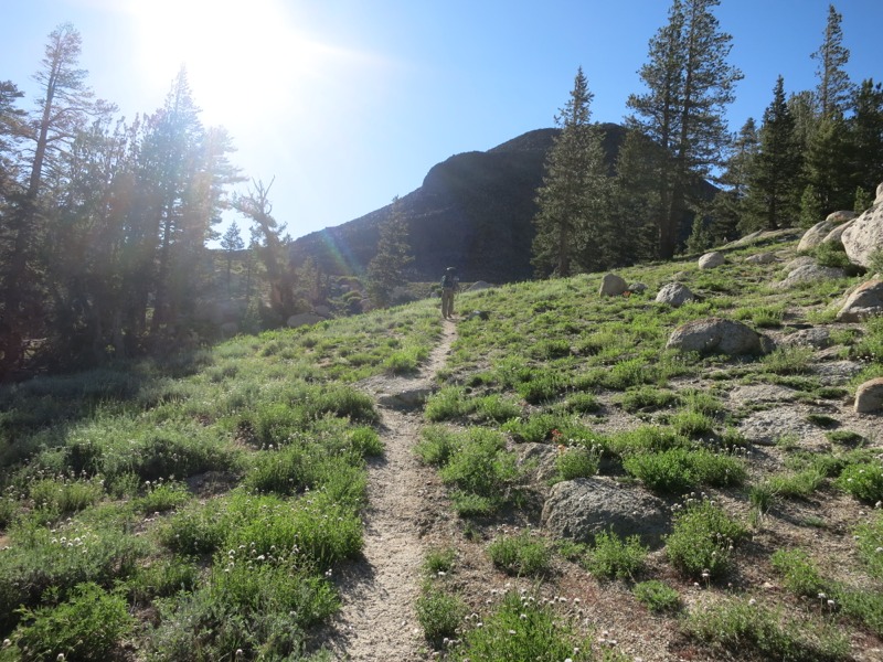
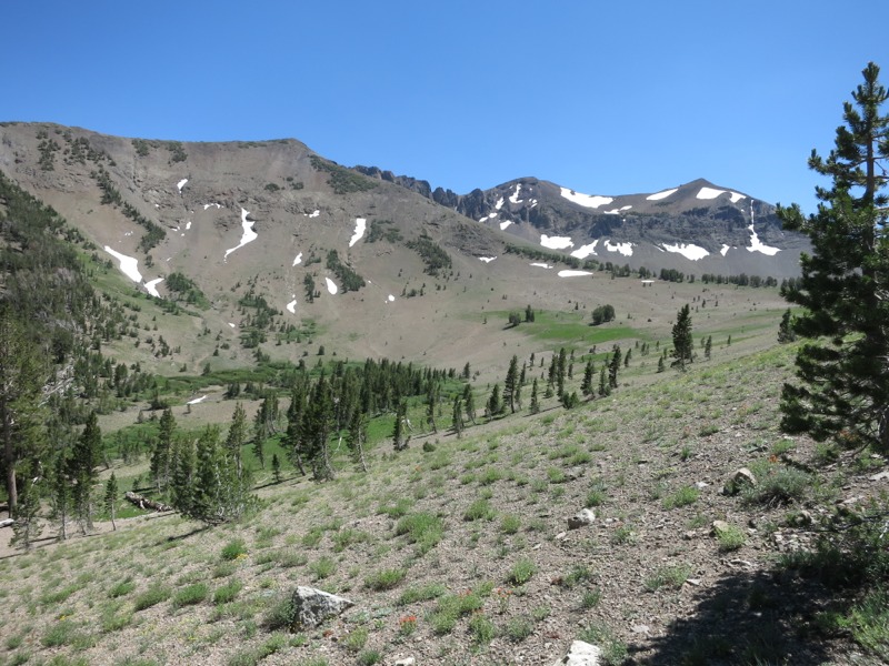
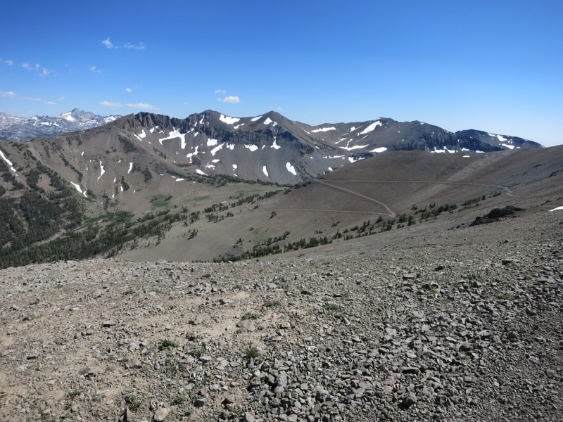
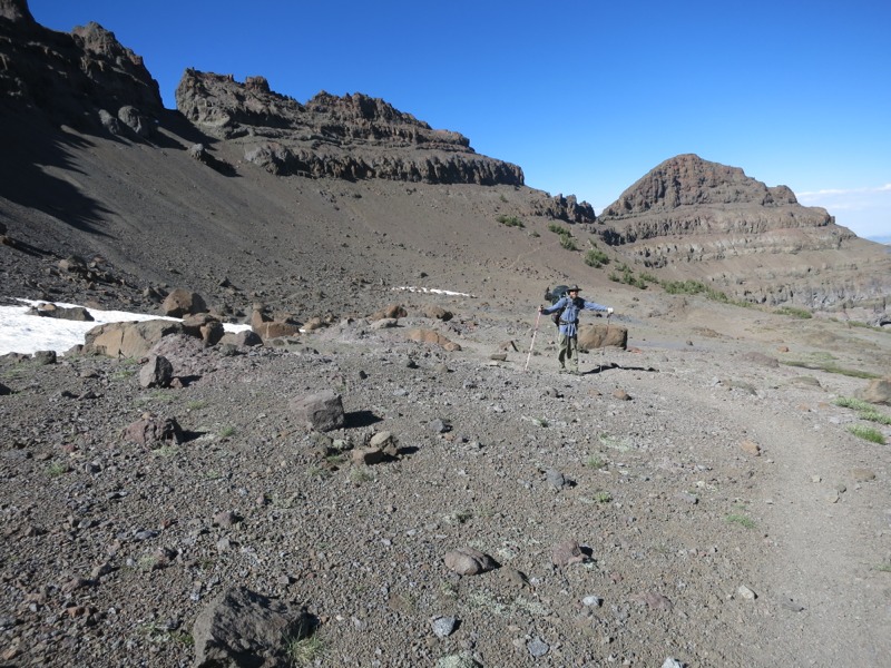
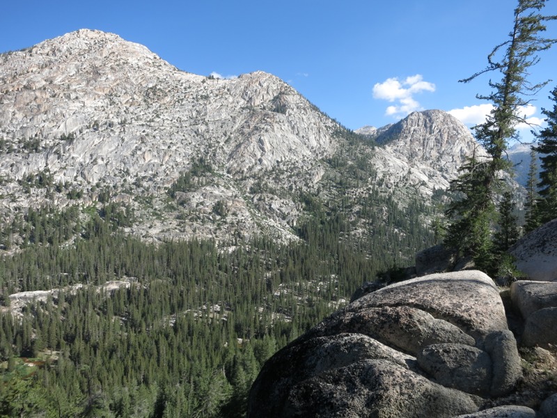
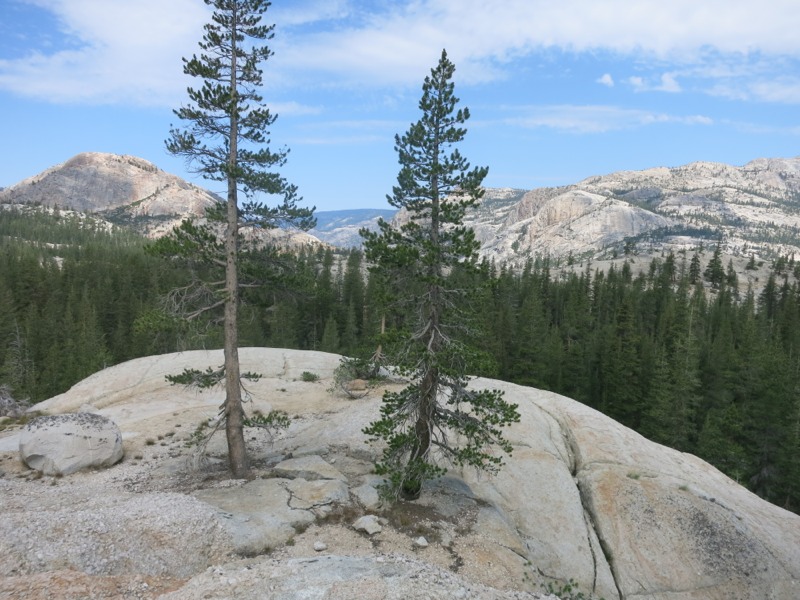
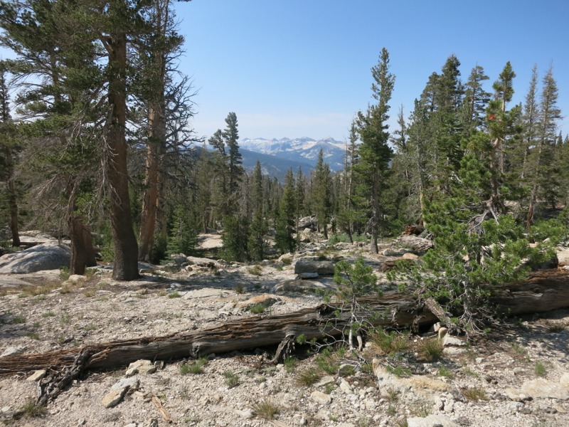
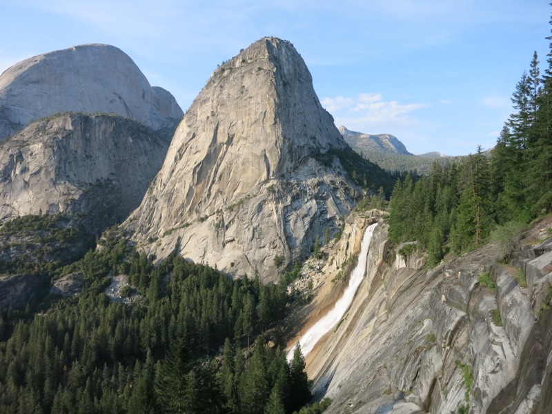
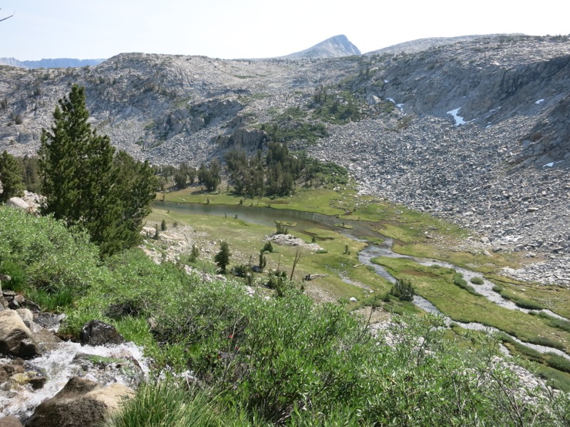
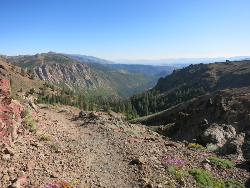
Today was one of the tougher mornings I’ve had. I didn’t sleep too well and I seemed to be sore everywhere for some reason. Town is tomorrow, though, and I wasn’t going to let some aches hold us back. The cereal we received yesterday from the trail angel was a wonderful change from our standard granola. Once we scrambled up the sandy slope back to the trail we headed along an exposed ridge for a while before dropping down to boulder-filled pine forest. After a few miles we started up again, hiking above treeline to skirt a rock formation called The Nipple with expansive views down onto the big reservoir below.


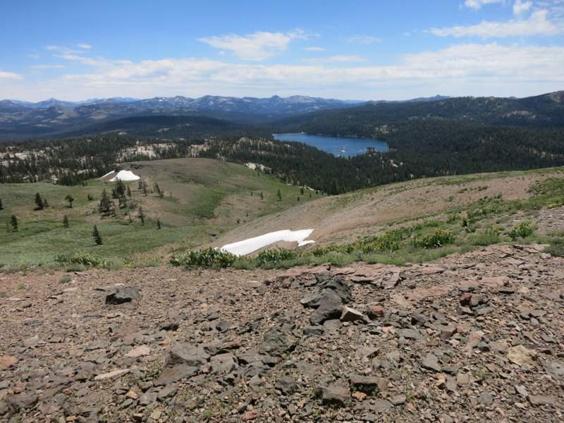
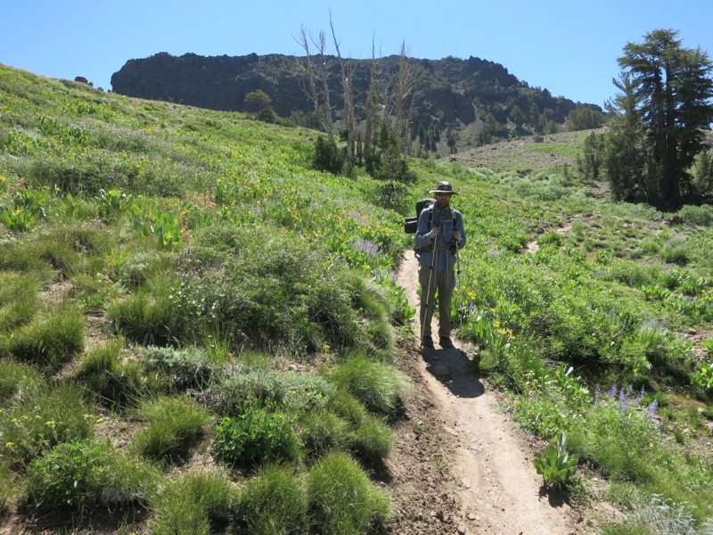
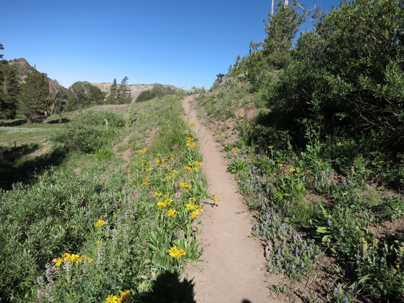
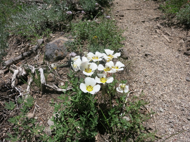
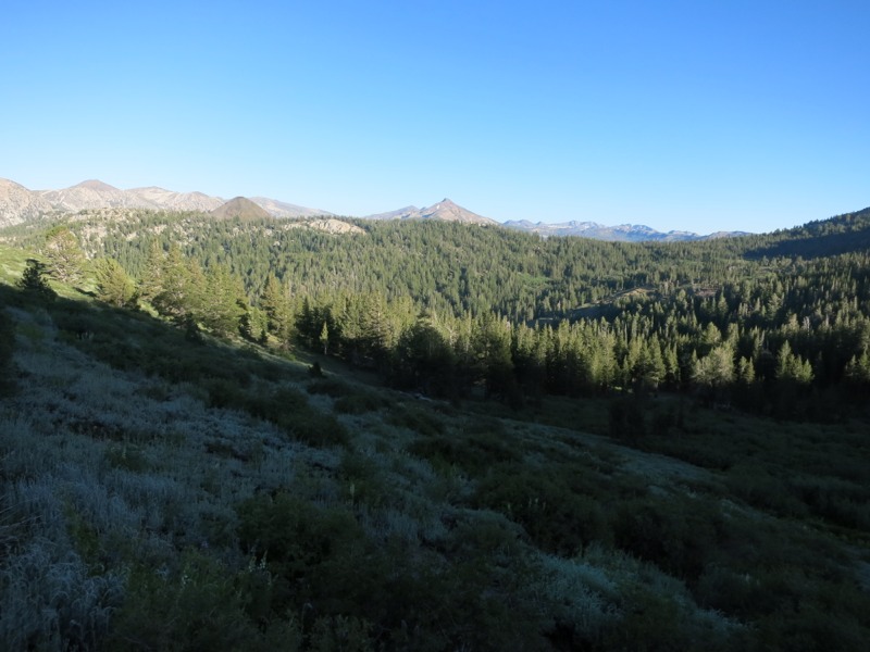
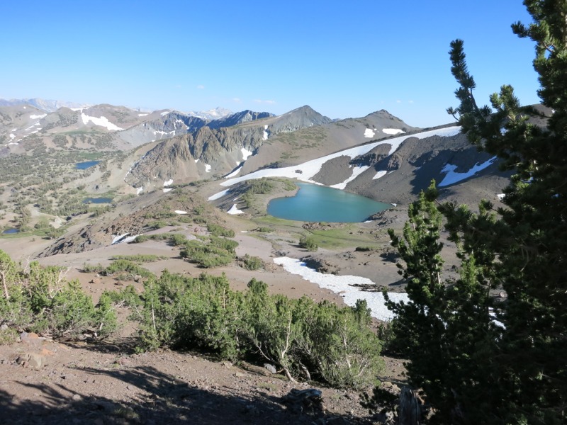
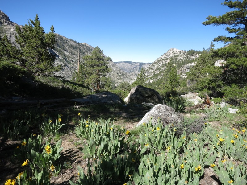
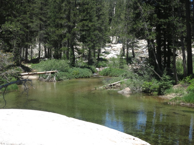
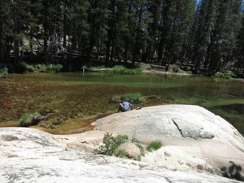
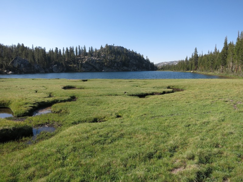
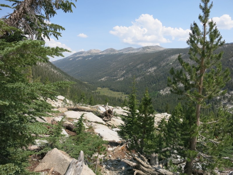
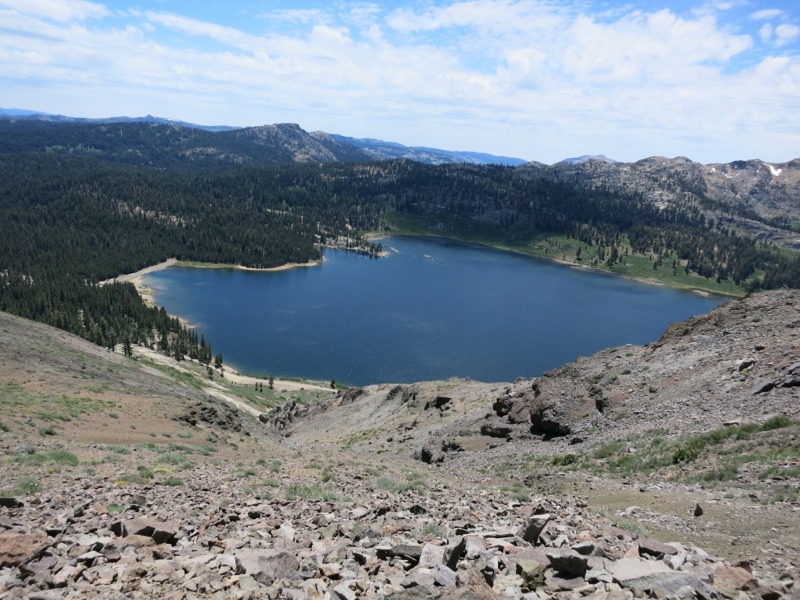
After coming down off the ridge we took a short detour to a nearby lake and deserted campground for lunch. Some food and a quick nap did a lot to make me feel better. We set off again somewhat refreshed and anxious to knock down the remaining miles between us and town. We climbed through forest for a short while before coming to a flower-filled canyon. Hummingbirds were everywhere. The skies were clouding over and we got a few sprinkles, but it let up pretty quickly.


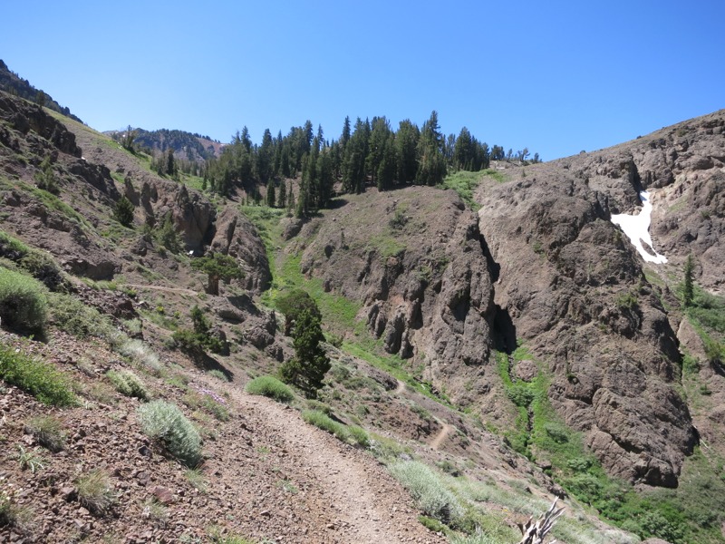
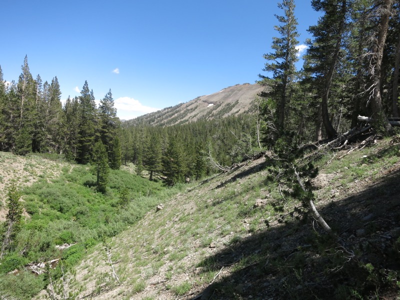
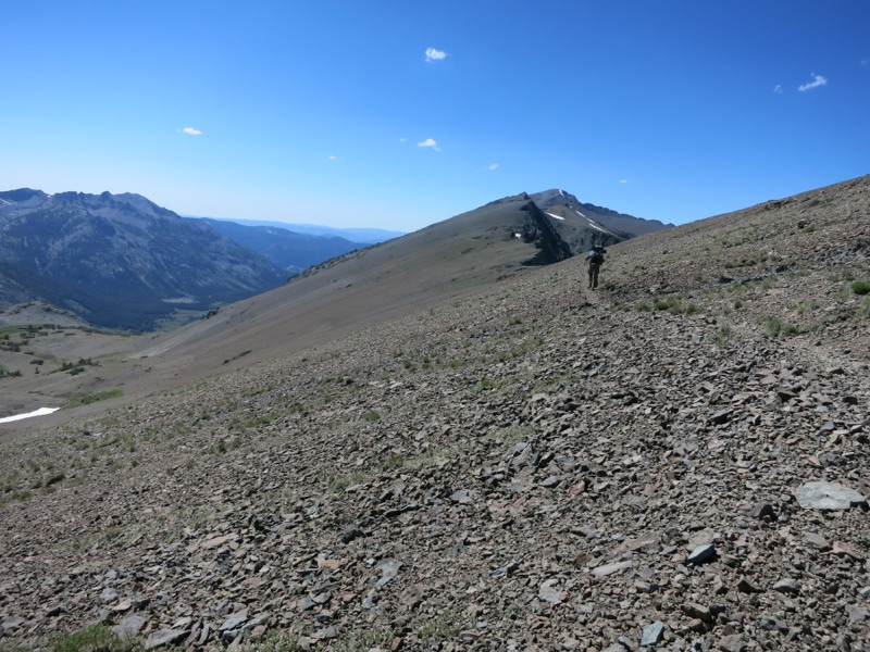
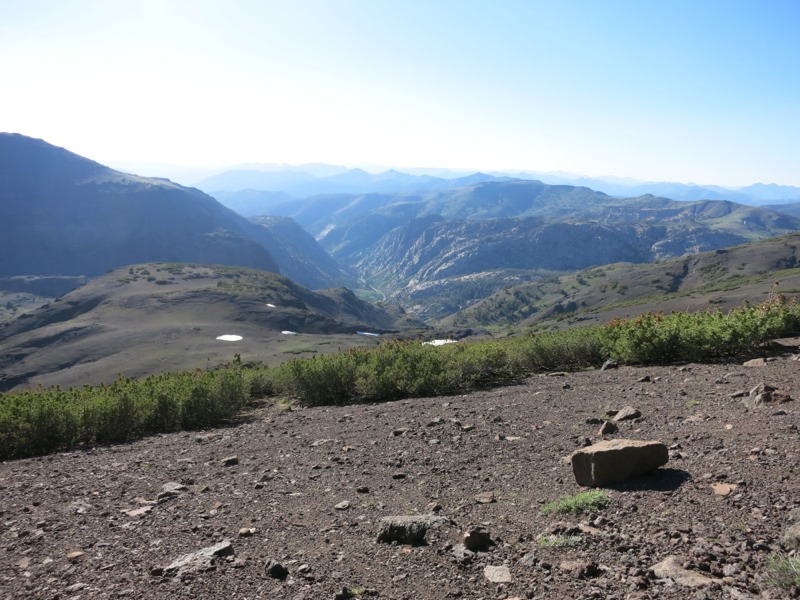
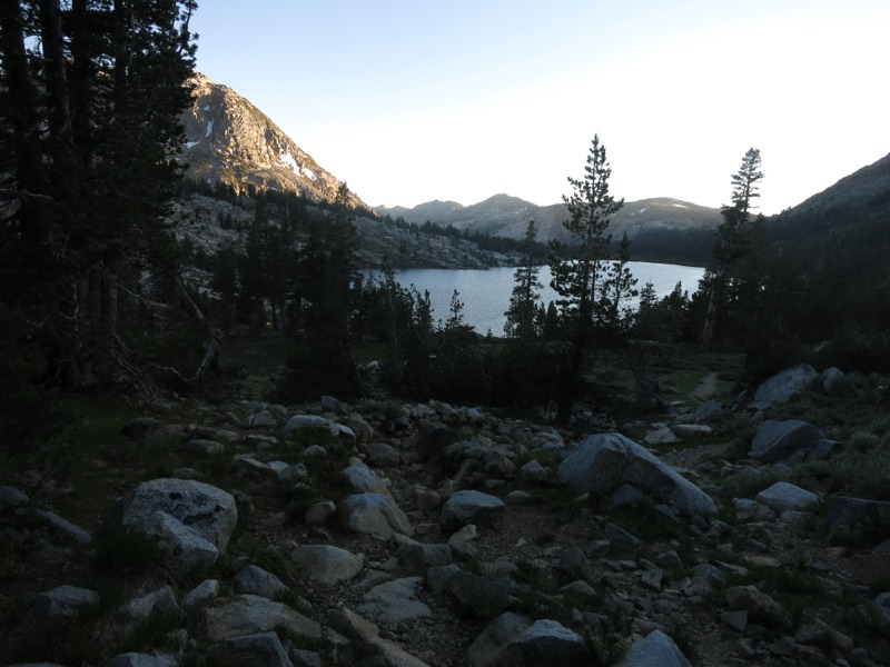
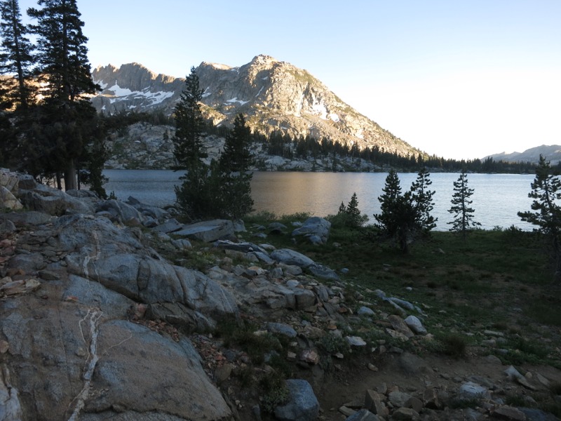
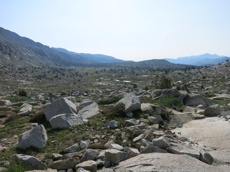
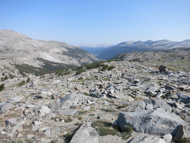
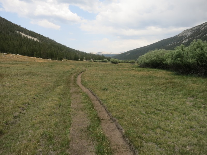
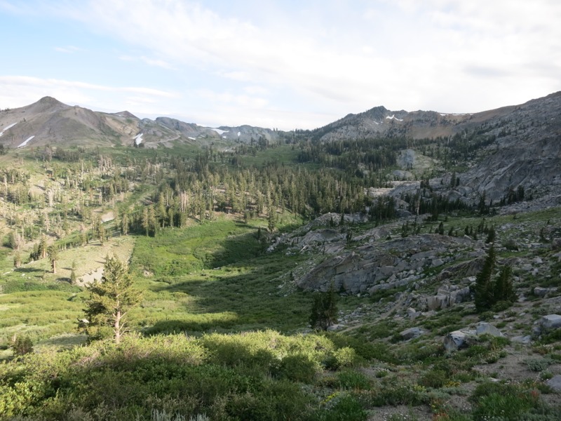
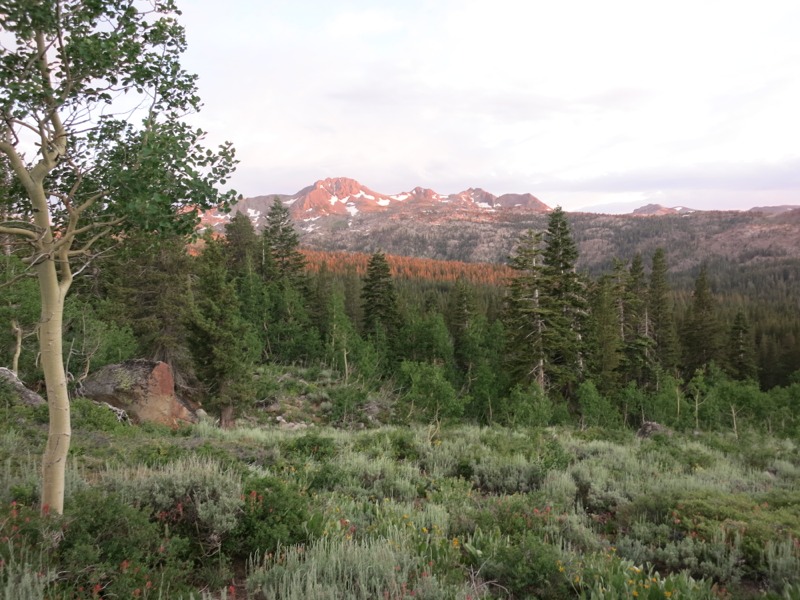
The climb out of the meadow was steep and winding, taking us back and forth as we rose. Near the end we climbed over the steep east side of the Elephant’s Back, a peak near Carson Pass. In bad years this can be a tricky, snowy traverse on a steep slope after most hikers have already sent home their ice axes. As with most obstacles this year, it wasn’t as much of an issue – the snow came right down to the trail but ended there. A little more climbing brought us to the crest and then it was all downhill to the highway pass. The trail abruptly turned into a four-lane hiker highway clear of debris and rocks. We strolled down the last few miles to the road and the facilities there.


We had heard that we could get water at the visitor center but it was long since closed when we arrived. Pit toilets and trash were consolation luxuries. We crossed the road and hiked west a little way, looking for where the trail picked back up. Another parking lot marked the spot and as we hunted around for a water spigot a family camped nearby called us over. They quickly solved our water problem by filling us up from their own supply, saving us from having to hike another two miles to a little pond.


More than that, though, they fed us massive spicy hot dogs with kraut, soda, and gave us a big bag of nuts to carry up the trail with us. We sat in yard chairs next to their sweet tricked-out camping van and talked about backpacking and our trip while we ate. They were super nice and it was such a treat at the end of a hard day and a hard section. They made us feel very welcome. It reminded me of camping with the family at home, with all of us sitting around the fire with our snacks and something delicious cooking in the Dutch oven.

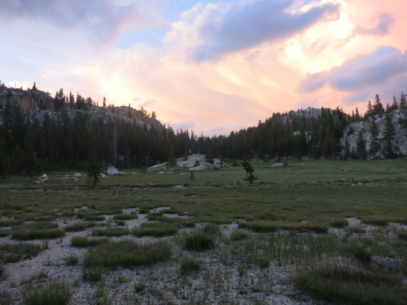
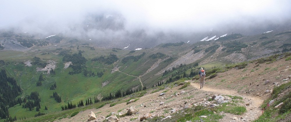
Finally we headed up the trail to find a spot for the night. It took a little longer than we had expected since we wanted to get away from the highway. By the time we were away from the road noise the terrain had gotten steep and choked with plants. After a while we pulled over to a grassy flat spot and threw up the tent against the looming clouds, hoping not to get rained on.

– Posted from the PCT

Location:Pct mile 1080

Day 82 – near Wolf Creek to past Pennsylvania Creek – 19 miles


We didn’t have much morning sun down in our tucked-away campsite. We packed up, scaled the slope back up to the trail, and headed north. The trail seemed to go up and up on our way to Tryon Peak, where we crossed a saddle and started down. It wasn’t a terribly steep climb but it was one where we could see the trail high above us. Sometimes it’s tougher when you can see where you need to end up.


Our reward was crossing over into the Mokelumne Wilderness, where we descended past Noble Lake and skirted the edge of the canyon of the same name. It was choked with flowers of all sorts in between streams that trickled off the red craggy rocks. It was gorgeous. The sheer volume of wild flowers reminded me of be meadows on the Wonderland trail – lupine and scarlet paintbrush as far as the eye could see.


We rounded the head of the canyon and started up the other side on our way to Ebbetts Pass for lunch. Along the way we met a few folks headed southbound. One group shared the good news that there was trail magic at the highway pass. That got our feet moving quickly! We stopped to fill up on water before we reached the road and met a few gentlemen out looking at flowers. They were curious about the trail and the plants we had seen and it was fun to chat with them and answer their questions. It’s always gratifying when people are interested in what we’re doing and we love sharing our experiences with them.


After another easy mile we reached the highway and, sure enough, a trail angel was parked there handing out food. We sat in his chairs, sipping on bottled water so cold that it was partly slush (what a treat!) and chatting. He shared delicious mud pie bars, chunks of frozen fruit, and bags of cereal that were something besides granola. To a couple of hikers developing food fatigue at what’s left in our bear cans, this was heavenly. I foolishly didn’t get his name – blame the distraction of food, I guess – but if you’re reading this right now thank you again for the snacks and the conversation! It was a big morale boost and just what we needed to power through the rest of this long section.


After this wonderful break we headed up the trail a little to Sherrola Lake, where we finished our usual lunch chores of filtering water and doing laundry. As I was wetting down our clothes I noticed that what I had thought were tiny fish were actually tiny shrimp-like swimmers. It was neat to watch them scoot around. We hit the trail again soon after, prepared for what could be a tough afternoon.


In a nice contrast to yesterday, though, what I had though would be difficult terrain turned out to be pleasant. We had some steep ascents but they were mostly brief. The scenery was incredible. We had wonderful views back to the peaks at the pass, and we were hiking nearly in the shadow of a ridge of craggy red pinnacles that stood like towers. The boulders scattered around looked like a huge hand had squeezed a bunch of little rocks together until they fused. Unless I’m misremembering my 8th grade geology, this means that they were sedimentary. A new flower started showing up in big numbers. It was purple and fuzzy and I think it might have been a kind of hyssop, or something else from the mint family. The bees were having a field day with it.


On the horizon we saw a huge plume of smoke towering over a haze. It looked like a volcano erupting. A southbound hiker we passed this morning had made mention of a fire and we’re anxious to learn more about it. Another hiker we passed said it was called the Reno fire, so maybe it’s too far east to affect us.


I had an odd experience at one point this afternoon that underscores how far out of touch we are with normal civilization. As we turned a corner and headed down to a stream I thought I smelled something perfumed – like soap or laundry detergent or deodorant. I didn’t know where it was coming from until we reached the bottom of the hill and heard a bunch of people in a campsite off in the woods. I was actually smelling them from way off! That’s how badly we need showers.


We had nearly reached our goal for the day when we started passing trickles of water coming down off the cliff face. Remembering yesterday evening and how we were a little stranded when we were ready to stop, we decided to end a little early. Below one of the trickles was a nice flat sandy patch in among the wildflowers and we set up camp there. The bugs are almost completely absent, so we decided to cowboy camp again. It’s nice to be back under the stars again!

– Posted from the PCT

Location:Pct mile 1059

Day 81 – Sonora Pass to near Wolf Creek – 22 miles


We packed up first thing this morning and headed back to the picnic area at the highway to have breakfast at an actual table like civilized people. As we ate a few cars pulled up to drop off hikers for various trips. One man out for a day trip cheerfully agreed to haul out our garbage, which by this point in the section was becoming a burden. He had given a ride to a hiker headed to Mt. Whitney and we all chatted for a bit before they set off. Soon it was time for us to go, too, and we hit the trail.


We started off with a climb up the slopes of red Mt. Sonora, twisting and turning and switchbacking up. The profusion of flowers was incredible – lupine, aster, penstemon, mule-ear daisy, and a dozen others I don’t know the names for. We reached the top of a ridge and started down, completing our last stretch of trail above 10,000 feet. We were heading back into granite territory for the moment and the trail became rocky instead of smooth and sandy.


At a corner of the trail right up against the mountain we encountered a trail crew cleaning up after a rockslide. We thanked them for all they do. It’s amazing that there haven’t been more sections of poor or dangerous trail in over 1000 miles, but they are few and far between. As we left them we headed down a section that was little more than a trench filled with large rocks. This must be the next job on their list!


Later we came across a group of eight or ten people out for a section hike from Ebbits Pass to Sonora Pass. They had lots of questions about our trip and we were of course happy to chat for a while. Soon after that we passed a couple from South Dakota out on the same leg. We admire people who come straight from the flatlands to hike at elevation. It’s tough enough even with acclimation!


The rest of the morning was a gradual descent to a seasonal creek where we had lunch. The trail was alternately rocky and smooth and we stepped over many trickling streams along the way. The group had warned us that the bugs would be bad as we got further north, but except for a bunch of flies buzzing around we didn’t see many yet.


We had a tough afternoon. Our elevation profile said we’d have a tough uphill followed by a gradual downhill to the end of the day, but it seemed like we climbed more than we dropped. It was hard to complain too much, though, since the trail took us nearly to the top of a scenic mountain and through some beautiful, flower-choked meadows. We saw our first sign of bears in our entire hike through the Sierra when I came across a single bear print on the trail.


As it started to get later we decided to go on until we made at least 20 miles, then to look for a place to camp. Once we reached the 20-mile mark, though, there was no water and no flat ground to be found on the steep slopes we were traversing. We had no choice but to push on, thinking about all the little creeks we had crossed back in the meadows. Eventually we came to a little trickle and, more importantly, a flat spot a little ways further down and off the trail. We jumped on it and had camp set up in record time. This was a tough day physically and mentally. Tomorrow should be a little easier in terms of terrain, and then we’re only a day and a half from dragging our dirty, stinky, hungry selves into Tahoe.

– Posted from the PCT

Location:Pct mile 1040

Day 80 – Dorothy Lake Pass to Sonora Pass – 20 miles


We had a fairly uneventful morning today. The mosquitos were swarming as has been the norm these past few days, but as usual they weren’t biting too badly as we packed up. We started off down the trail for an easy 9 miles with very little climbing. We navigated around a few creek crossings and over the ever-present rocks and boulders. With no fanfare and not even a marker, we passed the 1,000 mile mark of the PCT. Only 1,650 more to go!


Mid-morning we passed a ranger going the other way and got our permits checked again. She didn’t ask about our bear canisters, which I thought was strange until I realized that we had left Yosemite yesterday night and were no longer required to carry them. We chatted for a few minutes about MN and the BWCA before going our separate ways.


We are approaching Sonora Pass, the start of the northern Sierra, and the landscape is already starting to change. As we neared our lunch spot at the creek in Kennedy Canyon the ridges around us turned to weathered red volcanic rock instead of the white craggy granite we’ve become used to. It was nice to have a change in scenery. We are both dragging a little bit today – last night was a late one, we’re in the middle of a difficult section with a much-anticipated town stop ahead of us, and we’re worn out from being at high altitude for weeks. After the pass we have one more trip to 10,000 feet before we drop below it for the rest of the trail.


After lunch we started on a long climb up through the pines. The sun was hot but the grade was gentle at first and on good gravel trail. We put our heads down and slowly worked our way up. Before long we had hiked above the treeline to the base of a ridge and reached an abandoned jeep road. After heading up one switchback the hiker PCT split off from the stock route and headed across and up the ridge. The stock PCT followed the jeep road up the rest of the switchbacks to reach the top. We decided to take the hiker route for some reason and set off across the faint trail, hardly more than a mark in the side of the ridge. We made it to the top with no incident after crossing some dicey sections, but in the end it probably didn’t save us any time over the other route.


At the top of the ridge the scenery behind us was spectacular. The pines of Kennedy Canyon were spread out below us, flanked by dark, weathered ridges that looked odd after weeks of granite cliffs. Beyond the southern ridge we could see a landscape of Sierra peaks, contrasting bright white and dotted with snow. From this viewpoint it’s hard to imagine that we hiked all the way through them.


The amazing scenery continued as we hiked on towards Sonora Pass. Once we reached a saddle on the ridge we could see down into the Emigrant Wilderness on the other side. We hiked along the ridge, fighting the gusting wind, for the next 6 miles. Along the way we crossed small snowfields (probably dangerous in a normal year) and one hairy rock scramble where the gravel started to give way under Keith’s feet. The entire character of the landscape had changed so quickly. Being up on a ridge meant no water sources, but it also meant that the mosquitos were gone.


Eventually we reached the start of the descent towards the highway pass. The trail plunged down over 2 miles, winding back and forth across the hillsides. Now we started to see flowers and a few trickles of water, but still no bugs. Soon we were back in the trees and then we were at the highway. The pass was a little disappointing – no water or trash, but we hadn’t expected much. We debated hitching to a nearby resort with a restaurant, but they were full for the night and we knew leaving the trail would mean a late start tomorrow.


The trailhead didn’t allow overnight camping and we didn’t want to camp right next to the highway anyhow. After some discussion we headed backwards up the trail (blasphemy!) a few tenths of a mile to a flat spot in the trees. The bugs were still gone so we eased our disappointment over not having a real bed to sleep in by cowboy camping for the first time since before Muir Pass. It might not sound like much consolation but we were excited to sleep out under the stars again. I set up camp while Keith backtracked further to get water. We were both very glad to crawl into our bags. It was a long day and we’re both exhausted, but glad to be one day closer to town and to have had such an incredible afternoon.

– Posted from the PCT

Location:Pct mile 1018

Day 79 – Rancheria Creek to Dorothy Lake Pass – 20 miles


We started today off by walking along Rancheria Creek for a few miles. Eventually we crossed it by way of a rock-hop – a nice alternative to wading across and getting our feet wet first thing in the morning. Our guidebook and maps had said that this could be a difficult ford and we were glad to get across dry. This took us into our first climb of the day up out of Kerrick Canyon. As usual, it was rocky and semi-steep and we were sweating in the hot sun. At the top we took a break for a snack. The nice breeze kept the bugs off. From there we had a steep descent into Stubblefield Canyon, where we repeated the process: cross the creek at the bottom (shoes wet this time) and start a long, sweaty climb out. This would be our last tough, prolonged climb of the day.


We dropped down off Macomb Ridge and down into a wooded area, passing a chain of still lakes. By now we were thinking about lunch and had decided to head for Wilma Lake. When we got there, though, the bugs were so bad that they drove us on a little further. We skirted the lake shore and the reeds in the shallows. There were hundreds of bright blue damselflies clinging to the long grasses. With all the mosquitos they must have been feasting.


We pushed on to Falls Creek and waded across to the perfect lunch spot – a massive granite boulder on the other side. The damselflies were out in force here too, and they helped take care of whatever mosquitos we didn’t smoosh first. We encountered our first horseflies but they were easier to keep watch for since they were so loud. We took advantage of the lunch break to dry our shoes and socks from the ford, but there was no telling how long they would stay dry after we got going again.


Back on the trail, we faced an easier afternoon – a long, gradual hike up to Dorothy Lake Pass. We followed Falls Creek upstream through pine forest, huge green swampy meadows, and over stretches of granite rock. Our feet did get wet again as we slogged through mud and saturated grasslands in the meadows – swamp water, the best kind of water to ferment in your already-filthy socks and shoes. The hike reminded me a little of our walk down Lyell Canyon to Tuolumne in reverse, with the creek meandering along right net to the trail.


At the very end of the day after a more strenuous climb we reached Dorothy Lake – a huge lake set in between the cliffs, one of the largest we’ve seen so far. We skirted its northern shore and climbed the last leg to the pass immediately behind it. Another few minutes of sweating brought us to the top where we could see more lakes on the other side surrounded by sparse pines. The whole area reminded us of the high Sierra we had just left, with long views of the granite-strewn landscape and tall ridges surrounding us. It was a nice change from the landscape of the last few days – which, although beautiful and scenic, hadn’t changed much. We made camp under a few pines to keep the dew off and jumped into the net tent. The bugs are still around but thanks to the rising wind and chilly air they won’t be bad for long. It’ll be a cold night tonight if it stays windy…

– Posted from the PCT

Day 78 – Miller Lake to Rancheria Creek – 18 miles


We had lots of condensation on the tent this morning – the consequence of camping out in the open meadow near a lake. Luckily there were no hills to hide us from the sun and we were able to drape our bags out to dry. We started with a nice descent into the beautiful Matterhorn Canyon, where we crossed a few creeks and started up our first big climb of the day. The initial ascent to Benson Pass was steeper than the last part, but all of it had us working hard. We were glad we only had to go to 10,000 feet.


We started down the other side in a steep, rocky descent. We had to be careful not to misstep and potentially roll an ankle or worse. The narrow Kerrick Canyon was beautiful, bounded on both sides by granite cliffs. The trail was a bit of a challenge, though, as we found our way over slabs of granite that didn’t hold a tread or footprints. We had to look for little cairns, or the telltale signs of trail maintenance: large blocks marking a curve, or small stones fitted together as trail tread. We crossed a few more creeks as we descended to our lunch spot. Benson Lake was a large body of water ringed by ridges on three sides, with a lovely sandy beach to the north. A stiff breeze blowing across the lake kept the mosquitos away.


After lunch we headed back into the woods and right away began our second big climb of the day. The bugs returned in force and the heat was oppressive. We mitigated it a little by wetting down our bandanas but there was only so much we could do on such a steep climb. The path was beautiful – up the end of the canyon, seemingly towards a rock wall, we wove through small gaps between the granite and suddenly came upon lake after still alpine lake. It was a nice reward for all the effort.


Finally we started down into Kerrick Canyon, hiking alongside Rancheria Creek. The bugs got bad right away and we had to hike with headnets on – a little stuffy, but a small price to pay for our sanity. We rolled along, rising and dropping, until we reached a flattish area under some trees where we set up camp. Hopefully the pines overhead will prevent a replay of this morning and all the damp. Today was a bit of a tough one, as our second day out of town tends to be – our packs aren’t noticeably lighter yet but we’ve already worked through the energy we gained back from good food and rest. Tomorrow should be an easier day with less climbing and we’re hoping to make some bigger miles.

– Posted from the PCT

Location:Pct mile 978

Day 77 – Tuolumne Meadows to Miller Lake – 18 miles


Another early morning. We were so ready to hit the trail today. It’s great to see people enjoying the outdoors and supporting the national parks, but we are not used to being around so many people. Two groups of people arrived at the backpacking camp around 1 and 2 AM when most of the rest of us had been asleep for 2-3 hours already. This is understandable given that today is a holiday, but one of the groups was making no effort to be quiet as they put their tents up 10 feet from ours. We got some small revenge when we got up at 6 in the morning. We are so anxious to be out on our own again.


We had breakfast at the lodge and coincidentally were seated with one of the men we had dinner with last night. He announced to the rest of the table that we were the thruhikers he’d been telling them about around the fire last night. It was cool to know that we were such an item of conversation because we’d had a great time talking with them the previous night. We did this morning, too. It’s fun to be around people who are so curious about something we love doing.


After breakfast we caught a shuttle to the trailhead, hefted our ridiculously heavy packs (7 days of food for two ravenous hikers) and set off up the path towards Glen Aulin camp. Before long we met the couple we’d had dinner with last night – another happy coincidence! We would see them again at our morning break overlooking some enormous granite cliffs. The rest of the hike to the camp was mostly downhill, following the Tuolumne River past some beautiful waterfalls.


At the camp we did our laundry and checked out the solar composting toilets, then got back on the trail to make our miles. It was nice to be back on the sparsely-traveled PCT. The weather was warm but much cooler than it had been in the valley. We climbed gradually through pine forest broken up with long stretches of granite slabs. Huge fluffy clouds built up on the horizon and as the afternoon wore on they got larger and more unsettled. As with the previous few days we got thunder and a few sprinkles here and there…enough to pull out the rain gear and play on-again-off-again every 30 minutes.


We crossed Return Creek, a tricky, feet-wet 2-part ford through a fast current. A while later we crossed another stream that was a tricky rock hop. I slipped and went in butt-first, dragged off-kilter by a heavy pack. I was a little worried about my gear getting wet but this is why we store our clothes and bags in a waterproof liner. Another long climb gave time for my clothes and shoes to dry off a little. Eventually we reached the meadow around Miller Lake and decided to stop for the night.


We put up both tents as protection against the still-unsettled weather and the swarms of mosquitos, which had been surprisingly bearable all day until now. As the sun set it lit up the clouds with bright hot pink. It’s wonderful to be out here on our own again, with no one to bother us and no one to worry about bothering. This is why we love the backcountry. Where else could you have a sunset like this, over this incredible scenery, with frogs singing in the background, and not have to share it with a crowd of other people? Maybe we’ll end up sharing it with a few bears tonight.

– Posted from the PCT

Location:Pct mile 960

Day 76 – Yosemite Valley to Tuolumne Meadows


We had a leisurely day off today. We slept in a little, got breakfast at the cafeteria here, and sat in the shade and took advantage of the free wi-fi. Eventually we would have to either hitch back to Tuolumne or catch the 5 pm shuttle. Only a hitch would get us back in time to pick up our resupply at the post office before it closed for the 4th. We got a tip from another hiker, Stumbling Beef, on the best place to hitch in the park.


We caught a shuttle to the main visitor center where we dawdled for a bit to watch a movie about the park’s geology and history. Then we jumped on another bus to the west end of the park where the two main exit roads came together. Also on the bus was Rabbit, a hiker we haven’t seen since Kennedy Meadows a month ago. It was nice to talk with him for a bit and we hope to see him again down the trail. We had to cut it short when the bus arrived at our stop. We jumped off right at the Merced river, which by now was wide and slow-flowing. People were swimming in it and we might have been tempted to stop and take a dip as we walked up to the road junction…except a car was pulling over up ahead and the driver was waving us over. Laurie and her daughter Erica were on their way to Mammoth and would be passing right through Tuolumne. They had seen the cardboard sign we’d made – did we want a ride? We couldn’t believe it was that easy as we hopped in the car.

We chatted for a while on the long drive up – 23 miles by trail, over 50 winding miles by road – but towards the end our eyes kept closing despite our best efforts to not be rude. We dozed until we arrived at the post office with over an hour to spare. We couldn’t thank them enough for helping us out! The guy at the counter was as happy to hand off our packages (5 in all) as we were to get them. Keith got new shoes after over 900 miles. We sorted through our meals and handed off some extras to the other hikers hanging around the store. Finally we set off back to the backpack we’d campground to make sure nothing had happened to our gear.

Everything was right where it should have been and our collapsed tent, though it had been rained on, was mostly dry. Two hiking poles and a few minutes later it was ship-shape again and we were figuring out how to fit our new food into our packs. Since it was already late in the afternoon and a little stormy-looking, it was an easy decision to stay another night. This would also let us grab dinner AND breakfast at the nearby lodge. An easy decision, indeed.

Dinner was served family-style and we were seated at a table with a mix of other people – another thru-hiker, a couple on a backpacking trip through all the high Sierra camps in the park, and someone who came up here nearly every year. They were all very interested in our hike and we had a wonderful time answering their questions. We feel so lucky to be out here and it’s fun to be able to share what we know with people. By the time we finished it was dark and cool out and we had a nice, relaxing walk back to our tent. It’s a pleasure to hike without a pack on now and then. Once we got back it was off to bed. We’re looking forward to breakfast tomorrow, and to getting out on our own again after so many crowded days.

– Posted from the PCT

Location:Pct mile 942

Day 75 – Tuolumne Meadows to Yosemite Valley – 26 miles


We were up before the sun today with a long hike in front of us. We made sure all our smellables were packed away in the bear locker. Our packs were light since we were carrying a minimum of food and gear. We planned to either catch the early afternoon shuttle back from the valley or stay there for the night and hitch back tomorrow. The trail was level at first as it paralleled the stretch of civilization around Tuolumne, then it turned to the southwest and started climbing. We had a few steep stretches as we climbed out of the Tuolumne valley and over Cathedral Pass. From there it was nearly all downhill, all the way into Yosemite Valley (except for our side trip to Half Dome).


We passed through rolling green meadows surrounded by high, pale granite peaks. In many places two or three trail treads were worn into the soft soil – an example of what high use will do to an environment. We felt lucky that the vast majority of the PCT was less traveled than this. As we started our long descent, we also felt lucky to be hiking down into the valley instead of up out of it. The JMT must be a brutal trail for the first few days before hikers get their legs in shape and their lungs acclimated. We dropped down a series of tight switchbacks, passing laboring hikers going the other way. Above us the weather was unsettled for the second afternoon in a row and we heard thunder for a while. It sprinkled enough for us to put our ponchos over our packs.


At this point it was late enough in the afternoon that we needed to make a decision: skip Half Dome and catch the afternoon shuttle back to Tuolumne? Or do the dome, finish our hike down in leisure, and stay the night? The choice was obvious, and we started searching for cell reception to call the valley for a place to stay. Lack of 3G complicated things. Such a first-world problem, to not have cellular internet service 6 miles out from the main hub of a national park…in a deep river gorge. We did things the “old-fashioned” way – by calling my mother and asking her to google the number for us. After a surprising amount of effort we hit upon the right place to call and soon had a tent cabin waiting for us in Curry Village.


Our place and plans secure for tonight, we booked up the trail towards Half Dome. Or, at least we booked it until the trail turned steep. We rose gradually out of the trees. More and more rough granite appeared under our feet as we approached the subdome. Soon we reached the bottom of the staircase – tiny, winding steps cut into the granite. Thank goodness for hiking poles. We slowly worked our way up. As we got up further the path became less distinct and more of a scramble from cairn to cairn. And then we were on top, facing the towering bulk of Half Dome. A row of twin cables stretched up the side of the rock.


We took a few minutes to admire the incredible scenery around us – all the granite domes, the ridge of Clouds Rest to the northeast, and the deep valley to our north. We could see some trail switchbacking up the canyon wall, cutting a path into the green foliage. We had the place to ourselves – pretty unusual for a summer day, but the bad weather earlier had caused the park to close the dome and probably discouraged a lot of permit holders. The ranger usually stationed there had left for parts unknown, so no one was around to check our permit either.


As we admired the scenery someone started coming down the cables from the top. It was nerve-wracking to watch as be turned around and started down backwards. When he reached the bottom we chatted for a bit and found out he had come up the opposite side via a climbing route. As though the cables weren’t frightening enough. We came up to the start of the climb, where the lines were bolted into the rock, and discovered a cache of grippy work gloves. We each took a pair and started up. I didn’t get very far -maybe 15 yards – before I started to feel uncomfortable. Heights are not my cup of tea. The granite under my feet felt slick from the thousands of feet that walked over it every year and the wind was picking up. I might have been able to make it if I had the discipline to not look up OR down, but I didn’t have that kind of restraint.


We came back down, not too disappointed, and picked our way down the tiny stairs back into the trees. Soon we were back at the junction with the JMT and on our way down again. We passed the Little Yosemite Valley backpacker camp, with its nifty solar composting toilet that looked like a two-story outhouse. We crossed over the incredible Nevada Falls and started down steep switchbacks that gave us an even better side view – the cascade framed by the granite bulk of Half Dome. Down, down, down, on hard granite trail that was slick with dust and easy to slip on.


Finally we reached the bottom and started north along the Merced River. Another mile brought us to the shuttle bus, which brought us to Curry Village and the masses of people there. It was quite a shock to be thrown into such a crowd. We grabbed a much-needed bite to eat and headed to our tent cabin, exhausted from such a long day.

– Posted from the PCT

Location:Pct mile 942

Day 74 – near Donohue Pass to Tuolumne Meadows – 15 miles


Slept much better last night in the cool weather. We were up early and on our way to the pass, eager to get to Tuolumne Meadows. The morning wasn’t super warm but it was very humid for the first time in a long time. We were sweating like pigs on the climb and driving the mosquitos crazy. It wasn’t too far to the top where we crossed into Yosemite NP. Lyell Canyon stretched out in front of us, filled with the meandering Lyell fork of the Tuolumne River.


We started down a rocky descent, criss-crossing streams and trying not to trip on loose rocks. We stepped through a lot of muddy trail and over some surprisingly tricky fords. We dropped down and down to the valley floor and stepped abruptly into the huge meadow around the creek. The sun was intense, beating down on us, and we stopped to wet down our hats and bandannas in the water. The trail from here to Tuolumne was nearly flat and we moved up it at a good pace. The crystal-clear creek was wide and deep in places. If we hadn’t been in such a hurry it would have been fun to stop for a swim.


We were beginning to worry about the weather – the ridge to the east was surrounded by dark clouds and soon we could see them dropping hazy streaks of rain. As we hurried up the trail I blew by a couple of hikers standing around. Keith had to call me back – one of the hikers was a backcountry ranger checking permits. 950 miles and we finally get asked for them! He asked us how we were liking the trail, checked to make sure we were carrying bear cans, and sent us on our way.


By now it was thundering and we were sure we would get rained on. We pulled out our ponchos…just in time for a few sprinkles. Not that I’m complaining. Heads down, motivated by the weather, we made good time to the junction with the highway. We wandered up it to the wilderness center, where we got our overnight and Half Dome permits. Only one thing didn’t go according to plan – the quota on the trail was full for tonight, so we couldn’t start until tomorrow. Not a huge deal.


We headed up the road to the grill and store, where we got tasty burgers. I was finally reunited with my glasses after we were able to convince the store that another hiker had dropped them off. What trail magic! A lot of folks on the trail helped out with this one, and more than one person stopped to ask me if I had picked them up. After that excitement, we walked over to the backpacker campground and set up our tent. After today we were a bit worried about rain and it was nice to have the privacy.


It was a good thing we got there when we did, because not long after we claimed a site the place started to fill up with hikers. Since bears are such a problem out here every campsite has its own bear box. We were much more careful tonight than usual in packing away everything smelly that might attract wildlife. Tomorrow will be an early day…I hope we can sleep with so many other people around.

– Posted from the PCT

Location:Pct mile 942