Day 95 – Packer Lake Saddle to Whiskey Spring – 24 miles

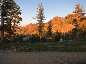
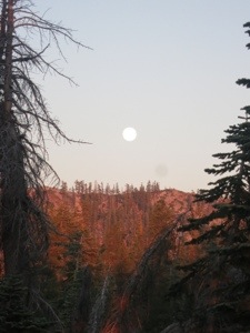
The sun woke us up this morning by painting us with heat. It had streamed the sky over the buttes with orange and scarlet. We packed up and moved up the trail into the forest to have breakfast in the shade, where it was still almost cool enough to wear a jacket.
20130807-154815.jpg

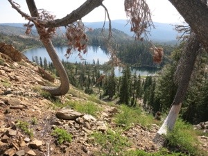
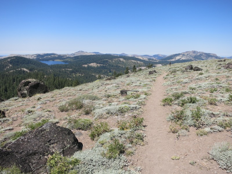
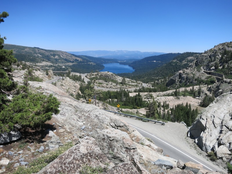
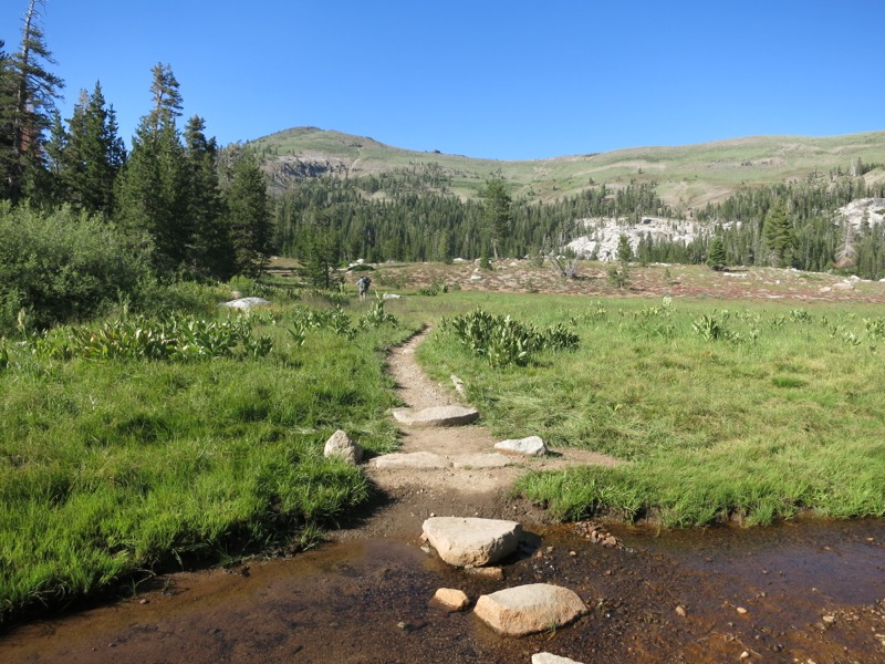
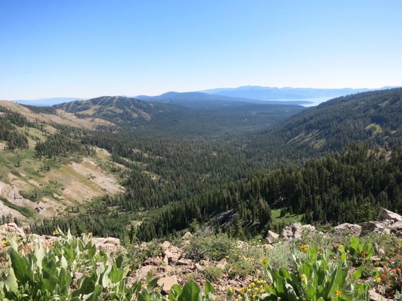
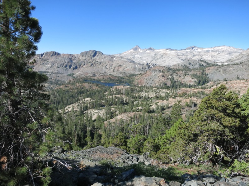
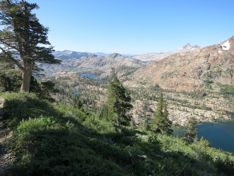
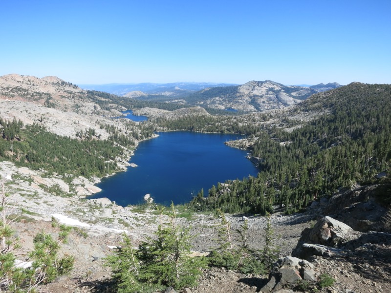
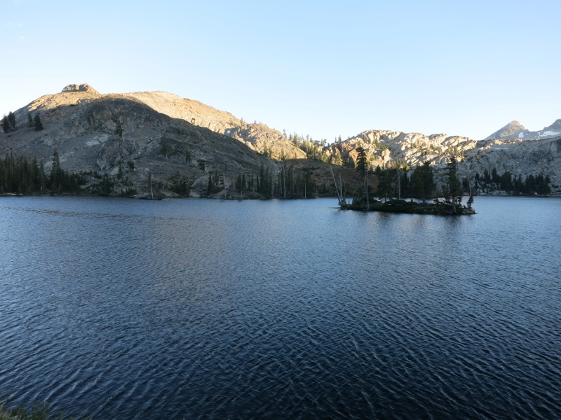
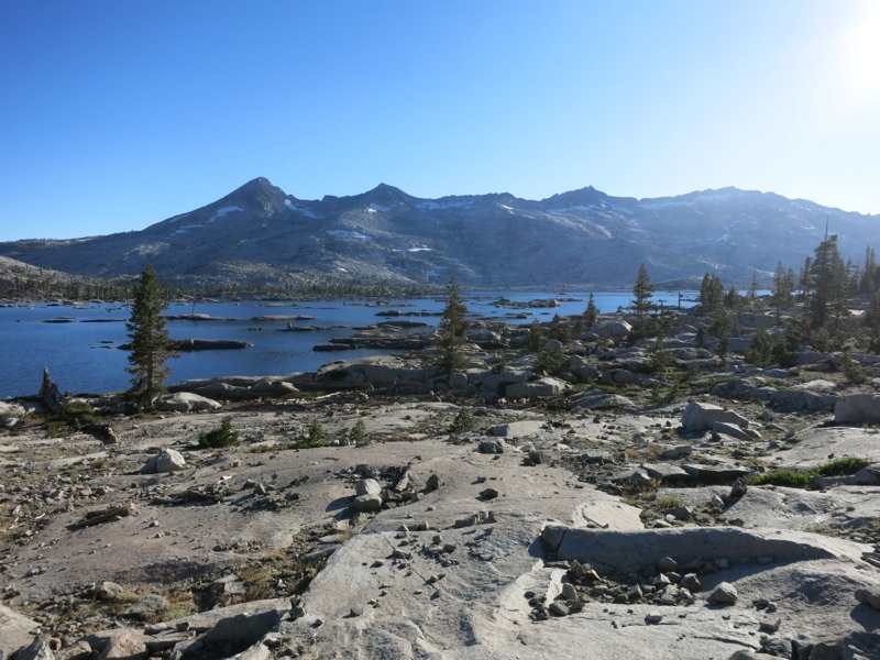
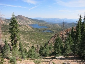
The morning consisted of another ridgewalk – a mix of slight grades, rocks, and nice smooth trail. We made great time as we skirted rocky spires and patches of dark shady pine forest. We crossed from the Tahoe into the Plumas national forests and passed overlooks high above a series of large lakes. We could see cars parked down at the boat launches and people out cruising around, leaving wake marks that followed them across the length of the lake. Towards lunch time we arrived at an intersection of dirt roads and the A-tree spring, gushing with cold water. It was super refreshing after the last few hot, exposed miles.
20130807-154906.jpg

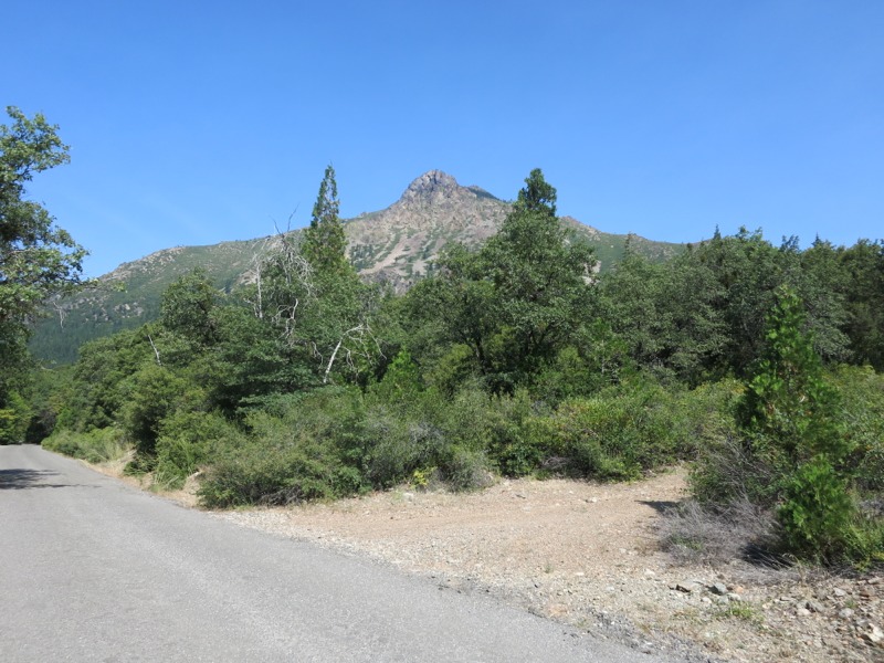
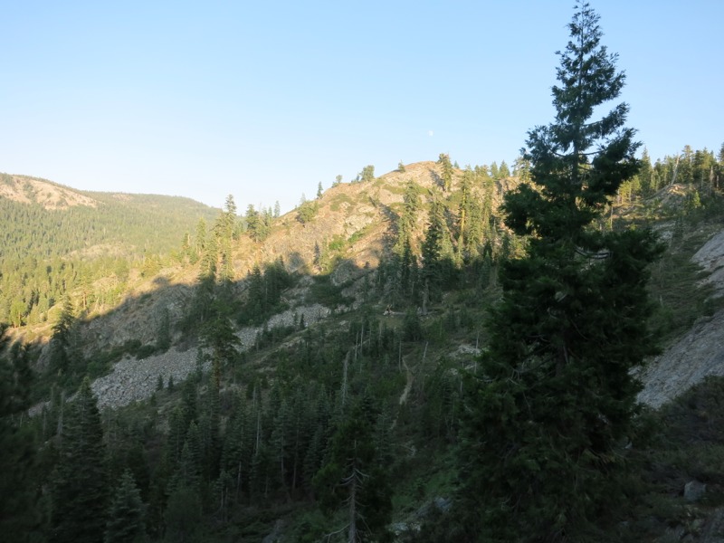
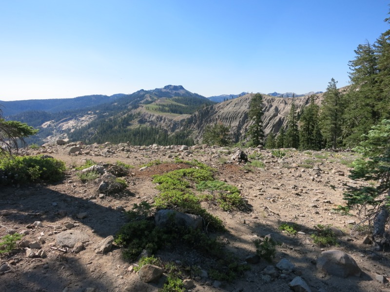
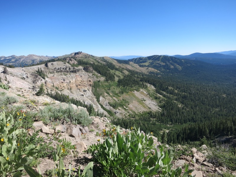
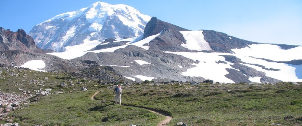
Our afternoon was much tougher and less scenic than the morning. It started with a moderate climb – not too steep and partly shaded, and we had wet ourselves down at the spring. Near the top we could see one last view of the buttes we’d climbed to yesterday from town, now hazy and indistinct in the distance. Once we got to the top of the ridge we started right down the other side and continued for a few miles through more pines. Then we started up again – and up, and up, over the course of a few miles. The trail we were on now was poorly maintained. We frequently had to get over blown down trees, which is a challenge when they come up to mid-thigh and you’re wearing a heavy pack. At times the sandy trail tread was wearing away and we had to be careful where we put our feet. Some sections were steeper than we’re used to seeing on a trail graded for stock animals. The saving grace was that the sky had hazed over, blunting the heat of the sun. We were still sweating freely but it was much better than if the sun had been as strong as it was around lunch.

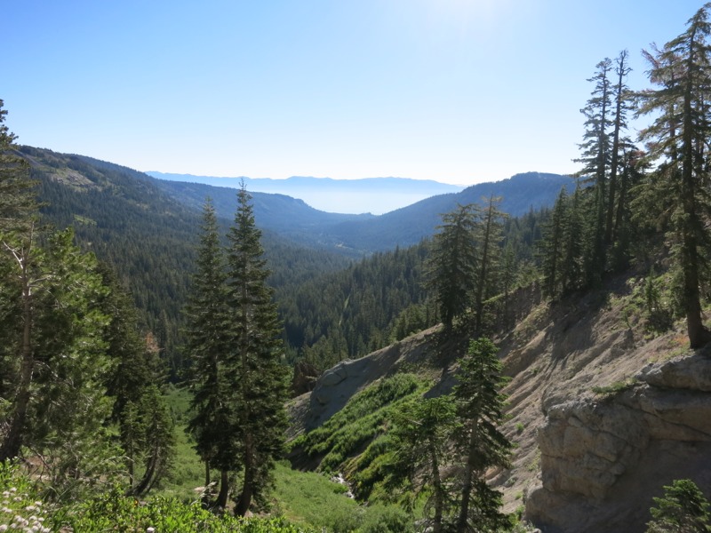
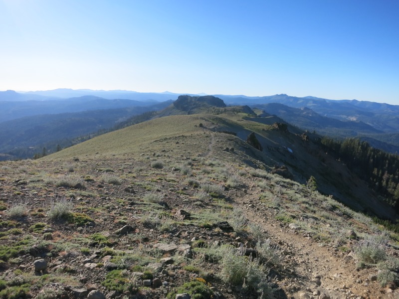
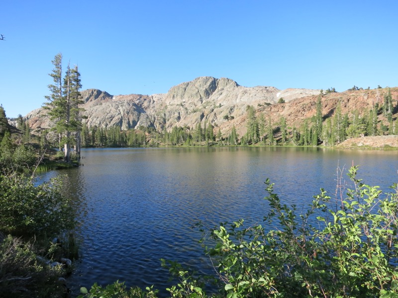
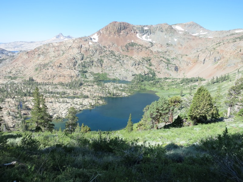
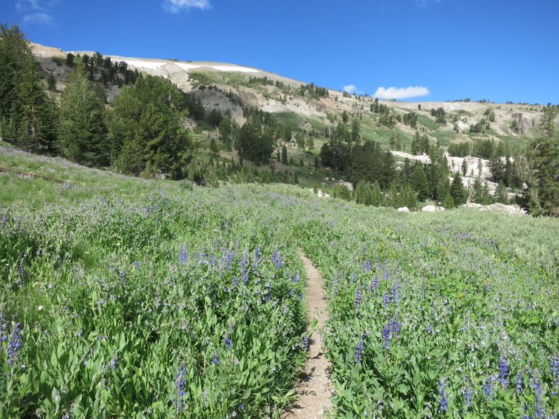
Finally we reached the top with a few more miles to go before camp. The last stretch was along the top of Bunker Hill Ridge – open and breezy with the views we’d been missing of the surrounding peaks and valleys. The trail leveled out along the ridge and we were glad for it. We hiked for a mile or so before catching sight of our next water source way down below. It was a small pond – our least favorite source to draw from, but we weren’t sure if a spring another mile up was flowing, so we had decided to fill up here and dump it later if we found better prospects. Past the lake there was a rough, steep side trail plunging down to access the water. We dropped our packs and then dropped down ourselves to reach what our map named Duck Soup Pond – although it looked more like Duck something-else Pond. There were a few other hikers camping down on the pleasant open shore next to the water. We filled up and started back up the eroding trail, hopeful that we wouldn’t actually have to use it.

We didn’t, as it turned out. Less than a half mile later we came across a sign for Whiskey Spring a few tenths of a mile down off-trail. This wasn’t in any of our guides or maps, but the water sources over the last few days have all been well-signed in this manner. Maybe this is a recent thing. We dropped our packs again and went to investigate.

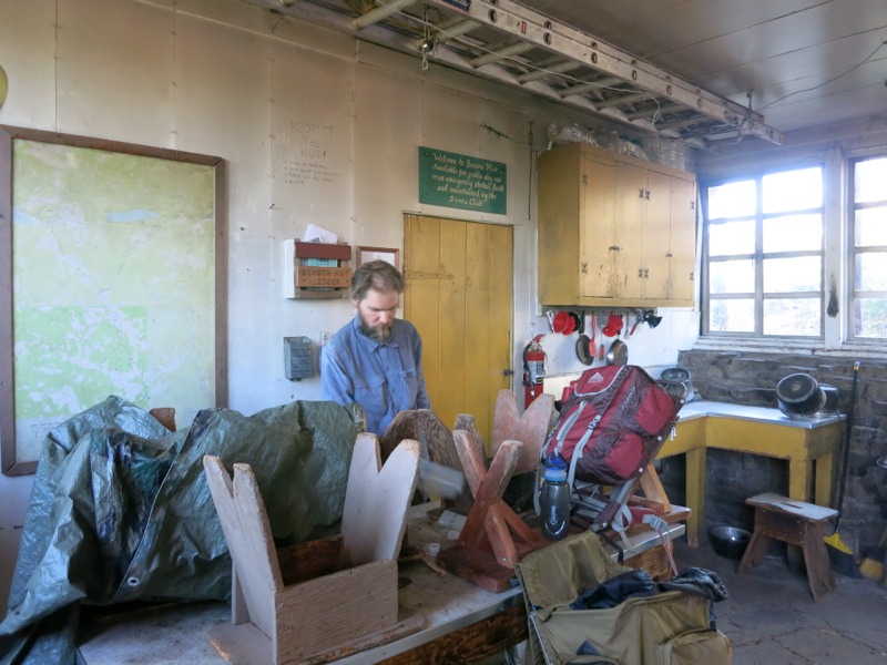
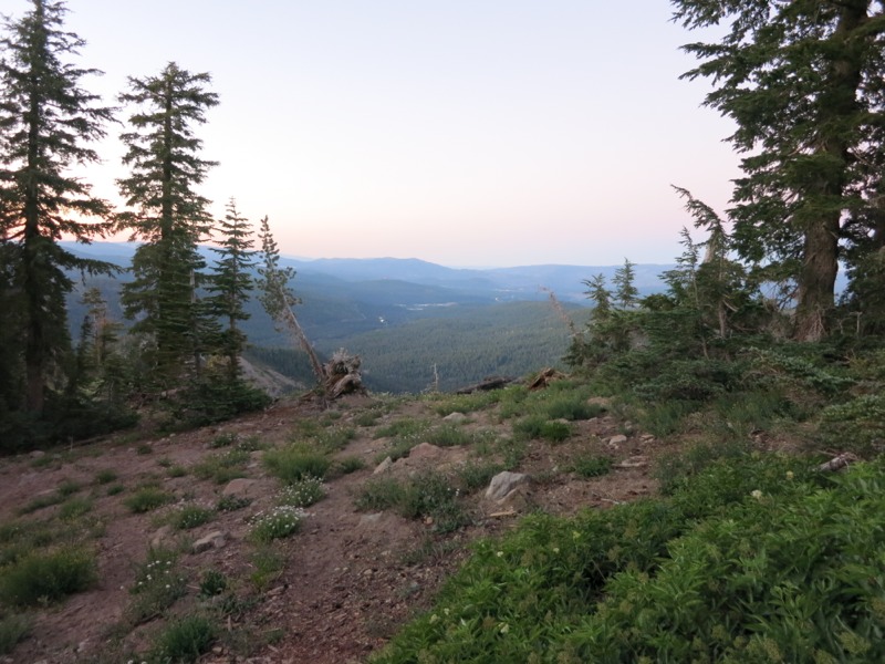
We found the spring running clear and well, much better than the pond water we’d collected. We headed back up to our gear. While Keith went back down to fill up I wrote a note about the spring for the hikers behind us, then hiked back to post it at the top of the pond trail. It’s nice to be able to pay forward some of the trail karma we’ve benefited from. When I got back I set up camp and finished just as Keith returned up the trail. It’s already cooler than it was last night and a nice breeze is hissing through the pines. I love camping out on our own, with no one to bother and no one to bother us.

Location:Pct mile 1231

Day 94 – Sierra City to Packer Lake Saddle – 10 miles

We slept in the most comfortable bed ever last night. After rib dinner, incredibly crisp watermelon and a pint of Ben and Jerry’s we dragged ourselves onto the cushy memory foam mattress and passed out for 11 hours. The droning of a fan provided white noise and blocked out voices from the yard. It was the best night’s sleep I’ve had since starting the trail.

This morning we slept in – it was impossible not to – and then stepped into the bar for breakfast. Delicious home cooking and Margaret even made us an extra stack of pancakes to carry back to the trail with us. This afternoon or tomorrow morning they will be a treat. After stuffing ourselves we went back to the room to clean up and pack. By then it was already stiflingly hot and we rewarded our efforts with drinks and Popsicles from the store. I had some journaling to catch up on now that we had a good wifi connection so we sat out on our deck in the shade and passed the time. One hour turned into a few hours. We were sweating while just sitting there, cool drinks in hand, and this made it hard to think seriously about hiking up the road to the trail. That and the nearly 3000-foot climb to the buttes awaiting us.

We whiled away a few more hours as the peak of the 100-degree afternoon heat passed. Bob, the other owner of the inn, said that this weather is more typical of late August than July. At nearly 4 pm, after another round of cold drinks and Popsicles, we finally started up the road. Keith caught us a hitch to the trailhead that saved us a mile of road walking. Then, with full packs and lots of water, we started up the many switchbacks to the butte. The climb was almost relaxing. We were thoroughly rested, well shaded from the sun and happy to be heading away from the road noise.

After a few miles of steady climbing we broke above the treeline just east of the buttes, huge jagged towers of rock that still loomed 2000 feet over us. We skirted them, climbing slightly on rocky, exposed trail. Sometimes we’d pop into a canyon beyond the late sun’s reach and it was as though someone had switched off a heat lamp. At last we crossed a jeep road and entered a blissfully dark and cool forest. A little more climbing brought us to the end of the long ascent and the grade eased, leading us gently up and down through rocky, semi-open woods. We caught glimpses of the spines of rock from across a deep valley. They were painted pink by the setting sun.
20130807-154137.jpg

We crossed a few forest roads and had to consult our GPSs to find out where the trail led. Usually it’s much better signed than this. Eventually we found our way to a ridge high above Packer Lake and spotted a campsite a short way below the trail. We jumped on it and hoped there were few enough bugs to cowboy camp. The moon is incredibly bright tonight – we don’t even need our headlamps.
20130807-154217.jpg

– Posted from the PCT

Location:Pct mile 1207

Day 93 – Milton Creek to Sierra City – 5 miles


Town day today! Since we only had 5 miles to hike we slept in a little before cramming all our gear into our bags and setting off up the trail. As we were packing up we were delighted to see fellow Minnesotan Mr. Green coming down the trail. At this point we had sort of assumed that all the time we took off in the Sierras meant that other hikers we’d met were way ahead of us, but apparently others took a lot of time off in Tahoe. After chatting for a bit he headed off to hit the post office before it closed and we finished packing. We continued to hike up the creek canyon for a few miles before crossing Wild Plum Road. We turned west here to take an alternate route into town. It was the same length as the PCT route, but this dropped us closer to downtown than the actual trail.


The road was mostly unshaded and the sun was already intense, even this early. We passed a packed forest service campground and envied all the people starting their day by sitting around their fires with a cup of coffee. Backpacking is wonderful and definitely has its advantages but car camping with my family, with all our luxuries at arm’s length, is something we miss. As we left the campground we crossed over the very inviting-looking Haypress Creek. A little further down the road we passed an incredible swimming hole formed by the same creek, a waterfall and a small rock dam. The water was a little cold for my tastes – for a Minnesotan I’m pretty wimpy about cold water. We thought about stopping but town, cold drinks, and snacks were just another mile or two away.


A half hour later we were strolling down Main Street to the Red Moose Inn, a hiker-friendly place where we dropped our packs. We picked up our resupply package up the street at the general store and came back to rent a room at the inn. Showers, laundry, snacking and all the other blissful town chores followed. Margaret, one of the owners of the inn, even offered to patch up the back of my shirt! I’ve worn a giant hole where my pack rubs against my spine. I patched it already back in Agua Dulce but it has spread. There’s no mistaking me for a hiker, unless it’s for a homeless person, which is a fine line we all walk by this point in the trail. Hikers tend to have a foam sleeping pad strapped to them somewhere – otherwise it can be hard to tell.


All you can eat ribs for dinner tonight!

– Posted from the PCT

Location:Pct mile 1197

Day 92 – White Rock Creek to Milton Creek – 24 miles


We slept very well last night but woke up to the drone of mosquitos at 5 AM. Back to sleep…when we finally got up they were better. A little. It was nice and cool at our campsite, but as soon as we got into the open the air heated up. The sun was intense again today. The morning took us through expansive meadows, up a few climbs, and on some amazing ridgewalks. Because of this it was 13 miles to the first reliable water at Mule Ear Creek, our lunch spot.


We were glad to reach the creek when we did. Pouring cold water over our heads was incredibly refreshing. We headed back up the spur trail to the PCT and the shade of the pines. This was understandably a popular spot and a few other hikers passed us as we had lunch. Stepping out into the sun again was a shock. Before long, though, we were into the shady forest as we came down from one last ridgewalk.


We passed to the east of Jackson Meadow Reservoir. Th massive lake looked very inviting but we were hiking well away from and above it. We got our chance for a dip when we crossed a road bridge over a stream and saw a few hikers below – some of the same folks who passed us at lunch. We dropped down to the water and soaked our legs for a bit. No substitute for the showers waiting for us in town, but a bandana wipe-down on five days of sweat and grime is much better than nothing.


We set off eventually to get closer to town in order to make for an easy hike tomorrow. The trail crossed a few roads (the reservoir is a popular place for boating and OHVs) and undulated through the forest. None of true uphills were particularly difficult and we made good time – until we started down into the creek canyon where we planned to camp. Then the trail got very rocky and a little steep and we had to slow down rather than risk an ankle injury. It reminded me of the Wonderland trail – switchback after switchback down into a deep creep canyon.

Soon we could hear the water but the trail seemed to take forever to reach it, running above and parallel to it for nearly a mile. It was obvious when we had arrived at the campsite on our maps – the only flat spot we’d seen since we started our descent into the canyon! It’s surprisingly non-buggy down here but we set up the net tent anyway to guard against other vermin. Tomorrow we have only 5 miles to hike into town, where we’ll pick up a package and grab some grub.

– Posted from the PCT

Location:Pct mile 1193

Day 91 – Benson Hut to White Rock Creek – 19 miles


We had a few mouse visits last night – not unexpected, but still irritating. For such small animals they can make a lot of noise. We didn’t sleep very well. At least they weren’t trying to get into our packs or our food. We were very glad to be up off the ground in bunks.


Waking up in the shelter this morning was a novelty. It was a luxury to be able to change clothes without getting cold, and it was nice to be able to sit in a bunk and pack our bags instead of sitting on the ground in a tent. Such small things but we appreciate them so much. Mindful of the couple in the attic, we packed up quietly (I hope) and moved outside to have breakfast on the front steps. They were up before long, though, and we had time to chat for a bit before setting off down the steep hill back to the trail.

It’s always fun for us when people are interested in our hike, and despite the fact that it was a weekday we met many more of them on our way to Donner Pass. There were lots of dayhikers out enjoying the same ridge walk we were, and many of them seemed to know about the trail and thruhiking. We were held up as an example of “hardcore backpackers” to a youth group we met along the way, which was very gratifying. Us, hardcore? I guess we can say that after three months on the trail. I’m not used to being called hardcore about anything – or being held up as a shining example of anything, for that matter.

We reached the highway and Donner Pass in good time considering all the conversations we had along the way. We were motivated by the fact that the town of Soda Springs was only 3 miles up the road, with the promise of every hiker’s siren song – second breakfast! Given the short distance we had to travel, it took us a long time to get a hitch. We must look pretty disheveled. Finally a guy stopped on his way to check out the Sugarbowl ski area, and he kindly hauled us into town when he realized how close by it was.

As it turned out, the delay was fortunate because the cafe didn’t open until 15 minutes after we got there – just enough time to make some calls and check in at home. Then it was on to delicious paninis and cold sodas. We chatted with a very nice trail angel from the area who had stopped in for a bite, and just like that we had a ride back to the pass when we were finished with our errands. Our waitress overheard that we were from MN – she used to live in Marshall and work at Lake Shetek state park. What a small world! After lunch we crossed the street to the general store and picked up dessert and a few snacks. Then we were whisked away by our trail angel and dropped right back where we’d left a few hours ago.


It was considerably hotter now than it had been before and the next few miles were partially exposed. The sun beat down on us in a humid haze as we climbed. We were sweating buckets. Given all the soda we’d just had to drink, it felt like big drops of corn syrup should have been running down my face. We were making for our next interstate crossing under I-80 and the rest area there. It was obvious that this was a well-traveled area and there were lots of side trails leading off into the boulders. At some junctions it took us a while to figure out which was the PCT. It got easier as we got closer to the highway and the road noise and we were finally rewarded by the sight of a metal culvert leading under the roadway.


Another reward was waiting at the other end – a cooler full of sodas. Despite our earlier drinks we each chugged a can to replenish what we’d lost on the sweaty climb between the highways. From there it was a short distance to the rest area where we washed ourselves off, threw away some trash, and refilled our water. We are in a relatively dry section compared to the last few weeks and the next reliable water was 10 miles away at our intended campsite. It felt strange to be on I-80, a road we drove on to get out here and one I’ve taken to Denver more than once. Outside the building was a plaque dedicated to the ill-fated Donner party, who got stuck here (very close to Donner Pass) during a brutal winter in the 1800s. Here’s hoping we have better luck on our trip.


Finally there was nothing more to delay us and we set off north, away from the roar of traffic. We were more shaded now than we were between the highways and it was much cooler under tree cover. We had a long, gradual climb out of Castle Valley and over the pass of the same name. On the other side we passed the Peter Grubb Hut, another Sierra Club shelter similar to the Benson Hut from last night. This one had no bunks but had a very cozy-looking addition with a wood stove and massive benches carved from two enormous tree trunks. The outhouse had a ramp instead of a ladder – a bit easier to negotiate. It would have been fun to stay there if we’d been finished for the day, but some of the glamor had gone out of the idea after the mouse encounters we had last night.


We set off again on another slight climb around the base of Basin Peak, followed by a descent into Paradise Valley and our last climb for the day. The uphills took us onto treeless, daisy-packed ridges with amazing views of the surrounding peaks. As we approached the creek where we’d stay for the night (the last water for 12 miles) we headed back into forest and the mosquitos came out for the first time all day. Safely wrapped in our net tent, we looked forward to a solid night’s sleep to make up for yesterday’s.


– Posted from the PCT

Location:Pct mile 1169

Day 90 – Blackwood Creek to Benson Hut – 21 miles


It was tough to get up this morning after our long day yesterday. Once we managed to drag ourselves back to the trail we started up a series of rocky switchbacks towards the top of a ridge. We caught glimpses of the big lake to the east. Once at the top we crossed into the Granite Chief Wilderness and began a section that walked along the ridge itself. Soon we passed the junction where the PCT and the Tahoe Rim trail split apart – the two had followed the same track since before we went into town. Without all the hiker traffic on the rim trail, it ought to be easier to find a campsite tonight.


We hiked along the ridge, eventually dropping slightly onto the west side so the lake was blocked from view. We passed the Alpine Meadows ski area and all the signs warning skiiers not to go past the border of the patrolled area. There were flowers everywhere along with all kinds of bugs – butterflies, bees, grasshoppers, and various flies. The grasshoppers make a clicking noise as they glide through the air. It takes some getting used to when they’re jumping out ahead of you. A little way past the ski area we dropped down into the forest again on another set of switchbacks.


We had a few level miles through open meadow before we started our next climb. The area was pretty exposed and the sun was intense, beating down on our hats. We stopped at a well-flowing and well-placed trickle of water to cool ourselves off, then got back to the climb as it took us towards Granite Chief peak. Before the top of the climb there was a seasonal river that might be flowing. We planned to stop there for lunch if the water was good, and thankfully it was.


The rest of the afternoon was a slog. We seemed to spend all our time on a long uphill that was at first rocky, and then just steep. We passed just west of the Squaw Valley ski area. A hiker had told us the day before that they were going to have a music festival and FOOD there this weekend, but we were a day too early. We were close enough to see the stage where the festivities would take place. Much later we reached the top of our climb near the peak Tinker’s Knob. We had come nearly back to 9000 feet, which explained why we were so tired. The panoramic views were incredible.


It was supposedly level or downhill for a while after that, but the trail went over long stretches of rockfall – large, foot-sized rocks piled haphazardly over each other and flattened to provide a walking surface. It’s our least favorite surface to hike on because the rocks shift under your feet. It’s hard to find a level surface to put your foot on and easy to turn an ankle or bend a foot in a painful way. Hiking poles make it easier, but it’s still slow going to cross these stretches.


The final delay of the day came when we needed to get water. The trail had been mostly dry since lunch, and the only source of water for the next 5 miles was a terribly steep, rough trail that headed nearly straight down off a saddle. Getting down there and back, about a half mile round trip, took us almost an hour. At least there was water – if we had gone all the way down to find a dry streambed it would have been a rough ending to a rough day. As it was we were already feeling disappointed that we had only made 20 miles.


The upshot to this was that we were a very short distance from a Sierra Club shelter up on Mt. Anderson behind us. We hiked up the steep trail to the Benson Hut, a two-story building with fold-up wall bunks and a wood stove on the lower level. A ladder to the upper level led to an attic under the eaves. This is used for emergencies and for ski/snowshoe groups in the winter. Some years the snow piles up so high that people have to enter through the second story window! It would be a mighty cozy shelter and a fun winter trip to take with a bunch of buddies…if you could get up there in the first place, that is. A two-story chemical toilet completed the luxury. It took a bit of finesse to climb the ladder to the outhouse entrance, TP in hand, and unlock and open the door without falling off the tiny ledge.


The shelter already had guests when we got there, but Chris and Sarah and their dogs took our arrival in stride. We unchained a couple of bunks and set up our beds on the plywood. Outside they had built a small fire in the nearby ring, and we sat around it and chatted as we had our pre-bed snacks. Before long it was time to turn in and we went to sleep hardly needing the warmth of our bags.

– Posted from the PCT

Location:Pct mile 1150

Day 89 – Susie Lake to Blackwood Creek – 25 miles


We had a restful night and took our time packing up this morning. The first day’s breakfast out of town is usually pretty tasty – in addition to whatever we’ve brought for the section, we usually have some fruit and a bottle of soda. I’ll sometimes bring yogurt with us and it’s a treat to have, nice and cool from overnight.


We started with a moderate climb up to Dick’s Pass – not the highest point of the climb, which seems a little like cheating. From the pass we could look down on Dick’s Lake and off to the west at Dick’s Peak. From the top of the climb we dropped down to the lake, switchbacking down a steep, pine-lined trail. From there the trail led to the shore of Fontanillis Lake, long and narrow, and then past the Velma chain of lakes, barely visible through the trees. We decided to head for Phipps Creek for lunch since that was the only likely water in an 8 mile stretch. When we got there we found that it wasn’t really flowing, but the remaining pools in the rock bed looked much less scummy than some of the trickles we’d passed.


After lunch we made great time over long stretches of flat, clear, mostly viewless trail through the open forest. This was good practice for Oregon. The woods were pleasant enough with all the flowers and tucked-away lakes and the bugs weren’t too bad. It was just us and the chickadees. Out here they have a three-syllable song – they say “cheese-burg-er” instead of “sing-song” like back home. During the last section, with all our food cravings, this actually got distracting. Combined with the carrot-romaine lettuce smell of the mule ear daisies, it became really difficult to avoid thinking about food.


At the end of the day, as seems to happen, we faced our steepest climb yet. It was still nothing to rival the last few sections but on sore feet and joints it was a challenge. The lure of a 25-mile day dangled in front of us, though, and we put our heads down and hiked up. As we reached the top of the climb we could see out over an enormous lake. It took me longer than it should have to realize that this was THE lake, and that we were near the eastern edge of the rim. Another mile or so of downhill brought us to a fork of Blackwood Creek and the campsites there. We made great miles today, the kind we’re going to have to do from now on if we want to finish before winter, but after our days off I’m definitely feeling it.


– Posted from the PCT

Location:Pct mile 1129

Day 88 – South Lake Tahoe to Susie Lake – 12 miles


Back to the trail today to tackle Northern California. As always, it was tough to drag ourselves from our creature comforts but we are ready to be away from the traffic and crowds. We had a great rest in town, including a day that consisted mostly of eating and napping – sleep for a few hours, wake up and eat until full, then repeat. We really must have needed the rest. Re-energized, we’re ready to tackle Tahoe’s west rim and the Desolation Wilderness.

We caught the bus to the outfitter to drop off some extra food and gear. The Lake of the Sky Outfitters here is super hiker friendly. They have a very nice “hikers’ lounge” with wifi and coffee, an extensive hiker box (where we dumped our food), and lots of essential gear. They also hold hiker packages and this is where we sent our resupply we picked up our first day in town. We left our packs here for a bit and ran up to the nearby Keys Cafe for a bite. It can’t rival the MN chain we love so much, but the sandwiches and enormous smoothies we ordered were delicious.

Back at the outfitter, I was finishing up on some journaling when a customer offered any needy hikers rides up to the Echo Summit where we jumped off. We leapt on the offer and were on our way up in no time. Our driver Suzanne is less than a week away from starting her thru-hike of the John Muir Trail, her first “long” backpacking trip. We wished her luck and hope she has a great time!


Back on the trail, we hoisted heavy packs (but not too heavy!) and started along the three miles to Echo Lake Resort, the more common jump-off point for hikers bound for town. Our packs were much more comfortable without the bulky bear cans in them. We’re also carrying less food at the start of this section than we have in a long time – only 4 days instead of 7. This made it easy to climb the slight rise between the highway and the resort. My thoughts zoned out for a while, happy to be back in the woods, and almost before we knew it we were at the lake. We took a quick break to finish up some food and drinks we had brought along so we could toss them in the last trash between here and Donner Pass 60 miles away.


The trail brushed the corner of Lower Echo Lake before ascending to a ridge above the lake and heading west along the north shore. Below us, cabins (reachable only by water?) lined the water’s edge. The trail was very rocky. We were entering another glacier-carved area, which tended to go hand in hand with lots of scattered rocks and boulders. Signs warned us that we were not allowed to camp between the resort and the border of the Desolation Wilderness a few miles away. We hiked the length of the lower lake, then the upper, passing through sparse pine forest.


A few miles more brought us to the rocky shores of Lake Aloha. It reminded us of Thousand Island Lake back on the JMT, studded with lots of tiny granite shallows poking above the surface of the water. The trail took a hard right at the western end of the lake. Thankfully, this was away from the path that led to Mosquito Pass. We dropped down to the smaller, calmer Heather Lake before descending further to the still-smaller Susie Lake. We started to look for campsites here but a lot of tents were already occupying the likely flat spots. What a novelty to have trouble finding a spot! It wasn’t too tough, though. We rounded the bottom of the lake and crossed its outflow stream, headed past another group of tents, and found a nice dirt patch a few rises away. Not having to camp on rocks makes it much easier to put in tent stakes, and we’ll probably need our net tent tonight. It’s good to be back out here, hearing the wind in the trees instead of road noise.

– Posted from the PCT

Location:Pct mile 1104

Days 85, 86, 87 – South Lake Tahoe


Three days off in Tahoe to rest our muscles, sleep in and put some meat back on our bones. I have a new pair of shoes waiting for me. Now that we’re north of Yosemite we can finally mail our bear canisters home! It will be much easier to stuff our packs without them. This will be one of our last large town stops for the rest of the trail as it takes us through some less-populated areas.

Only 200 miles or so to the halfway point!

– Posted from the PCT

Location:Pct mile 1092

Day 84 – Carson Pass to South Lake Tahoe – 12 miles


We tried to get an early start today but slept through our alarm. I guess that means we needed our rest. Instead we were up and leaving camp around our regular time, which was no big deal since we only had about 12 miles to make today. The morning was overcast and surprisingly cool. It made for nice climbing as we ascended to a ridge on the Tahoe Rim and got our first sight of the huge lake below.


We crossed long meadows, passed by more beautiful lakes, and started a stumbling descent over granite rocks and boulders on our way down. We finally came out into a parking lot for a ski and sledding area – deserted, obviously – and walked north to the highway to hitch into town. Hwy 50 was a major road and the cars were roaring along. It took us a while to catch anyone’s eye but just as we were starting to think about heading up the trail to another likely spot someone pulled over. He couldn’t take us all the way down but he could bring us to civilization, and from there we were on our way.

A few rides later we were fully immersed in the crowds and confusion of town. We got a lot done – picked up our packages, bought some supplies and snacks, and found a hotel. Then it was time to catch the bus, and after that, showers, laundry, and a real bed. We are always glad to get into town – and we know that in just a few days we’ll be glad to leave.

– Posted from the PCT

Location:Pct mile 1092