Our PCT Denouement

Finally, sweet closure!

Keith and I traveled back to Seattle in August to finish our final 180-mile stretch of the PCT.   It was thrilling and deeply satisfying to be back on the trail again, working up a sweat and sleeping under the stars.  These last sections – Glacier Peak and the North Cascades – were some of the most scenic and most difficult that we’d hiked on our entire journey from border to border.  Or maybe they just felt that way after a year of easy living and full-time sedentary jobs!  Numbers can’t lie, though – according to our map data, the trail between Stevens Pass and Stehekin had more elevation change than any stretch since the High Sierra, when we were traveling over high passes every day.  We held up well despite the fact that we weren’t quite in prime thru-hiker shape.  What a luxury to be able to set a goal of 12 miles a day!  Hiking from 9 to 5 and watching the sunset from our tent was a nice change from the standard thru schedule of being on the move from dawn to dusk.  Every day we met a few hikers from the current season, so close to the finish that they could nearly taste it, and chatting with them brought back great memories of the previous summer.  The weather was mostly gorgeous aside from some rain over the first and last few days – hardly something to complain about given that we were hiking in northern Washington.  This allowed us to soak in all the amazing, hundred-mile views.  I could spend the rest of my life in these mountains and never get tired of the scenery.

And oh, what views!

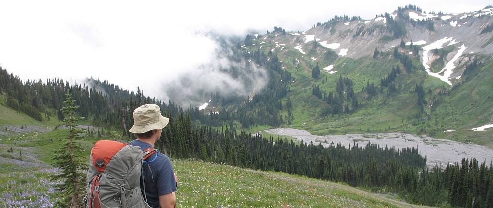
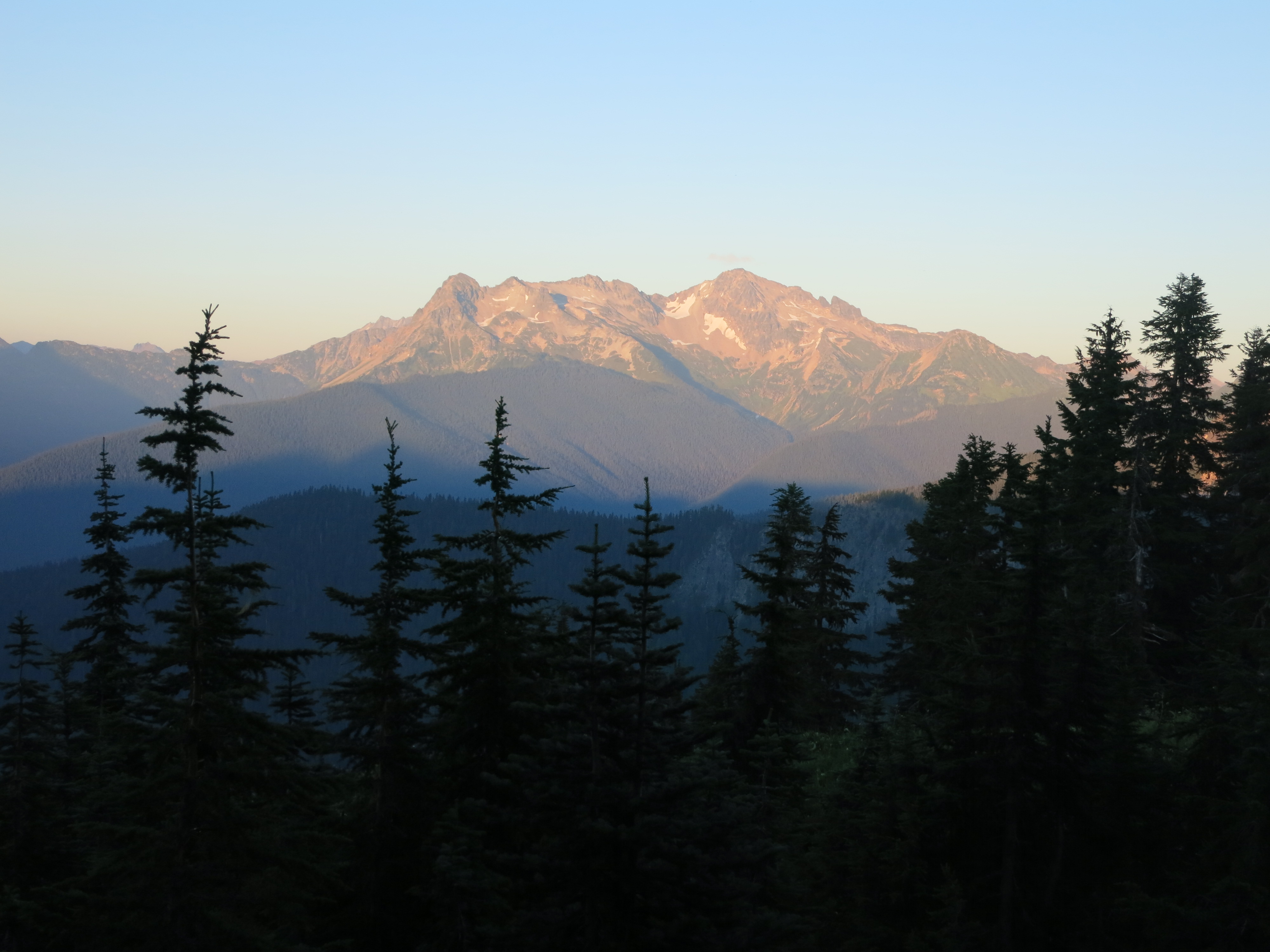
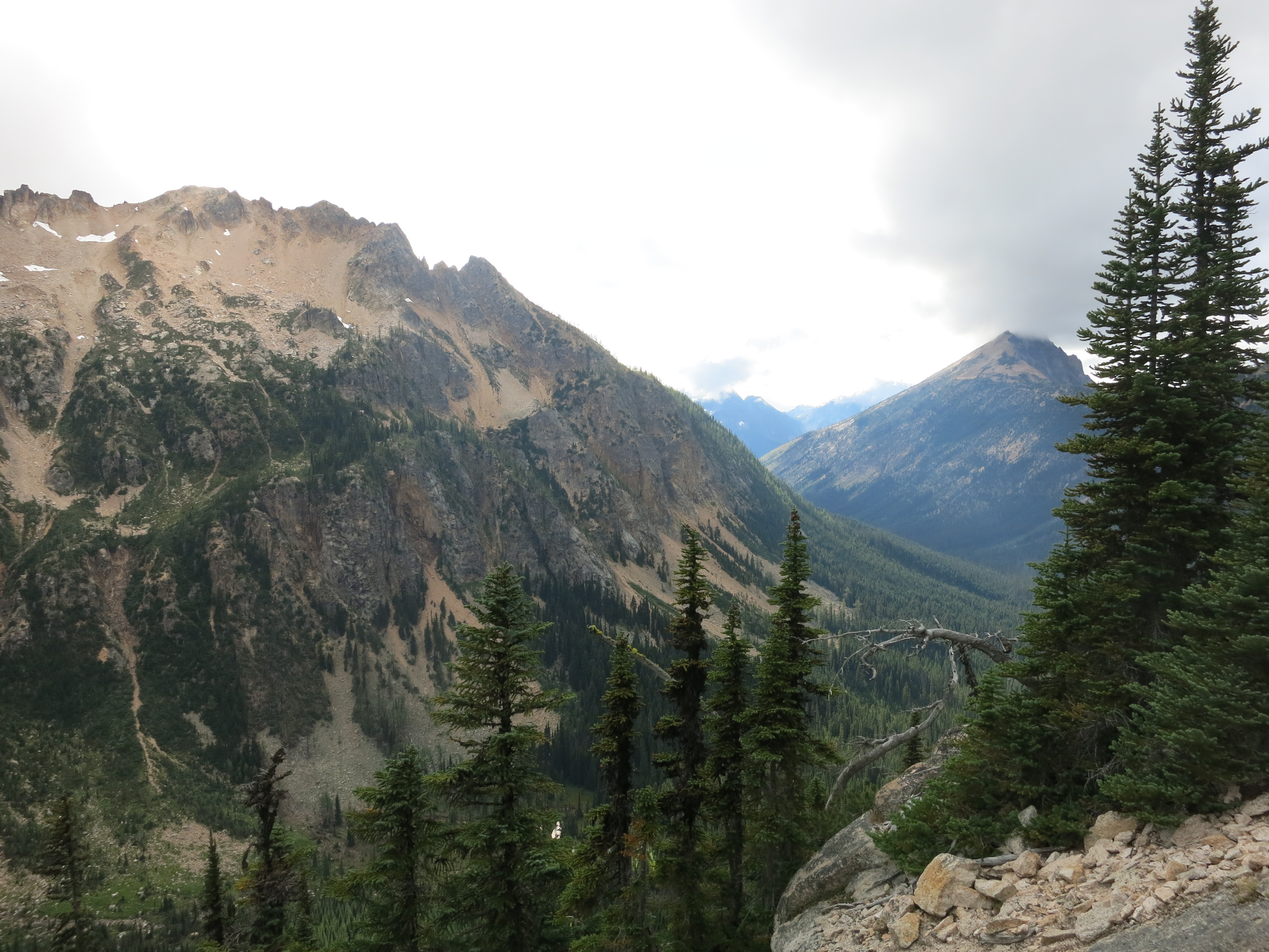
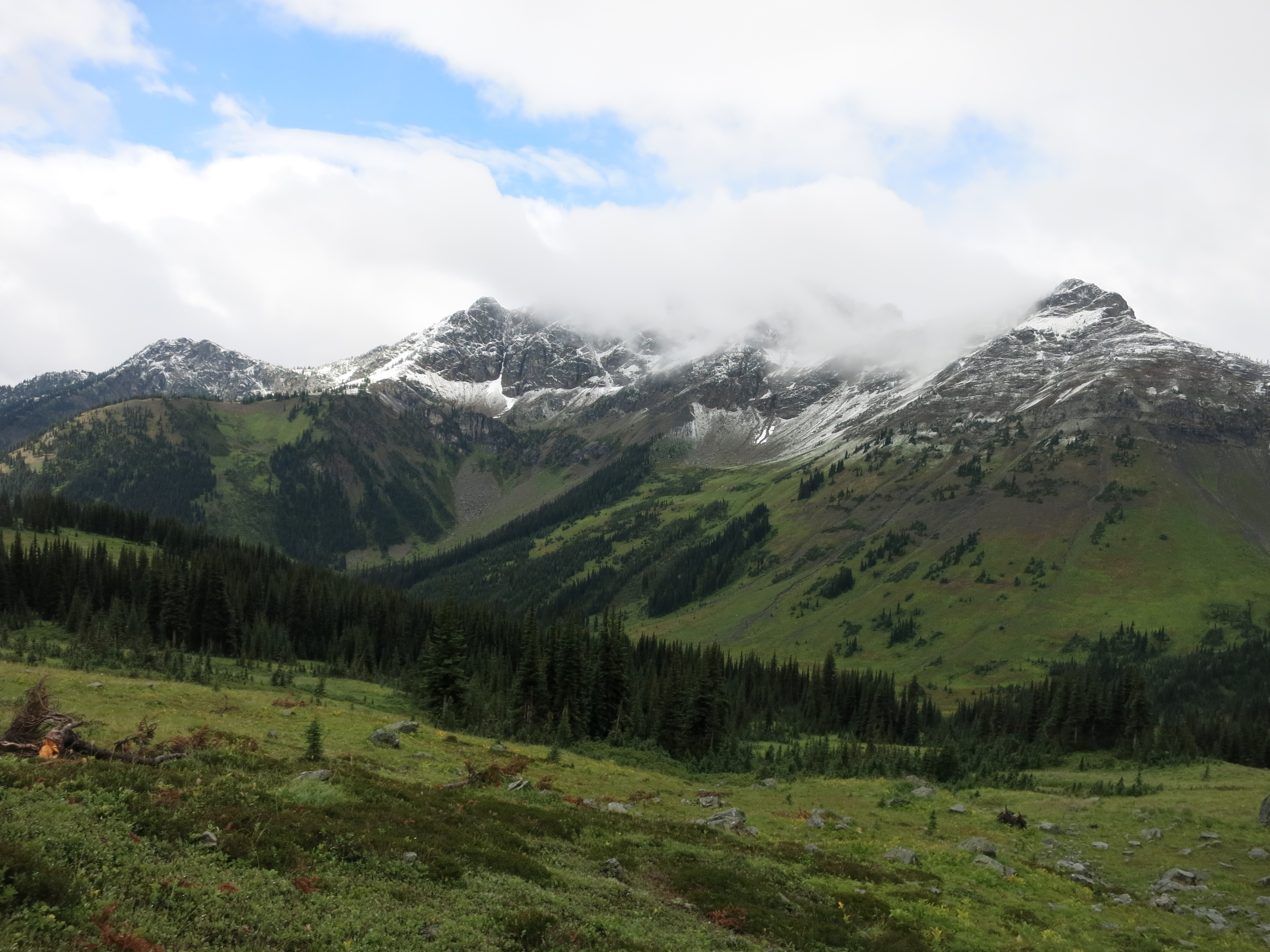
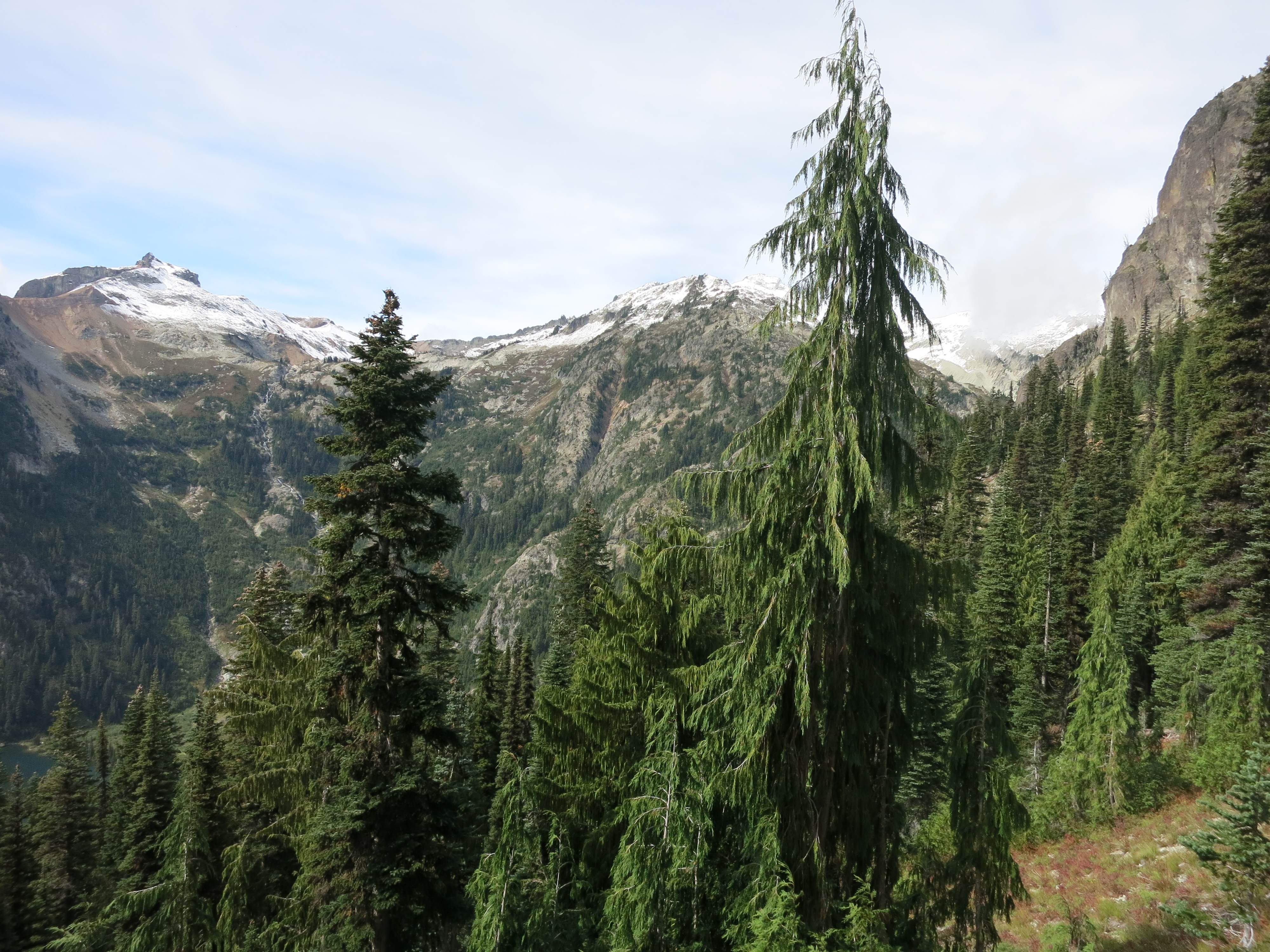
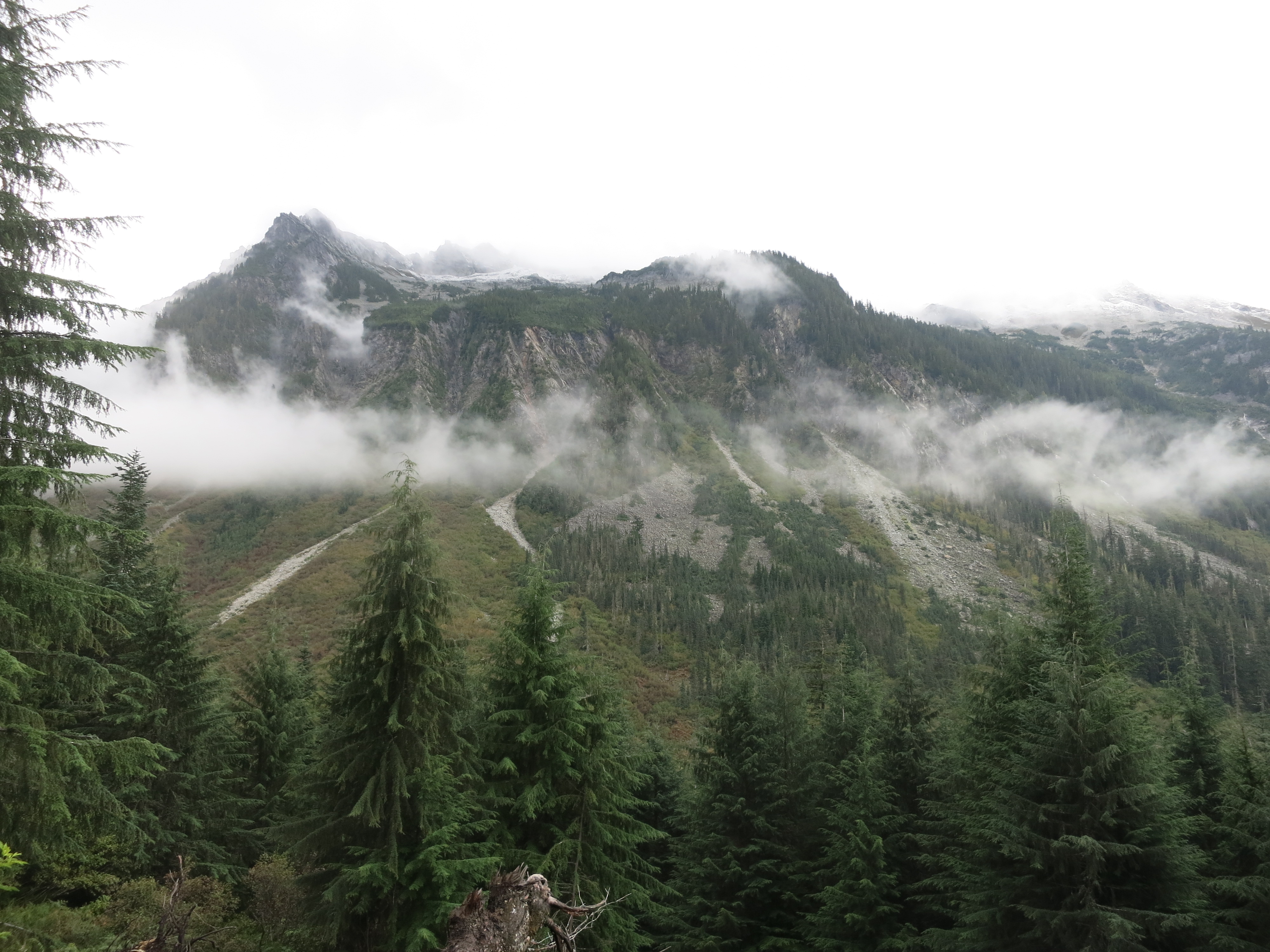
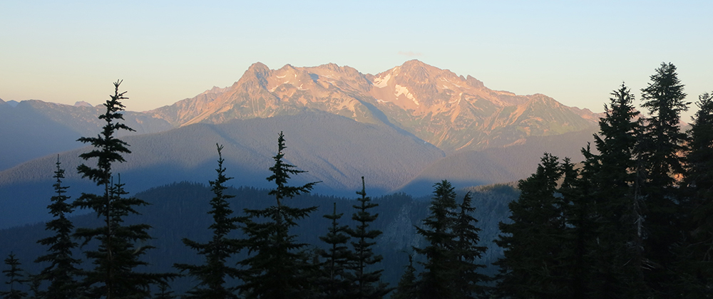
During our first few days Glacier Peak grew larger and larger on the horizon:

IMG_1496

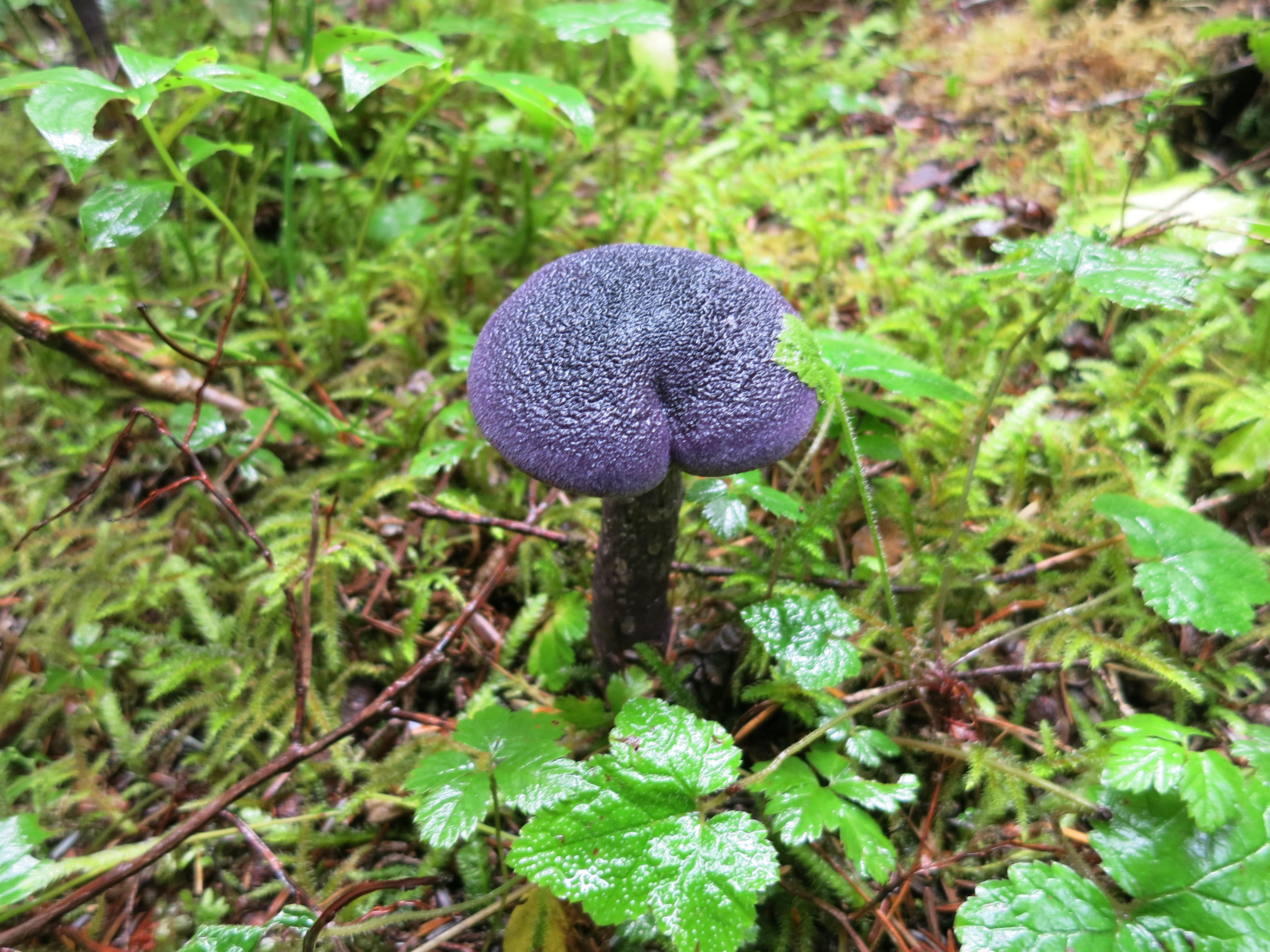
Tough climbs were rewarded with fields of lupine and ridgetop views:IMG_1530IMG_1511

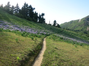
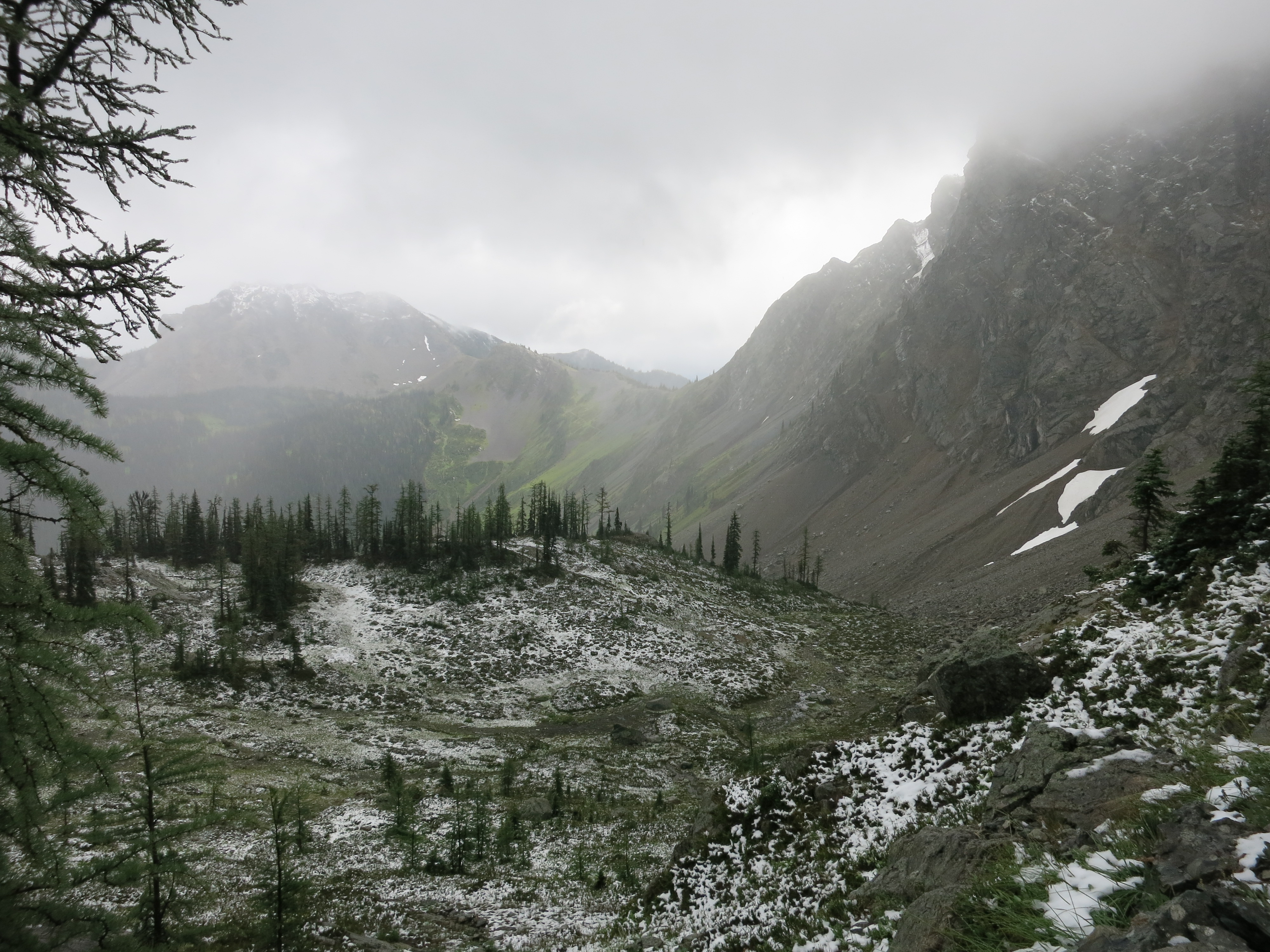
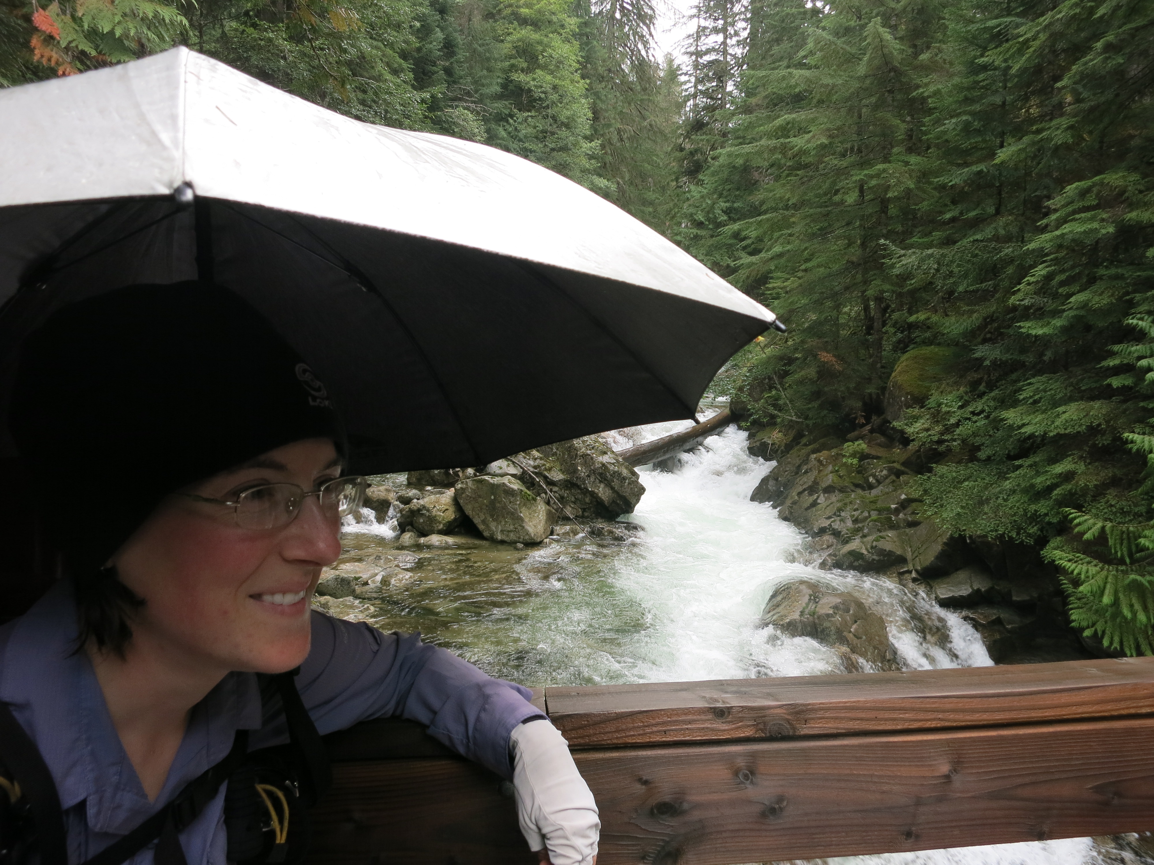
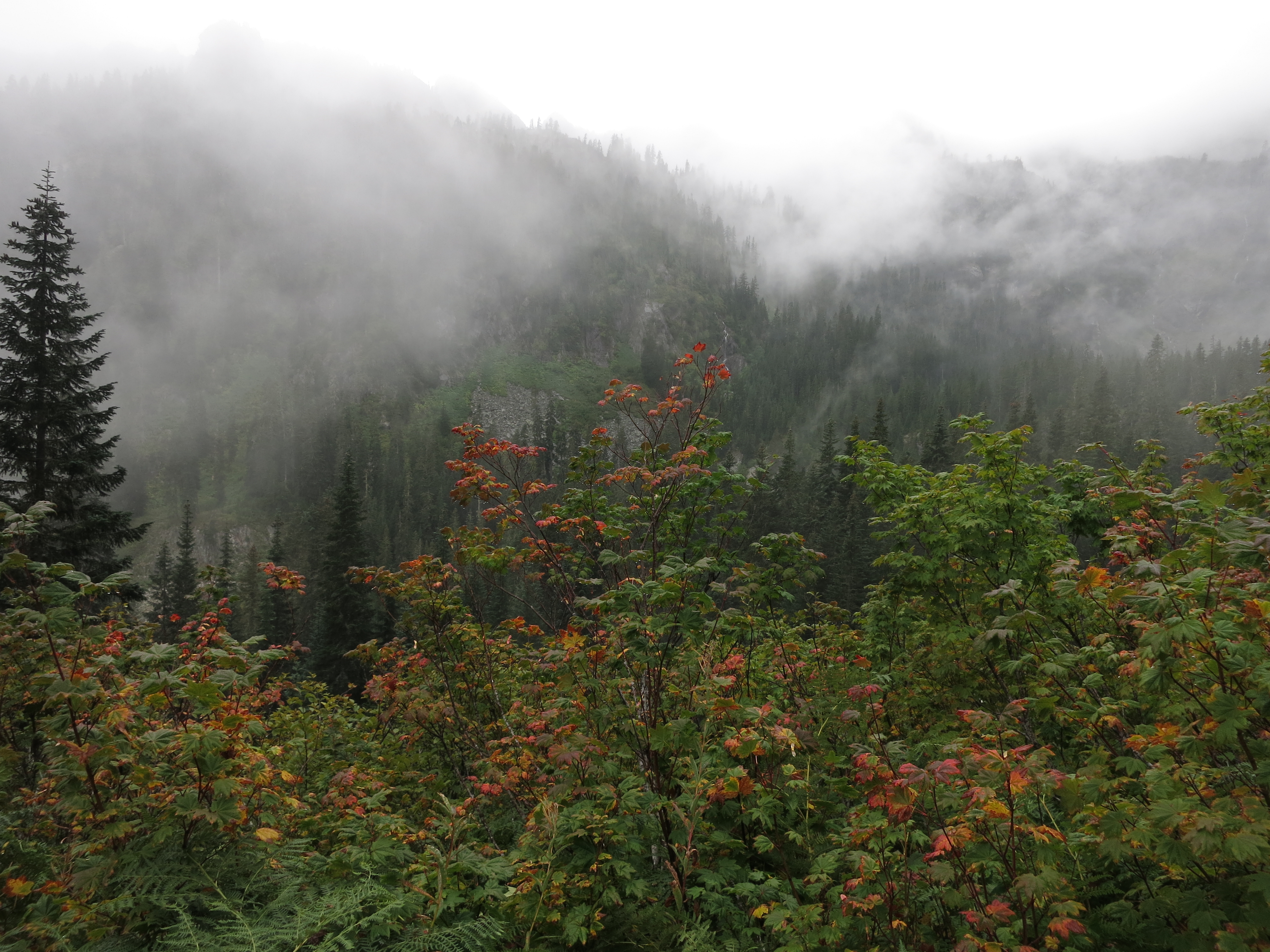
A fast-moving storm on our third day took us by surprise:

IMG_1521

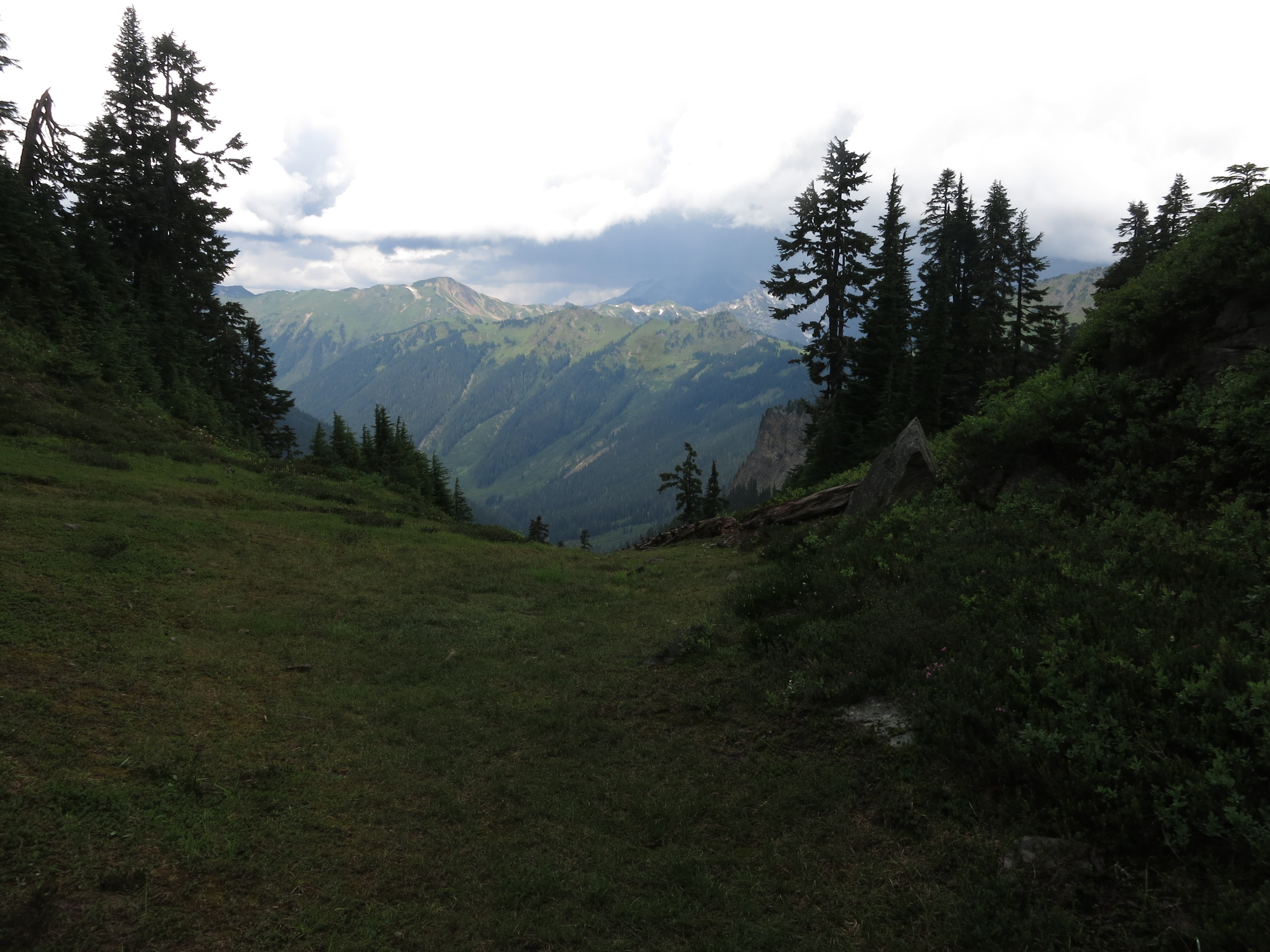
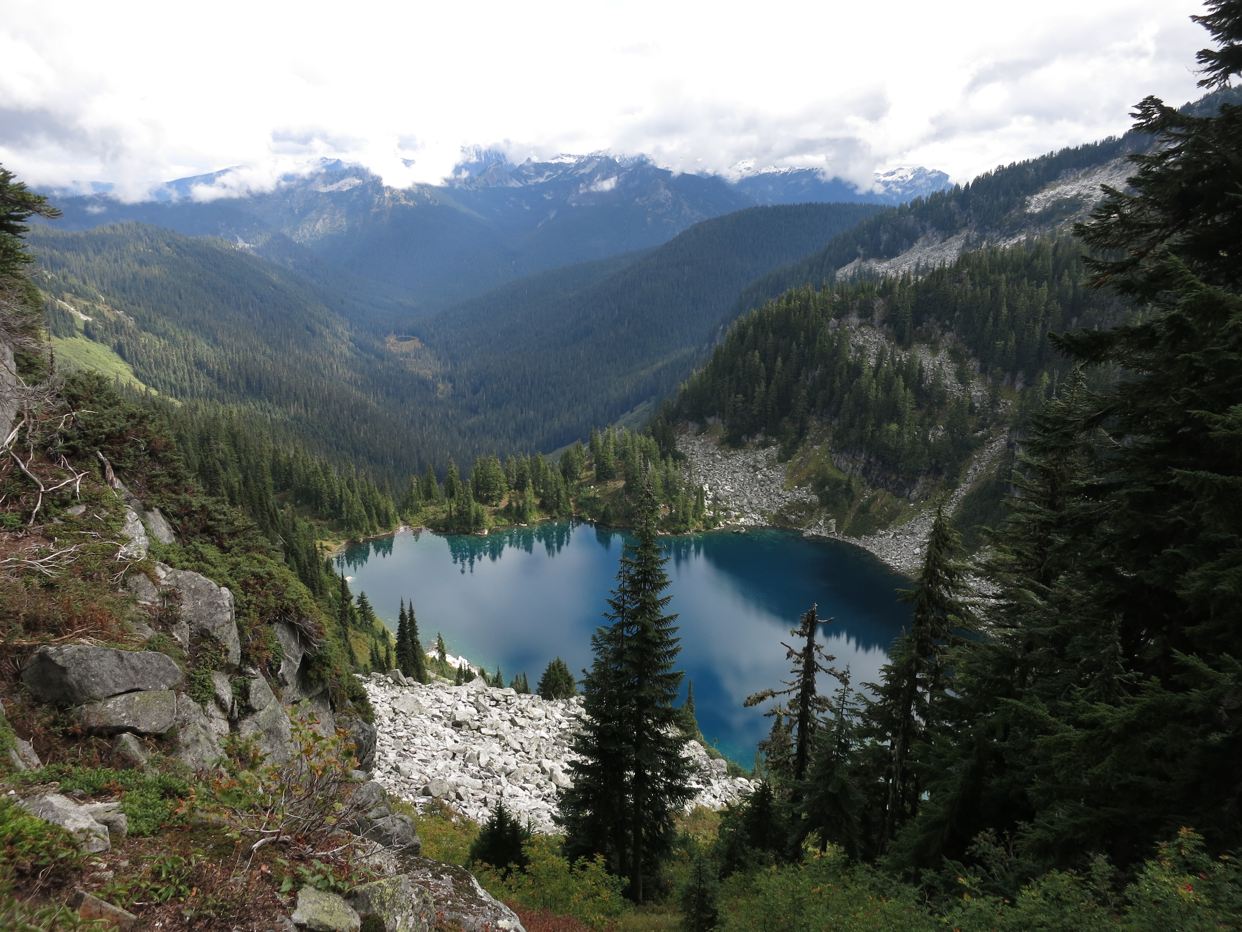
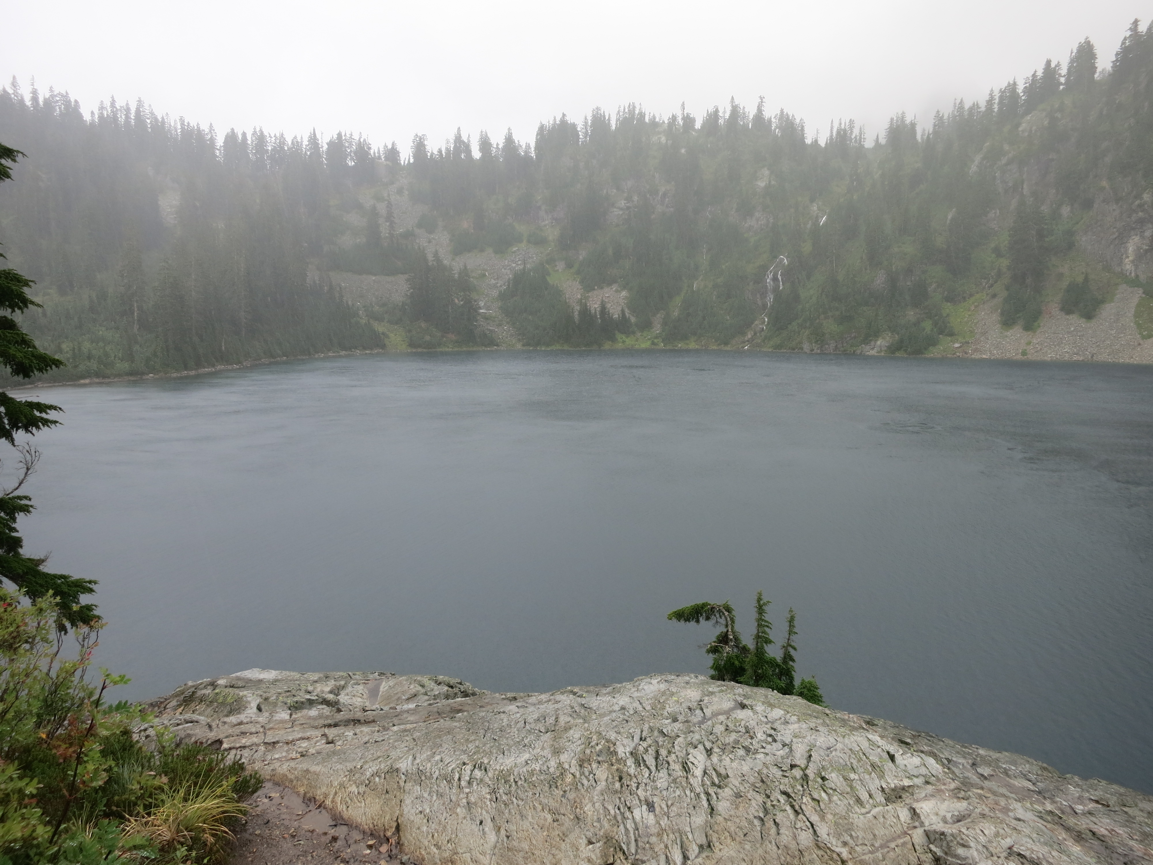
But we stayed dry under our ponchos and umbrellas and ended up at one of the most beautiful campsites we’ve ever had, overlooking the White River valley:

IMG_1550IMG_1564

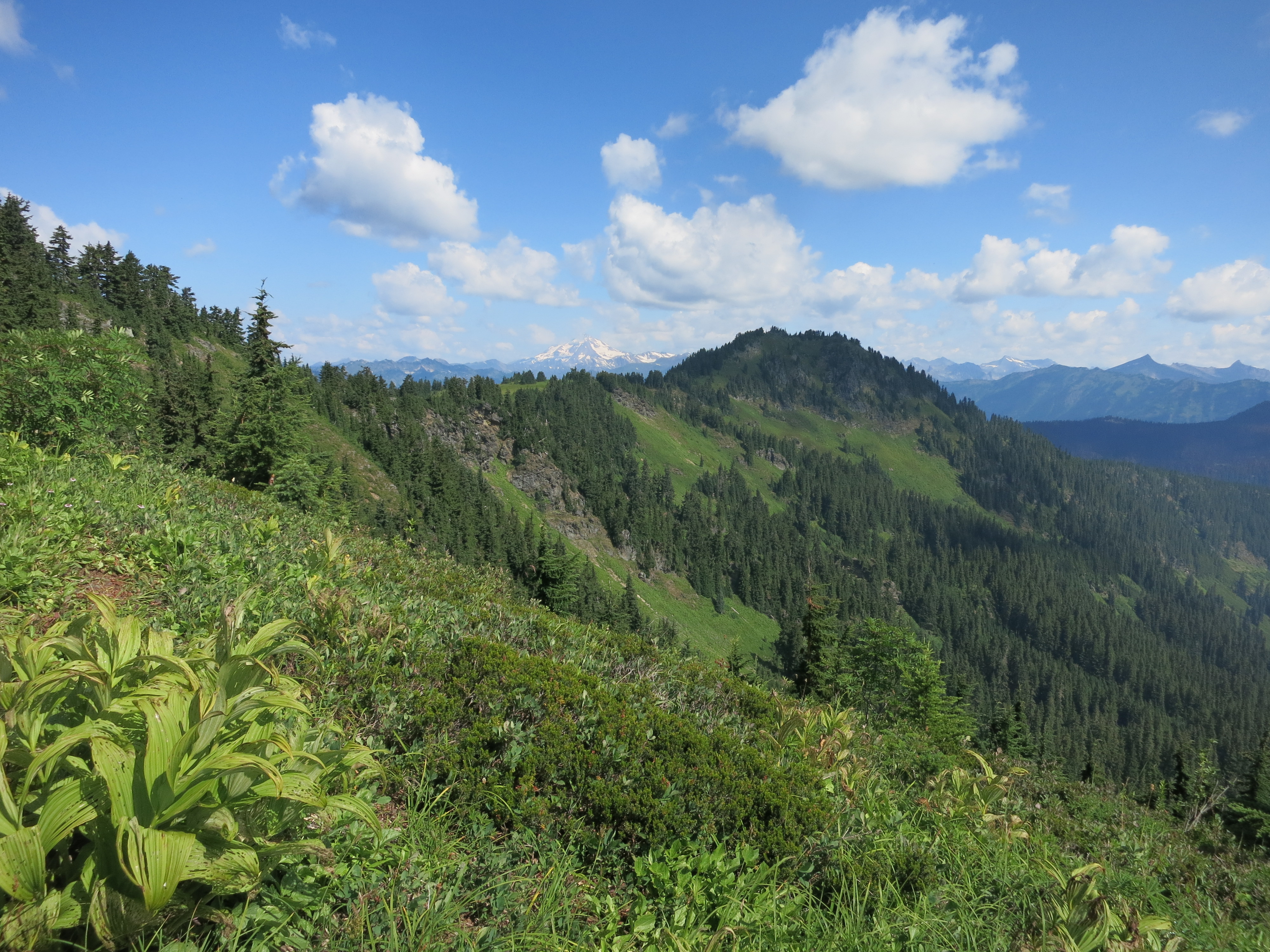
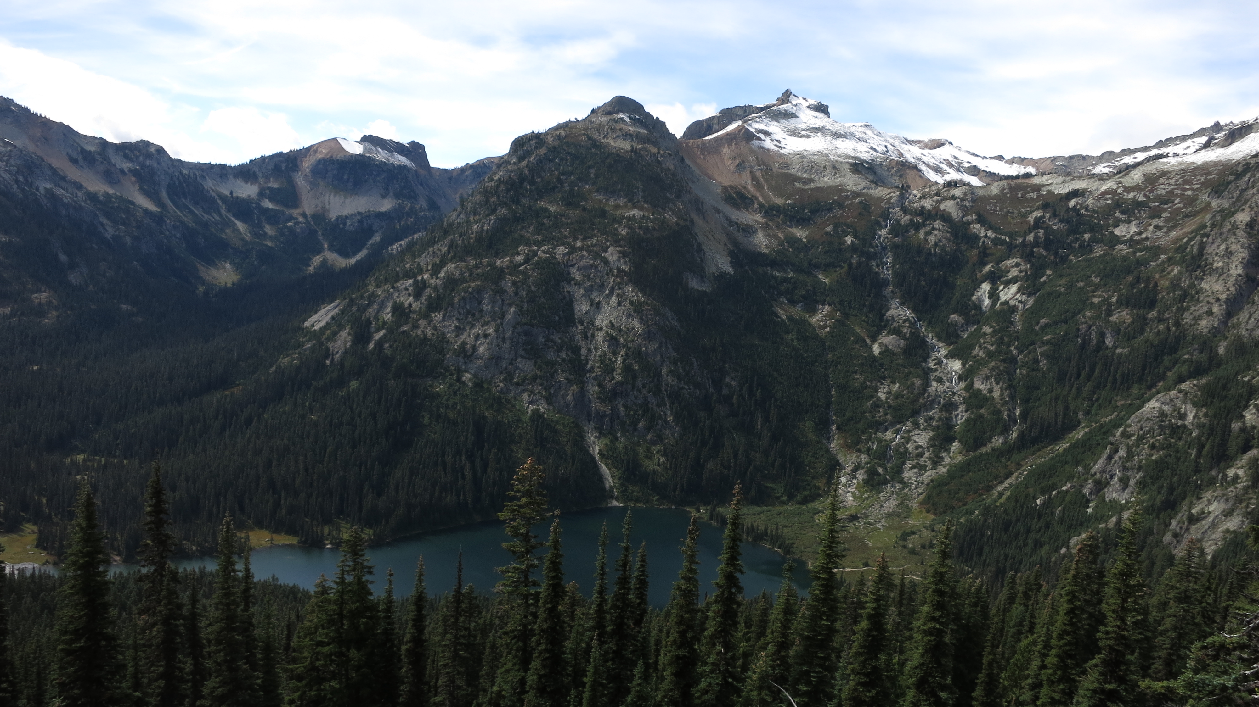
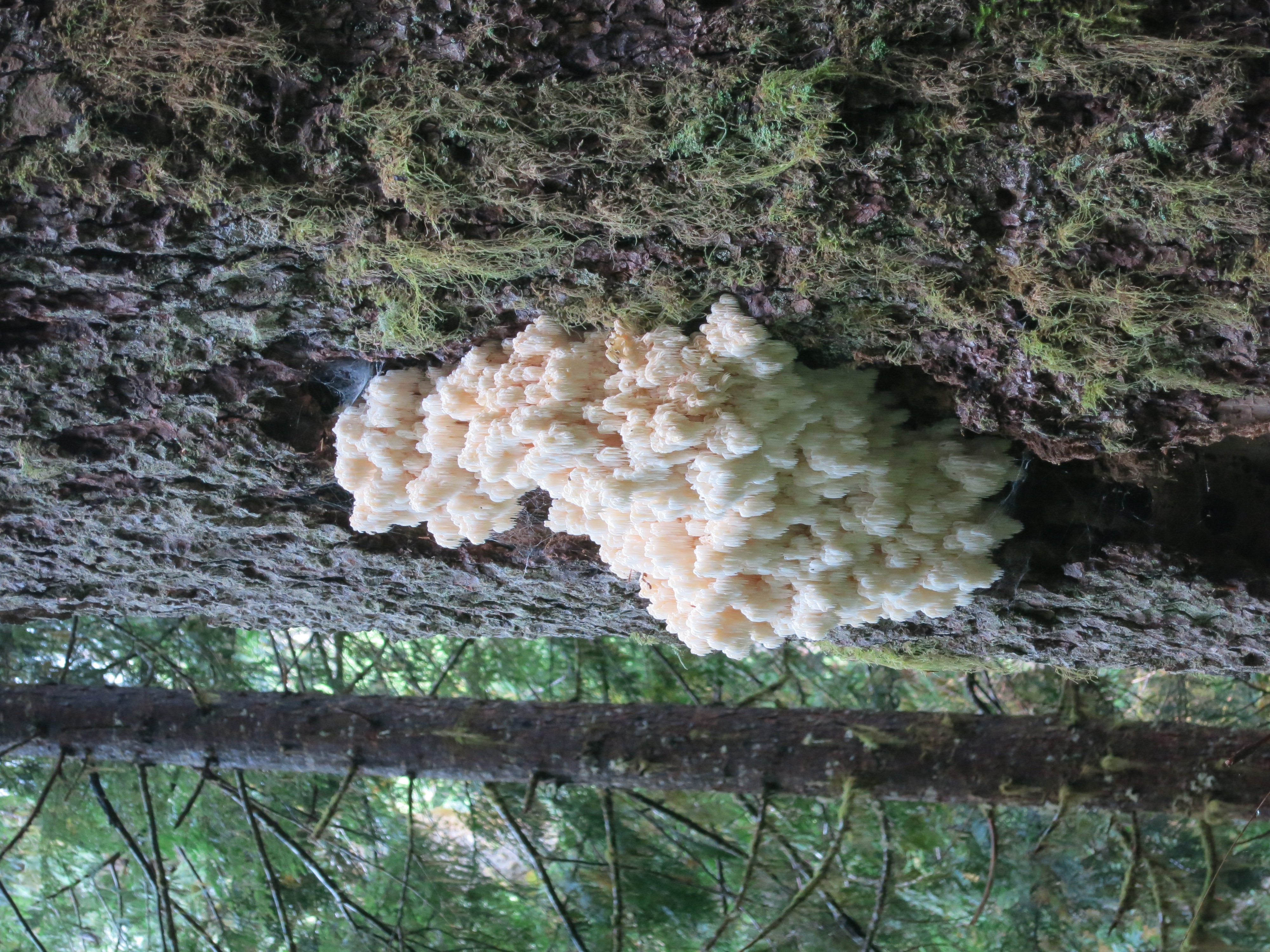
The next day started with the traverse of a steep ridge.  On our left the panorama of the Cascades stretched away to the south.  We could even see Mt. Rainier, just a tiny, ghostly two-peaked nub on the horizon:IMG_1573IMG_1578 crop

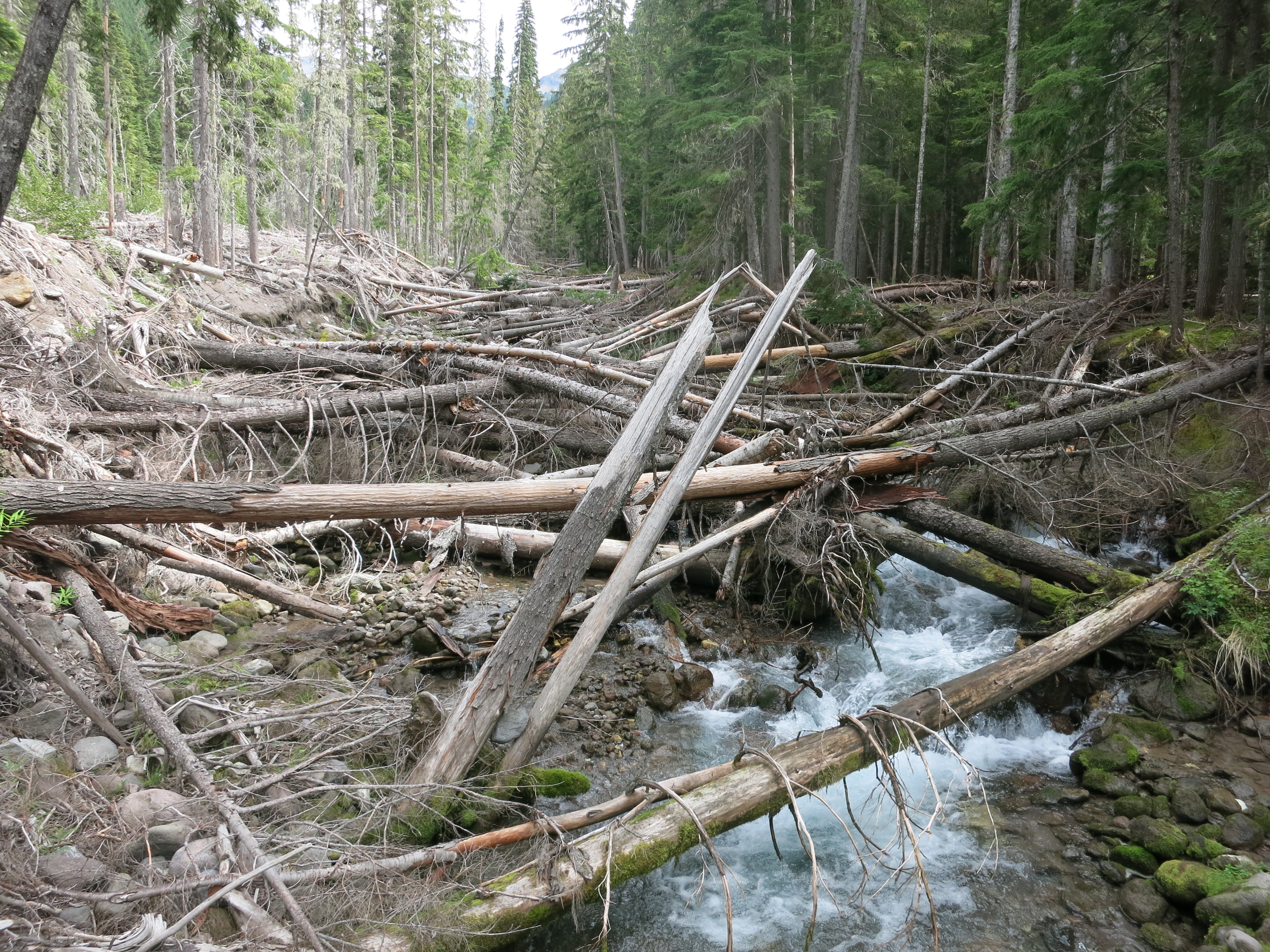
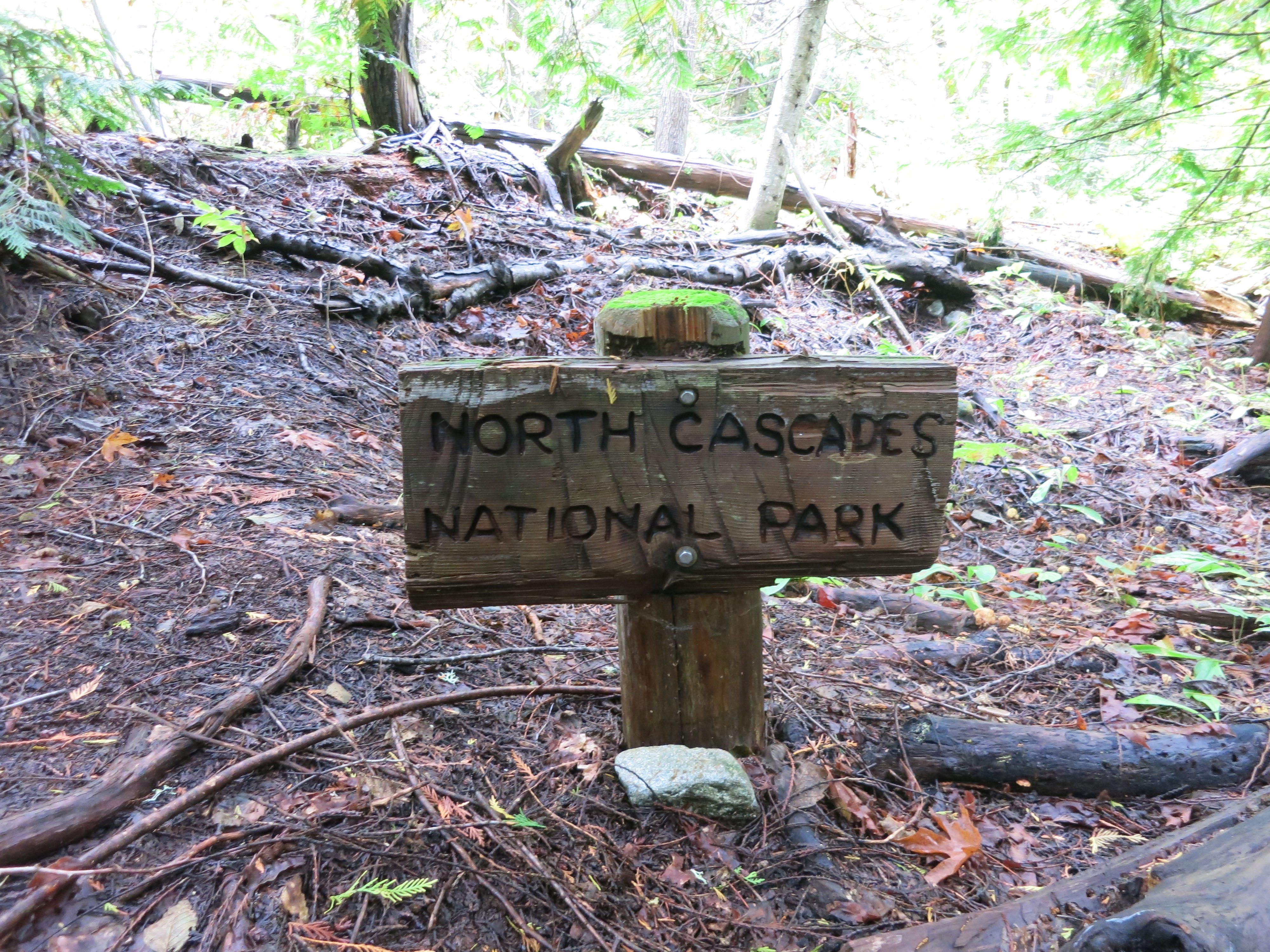
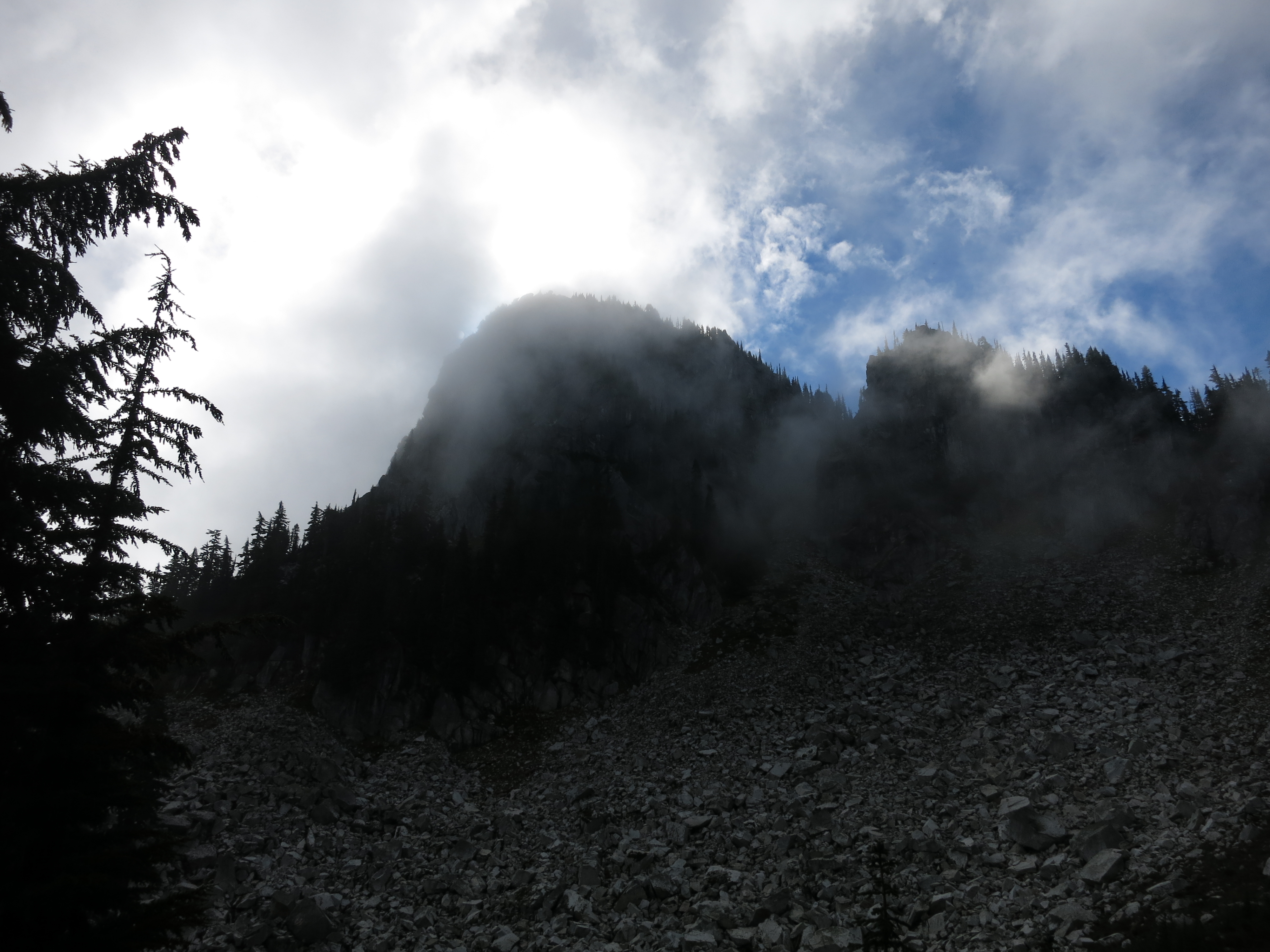
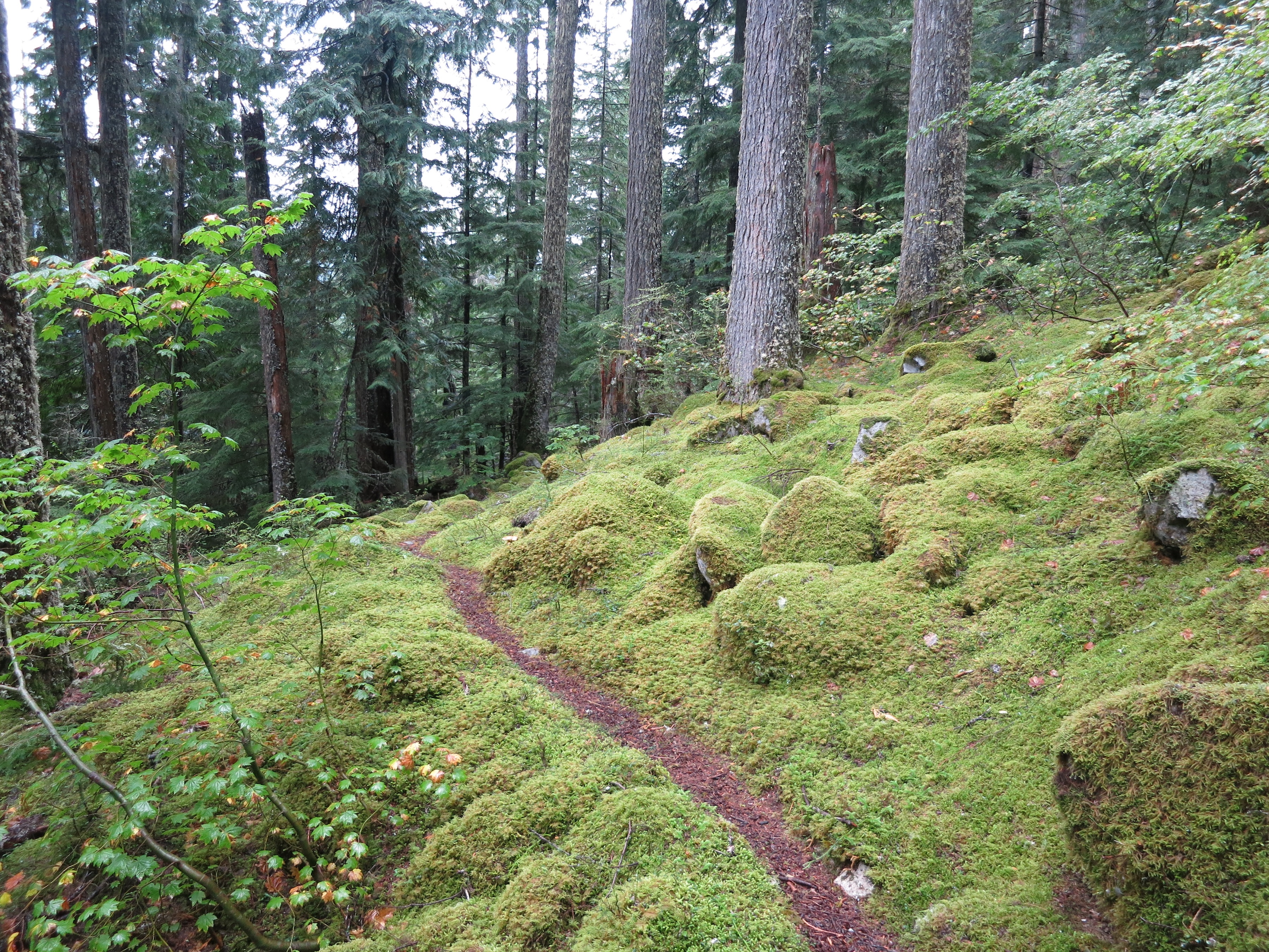
We came around the west side of Glacier Peak and dropped down into the dense forest on its flanks.  This entire section had been closed from 2003-2011 after massive flooding.  The trail through here was completely obliterated.  Leftovers from the devastation were all around us we hiked through the nearly-silent woods – but the path was in great condition!

IMG_1591

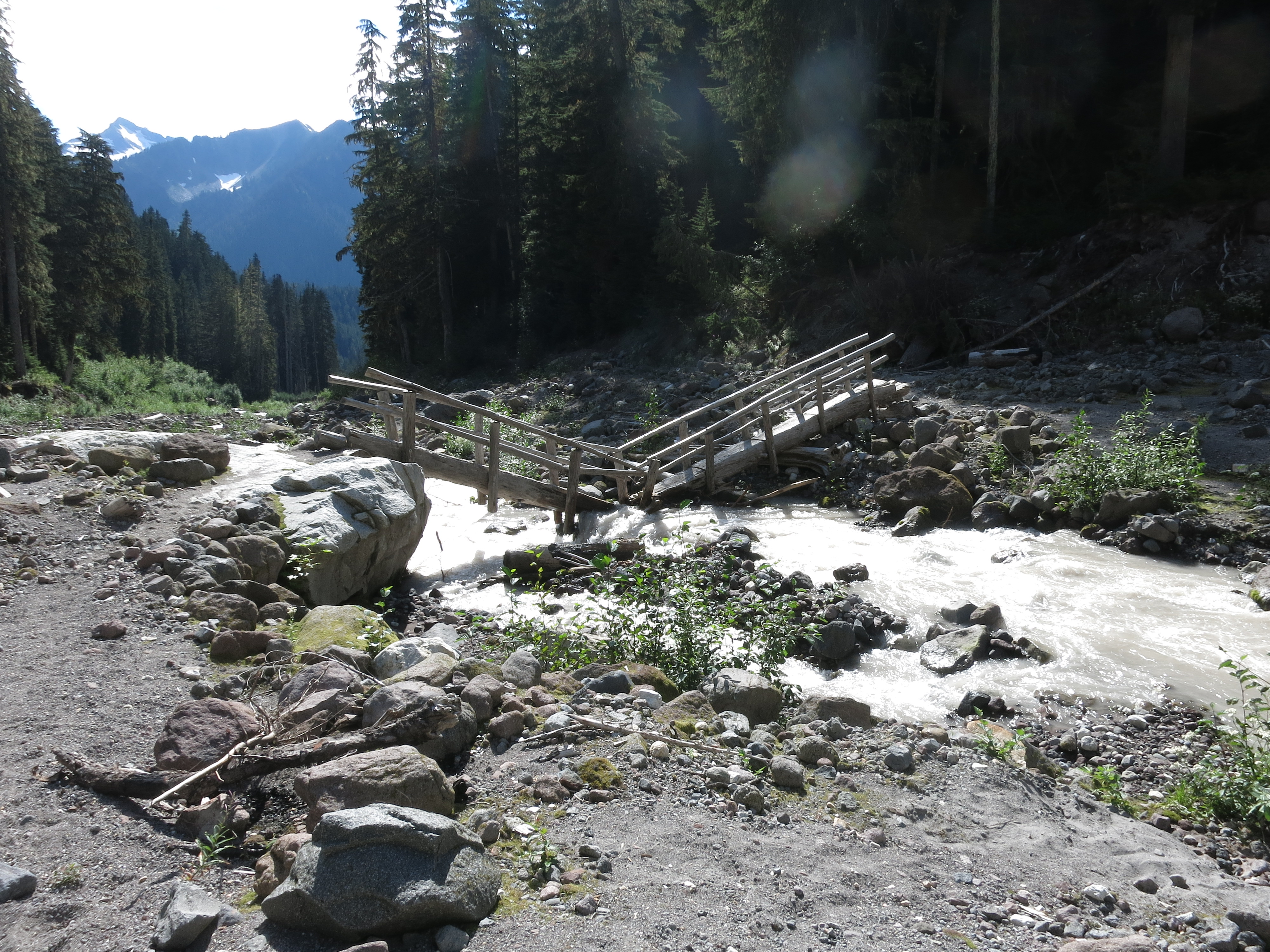
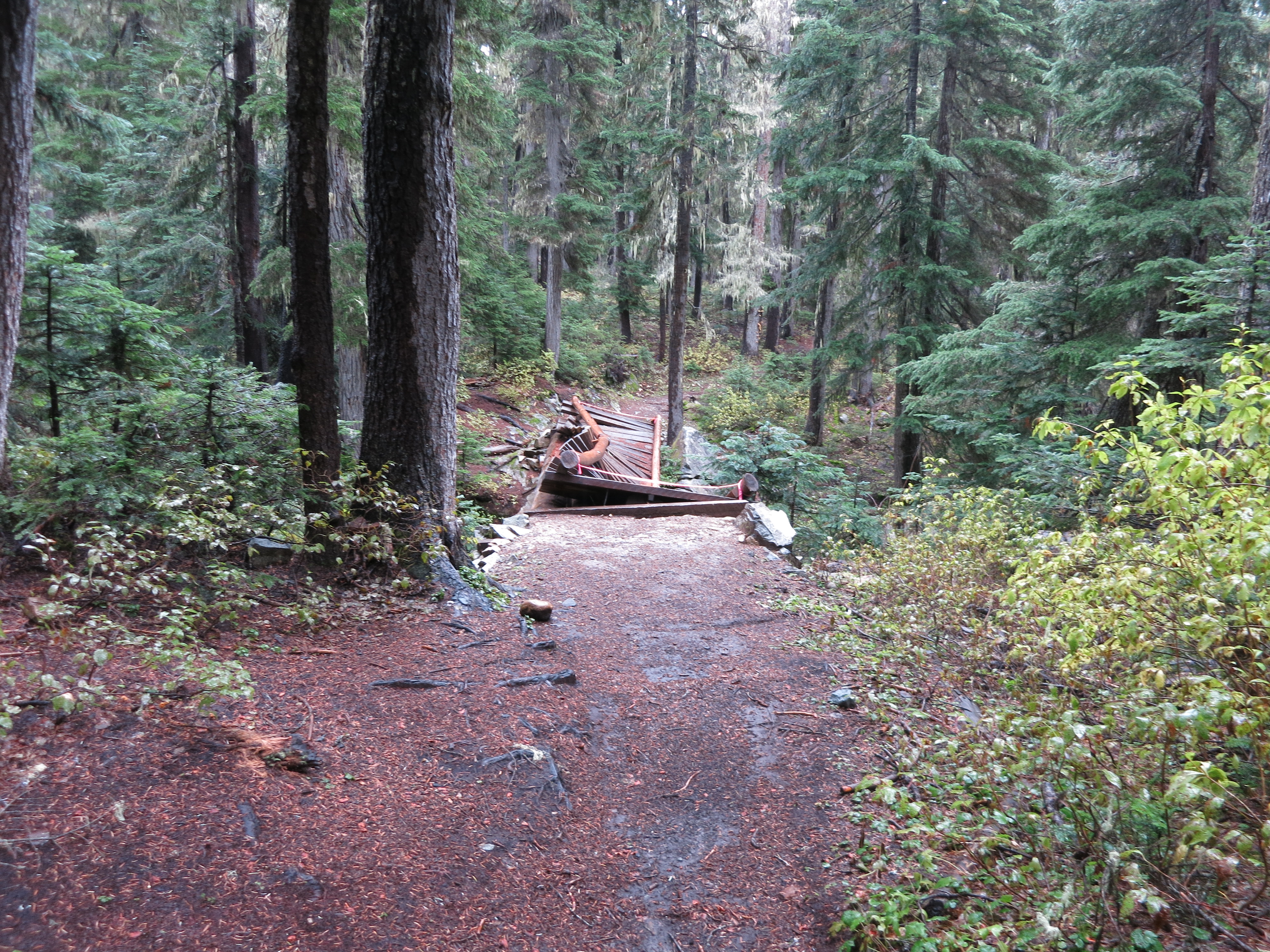
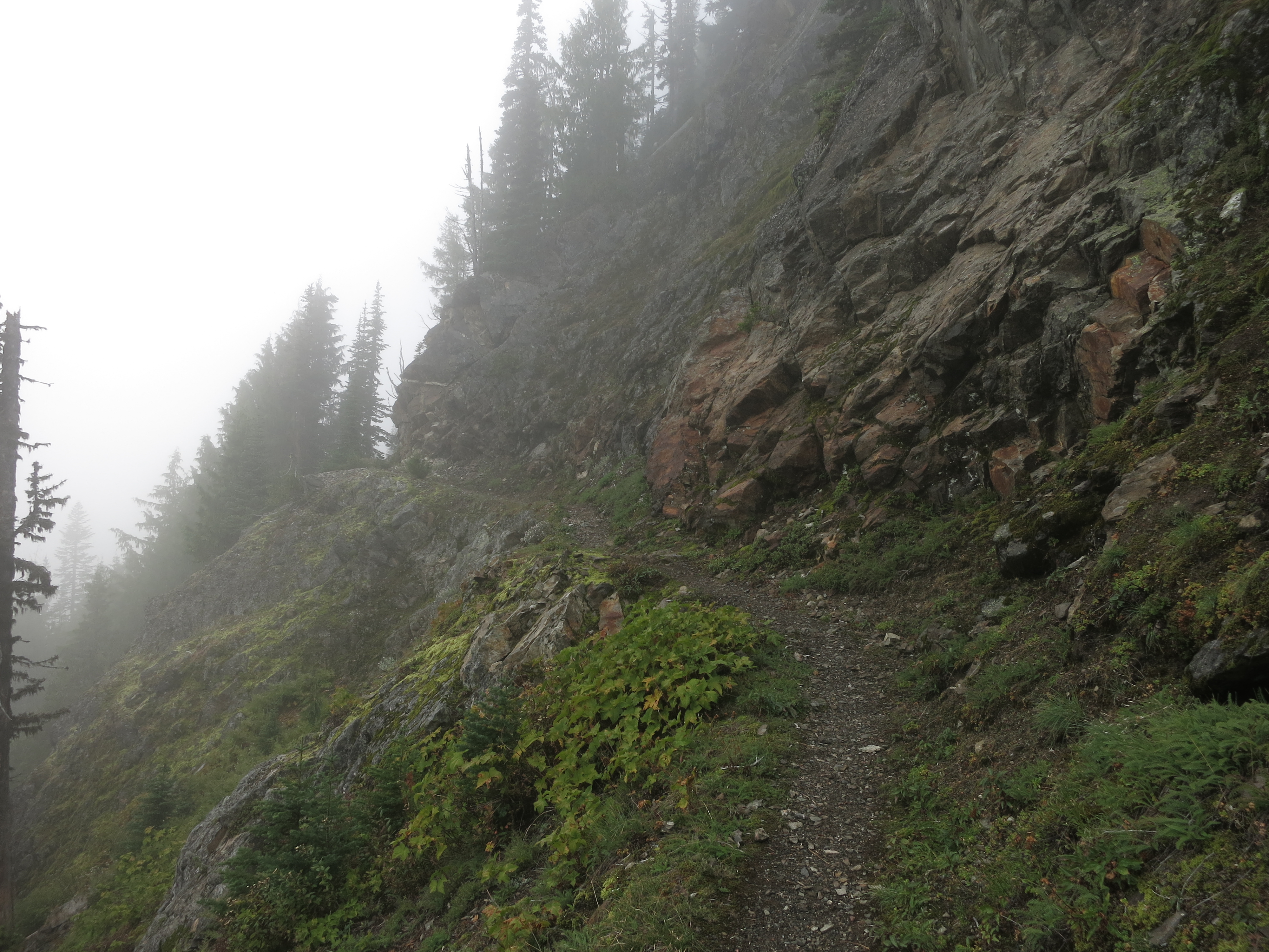
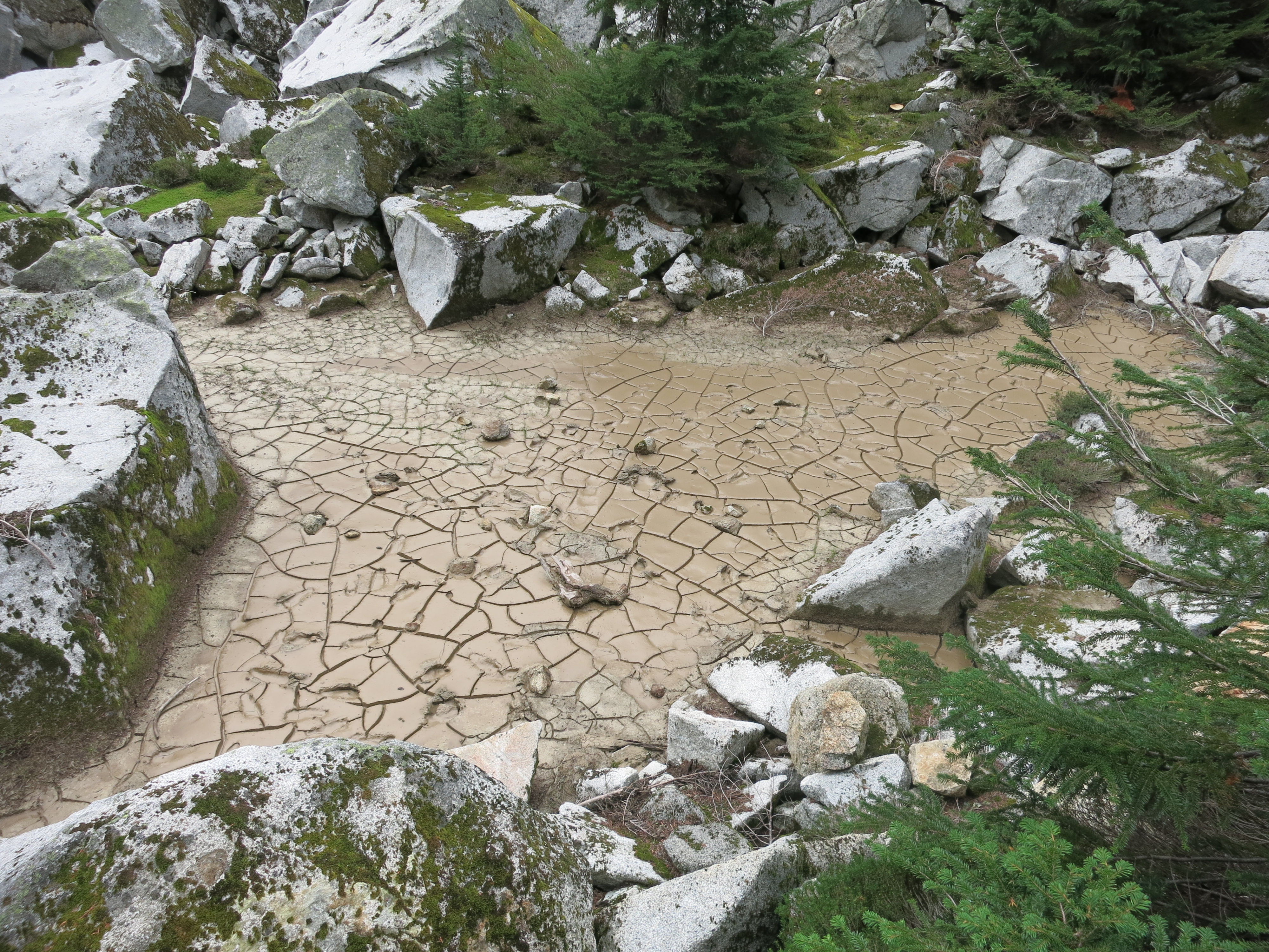
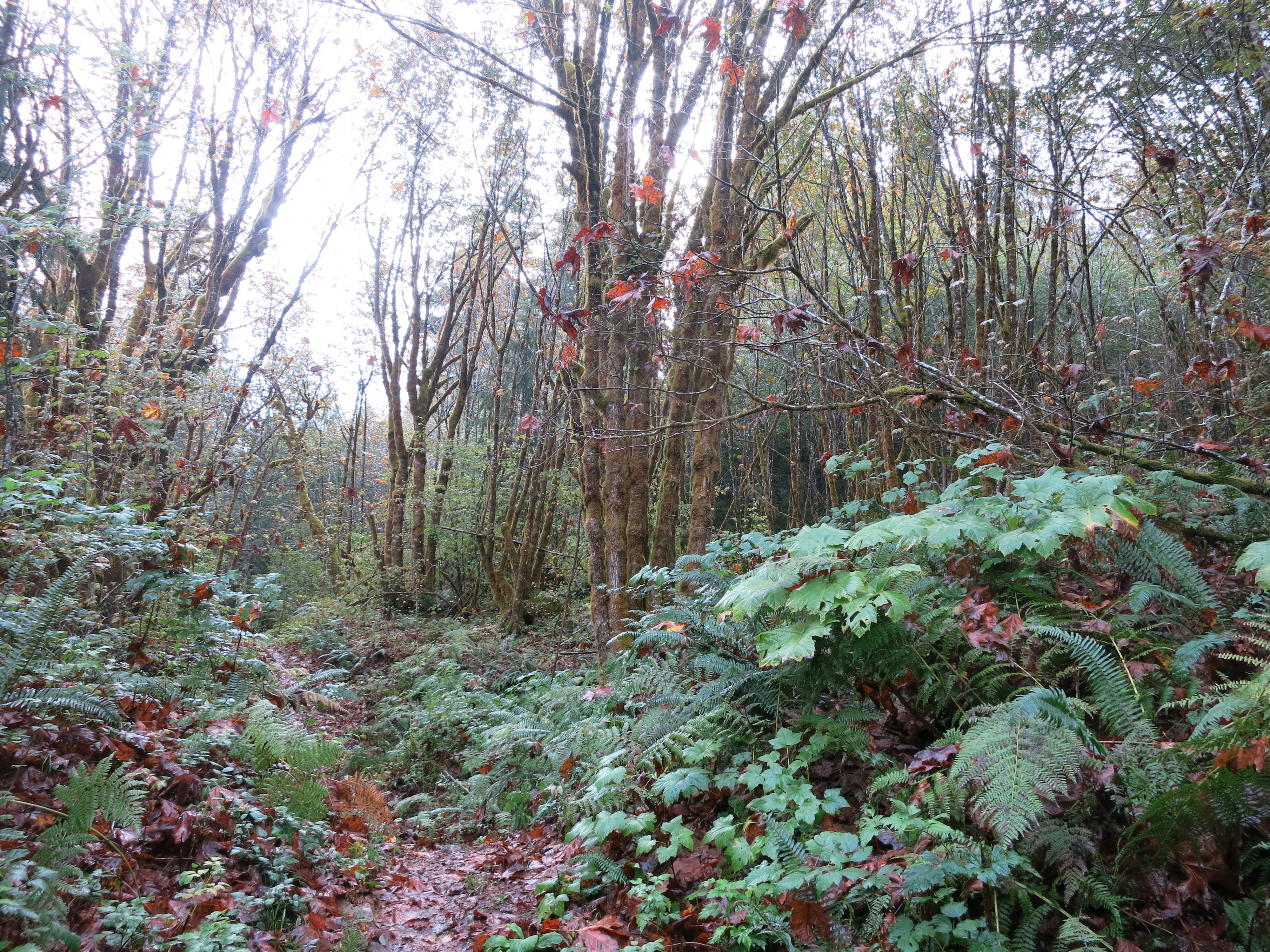
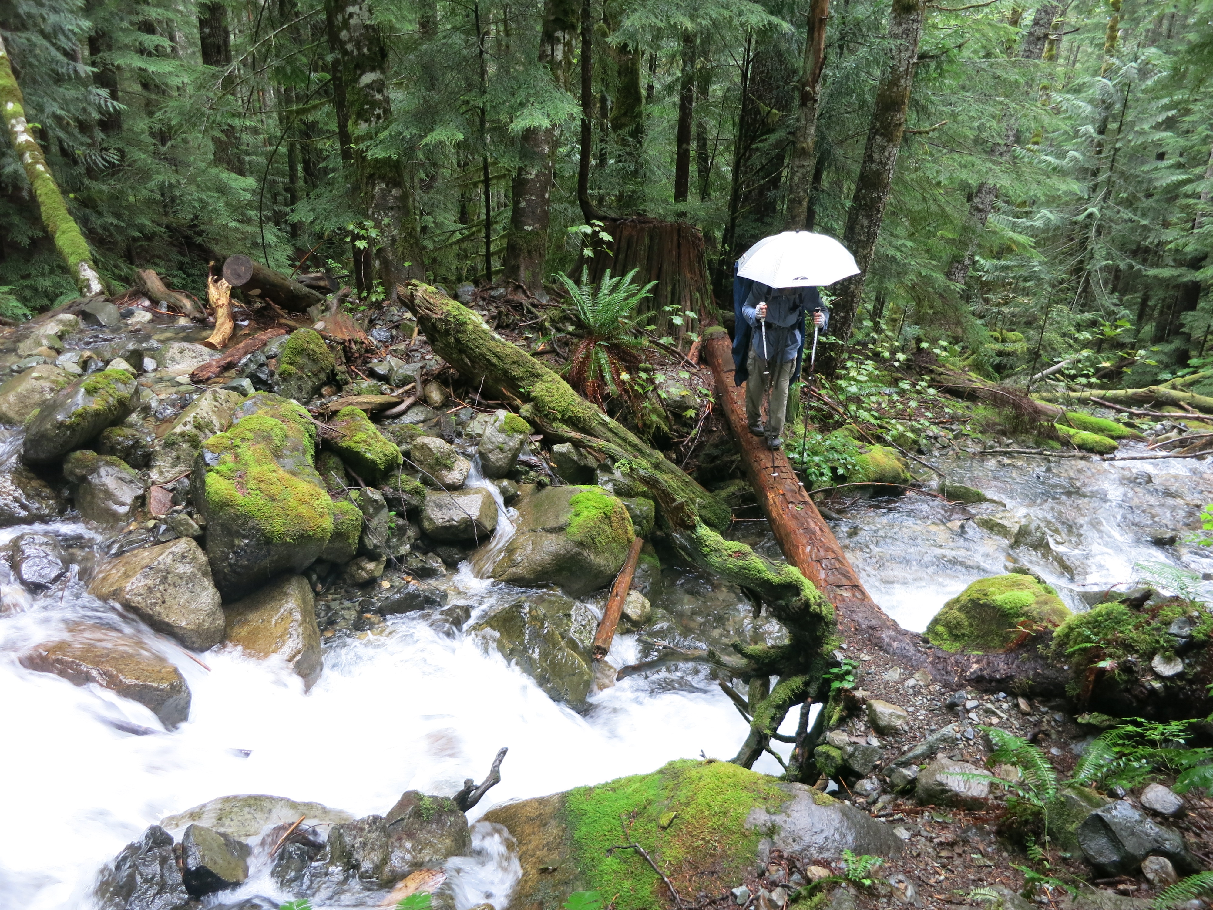
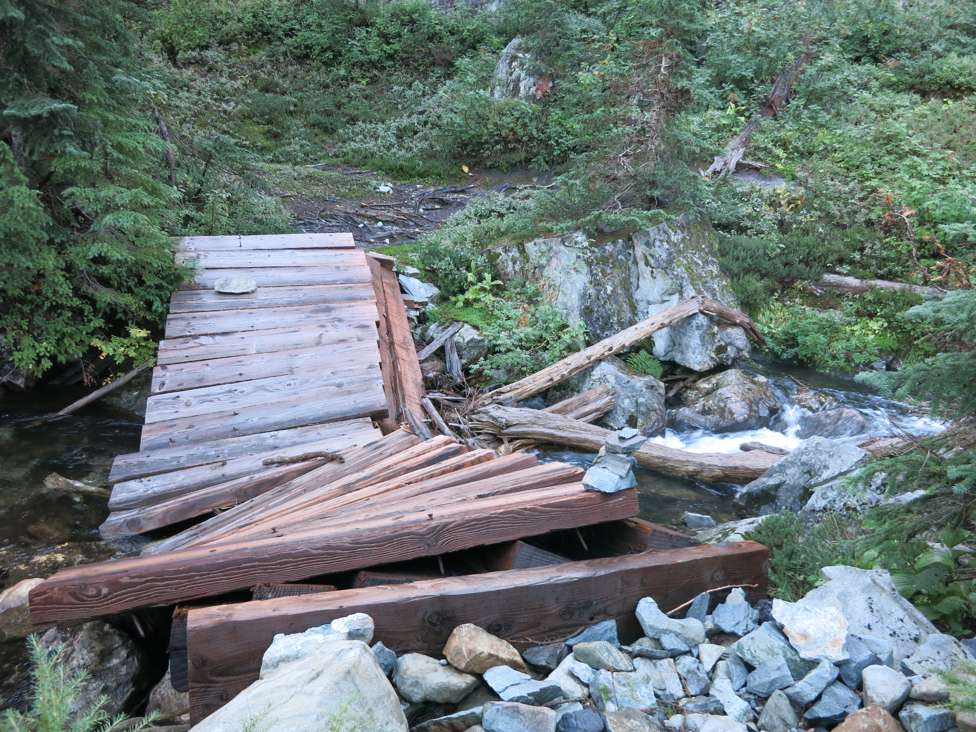
The trail to Kennedy Creek was rocky, muddy and very overgrown – a testament to how difficult this remote section is to maintain!  The bridge over the silty creek had suffered some backbreaking damage but still worked fine for our purposes:

IMG_1595

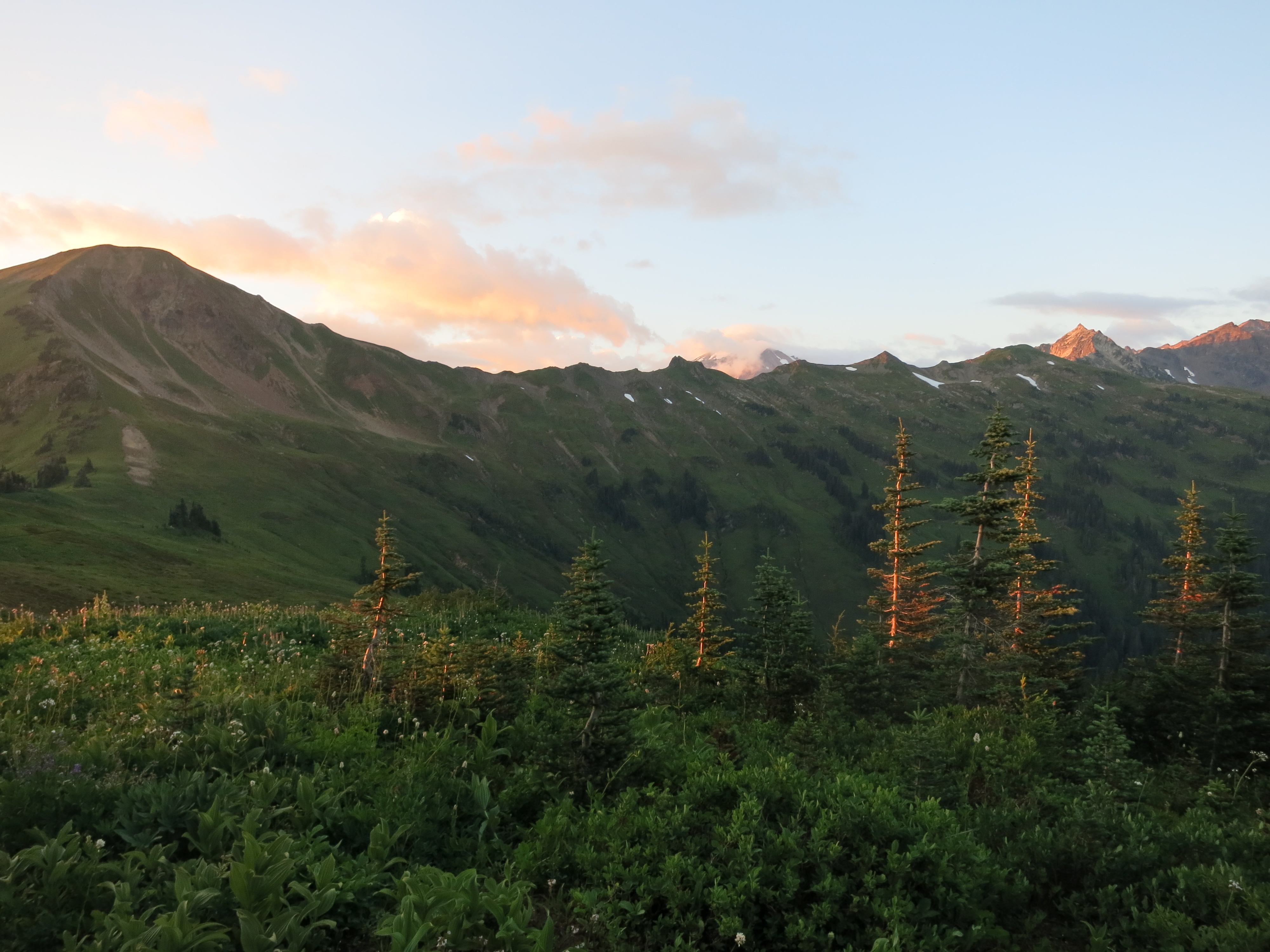
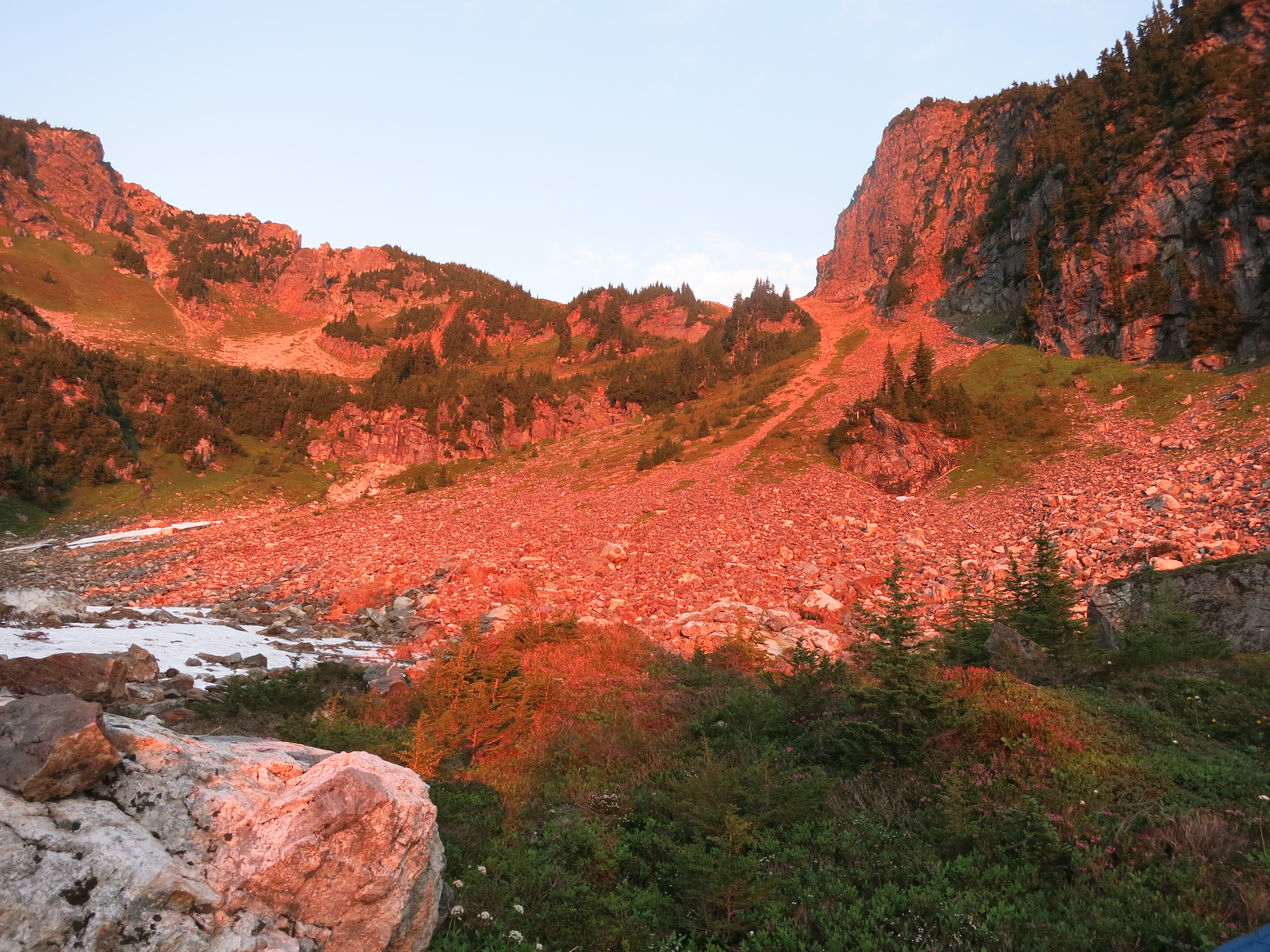
Afterwards we faced a long climb up the side of the mountain.  Good camping spots were suddenly rare and we pushed on longer than we’d expected, but were treated to luminous alpenglow at Fire Creek:

IMG_1601
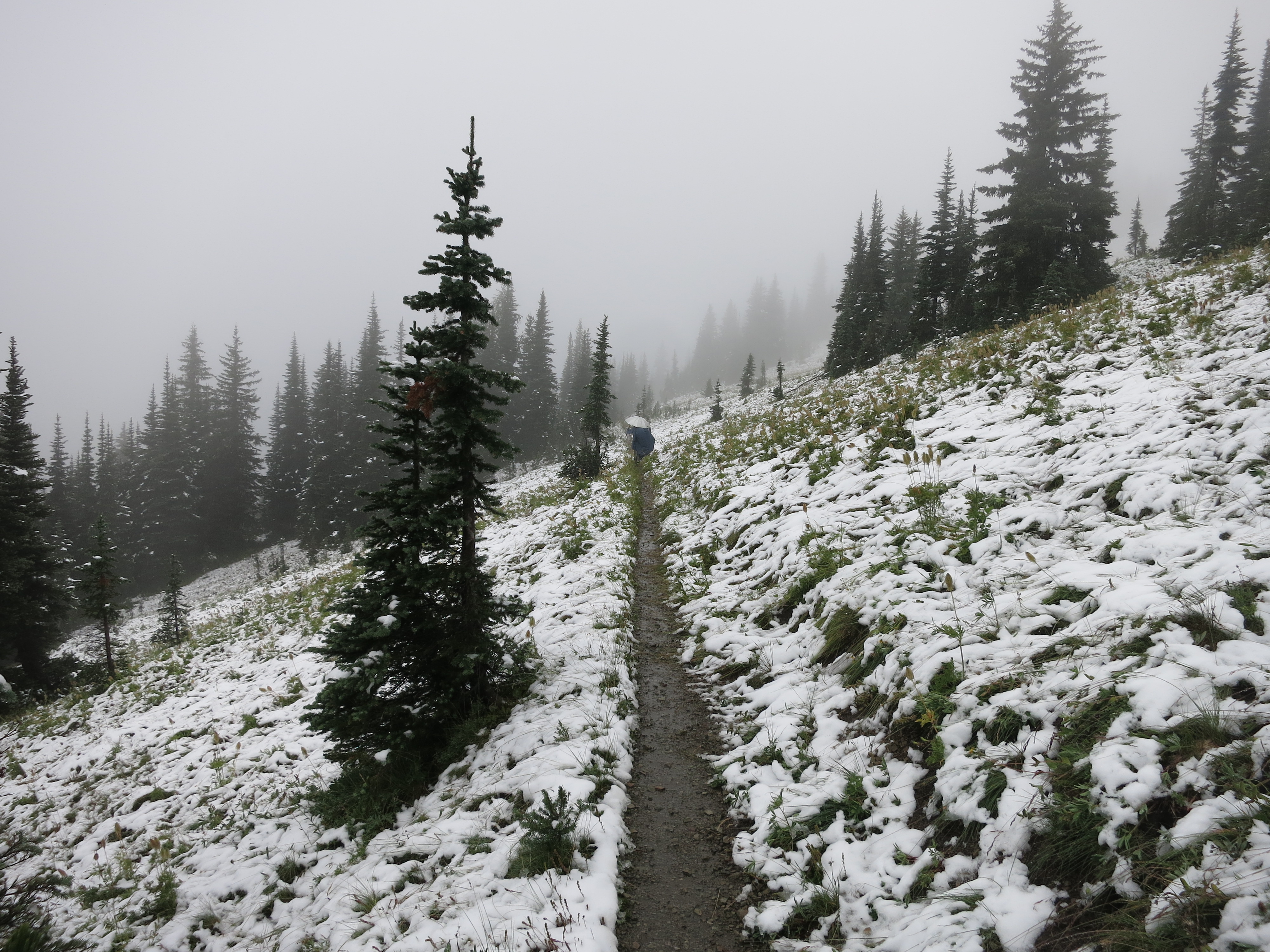
The next day took us over Fire Creek Pass:IMG_1608

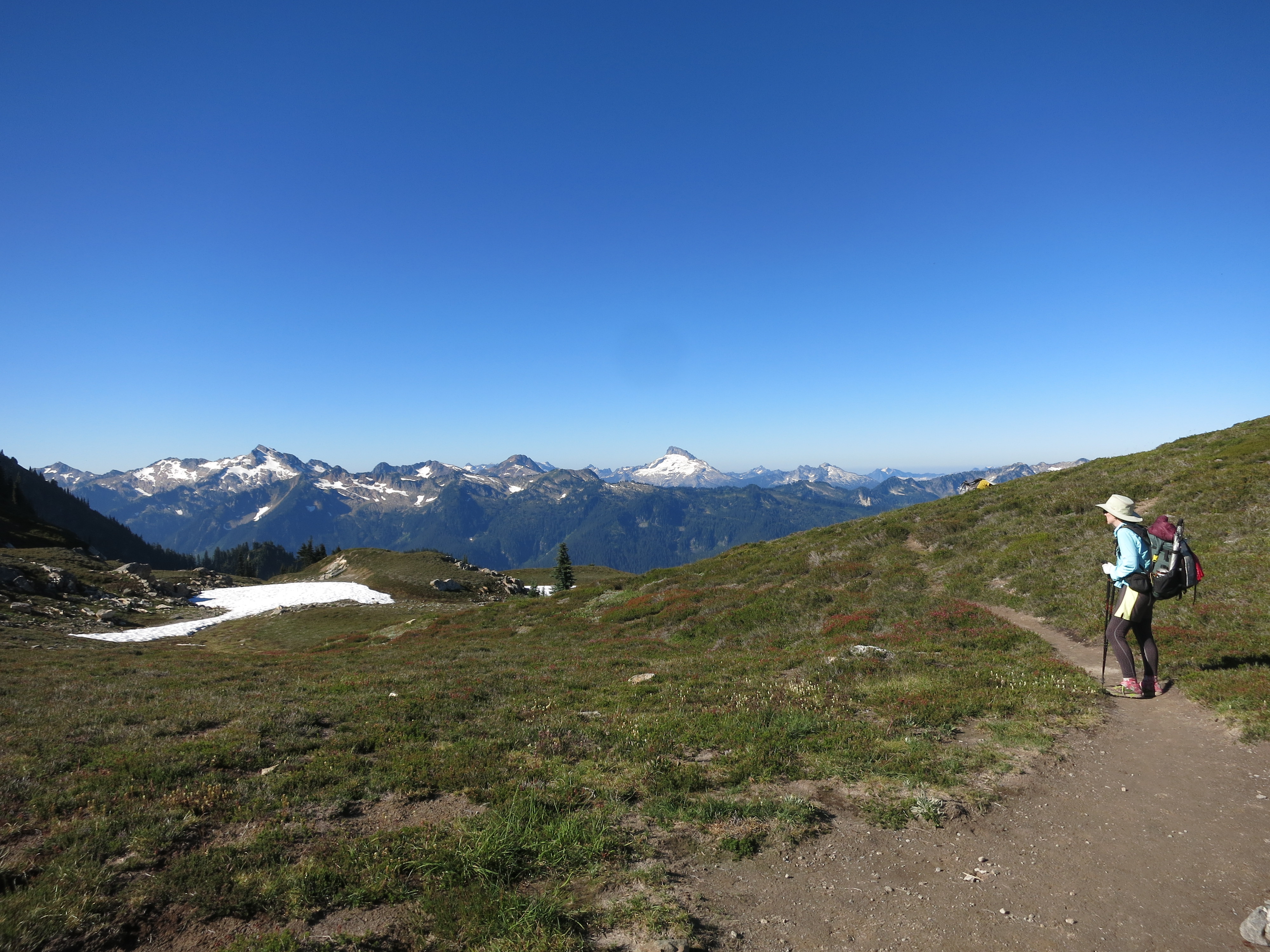
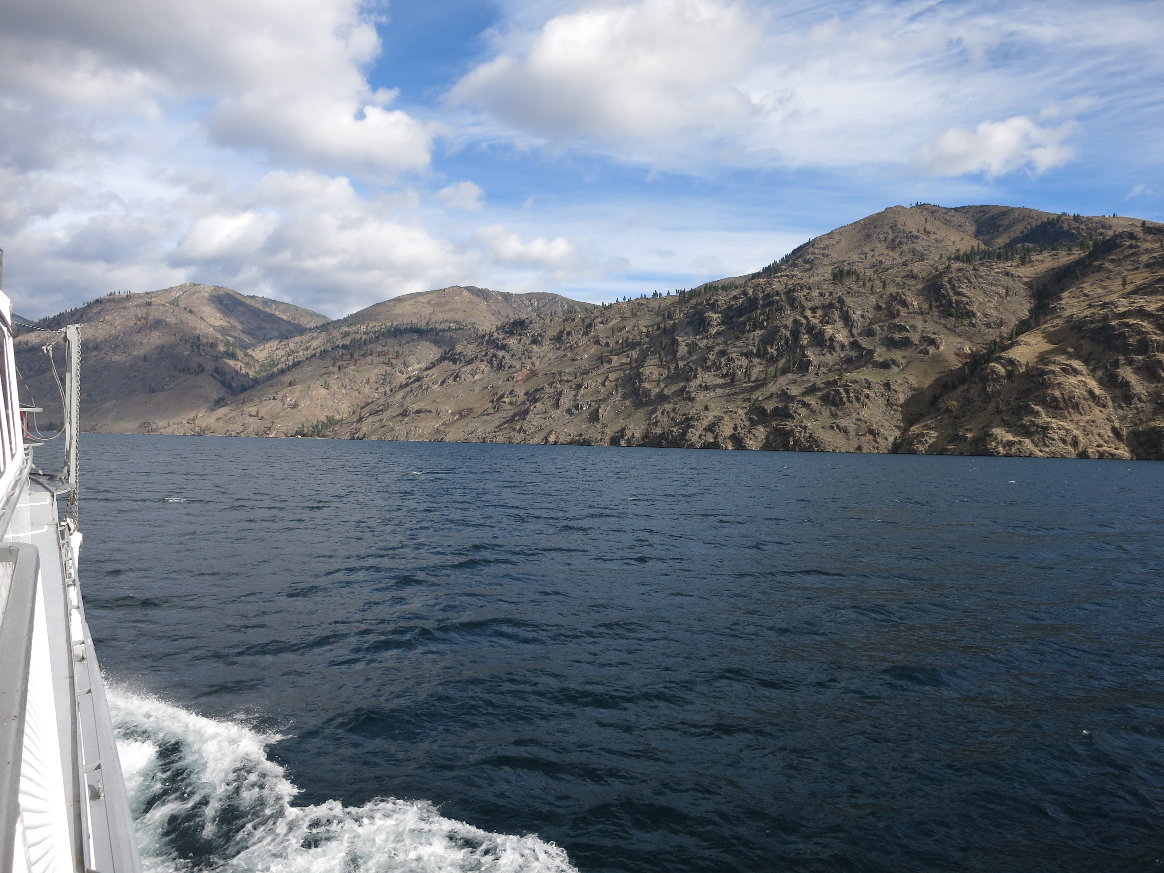
And down, down, down nearly 3000 feet to Milk Creek, where we had lunch with a thru-hiking couple we met in 2013! We first met Scattracker and Unicroc on Mother’s Day a month into our hike – an easy day to remember, since it also featured trail magic in the form of root beer floats in the Mojave Desert.  They had also been stymied by the weather last year and were back to complete the trail.  They were in much better shape than us since they had just finished hiking the Long Trail in Vermont. We felt so lucky to have bumped into them!  After eating they left us in their dust as they zoomed (and we plodded) up the long climb. Just like on the Wonderland Trail, what goes down a glacial valley must come up, and it was a hot, overgrown up:milk creek

We finished the day in fine fashion, in an eastern-facing meadow full of flowers and fat marmots:

IMG_1623
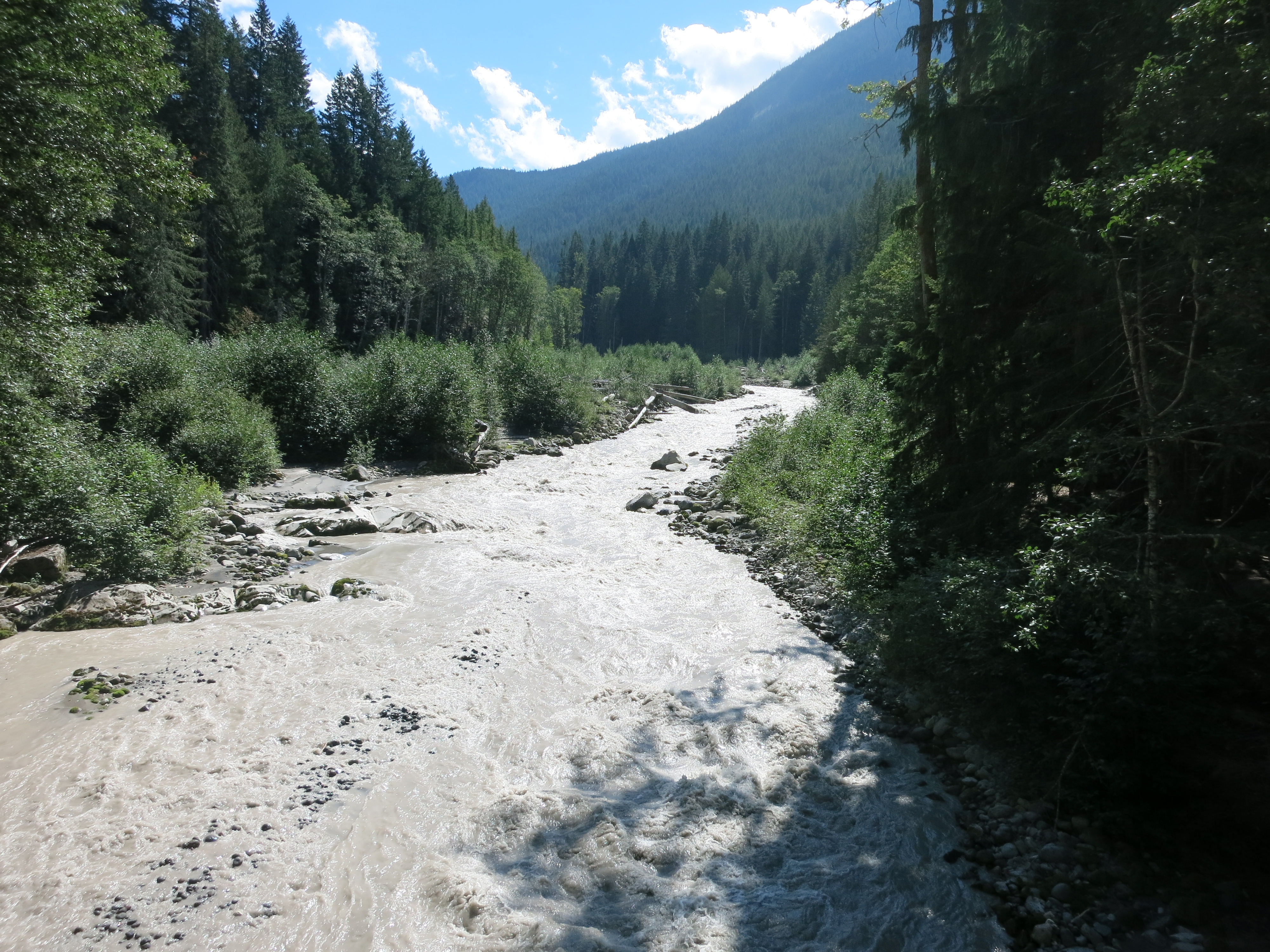
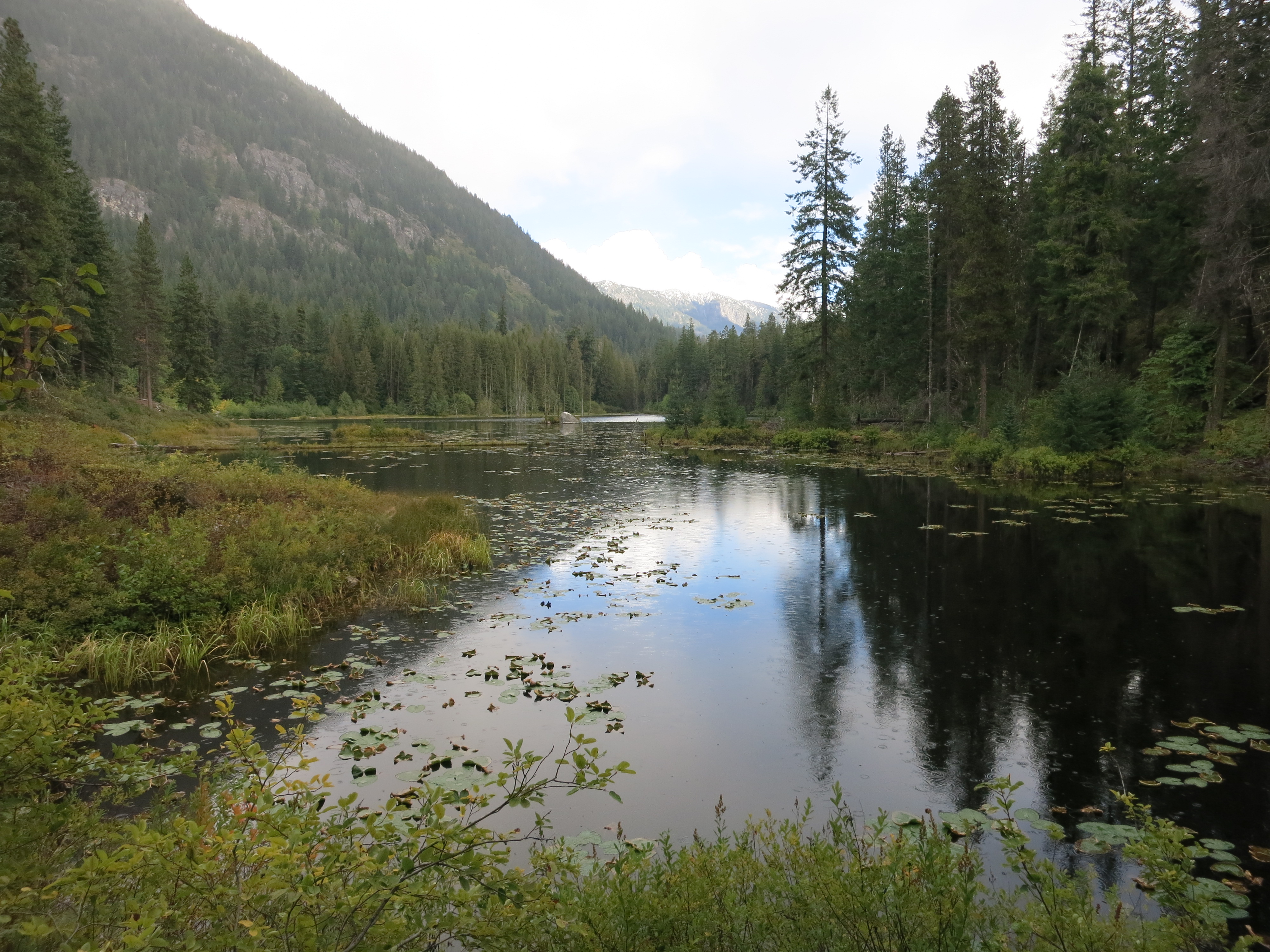
The next morning took us down another long, gentle descent to the chocolate-milk-filled Suiattle River. We climbed over what felt like hundreds of downed trees:IMG_1626IMG_1628

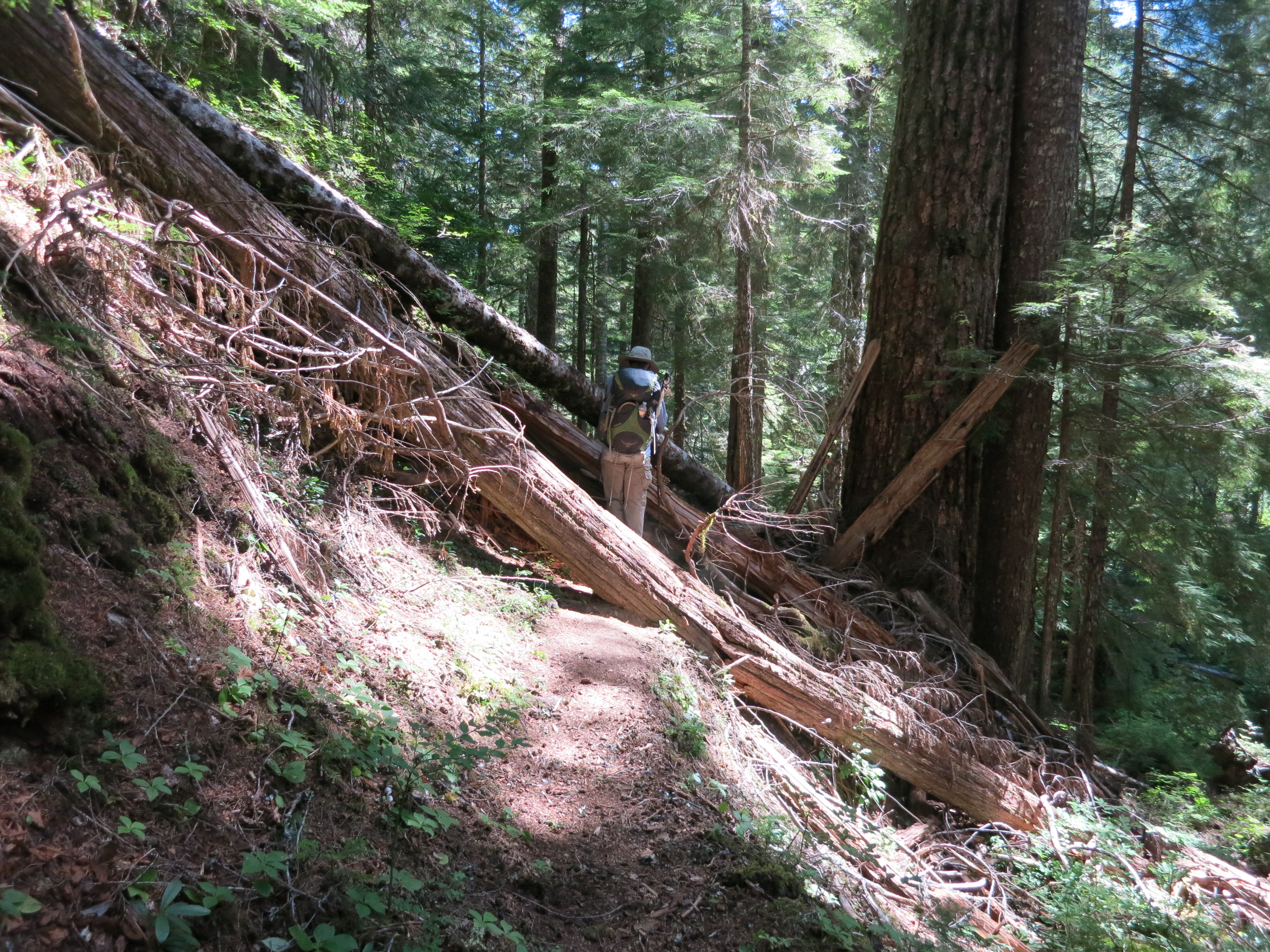
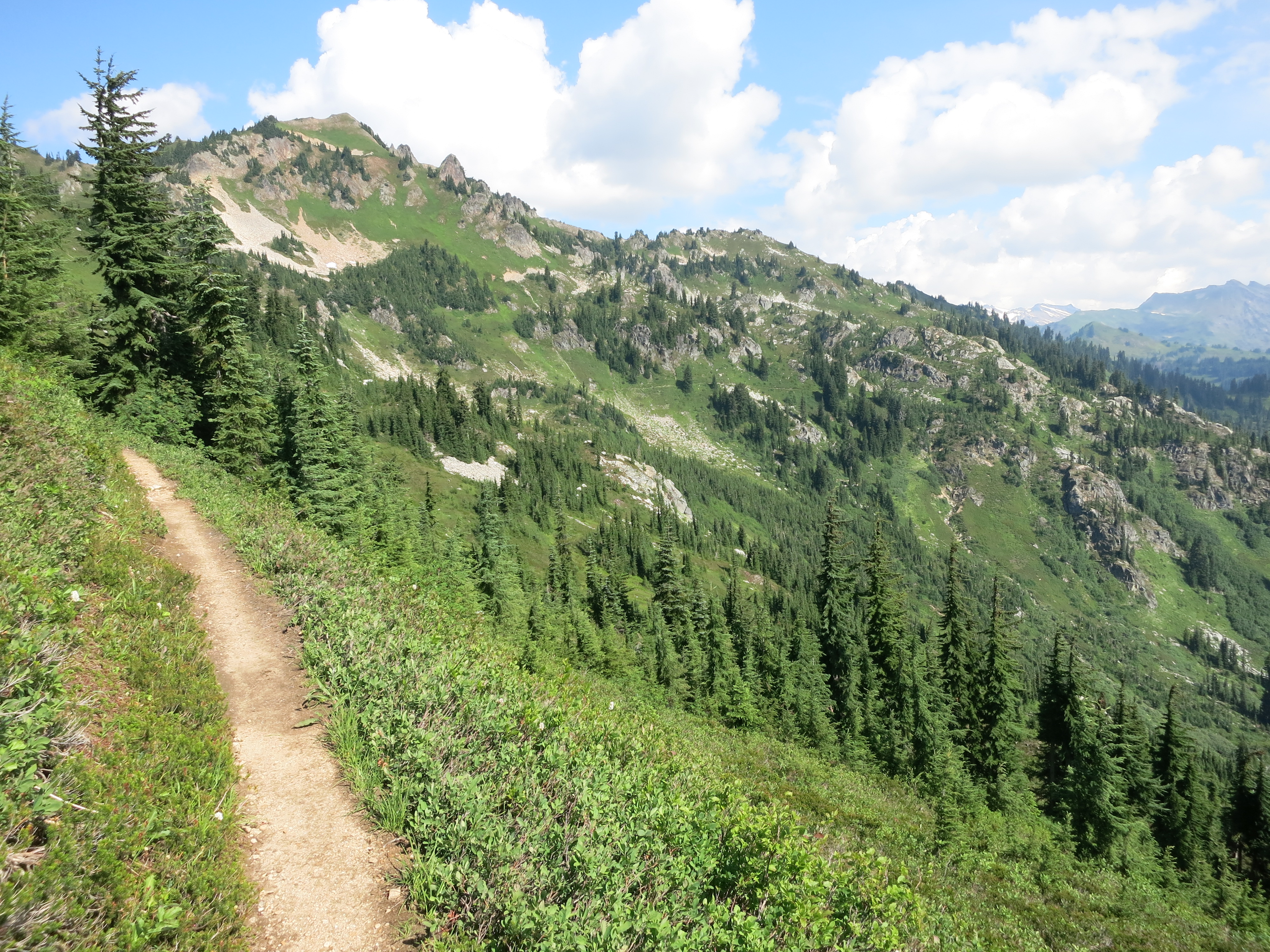
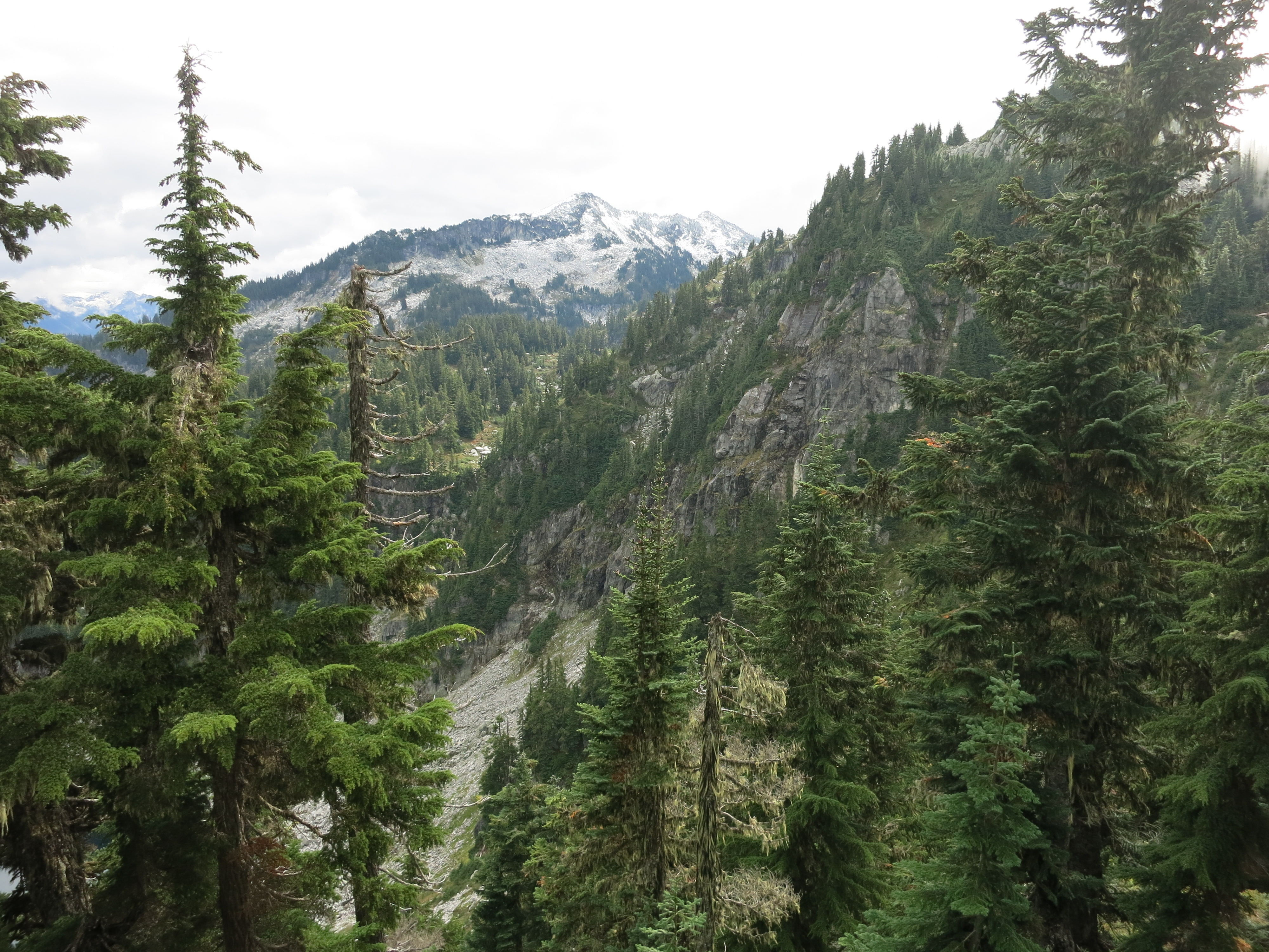
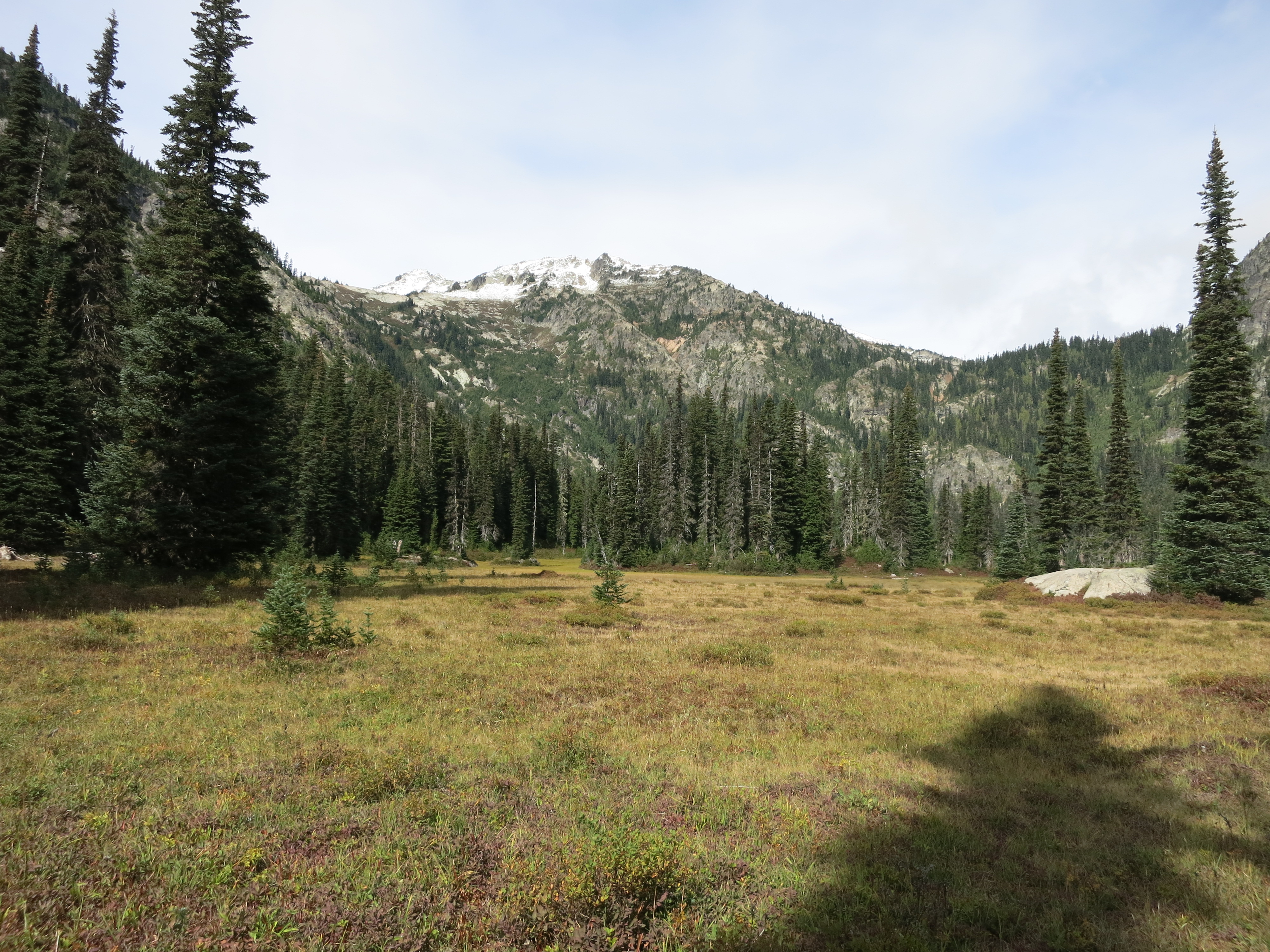
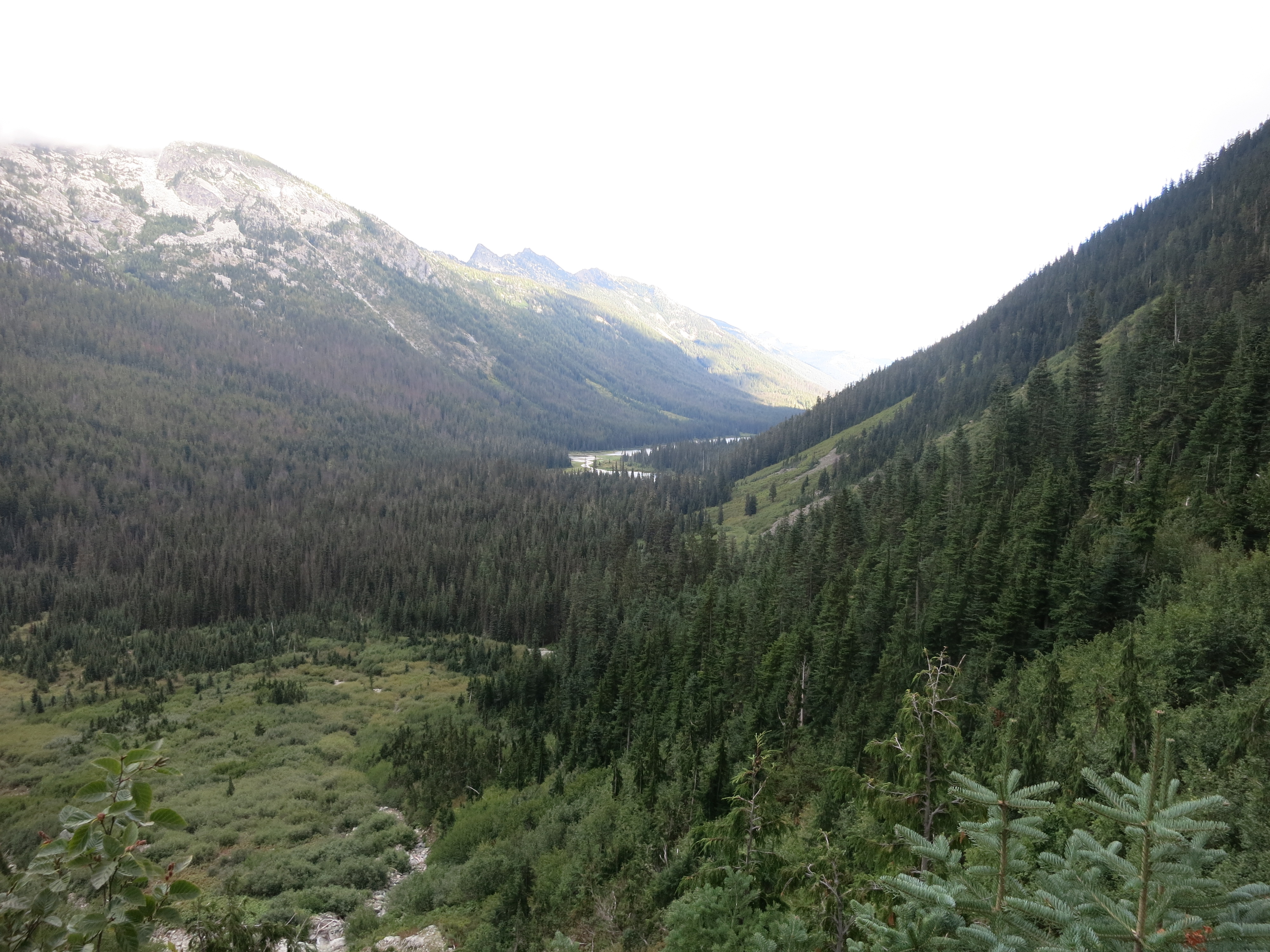
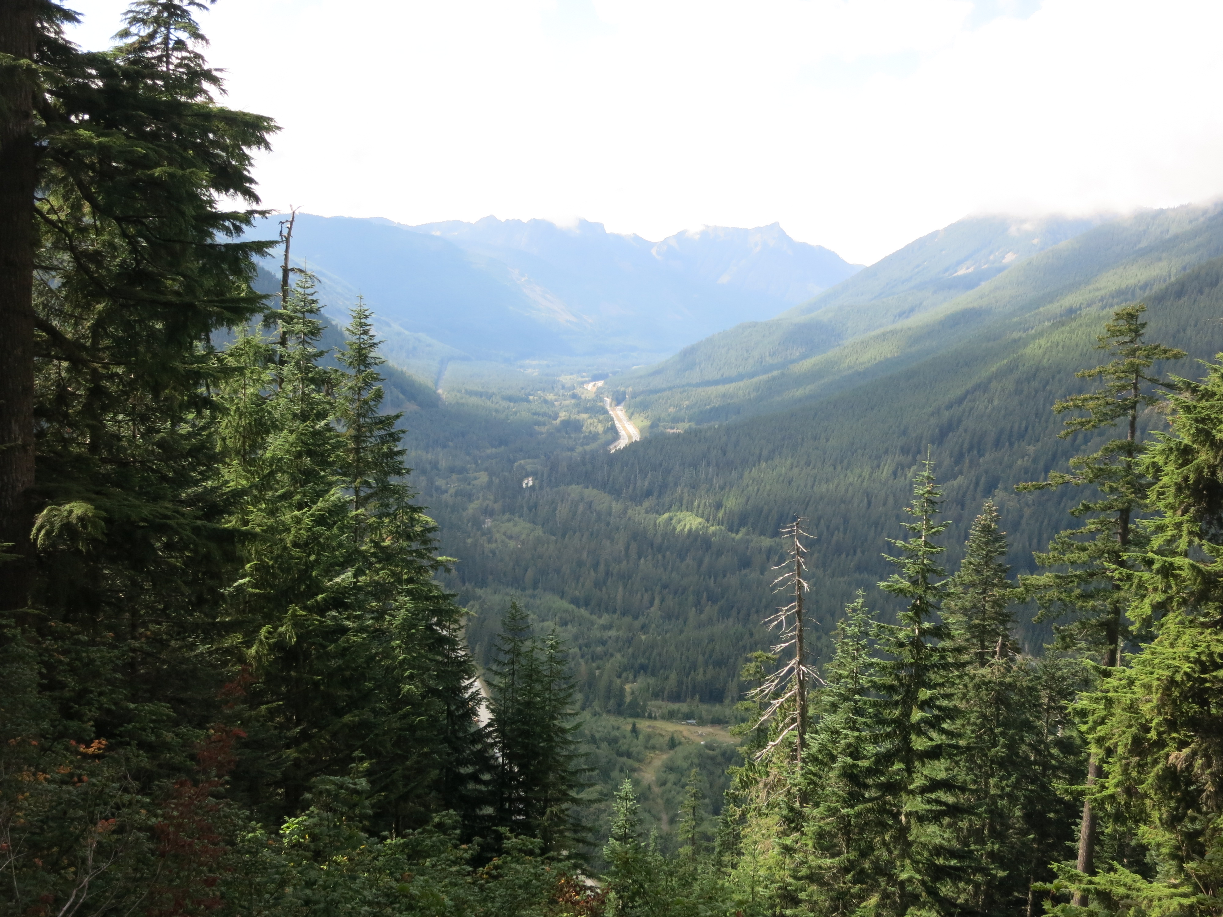
The climb back up wasn’t as steep this time, and at the top we had a cozy little campsite all to ourselves.  The next morning we tackled the last ridge between us and Stehekin.  At the top it seemed as though we could see the entire valley stretched out in front of us:IMG_1635

We followed a fork of Agnes Creek, crossing the many side streams:

IMG_1652

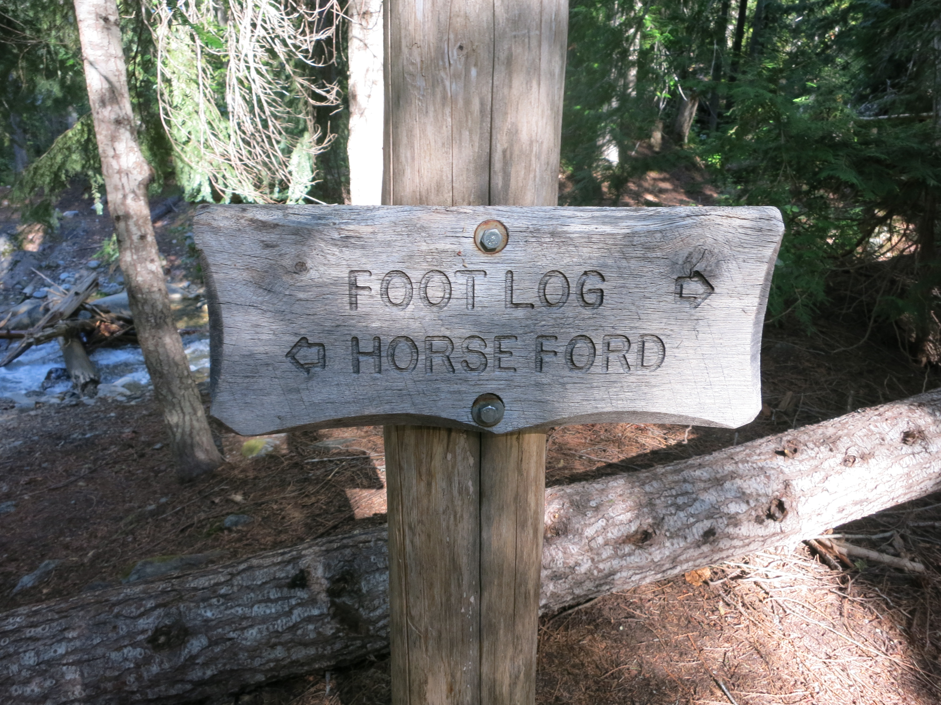
But were too slow to catch the last bus of the day into town.  So we camped a quarter-mile from the road and let the Stehekin River lull us to sleep.  The next morning we were up, packed, and hiking in record time.  Our hiker hunger was back, and after a week of dehydrated meals we were looking forward to the bakery in town.  What’s the best way to spend $60 in 30 seconds?  Put two hungry hikers in a pastry dreamland:IMG_1657

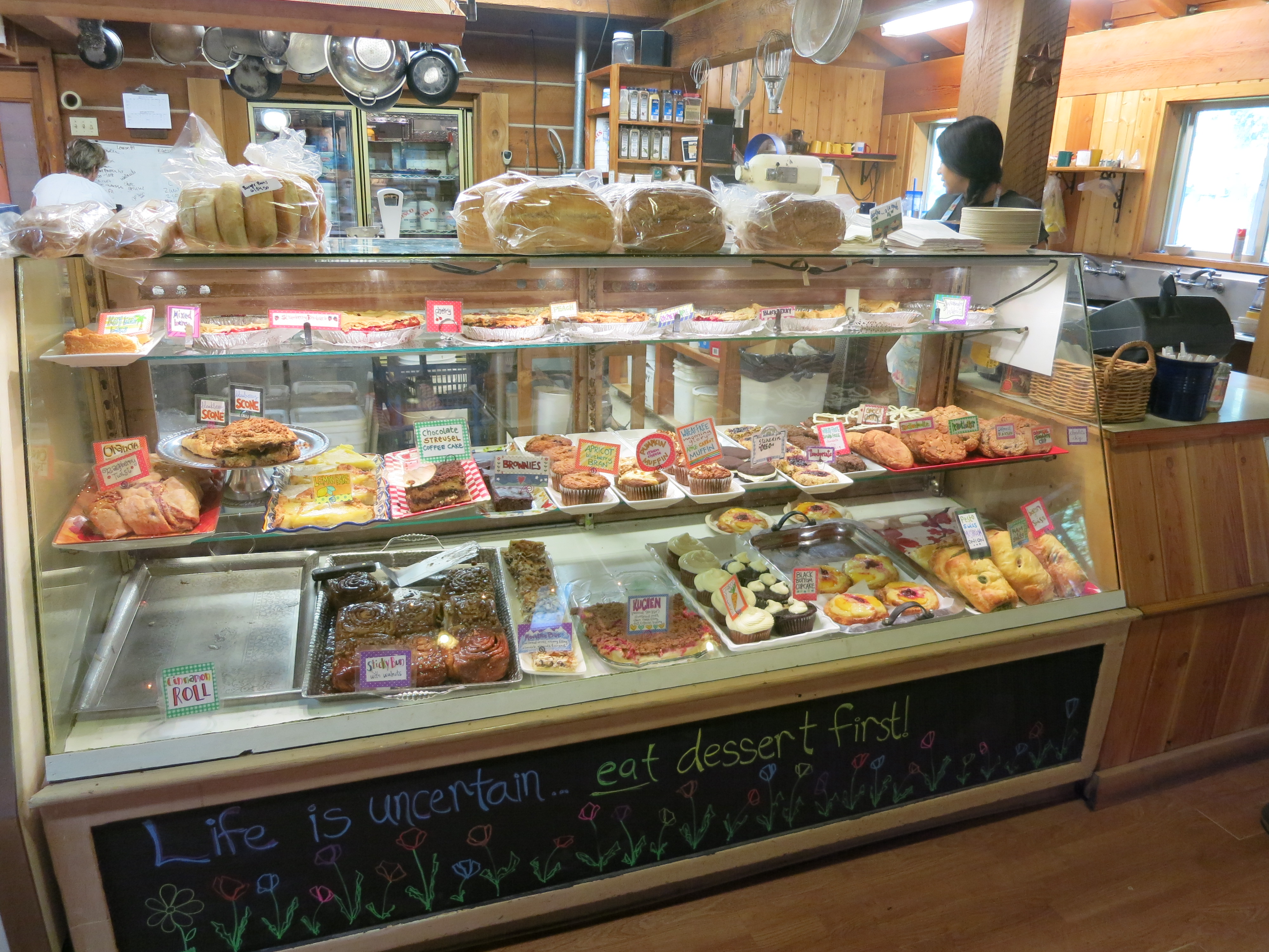
It was like Rodney Dangerfield in the Bushwood Pro Shop.  We bought pastries for our first few lunches back on the trail and pizza pockets to replace the breakfast granola neither of us had any appetite for. Another short bus ride brought us to an organic farm where I satisfied my craving for fresh fruit:IMG_1660

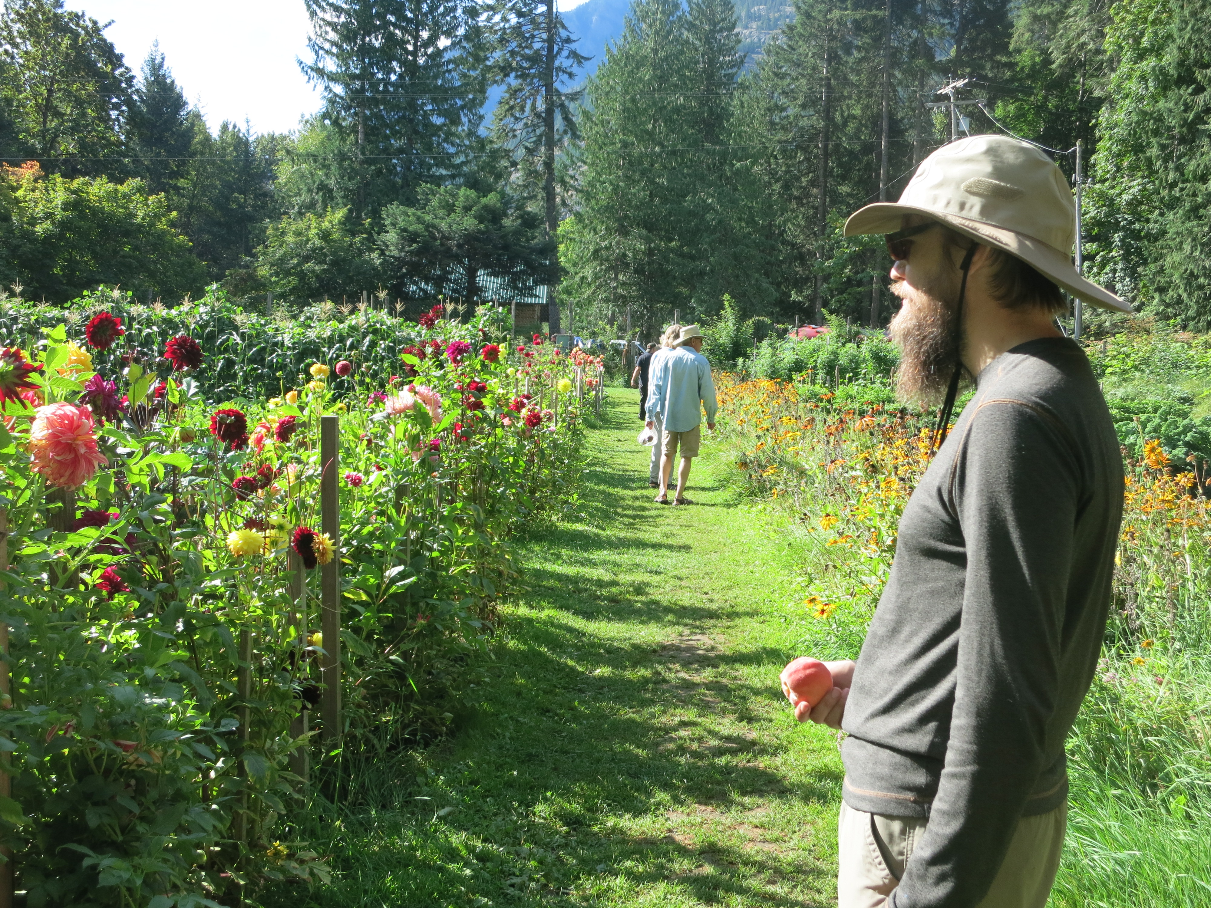
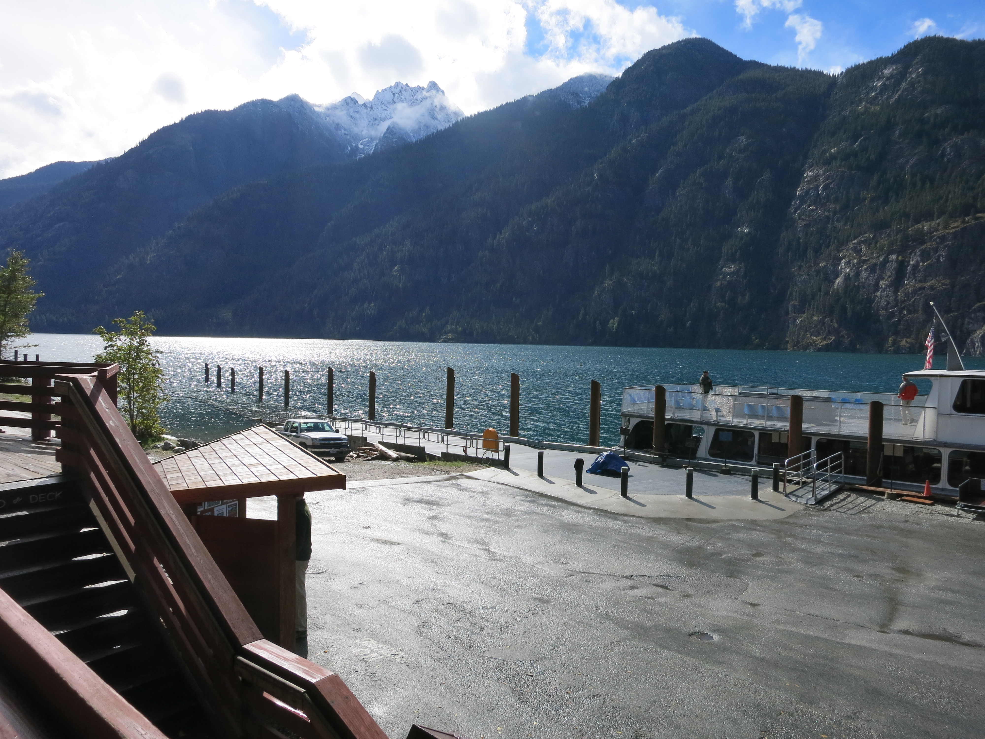
Then we arrived at the landing, where we ate, did our laundry, picked up our resupply package, ate, got a camping permit for the national park, ate, and generally enjoyed our day off.  Much nicer weather than last year!IMG_1661
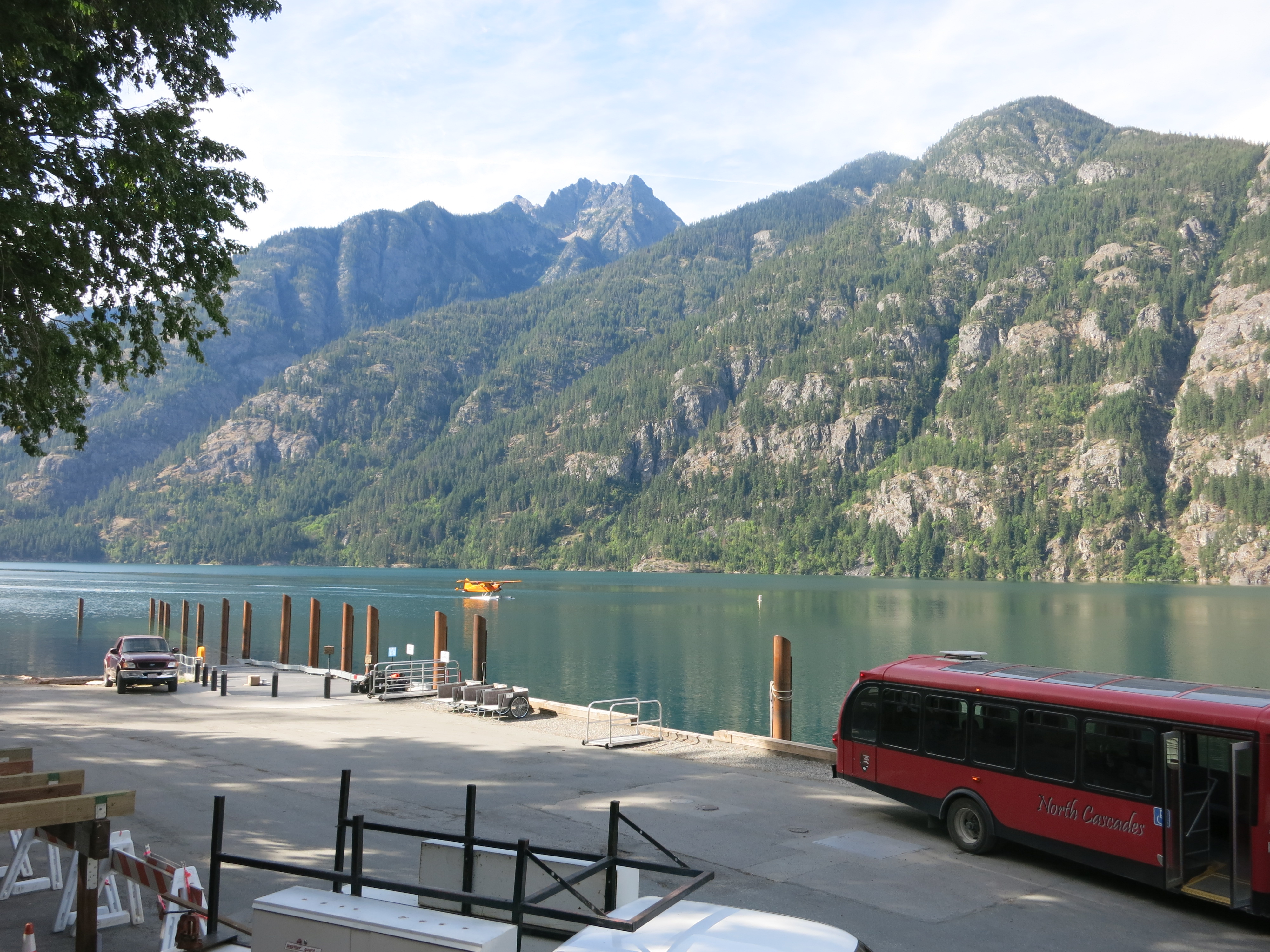
The next day we returned to familiar trail as we hiked north along the Stehekin River.  We passed the spot where we spent the final night of our hike almost a year ago.  Shortly afterwards we crossed Maple Creek on a suspicious-looking suspension bridge – a nice alternative to the long, frigid foot crossing of last time.IMG_1668

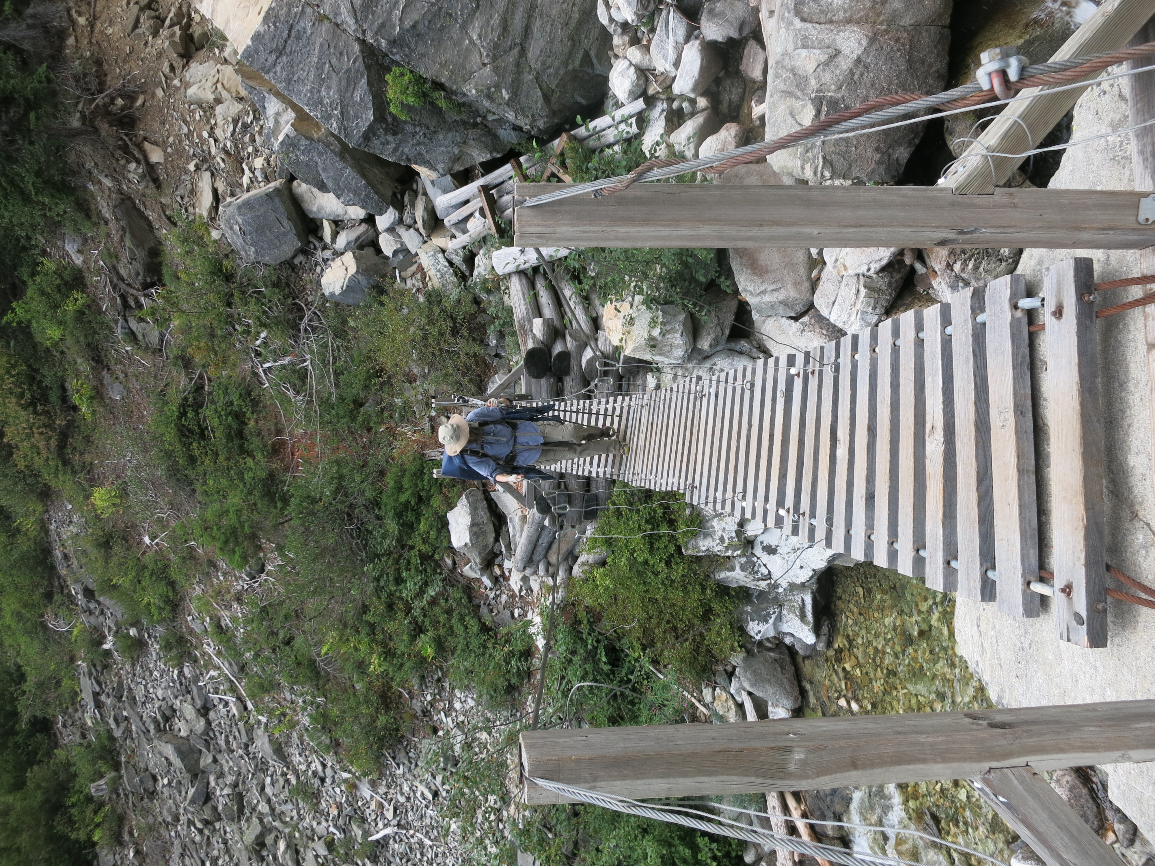
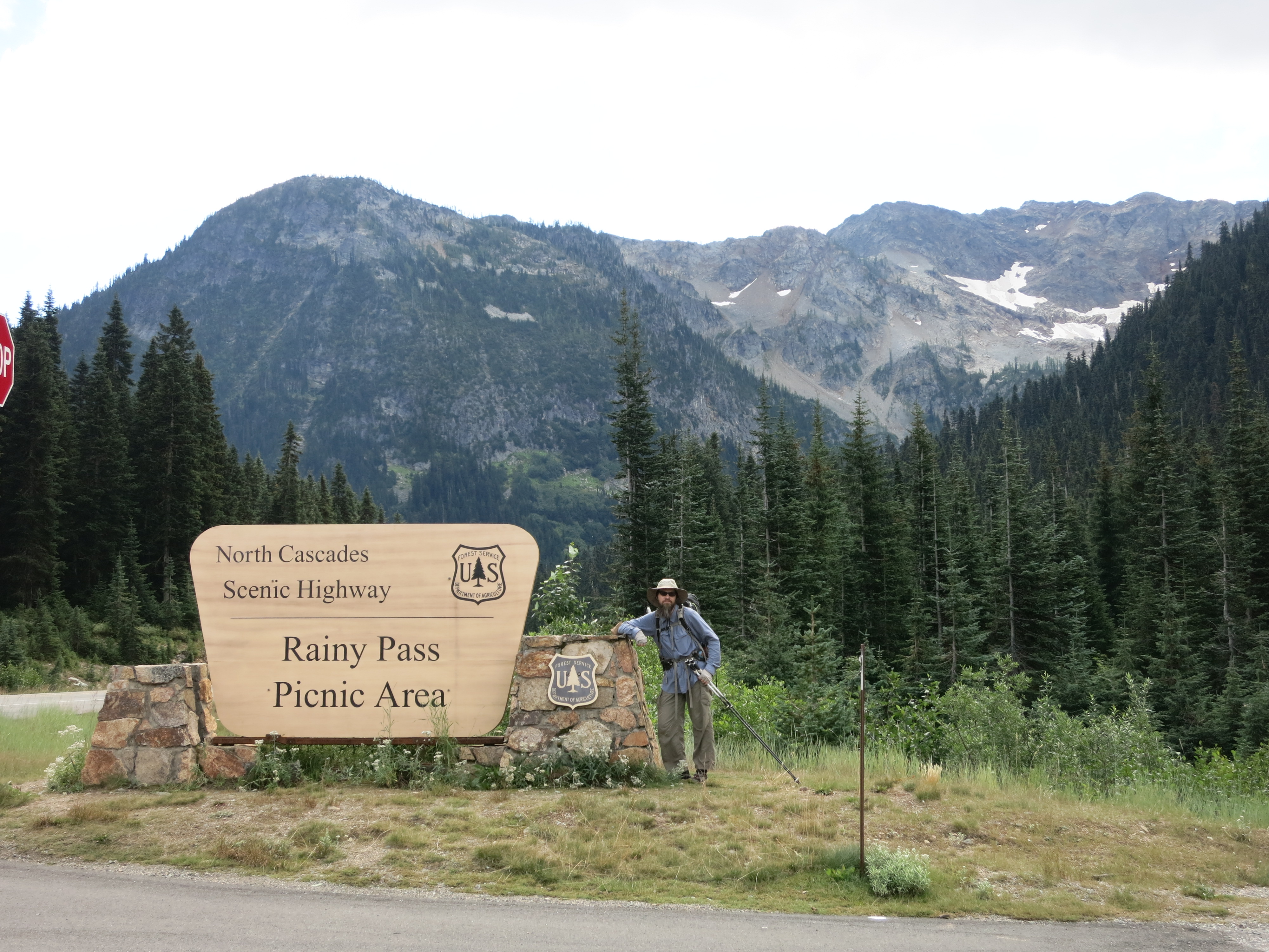
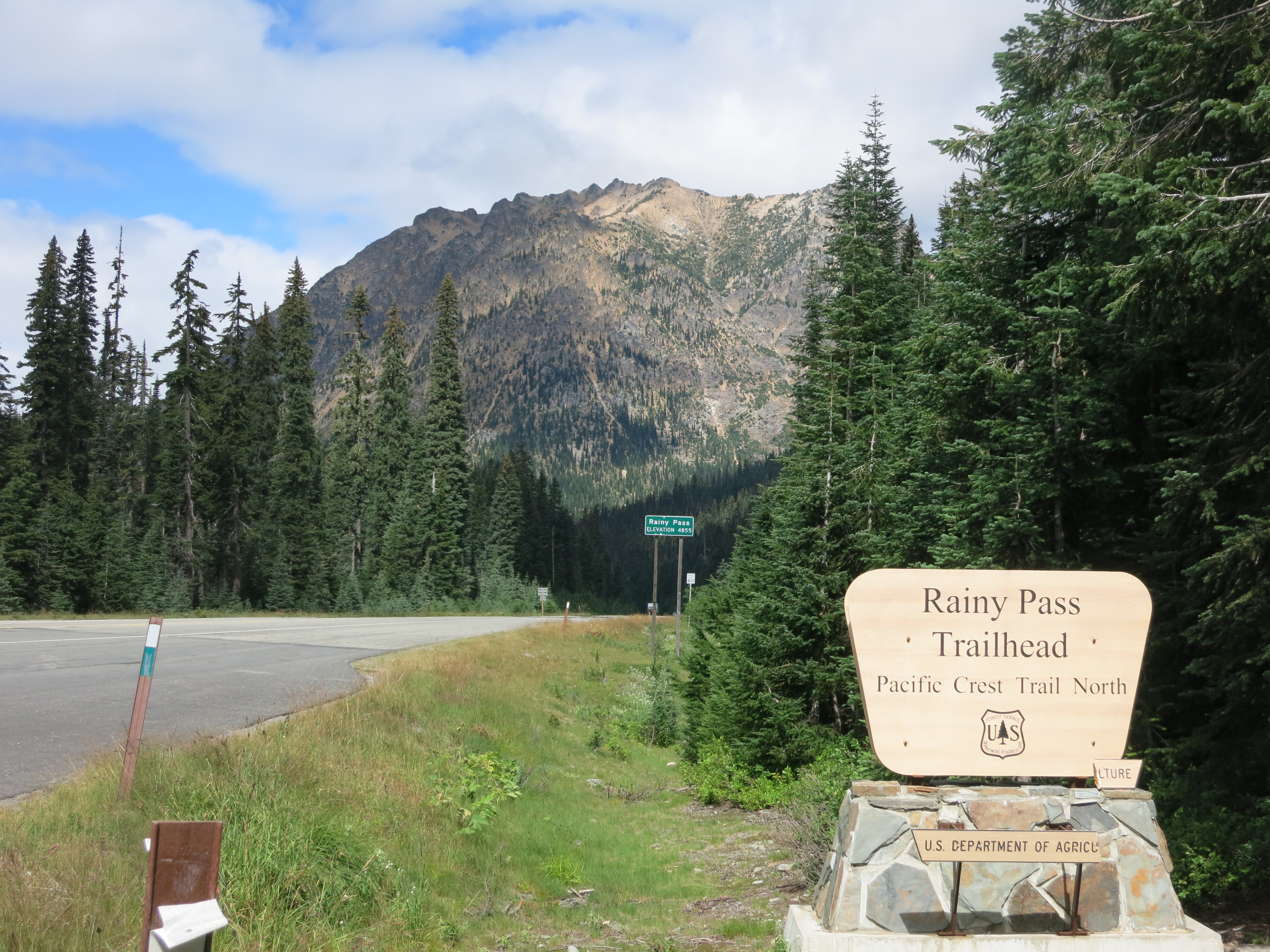
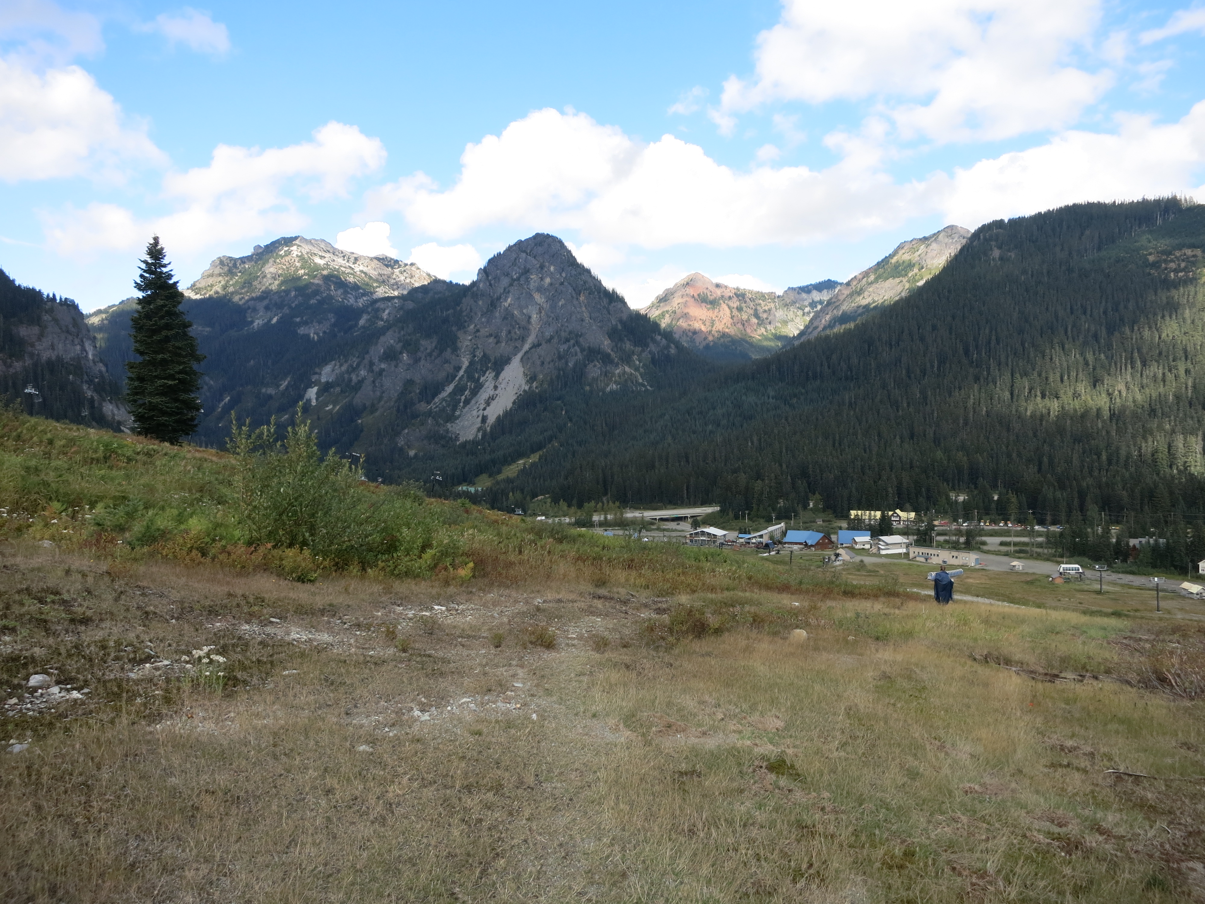
It was a long, gradual uphill to Highway 20.  Just before the trailhead we passed The Mayor, a northbound thruhiker who had flip-flopped to the Canadian border and was now hiking south to California.  We ended up chatting with him for two thoroughly enjoyable hours, swapping stories about our PCT hikes and talking about the Appalachian trail. It was nice to be able to take such a long break without worrying about the time! The highway appeared soon after we said our goodbyes and hit the trail again.  The last time we’d been here low clouds and falling snow had blocked out views of the peaks around us, so we had lunch while we took it all in:

IMG_1675IMG_1677

Lunch was our last few pastries from the bakery. People can say what they want about empty calories from fat, sugar, and flour, but they perked us right up.  The next 5 miles – a long climb to Cutthroat Pass – flew by with little effort.  Low-hanging clouds drizzled on us and then broke up as we reached the saddle.  What a vista!

IMG_1687_header

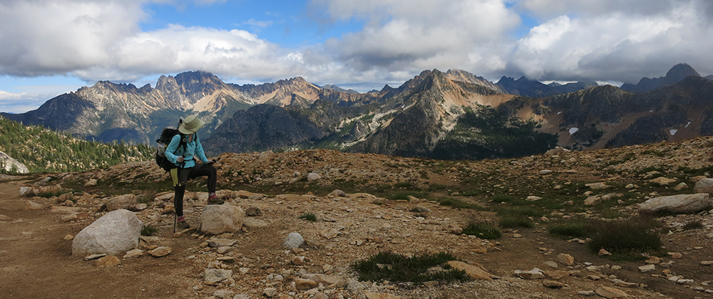
It looked like a painting.  Strange to think that we had stopped just short of this view last year.  I tried to imagine it under a few feet of dense snow and figured that we had the better end of the deal here and now.

IMG_1692 IMG_1698 IMG_1702


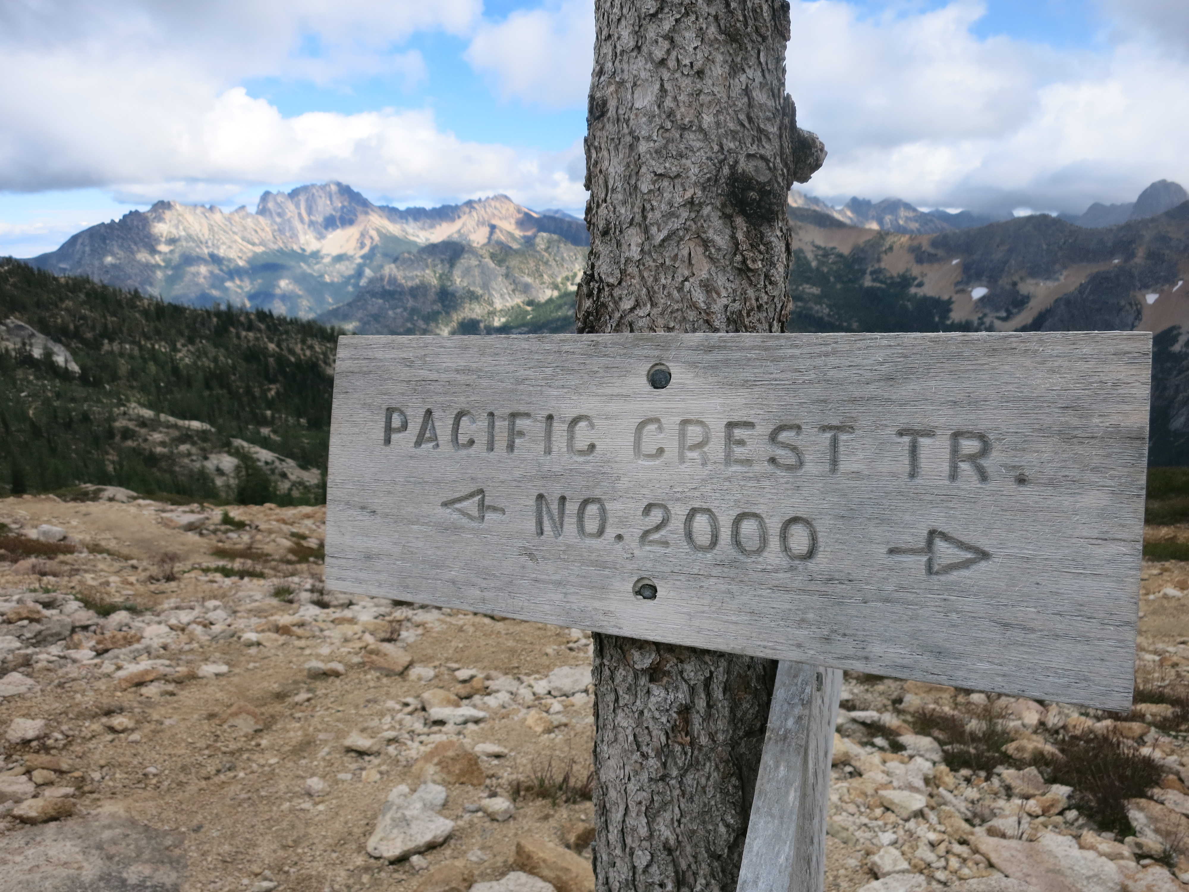
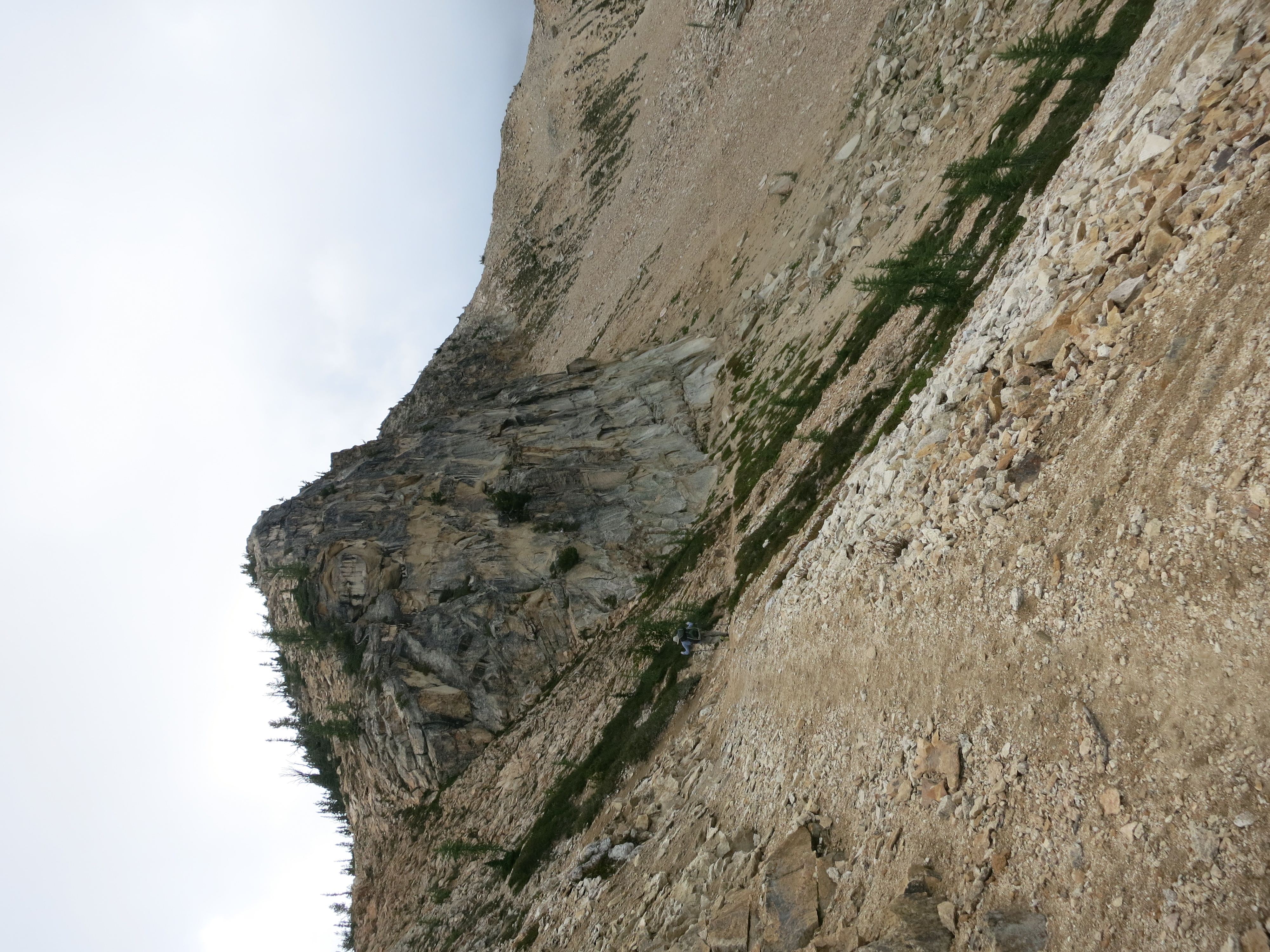
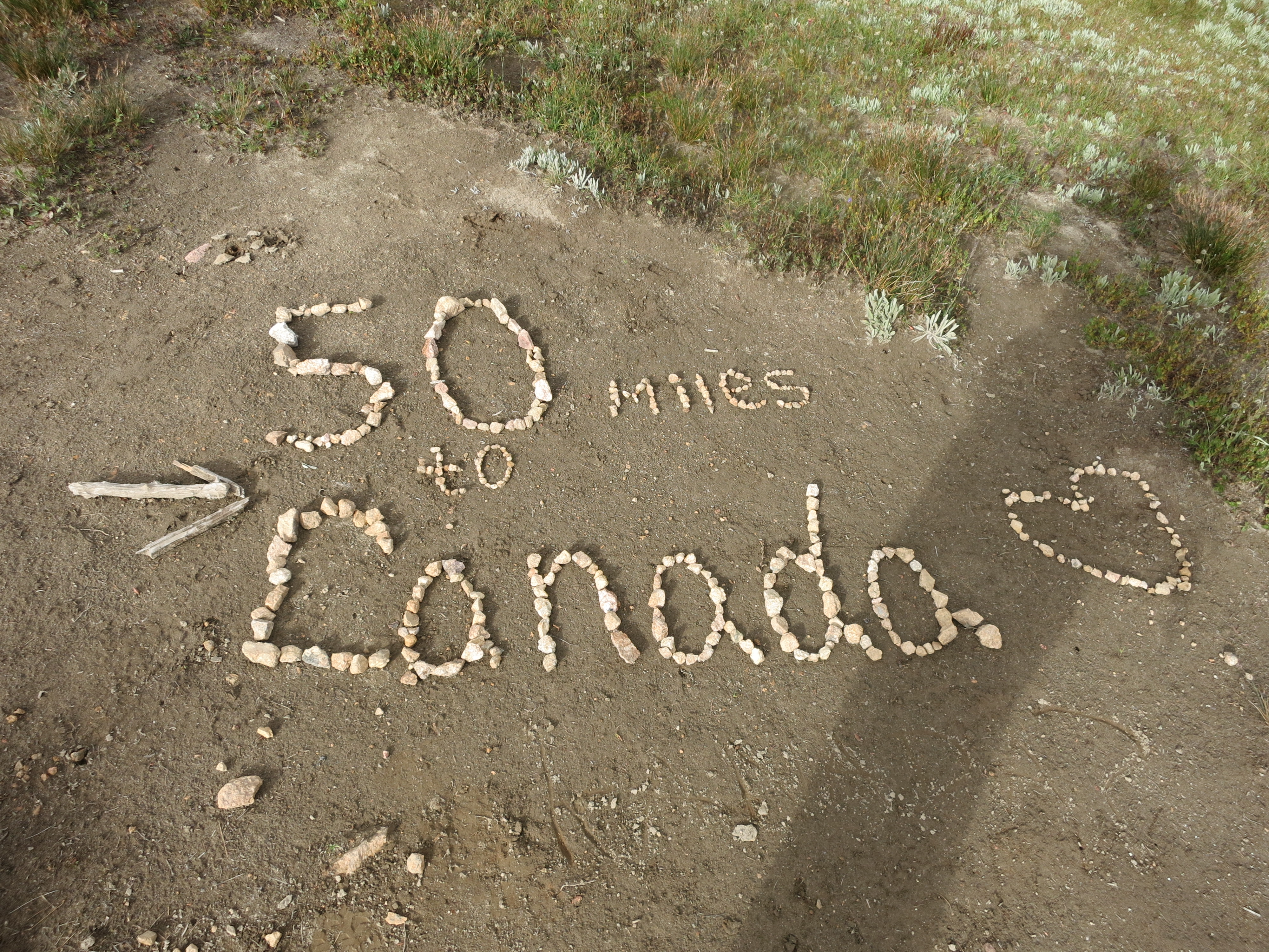
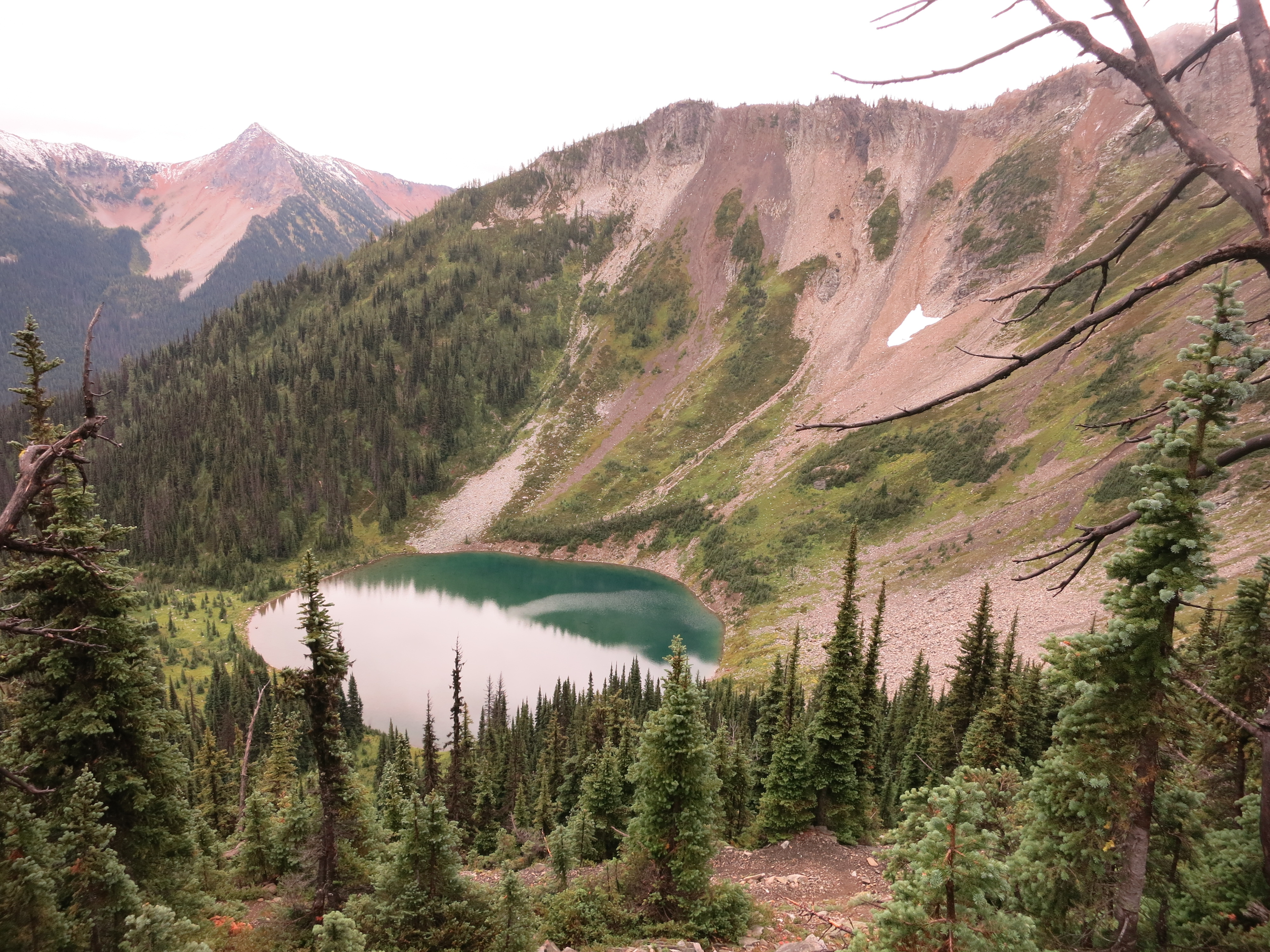
We cruised over solid trail carved out of scree slopes and camped at one of the first flat spots we found, just short of Methow Pass.  The next morning brought another milestone:

IMG_1703

followed by a long trip down into the Methow River valley and out through Glacier Pass.  That night our campsite was invaded by deer:

IMG_1718

They hung around all night grazing.  Whenever one of us turned over on our mattresses they would snort and stomp as though they’d forgotten we were there. The clouds moved in the next morning as we hiked toward the last road crossing of the trail:

IMG_1732

After lunch the clouds finally made good on their threat and started to rain:

IMG_1736

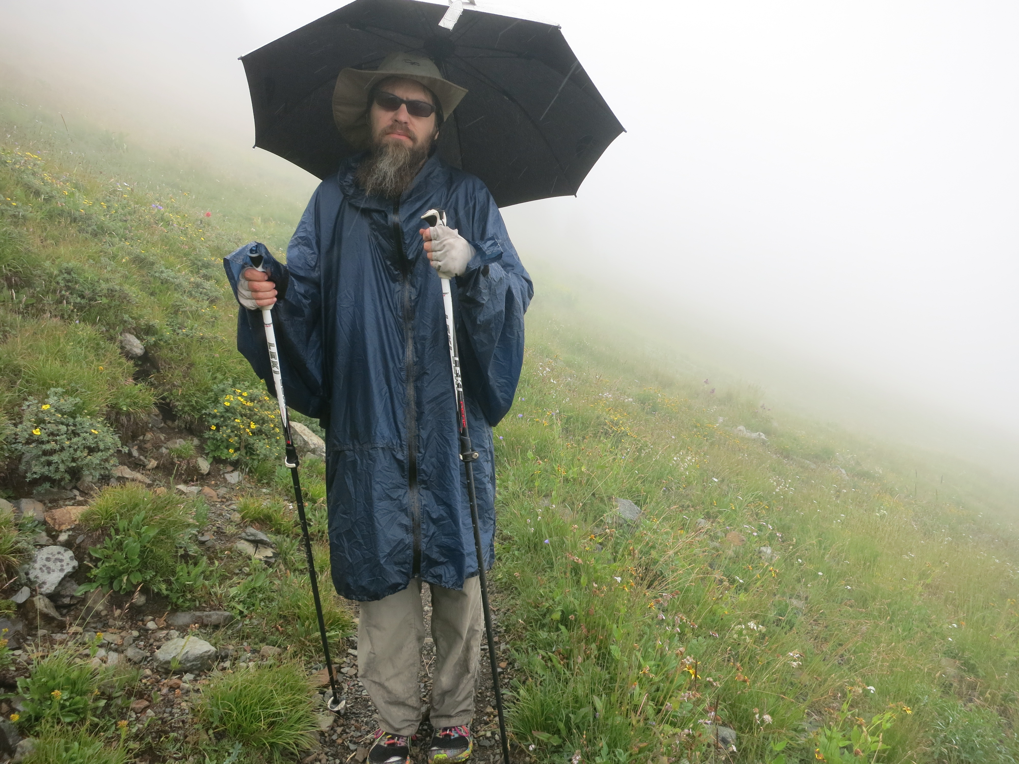
It got colder and clammier as the day went on.  We camped at a popular spot, arriving just in time to squeeze into a nook near some other tents, and jumped into our cozy bags.  The night stood a good chance of being our last night before the border!  It rained on and off until morning.  It was tough to force ourselves up and into the cold, but we took advantage of a break in the rain to pack up the tent and don our ponchos.  As we climbed to higher elevations the clouds lifted a little and we saw that the peaks around us had gotten a dusting of snow.  Not enough to stop us this time, but it did add a kind of bittersweet callback to last year as we finally finished our journey:

IMG_1743 IMG_1747 IMG_1751 IMG_1752 IMG_1763

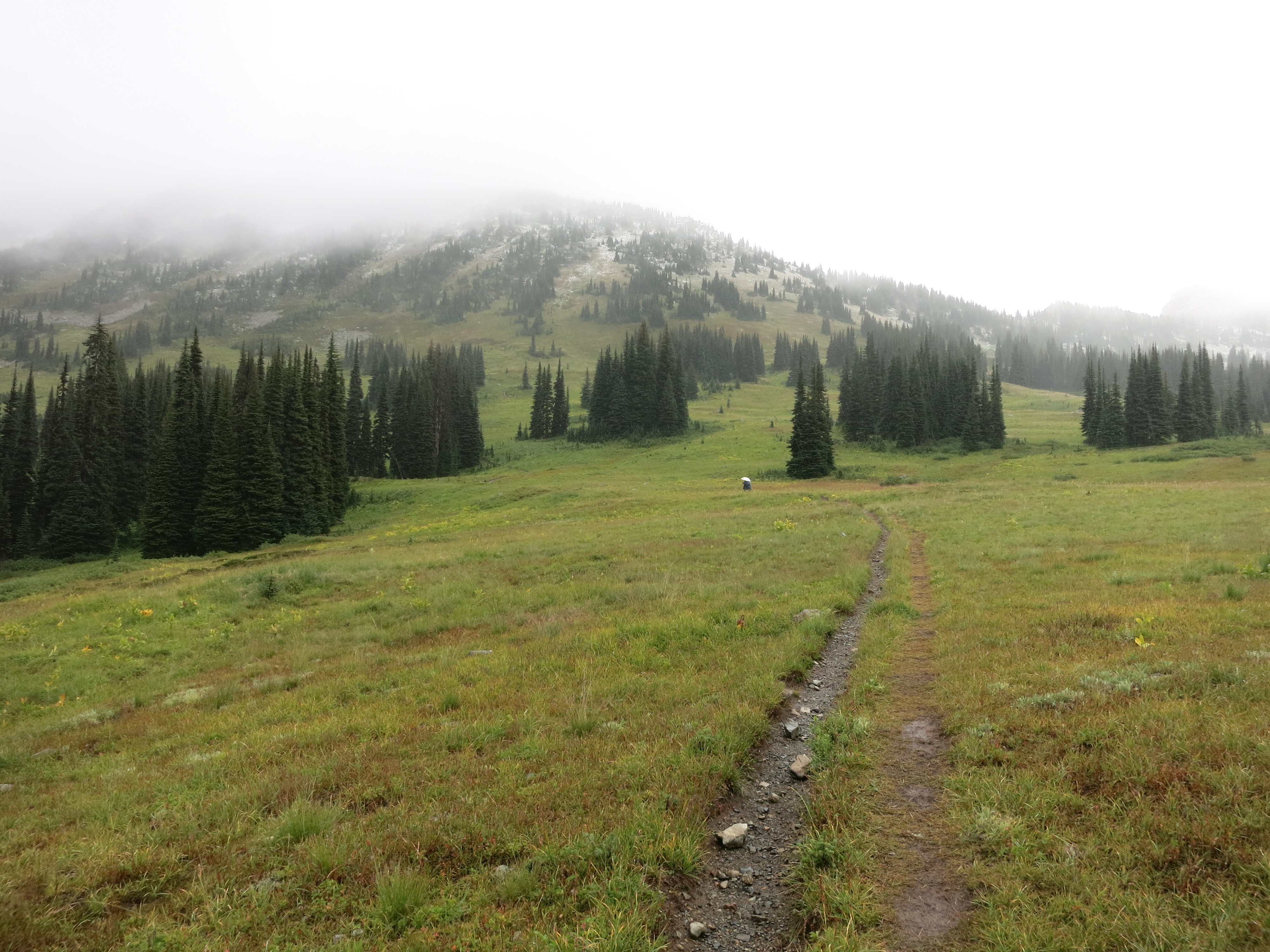
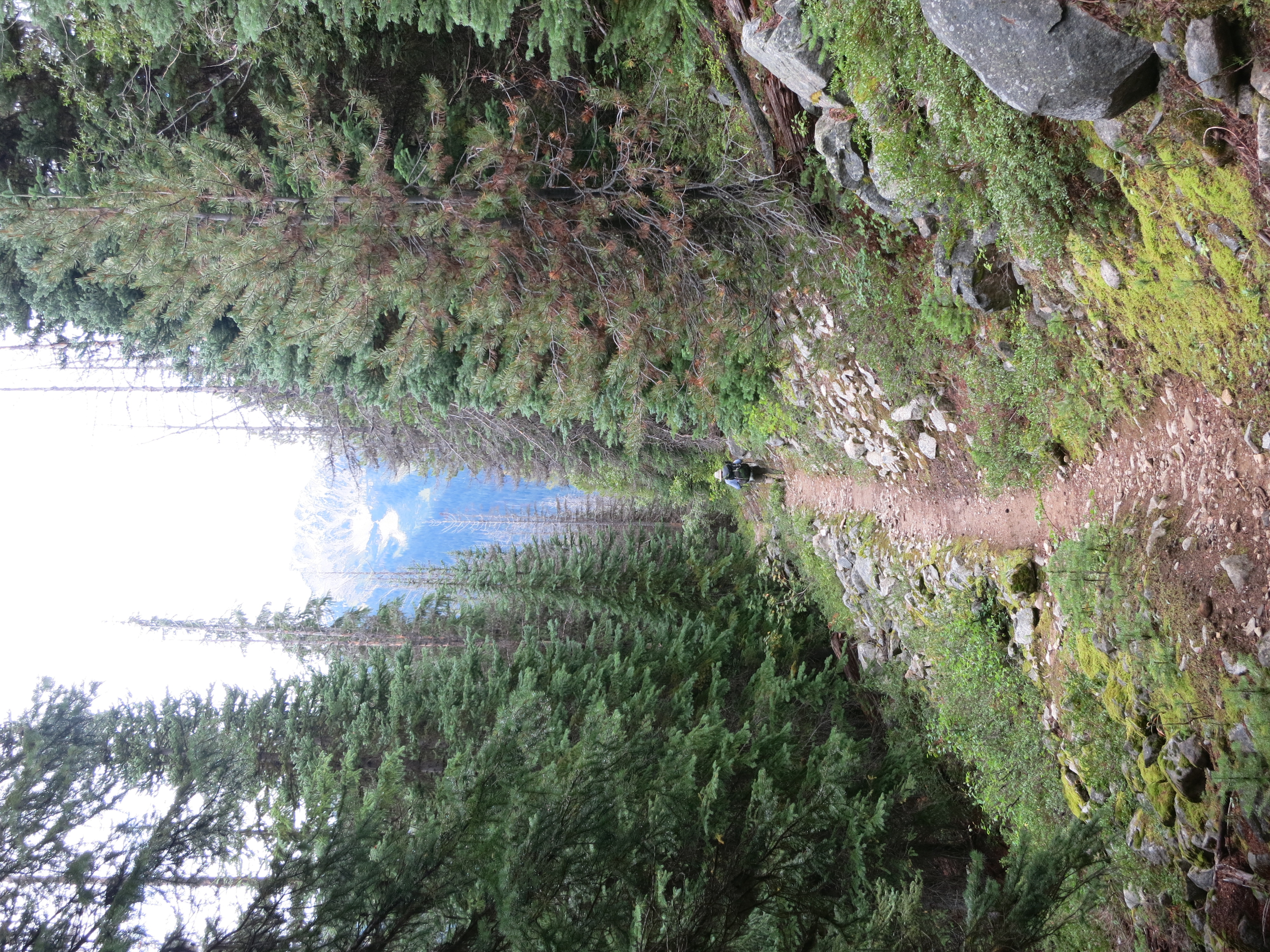
Thanks to the low clouds the view changed from minute to minute.  For long stretches everything was gray and misty, but then the clouds would part just a little and we’d catch glimpses of faraway peaks before our world narrowed down again. We started our descent to the border above Hopkins Lake:

IMG_1766

IMG_1767


The clouds cleared as we hiked down a long tunnel of forest:

IMG_1768

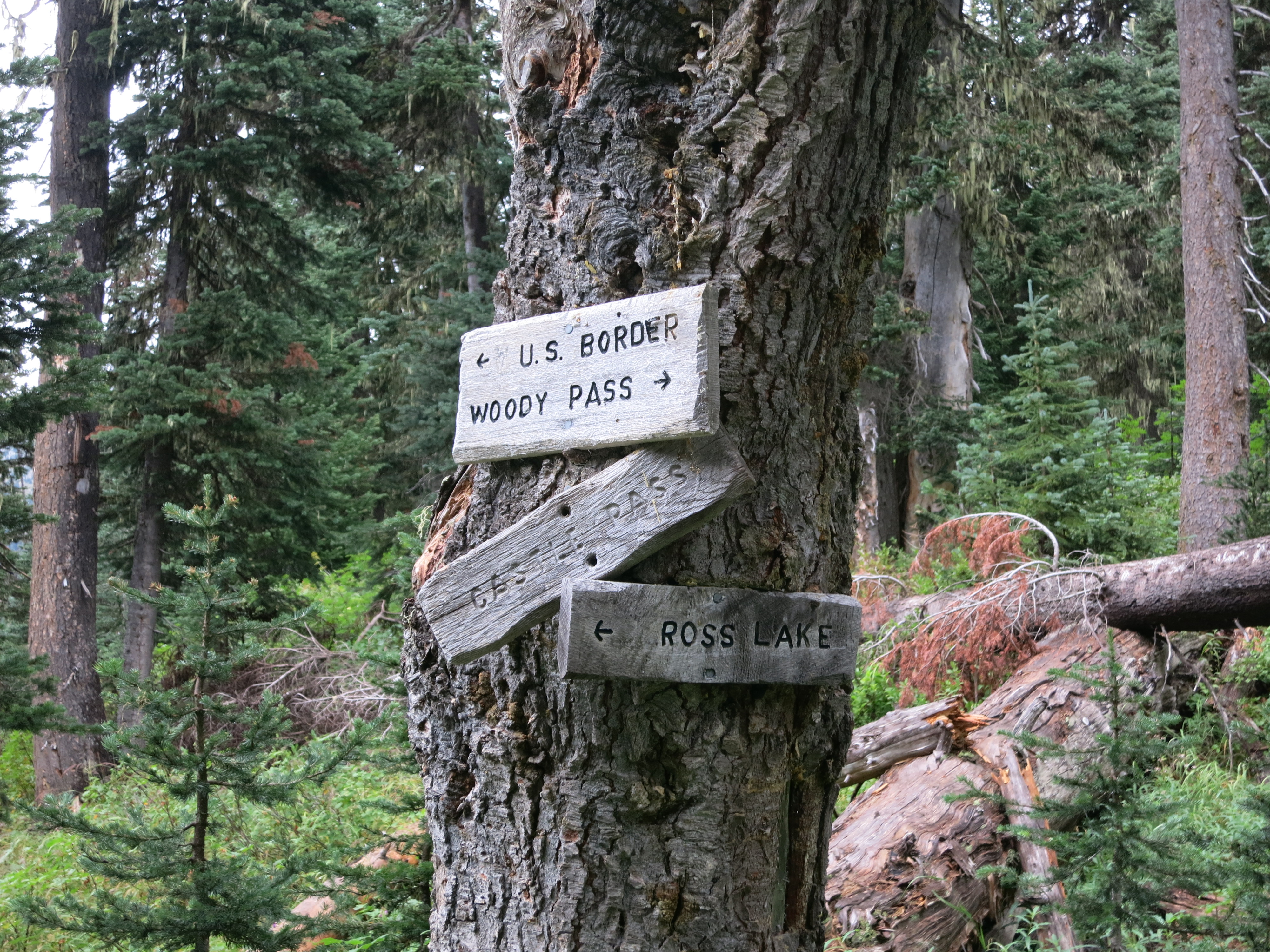
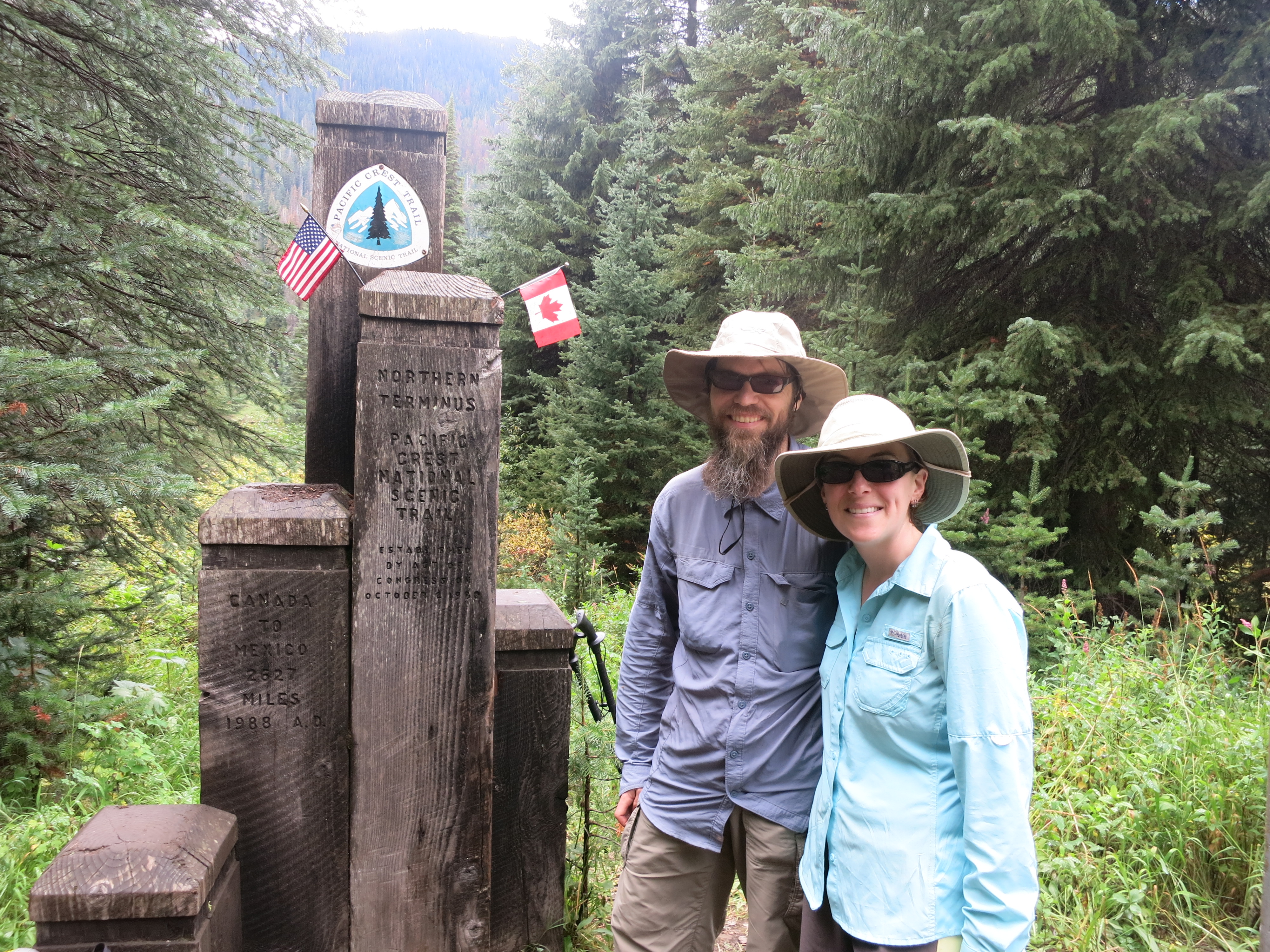
And there was the monument, in the middle of a 10-foot wide clear cut strip that marched up the mountains to either side:

IMG_1772 IMG_1769 IMG_1774

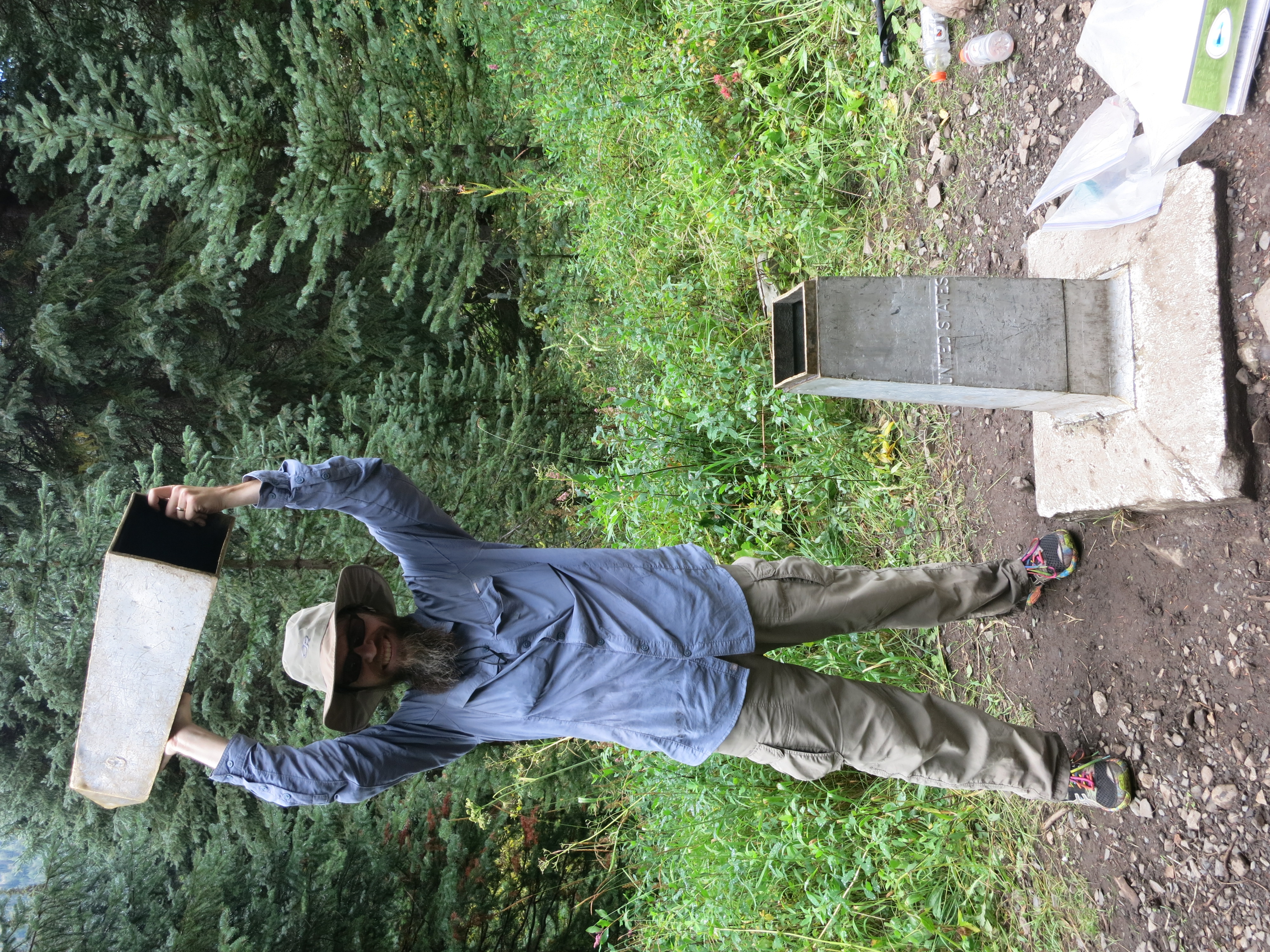
After so many miles, we managed to avoid getting lost on the way to the road:

IMG_1785

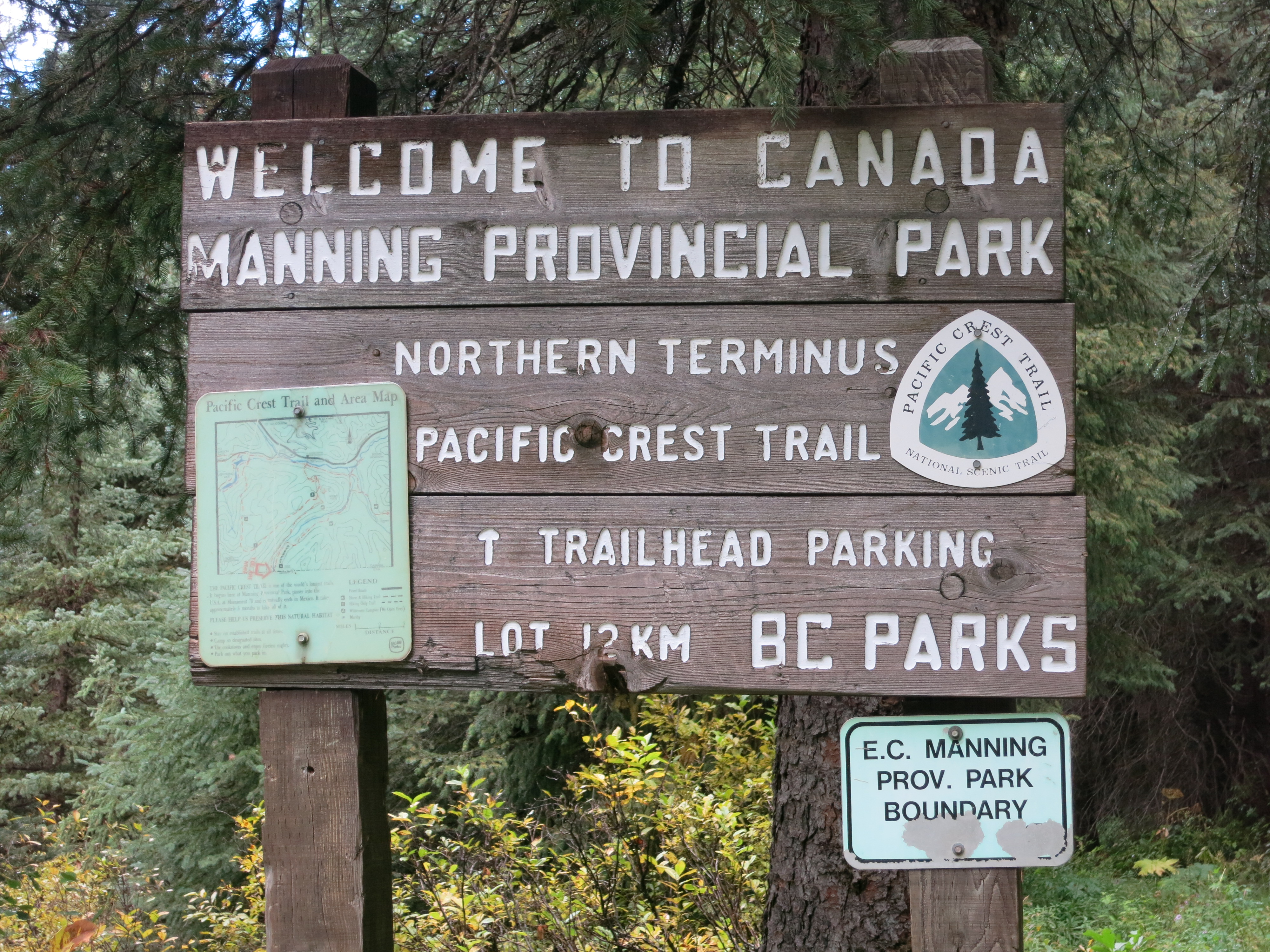
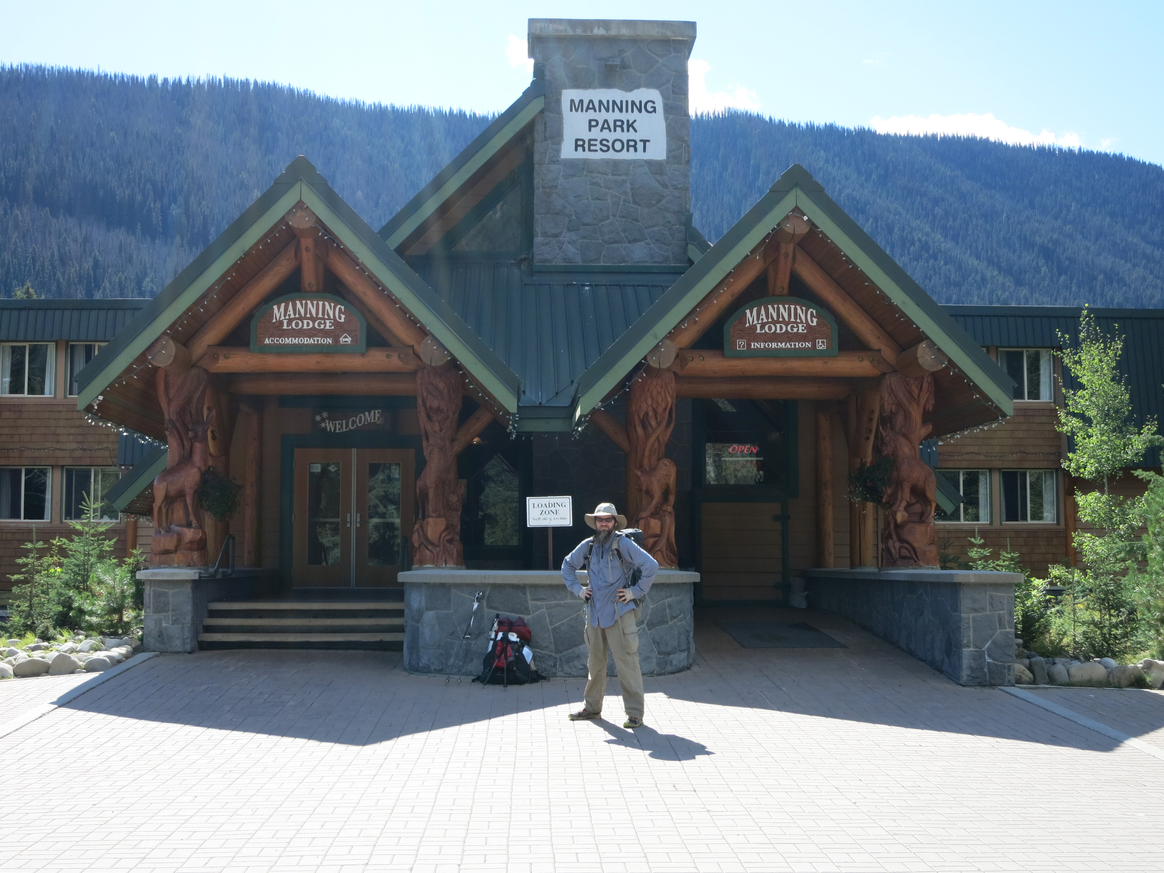
And ended up at the park lodge, where we treated ourselves with the most Canadian of rewards: poutine!  We made it!

IMG_1787

Day 167 – End of the line, for now…

IMG_1452Our hike is over for the season.  We reached this sad conclusion last night among many tears, but at least we were in good company – the hostel where we were staying was packed with hikers in the same situation.  After arriving in town we bought a map of the North Cascades and searched for any possible alternate routes to the border.  Many side trails stayed mostly at lower elevations, but all climbed up to at least 6500 feet to join the PCT. They wouldn’t avoid the snow and would likely be in much worse condition than the main trail.  We considered catching a ride up to Hart’s Pass and slogging slowly through the remaining 30 miles to Canada, but a picture of the trailhead taken by another hiker convinced us that this would be a foolish attempt.  The trail was invisible in the snowy landscape.  Even if we were able to find our way, we’d still have to negotiate the two washouts north of the pass.  50+ Minnesota winters between the two of us had made us hopeful that we could push on where warmer-climate hikers wouldn’t.  They didn’t, but they DID give us the good judgment to know when  the conditions were too much for us.  Our final backup plan was to hike to the border along Ross Lake, another long, narrow mountain valley lake about 30 miles west of the trail.  This trail stayed below 2000 feet and seemed like a safe option.  From the border we’d hike east through Manning Park to meet the PCT at the northern monument.  This sounded great, like a last-minute reprieve, but once again the federal shutdown reared its head: the Ross Lake trail ran through a national recreational area.  Other hikers with the same idea had been stopped at the highway by rangers.  After taking down their ID info, the rangers warned them that it was a felony to be on federal lands during the closure. We were determined to reach the border but we weren’t stupid. We didn’t want to become a drain on the local volunteer search and rescue crews just because we’d invested 5 ½ months into our hike, and we certainly didn’t want to tangle with rangers or border control.  Still in shock, we hung our thumbs out on the highway.  A nice man on his way to the northern burbs of Seattle took pity on us and drove us all the way west back over the crest.  We’ve been plunged back into civilization for good and are on the first steps to reintegration with normal life.

We’ll be back next summer to get that picture at the border…and to actually see the beauty of the North Cascades.

Day 166 – Maple Creek to Rainy Pass – 10 miles

IMG_1448It was cold this morning!  Our tent looked like the quintessential REI ad, perched up on a knob against the fog and a backdrop of sheer granite cliffs.  Right after we got going we encountered a wet ford across Maple Creek. Rather than soaking our shoes first thing in the day we decided to ford the shallow water in our flip flops.  It was the right decision to make but the water was so cold that our feet numbed into clumsy blocks right away. Even in dry socks they took a long time to thaw out. The cool weather was pleasant as we hiked along in our ponchos. We passed through more damp rainforest as we climbed towards Rainy Pass and highway 20, the last major road between us and Canada.  As we neared the pass we came up to about 5000 feet and started to see patches of snow.  A bad blowdown just before a stream crossing forced us off trail and onto the road for the last few miles to the trailhead.  As we walked along the shoulder the snow started in earnest.  It was beautiful but worrying…if we were already at snow level with such heavy precipitation, how would things look at 7000 feet? We reached the pass without incident and decided to have lunch.  We’d hoped to be able to get out of the weather by sitting in one of the palatial forest service pit toilets – which sounds gross but is totally normal hiker behavior – but they were locked up tight.  Thank you, broken federal government!  We huddled up under the totally inadequate shelter of the trailhead info board and shivered as we cooked and ate.  Our feet were soaked again and our clothes were rapidly following suit in the damp falling snow.  As we ate two hikers came back down the trail from the north.  They’d attempted to push on but turned back as they neared Cutthroat Pass a few thousand feet above us.  They had been traveling at a slow but acceptable pace until they reached the end of the previously-broken trail, when their speed plunged to less than a mile an hour.  The snow was already 3 feet deep up on the ridge, heavy and wet and exhausting to move through.  The icing on the cake was a warning posted on the info board about two large trail washouts north of Hart’s Pass.  The suggested detour added lots of miles and was cluttered with blowndown trees.  Cold, wet and despondent at suddenly facing the possible end of our hike, we decided to hitch down off the crest to Winthrop and assess our options.IMG_1449

Day 165 – Stehekin to Maple Creek – 10 miles

IMG_1445It rained off and on this morning, as we expected, but when we boarded the afternoon shuttle for the trailhead the sun was actually shining and we could see streaks of blue sky.  We stopped briefly at the bakery – not open today, but they left some day-old goods in their gazebo under the honor system and we loaded up for the trip north.  From there the bus took us by the ranch to pick up a group of day hikers and then cruised up to the trailhead.  We’d hoped to see a few other hikers waiting to come into town but no one was there.  With the government shutdown the National Park shuttles stop running in two days and it’s a 12-mile walk into town.  Not good news for hikers…

IMG_1447This marked our official entry into North Cascades National Park, our last park along the way.  We followed the Stehekin River a few miles upstream, crossing the many creeks that feed into it on fairly gentle terrain.  The trail was a little rocky and muddy in a few places but in much better shape overall than I’d expected from days of heavy rain. We reached the Bridge Creek backcountry camp – lots of nice sites with picnic tables – and turned east to follow Bridge Creek upstream.  The peaks of the ridges came into view around us, all coated with snow.  The foliage has turned a little, too – not the brilliant reds and oranges we’re used to, but a lovely yellow splashed with brighter colors.  Winter is coming…  We passed the North Fork backcountry camp, having made great time so far, and headed on to Maple Creek to take advantage of the remaining daylight.  We weren’t sure if there would be a good campsite nearby but there was a clear knoll just before the water. A good thing, too, because it was getting noticeably cooler. We wasted no time setting up – grateful that it was dry as we did so – and jumped into our bags. Tomorrow we’ll cross Hwy 20 at Rainy Pass, one of our potential bail-out points if the weather or snow are too much to handle. So far it’s been standard hiking but I know we’ll reach snow level sometime tomorrow.IMG_1446

Day 162-164 – Baring to Stehekin

The beginning of the end – it’s all downhill from here…

Zero in Baring

Weather continues to deteriorate.  Record heavy rain all day down here is falling as heavy, wet snow up on the crest.  Lots of hikers are either abandoning their trips or making alternate plans.  Regretfully, we have decided to skip the next rugged and challenging section.  Stehekin is potentially headed for a clear window of weather in a couple days that will likely be our best chance of reaching the border and we would hate to spend any short reprieve getting there instead of getting to Canada.  Even so, we may already be too late – we won’t know until we see the trail and snowfall for ourselves.  From here to the border the trail mostly runs above 5000’.  We are starting to mentally prepare ourselves for a shorter-than-expected end to our 5 1/2 months of heaven.  Today we will stay here and hang out with the crowd of hikers that have built up.  It’s a blessing to be able to spend one last break with so many wonderful people we’ve met over our journey.  From here I’m guessing we’ll be much more fragmented as people take their own paths to the border.

Baring to Chelan

We said goodbye to our herd of hiker friends today, probably for the last time, and headed east on the first step of our trip to Stehekin. A friendly local trail angel gave us a ride all the way over the crest through apple and pear country to Chelan, which lies at the south end of the lake of the same name.  Stehekin, at the north end of the lake, can only be reached by foot (via the PCT), ferry, or seaplane.  We are in a bit of a funk because of all the uncertainty over the last few days and the snow we will likely encounter when we head north.  Before reaching Stevens Pass we were almost ready for our hike to end – having to make so many miles every day is starting to wear thin – but now that it might not end on our terms we’re a little distressed. Another thing to worry about is the federal government shutdown that seems likely to begin the day after tomorrow.  Stehekin is located within the boundary of North Cascades nat’l park and a lot of the land between there and Canada is federal so this will cause problems.  It continues to rain and our expected weather window now looks as though it might not materialize.

Chelan to Stehekin – pct mile 2580

IMG_1436We hopped on the morning ferry to Stehekin today.  After the last few hectic days it was a nice, relaxing ride up the narrow lake.  Once there and checked into our room we took the shuttle bus up from the landing to the Stehekin Pastry Company, one of the most-anticipated stops along the entire PCT.  This is something hikers look forward to all the way from Mexico.  It absolutely lived up to the hype.  We stuffed ourselves on pizza pockets, pumpkin muffins and red velvet cupcakes, raspberry-hazelnut pastries and a slice of sour cream apple pie.  We won’t be able to eat like this much longer…There are not many hikers in town right at the moment.  A lot of people have either thrown in the towel or are stuck on the section between Stevens Pass and here. We’ve also heard some worrying reports about search and rescue teams and hypothermic hikers.  Our chances of reaching the border aren’t looking good but we’ll have to see the snow for ourselves before giving up on our trip.IMG_1444

Day 161 – creek to Stevens Pass – 18 miles

IMG_1430A bit of an uneventful day today, except that the weather cleared enough to give us some sun and the chance to see the incredible scenery the clouds had been hiding.  Lots of up and down as is common for this section.  We passed a few ultra-blue surprise lakes, which seemed to appear from nowhere as we summited ridges one after the other.  It clouded over again as we stopped for another chilly lunch.

IMG_1422The trail became very muddy as we went on and it slowed us down more than I would have expected.  With all the rain we’ve gotten and all that’s forecast to come we’re worried about the trail tread coming up.  I took a spectacular faceplanting fall after lunch, hard enough to lose my wind and worry about chipping a tooth.  Luckily all my bones were all still in their correct places and there was nothing to do but pick up and move on.

IMG_1423As the rain restarted we began to see power lines and ski lifts, a sign of impending civilization.  We passed a fast day hiker just before we reached the road and he very helpfully offered us a ride down off the crest to Baring, where we’ll be staying at the Dinsmore’s Hiker Haven – another must-visit stop for lots of hikers.

IMG_1429Andrea and Jerry host the herd as they pass through every year, holding our packages, doing our laundry, and giving us all a place to sleep in their warm and well-outfitted hiker bunkhouse.  This year especially they are serving as an important safety net for those – like us – who are pushing the end of the season.  We filled out contact forms that could be passed along to search and rescue teams if a mishap were to occur between here and Stehekin.  This was especially important now given that the weather up on the trail is headed for a heavy stretch of snow.  Last year a hiker left under these conditions, became snowed in, and was trapped for two weeks before finding the trail and hiking out.  While we were hanging out with the crowd we started to hear about folks heading north who had turned around and come back rather than risking hypothermia.  Some are already deciding to end their hike, just 180 miles from Canada.  The writing is on the wall – hiking season is ending a week or two earlier than expected and we will have to make some decisions about what to do before hitting the trail again.IMG_1427

Day 160 – Waptus River to creek – 20 miles

IMG_1412We had no rain at all last night and actual sunshine this morning.  We were still slow in getting up and going thanks to the cold, as we have been for the last few days.  When we hit the trail we soon crossed the Waptus River on a good bridge.  Right after that we bumped into quite a few other hikers camped there.  This was a surprise – we always sort of assume that we’re the last ones out of camp on any given day, but they were still eating breakfast.  It sounds like everyone is having trouble doing big miles now.  Part of it must be the terrain and decreased daylight, but I think people are starting to slow down a little now that we’re about a week’s hike from the border.  All of a sudden it’s almost here and hikers seem to be relaxing a little to enjoy their last few days.  After dragging ourselves away from the good conversation we continued on down the trail. The first few miles were gently rolling as we worked our way out of the canyon where we’d regained the trail last night.  We could catch glimpses of Waptus Lake below us through the trees to our right.  We rounded the nose of the canyon and started right up another, following Spinola Creek up and up to a brief flat respite near Deep Lake, and then up and up further to Cathedral Pass.  The rocky meadows and scrubby blueberry bushes, turned red and purple by the cold, marked the end of the morning’s climb.

IMG_1411We saw a grouse family, babies all grown and in their adult plumage, as they passed through a light section of the undergrowth.  We took in the view of the snow-dusted peaks still towering above us and then started down the other side of the ridge. Here the going was a little slow as we picked our way down steep, rocky trail.  It was still worlds easier than the alternate we had taken. In fact, we kept mentioning all day how it was nice to hike on good, clear trail again.  We crossed a few streams before reaching the one marked as a tricky crossing in our maps.  Keith got across dry and I soaked my feet – lucky compared to another hiker we crossed with, Legend, who fell in but somehow avoided hitting his head on the rocks.  I’d hate to see what this creek is like earlier in the season.

IMG_1409A few yards up the trail from the crossing we stopped and had lunch. I had to put on another layer of pants in addition to my hat, gloves and jacket.  Hiking keeps us warm enough when we’re moving but it was cold enough today that we cooled off very quickly when we stopped.  After polishing off a bag of cheesy bacon potatoes we packed up quickly and started north again under now-overcast skies. I hiked for about a half hour – most of it uphill – before I was warm enough to take off my jacket.  Thankfully my wet feet didn’t take that long to thaw out. We hiked up to Deception Pass, then passed the creek of the same name. One more climb – almost welcome for the heat it generated now that dusk was approaching – brought us up near Deception Lakes.

IMG_1418We stopped a little short of them, just past a nameless creek, when I found a faint side trail leading up to a small knoll. Since we were now hunting for campsites I followed the trail without much hope and was surprised to find a nice, open campsite that looked back down over the trail. This was a great find.  We assumed that a lot of the hikers from this morning, who had passed us at lunch, were camped up at the lakes and we do like our privacy.  In the last few minutes of gray daylight we set up camp, filtered water, and sank ourselves deep in our down bags.  It’s already a little colder now than last night.  No surprise, since we’re up higher and more exposed.  Tomorrow we have a nearly full day’s hike to reach Stevens Pass, where we’ll hitch into Baring and stay the night at the local trail angels’ place.  We were going to take a day off but didn’t expect this section to take 4 full days. I’m sure the weather forecast will play a role in deciding what we’re going to do. Nearly 200 miles to Canada!IMG_1419

Day 159 – Thunder Creek to Waptus River – 17 miles

IMG_1389We stayed dry again last night. The rain was light and intermittent and almost nonexistent when we woke up.  It was a much warmer night at the low-altitude creek than it would have been on the PCT.  Still, we were loath to leave our beds. As on most rain mornings it took us longer to get going than normal.

IMG_1387We started off eventually through the rainforest and were confronted right away with a difficult ford of Thunder Creek.  The icing on the cake was a slippery log bridge suspended 5 feet over the raging water. Smoother sailing after that, with a few other stream crossings and a lot of puddles to avoid – and a lot of spiderwebs hanging over the trail.

IMG_1390We crossed Bootburn Creek a few miles later (much easier thanks to some massive logs) and passed the junction for the hot springs.  We decided not to take the side trail down there in the interest of time and not wanting to pay admission just to have a look around.

IMG_1393We turned north and paralleled the middle fork of the Snoqualmie River, which dominated the canyon we’d been hiking through since yesterday.  Going up river meant going uphill, and we climbed gradually at first.  After crossing the river itself (on a bridge, thankfully) it got steeper and we switchbacked up a dropoff.

IMG_1388A few more miles of gentle climbing brought us to an abandoned road and a horse camp where we had our morning snack. How someone is supposed to get a horse over the trail we hiked yesterday is beyond me. That tided us over to lunch a few miles (and more climbing) later.  As we sat down it started to sprinkle for the first time all day, but it was inconsistent. As we ate our beef stew – very satisfying in the chilly weather – the clouds boiled above us.  A patch of blue sky would open and shut a few minutes later.  We even had a short period of sun.

IMG_1395With the general clearing trend we could finally see the craggy, ultra-steep granite ridges that framed the canyon on either side of us. It reminded us of the Sierras 1600 miles ago!  After eating we got going quickly to avoid getting any colder than we already were.  More climbing followed, but we were starting to get out of the dense forest and into more alpine territory.

IMG_1401Meadows began to open up around us and the trail got more and more rocky.  After passing a trail junction it started to climb in earnest to the Dutch Miller Gap, a little pass that allowed access to the canyon between the rugged ridges that towered on either side.  As had been the case yesterday, the trail doubled as a waterway at times and it made our progress even slower than the climb and the rocks did on their own. Finally we reached the top.

IMG_1405We took a quick break to snack and take in the views behind us, then started right down the other side.  The trail was extremely challenging – washed out, boulder-filled, and muddy – and we crawled along at a snail’s pace.

IMG_1407Even when we got down off the high point and started winding around ultra-blue Lake Ivanhoe it was in bad condition. The final obstacle was a bridge over a stream that was cracked in half, its belly right in the middle of the water.

IMG_1408A half-mile or so after this it started to get better as it re-entered the forest and began a series of long, gentle switchbacks down towards Waptus Lake and the sea of trees below.  As we came into view of some of the higher peaks around us we could see that they were dusted with snow. We moved faster down the switchbacks than we had at any other time that day.

IMG_1391Soon they leveled out and swung us around towards the Waptus River.  We saw a sign – PCT only a half mile away – but still had to fight our way through a terrible maze of blown-down pines and one last tricky stream crossing.  Despite the fact that we’d only come 17 miles so far it was getting dark and we were more than ready to stop at the campsites right where we rejoined the trail.  It’s already 10 degrees cooler than last night and will probably get colder.  We’re very happy to be back on good trail…it will be nice to hike without stumbling over every step.  Taking the shorter alternate didn’t really save us any time over the longer PCT section but we’re still glad we had the chance to see such amazing scenery!IMG_1392

Day 158 – Snoqualmie Pass to Thunder Creek – 9 miles

IMG_1380We knew we would face the challenge of rainy weather sooner or later, and today was one of those days.  The worst of the front passed through yesterday while we were snug in a hotel but the next few days are still supposed to be rainy.  At least we only have three full hiking days until our next stop in Skykomish.  It was still very hard to leave when lots of other hikers were taking an extra day off.  Thankfully it wasn’t raining too hard.  It’s gotten cold as well, but we were warm enough under our rain gear.  We took an alternate route out of town.  The Goldmyer alternate takes us down into the Snoqualmie river valley and right past a nice hot spring.  Access to the spring is tightly regulated – only 20 people are allowed in each day to limit the impact – and our timing won’t allow us to take time off and soak, but we’re at least hoping to get in and see the place tomorrow.  This alternate saves us a few PCT miles, but more importantly, it stays lower than the PCT. We’ve heard that there may be snow tonight at higher elevations and we’re not quite ready to deal with it on top of the rain.

IMG_1383 The hike today started with a road walk away from the noisy I-90 corridor and up one of the canyons near the pass.  We entered the Alpine Lakes wilderness and immediately started climbing towards Snow Lake. It was gradual at first, through thick rainforest, but soon got steep and started switchbacking up rocky trail towards a ridge coming off Snoqualmie Mountain. As soon as we got up we started heading down, along some of the most rugged and challenging trail we’ve hiked yet.  Because of all the rain many trickles had appeared and begun dumping their water on the trail. It was like hiking through a stream for the first few miles as we dropped steeply into the river canyon.  We crossed ridiculous rock beds, slippery with moss and dead leaves. They were so jumbled that we couldn’t tell if this was just how the trail was maintained or if there had been multiple rockslides. The scenery, at least, was spectacular – sheer, craggy granite cliffs that plunged into the valley. They were lined here and there with patches of plants than managed to find a spot flat enough to gain a foothold. Cascades of foaming whitewater trickled down the rock faces – waterfalls everywhere we looked.

IMG_1382Finally, after hours of crawling along, we made it nearly 2500 feet down to the trail that ran level (more or less) along the river.  This was much easier hiking and was a relief on our ankles, knees and feet.  It was also gorgeous. Everything on the ground was covered in bright green moss that contrasted sharply with the dark, shiny black of the wet tree trunks around us.  Emerald ferns, glossy with moisture, grew along the border of the trail. It formed a tunnel of green stretching on through the dense forest. An owl hooted somewhere down the slope towards the river. Out early, maybe, but it was very dark under such heavy tree cover. We hiked another few miles down the canyon to reach Thunder Creek and decided to stop at the site here even though we hadn’t even done 10 miles yet.  We went so much slower than expected that it was rapidly approaching dark and we were anxious to find a spot with enough of a slope to avoid pooling water from the rain.  This site fit the bill. It took us a while to get the tent up on the softened ground.  By the time we got everything set up and dove in out of the rain it was getting dark and we were glad we’d stopped early. We were very happy with how warm and dry we stayed under our ponchos and umbrellas today.  If we can just stay dry during the nights (and not get stuck in any downpours) I think we can handle the rain comfortably enough.IMG_1385 sm

Day 156 – dry meadow to Snoqualmie Pass – 16 miles

IMG_1376We got a little rain last night that lasted off and on into the morning. We packed up during a lull and got going without our gear getting too damp.  We might have dodged the rain, but all the brush was so wet that in no time our shoes and pants were soaked.  All morning we adjusted our ponchos as the weather rolled through, zipping up and zipping down, shedding umbrellas and strapping them on again as the wind picked up and the trees dropped their moisture. At one point we dropped into the Seattle River valley, where signs warned us to stay on trail and not trespass since the river is one of Seattle’s municipal water source.  We joked that between the power lines yesterday and the river today, hiker mischief could bring the city to a standstill!

IMG_1377After the river we began another steep climb through thinning forest. Even on a day like this we saw lots of people as we neared the pass and I-90. The sun began to peek out from behind the clouds – tentatively at first, then stronger as the clouds burned off.  The last leg of our hike took us along a ridge we followed to the east.  We could hear and then see the highway below us.  So many cars!  The terrain to the north was different from what we’d been hiking through over the last section.  Huge, sparsely forested granitic knolls towered over the road.  It was very scenic and we looked forward to entering the beautiful North Cascades after our resupply. With the lure of town just ahead it felt like it took us forever to hike the last few miles.  My knee was bothering me a little, too, and despite the flat-looking elevation map it seemed like we had a lot of up and down over rocky trail.

IMG_1378Finally we turned a corner and could see the pass below us at the bottom of the ski hill – just like White Pass but better weather and more people.  Soon we reached civilization, our hotel room, and all the luxuries that came with it. We made an expensive visit to the local convenience store to pick up our packages and snacks, then returned to do our laundry and relax in front of the TV.  We are entering another stretch of bad weather.  Just in time for the start of fall, a wet, windy, cold front is pushing through.  We will likely stay the day tomorrow to rest our aching feet.  We’re excited to see the scenic trail north of here – if we can through the fog – but it will be nice not to have to put on damp, stinky shoes tomorrow.