Day 155 – forest road to dry meadow – 23 miles

IMG_1372
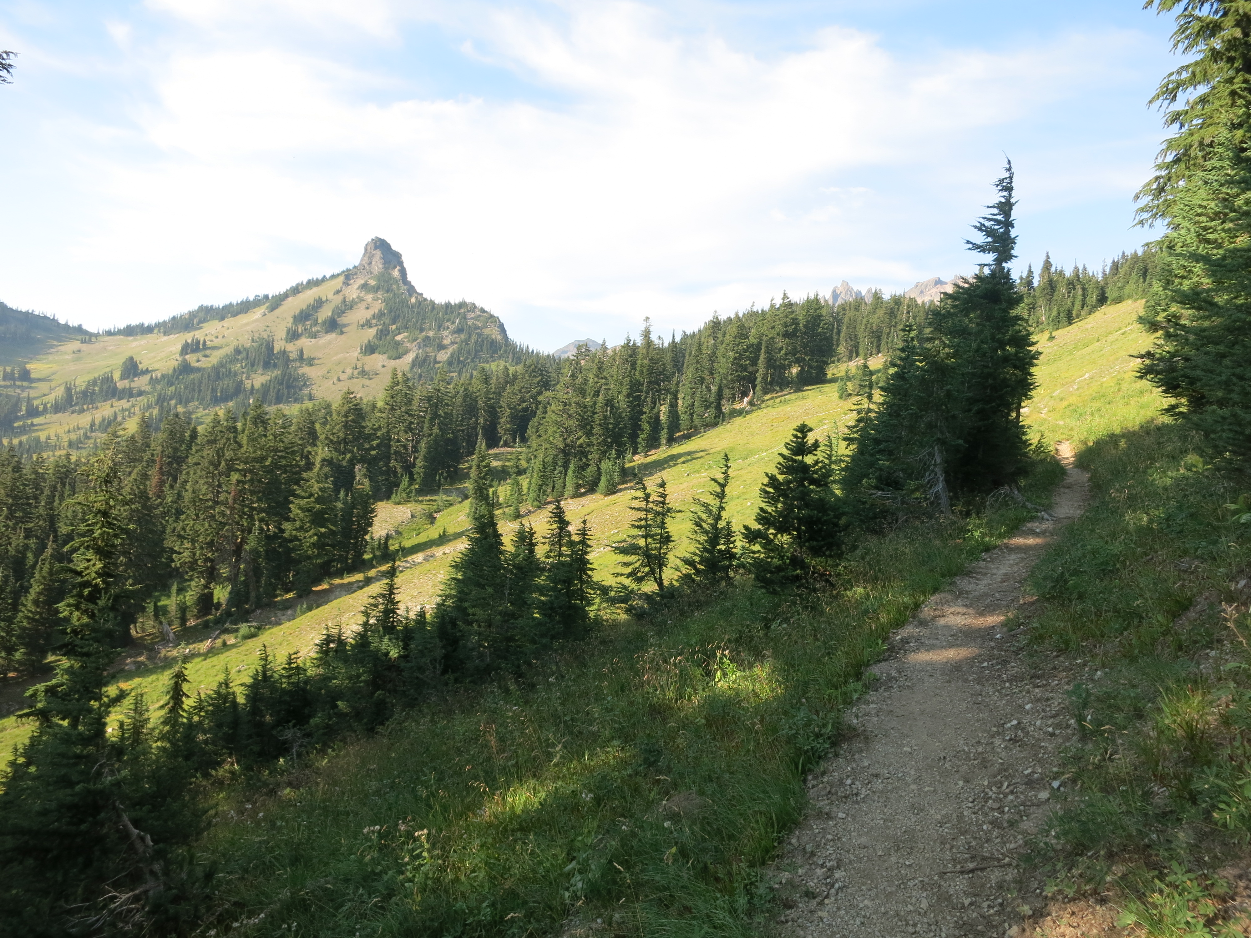
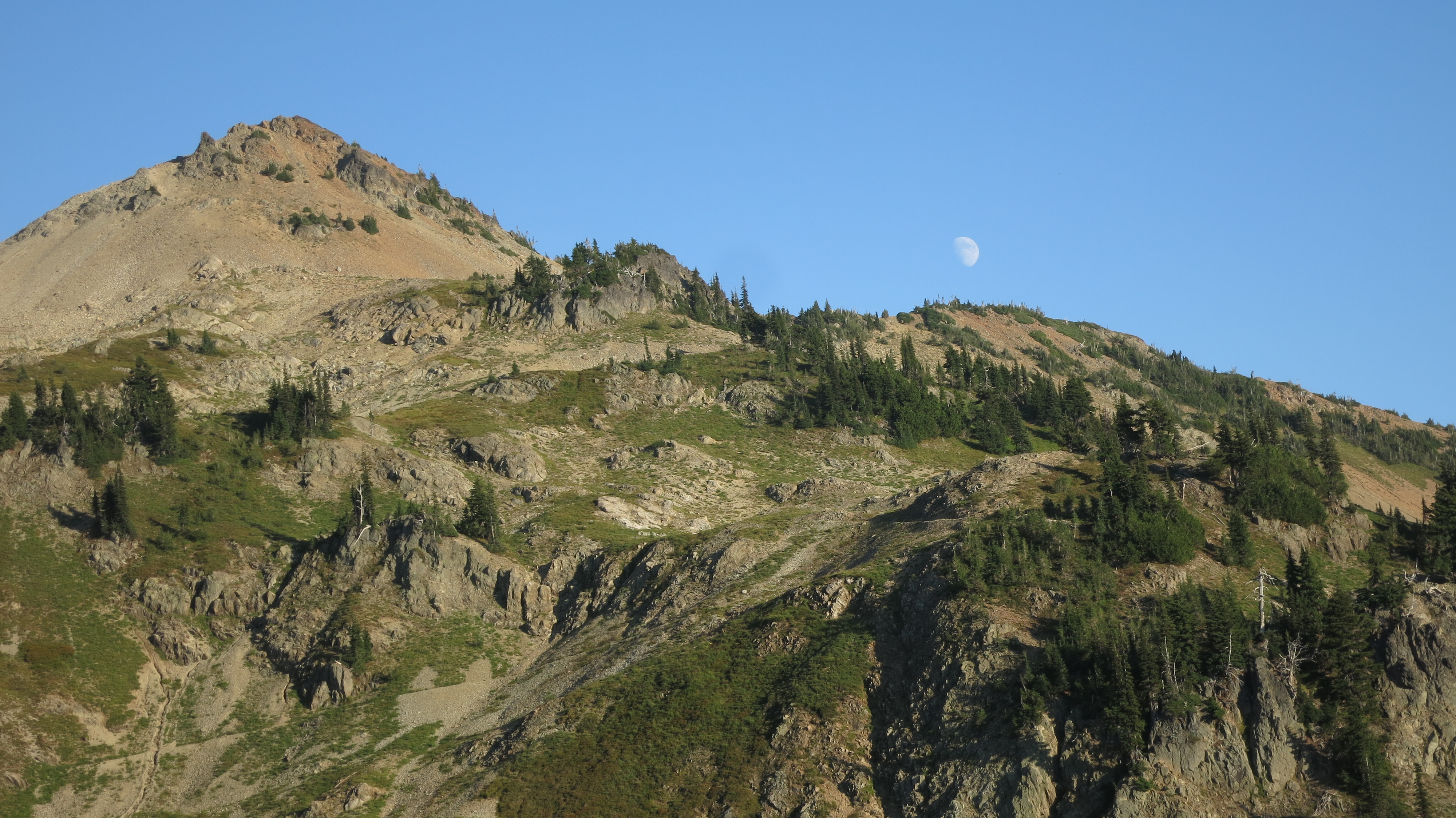
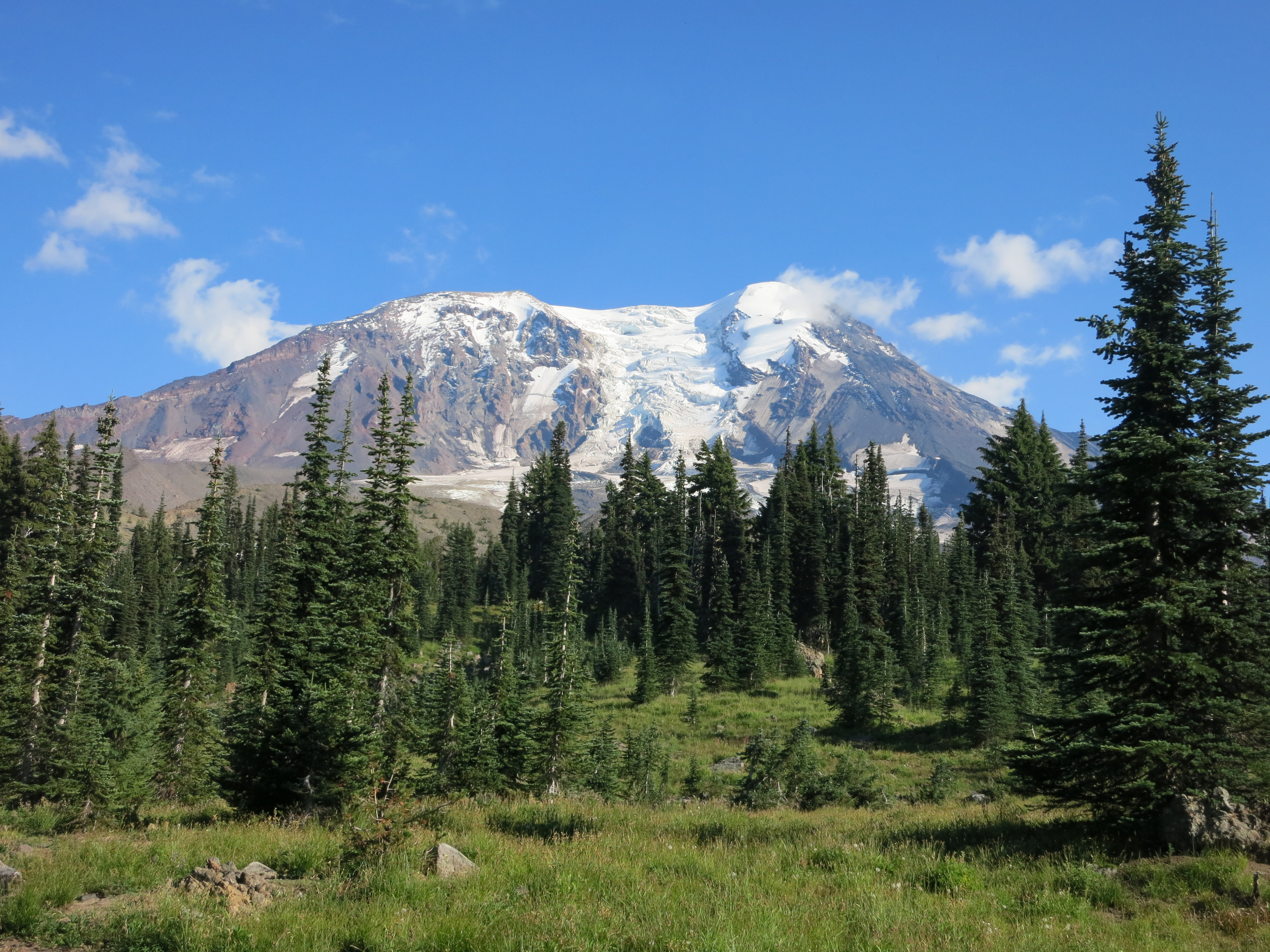
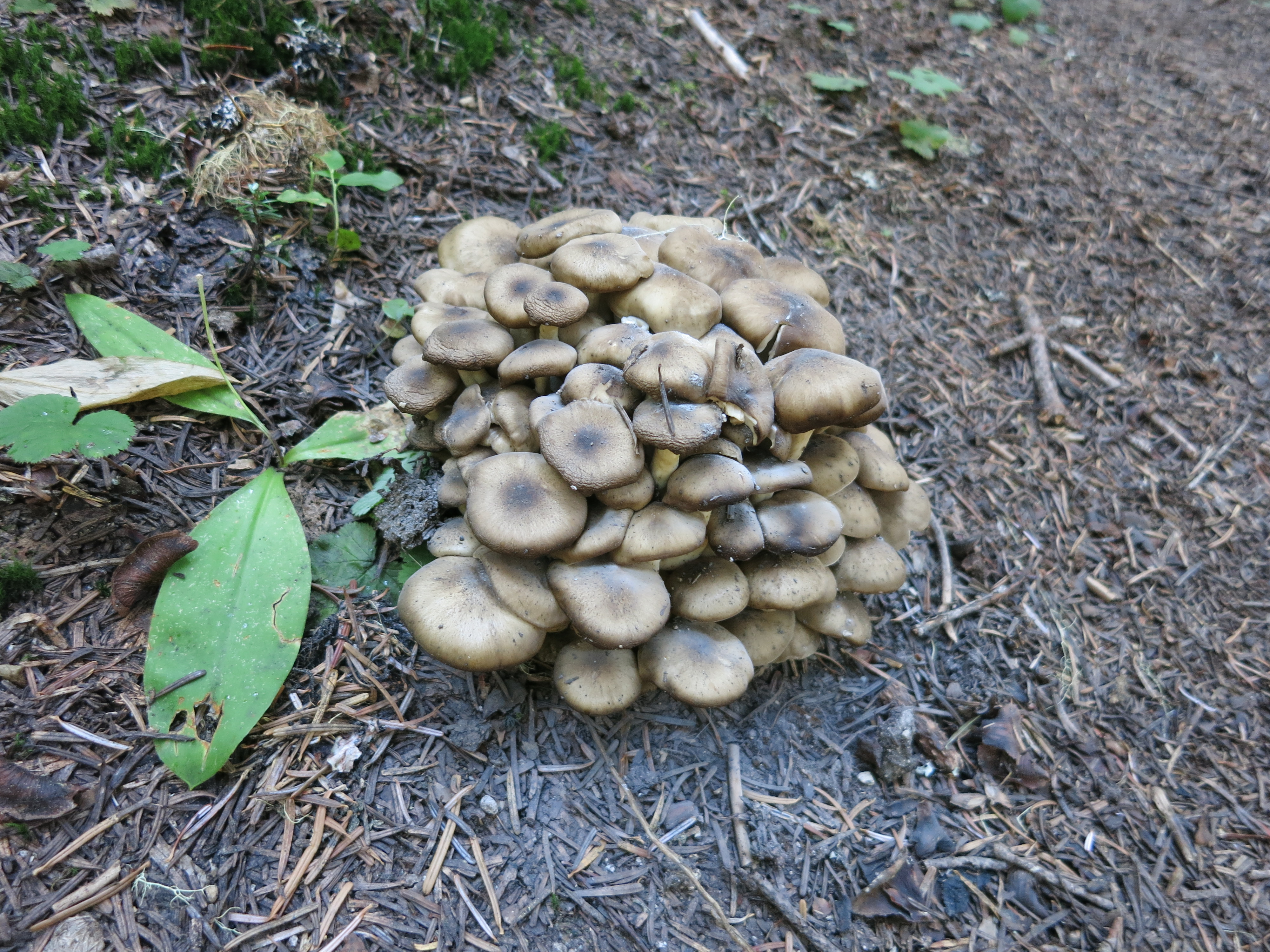
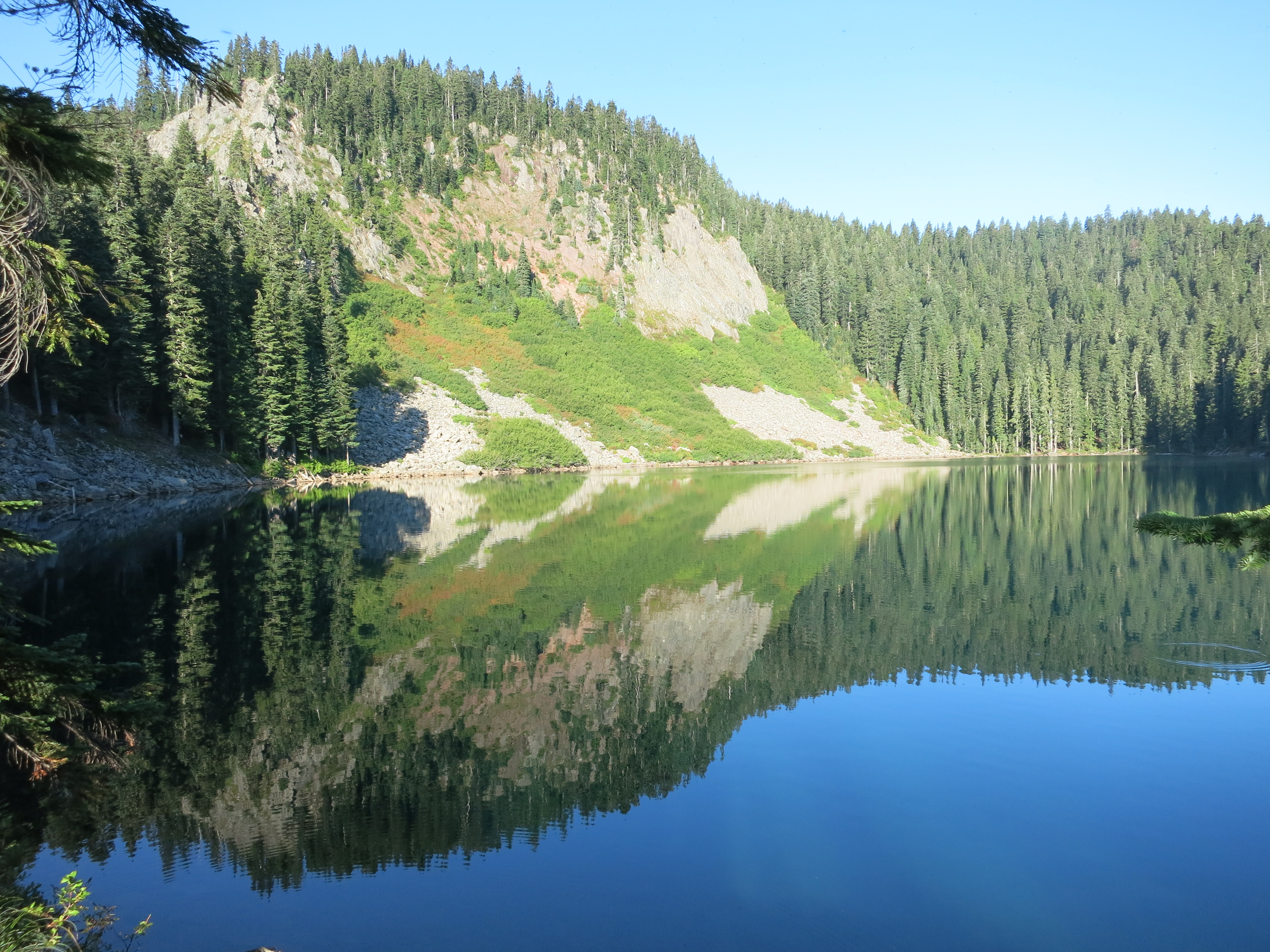
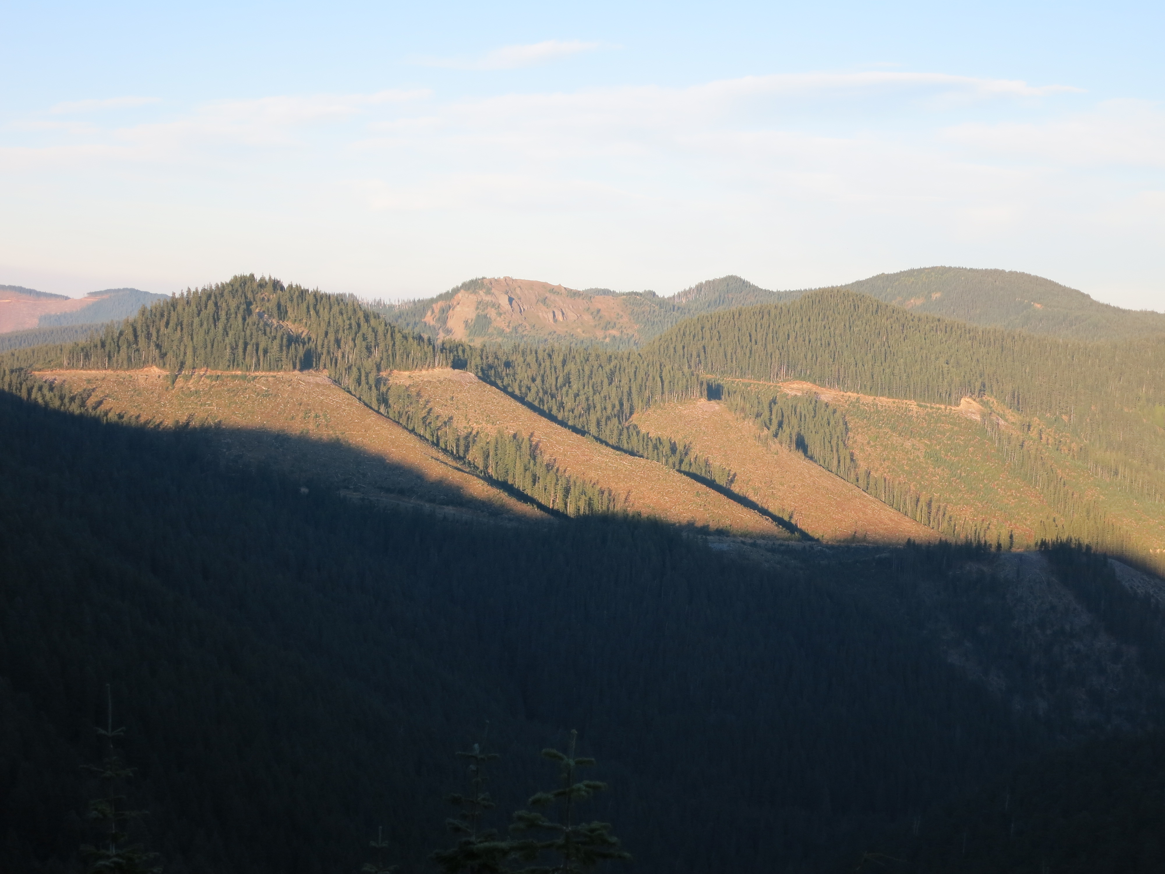
Last night was warmer than the night before, but the wind was so noisy as it gusted through the pines that it was hard to sleep.  Today was the day of ups and downs. It felt like we spent all day either picking our way down steep slopes or slogging back up them.  The sun was still shining in a clear sky for the first half of the day and it was intense even this late in September. This made itself felt most through the continuing clear-cut areas, but the shady forest sections we alternated with were cool and humid. Like natural air conditioning.

IMG_1370
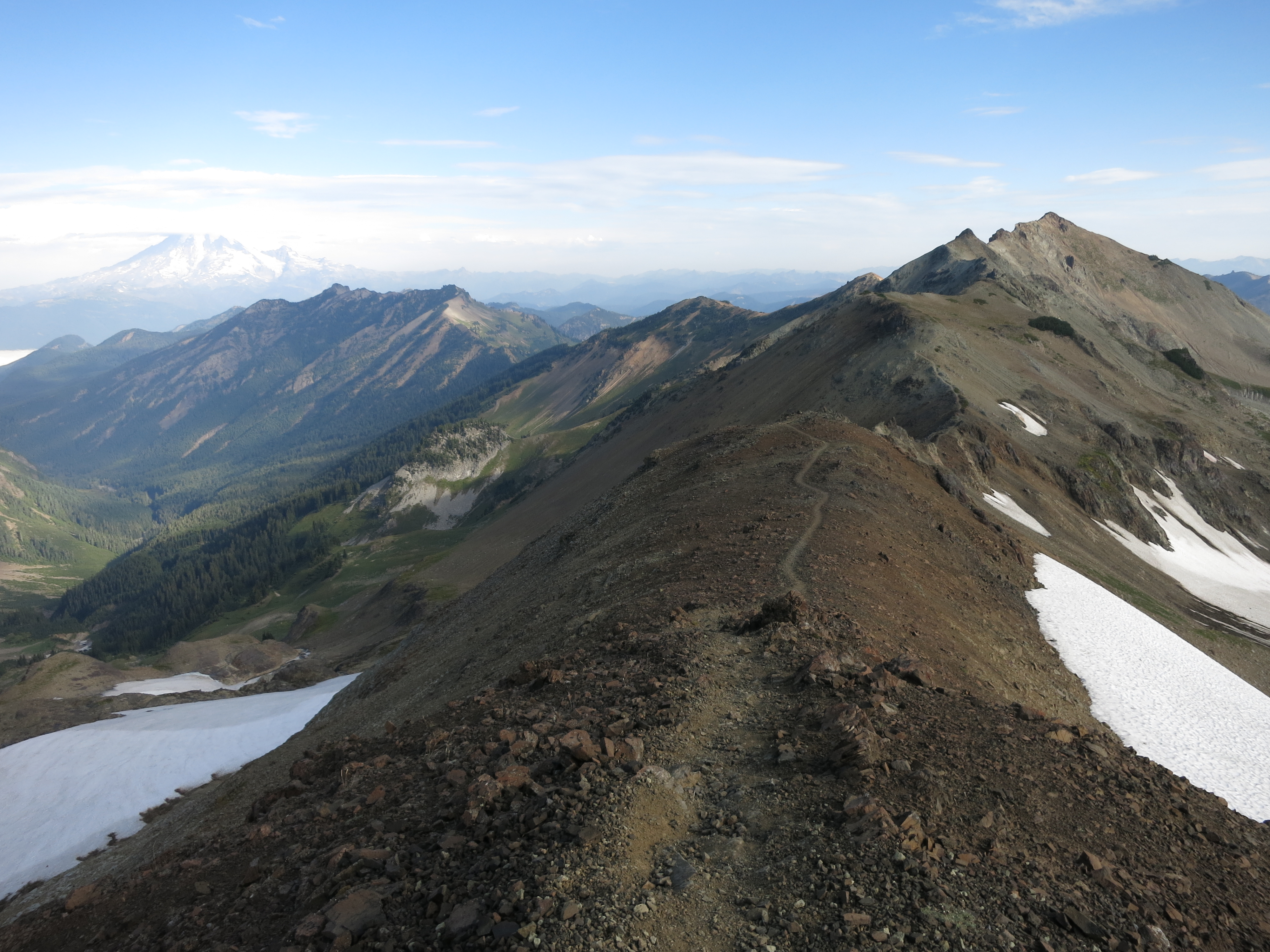
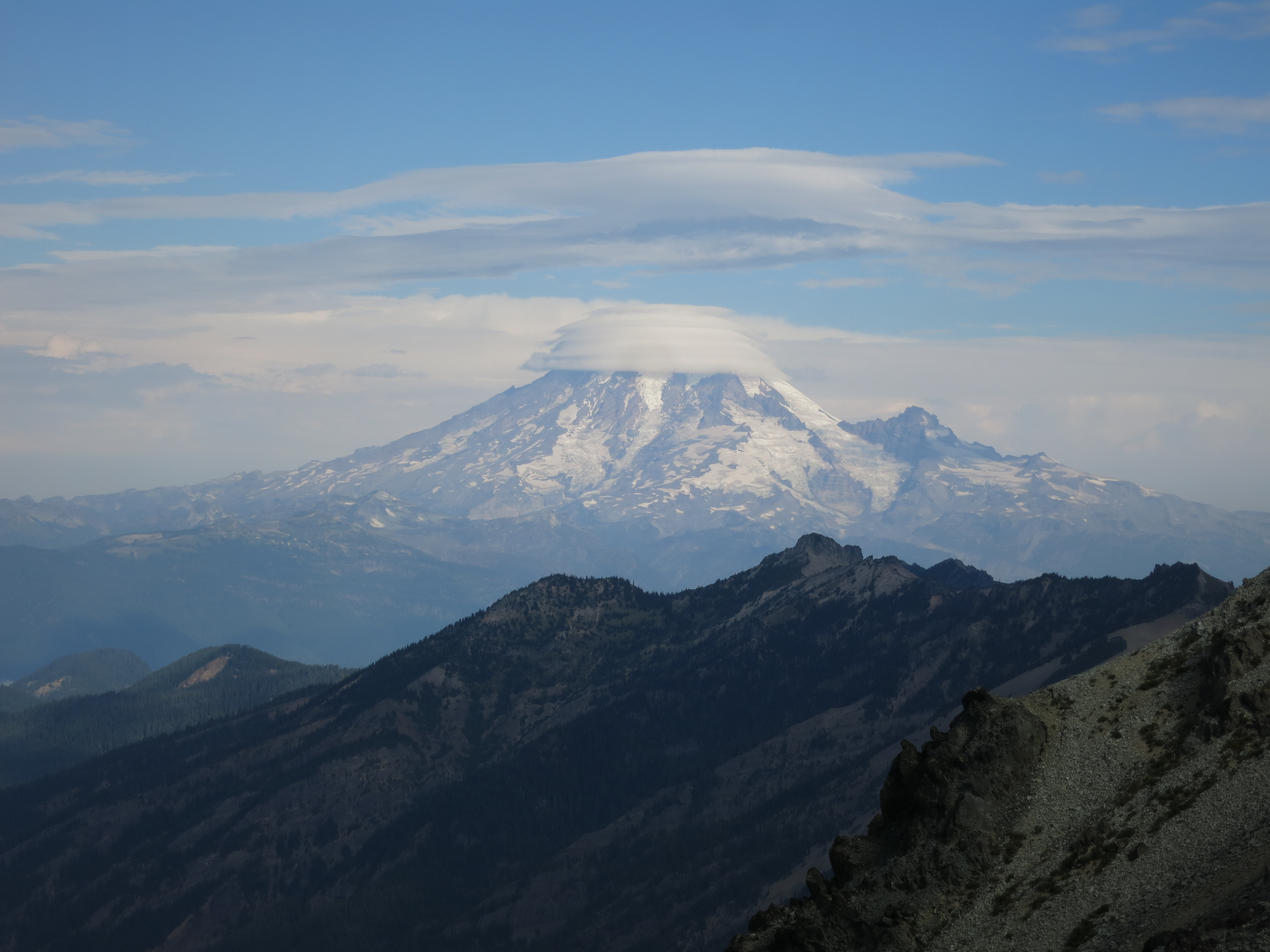
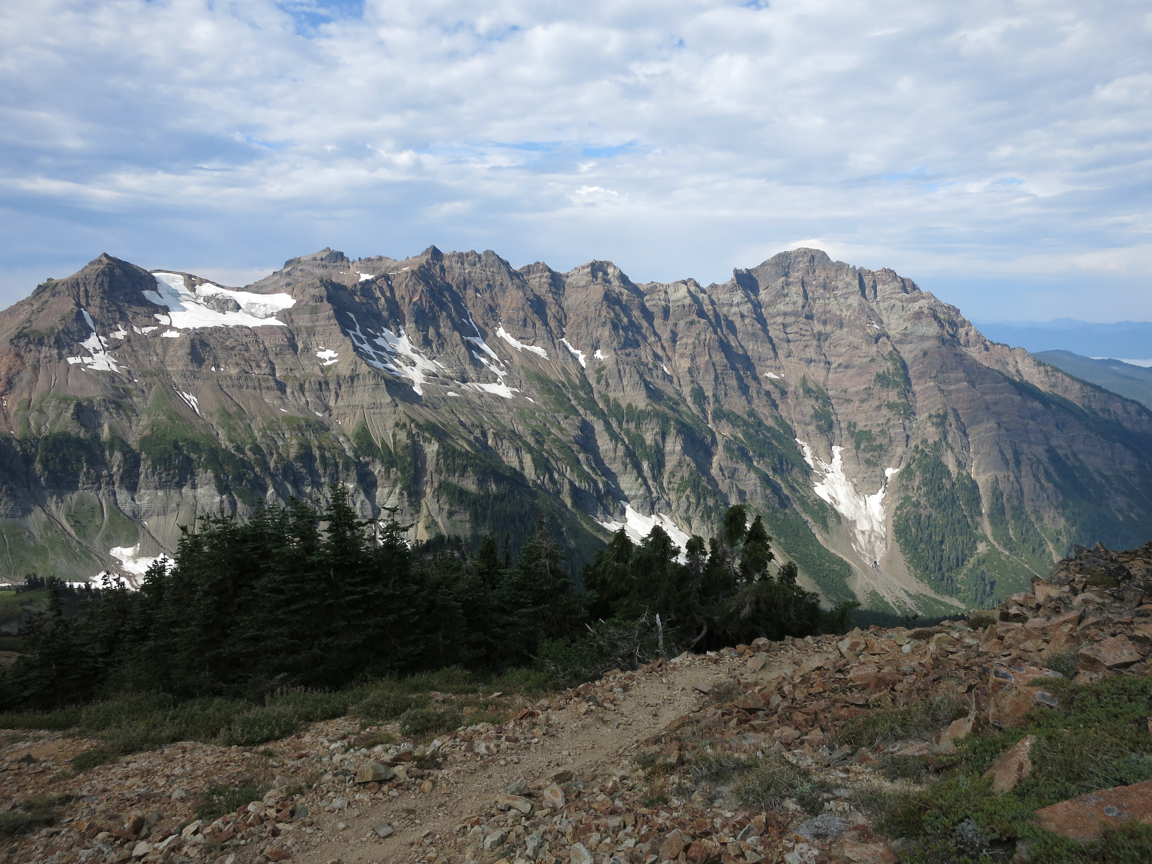
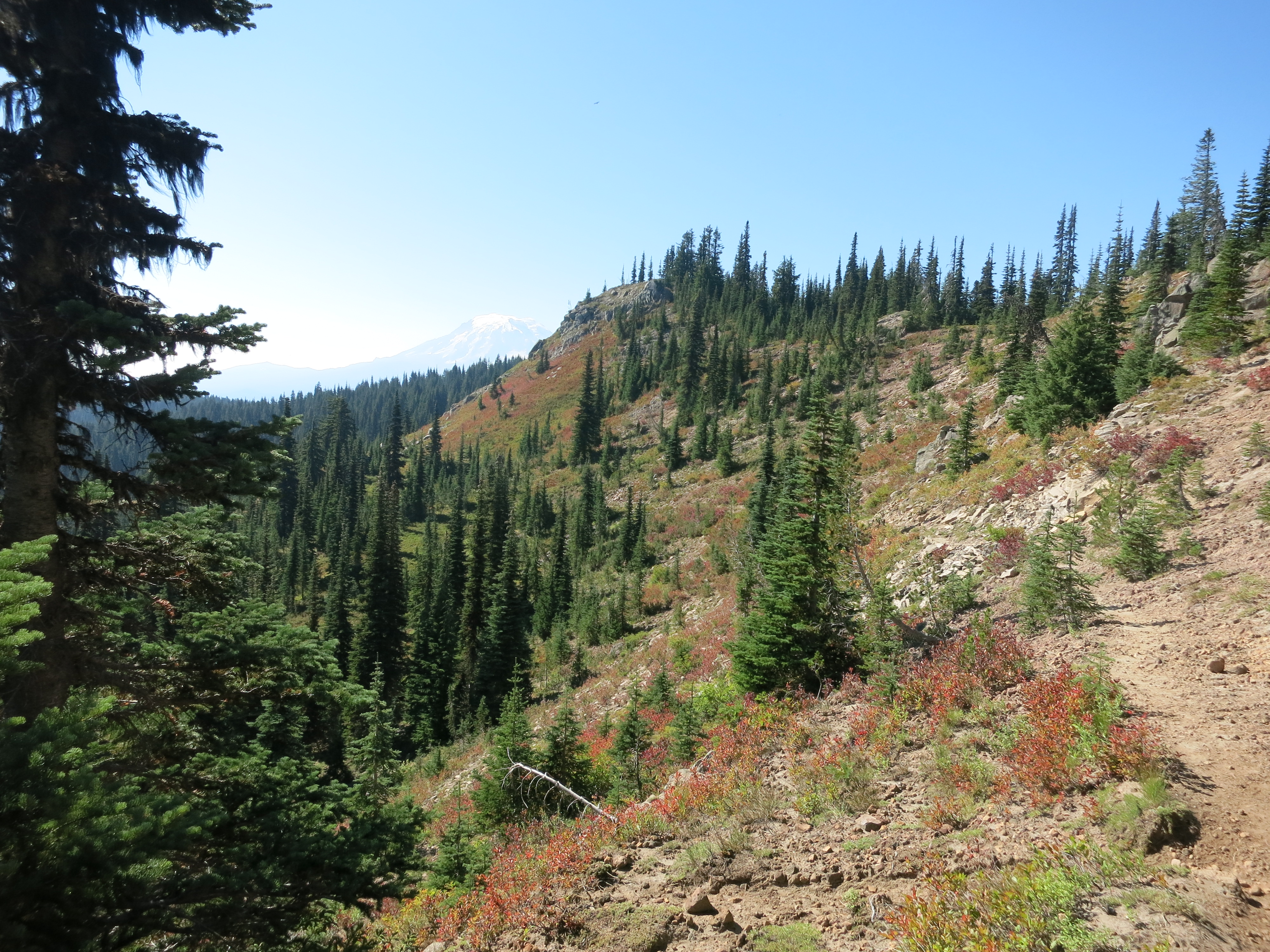
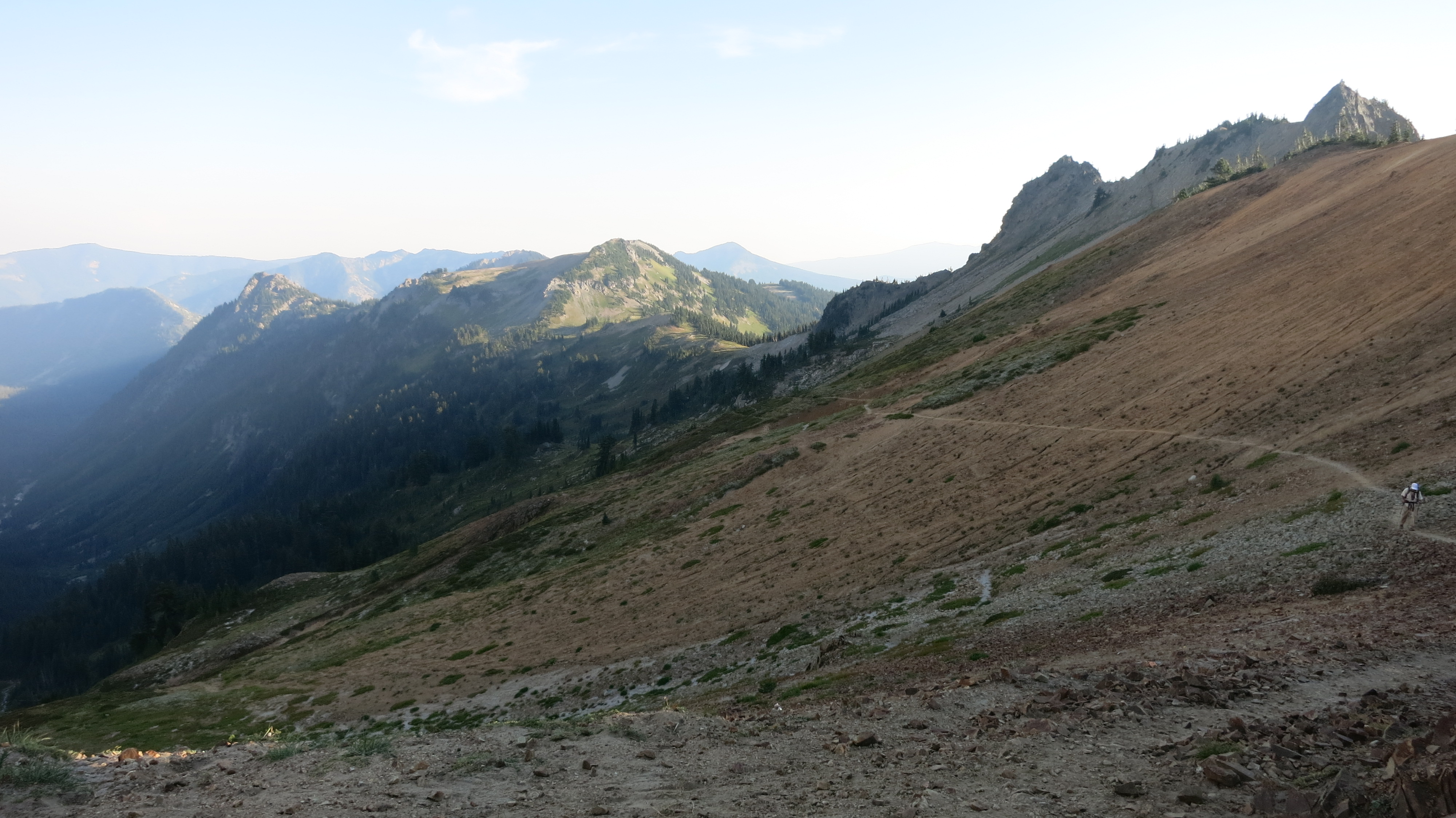
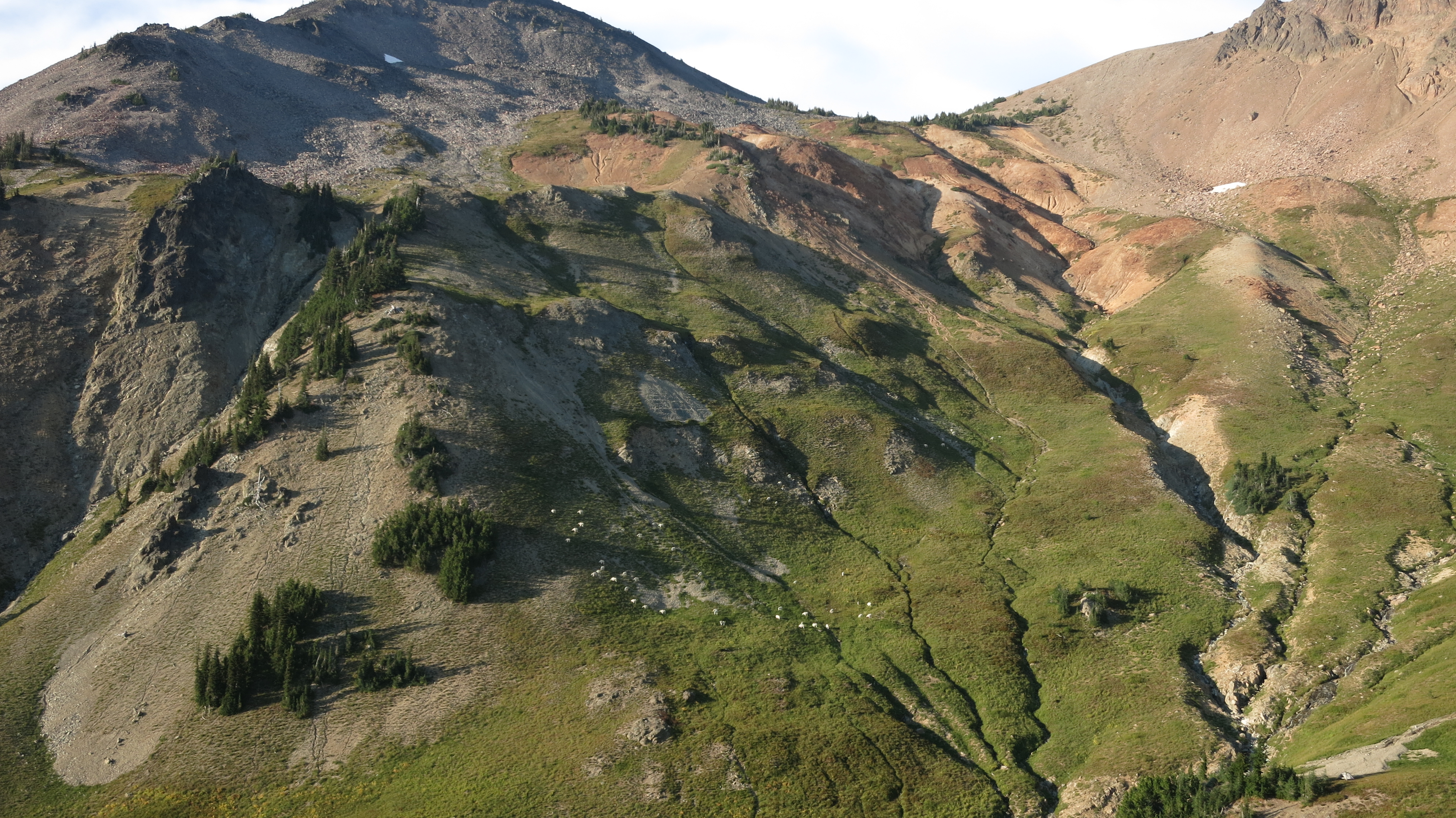
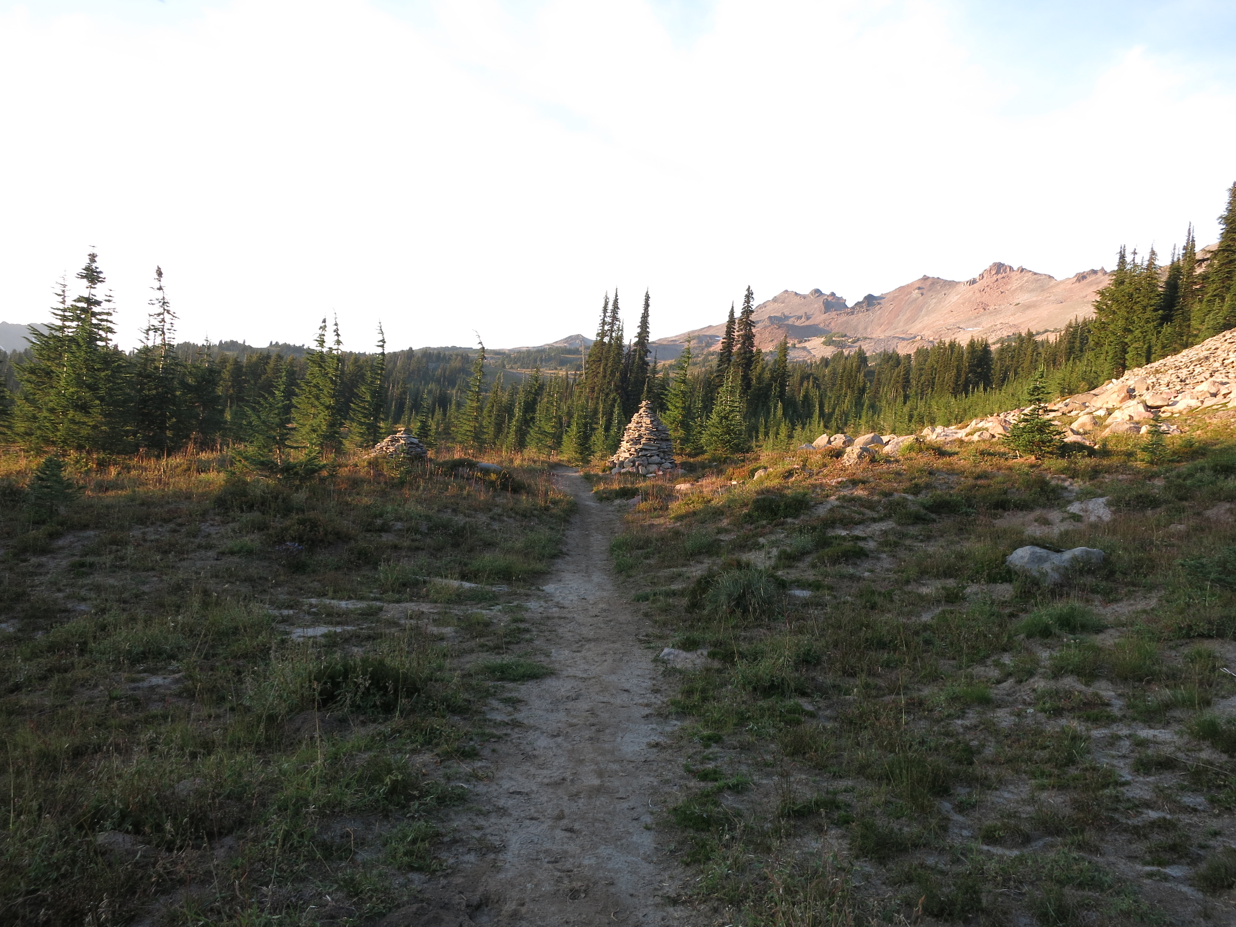
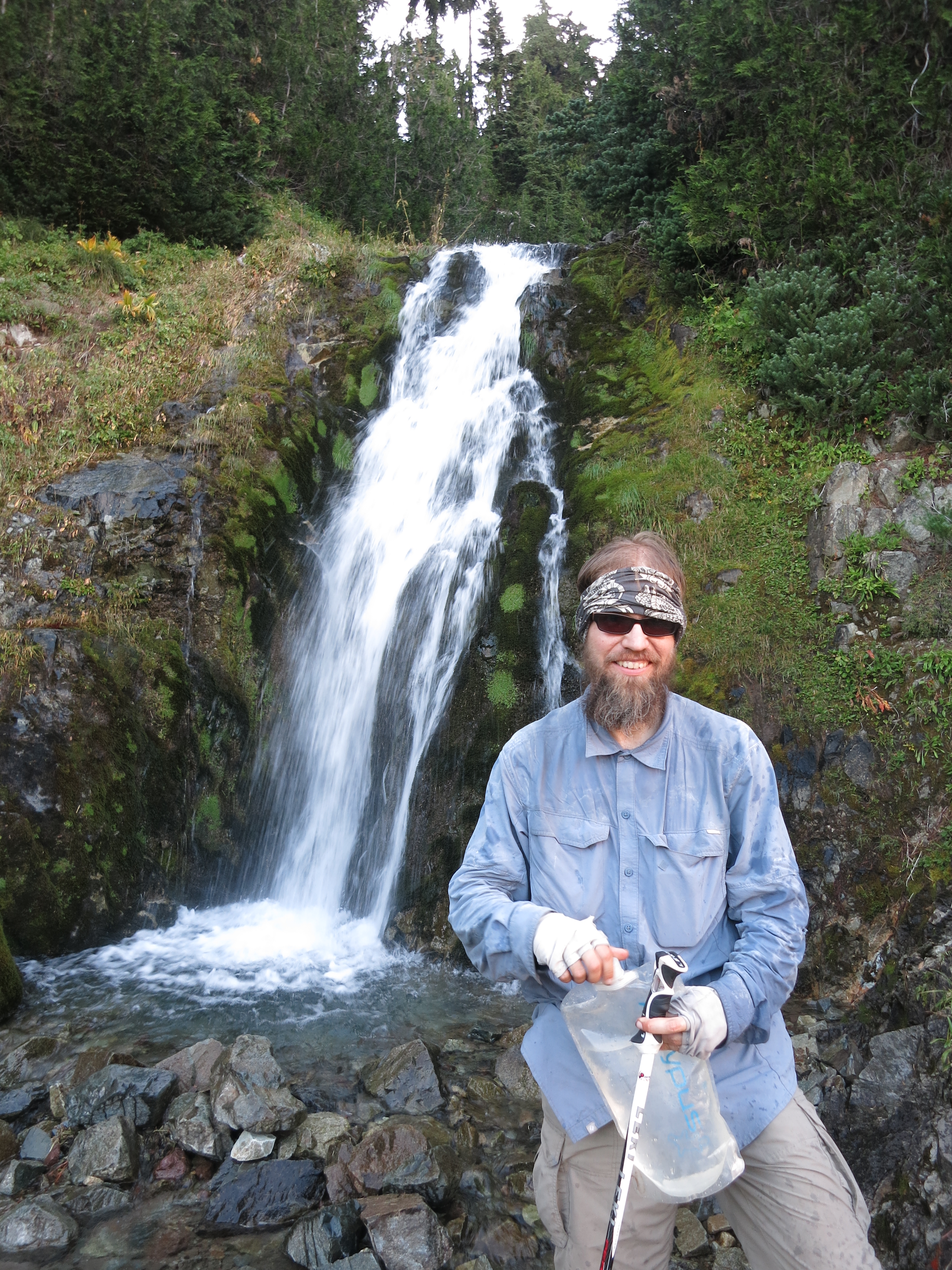
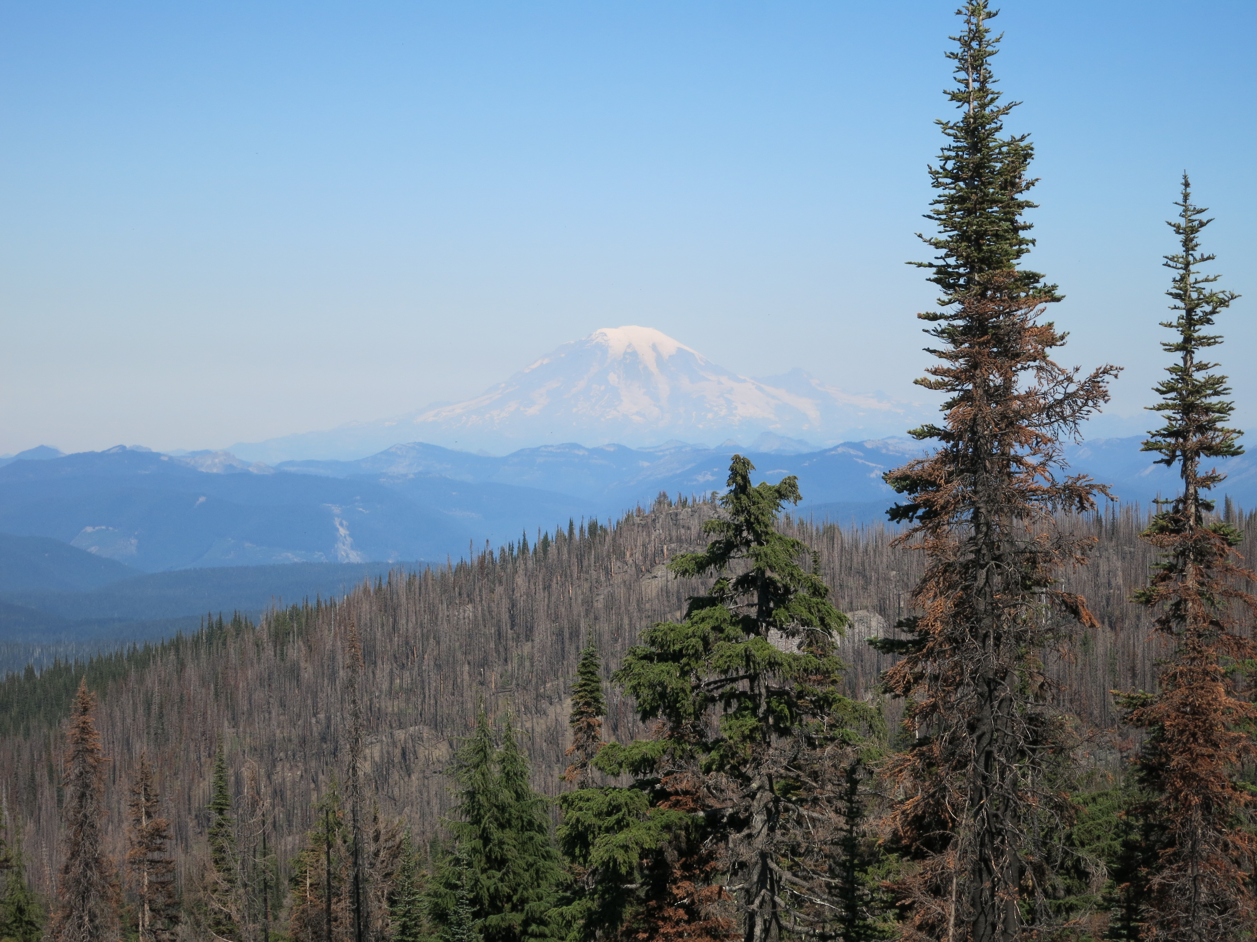
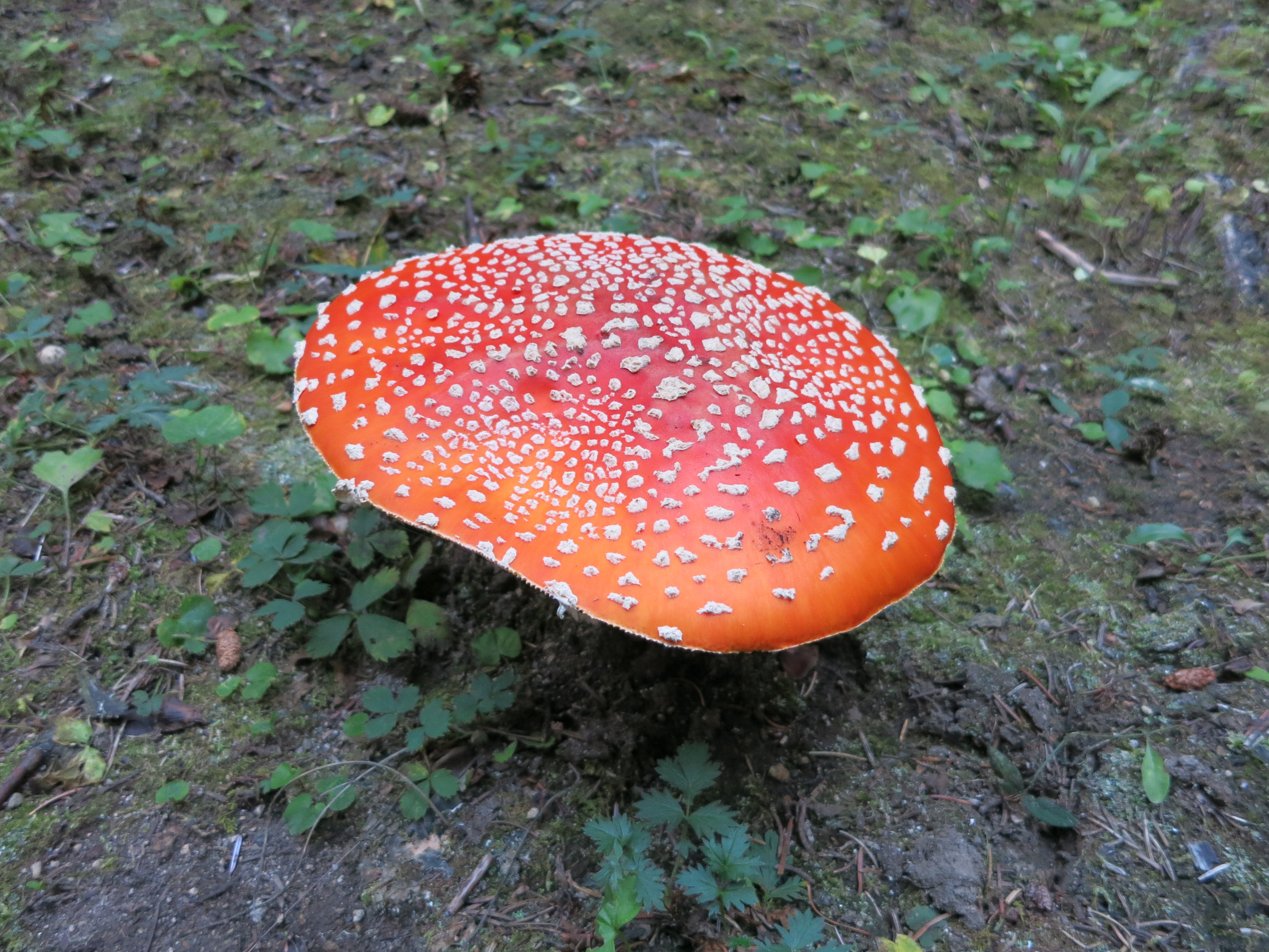
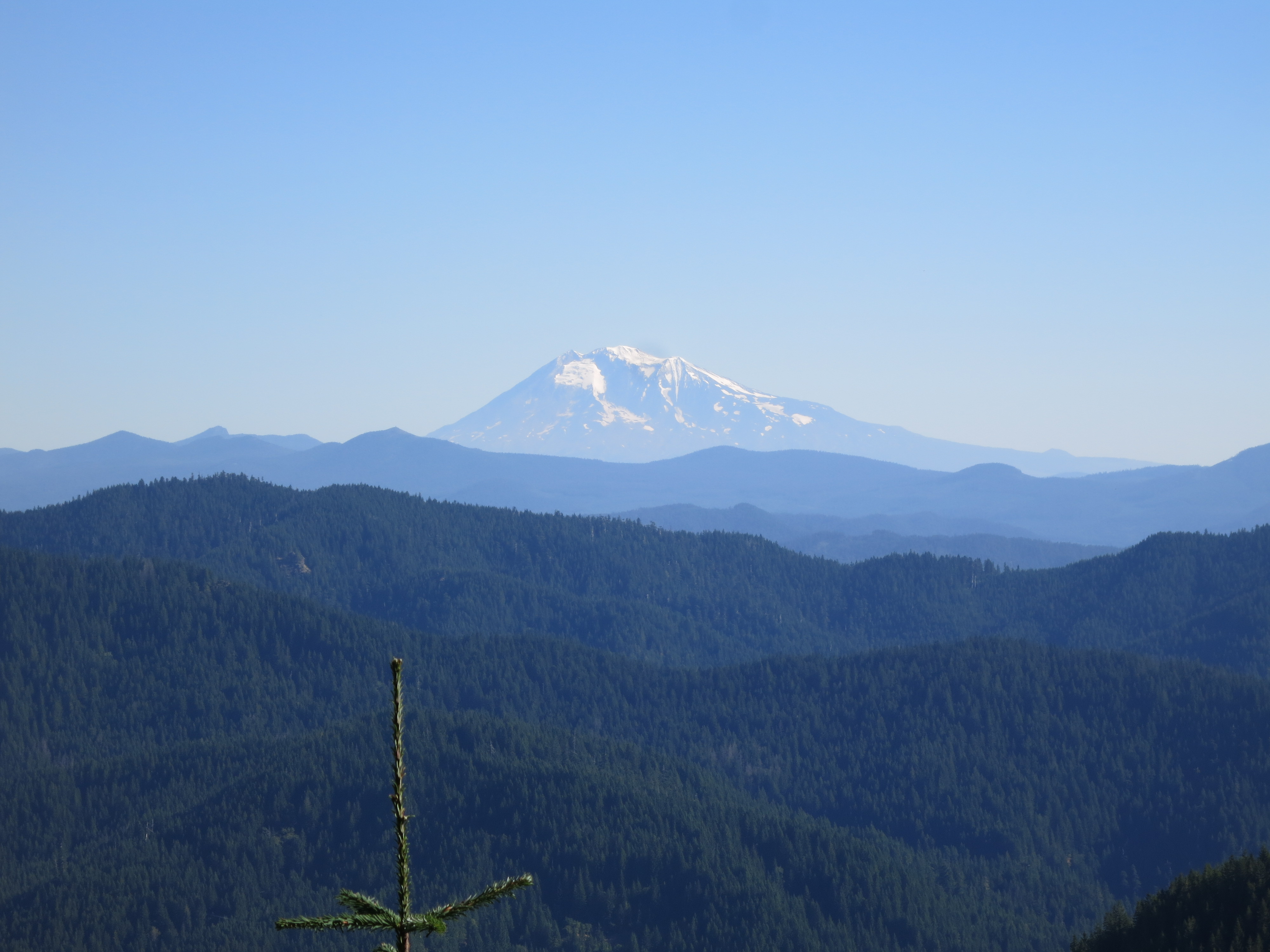
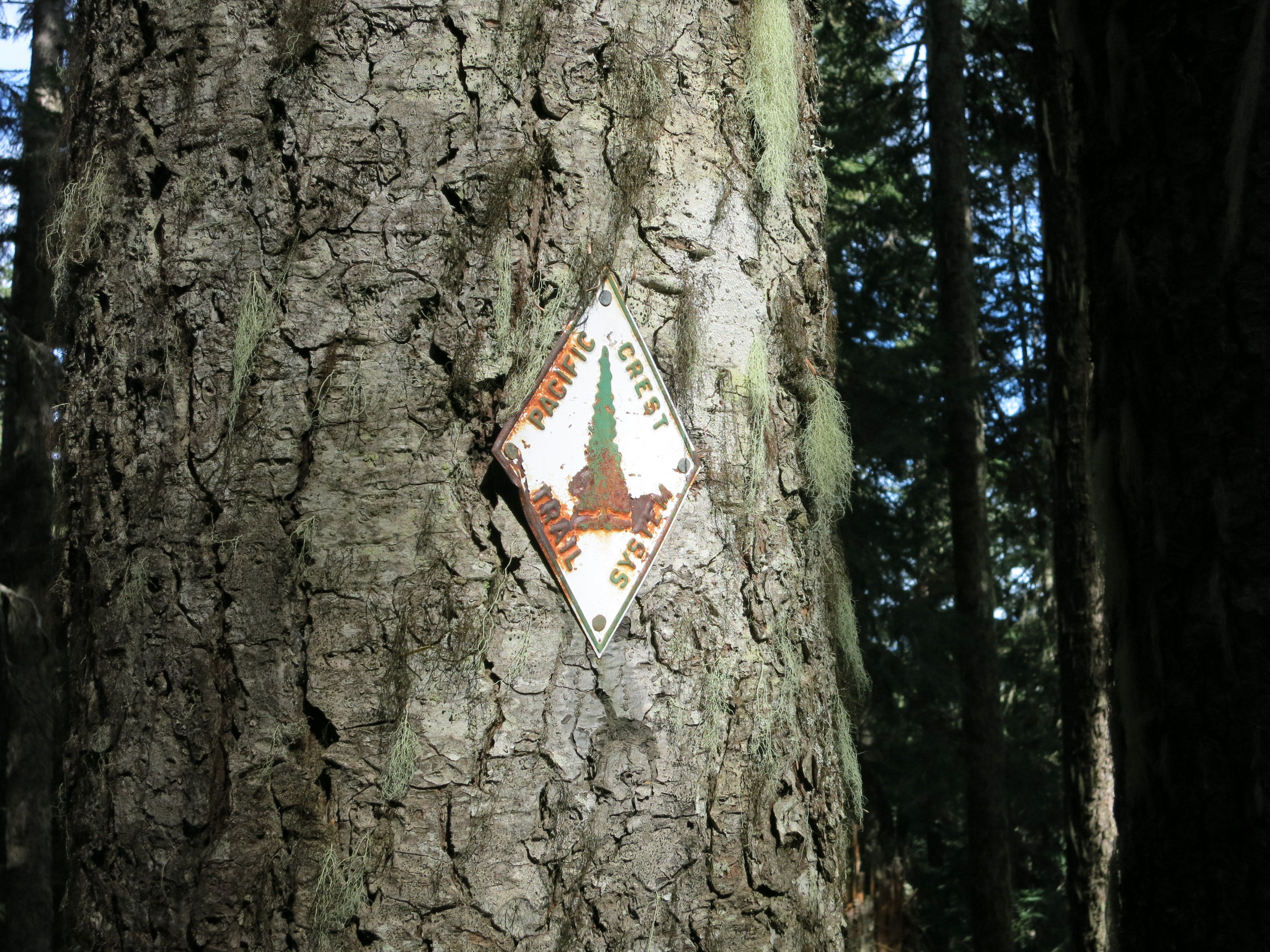
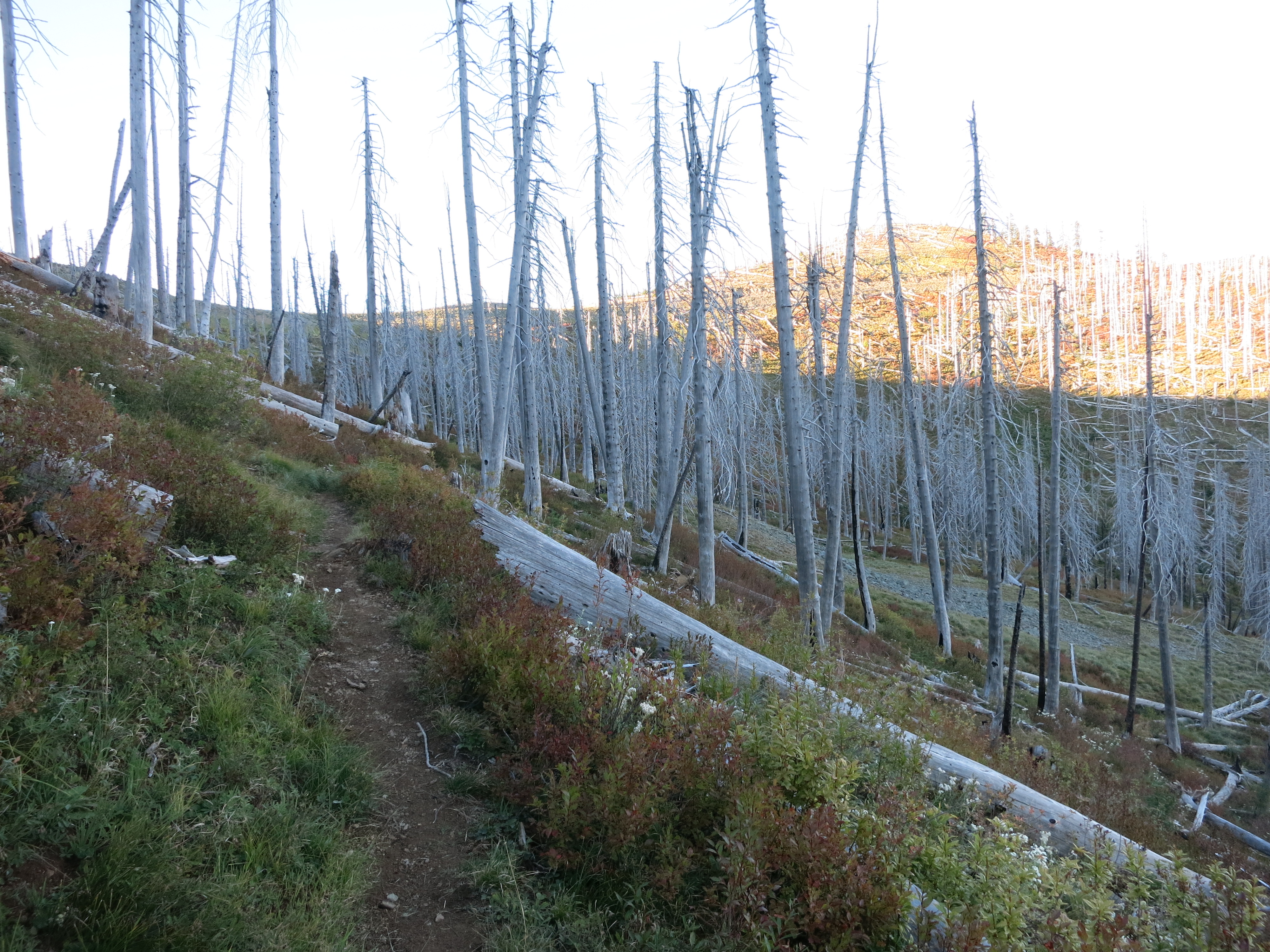
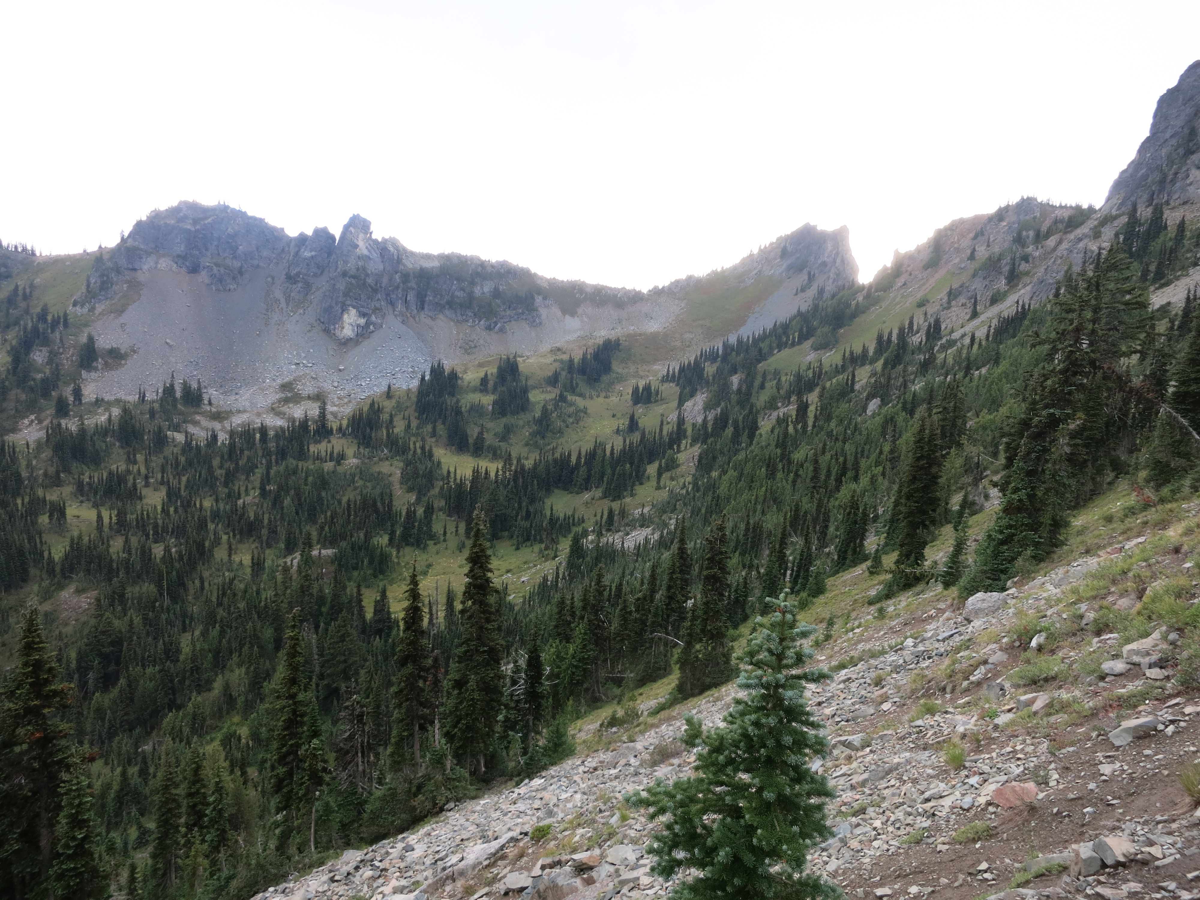
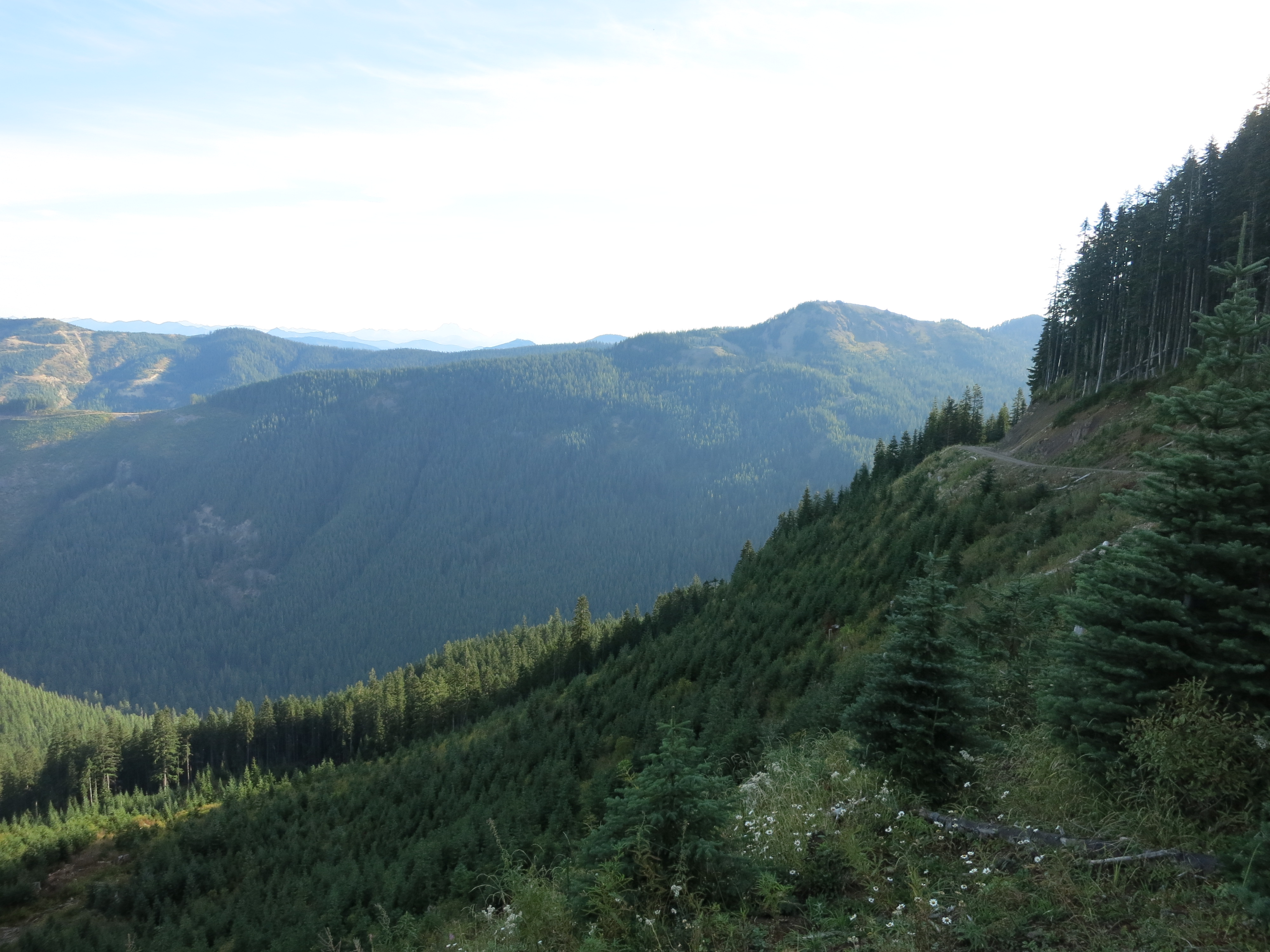
The trail still suffered through the logged patches.  On steep slopes it was deeply rutted and full of loose rocks from the runoff that flowed down the path during rainstorms. We stopped at a very low-flowing stream for lunch and were glad for it since the next water was 5 miles and a steep uphill away. Lunch was veggie daal, a meal we often overlook when deciding which ones to take from our resupply.  I’m not sure if it’s because we haven’t had it in a while or what, but it tasted especially delicious. Maybe it was all the veggies – cauliflower, zucchini, carrots and a lot of other stuff we don’t normally get the chance to eat out here. The second half of our day started with yet another steep climb.  The sky had clouded over a little and would continue to move towards overcast for the rest of the day – the promised shift in weather.  We went down the other side of the slope in a knee-punishingly steep descent, crossed a dirt road, and immediately started back up the other side in a thigh-burningly steep ascent.  I guess that’s why it’s called the pacific crest trail and not the pacific flats trail.  We crossed under three different buzzing high-voltage transmission lines as they marched west towards Seattle.

IMG_1373
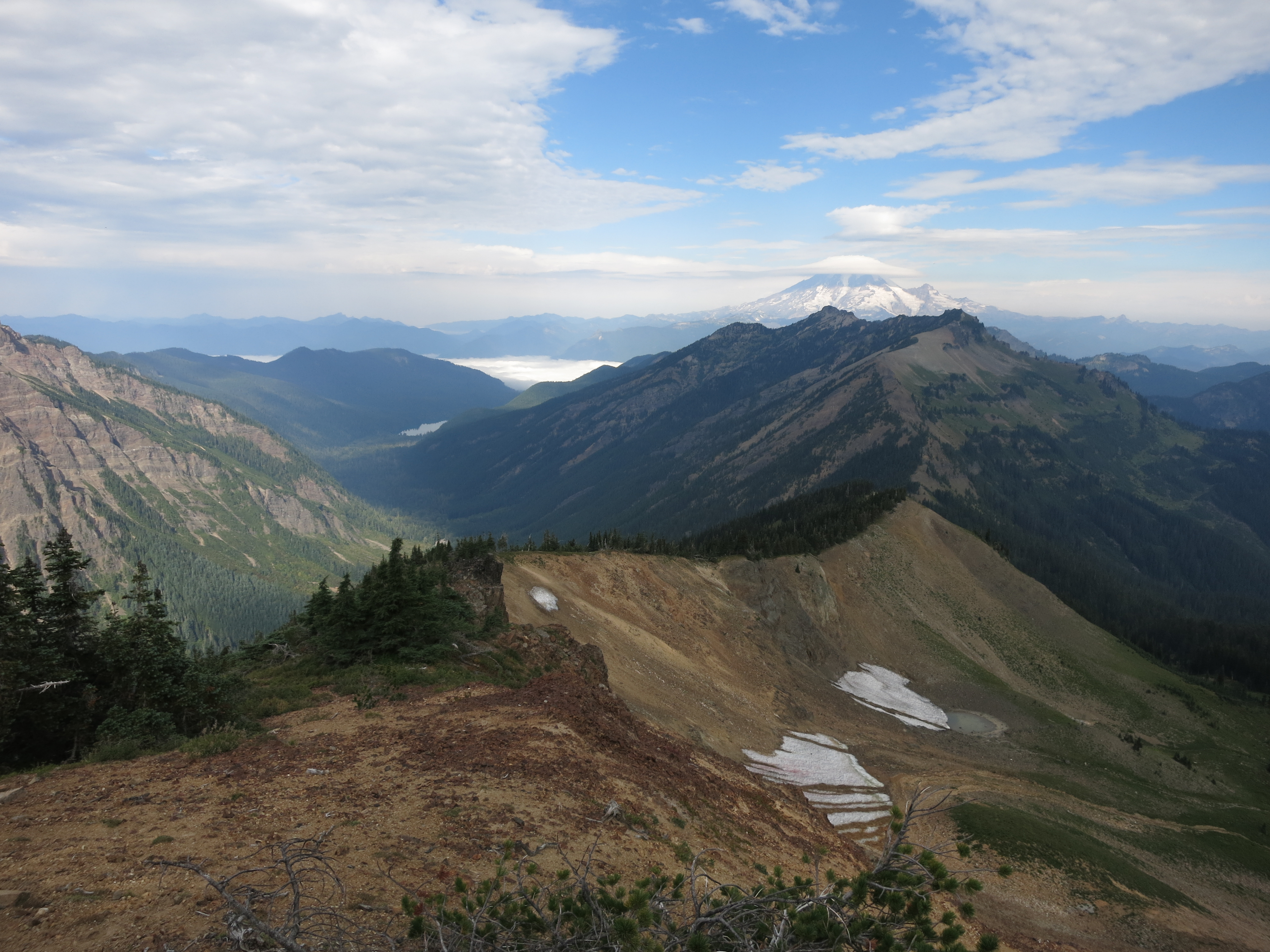
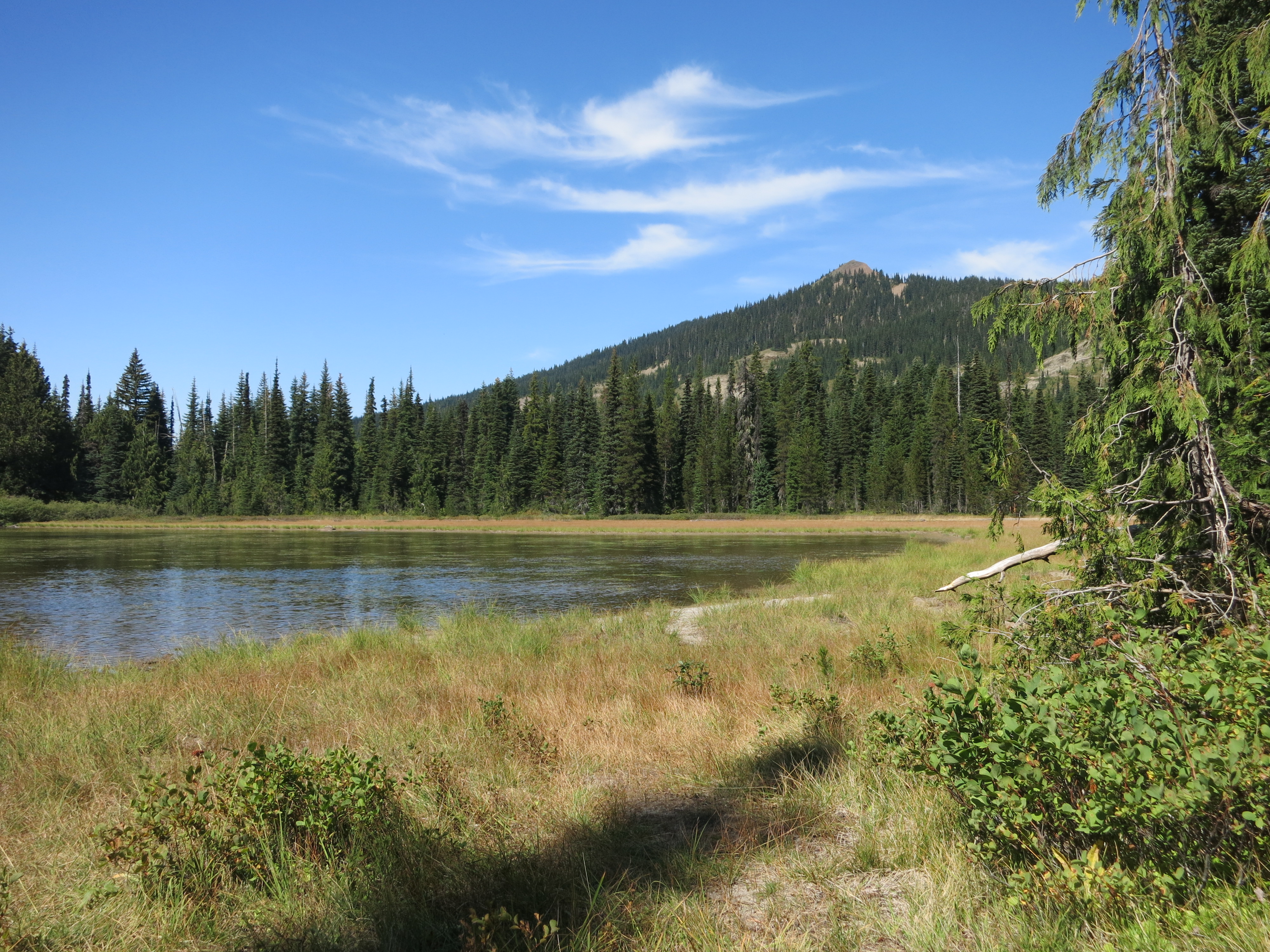
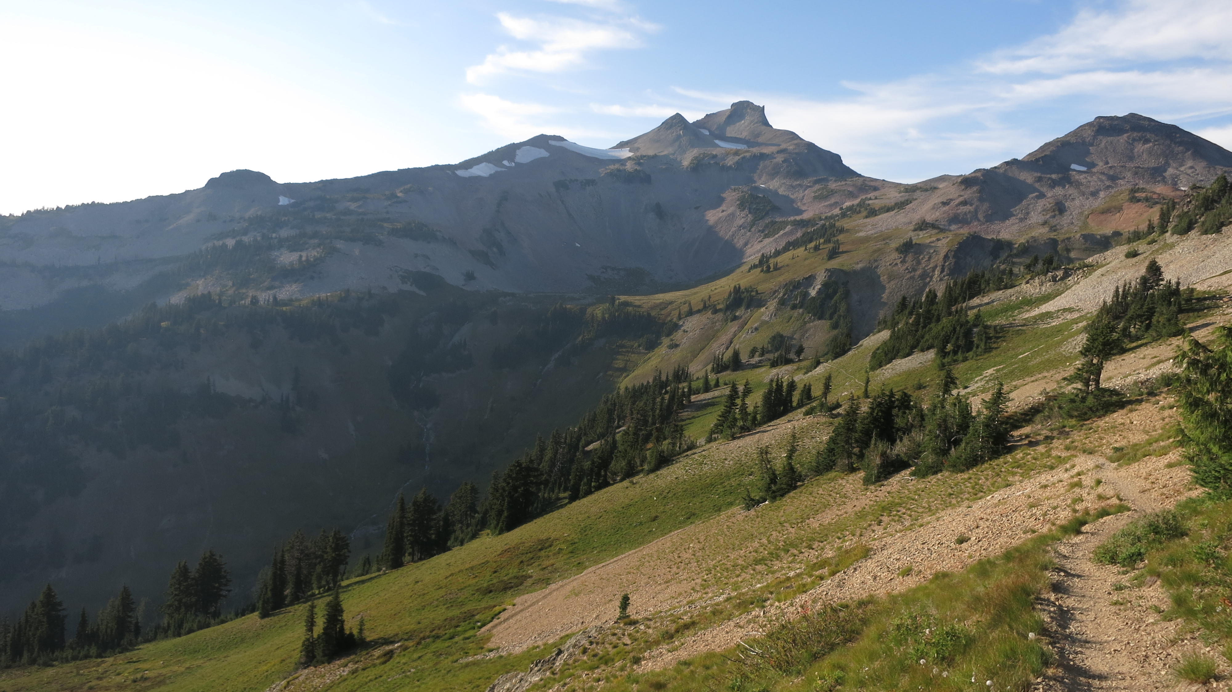
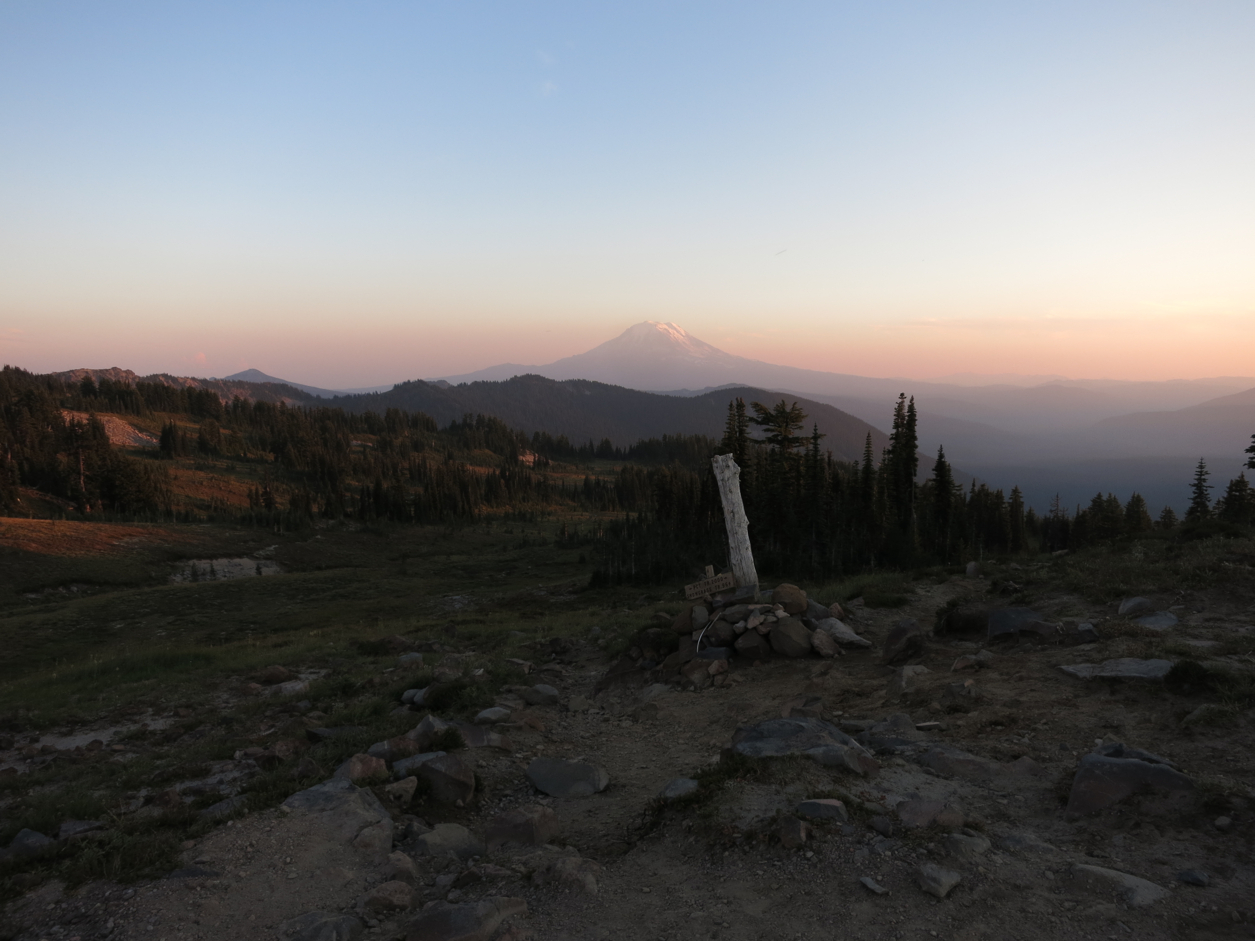
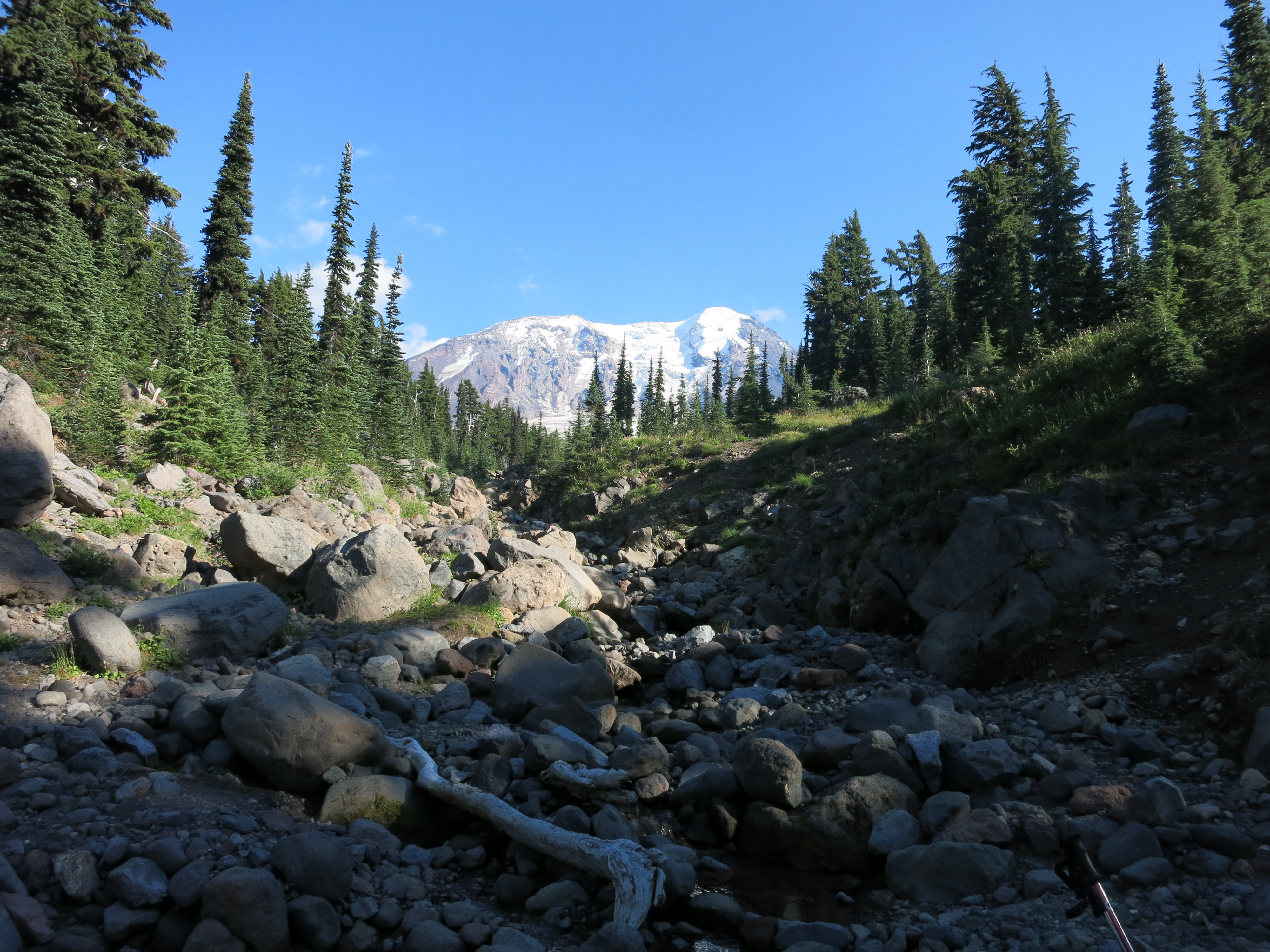
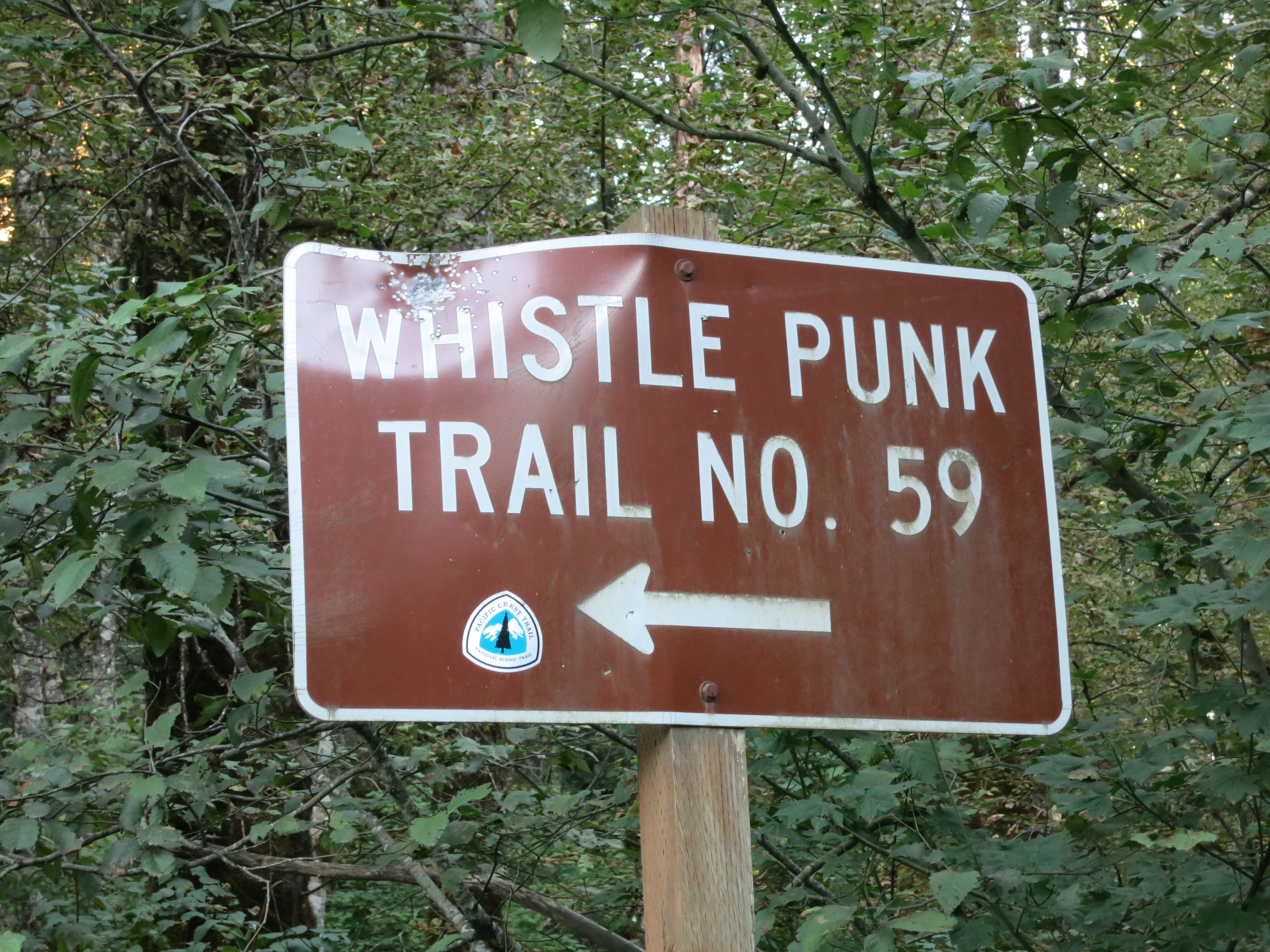
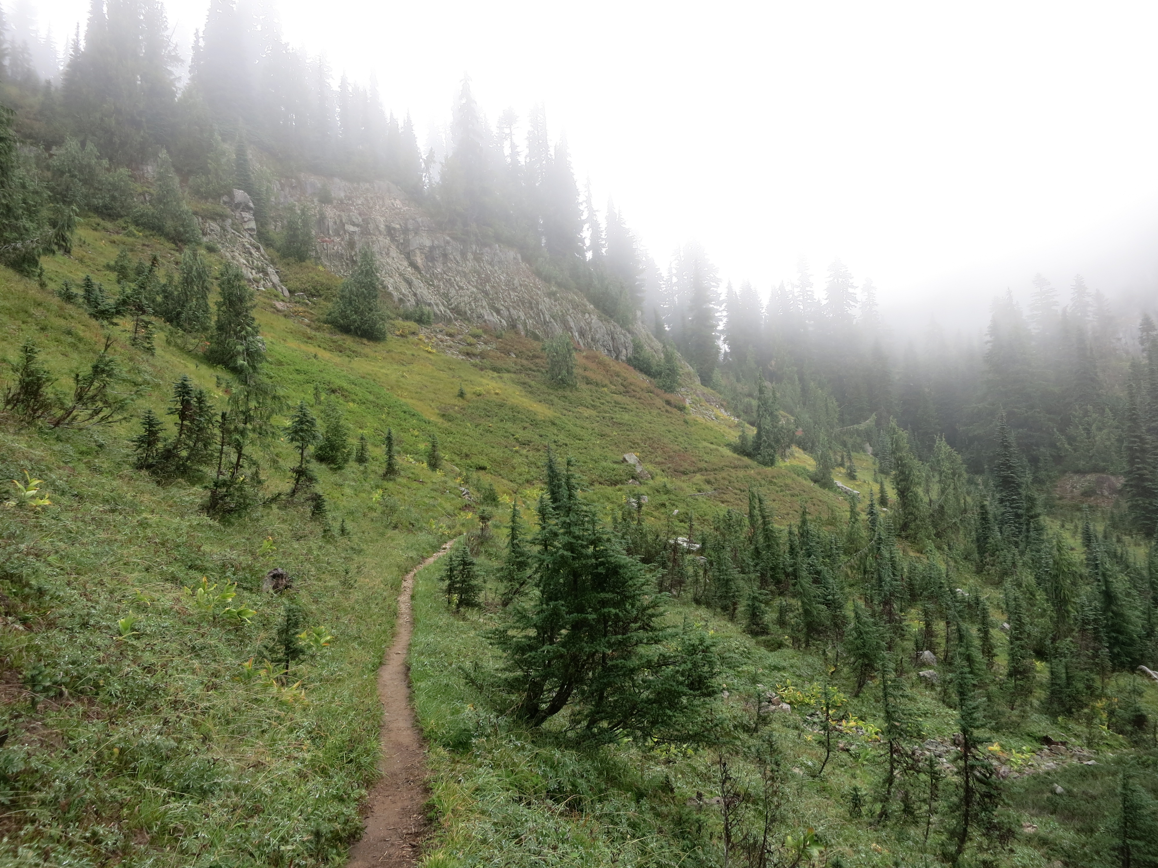
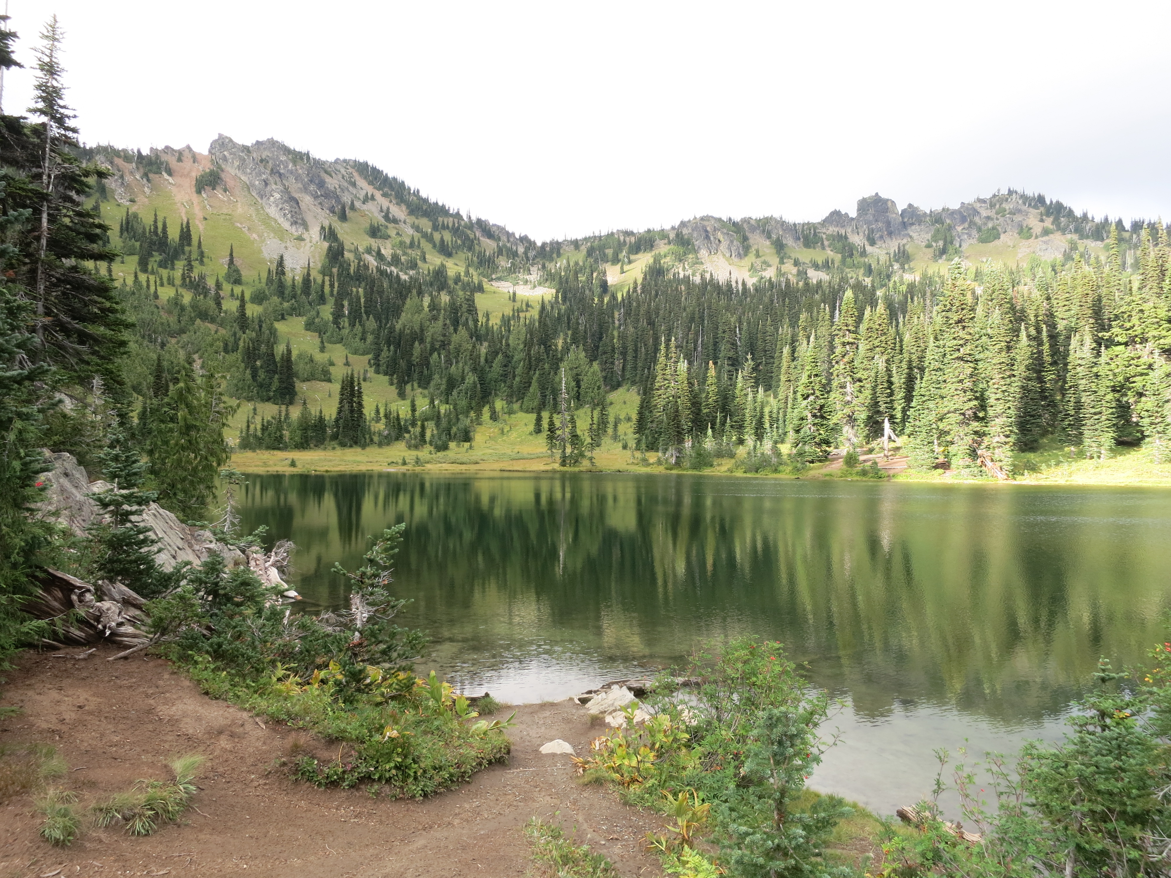
After one last steep climb we headed down the backside of a ridge to another hopefully-flowing trickle and our campsite for the night. The trickle was better than we’d had for lunch, flowing with a noticeable current across the trail.  Another tenth of a mile or so brought us to a wide, scrubby meadow where we set up for the night.  There was enough daylight left to pick what we thought was a site sloped enough to allow any rain to run off. Tonight is definitely a tarp night.  Tomorrow we’ll have a short day into Snoqualmie Pass, our third-to-last stop before the border.  We’re excited for burgers and a real bed out of the elements, which are sure to be a factor.IMG_1375

Day 154 – Blue Bell Pass to forest road – 23 miles

IMG_1360Last night, all snug and warm in my bag, I had what seemed like the best night’s sleep on the entire trail. I was very glad we’d set up our tarp even through we didn’t get any rain.  When the wind picked up overnight it helped keep us warm and in the morning it felt about 15 degrees warmer inside the tent than outside.

IMG_1359Our view was incredible when we finally poked our heads out of the tent.  We could see the nearly-full moon, bright and seemingly enormous, just setting behind a ridge to the west. South of that, making its appearance at last and dominating the horizon, was Rainier. Its snowy slopes were painted pink by the rising sun.

IMG_1361I bundled up to start the day’s hike – jacket, warm hat, long pants over my base layer, and gloves.  I actually hiked in it for a good long while, too. Normally a few minutes after I get going I have to stop and strip layers.  The dirt of the trail tread was frosted on the shaded western slopes of the ridges we traversed.

IMG_1367It was sunny and clear but very windy. Even when we were down off the ridgetops and out of the main force of it we could hear it whipping around the treetops.

IMG_1363We made 16 miles to a water source and a very nice shelter – the Urich cabin – for lunch.  There we ran into a few dayhikers and chatted for a while about the trail and our trip so far.  They even gave us some Nature Valley and Clif bars, completely unasked!  While we were cooking up our beef stew lunch a few other hikers showed up.  The weather is on everyone’s mind, of course. The rumor is that it will be dry but overcast tomorrow and that Saturday will be rainy – a good day to get into town.  We heard this morning that it might snow Monday night at the higher elevations.  We’ll see how the forecast shakes out, but we’re getting down to the wire and every beautiful day like this is a blessing. The cabin would be a wonderful place to stay in bad weather. There was a huge wooden stove, a good stash of cut logs, and hooks everywhere to hang wet gear. The snowmobile club that built this place really knew their audience – summer AND winter.

IMG_1369After lunch we headed up towards Diamond Peak to traverse the ridgeline east for a few miles.  We entered the much-reviled clearcut area, where huge sections of hillside were empty of trees over 5 feet tall.  They looked much more barren from far away than they did while hiking through them – like huge, straight-edged scars cut into the hillside.  The trail through these open areas suffered a lot.  Erosion made them slope slightly downhill, exhausting our ankles, and they were very rocky and uneven instead of nice soft duff like in the still-forested sections.  We stopped and got water at a little creek – the last source for 12 miles – and kept hiking for one last hour.  We reached our goal of a particular road crossing with enough light to see by but didn’t have to hunt very hard for a spot.  There was a nice sheltered one set well away from the road and back from the edge of the ridge.  Hopefully we’ll be protected from the still-gusting winds.IMG_1365

Day 153 – small creek to Blue Bell Pass – 22 miles

IMG_1343We stayed dry even though it rained for most of the night. I didn’t sleep very well – every time it started up again I woke up to check that no water was getting in. When the alarm went off neither of us was inclined to move, so we lay in our bags and ate our snickers and granola and other breakfast snacks while raindrops tapped on the tent.  Eventually we made ourselves get up but the wet and the cold made it really tough.  If we didn’t have to make the miles we would have gone back to sleep for a few hours.

IMG_1345We got out of camp later than normal and started right into a steep climb up a ridge. Everything was still draped in fog and coated with moisture.  The trail was in better condition than yesterday.  Although some spots were still squishy we didn’t had to slog through any mud.  The forest smelled wonderful – a sweet, grassy vanilla scent with spicy pine and anise notes.  As we came over the top of a ridge I startled what I thought was an elk.  Later on we heard them bugling in their strange, squeaky voices.  Fall is marching on…

IMG_1344As the morning progressed some of the mist burned off and we even had a few rays of sun. We began to catch glimpses of the rocky cliffs around us. We crossed into Mt. Rainier national park, our next to last such park on our hike.  It’s strange to think that we were here just over a year ago hiking around the mountain. I never would have guessed that we’d be back so soon – and all the way from Mexico!

IMG_1352We stopped for lunch at Chinook Pass, which had trash cans and outhouses.  The chilly air and lack of sun had us shivering when we weren’t hiking and we devoured our meal of pork daal faster than usual just so we could get moving again. The trail followed the highway for a short while before starting us on another climb.  We passed Sheep Lake, nestled in a bowl of craggy cliffs, and continued up.  Once we reached the top we dropped into the basin on the other side and started following the sides of ridges. With the fog mostly cleared we had spectacular views of the surrounding mountains – although we still couldn’t see Rainier itself.

IMG_1353It got colder and colder.  At one point we stopped to make a quick phone call to reserve a room at Snoqualmie Pass this weekend.  The break couldn’t have been more than 5 minutes but by the time we got going again our hands were numb.  We’ve been wishing for colder weather and here it is!  We hiked until nearly dark and found a nice site up on a ridge, far enough off the trail to be private.  It’s very cold – 37 degrees, by my watch thermometer – and we’re all bundled up in our bags.  Hope it’s not too cold to sleep…IMG_1356

Day 152 – White Pass to small creek – 15 miles

IMG_1339 IMG_1340 IMG_1336Back to the trail today after a restful day off. It wasn’t raining when we cleared out of our room but it was cold and damp. The clouds were still very low, hiding the upper parts of the ski slopes in white fog. We hung around the store for a bit to get a few last snacks and a cup of coffee before setting off into the mist and inevitable wet.  Dealing with the rain might be our biggest challenge of the whole trip.  The trail climbed gradually as we left the highway and the chilly air became comfortably cool as we warmed up. We hiked through dense, scrubby, piney forest similar to the stuff we’d passed before entering the Goat Rocks.  It was different in the wet weather – quieter and full of muted colors.  Everything was coated in perfect silver beads of moisture. As we climbed the mist began drifting through the trees. We felt closed off, like we were hiking in our own little pocket of silence.  After a while it began to drizzle and we put on our pack covers to protect against the drops falling from the trees.  Gradually it got heavier and we progressed to full ponchos. It was wonderful to have our umbrellas back.  With them strapped to our pack straps, we didn’t need to wear hoods and we could keep the ponchos partially unzipped to help with ventilation.  They even shielded our arms and prevented the inevitable creep of rain up our sleeves.  I’m sure we’ll get the chance to test them in much worse weather, but for the gentle rain we had today they worked like a charm.

IMG_1339As the rain got heavier the trail got wetter.  We started slogging through long patches of slippery mud and avoiding puddles. Before long our shoes were soaked. As it started to get dark – earlier than normal with the heavy cloud cover – we started to look for a campsite. After our last rainy night we knew we had to choose our site carefully and we wanted daylight to scope things out.  We started to climb up a series of gentle (but slippery) switchbacks. We crossed back and forth over a creek that was running down the hillside. Just after the third crossing we spotted a site slightly uphill from the trail. It seemed well-drained, unlike some of the places we’d seen, and sloped gently enough so we wouldn’t be sliding downhill all night.  We set up the tarp first and crawled in to put down the footprint while our packs stayed dry in the ponchos. Then we put up the net inner and threw our packs in.  All in all, things stayed surprisingly dry. We’d hate to soak our gear on the first day out on a section.  It got very chilly and we quickly changed into our dry sleep clothes and crawled into our bags.  Tomorrow is supposed to be a little drier than today, so we’ll hope for the rain to stop overnight.  It might be a little tough to sleep soundly after what happened last time we camped in the rain…IMG_1340

Day 150 – Packwood Glacier to White Pass – 19 miles

IMG_1283We were up earlier than normal this morning.  We knew our hike into town would take longer than normal, both because of some challenging terrain and because we would take a lot of time sightseeing.  After nearly a week of gorgeous, clear, hot weather the pattern was shifting.  In the morning dusk we could see lightning filling the clouds that had settled around Mt. Adams overnight.

IMG_1282We started off across the rocky landscape, quickly passing the last few trees as we hiked above the treeline. Our first obstacle today was one of the most scenic and photographed stretches of the entire PCT – the Knife’s Edge, a narrow and rugged ridgetop that took us above the Packwood Glacier.

IMG_1286We climbed steeply towards Old Snowy Mountain, traversing a large snowfield and filling our shoes with mud as we mucked through the surprisingly soft till at its edges.

IMG_1289IMG_1288
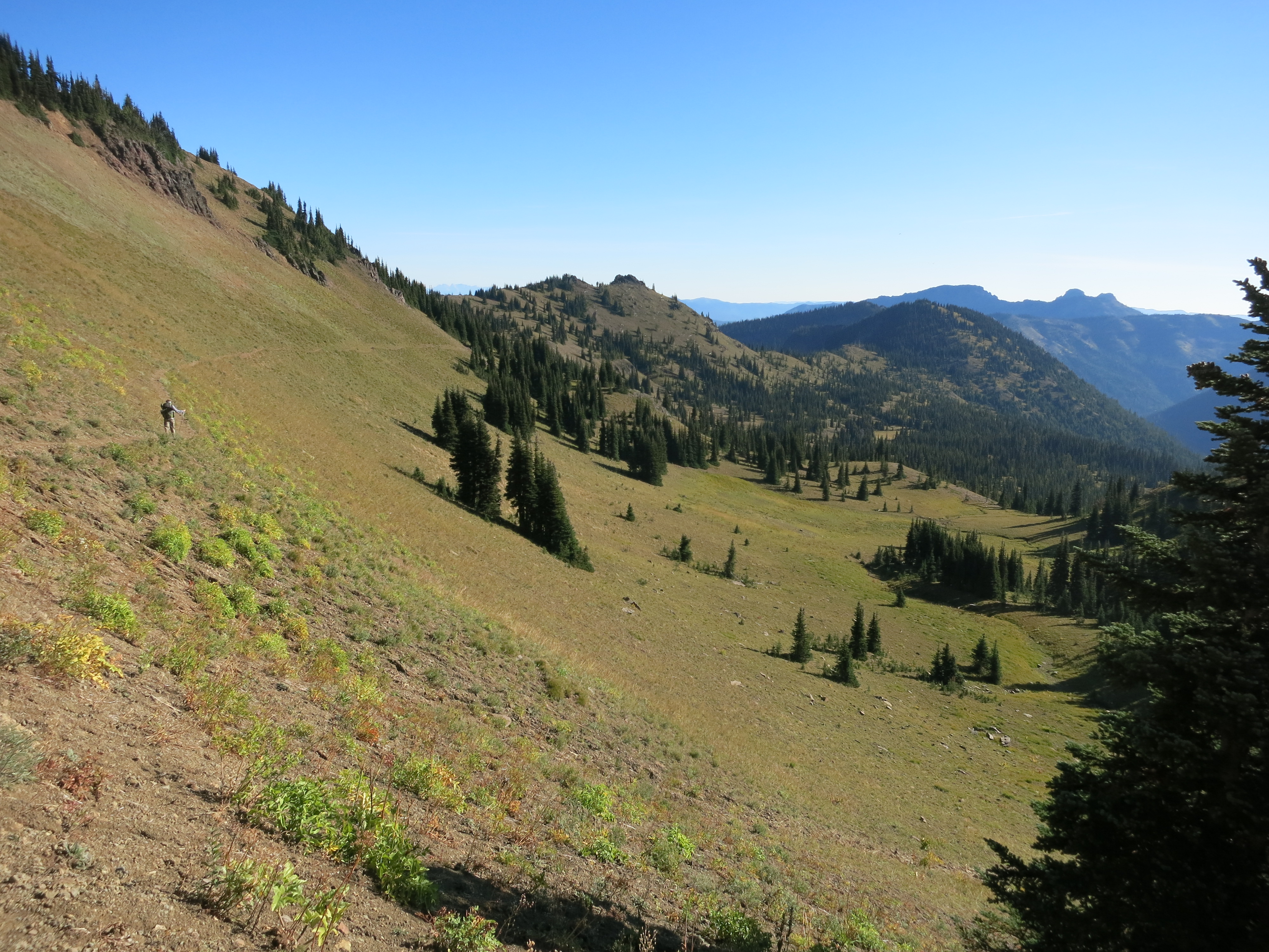
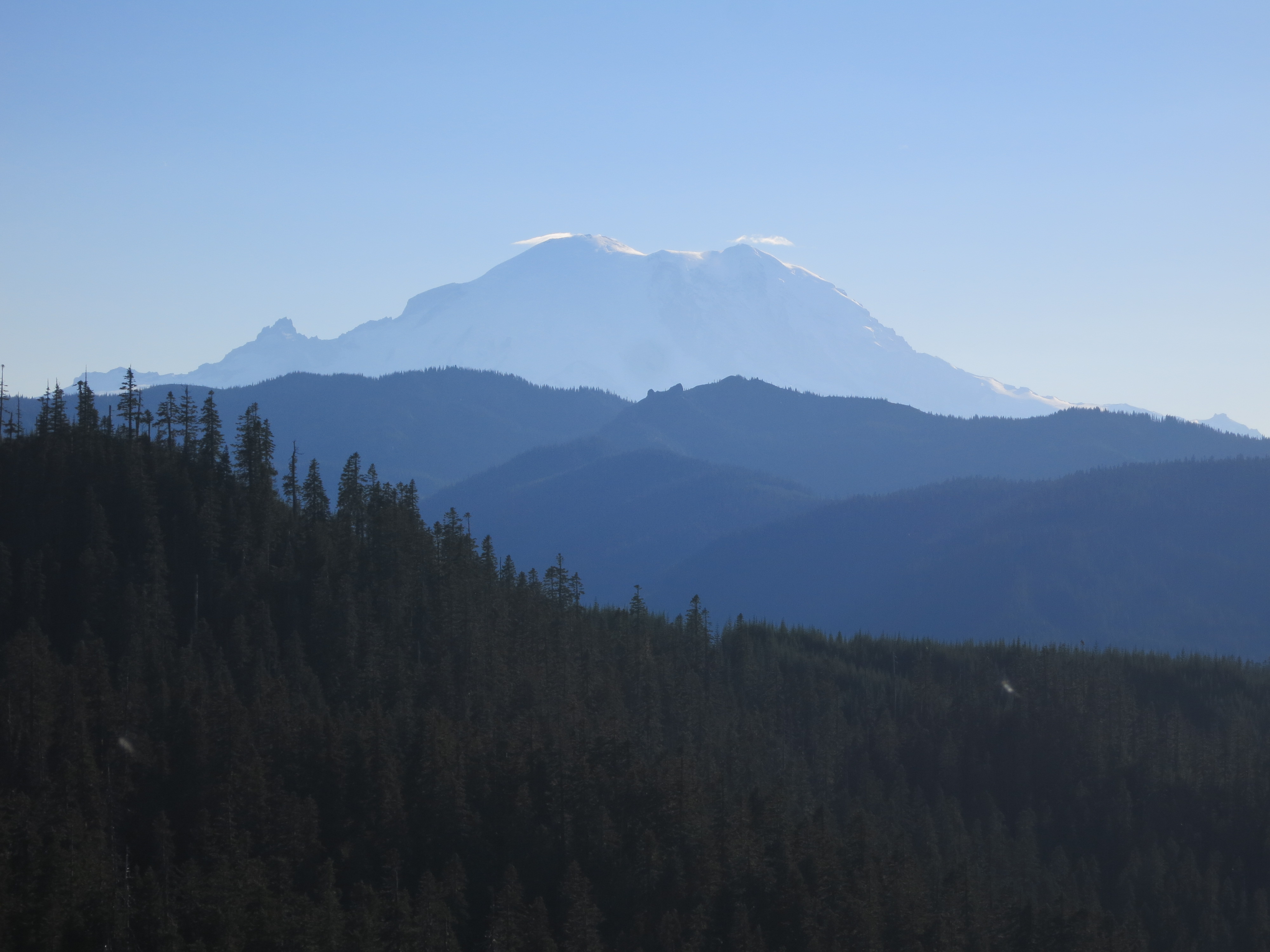
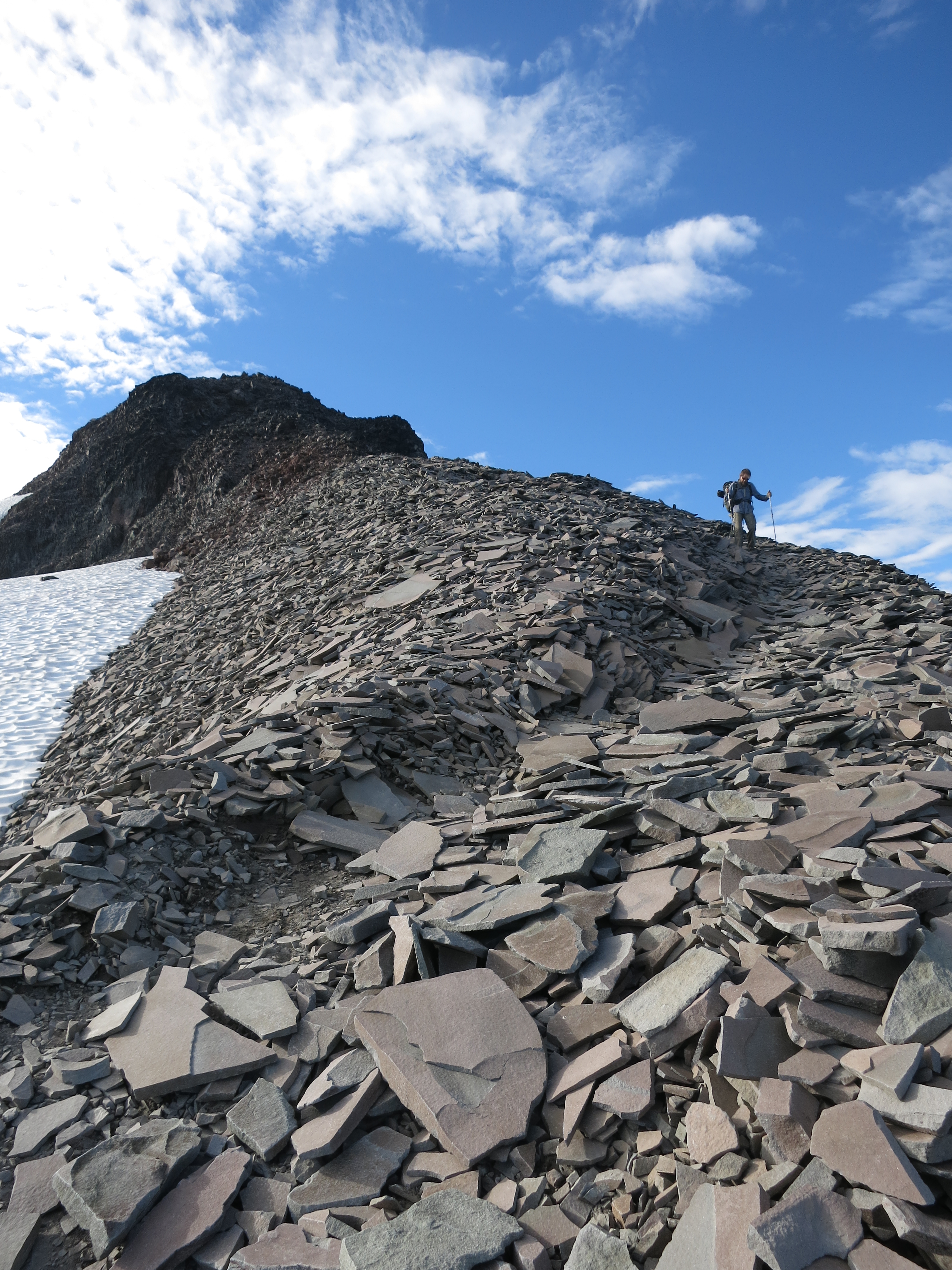
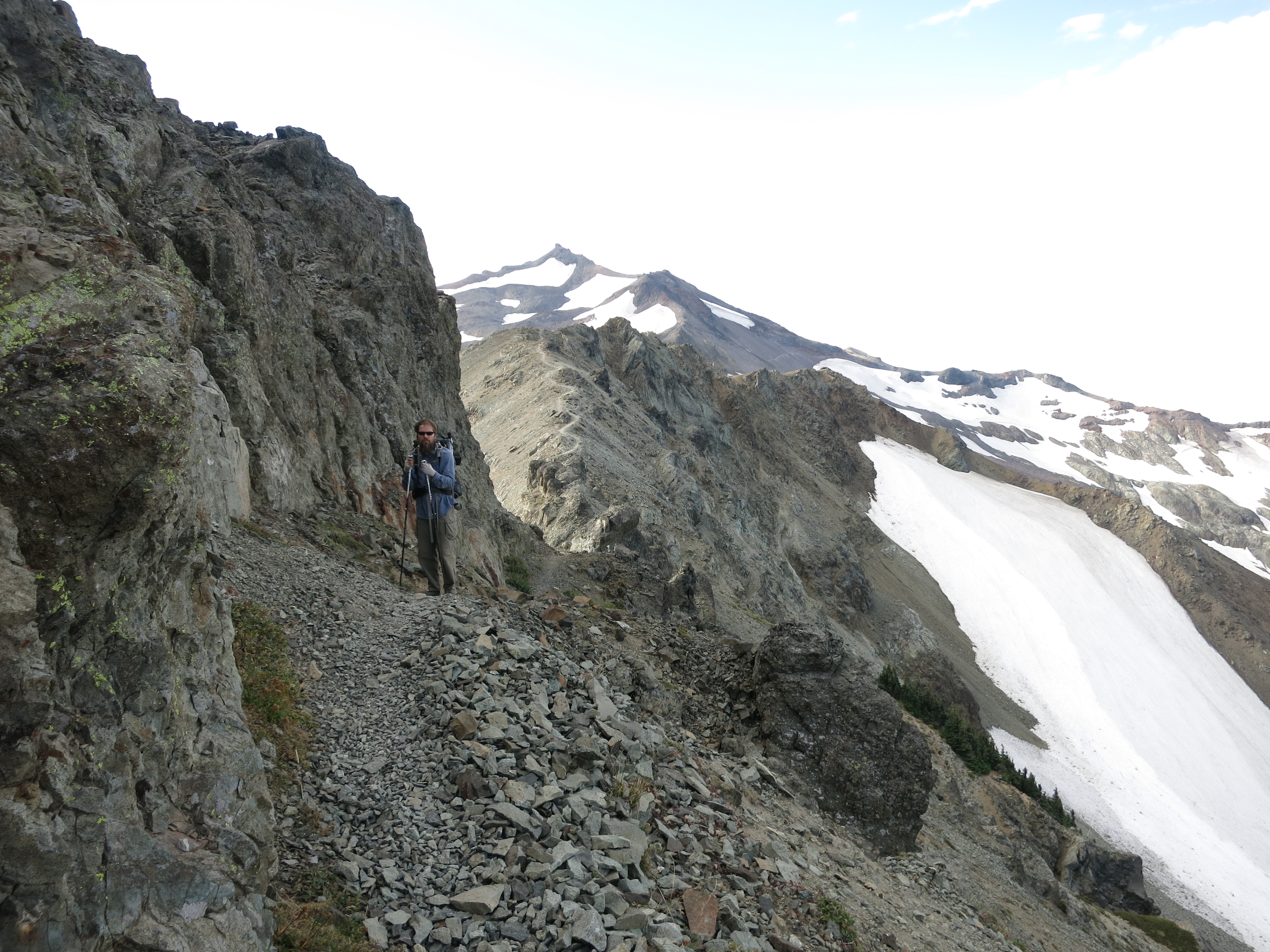
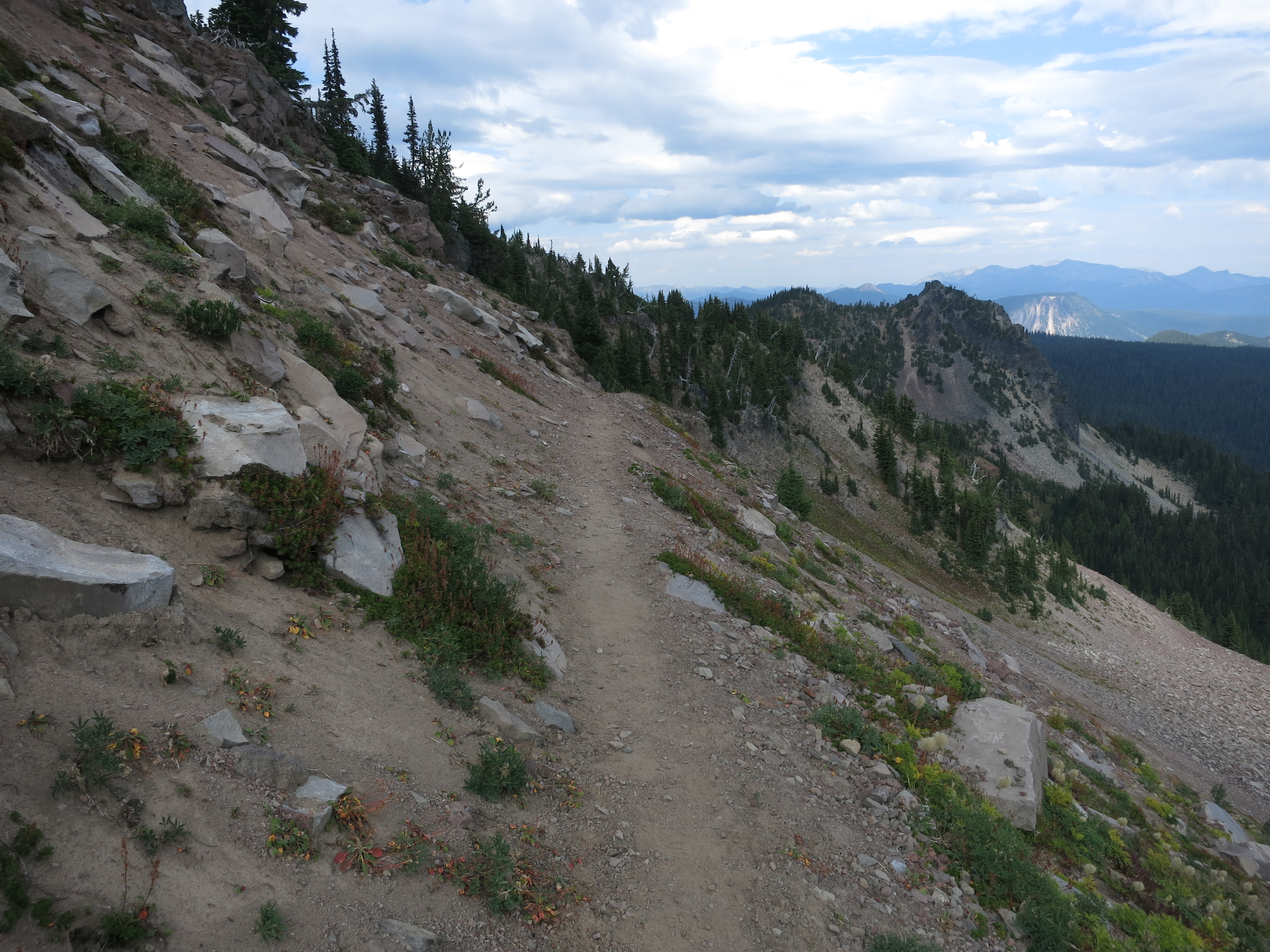
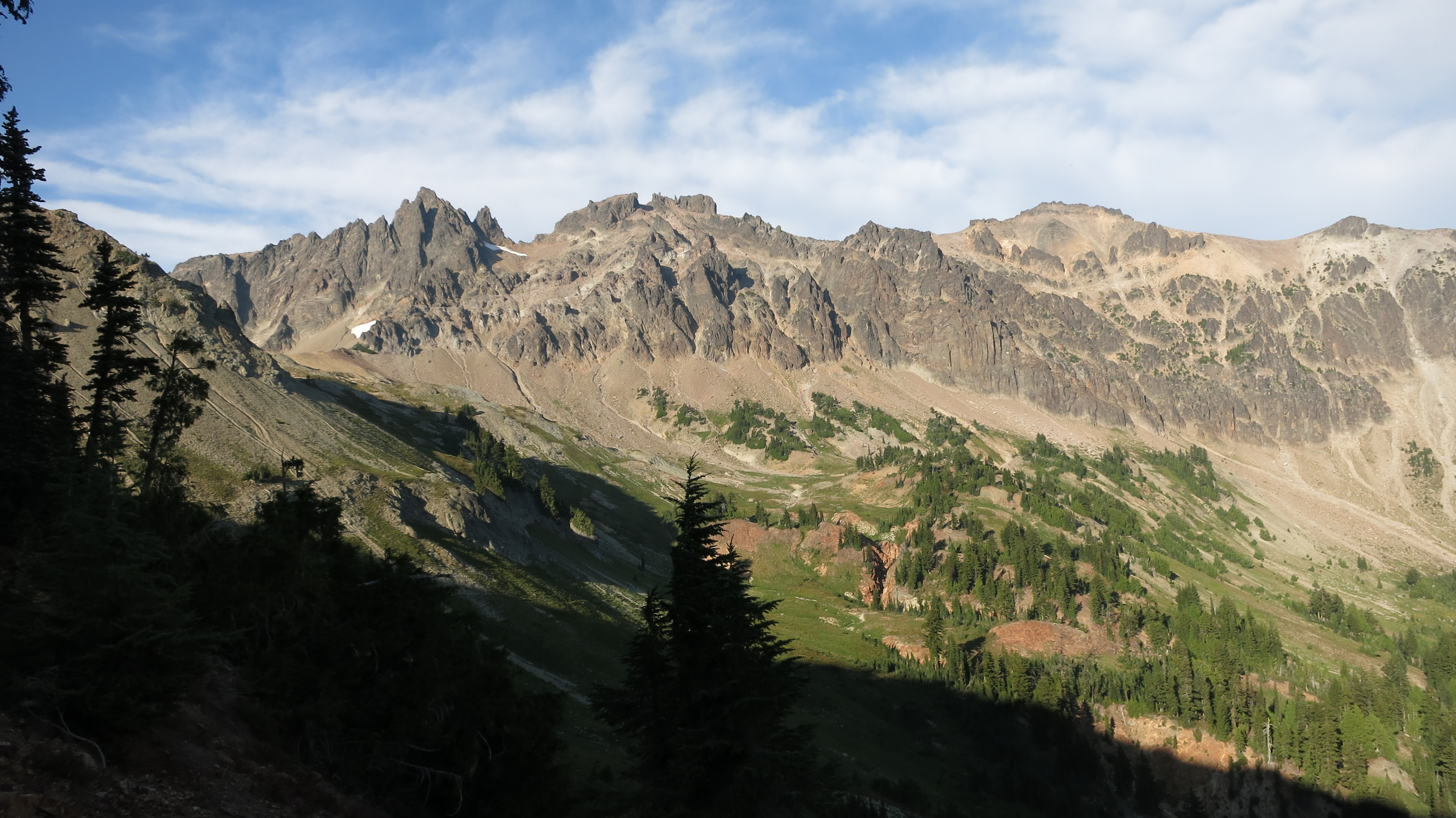
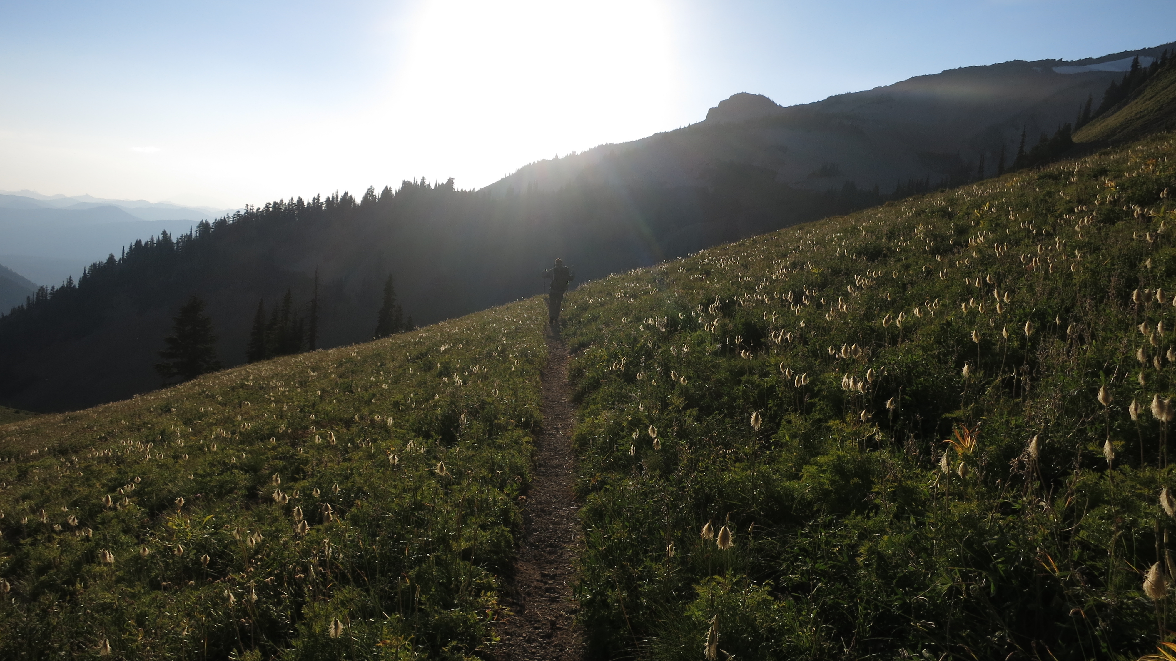
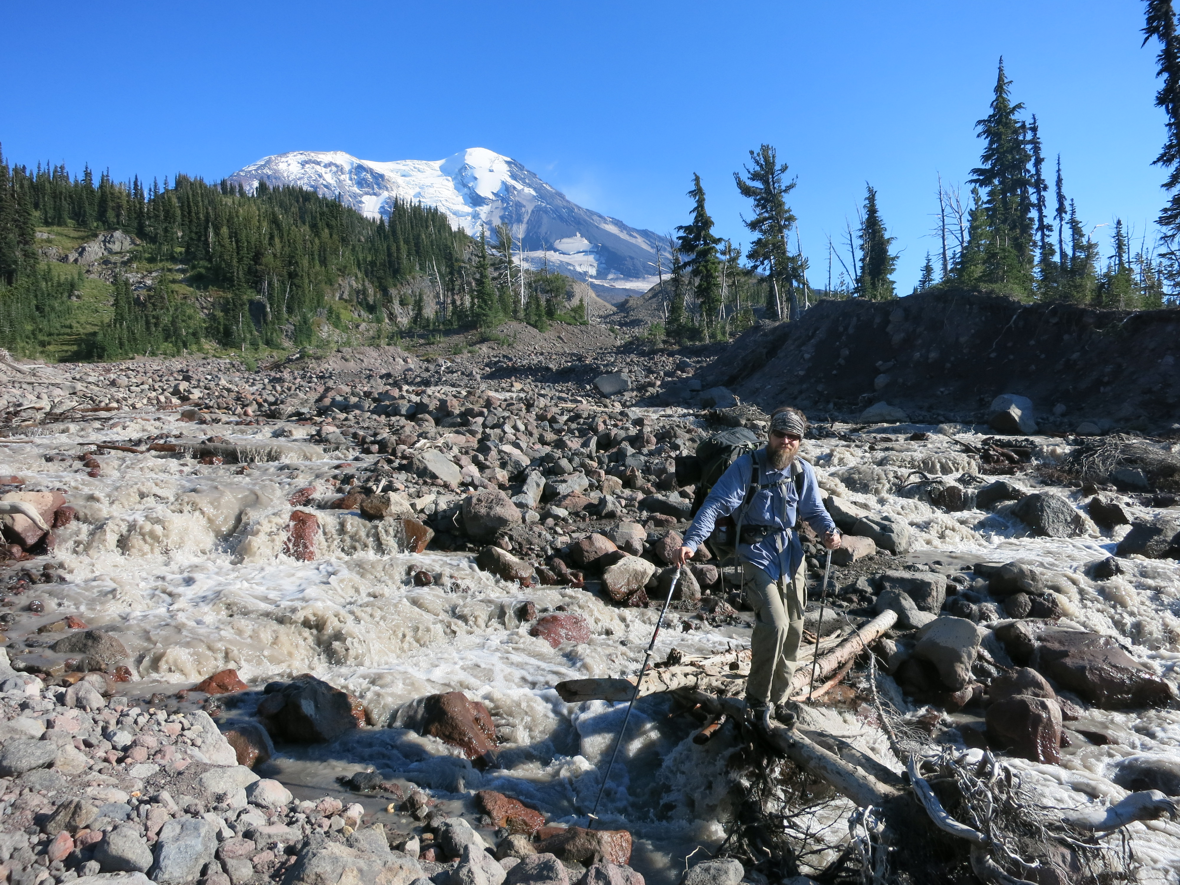
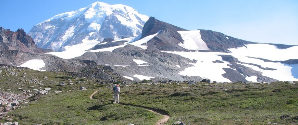
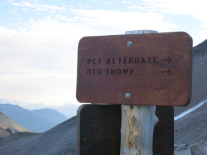
After a little more rock scrambling we reached a trail junction where an equestrian bypass took a slightly less scenic but much less exposed route.  We pushed on, eager to feast our eyes on a stretch of trail I’ve looked forward to hiking ever since I first heard about the PCT.

IMG_1292 IMG_1303Soon we were there at the top, the 2-mile ridgewalk laid out before us, with the mountain spine reaching all the way to Mt. Rainier in the distance.  It was the most beautiful and rugged stretches I’ve ever hiked.

IMG_1317The hills were steep – both up and down – and our first descent was built entirely on piled shale: thin, flat slabs of rock that shifted, tilted, and clinked musically under our feet.

IMG_1318 IMG_1324 IMG_1325 IMG_1327IMG_1328 As we had expected, we were slowed both by the terrain and by the constant compulsion to just stop and stare, overwhelmed, at the landscape around us.

IMG_1330When the trail finally left the ridge it dropped into rocky green alpine park, rolling over the open valley until we gradually descended back into the forest.  We were feeling the call of town and the pressure of impending weather after having spent so much time on the ridge and we put on the afterburners.  We skipped lunch in favor of snacks and sped through the trees up a long climb.

IMG_1333Near the top we emerged into another open area overlooking Shoe Lake.  Now it became obvious that we were racing the first rain since Mt. Hood.  Ahead of us the land dropped away to a low valley where our destination sat at the bottom of a ski hill. We could see clouds boiling over the ridge on the other side of the highway and we began to think we’d be caught in the rain.

IMG_1334The trail turned east to follow the spine we were currently on.  We hiked for a few more miles before taking a side trail shortcut down through the ski hills, following maintenance roads until we could see civilization below us.  White Pass is a tiny resort with the few amenities we needed the most – nice little condo-kitchenette rooms for rent and a convenience store next door stocked with lots of Costco’s oven-ready lasagna.  A few minutes after we returned to our room, fully laden with resupply boxes and town food, the rain began.  The clouds were so low that we could only see a hundred feet up the ski slopes – the clear skies and long views we’d had on the Knife’s Edge a few hours earlier were gone.  What amazing timing!  The rain is supposed to continue tomorrow and we will likely take the day off to pile on some calories.

Day 149 – Midway Creek to near Packwood Glacier – 22 miles

IMG_1234Today we crossed into one of the most anticipated and scenic sections of the entire trail – the Goat Rocks Wilderness.  This is what hikers look forward to once they leave the Sierra Nevada, through all the dry and viewless parts of Northern California and Oregon.  Despite having spent three weeks on the John Muir trail in some of the most beautiful backcountry we’ve ever seen, this area still blew us away.

IMG_1233We started with about 10 miles of hiking through dense forest and scrub, playing peekaboo with some shallow and overgrown lakes.

IMG_1236Shortly after crossing the wilderness boundary we looped around a peak to get another look at Mt. Adams, already noticeably smaller in the distance.

IMG_1238We took a break at a lake as the foliage began to thin out.

IMG_1240A climb was next on the list and we began to get a glimpse of things to come as we hiked along the narrow path cut into the side of a ridge. 7 more miles and a lunch stop brought us to the start of the real excitement.

IMG_1250We negotiated an eroding section of trail by hopping over runoff channels, now dry, that had carved into the loose gravel across the trailbed.

IMG_1248Suddenly we were at Cispus Pass, balanced on a ridge between one stunningly scenic valley and another.

IMG_1251We started to encounter lots of people as we continued on – many more than we were used to! No real surprise considering the great weather, breathtaking landscape and the fact that it was a weekend.  IMG_1263

IMG_1265Other highlights included waterfalls within reach of the trail, little fairy-forest clusters of trees, a full moon rising just over a ridge, and best of all, a large herd of mountain goats!

IMG_1254 IMG_1256 IMG_1261All day we had been joking about how we’d seen lots of rocks in the Goat Rocks but no actual goats.  They were shaggy, bright white with stark black horns and hooves, and somehow much larger than I’d expected.

IMG_1272As we hiked on we passed groups of campers settling in for the night.

IMG_1273The setting sun was casting everything in a pink alpenglow as we came to our own little site out of sight above the other groups.  On an impulse we decided to cowboy camp since bugs wouldn’t be an issue.

IMG_1274We sat in our bags watching the sun set as Mt. Adams disappeared in the dusk to our south.  This was an especially blissful day and we’re in for even more spectacular scenery tomorrow…IMG_1267IMG_1259

Day 148 – Williams Mine trailhead to Midway Creek – 24 miles

IMG_1220Today we finally traversed the slopes of Mt. Adams after watching it grow closer and closer every day since Cascade Locks. My sting was still bothering me – it felt as though my entire calf was clamped in a vise.  Soaking it in a cold stream at lunch seemed to help. We started by climbing up out of dense forest into a sparser burn area on the lower slopes.  After a few miles we negotiated a slightly confusing trail junction and then began to circle around the mountain’s west side.  It was wonderful to be back up in the alpine park with all its tiny trees, flowers, trickling (and sometimes raging) streams and long, sunny, scenic views.  Very different from the foggy weather we had on Mt. Hood!  It reminded us of our first day on the Wonderland trail, when we hiked through the lushly-flowered and popular Spray and Seattle Parks.

IMG_1229We could see the ripples and crevasses in Adams Glacier higher up the slopes.

IMG_1222After lunch we started to get peeks at Mt. Rainier, now only a few days away.

IMG_1231Adams Creek was a bit of a dicey crossing that involved wading through cold, milky, sulfur-smelling glacier runoff.  Not being able to see our feet was disconcerting but we made it across the various channels and log bridges without incident.

IMG_1232Wet feet plus fine volcanic dust made for extra-filthy shoes tonight.  As daylight faded we dropped back into scrub and forest and passed the impressive Lava Spring, which seems to come right out of one of the ubiquitous piles of black lava rock.  We finished the day just short of Midway Creek at a little campsite by the side of the trail that was just large enough for our tent.  Tomorrow will be another scenic day as we enter the Goat Rocks Wilderness.

IMG_1226

Day 147 – Blue Lake to Williams Mine trailhead – 24 miles

IMG_1211It was very warm again this morning – no need for jackets.  We woke up to the hum of bees and other swarms of insects.  These little bee-like flies would not leave us alone.  I’m not sure if they’re attracted to our salty sweat stains or what.  The trail was much easier today than yesterday, with no real hills to speak of.  We passed a number of small lakes hidden in the forest – including Junction Lake, where we had intended to stay yesterday. It looked scummy and stagnant.  Blue Lake was a much better source and we were glad we’d stopped short.  I got stung again in the leg while just hiking along and minding my own business.  It didn’t hurt for as long as the last one, but it itched like the world’s worst mosquito bite.  I can’t wait for the weather to turn cooler and (hopefully) put the bees to bed for the winter.  We hiked through the forest, checking out all the mushrooms that had reappeared. So many varieties!  We seemed to pass a new one every few minutes.  We even got to chat briefly with a knowledgeable day hiker who was out photographing them. IMG_1215 IMG_1213On one ridge we got another peek at Mt. Adams – closer than ever before.  We will hike its slopes tomorrow. We stopped for lunch at Mosquito Creek, which had no mosquitos but a million bees and bee-flies droning around.  The afternoon should have been a piece of cake but was made more difficult by my mystery sting.  My calf swelled up like a balloon and ached.  It was painful to move my ankle.  Even with the minor ups and downs I was hiking slowly.  Eventually we made it to the road into Trout Lake, which we will skip in favor of pushing on to White Pass.  A local Zen Buddhist temple had left their blessings and some trail magic here next to a shrine for travelers. The creek right next to the road was crowded with tents so we hiked on another half-mile to a nearby trailhead.  Tomorrow the scenery ought to start getting more interesting…IMG_1217

Day 146 – Panther Creek Road to Blue Lake – 24 miles

IMG_1207Very clammy and damp this morning – our shirts were still damp with yesterday’s sweat.  The forest around us looked like a real rainforest, with massive trees cloaked in green moss and ferns everywhere. We started the day with a 10-mile climb I could have sworn that our map showed a flat section in there somewhere but we sure didn’t pass one.  We hiked into the Wind River experimental forest.  Experimenting with the limits of hiker endurance, maybe. When we finally leveled off the trail crossed an exposed ridge and we got a great look at Mt. Adams, much closer than it was yesterday morning. Because of the humidity and exertion of the climb we went through our water faster than normal and stopped early for lunch. We climbed less during the afternoon, but it still felt like we were always working our way up another hill. We skirted some lava beds – on good trail and not rock, thankfully – and entered the Indian Heaven Wilderness. The trail was mostly viewless except for a southern-facing ridge that gave us a glimpse of Mt. Hood.  Had it shrunk since yesterday? Maybe, or maybe it’s just wishful thinking.  With all the climbing (and a longer than normal lunch break) we didn’t quite make all the miles we’d hoped, but the lake we camped at sounded like a better water source than the one a few more miles up.

IMG_1208

Day 145 – Forest Road to Panther Creek Road – 25 miles

IMG_1203It was breezy and surprisingly warm this morning – too warm to be wrapped up in a down bag.  We seem to have traded in the multitude of mushrooms for another resident of the Pacific Northwest: giant green slugs.  We saw two oozing around our tent while packing up and countless others on the trail today.  We started off by finishing yesterday’s climb.  It took us up to a sunny ridge with wonderful views of the major Cascade peaks.  In front of us (to the east) was Mt. Adams.  To our left, northeast, we could barely see the rounded peak of Mt. Rainier. To our right, now in the rear-view mirror, was Mt. Hood – no longer hidden by clouds. We continued up this ridge, alternately climbing and dropping and sweating in the heat.  I’ll take that over rain any day. We stopped at a small creek for lunch before tackling the rest of our miles for the day. The afternoon was much the same, except for less climbing and fewer views.  We crossed a few meadows and bushwhacked around a wasp’s nest in the trail.  Some courteous hiker-victim before us had left a note begging us not to be heroes – “they drew blood!”  No problem!  We ended the day at Panther Creek Road, just before the creek of the same name.

IMG_1204